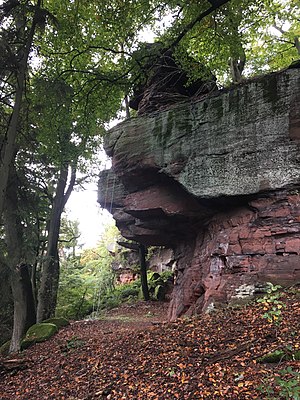
Rahnfels
| Rahnfels | ||
|---|---|---|
| height | 516.5 m above sea level NN | |
| location | Rhineland-Palatinate , Germany | |
| Mountains | Palatinate Forest | |
| Coordinates | 49 ° 28 '18 " N , 8 ° 5' 23" E | |
|
|
||
| rock | Red sandstone | |
| particularities | Opened American relay radio station, shelter of the Palatinate Forest Association Frankenthal | |
The Rahnfels is a mountain in the Palatinate Forest , approx. 2 km northwest of the Hardenburg castle ruins . With a summit height of 516.5 m above sea level. NN , the Rahnfels is the highest point in the Palatinate Forest north of the Isenach .
Summit plateau
The Frankenthaler Hütte is located at a vantage point on the summit plateau of the Rahnfels . The simple wooden shelter was built in 1906 by the Frankenthal branch of the Palatinate Forest Association and has since offered hikers protection from bad weather.
During the Cold War , a relay radio station and a telephone forwarding device for the DSN network of the American armed forces were located on the south side of the summit in the Freinsheim district. The asphalt road to the summit dates from this time and ends in a forest clearing. Today there is an environmental monitoring station at this.
traffic
The Rahnfels can either be reached by a scenic hike on foot ( signpost: Roter Punkt ) or via the L518, which starts at a roundabout on the southern outskirts of Leistadt . At kilometer 7, an asphalt road branches off to the left in a right-hand bend, which reaches the summit plateau after about 1.5 km.
Web links
Individual evidence
- ↑ LANIS: Topographical Map - Height and Location of the Rahnfels. Retrieved August 26, 2020 .
- ↑ Page no longer available , search in web archives: Hundred years of Frankenthaler Hütte


