
Birkweiler
| coat of arms | Germany map | |
|---|---|---|

|
Coordinates: 49 ° 12 ' N , 8 ° 2' E |
|
| Basic data | ||
| State : | Rhineland-Palatinate | |
| County : | Southern Wine Route | |
| Association municipality : | Landau country | |
| Height : | 189 m above sea level NHN | |
| Area : | 4.99 km 2 | |
| Residents: | 695 (Dec. 31, 2019) | |
| Population density : | 139 inhabitants per km 2 | |
| Postal code : | 76831 | |
| Area code : | 06345 | |
| License plate : | SOUTH | |
| Community key : | 07 3 37 009 | |
| LOCODE : | DE BWQ | |
| Association administration address: | To 44 No. 31 76829 Landau in the Palatinate |
|
| Website : | ||
| Local Mayor : | Bernd Flaxmeyer ( CDU ) | |
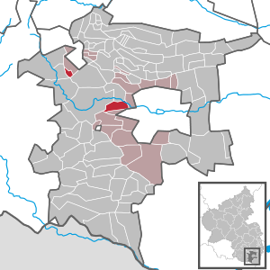
| Location of the local community of Birkweiler in the southern Weinstrasse district | ||
  |
||


Birkweiler is a municipality in the Südliche Weinstrasse district in Rhineland-Palatinate . It belongs to the Landau-Land association, which has its administrative headquarters in the city of Landau in the Palatinate .
geography
location
The community is a typical wine village in the Siebeldinger Valley. The community includes the residential areas Am Kolgenbach , Am Wald , Herrenbergerhof and Mandelbergerhof as well as an exclave in the Palatinate Forest . Neighboring communities are - clockwise - Albersweiler , Siebeldingen , Landau in der Pfalz , Ranschbach and Annweiler am Trifels .
Elevations and waters
Birkweiler is located at the foot of the Hohenberg, which measures 551.9 meters . In the north, the district reaches up to the Queich . The forest enclave is bounded in the northeast by the Dürrentalbach .
history
The place was first mentioned in a document in 1285. Initially, Birkweiler was one of the seven empire-free villages in the Siebeldinger Valley. After 1400 the area came under the rule of the Electorate of the Palatinate . The community stayed with the latter until the end of the 18th century.
From 1798 to 1814, when the Palatinate was part of the French Republic (until 1804) and then part of the Napoleonic Empire , Birkweiler was incorporated into the canton of Annweiler and was subordinate to the Mairie Siebeldingen . In 1815 the community had a total of 464 inhabitants. In the same year, Austria was struck. Just one year later, the place, like the entire Palatinate, changed to the Kingdom of Bavaria . In 1817 the community moved to the canton of Landau . From 1818 to 1862 Birkweiler belonged to the Landau Landau commissioner ; from this the district office of Landau emerged.
In 1938 the place was incorporated into the Landau district. After the Second World War , Arzheim became part of the then newly formed state of Rhineland-Palatinate within the French occupation zone . In the course of the first Rhineland-Palatinate administrative reform changed the place on 7 June 1969 in the newly created district Landau-Bad Bergzabern, in 1978 in South County Wine Trail is renamed . 1972 Waldhambach was assigned to the also newly formed community of Landau-Land .
politics
Municipal council
The municipal council in Birkweiler consists of twelve council members, who were elected in a personalized proportional representation in the local elections on May 26, 2019 , and the honorary local mayor as chairman.
The distribution of seats in the municipal council:
| choice | SPD | CDU | FWB | total |
|---|---|---|---|---|
| 2019 | - | 8th | 4th | 12 seats |
| 2014 | 2 | 7th | 3 | 12 seats |
| 2009 | 3 | 9 | - | 12 seats |
| 2004 | 3 | 9 | - | 12 seats |
- FWB = Free Voters Birkweiler
mayor
Bernd Flaxmeyer (CDU) became the local mayor of Birkweiler in 1994. In the direct election on May 26, 2019, he was confirmed in office for a further five years with a share of 72.86% of the votes.
coat of arms
|
|
Blazon : "In gold, a double-headed, red-armored and tongued black eagle, each holding a green birch branch in its claws." |
|
Justification of the coat of arms: From 1779, the community was sealed with the double-headed imperial eagle . To distinguish it, this was later supplemented by birch twigs.
The coat of arms was approved in 1985. |
Culture
Buildings
- Cultural monuments

The town center and the Albersweiler Canal are each designated as monument zones. The latter extends over several places.
In addition, there are about two dozen individual objects that are under monument protection , including the Catholic Bartholomäus Church , which was built from ocher-colored sandstone and a Protestant church, which was built from red sandstone. Both churches are neo-Gothic hall buildings.
- Other structures
There is also an observation tower on the Hohenberg.
nature
The only natural monument on site is the architectural ensemble Two Linden in the Church Street . The Haardtrand nature reserve - Auf dem Kirchberg extends partially over the district of Birkweiler.
Economy and Infrastructure
economy

Birkweiler lives mainly from viticulture , but also from tourism and gastronomy . A well-known vineyard in Birkweiler is the so-called "Birkweiler Keschdebusch" ( Birkweiler Kastanienbusch ), in which the "Birkweiler Weinfrühling" takes place every spring. The Dr. Wehrheim and Siener .
traffic
The Landau – Rohrbach railway connects Birkweiler to the rail network. There is a direct transport connection to the B 10 . The large cities of Mannheim or Karlsruhe, for example, can be reached in around 40 minutes. In addition, the bus line 520 of the Rhein-Neckar transport association runs through the community, which connects it with Landau and Ranschbach.
Public buildings
There is also a municipal kindergarten in Birkweiler, the “Rainbow Kindergarten”. Most of the children attend the primary school in neighboring Siebeldingen after attending the local kindergarten , as there is no longer a school in Birkweiler.
tourism
Birkweiler is on the German Wine Route . In addition, the Palatinate Almond Trail and the German Wine Route cycle path run through the community.
Personalities
Honorary citizen
- Heinz Wehrheim (1922–2016), winemaker
People who worked on site
- Thomas Hirsch (* 1967), politician (CDU) and Lord Mayor of Landau, lives on site
- Theo Kautzmann (* 1948), politician (CDU), from 1971 to 1974 chairman of his party's Birkweiler local association
literature
- Literature about Birkweiler in the Rhineland-Palatinate state bibliography
Web links
Individual evidence
- ↑ State Statistical Office of Rhineland-Palatinate - population status 2019, districts, communities, association communities ( help on this ).
- ↑ State Statistical Office Rhineland-Palatinate (ed.): Official directory of the municipalities and parts of the municipality. Status: January 2018 [ Version 2020 is available. ] . S. 102 (PDF; 2.2 MB).
- ↑ a b Erhard Nietzschmann: The free ones in the country. Former German imperial villages and their coats of arms. Melchior, Wolfenbüttel 2013, ISBN 978-3-944289-16-8 , p. 18.
- ^ The Regional Returning Officer Rhineland-Palatinate: Municipal Council Election 2019 Birkweiler. Retrieved April 9, 2020 .
- ^ The Regional Returning Officer Rhineland-Palatinate: Municipal elections 2014, city and municipal council elections
- ↑ Gerhard Sommer: Birkweiler: Flaxmeyer not exhausted even after 25 years. Die Rheinpfalz, May 13, 2019, accessed on April 9, 2020 .
- ^ The State Returning Officer Rhineland-Palatinate: direct elections 2019. see Landau-Land, Verbandsgemeinde, third line of results. Retrieved April 9, 2020 .

Cities: Annweiler am Trifels | Bad Bergzabern | Edenkoben
Municipalities: Albersweiler | Altdorf (Palatinate) | Barbelroth | Cheapheim-Ingenheim | Birkenhördt | Birkweiler | Böbingen (Palatinate) | Böchingen | Böllenborn | Bornheim (Palatinate) | Burrweiler | Dernbach (Palatinate) | Dierbach | Dörrenbach | Edesheim | Eschbach (Palatinate) | Essingen (Palatinate) | Eusserthal | Flemlingen | Frankweiler | Freimersheim (Palatinate) | Gleisweiler | Gleiszellen-Gleishorbach | Goecklingen | Gommersheim | Gossersweiler-Stein | Großfischlingen | Hainfeld (Palatinate) | Hergersweiler | Herxheim near Landau / Pfalz | Herxheimweyher | Heuchelheim Blades | Hochstadt (Palatinate) | Ilbesheim near Landau in the Palatinate | Vaccinees | Insheim | Kapellen-Drusweiler | Kapsweyer | Kirrweiler (Palatinate) | Small fish | Klingenmünster | Knöringen | Leinsweiler | May Chamber | Münchweiler am Klingbach | Niederhorbach | Niederotterbach | Oberhausen (near Bad Bergzabern) | Oberotterbach | Oberschlettenbach | Offenbach an der Queich | Pleisweiler-Oberhofen | Ramberg (Palatinate) | Ranschbach | Rhodt under Rietburg | Rinnthal | Rohrbach (Palatinate) | Roschbach | Saint Martin (Palatinate) | Schweigen-Rechtenbach | Schweighofen | Siebeldingen | Silz | Steinfeld (Palatinate) | Venningen | Völkersweiler | Vorderweidenthal | Waldhambach | Waldrohrbach | Walsheim | Wernersberg | Weyher in the Palatinate