
Völkersweiler
| coat of arms | Germany map | |
|---|---|---|

|
Coordinates: 49 ° 10 ' N , 7 ° 56' E |
|
| Basic data | ||
| State : | Rhineland-Palatinate | |
| County : | Southern Wine Route | |
| Association municipality : | Annweiler am Trifels | |
| Height : | 280 m above sea level NHN | |
| Area : | 4.1 km 2 | |
| Residents: | 551 (Dec. 31, 2019) | |
| Population density : | 134 inhabitants per km 2 | |
| Postal code : | 76857 | |
| Area code : | 06346 | |
| License plate : | SOUTH | |
| Community key : | 07 3 37 078 | |
| Association administration address: | Messplatz 1 76855 Annweiler am Trifels |
|
| Website : | ||
| Local Mayor : | Gerhard Hammer | |
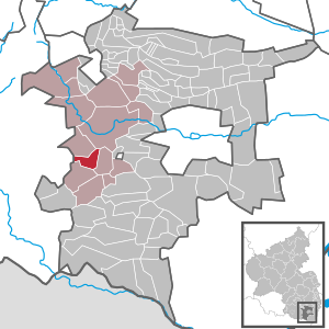
| Location of the local community Völkersweiler in the southern Weinstrasse district | ||
  |
||


Völkersweiler ( Palatinate Velgeschweiler ) is a municipality in the southern Weinstrasse district in Rhineland-Palatinate . It belongs to the Verbandsgemeinde Annweiler am Trifels , within which it is the fifth smallest local community in terms of population.
geography
location
The place is in Wasgau , as the southern part of the Palatinate Forest and the adjoining northern part of the Vosges are also called, in the west of the Southern Wine Route district on the border with the neighboring district of Südwestpfalz . It is located in the middle of mixed forests in the Gossersweiler valley between Annweiler am Trifels and Bad Bergzabern in a leveled area. Neighboring communities are - clockwise - Wernersberg , Annweiler am Trifels, Waldrohrbach , Gossersweiler-Stein and Lug .
Elevations and waters
The Kaiserbach flows through the southeast of the municipal area away from the buildings. First it takes the stream from the Pfarrbusch from the right and then the stream from Völkersweiler from the left . The stream from the B 48 largely forms the boundary to Waldrohrbach. In addition, the southern flank of the 462.1 m above sea level is located. NHN meter high Ebersberg on the parish of the local community.
history
Until the end of the 18th century, the place belonged to the Oberamt Germersheim and the Unteramt Landeck , which was jointly owned by the Electoral Palatinate and the Speyer Monastery. After the Left Bank of the Rhine was taken by French revolutionary troops (1794), Völkersweiler was assigned to the canton of Annweiler in the Donnersberg department from 1798 to 1814 and was administered by the Mairie in Schwanheim .
Due to the agreements made at the Congress of Vienna (1815), the Palatinate and thus also the municipality of Völkersweiler were initially assigned to Austria . In a state treaty concluded in 1816 , Austria ceded the region to the Kingdom of Bavaria . The now Bavarian canton Annweiler belonged in the newly created Rhine district for the time being to the district of Zweibrücken formed from the previous arrondissement and came to the district of Landau on August 1, 1816. After the subdivision of the districts into Landkommissariate in 1818 Völkersweiler belonged to the Landkommissariat Bergzabern ; The Bergzabern district office emerged from this in 1862 .
From 1939 the place was part of the Bergzabern district . After the Second World War , Völkersweiler became part of the then newly formed state of Rhineland-Palatinate within the French occupation zone . During the first Rhineland-Palatinate administrative reform changed the place on 7 June 1969 in the newly created district Landau-Bad Bergzabern, in 1978 in South County Wine Trail is renamed . 1972 Völkersweiler was assigned to the also newly formed community of Annweiler am Trifels .
population
Population development
In 1815 Völkersweiler had a total of 230 inhabitants. In 1928, 403 people lived in the community, living in 79 residential buildings. In 2004 there were 627, since then a population decline has been observed.
religion

The Catholics belong to the Diocese of Speyer and are subordinate to the Landau deanery , the Evangelicals to the Protestant Church of the Palatinate . The Catholics in 1928 to the parish of Gossersweiler , which the Protestants to that of Annweiler . The local community is predominantly Catholic.
politics
Municipal council
The council in Völkersweiler consists of twelve council members, who in the local elections on May 26, 2019 in a majority vote were elected, and the honorary mayor as chairman.
mayor
Gerhard Hammer became mayor of Völkersweiler in 2014. In the direct election on May 26, 2019, he was confirmed in office for a further five years with a share of the vote of 59.08 percent. His predecessor Ernst Braun had held the office for 24 years.
coat of arms
|
|
Blazon : “Under a red shield head, inside two floating silver crosses, on a green three-mountain a sandstone-red Romanesque church with an octagonal apse, transept and tower with a gold cross, with silver tracery windows, covered in silver on the right by a green leaf, on the left by a green ear. " |
Culture
Cultural monuments

With the church, two crosses, a chapel and a residential building, there are a total of five objects on site that are listed .
nature
The municipality is located in the Palatinate Forest Nature Park , which in turn belongs to the Palatinate Forest-Vosges du Nord Biosphere Reserve . Völkersweiler is also part of the Palatinate Forest climbing area , where it belongs to the Luger area .
Economy and Infrastructure
economy
Due to the geographic conditions, the forest and timber industry dominated the area for centuries. The local forest areas are subject to the Annweiler Forestry Office .
traffic

The 531 bus connects the Rhein-Neckar transport association with Landau in the Palatinate and Annweiler am Trifels. The closest train station is Annweiler am Trifels on the Landau – Rohrbach railway line .
The federal highway 48 runs through the northeast of the district far away from the settlement area . The northern edge of the settlement is affected by Landesstrasse 495 , which leads via Lug to Hauenstein . This leads into the state road 494, which passes directly to the east of the development and leads to the federal road 38 and as far as Silz ; District road 7 runs through the town itself .
tourism
The Staudernheim-Soultz-sous-Forêts long-distance hiking trail marked with a blue bar and a 15-kilometer secondary route of the Palatinate Keschdeweg , which leads from Hauenstein to Annweiler, lead via Völkersweiler . In addition, the community is located on a hiking trail marked with a green triangle on a white background . In addition, the Wasgaublick viewpoint is located on the Ebersberg in the municipal area.
St. Josefshof
St. Josefshof, located in the north of the municipality, was acquired by the Paulus Brothers in 1930 and operated as a care facility from 1948. In 1982 it was leased to the Caritas Association Speyer , which decided to relocate the residents in 2006. Two years later, the Paul Brothers therefore gave up the institution. In the meantime, the FNL - Förderverein Naturschutz und Landwirtschaft e. V. , who published the book Fascinating Orchids of the Palatinate in 2017 .
dish
The community belongs to the judicial district of the Landau District Court .
education
Völkersweiler belongs to the catchment area of the Gossersweiler-Stein elementary school .
Personalities
- Johannes Kriebitzsch (1857–1938), glass painter, painted the glasses of the local church in 1912
Web links
- Local community Völkersweiler on the website of the association community Annweiler am Trifels
- Literature about Völkersweiler in the Rhineland-Palatinate state bibliography
Individual evidence
- ↑ State Statistical Office of Rhineland-Palatinate - population status 2019, districts, communities, association communities ( help on this ).
- ↑ List of localities for the Free State of Bavaria. In: daten.digitale-sammlungen.de. Retrieved July 5, 2018 .
- ^ The Regional Returning Officer Rhineland-Palatinate: Local elections 2019, city and municipal council elections.
- ↑ Gerhard Sommer: On Case II: Which local chiefs in Trifelsland are running again. Die Rheinpfalz, September 14, 2018, accessed on April 18, 2020 .
- ↑ The Regional Returning Officer Rhineland-Palatinate: direct elections 2019. Retrieved on April 18, 2020 (see Annweiler am Trifels, Verbandsgemeinde, tenth line of results).
- ↑ Thanks and appreciation. Honoring resigned local mayors. Verbandsgemeinde Annweiler am Trifels, December 2, 2014, accessed on April 18, 2020 .
- ↑ General Directorate for Cultural Heritage Rhineland-Palatinate (ed.): Informational directory of cultural monuments - Southern Wine Route district. Mainz 2020, p. 94 f. (PDF; 10 MB).

Cities: Annweiler am Trifels | Bad Bergzabern | Edenkoben
Municipalities: Albersweiler | Altdorf (Palatinate) | Barbelroth | Cheapheim-Ingenheim | Birkenhördt | Birkweiler | Böbingen (Palatinate) | Böchingen | Böllenborn | Bornheim (Palatinate) | Burrweiler | Dernbach (Palatinate) | Dierbach | Dörrenbach | Edesheim | Eschbach (Palatinate) | Essingen (Palatinate) | Eusserthal | Flemlingen | Frankweiler | Freimersheim (Palatinate) | Gleisweiler | Gleiszellen-Gleishorbach | Goecklingen | Gommersheim | Gossersweiler-Stein | Großfischlingen | Hainfeld (Palatinate) | Hergersweiler | Herxheim near Landau / Pfalz | Herxheimweyher | Heuchelheim Blades | Hochstadt (Palatinate) | Ilbesheim near Landau in the Palatinate | Vaccinees | Insheim | Kapellen-Drusweiler | Kapsweyer | Kirrweiler (Palatinate) | Small fish | Klingenmünster | Knöringen | Leinsweiler | May Chamber | Münchweiler am Klingbach | Niederhorbach | Niederotterbach | Oberhausen (near Bad Bergzabern) | Oberotterbach | Oberschlettenbach | Offenbach an der Queich | Pleisweiler-Oberhofen | Ramberg (Palatinate) | Ranschbach | Rhodt under Rietburg | Rinnthal | Rohrbach (Palatinate) | Roschbach | Saint Martin (Palatinate) | Schweigen-Rechtenbach | Schweighofen | Siebeldingen | Silz | Steinfeld (Palatinate) | Venningen | Völkersweiler | Vorderweidenthal | Waldhambach | Waldrohrbach | Walsheim | Wernersberg | Weyher in the Palatinate