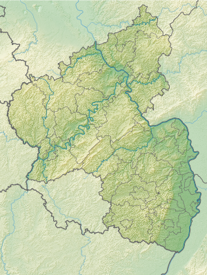
Helmbachweiher
| Helmbachweiher | |||||||||
|---|---|---|---|---|---|---|---|---|---|
|
|||||||||
|
|
|||||||||
| Coordinates | 49 ° 20 '2 " N , 7 ° 58' 53" E | ||||||||
| Data on the structure | |||||||||
| Lock type: | Reservoir | ||||||||
| Construction time: | 1970 | ||||||||
| Data on the reservoir | |||||||||
| Altitude (at congestion destination ) | 208.2 m above sea level NHN | ||||||||
| Water surface | 1 ha | ||||||||
| Reservoir length | 90 m | ||||||||
| Reservoir width | 120 m | ||||||||
| Maximum depth | 2 m | ||||||||
The Helmbachweiher is a reservoir of the Kohlbach in the central Palatinate Forest ( Rhineland-Palatinate ). The name is misleading, so that the literature occasionally gives the wrong information that it is a reservoir in the Helmbach , which flows by at a distance of a few meters .
geography
The lake is 208.2 m above sea level, close to the right bank of the Helmbach, about 2 km before its confluence with the Speyerbach , at the point where the forest markings of the communities Elmstein , Kirrweiler (exclave) and Venningen (exclave) meet.
The Helmbach sawmill , the forester's house in Helmbach , an adventure playground , a barbecue area and a teaching garden are in the immediate vicinity .
description
The lake is about 90 m long and 120 m wide. It has an area of about one hectare and is a maximum of 2 m deep. First and foremost, it serves as a Kneipp water body , but also as a bathing lake , in which the green algae of the water network genus, which only occur in unpolluted water, have been identified and whose water quality was classified as “excellent” in 2014 by the European Union . A long wooden walkway facilitates access to the water.
Building history
The lake is comparable in its formation to the woog of the Middle Ages . It was created in 1970 by damming the Kohlbach, a forest brook that passes the dam at the end of the lake and flows into the Helmbach a few steps further. On both sides of the Kohlbach estuary, the right bank of the Helmbach was filled up over a stretch of 100 m to serve as a dam for the Kohlbach.
traffic
The lake is reached via Kreisstraße 18 , which runs along the Helmbach and connects the Elmsteiner Tal in the north with the hamlet of Stilles Tal . Iggelbach 3.5 km west of the lake is the closest place to live. The VRN operates a bus line between the Lambrecht railway station and Elmstein , which is used several times a day; the stop in the hamlet of Helmbach is about 1.5 km from the lake by foot.
Web links
- Key data on badeseen.rlp-umwelt.de
- Helmbachweiher on Urlaub-in-rheinland-pfalz.de
References and comments
- ↑ Bathing and grilling - Helmbachweiher natural bathing lake. vg-lambrecht.de, accessed on December 21, 2019 .
- ↑ Helmbachweiher natural bathing lake. outdooractive.com, accessed December 21, 2019 .
- ↑ Helmbachweiher. Urlaub-in-rheinland-pfalz.de, accessed on December 20, 2019 .
- ↑ LANIS. naturschutz.rlp.de, accessed on December 20, 2019 (measured lake area: ~ 9978 m²).
- ↑ a b c Helmbachweiher. rlp-umwelt.de, accessed on December 20, 2019 .
- ↑ Helmbachweiher. pfalz-info.com, accessed December 20, 2019 .
- ↑ a b Rolf Sperber: Local recreation: The idyllic Helmbachweiher in the Palatinate Forest attracts with the best water quality and gastronomy. echo-online.de, August 10, 2017, accessed December 20, 2019 .

