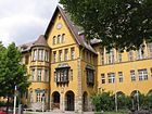
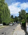
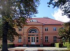
List of streets and squares in Berlin-Steglitz

The list of streets and squares in Berlin-Steglitz describes the street system in the Berlin district of Steglitz with the corresponding historical references. At the same time, this compilation is part of the lists of all Berlin streets and places .
overview


The public road network in the entire Steglitz-Zehlendorf district (including the other six districts) measures 635.4 kilometers. This means that the district before Treptow-Köpenick (628.1 km) and Pankow (604.7 km) has the largest road system in the capital. The following list shows the 192 dedicated streets and 13 squares. Nineteen of these streets continue in neighboring districts or partly belong to them. The total length of these traffic routes in the district is 77.7 kilometers.
In the Berlin road network , 430 meters of Bundesstraße 1 ( Schloßstraße ), 3200 meters of main lane of Bundesautobahn 103 (Westtangente) and 700 meters of secondary lane (exit to Wolfensteindamm and entrance from Schloßstraße) belong to the large-scale road connections ( Category I ). The other entrances and exits on Steglitz territory with a total length of 2210 meters belong to the higher-level road system ( category II ) in the state of Berlin. The west bypass runs right through Steglitz and ends at the Steglitz roundabout in the street system of the district. At Breitenbachplatz , the former federal highway 104 turns into Schildhornstrasse. This section establishes the connection to the city ring in Wilmersdorf .
With a further 11.9 kilometers, Steglitz city streets are classified in this category II of Berlin : Albrechtstraße (1220 m), Attilastraße , Filandastraße (360 m) and Neue Filandastraße , Grunewaldstraße , Halskestraße , Knausstraße (130 m), Königin-Luise-Straße , Munsterdamm , Schildhornstraße (1400 m), the 420 meters of Schloßstraße , Siemensstraße , Steglitzer Damm , Thorwaldsenstraße and Wolfensteindamm , as well as the Joachim-Tiburtius-Brücke and the entrances and exits of the A 103 and the former Schmargendorf junction in the district . The mountain road (180 m), Birkbusch- , Bismarckstraße , Feuerbachstraße (590 m), Klingsorstraße , Lepsius Street (820 m), Maßmannstraße , Castle Street (910 m), Schöneberg Street and the Hermann-Ehlers-Platz are among the 8.5 km regional road connections . The other sections of Bergstrasse and Düppelstrasse are supplementary roads ( Category IV , which roughly corresponds to a local connecting road ). Thus, 30% of the streets in the district are in the meaning of federal and main roads.
Steglitz has 75,803 inhabitants (as of December 30, 2019) and includes the postcode areas 12157, 12161, 12163, 12165, 12167, 12169, 12203, 12247, 14195 and 14197.
Overview of streets and squares
The following table gives an overview of the streets and squares in the district as well as some related information.
- Name / location : current name of the street or square. Via the link Location , the street or the square can be displayed on various map services. The geoposition indicates the approximate center of the street length.
- Traffic routes not listed in the official street directory are marked with * .
- Former or no longer valid street names are in italics . A separate list may be available for important former streets or historical street names.
-
Length / dimensions in meters:
The length information contained in the overview are rounded overview values that were determined in Google Earth using the local scale. They are used for comparison purposes and, if official values are known, are exchanged and marked separately.
For squares, the dimensions are given in the form a × b for rectangular systems and for (approximately) triangular systems as a × b × c with a as the longest side.
If the street continues into neighboring districts, the addition ' in the district ' indicates how long the street section within the district of this article is. - Name origin : origin or reference of the name.
- Notes : further information on adjacent monuments or institutions, the history of the street and historical names.
- Image : Photo of the street or an adjacent object.
| Name / location | Length / dimensions (in meters) |
Origin of name | Date of designation | Remarks | image |
|---|---|---|---|---|---|
|
Adolfstrasse
( Location ) |
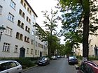
220 | Adolf , male first name | before 1878 | The street is between Schützenstrasse and Breite Strasse. |
|
| Ahornstrasse
( Location ) |
310 | the first planting consisted of maple trees | before 1878 | The street lies between the castle and the Lepsius street . |

|
| Albrechtstrasse
( Location ) |
2140 (1140 + 1000) |
Karl Friedrich Wilhelm Albrecht (1819–1904), local politician in Steglitz | Apr 18, 1871 | The road used to be an almost straight connection from Steglitz to Lankwitz. It was divided in 1906 when the Teltow Canal was built . A short stretch of road that used to belong to Lankwitz, but was now on the Steglitzer canal side, was renamed from Steglitzer Strasse to Albrechtstrasse in 1916 . Trams ran through Albrechtstrasse until 1930 . From 1935 to 1965 there was an electrically operated trolleybus (line A32) here. Around 1970 a short stretch of road near the Steglitz city park between Sedanstrasse and Bismarckstrasse was closed. The Handjeryplatz located there was built over with a skyscraper designed by Hans Wolff-Grohmann . Since then, the road has been divided into two at this point, and traffic is routed through the Steglitzer Damm / Bismarckstrasse intersection. |

|
| Alsenstrasse
( Location ) |
300 | Alsen ( Danish : Als ), Danish island, the name was given with reference to the German-Danish War in 1864 | 1897 | The street was empty when it was first mentioned in the address book in 1898. It existed before that as a section of Fregestraße . The properties on the eastern side of the street (houses no. 1–7) no longer exist because the west bypass runs there. |

|
| Althoffplatz
( Location ) |
80 × 80 | Friedrich Althoff (1839–1908), Prussian cultural politician | July 17, 1906 | The square is on Filandastraße and was previously part of street A of the development plan. With its size, proportions and trees, Althoffplatz is one of the typical squares that were kept free for development according to the Hobrecht plan. A development plan from July 5, 1904 saw then for Heese specific plantation ( mulberry ) between mountainous, Heese-, Südend- and Filandastrasse a 500 square rods large jewelry square in front. The green area is largely preserved. |

|
| Althoffstrasse
( Location ) |
250 | Friedrich Althoff (1839–1908), Prussian cultural politician | July 17, 1906 | The street was previously part of street A of the development plan, it lies between Heesestrasse and Althoffplatz. |

|
| Altmarkstrasse
( Location ) |
410 | Altmark , region in the north of Saxony-Anhalt | July 18, 1908 | The first name was Street 35 of the zoning plan. The street is in the Bismarckviertel , the Bismarck's property was in the Altmark. |

|
| At the Bäkequell
( Location ) |
100 | Bäke , formerly a water-rich brook that originally flowed from Steglitz to Griebnitzsee and today only exists in two small sections | Aug 18, 1926 | The street is between Schloßstrasse and Fronhoferstrasse. The first name was Street 89 of the zoning plan. |

|
| At the Eichgarten
( Location ) |
440 | a park-like garden with oak trees to a villa that used to exist here | Nov 26, 1925 | The western section between Brückenstraße and Stindestraße is developed as a road. The eastern continuation between Stindestraße and Siemensstraße is a footpath. From 1878 to 1925 the street was called Viktoriastraße . It is located on the north bank of the Teltow Canal, which borders the district here. |

|
| At the Fenn
( Location ) |
320 | Fenn , Low German name for moor | Nov 26, 1925 | The street opens up an area between Albrechtstrasse and Unter den Rüstern, where it continues as a footpath . It is located on the route from Straße 79 and Straße 75 of the development plan. The previously existing triangular fen has disappeared due to the construction of the Teltow Canal (it fell dry). |

|
| On the Fichtenberg
( Location ) |
440 (in the district) |
Fichtenberg , highest point in Steglitz | Oct. 20, 1913 | The north-east side of the street including the roadway belongs to the district, the south-west side to Lichterfelde . At Fichtenberg runs from Schloßstraße northwestwards and turns into Lepsiusstraße. The path lies on the routes of street 1, street 4 and street 5 of the development plan. At the end of the 19th century a villa colony for senior officials, scholars and artists was built here. |

|
| At the city park
( Location ) |
150 | Steglitzer Stadtpark, laid out between 1906 and 1914 as a landscape park on the former forest and estate garden area. | before 1920 | At the Stadtpark there is a footpath between Sedan and Brückenstraße. The first name was street 87a of the zoning plan. The building land was owned by "Boden-Aktiengesellschaft Steglitz (Berlin)". |

|
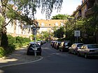
| Amfortasweg
( Location ) |
280 | Amfortas, character from the opera Parsifal by Richard Wagner , King of the Holy Grail and Uncle Parsifals | May 17, 1930 | The street, laid out as street C in the development plan, lies in the arch from and to Klingsorstraße. |
|
| Arno-Holz-Strasse
( Location ) |
210 | Arno Holz (1863–1929), poet and playwright of naturalism and impressionism | May 3, 1935 | The street is between Schmidt-Ott-Straße and Zeunepromenade (here as a dead end ). The previous name between 1878 and 1935 was Schillerstrasse . |

|
| Attilastrasse
( Location ) |
700 (in the district) |
Attila (also Etzel ; † 453), King of the Huns | before 1909 | In the district, the street connects the Teltow Canal with the S-Bahn line (exclusive). The longer eastern section of the road is in Tempelhof . The place name was first given in Tempelhof. The previous names were Lankwitzer Strasse (around 1900 – around 1909), Lankwitzer Weg (before 1882 – around 1900) and Tempelhofer Weg (19th century - around 1899), Tempelhofer Strasse (around 1899–1928). The Tempelhofer Weg , which ran through the south end until around 1899 , was expanded and turned into Tempelhofer Straße , in the Steglitz address book for 1903 as Tempelhofer Chaussee . In 1928 it was included as a new section in Attilastraße. City villas and individual blocks of flats characterize the busy street in the district. |

|
|
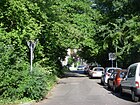
Barsekowstrasse
( Location ) |
370 | Otto Barsekow (1856–1918), local politician in Steglitz | May 17, 1930 | In 1930 a section of Johanna-Stegen-Straße between Breite Straße and Gravelottestraße was renamed Barsekowstraße.
The architect Gustav Lilienthal , brother of the aviation pioneer Otto Lilienthal , had planned and built a commercial building in this street , which was given a castle-like appearance - with battlements, bay windows and pointed arches. The building has been preserved and is a listed building. Another two houses (number 27/29) belong to the "Steglitz III residential complex", which was built according to plans by Paul Zimmerreimer in 1928/1929 and is also on the list of monuments. |
|
| Benzmannstrasse
( Location ) |
420 | Hans Benzmann (1869–1926), writer | Apr 8, 1933 | The previous name was Potsdamer Strasse from 1896 to 1933 . |

|
| Mountain road
( Location ) |
1400 | Rough mountains to which the road leads | Apr. 1871 | The street lies between Kieler / Robert-Lück-Straße and Thorwaldsenstraße / Prellerweg and borders the Bismarckviertel to the south. |

|
| Berlinickestrasse
( Location ) |
400 | Gottlieb Berlinicke (1835–1898), farm owner and community leader in Steglitz | before 1869 | The street is located to the south-east of the Wannseebahn and connects the Ruge and Albrecht streets. |

|
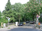
| Beymestrasse
( Location ) |
300 | Carl Friedrich von Beyme (1765–1838), lawyer and politician | before 1878 | The road connects Klingsorstrasse with Sedanstrasse. In 1901 the address book here (Beymerstrasse 19) shows the Deutsche Eisenbahn-Bau-Gesellschaft GmbH . The theologian and publicist August Hinderer lived in Beymestrasse and headed the Evangelical Press Association for Germany from 1918 in a house across the street. His home, the Villa Hinderer , was badly damaged in World War II and is one of the few remaining war ruins in Berlin. |
|
| Biberacher way
( Location ) |
125 | Biberach an der Riss , district town in Baden-Württemberg | July 20, 1960 | The street is between Steglitzer Damm and Ellwanger Straße. When the traffic route was laid out before 1878, it was probably planted with linden trees and was therefore first called Lindenstrasse . |

|
| Birkbuschgarten
( Location ) |
130 | Birkbusch, formerly a Vorwerk and a sheep farm that belonged to the estate Steglitz | Jan. 7, 1928 | The previous name of the street between Birkbusch- and Johanna-Stegen-Straße from 1912 to 1928 was Marslatourstraße , it was on the route of Straße 83a in the development plan. |

|
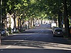
| Birkbuschstrasse
( Location ) |
1150 (in the district) |
Birkbusch, formerly a Vorwerk and a sheep farm that belonged to the estate Steglitz | Apr 18, 1871 | The section of the road south of the Teltow Canal runs in Lankwitz . In 1608 the Vorwerk area was first mentioned as Birckenbusch , in 1831 the Birkenbusch , 1836 Steglitzer Busch and 1854 Birken Busch . Around 1910, the largely swampy area in the Steglitzer Stadtpark opened up. In the 1920s, several chemical factories were located on this street, on lot 11 . During the Second World War, there was a forced labor camp in this street (plot 18), the residents of which were employed in the Reich Office for Technical Emergency Aid. Long after the end of the war, chemicals (such as cleaning agents) were still produced on the land, so that in 2000 the Dibag company commissioned an environmental office to carry out “explorations and assessments” of the contamination of soil layers.
The house at Birkbuschstrasse 65, built in 1928/29 as part of the "Steglitz III residential complex", is a listed building monument. |
|
| Bismarckstrasse
( Location ) |
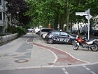
1440 | Otto von Bismarck (1815–1898), politician and Reich Chancellor | 1896 | It is included for the first time in the 1897 address book with the note "undeveloped". At that time there was only the section south of the mountain road. The extension to the north by including street E of the development plan (extension of Bismarckstrasse) into Bismarckstrasse took place on July 18, 1908. From 1914 to 1963, tram line 88 ran through this street. In the northern part, the lateral position of the rails, which was untypical for Berlin at that time, can still be recognized today by the large distance between the trees and the sidewalk, which is why transverse parking spaces were created here - also untypical for old streets. In contrast, the southern area was completely redesigned around 1984. To the north of Bergstrasse, Bismarckstrasse forms the center of the Bismarckviertel : the streets to the east and west are named after places and personalities from Bismarck's life. The Steglitz cemetery is located on the eastern side of the street. |
|
| Björnsonstrasse
( Location ) |
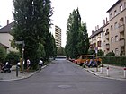
220 | Bjørnstjerne Bjørnson (1832-1910), Norwegian writer | Dec 10, 1910 | The first name of the street between Grillparzerstrasse and Schildhornstrasse was Strasse 9b in the development plan. Around 1912, the extension of Björnsonstrasse, Gellertstrasse , was included. The street is in what is known as the Dichterviertel because of its street names. |
|
| Bornstrasse
( Location ) |
525 (in the district) |
David Born (actually David Buttermilch , 1817–1879), entrepreneur and founder of the Friedenau country house colony | 5th Sep 1889 | Between 1874 and 1889 Bornstrasse was called Steglitzer Strasse . The north side of the street and the street are in Friedenau , the street (partly one-way street ) connects Schloßstraße and Odenwaldstraße. In the 19th century, the street belonged entirely to Friedenau; it has only been the border with Steglitz since 1938. |

|
| Borstellstrasse
( Location ) |
800 | Ludwig von Borstell (1773–1844), Prussian general | Nov 11, 1913 | The first name was Street 76 of the zoning plan. On April 10, 1931, the extension of Borstellstrasse, Märkische Strasse and Lichterfelder Strasse were included. The street is between Liebenowzeile and Siemensstraße (Siemensbrücke). |

|
| Braille Street
( Location ) |
120 | Louis Braille (1809-1852), French inventor of the eponymous Braille system for the blind | Nov 2, 1953 | The street lies between Schloßstraße and Rothenburgstraße and was called Kurfürstenstraße from 1896 to 1953 . |

|
| Brandenburg Street
( Location ) |
360 | Mark Brandenburg , Margraviate of the Holy Roman Empire | 1897 | The street lies between Borstellstrasse and Buhrowstrasse. When it was first mentioned in the address book in 1898, it left Stephanstrasse and was vacant. According to another source, it was named on June 2, 1904 and was previously called Dahlemer Strasse from 1887 to 1904 , but it is not included in the address books (first edition 1896) |

|
| wide street
( Location ) |
560 | For a long time the street was the widest street in Steglitz | before 1878 | The street lies between Albrechtstrasse and Birkbuschstrasse. |

|
|
Breitenbachplatz
( Location ) |
200 × 100 (oval shape) |
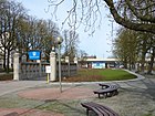
Paul von Breitenbach (1850–1930), Prussian Minister for Public Works | Aug 26, 1913 | From 1892 to 1913 it was called Rastatter Platz . The garden architect Georg Kuphaldt designed the green areas of the square . The greater part of the square is in Dahlem . The smaller part belongs to Steglitz and borders Wilmersdorf . The square was renamed in 1913 on the occasion of the opening of the underground line to Dahlem , in the construction of which the Prussian Minister Paul von Breitenbach played a major role. |
|
| Brentanostrasse
( Location ) |
660 | Clemens Brentano (1778–1842), writer | June 9, 1933 | This road, which runs essentially in north-south direction, lies between Schildhornstrasse and Grunewaldstrasse. Between 1901 and 1933 it was called Kleiststrasse , which was laid out by Rheingau AG. |

|
| Brinkmannstrasse
( Location ) |
110 | Conradin Brinkmann (1873–1956), teacher and co-founder of the Steglitzer Heimatverein | July 15, 1957 | The previous name of the street between Karl-Fischer-Weg and Sembritzkistraße from 1903 to 1957 was Turmstraße . Until 1920 the street belonged to the "Landhauskolonie Südende" and thus to Mariendorf. |

|
| Brueckenstrasse
( Location ) |
150 | a small stone bridge that formerly spanned the Faulen Graben | before 1878 | The street is a dead end between Johanna-Stegen-Straße and Am Eichgarten . To the north is the Steglitz city park. The extension of Brückenstraße along the newly built Teltow Canal , street 62e in the development plan, was also named Brückenstraße on January 15, 1910. After the Second World War , this stretch of road, which had never been built on, was converted into a green area. |

|
| Buggestraße
( Location ) |
480 | Ferdinand Bugge (1852–1911), local politician and initiator of the Steglitz city park | 1912 | The street belonged to Dahlem until the district boundaries were changed in 1938 . From 1910 until it was renamed in 1912, the traffic route was called Tolstoistraße . On January 16, 1925, the road 46a was included. The street connects Schildhornstraße and Englerallee. |

|
| Buhrowstrasse
( Location ) |
450 | Karl Wilhelm Hermann Buhrow (1863–1939), lawyer and mayor of Steglitz | July 11, 1957 | The street lies between Steglitzer Damm and Brandenburgischer Straße. The previous name from 1903 to 1957 was Bahnstraße after the Südende train station at the north end of the street. |

|
|
Carl-Heinrich-Becker-Weg
( Location ) |
310 | Carl Heinrich Becker (1876–1933), orientalist and politician | Aug 24, 1992 | The previous names were Friedrichstrasse from 1883 to 1934 and Dietrich-Schäfer-Weg between 1934 and 1992 . |

|
| Carmerplatz
( Location ) |
115 × 50 (triangular shape) |
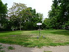
Johann Heinrich von Carmer (1720–1801), Prussian Grand Chancellor and judicial reformer | 1903 | The space between Birkbuschstrasse and Rugestrasse was created around 1900 by filling in a pond. The farm owner Schröder had previously leased it (from around 1870) and operated a bathing establishment there, which consisted of a two-part wooden building with bath cells. |
|
| Crailsheimer Strasse
( Location ) |
480 | Crailsheim , town in the Schwäbisch Hall district in Baden-Württemberg | July 20, 1960 | The previous names were Lankwitzer Strasse after 1850 to 1893 and Friedrichstrasse between 1893 and 1960 . |

|
|
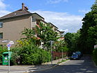
Dalandweg
( Location ) |
280 | Daland, figure of a Norwegian navigator in Wagner's opera Der Fliegende Holländer | May 17, 1930 | The first names were street K and street G of the development plan. |
|
| Deitmerstrasse
( Location ) |
240 | Josef Deitmer (1865–1929), Catholic theologian and auxiliary bishop based in Berlin | Aug 16, 1952 | The previous name from before 1883 to 1952 was Flensburger Straße . |

|
| Denkstrasse
( Location ) |
190 | Otto Denk (1837–1906), Mayor of Mariendorf | Feb. 1, 1909 | The first name was street 8a of the zoning plan. |

|
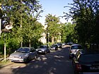
| Dijon Street
( Location ) |
100 | Dijon , city in France | before 1914 | The street originally went through to today's Klingsorstraße. After it was divided by a plot of land laid out in the middle section, the western part was named Leydenallee in 1933 . |
|
| Doldenweg
( Location ) |
60 | Umbelliferae , a family of plants | Aug 21, 1931 | The Doldenweg is a pure pedestrian street, which as a dead end forms the access to the side wing of a residential building and is accessed via Kelchstraße. The multi-family houses on the quiet residential street are part of a housing association and all date from the early 1930s. The building plans were provided by the architect Emil Müller, who designed the estate for the Neukölln housing association. The Doldenweg borders directly on the Georg-von-Siemens-Park and is close to the bank on the Teltow Canal . |

|
| Dünther Strasse
( Location ) |
110 | Dünth, a place in Denmark near Düppel , here the Düppeler Schanzen were stormed in 1864 | before 1878 | The street is between Düppelstrasse and Florastrasse. |

|
| Düppelstrasse
( Location ) |
440 | Düppel , town in Denmark , storming of the Düppeler Schanzen in 1864 | before 1878 | The street is between Albrechtstraße on Hermann-Ehlers-Platz and Alsen- / Florastraße. In the 20th century, this street (building numbers 20/21) was home to the “Friedrich Mönnig Brewery, vorm. Oskar Walter ”. |

|
|
Elisenstrasse
( Location ) |
240 | Elise Luise Mathilde Mannstaedt († after 1904), wife of the conductor and writer Wilhelm Mannstaedt (1837–1904) | before 1878 | Wilhelm Mannstaedt owned a villa on this street (house number 9). The naming of the street after Elise Mannstaedt is not clearly proven. |

|
| Ellwanger Strasse
( Location ) |
350 | Ellwangen (Jagst) , town in the Ostalb district in Baden-Württemberg | March 20, 1939 | The previous names were successively Mariendorfer Strasse , Hermannstrasse and Hünefeldstrasse . |

|
| Englerallee
( Location ) |
730 | Adolf Engler (1844–1930), botanist, 1st director of the Berlin Botanical Garden | 17 Sep 1938 | The previous name was Sachsallee around 1907-1938 . The west side of the road and the road land are in Dahlem . |

|
| Erlenstrasse
( Location ) |
200 | Alder trees , birch trees | 1905 | First mentioned in 1906 in the address book. On September 1, 1964, Eschenstrasse , which ran at right angles to Erlenstrasse, was incorporated into Erlenstrasse. |

|
| Ermanstrasse
( Location ) |
250 | Jean Pierre Adolphe Erman (actually: Johann Peter Adolf Ermatinger , 1854–1937), Egyptologist | December 3, 1954 | The previous name was Uhlandstrasse around 1890 to 1954 . |

|
|
Feuerbachstrasse
( Location ) |
800 | Anselm Feuerbach (1829–1880), painter | July 17, 1906 | The first name was street H of the zoning plan. On October 20, 1932, the Feldstrasse , which had already existed in the 19th century, was incorporated into Feuerbachstrasse. It forms the northern boundary of the Bismarck district . |

|
| Filandastrasse
( Location ) |
300 | Filanda, Italian name for a plant for reeling of silk cocoons | before 1878 | The road runs from Albrechtstrasse to Bergstrasse. The name is reminiscent of the silkworm rearing of Johann Adolph Heese, which was discontinued in 1889 . |

|
| Flemmingstrasse
( Location ) |
340 | Karl Flemming (1858–1907), architect | around 1910 | The first name was Street 16 of the development plan. |

|
| Florastrasse
( Location ) |
100 | Flora , Roman goddess of flowers | before 1883 | Florastraße was paved in 1896. With the construction of the city motorway (Westtangente), the section between Schadenrute and Alsenstraße fell away and was rededicated on April 13, 1966. The short residential street with old buildings stretches from the city motorway (A 103) to the Joachim-Tiburtius bridge, which serves as a feeder to the city motorway, there is a pedestrian passage to Schloßstraße. |

|
| Forest road
( Location ) |
700 | Forst , after the nearby Grunewald . | before 1883 | The road runs from Lepsiusstrasse to Brentanostrasse. |

|
| Franz-Amrehn-Platz
( Location ) |
30 × 20 | Franz Amrehn (1912–1981), CDU politician | Oct 4, 2011 | The previously unnamed place in front of the clothing store C&A on the corner of Schloßstraße and Schildhornstraße was named after Franz Amrehn by decision of the BVV . Around 1904 the triangular Schildhornplatz was located here . |

|
| Fregestrasse
( Location ) |
460 (in the district) |
Ferdinand Ludwig Frege (1804–1883), theologian and historian and between 1846 and 1883 first pastor in Schöneberg | April 29, 1884 | Parts of the street belong to Friedenau and Schöneberg . The first name of Fregestraße was Straße 27 . The later Federal President Theodor Heuss lived with his wife Elly Heuss-Knapp from 1918 to 1930 at Fregestraße 80 and was a city councilor for Schöneberg. The poet and writer Hans Magnus Enzensberger lived at 19 Fregestraße. |

|
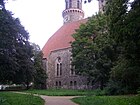
| Friedrichsruher Platz
( Location ) |
120 × 60 | Friedrichsruh , place in the Sachsenwald , from 1871 residence of Bismarck | Jan 15, 1910 | The square is the location of the Lukaskirche . It is in the Bismarck district . |
|
| Friedrichsruher Strasse
( Location ) |
900 | Friedrichsruh , place in the Sachsenwald , from 1871 residence of Bismarck | July 18, 1908 | The first name was Street 41 of the zoning plan. The street is in the Bismarckviertel . |

|
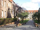
| Fritschweg
( Location ) |
200 | Bruno Fritsch (1842–1933), politician | May 3, 1935 | The previous name was Fritschstrasse from 1909 to 1935 . |
|
| Fronhoferstrasse
( Location ) |
260 | Christoph von Fronhofer (1728–1782), military and landowner | before 1912 | The street runs from Wolfenstein- to Hindenburgdamm. |

|
|
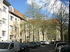
Ganghoferstrasse
( Location ) |
100 | Ludwig Ganghofer (1855–1920), writer | Dec 10, 1910 | The street runs from Grillparzerstrasse to Opitzstrasse. |
|
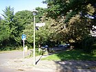
| Goebenstrasse
( Location ) |
310 | August Karl von Goeben (1816–1880), Prussian general | Oct. 27, 1890 | The road is not continuously passable. It runs between Klingsorstrasse and Sedanstrasse. The house at Goebenstrasse 1/2, built in 1928/29 as part of the "Steglitz III residential complex", is a listed building monument. |
|
| Göttinger Strasse
( Location ) |
250 | Göttingen , university town in Lower Saxony , Bismarck's place of study 1832–1835 | July 18, 1908 | The first name was Street 37 of the zoning plan. The quiet residential street with large courtyards is located in the Bismarckviertel . |

|
| Grabertstrasse
( Location ) |
290 | Martin Grabert (1868–1951), composer and organist | July 11, 1957 | The previous name between 1893 and 1957 was Wilhelmstrasse . The quiet residential street connects Sembritzkistraße and Steglitzer Damm. On the eastern side of the street are the barely visible Hambuttenpfuhl and the built-in Karutschenpfuhl, which have no public access. The Steglitz-Zehlendorf music school is located in a restored villa at the Karutschenpfuhl. |

|
| Gravelottestrasse
( Location ) |
425 | Gravelotte , municipality in France , 1870 site of the battle of Gravelotte . | Nov 8, 1912 | The first name was street 81a of the zoning plan. |

|
| Grenzburgstrasse
( Location ) |
65 | on the nearby Fichtenberg there was an artificial ruin called Grenzburg | March 16, 1910 | The border castle was an artificial ruin built in 1790, the privately built "Belvedere". From here you should have had a beautiful view of Charlottenburg , Wilmersdorf , Schöneberg and the old Berlin beyond . |

|
| Grillparzerstrasse
( Location ) |
400 | Franz Grillparzer (1791–1872), Austrian writer | before 1910 | The first name was Street 8 of the zoning plan. The western section of Grillparzerstraße, the former street 46f of the development plan of Dahlem , was named Grillparzerstraße on January 16, 1925 and belonged to Dahlem until April 1, 1938. |

|
| Gritznerstrasse
( Location ) |
840 | Maximilian Gritzner (1843–1902), heraldist , creator of the Steglitz coat of arms | before 1946 | The previous name was Arndtstrasse . The section north of Schildhornstrasse was called Friesenstrasse . The Paulsen grammar school and the Dunant elementary school are located on Gritznerstraße . |

|
|
Grunewaldstrasse
( Location ) |
930 | Grunewald , Berlin's largest forest | Apr 18, 1871 | The previous name after 1850 until before 1878 was Dahlemer Weg . In 1905 the road was expanded and paved. |

|
| Gurlittstrasse
( Location ) |
220 | Louis Gurlitt (1812-1897), painter | July 15, 1957 | The previous name before 1903 was Teichstrasse . |

|
| Gustav-Mahler-Platz
( Location ) |
90 × 80 | Gustav Mahler (1860–1911), Austrian composer | Dec. 1, 1968 | The first name was place R of the development plan. It is located between Englerallee and Haderslebener Straße. |

|
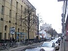
| Gutsmuthsstrasse
( Location ) |
350 | Johann Christoph Friedrich GutsMuths (1759–1839), teacher and co-founder of gymnastics | around 1920 | The street runs from Schloßstraße to Lepsiusstraße. This is where the entrance to the Titania Palace and the south side of the Forum Steglitz are located .
The street is not yet entered on city plans from 1907 and 1910; the area belonged to the Friedenau district. In 1926 the street existed and belonged to Friedenau |
|
|
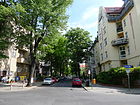
Hackerstrasse
( Location ) |
200 (in the district) |
Johann Carl Hacker (1811–1892), local politician and secret accountant in the Imperial War Ministry | 1890 | The northern section of the road runs in Friedenau . The part located in Steglitz was created by extending it to the south between 1905 and 1910. It includes house numbers 10–23. |
|
| Haderslebener Strasse
( Location ) |
560 | Hadersleben , city in Denmark | after 1907 | The first name was street 46c of the zoning plan. On a city map from 1907 the street is marked as Kleiststraße . |

|
| Halskestrasse
( Location ) |
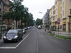
400 | Johann Georg Halske (1814–1890), technician, entrepreneur and Berlin local politician. The company name Siemens & Halske lasted until 1966. | 1897 | When the street was first mentioned in the address book in 1898, there were only two houses near today's Benzmannstraße. It led beyond today's Steglitzer Damm through undeveloped terrain further to the northeast in the course of today's Hanstedter Weg to today's Sembritzkistraße. In 1931 the north-eastern part was renamed Hanstedter Weg. When the Munster dam was built, the part north of the Steglitzer dam was renamed or given up for re-routing. |
|
| Hanstedter way
( Location ) |
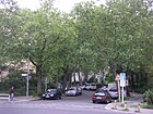
180 | Hanstedt , municipality in the Harburg district in Lower Saxony | Nov 23, 1931 | The street runs between Munsterdamm and Sembritzkistraße. Here is the primary school at the Insulaner . |
|
| Haydnstrasse
( Location ) |
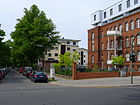
320 (in the district) |
Joseph Haydn (1732–1809), Austrian composer | before 1909 | The first name was street A of the zoning plan. The western section of the street runs in Lichterfelde . |
|
| Heesestrasse
( Location ) |
320 | Johann Adolph Heese (1783–1862), silk weaver and entrepreneur | Apr 18, 1871 | The road runs from Albrechtstrasse and Schützenstrasse to Bergstrasse. The Steglitz grammar school is located here . |

|
| Heimstättenweg
( Location ) |
150 | Heimstätten settlement, on the site of which the road was laid | 22 Sep 1922 | The street runs from Paulsenstrasse to Flemmingstrasse. |

|
| Heinrich-Seidel-Strasse
( Location ) |
220 | Heinrich Seidel (1842–1906), engineer and writer | Jan 15, 1910 | The street runs from Liliencronstraße to Steglitzer Damm. |

|
| Herderstrasse
( Location ) |
340 | Johann Gottfried Herder (1744–1803), poet | before 1890 | The street runs from Lepsiusstrasse to Gritznerstrasse, beyond that as a dead end street or as a pedestrian path to Paulsensrasse. |

|
| Hermann-Ehlers-Platz
( Location ) |
85 × 40 | Hermann Ehlers (1904–1954), politician and President of the German Bundestag | March 28, 1958 | The square is on Schloßstraße , Düppelstraße, Albrechtstraße, Grunewaldstraße and Kuhligkshofstraße. The Rathaus Steglitz , the Steglitzer Kreisel and the Rathaus Steglitz train station are located here ( S-Bahn line S1 and U9 line ). A weekly market takes place regularly on the square. The Steglitz Holocaust Memorial is also here . At first it was unofficially called Rathausplatz . |

|
| Hermesweg
( Location ) |
140 | Ernst Sigismund Timotheus Oswald Hermes (1826–1909), mathematician and founder of the Steglitzer Anzeiger | May 17, 1930 | The first name was street 73 of the zoning plan. |

|
| Herrfurthstrasse
( Location ) |
125 | Ernst Ludwig Herrfurth (1830–1900), Prussian statesman | July 17, 1906 | The first name was street 20a of the zoning plan. The road remained undeveloped until 1925. |

|
| Hindenburgdamm
( Location ) |
280 (in the district) |
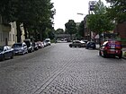
Paul von Hindenburg (1847–1934), Field Marshal General and President | Nov 16, 1914 | The previous name from 1878 to 1914 was Chausseestrasse . Most of the street runs in Lichterfelde . The tram ran through Hindenburgdamm until 1963 , which can still be seen in the Steglitzer part of the street through the paving along the street. The Steglitz depot was located here . |
|
| Holstein Street
( Location ) |
700 (in the district) |
Holstein , southern part of Schleswig-Holstein , duchy until 1864 | around 1896 | The first names were Street 22 and Street 26 of the development plan. Part of the street is in Friedenau . |
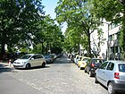
|
| Horst-Kohl-Strasse
( Location ) |
350 | Horst Kohl (1855–1917), Bismarck researcher and historian | July 18, 1908 | The first name was street X of the zoning plan. The street is in the Bismarckviertel . |

|
| Hubertusstrasse
( Location ) |
170 | Hubertus of Liège (655–727), Bishop of Maastricht and Liège | before 1878 | The street runs from Schloßstraße to Düppelstraße. |

|
| Hünefeldzeile
( Location ) |
320 | Ehrenfried Günther Freiherr von Hünefeld (1892–1929), aviation pioneer | 1953 | The name between 1903 and 1953 was Mittelstrasse according to its location in the road network. The memory of Hünefeld became possible because a previous Hünefeldstrasse no longer existed. |
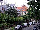
|
| Hünensteig
( Location ) |
530 | Hüne , old word for giant | Nov 23, 1931 | The first name was Street 53 of the zoning plan. The Hünensteig establishes the connection between Walsroder Straße and Immenweg, whereby it also forms a further six individual paths between Bismarckstraße and Walsroder Straße. |
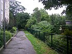
|
|
In the garden home
( Location ) |
75 | Gartenheim Genossenschaft Steglitz egmbH | before 1915 | The street name first appeared in the address book in 1915. An official naming is not documented because the street is a private road . At the time, there were six developed plots on it. |
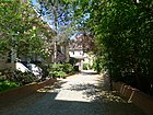
|
| Immenweg
( Location ) |
360 | Imme, old name for the bee | Nov 23, 1931 | The first name was Street 8 of the zoning plan. |

|
|
Jeverstrasse
( Location ) |
350 | Jever , district town in Lower Saxony | Feb 9, 1910 | The first name was Street II of the zoning plan. The street is in the Bismarckviertel . |

|
| Jochemplatz
( Location ) |
70 × 70 (triangular shape) |
Arthur Jochem (1874–1960), Steglitz local politician | Dec. 1, 1962 | Until 1962 the place was called Stubenrauchplatz . It was then named after Arthur Jochem, the district mayor of Steglitz appointed by the US Allied Administration on June 27, 1945 . |

|
| Johanna-Stegen-Strasse
( Location ) |
440 | Johanna Stegen (1793–1842), formerly known as the "hero girl of Lüneburg" | before 1913 | The first names were street 70 and street 70a of the development plan. Around 1926 the street reached from Breite (n) Straße to the Teltow Canal , where it led over the Kirchner Bridge to Lankwitz and changed into today's Nicolaistraße . In 1930 the western section was renamed Barsekowstraße . In the 21st century it is a footpath to the west of Vionvillestrasse on the edge of a green area and ends in the east just before the Teltow Canal. The bridge that used to be there no longer exists.
The house Johanna-Stegen-Straße 2, built in 1928/29 as part of the "Steglitz III residential complex", is a listed building monument. |

|
|
Kantstrasse
( Location ) |
120 | Immanuel Kant (1724–1804), philosopher | before 1892 | During the National Socialist era , the street was renamed Nietzschestraße , which was later reversed. Not present in the address books until 1943. Kantstrasse connects Filandastrasse with Lessingstrasse in a west-east route. |

|
| Karl-Fischer-Weg
( Location ) |
580 | Karl Fischer (1881–1941), founder of the migratory bird movement | 1956 | The previous name from 1903 to 1956 was Parkstrasse . Row houses and single-family houses are predominant in the street along the railway line. At the south end, a block of flats marks the entrance to the street. At the north end of the street is an allotment garden and at the south end of the Hambuttenpfuhl. There is a connection path for pedestrians along the pond to the S-Bahn station. |

|
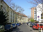
| Karl-Stieler-Strasse
( Location ) |
410 | Karl Stieler (1842–1885), writer | Jan 15, 1910 | The first name was street 63a of the zoning plan. |
|
| Kelchstrasse
( Location ) |
300 | nearby Kelchpfuhl | Aug 9, 1929 | The quiet residential street runs from Steglitzer Damm to Langensteiner Weg and beyond then as a dead end . The large building at the end of Kelchstrasse used to be the headquarters of the Scherk cosmetics company - now the Institute for Pharmacy at the Free University. With the exception of one new building, the houses of a housing association all date from the early 1930s. The street ends in a triangle of train tracks as a dead end. Before the street got its current name, it was called Am Kelchpfuhl from 1925 to 1929 . |

|
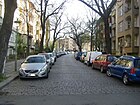
| Kellerstrasse
( Location ) |
90 | Gottfried Keller , Swiss writer | Jan 15, 1910 | The first name was Street 62 of the zoning plan. |
|
| Kieler Strasse
( Location ) |
230 | Kiel , capital of Schleswig-Holstein | before 1878 | The street runs from Bergstraße and Robert-Lück-Straße - from Düppelstraße as a dead end street - to Schloßstraße . |

|
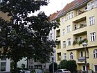
| Kissinger Strasse
( Location ) |
280 | Bad Kissingen , district town in Lower Franconia , Bavaria | July 18, 1908 | The first name was Street VII of the zoning plan. The street is in the Bismarckviertel . |
|
| Klingsorstrasse
( Location ) |
1100 (in the district) |
Klingsor , magician from the Wagner opera Parsifal | May 17, 1930 | The western section of the street runs in Lichterfelde .
The building tracts at Klingsorstrasse 35–59 and 50–58, which were built in 1928/29 as part of the "Steglitz III residential complex", are listed monuments. The houses at Klingsorstrasse 22–34 were built in a first construction phase from 1901 to 1904 (Steglitz I residential complex) based on designs by Erich Köhn and are also listed. |

|
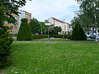
| Knausplatz
( Location ) |
50 × 25 (triangular shape) |
Ludwig Knaus (1829–1910), painter | before 1904 | The first name was place I of the development plan. From 1912 to 1914 this was the terminus of the Steglitz track globe . |
|
| Knausstrasse
( Location ) |
100 | Ludwig Knaus (1829–1910), painter | Jan. 12, 1892 | The east side of the street is in Schöneberg . The first name was Street 46 . Originally (probably until 1938) the northern part of the west side (No. 1 to 5) was also in Schöneberg, only the three southern properties (No. 6 to 8) belonged to Steglitz. In 1906 the first house (No. 7) was built in the Steglitz part of the street. |

|
| Kniephofstrasse
( Location ) |
1000 | Kniephof , manor in the province of Pomerania | July 18, 1908 | The first name was Street XII . |

|
|
Queen-Luise-Strasse
( Location ) |
180 (in the district) |
Luise von Mecklenburg-Strelitz (1776–1810), Queen of Prussia | 1931 | The road was created in 1889-1901 by the commission for the division of the Dahlem domain . It was initially named Luisenstrasse after the nearby Luisenstift . The previous name from 1900 to 1906 was Dorfstrasse . The greater part of the street runs in Dahlem . |

|
| Körnerstrasse
( Location ) |
960 | Fritz Körner (1830–1894), landscape gardener, had set up a 30 acre (75,000 m²) tree nursery on this street | 1892 | The road originally led north from Bergstrasse, before 1896 to the Steglitz freight yard, the main building of which was only demolished in 2018. The northern extension, street A of the development plan, was also named Körnerstraße after 1900 up to the Friedenau district boundary . The southern extension to Südendstrasse has been recorded in the address book since 1906, when it was still undeveloped. |

|
| Kottsteig
( Location ) |
100 | Karl Kotte (1853–1927), gardener and local politician | July 13, 1934 | The first name was 11 Street . |

|
| Kreuznacher Strasse
( Location ) |
750 | Bad Kreuznach , district town in Rhineland-Palatinate | 1903 | The north side of the street and the road area are in Wilmersdorf and Friedenau . |

|
| Kühlebornweg
( Location ) |
210 | Kühleborn, Prince of the Water Kingdom from the opera Undine by Albert Lortzing | Aug 9, 1929 | The first name was street B of the zoning plan. |

|
| Külzer Strasse
( Location ) |
70 | Külz, the German name of today's place Kulice ( Nowogard ) in the powiat Goleniowski in West Pomerania (Poland), where Bismarck managed an estate around 1840 | 1910 | The first name was street IIa of the development plan. The passage to Menckenstrasse is interrupted by the driveway to the Joachim-Tiburtius-Brücke . The street is in the Bismarckviertel . |

|
| Kuhligkshofstrasse
( Location ) |
300 | Karl Kuhligk (1841–1919), master mason in Steglitz | around 1889 | The street was initially called Kuhligks Hof or Kuhligkshof . Around 1910, its extension, the parallel street, was incorporated into Kuhligkshofstraße. |

|
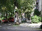
| Short street
( Location ) |
120 | after the shortness of the road | before 1878 | The street is between Birkbuschstrasse and Adolfstrasse. |
|
|
Lacknerstrasse
( Location ) |
140 | Carl Gottfried Lackner (1831–1902), gardener owner and community leader in Steglitz | before 1913 | In 1913 this street between Albrechtstrasse and Borstellstrasse was already mentioned in the address book, but it was still undeveloped. |

|
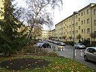
| Langensteiner Weg
( Location ) |
250 | Langenstein , district of Halberstadt in Saxony-Anhalt | 1931 | Before a private street , it was called Langensteinstraße between 1929 and 1931 . The quiet residential street is a connection to Kelchstraße. The apartment building association Neukölln had the apartment buildings from the early 1930s built. The complex includes a small park with the Kelchpfuhl, which is only accessible to residents and guests. |
|
| Lauenburger Platz
( Location ) |
80 × 40 | Duchy of Lauenburg , German principality | 1910 | The place is in the Bismarckviertel . The garden landscape was designed according to the drafts of horticultural director Fritz Zahn: with a pond, curved pathways and a marsh oak avenue laid out as a promenade. The main entrance is on Bismarckstrasse and has a viewing platform and a double staircase. |

|
| Lauenburger Strasse
( Location ) |
1360 | Duchy of Lauenburg , German principality | 1908 | The section south of the Bergstrasse was called the Ringstrasse from before 1884 to 1960 . The section north of Bergstrasse is in the Bismarckviertel . |

|
| Lenbachstrasse
( Location ) |
50 | Franz von Lenbach (1836–1904), painter | 1904 | The street between Körnerstrasse and Knausstrasse is north of the Bismarckviertel and on the route of the street X of the development plan. |

|
| Lepsiusstrasse
( Location ) |
1400 | Karl Richard Lepsius (1810-1884), Egyptologist | Apr 4, 1934 | The street runs from Bornstrasse to the Botanical Garden. The street was formerly called Jahnstrasse (north of Schildhornstrasse) and Fichtestrasse (south of it). The Royal Thai Embassy (No. 64/66) and the Embassy of the Republic of Chad (No. 114) are located on Lepsiusstrasse . |

|
| Lessingstrasse
( Location ) |
320 | Gotthold Ephraim Lessing (1729–1781), poet | before 1869 | The street lies between Bergstrasse and Südendstrasse, it borders on the green area of Lauenburger Platz. |

|
| Leydenallee
( Location ) |
560 | Ernst von Leyden (1832–1910), medic | June 8, 1932 | The street between Berlinickestrasse and Klingsorstrasse continues as a dead end to the east until the Evangelical School in Steglitz . The name of the street that existed before 1883 until it was renamed in 1932 was Lindenstraße . |

|
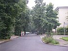
| Liebenowzeile
( Location ) |
400 | Heinrich Liebenow (1817–1881), landowner and village mayor in Steglitz | 1957 | The previous name between 1905 and 1957 was Lange Straße after its expansion. |
|
| Liliencronstrasse
( Location ) |
320 | Detlev von Liliencron (1844–1909), writer | Jan 15, 1910 | The road 63b of the development plan was named in 1910 and is located between Pressel- and Halskestraße. |

|
| Loerracher Strasse
( Location ) |
180 | Loerrach , district town in Baden-Wuerttemberg | 1960 | The street between Hünefeldzeile and Crailsheimer Straße was named Neue Straße in 1903, in contrast to the streets in the area that had already existed for some time. In 1910 it was located in Anhalter Straße with reference to the Berlin-Anhalter-Eisenbahn , which was built in the middle of the 19th century and the road ran directly along its route and the Südende station . |

|
| Lothar-Bucher-Strasse
( Location ) |
400 | Lothar Bucher (1817–1892), Prussian journalist and politician, close confidante of Bismarck | 1908 | The western part of the street was laid out where the Steglitz cycling track was from 1905 to 1910 . The street is in the Bismarckviertel . |

|
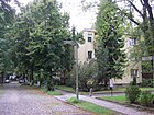
| Ludwigsburg way
( Location ) |
200 | Ludwigsburg , district town in Baden-Württemberg | 1960 | The previous name was 1903-1960 Krumme Straße after the route. |
|
| Lutherstrasse
( Location ) |
210 | Martin Luther (1483–1546), theologian, author of the Reformation | 1897 | The street runs between Breite Straße and Klingsorstraße. When it was first mentioned in the address book in 1898, it contained a "Luther pen". It is said to have been named Grabenstrasse around 1896 . |

|
|
Markelstrasse
( Location ) |
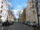
700 | Karl Emil Markel (1860–1932), chemist, founder of the Markelstiftung | Nov 26, 1927 | The Markelstraße lies between Schloßstraße and the cul-de-sac of Gritznerstraße. Before Str. 13 of the development plan, it was named Mommsenstrasse on November 11, 1903, after the historian Theodor Mommsen (1817–1903) (Nobel Prize for Literature 1902). |
|
| St. Mark's Square
( Location ) |
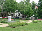
110 × 90 | St. Mark's Church | before 1913 | Before place Y of the development plan, it is between Liliencron and Karl-Stieler-Strasse on Heinrich-Seidel-Strasse. |
|
| Martinstrasse
( Location ) |
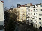
140 | unexplained, probably Martin , male first name, Saint Martin (317–397) is also possible | 1904 | Martinstraße with only twelve house numbers is located between Schützenstraße and Kurzen Straße. It is mentioned for the first time in the address book in 1905 and was only laid out when the neighboring streets were already built on. |
|
| Maßmannstrasse
( Location ) |
230 | Hans Ferdinand Maßmann (1797–1874), Germanist and sports educator | before 1910 | Maßmannstrasse is located in the main street between Markel- and Kreuznacher Strasse and connects Lepsiusstrasse to Wilmersdorf and Laubacher Strasse. |

|
| Maulbronn bank
( Location ) |
550 | Maulbronn , town in the Enzkreis in Baden-Württemberg | Aug 18, 1926 | The quiet residential street is only built on on the north side. The south side borders the bank of the Teltow Canal. The street is mostly built up with single and multi-family houses, there is only one apartment block on Attilastraße and it is located between Attilastraße and Sieversbrücke as a one-way street in a westerly direction along the Teltow Canal. On April 14, 1936, street 88 was laid out on the route of street 10b of the development plan . |

|
| Menckenstrasse
( Location ) |
430 + 50 | Wilhelmine Luise Mencken (1789–1839), mother of Otto von Bismarck | Feb 9, 1910 | The southern end of the street is interrupted by the driveway to the Joachim-Tiburtius-Brücke. The street is in the Bismarckviertel . |

|
| Mergentheimer Strasse
( Location ) |
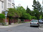
190 | Bad Mergentheim , town in the Main-Tauber district in Baden-Württemberg | December 31, 1924 | The street lies between Attilastraße and Maulbronner Ufer, it was laid out as street 7 of the development plan. |
|
| Mittelstrasse
( Location ) |
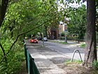
560 | Gardens that divided the street in half | before 1878 | It is between Berlinicke and Klingsorstrasse. The course of the road is interrupted by a footpath and a cycle path between Schützenstrasse and Breite Strasse (introducing a dead end here). In the west, the street reached Schützenstraße and was only extended to Berlinickestraße in 1905. There has been access to the S-Bahn since the late 1980s. |
|
| Munsterdamm
( Location ) |
1000 | Munster , town in the Heidekreis district in Lower Saxony | Nov 23, 1931 | The Munsterdamm was extended to the north in 1958 across the Rauhen Berge area . The house numbers 86-90 are in Schöneberg . The planetarium at the Insulaner is located there . |

|
| Muthesiusstrasse
( Location ) |
290 | Hermann Muthesius (1861–1927), architect | 26 Sep 1929 | On a city map from 1907 the street is marked as Miquelstraße . |

|
|
Neckarsulmer Strasse
( Location ) |
270 | Neckarsulm , town in the Heilbronn district in Baden-Württemberg | December 31, 1924 | The route according to the development plan for Straße 9 was laid in 1924 between Attilastraße and Maulbronner Ufer. |

|
| New Filandastrasse
( Location ) |
210 | Extension of Filandastrasse, Filanda is the Italian term for a system for unwinding of silk cocoons | Dec. 1, 1969 | Neue Filandastrasse is located between Albrechtstrasse and Filandastrasse and leads into Klingsorstrasse. It continues the two-lane Filandastraße bypassing the residential area. |

|
|
Oberlinstrasse
( Location ) |
200 | Johann Friedrich Oberlin (1740–1826), pastor and social pioneer from Alsace . | 21 Sep 1960 | The previous name was Bahnstrasse . As early as 1946, the street was briefly called Oberlinstrasse. |

|
| Oehlertplatz
( Location ) |
35 × 20 (oval shape) |
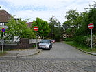
Karl Oehlert (1843–1923), mayor of Mariendorf | Aug 25, 1939 | The first name was Platz Oe of the development plan. The Oehlertplatz belonged to Mariendorf until 1920 . |
|
| Oehlertring
( Location ) |
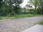
890 | Karl Oehlert (1843–1923), mayor of Mariendorf | July 11, 1957 | The previous names were Ringstrasse (before 1884 to 1901), Karlstrasse (1901–1957), Oehlertstrasse (1901–1957) and Friedenauer Strasse (1901–1957). They belonged to Mariendorf until 1920 . |
|
| Opitzstrasse
( Location ) |
130 | Martin Opitz (1597–1639), poet | 1910 | The first name was street 9c of the zoning plan. |

|
| Orleans Street
( Location ) |
80 | Orléans , city in France and the site of the French-German War in 1870 | before 1914 | The first name was street 84a of the zoning plan. It leads from Am Stadtpark to Johanna-Stegen-Straße and comprises only 6 parcels. |

|
|
Paul-Henckels-Platz
( Location ) |
60 × 45 | Paul Henckels (1885–1967), actor | Sep 9 1975 | The square is located on both sides of Carl-Heinrich-Becker-Weg at its confluence with Schmidt-Ott-Straße. |

|
| Paul-Schwarz-Promenade
( Location ) |
1080 | Paul Schwarz (1877–1951), engineer and 1945 mayor of the Steglitz district | Feb 20, 1952 | The promenade runs along the Teltow Canal from Krahmersteg to Dalandweg. |

|
| Paulsenstrasse
( Location ) |
880 | Friedrich Paulsen (1846–1908), educator and philosopher | 1901 | The first name was street 10 of the development plan. It connects Grunewaldstrasse with Mommsenstrasse and comprises 47 parcels. In 1931, many of these were still designated as “construction sites”. |

|
| Peschkestrasse
( Location ) |
250 | Karl Hermann Peschke (1838–1912), local politician and from 1892–1901 community representative in Steglitz | around 1902 | The first name was Street 25 of the zoning plan. Part of the north side of the street is in Friedenau . |

|
| Plantation road
( Location ) |
220 | nearby Heese mulberry plantation | before 1878 | The street runs from Albrechtstraße to Südendstraße. In 1920 it already included house numbers 1–30. |

|
| Poschingerstrasse
( Location ) |
580 | Heinrich von Poschinger (1845–1911), writer and historian, Bismarck biographer. | July 18, 1908 | The first names were Street I and Street Ia in the development plan. The street is in the Bismarckviertel . |

|
| Presselstrasse
( Location ) |
220 | Gustav Pressel (1827–1890), composer | Jan 15, 1910 | The first name was street 61a of the zoning plan. |

|
|
Reutlinger Strasse
( Location ) |
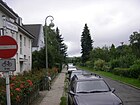
270 | Reutlingen , district town in Baden-Württemberg | 1924 | The first name was street 10 of the development plan. The quiet residential street, mainly built with single-family houses, is only built on on the west side. On the east side is the "KGA Reutlinger Straße" and behind it the Dresdener Bahn . The street is a one-way street to the south. |
|
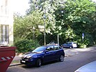
| Rezonvillestrasse
( Location ) |
70 | Rezonville , commune in France and the site of the 1870 Franco-German War battle | before 1912 | The first name was street 86a of the zoning plan. |
|
|
Rheinstrasse
( Location ) |
90 (in the district) |
Rhine , European river | Oct. 22, 1875 | The previous name was Provinzial chaussee Berlin-Potsdam . The traffic route forms the district border to Tempelhof-Schöneberg between Walther-Schreiber-Platz and Peschkestrasse . Most of the street including the entire street area belongs to Friedenau , only house numbers 40-42 are in Steglitz. When the then newly built part of the street was first mentioned in the Steglitz address book in 1903, the numbers 43 and 44 north of Peschkestraße also belonged to Steglitz. |

|
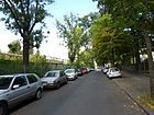
| Robert-Lück-Strasse
( Location ) |
340 | Robert Lück (1851–1930), 1886–1919 first director of the Steglitz grammar school , whose schoolyard is on the street | 1919 | The western side of the street borders the S-Bahn line . The former name of the traffic route was Klixstraße . From 1912 to 1914 the street was used by the Steglitz track globe . |
|
| Rösnerstrasse
( Location ) |
120 | Carl Friedrich Rösner (1830–1882), educator and first director of the Royal Institute for the Blind in Steglitz | Aug 18, 1926 | The first name was street 1a of the development plan. |

|
|
Rothenburgstrasse
( Location ) |
950 | Friedrich Ernst von Rothenburg (1766-1833) supported the work with blind people and bequeathed his fortune to the asylum for the blind after his death | May 8, 1877 | In the street there has been a school for the blind and a museum for the blind since 1877, the Matthäuskirche since 1880 and the building of the higher girls' school since 1912 (today: Fichtenberg Oberschule ) |

|
| Rottweiler Street
( Location ) |
260 | Rottweil , district town in Baden-Württemberg | 1924 | The first name was Street 8 of the zoning plan. | |
| Rückertstrasse
( Location ) |
200 | Friedrich Rückert (1788–1866), poet and orientalist | Nov 10, 1903 | The first name was street 7 of the development plan. The street belonged to Dahlem until April 1, 1938 . Since February 1, 1989, the section from Gustav-Mahler-Platz to Haderslebener Strasse and Englerallee has also belonged to Rückertstrasse. |

|
| Rugestrasse
( Location ) |
110 | Max Ruge , local politician in Steglitz and member of the Reichstag | before 1894 | The street runs from Schützenstraße to Berlinickestraße. From 1898 there was a Rugeplatz on this street, which was probably later integrated into the course of the street. |

|
|
Saarstrasse
( Location ) |
50 (in the district) |
Saar , river through France and Germany | Oct. 22, 1875 | Most of the road including the road land belong to Friedenau . Only house number 11a (left in the picture) is in Steglitz. |

|
| Sachsenwaldstrasse
( Location ) |
520 | Sachsenwald , a forest east of Hamburg , was donated to Bismarck in 1871 . Here are Friedrichsruh Palace and the Bismarck Mausoleum. | 4th Sep 1908 | The previous name was Allerstrasse . The street is in the Bismarckviertel . |

|
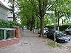
| Schalloppstrasse
( Location ) |
230 | Emil Schallopp (1843–1919), stenographer and chess master | May 17, 1930 | The first name was Street 69 of the zoning plan. |
|
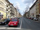
| Schildhornstrasse
( Location ) |
1180 | Schildhorn , peninsula in the Havel | before 1878 | The street runs from Schloßstraße to Breitenbachplatz . |
|
|
Schlossstrasse
( Location ) |
1600 | Gutshaus Steglitz at Schloßstraße 48, which was popularly known as "Castle" because of its beautiful appearance. | Apr 18, 1871 | Schloßstraße is the main shopping street in Steglitz and part of the road connection from old Berlin to Potsdam , today Bundesstraße 1 . The name from 1792 to around 1860 was Potsdamer Chaussee . At the end of the 18th century, the traffic route was expanded into an efficient art road. Around 1900, Schloßstraße became a modern urban main street with trams . The Steglitz Town Hall was built in 1898, the Titania Palace in 1928. The last trams ran in 1963. In the 1970s, the Steglitzer Kreisel , the Forum Steglitz and the Bierpinsel were built on the street . Since the 2010s, the administration has tried to divert car traffic in order to make the shopping center even more attractive.
The Harry Bresslau Park and the Botanical Garden at the southwest end of the road are designated green areas in the district, the latter is an admission charge. |

|
| Schmidt-Ott-Strasse
( Location ) |
650 | Friedrich Schmidt-Ott (1860–1956), science politician | 1960 | The street has been called Kaiser-Wilhelm-Strasse since the 1870s and had a Wilhelmplatz until 1933 . During the National Socialist era it was called Manckestrasse , then again Kaiser-Wilhelm-Strasse until 1960 . |

|
| Schöneberger Strasse
( Location ) |
720 | Schöneberg , formerly an independent city, from 1920 a district and since 2001 part of Berlin | before 1883 | The street connects Feuerbachstrasse with Rheinstrasse , Schloßstrasse , Bundesallee and Walther-Schreiber-Platz . |

|
| Schönhauser Strasse
( Location ) |
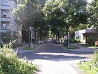
640 | Schönhausen (Elbe) , municipality in the Stendal district in Saxony-Anhalt and the birthplace of Otto von Bismarck | July 18, 1908 | The first name was Street III of the zoning plan. The street is in the Bismarckviertel . |
|
| Schorlemerallee
( Location ) |
70 (in the district) |
Clemens Freiherr von Schorlemer-Lieser (1856–1922), politician | before 1920 | The road was laid out around 1900 on the recommendation of the commission to subdivide the Dahlem domain . Most of the road runs in Dahlem . |

|
| Schünemannweg
( Location ) |
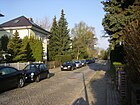
210 | Adolf Schünemann (1847–1919), landowner in Südende | April 14, 1936 | The quiet residential street consists of single-family houses with gardens and was created as street 221 of the development plan. The street goes west from Attilastraße and ends as a dead end at the allotment gardens Schünemann. There are two passages to a footpath that runs directly on the Teltow Canal. |
|
| Schützenstrasse
( Location ) |
700 | Barracks of the Guard Rifle Battalion in Lichterfelde , in the direction of which the street ran | before 1893 | The previous name was Teichstrasse . |

|
| Sedanstrasse
( Location ) |
700 | Sedan , municipality in the Ardennes in France and site of the Battle of Sedan on September 1, 1870 | around 1895 | The street creates the connection between Albrechtstraße, Lauenburger Straße and Steglitzer Damm to Birkbuschstraße. |

|
| Selerweg
( Location ) |
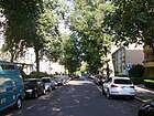
320 | Eduard Seler (1849–1922), American scholar | July 20, 1960 | The previous names were Humboldtstrasse and Moltkestrasse . |
|
| Sembritzkistraße
( Location ) |
770 (in the district) |
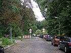
Martin Sembritzki (1872–1934), Steglitz district mayor from 1921 to 1933 | July 11, 1957 | The previous name was Doellestrasse between 1934 and 1947 . In 1947, Priesterweg and Doellestrasse were merged and renamed. The northern section of the road runs in Schöneberg . |
|
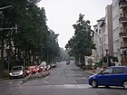
| Siemensstrasse
( Location ) |
230 (in the district) |
Werner von Siemens (1816–1892), physicist and entrepreneur | Feb. 24, 1894 | The western section of the road runs in Lankwitz . |
|
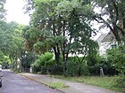
| Sohnreystrasse
( Location ) |
200 | Heinrich Sohnrey (1859–1948), teacher, folk writer and publicist | July 11, 1957 | The previous name was Seestrasse . |
|
| Spinoza Street
( Location ) |
200 | Baruch de Spinoza (1632–1677), Dutch philosopher with Iberian-Jewish ancestors | July 31, 1947 | The first name was street 46d of the zoning plan. |

|
| Steglitzer dam
( Location ) |
1700 | Steglitz , part of Berlin and an independent municipality until 1920 | 5th Sep 1957 | The central residential and commercial street in southern Berlin is between Lauenburger and Attilastraße. The street was merged in 1957 from the Mariendorfer Straße , which was laid out before 1883, and the Steglitzer Straße , which was laid out around 1896 . The local shopping center is located between Bismarckstrasse and Halskestrasse and residential buildings predominate from Munsterdamm (mostly post-war buildings). Between the S-Bahn station Südende and the S-Bahn station Attilastraße there are single-family houses on the south side, the north side on Kelchstraße and Langensteiner Weg borders on a closed residential area from the early 1930s. |

|
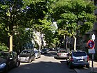
| Steinstrasse
( Location ) |
320 | Heinrich Friedrich Karl vom und zum Stein (1757–1831), Prussian civil servant, statesman and reformer | 1896 | Steinstrasse runs from Elisenstrasse to Bismarckstrasse. In the 1897 address book it is included for the first time as a street with a house from Elisenstraße only to Ringstraße (today Lauenburger Straße), in the development plan Straße 54 . |
|
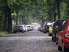
| Stephanstrasse
( Location ) |
440 | Heinrich von Stephan (1831–1897), postmaster general and politician | June 21, 1897 | The previous name before 1897 was Schöneberger Straße according to the direction. |
|
| Minimum road
( Location ) |
420 | Julius Stinde (1841–1905), writer | Jan 15, 1910 | The first name was Street 62a of the zoning plan. The street 62a and its extension, the Brüderstraße , were incorporated into the previously named Stindestraße on November 12, 1925. |

|
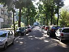
| Stirnerstrasse
( Location ) |
150 | Max Stirner (1806–1856), philosopher and journalist | July 31, 1947 | The previous names were Hardenbergstrasse (around 1896 to 1937) and Gerhard-Weber-Strasse (1937-1947). |
|
| Search highway
( Location ) |
140 | Suchland, name of a farming family in Steglitz | 17 Sep 1938 | The previous names were Neue Strasse from 1893 to 1938 and Marksteinstrasse around 1896 to 1938 . |

|
| Südendstrasse
( Location ) |
840 | Südende , former villa colony in the Mariendorf district , part of Steglitz since 1920. | before 1883 | The street runs from Lauenburger to Robert-Lück-Straße. |

|
|
Telramundweg
( Location ) |
150 | Friedrich von Telramund, figure from the Wagner opera Lohengrin | March 19, 1938 | The first name was Street J of the zoning plan. |

|
| Thorwaldsenstrasse
( Location ) |
740 (in the district) |
Bertel Thorvaldsen (1770–1844), Danish sculptor | Nov 15, 1901 | The busy thoroughfare with a median and two lanes on each side (one partly as a bus lane) is lined with a mixture of old, post-war and new buildings. The south side and the street area belong to the district. The northeast side of the street is in Schöneberg . The Auguste Viktoria Clinic is located on the street . It forms the north-eastern boundary of the Bismarck district . |

|
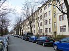
| Treitschkestrasse
( Location ) |
650 | Heinrich von Treitschke (1834-1896), historian | July 17, 1906 | The street runs between Schloßstraße and Paulsenstraße, whereby the section between Schloßstraße and Harry-Bresslau-Park was built over by Boulevard Berlin in 2011 and the street was thus shortened. There is no longer a direct car connection to Schloßstraße. The first name was Street 14 of the zoning plan. Harry-Bresslau-Park ( popularly known as Treitschkepark ) is located on the south-western side with an area of 160 × 60 meters . The Dunant Primary School and the Copernicus High School are located between Lepsiusstrasse and Gritznerstrasse . Until 2012 there was a dispute about the naming after Heinrich von Treitschke, who was significantly involved in the Berlin anti-Semitism dispute. The BVV therefore decided in September 2012 to survey all 428 residents about the renaming of the street, which ran until December 17, 2012. The counting of the 305 votes cast on December 19, 2012 resulted in a large majority in favor of keeping the street name. 226 residents voted against renaming and only 64 in favor. 15 votes were invalid. |
|
| Tuttlinger way
( Location ) |
80 | Tuttlingen , district town in Baden-Württemberg | Apr 14, 1936 | The first name was street 220 of the zoning plan. |

|
|
Among the armors
( Location ) |
150 | Initial planting with armaments | Nov 12, 1925 | The street was laid out as Rüsternstraße as early as 1904 , but was only built upon after it was renamed. |

|
|
Club path
( Location ) |
120 | Official housing association that created living space here | around 1907 | The club path was previously a private street of the civil servants' housing association in Berlin. |

|
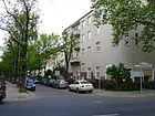
| Vionvillestrasse
( Location ) |
160 | Vionville , commune west of Metz in France and site of the 1870 Battle of Vionville | Nov 8, 1912 | The first name was street 85a of the zoning plan. |
|
|
Waetzoldtstrasse
( Location ) |
85 | Christian Stephan Waetzoldt (1849–1904), educator | 1911 | The first name was street 3b of the zoning plan. |

|
| Walsroder Strasse
( Location ) |
260 | Walsrode , town in the Heidekreis district in Lower Saxony | Nov 23, 1931 | The first name was Street 54 of the zoning plan. |

|
| Weverpromenade
( Location ) |
150 | Arnold Wever (1850–1922), bank director and lay judge | around 1922 | The Steglitz district named a wide promenade after him in the city park created by Wever. In 1924 the eldest son Karl put a memorial stone there at the suggestion of the district. |

|
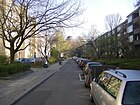
| Wilseder Strasse
( Location ) |
300 | Wilsede , district of Bispingen in Lower Saxony | Aug 16, 1928 | The first name was street 58 of the zoning plan. |
|
| Wolfensteindamm
( Location ) |
330 (in the district) |
Moses Wolfenstein (1838–1907), Jewish merchant and founder of the Steglitz synagogue | March 15, 1966 | The western section of the street runs in Lichterfelde . The Wolfensteindamm was created as a new road through the construction of the west bypass . It was named in Wolfensteindamm along with a section of Birkbuschstraße between Neuer Straße and Schloßstraße . |

|
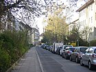
| Worpsweder Strasse
( Location ) |
170 | Worpswede , municipality in the district of Osterholz in Lower Saxony | Aug 16, 1928 | The first name was Street 57 of the zoning plan. |
|
| Wrangelstrasse
( Location ) |
140 | Friedrich von Wrangel (1784–1877), Prussian field marshal | around 1880 | The Schlossparktheater is located in the farm building of the former Steglitz Castle on Wrangelstrasse . |

|
| Wulffstrasse
( Location ) |
170 | Karl Wulff (1828–1897), educator | 28 Sep 1935 | The previous name from 1893 to 1935 was Hohenzollernstrasse . |

|
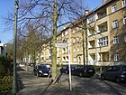
| Wuthenowstrasse
( Location ) |
120 | Karl Ernst Heinrich Arthur Wuthenow (1844–1921), theologian | Nov 12, 1925 | The first name was Street 45 of the zoning plan. |
|
| Zeunepromenade | 125 | Johann August Zeune (1778–1853), teacher for the blind, pedagogue, geographer and Germanist | 1906 | It was named after its founder on the occasion of the centenary of the state institution for the blind. The promenade is a footpath in two separate sections. The northern part runs along the border between Steglitz and Lichterfelde , right next to the Botanical Garden ; the southern part runs between the Fichtenberg Oberschule and the State Institute for the Blind and connects Lepsiusstrasse with Rothenburgstrasse. |

|
| Zimmermannstrasse
( Location ) |
300 | Julius Zimmermann (1834–1902), community leader in Steglitz | 1901 | The first name was Street 18 of the zoning plan. |

|
Former and renamed streets
| Name, possibly picture |
Origin of name | Date of designation | when renamed | renamed or canceled |
Remarks |
|---|---|---|---|---|---|
| Allerstrasse | All , river | July 18, 1908 | → Sachsenwaldstrasse | According to the development plan, it was laid out as street 38 . | |
| Akazienstrasse | Acacia , deciduous tree. Probably first planting on the roadside | 1901 | Apr 19, 1966 | dedicated | Entered in the address book in 1910 between Düppelstrasse via Schadenrute to Stubenrauchplatz with three apartment buildings. The Akazienstraße became obsolete due to the construction of the city motorway (west bypass). |
| On the market | Market , main trading place ("Düppelmarkt") of the former municipality of Steglitz in the district of Teltow | before 1902 | Apr 13, 1966 | canceled | |
| At the Stubenrauchplatz | Parlor smoking place | before 1920 | after 1943 | → Jochemplatz | (The information about the existence of this street is taken from the address books between 1915 and 1943, each with the addition “Am”.) It ran from Florastraße to Akazien- / Düppelstraße and in 1920 comprised six developed parcels. The street was included in the address after the square was renamed. It can still be seen on maps from 2013 and is around 60 meters long. |
| Arndtstrasse | Ernst Moritz Arndt (1769–1860), German enlightener, poet, politician | before 1895 | March 20, 1939 | → Gritznerstrasse | In 1905, Straße 11 was incorporated into Arndtstraße. |
| Belfortstrasse | Belfort , city in France | before 1878 | May 17, 1930 | → Klingsorstrasse | |
| Berlin street | Old Berlin , direction | before 1878 | Oct. 1, 1961 | → Ostpreußendamm (one section) Other sections were renamed Halskestrasse (around 1896), Siemensstrasse (1897) and Hanstedter Weg (1931). |
Almost every place in the surrounding area had a Berlin street . In preparation for the congregation in Greater Berlin , renaming was necessary.
A section of the street was called Doellestraße 1934–1947 , was renamed Priesterweg in 1947 and Sembritzkistraße in 1957 |
| Bismarckplatz | Otto von Bismarck | 1896 | 1939 | Dedicated as a place | The square was at the intersection of Bismarckstrasse and Moltkestrasse (today Selerweg). Both streets were still vacant when the square was named. |
| Brothers Street | Brothers | before 1884 | Nov 12, 1925 | → Stindestraße in the Steglitz district; in the district of Lichterfelde the name was retained |
The street ran from Albrechtstraße to the Teltow Canal (1910) and had 19 house numbers. |
| Dahlemer Strasse | Berlin-Dahlem , direction, eh. Neighboring village | around 1887 | June 2, 1904 | → Brandenburgische Strasse | Sources unclear, not included in the address books (first edition 1896) |
| Dahlemer way | Berlin-Dahlem , direction, eh. Neighboring village | after 1850 | before 1878 | → Grunewaldstrasse | |
| Dietrich-Schäfer-Weg | Dietrich Schäfer (1845–1929), historian, university professor | Sep 18 1934 | Aug 24, 1992 | → Carl-Heinrich-Becker-Weg | When the name was determined in 1934, the former Friedrichstrasse and Wilhelmplatz were merged. - Because of Schäfer's proximity to National Socialist ideas ( anti-Semitism and annexationism ), the district administration decided on April 24, 1989 to change its name. Due to objections from residents and a lawsuit before the administrative court, the renaming could only be carried out three years later. |
| Doellestrasse | Werner Doelle (1909–1925), supporter of the Nazi movement who died as a result of political conflicts | Sep 18 1934 | July 31, 1947 | → Sembritzkistraße | Part of Berlin's street and part of Lichterfelder Strasse in the south end were given this name during the Nazi era. |
| Eschenstrasse | Ash trees , deciduous trees | 1904 | Sep 1 1964 | → Erlenstrasse | Eschenstrasse was first mentioned in the address book in 1905. The two traffic routes named after trees ran at right angles to each other and were grouped by name. |
| Feldstrasse | field | 1897 | Oct. 20, 1932 | → Feuerbachstrasse | Direction towards the fields of the Steglitz farmers in Friedenau . It is included for the first time in the 1898 address book with the note "undeveloped". She started on Florastrasse. |
| Fichtestrasse | Johann Gottlieb Fichte , German educator and philosopher | before 1878 | Apr 4, 1934 | → Lepsiusstrasse | |
| Flensburger Strasse | Flensburg , city in Lower Saxony | before 1883 | Aug 16, 1952 | → Deitmerstrasse | |
| Friedenauer Strasse | Friedenau , direction | Nov 3, 1901 | 1957 | → Oehlertring | Initially the traffic route was called the Ringstrasse . In 1901, individual parts began to be renamed. After more than 50 years, they were all brought back together under the name Oehlertring. |
| Friedrichstrasse | King Friedrich I. | before 1883 |
Sep 18 1934 July 20, 1960 |
A first section was renamed → Dietrich-Schäfer-Weg , another section kept its name until 1960. |
|
| Friesenstrasse | Karl Friedrich Friesen (1784–1814), gymnastics teacher, member of the Lützow Free Corps | before 1910 | March 20, 1939 | → Rathstrasse | According to the development plan, the street was first called Straße 11 . In the address book of 1910, it is between Schildhornstrasse and the Friedenau district with two developed parcels (9 and 10), the rest are "construction sites". There were a total of 28 house numbers here in the 1930s. |
| Gellertplatz | Christian Fürchtegott Gellert (1715–1769), poet | around 1911 | 1936 | dedicated | Gellertplatz was on the forest road. |
| Gellertstrasse | Christian Fürchtegott Gellert (1715–1769), poet | around 1911 | 1912 | Gellertstrasse was included in → Björnsonstrasse . | |
| Gerhard-Weber-Strasse | Gerhard Weber (1907–1929), driver and supporter of the Nazi movement, who died in political conflicts | Aug 6, 1937 | July 31, 1947 | → Stirnerstrasse | Before that, the traffic route was named Hardenbergstrasse . |
| Grabenstrasse | Moat that drained into the Bäke in the 19th century | around 1896 | around 1897 | → Lutherstrasse | The traffic route was laid out as road 68 according to the development plan . Sources unclear, not included in the address books (first edition 1896) |
| Handjeryplatz | Nicolaus Prinz Handjery (1836–1900), politician | around 1896 | Aug 17, 1965 | Dedicated and built over | was in the corner between Albrechtstrasse and Steglitzer Damm |
| Hardenbergstrasse | Prince von Hardenberg (1750–1822), Prussian statesman and reformer | 1896 | Aug 6, 1937 | → Gerhard-Weber-Strasse | The traffic route was laid out as road 55 in the development plan. He started on the Ringstrasse. |
| Heidschnuckenweg | Heidschnucken , special frugal breed of sheep | Nov 23, 1931 | Dec. 4, 1959 | Dedicated for the construction of the allotment garden colony "Heimgarten" | The Heidschnuckenweg was a private path in extension of the Hünensteig, on the southern edge of the Bergstraße cemetery. |
| Hermannstrasse | Hermann the Cheruscan or "Hermann", male first name | 1897 | 1936 | → Hünefeldstrasse | |
| Hohenzollernstrasse | Hohenzollern , ruling family in Prussia | before 1893 | 28 Sep 1935 | → Wulffstrasse | The "Steglitzer Hunting Club" had established itself in Hohenzollernstrasse 3. In 1910 this club no longer existed here. |
| Humboldtstrasse | Wilhelm von Humboldt (1767–1835), scientist, politician | before 1878 | July 20, 1960 | together with Moltkestrasse in → Selerweg | |
| Hünefeldstrasse | Ehrenfried Günther Freiherr von Hünefeld (1892–1929), aviation pioneer | 1933 | 1939 | → Ellwanger Strasse | The name of the aviation pioneer was reassigned to the previous Mittelstrasse in 1953. Now it's called the Hünefeldzeile. |
| Jahnstrasse | Friedrich Ludwig Jahn (1778–1852), gymnastics teacher, reformer | before 1878 | Apr 4, 1934 | → Lepsiusstraße , together with Fichtestraße | The street in Steglitz included house numbers 1–10 and 21–31; in 1915, numbers 11–20 belonged to Friedenau . It connected Schildhornstrasse with the Friedenau district (behind Mommsenstrasse ). |
| Kaiser-Wilhelm-Strasse | Wilhelm II , German Emperor until 1918 | around 1870 | 1960 | → Schmidt-Ott-Strasse | Around 1910 the road ran between Rothenburgstrasse and Fichtestrasse with 21 parcels. |
| Karlstrasse | Karl Alexander (1801–1883), Prince of Prussia | after 1920 | July 11, 1957 | → Oehlertring | It was created by dismantling the former Ringstrasse and was located in the south end, which did not belong to Steglitz until 1920. |
| Kleiststrasse | Heinrich von Kleist (1777–1811), poet | 1903 | June 9, 1933 | → Brentanostraße and → Haderslebener Straße | First appeared in the address book in 1904. In 1910 it connected the Grunewaldstrasse with the Wilmersdorf field mark. Only one nursery owned by landscape gardener R. Köhler is registered under number 38. |
| Klixstrasse | Gustav Adolf Klix (1822–1891), theologian, philologist, educator | 1903 | Apr 7, 1919 | → Robert-Lück-Strasse | First appeared in the address book in 1904. The renaming was probably carried out in preparation for the merger to form the municipality of Greater Berlin . During this time there were streets with the same name in three other previous suburbs. |
| Kurfürstenstrasse | Elector , title of former ruler of the Mark Brandenburg | around 1896 | Nov 2, 1953 | → Braille Street | It ran between Schloßstrasse and Rothenburgstrasse. In 1901, it comprised nine parcels built with rental houses. |
| Lankwitzer Strasse | Lankwitz , direction | after 1850 | 1893 | → Friedrichstrasse | |
| Lichterfelder Chaussee | Lichterfelde , direction | before 1883 | after 1925 | → Hindenburgdamm | The 260 meter long street ran between Schloßstraße and the railway (later to Fronhoferstraße ). Around 1926 this was incorporated into the Lichterfelder Hindenburgdamm in Greater Berlin .
The car depot of the western Berlin suburban railway was initially located on property 1 on Lichterfelder Chaussee (west side of the street) ; from 1935 as the Steglitz depot and to the east the Erdmann'sche Haus at number 8 with eight tenants. The western property 67 was assigned to Schloßstraße 62/63 and the address book of 1927 noted for number 67: “Station of the western Berlin suburban railway, belongs to Lichterfelder Hindenburgdamm 68”. The parcels were renumbered when they were included in the Hindenburgdamm. |
| Lichterfelder Strasse | Lichterfelde , direction | before 1878 | Apr 10, 1931 | Inclusion in → Borstellstrasse | It ran from Stephanstraße (house number 1) to Potsdamer Straße with 40 house numbers in the shape of a horseshoe. |
| Lindenstrasse | Linden trees , deciduous trees | before 1883 | June 8, 1932 | → Leydenallee | In 1920 the address book contains the following history: "From the railway / Berlinickestrasse to Breite Strasse". It comprised 49 built plots. |
| Luisenstrasse | Luise von Mecklenburg-Strelitz (1776–1810), German Empress | March 1906 | June 8, 1932 | → Koenigin-Luise-Strasse | The first name was Dorfstrasse ; it was created 1889–1901 according to the specifications of the commission for the division of the Dahlem domain . It was named Luisenstrasse because it was close to the Luisenstift .
The route between Siemensstrasse and Teltow Canal is given in the 1910 address book . It already comprised five plots built with multi-family houses. Number 9 housed the “Neue Photographische Gesellschaft AG” and the “Werk-Konsum-Verein Steglitz egmbH”. There were also 13 construction sites. Around 1932, the street name was expanded with the title of the ruler. | |
| Mariendorfer Strasse (1) | Mariendorf , direction | before 1883 | 5th Sep 1957 | → Steglitzer dam | Mariendorfer Strasse in the village of Steglitz ran in 1910 between Albrecht- and Südende / Steglitzer Strasse and comprised 57 built-up plots. |
| Mariendorfer Strasse (2) | Mariendorf , direction | around 1850 | 1887 | → Hermannstrasse | This Mariendorfer Strasse was located in the Südende country house colony, which did not belong to Steglitz until 1920. First it became Hermannstrasse , then Hünefeldstrasse , on March 20, 1939 it was renamed → Ellwanger Strasse . |
| Märkische Strasse | Mark Brandenburg , direction | Apr 18, 1907 | May 10, 1931 | Inclusion in → Borstellstrasse | In the 19th century, Märkische Strasse was a section of Lichterfelder Strasse. In 1910 there were eight developed parcels on the road. It ran from Stephanstrasse to Brandenburgische Strasse. |
| Marksteinstrasse | Tappert, Markstein & Co., bronze goods factory in Steglitz | around 1896 | 17 Sep 1938 | in the newly designated → Search Highway incorporated | It ran between Schützenstraße and Kurz Straße with 13 house numbers (in 1915). Under National Socialism, naming the street after a Jewish person did not fit into the political concept. |
| Marslatourstrasse (Mars-la-Tour-Strasse) | Battle of Mars-la-Tour in the Franco-Prussian War | Nov 8, 1912 | Jan. 7, 1928 | → Birkbuschgarten | The traffic route was laid out as road 83a according to the development plan . He started on Birkbuschstrasse. Up until 1920 there were no buildings here. |
| Miquelstrasse | Johannes von Miquel (1828–1901), politician | 1904 | 26 Sep 1929 | → Muthesiusstrasse | The first name was Street 20 of the zoning plan. It is first mentioned in the address book in 1905. In 1910, it had 32 built-up lots and ran between Schloßstraße and Fichtestraße . |
| Moltkestrasse | Helmuth Graf von Moltke (1800-1891), military | before 1905 | July 20, 1960 | together with Humboldtstrasse in → Selerweg | It started on Humboldtstrasse and was still "undeveloped" in 1910. Five years later, tenant houses were built on five parcels. It now connected the Ringstrasse with the Bismarckstrasse. |
| Mommsenstrasse | Theodor Mommsen (1817–1903), historian | Nov 11, 1903 | Nov 26, 1927 | → Markelstrasse | According to the development plan, the traffic route was built as street 13 . In 1915 63 rental houses had already been built, some of which even had several stairways.
|
| Potsdamer Strasse | Potsdam , direction | before 1896 | Apr 8, 1933 | → Benzmannstrasse | A street extension made around 1900 was incorporated into Potsdamer Strasse in 1910. At that time it had 27 built-up plots and stretched from Halskestrasse to Lichterfelder Strasse. In 1920 the address book shows that Potsdamer Strasse ran between Heinrich-Seidel-Strasse and the Südende district. Parcels 4–32 belonged to the southern end of the post area. |
| Priest path | Priest , another term for pastor | handed down | July 11, 1957 | → Sembritzkistraße | The street marked the path of the "worshipers" working in Schöneberg and in the village of Lankwitz . |
| Rastatter Platz | Rastatt , city in Baden-Württemberg | Jan. 8, 1892 | Aug 26, 1913 | → Breitenbachplatz | |
| Town Hall Square | Steglitz town hall | around 1898 | June 1, 1955 | → Hermann-Ehlers-Platz | When the Steglitz town hall was completed, the square in front of it was named after the official building. Between 1955 and 1958 it was called Ehlersplatz. |
| Rathstrasse | Ernst Eduard vom Rath (1909–1938), diplomat; died as a result of an assassination attempt based on mistaken identity | March 20, 1939 | July 31, 1947 | → Gritznerstrasse | The renaming of the street after the Second World War was a consequence of the National Socialist pogroms that followed the attack on Rath. |
| Ring road | Ringstrasse , form for the development of the building land | before 1884 |
Nov 3, 1901 (Friedenauer Str., Oehlertring)
|
dismantled in Friedenauer Strasse , → Oehlertring and Lauenburger Strasse | The Ringstrasse is still included in the 1901 address book. It began on Albrechtstrasse (house number 1) and crossed Hardenbergstrasse after parcel 4. After that, via Steinstrasse to Moltkestrasse only “construction sites” of the Terrain Society are given, house number range 5–27 is missing. From house number 41 on Humboldtstrasse, there are further construction sites without details of the building owner. The ring closes on Albrechtstrasse. |
| Rugeplatz | Max Ruge , local politician in Steglitz and member of the Reichstag | 1898 | 1903 | canceled | The vacant space on Rugestrasse was in the address book from 1899 to 1903. |
| Sachsallee | Hans Sachs (1494–1576), shoemaker, a main character in the opera “Die Meistersinger von Nürnberg” by Richard Wagner | around 1907 | 17 Sep 1938 | → Englerallee | |
| Damage rod | Damage rod is a protective strip against fire damage caused by flying sparks of the railway with a width of a Prussian rod = 3.766 meters. | before 1904 | 1966 | dedicated | The street, indicated in 1904, ran in the center of Steglitz along the embankment of the Berlin-Potsdam railway . It was de-dedicated for the construction of the west bypass in 1966. Today there is a nameless footpath on the southern part. |
| Schiller Street | Friedrich Schiller (1759–1805), poet | before 1878 | March 5, 1935 | → Arno-Holz-Strasse | Because of the numerous streets of the same name in Greater Berlin , renaming had to be made. |
| Schlageterstrasse | Albert Leo Schlageter (1894–1923), German free corps fighter, convicted and executed by a French military court for espionage | 1925 | July 31, 1947 | → Spinozastrasse | The execution of NSDAP member Schlageter stirred up hatred against French neighbors in Germany, and Schlageter was hyped up as a “martyr”. This ideological abuse during the Nazi era was the reason for the street renaming after the Second World War. |
| Schmargendorfer way | Schmargendorf , part of Berlin since 1920 | 1896 | ? | ? | In the 1897 address book it is included for the first time as an undeveloped street leading off from Fichtestrasse (now Lepsiusstrasse). On plans from 1907 it appears as a probably only planned diagonal connection from Rastatter Platz (today Breitenbachplatz) to Paulsenstrasse. |
| Seestrasse | South lake , way there | before 1903 | July 11, 1957 | → Sohnreystraße | |
| Parlor smoking place | Ernst von Stubenrauch (1853–1909), district administrator in Teltow, later police chief in Berlin | 1896 | Dec. 1, 1962 | → Jochemplatz | It is included for the first time in the 1897 address book. From 1897 to at least 1901 the square had three house numbers and was bordered by Düppelstrasse and Florastrasse. |
| Teichstrasse | Ponds that lay on the bank | before 1883 | before 1893 | → Schützenstrasse | |
| Tempelhofer Strasse | Tempelhof , direction from the south end | around 1899 | Jan. 7, 1928 | Inclusion in → Attilastraße | |
| Tolstoistrasse | Lev Tolstoy (1828-1910), Russian writer | 1910 | 1912 | → Buggestraße | A section of this street was laid out as street 9 according to the development plan . |
| Turmstrasse | Exercise tower of the volunteer fire brigade "Südende" in the street area | before 1903 | July 15, 1957 | → Brinkmannstrasse | |
| Uhlandstrasse | Ludwig Uhland (1787–1862), poet | around 1890 | December 3, 1954 | → Ermanstrasse | |
| Wilhelmplatz | Wilhelm I , German Emperor | 1896 | Sep 18 1934 | → Dietrich-Schäfer-Weg | The square was renamed after Schäfer along with Friedrichstrasse . |
| Wilhelmstrasse | Wilhelm I , German Emperor | July 3, 1893 | July 11, 1957 | → Grabertstrasse | |
| Wilmersdorfer Weg | Wilmersdorf , part of Berlin since 1920 | 1898 | 1904 | canceled | In the address books from 1899 to 1904 it is included as an undeveloped street leading off from Kaiser-Wilhelm-Straße (today Schmidt-Ott-Straße). |
| Wichernstrasse | Johann Hinrich Wichern (1808–1881), theologian | before 1911 | August 31, 1937 | → Altensteinstrasse | The street ran through the districts of Steglitz and Dahlem. The section there kept its name. |
In addition, in 1910 there was Straße 2, which was laid out according to the development plan (between Bergstraße and Friedrichsruher Straße). The street 60 (in 1915) was a cross street of the Mariendorfer street.
Allotment gardens (KGA)
- KGA Bahn-Land-Wirtschaft (BLW), Steglitz sub-district, “Albrechtstrasse-Teltowkanal” group (Albrechtstrasse / Teltowkanal, location ), allotment gardens with eleven plots on 3,297 m².
- KGA "Am Fichtenberg" (Rothenburgstrasse 20, Lage ), permanent allotment garden with 16 plots on 3,125 m². The facility is intended as a reserve area for the Fichtenberg secondary school .
- KGA “Bäketal” (Haydnstrasse 21, Lage ), permanent allotment garden with 50 plots on 15,994 m² of leased land owned by the state.
- BLW, Steglitz sub-district, “Fronhofer Straße” group (on Fronhofer Straße, Lage ), allotment garden with 16 lots on 6,358 m².
- BLW, Steglitz sub-district, “Buhrowstrasse” group (Buhrowstrasse 13, Lage ), allotment garden with six plots on 2,063 m².
- FOAG, sub-district Steglitz, group “Crailsheimer Straße” (Crailsheimer / Tuttlinger Straße, Lage ), allotment garden with 36 plots on 11,241 m².
- KGA “Erlenstrasse” (Erlenstrasse 11–17, Lage ), permanent allotment garden with 45 plots on 13,294 m² of leased land owned by the state.
- KGA "Heimgarten" (Munsterdamm 53, Lage ), permanent allotment garden with 34 parcels on 8,780 m² of leased land owned by the state.
- FOAG, sub-district Steglitz, group “Karl-Fischer-Weg” (Priesterweg / Sembritzkistraße, Lage ), allotment gardens on railway-owned site with 31 plots, of which 5,099 m² (of 11,241 m²) are on Steglitz territory (KGA Sembritzkistraße / Oehlertring).
- Allotment garden “Karl-Lange-Brücke Nord” (Albrechtstraße 60c, Lage ), permanent allotment with 48 parcels on 14,344 m² of leased land owned by the state, part of KGV Berlin-Steglitz-Ost e. V.
- FOAG, sub-district Steglitz, group "Kelchstraße" (Kelchstraße, Lage ), allotment garden with 20 plots on 4,701 m² railway area.
- KGA "Rauhe Berge" (Munsterdamm 83, Lage ), permanent allotment garden with 91 plots on 29,939 m² of leased land owned by the state.
- KGA “Reutlinger Straße” (Reutlinger Straße 12-18, Lage ), permanent allotment garden with 34 plots on 11,764 m² of state-owned leasehold areas, part of KGV Berlin-Steglitz-Ost e. V.
- FOAG, sub-district Steglitz, group "Schünemannweg" (Schünemannweg 22 location ), allotment garden with 13 plots on 4,496 m² railway area.
- KGA “Schutzverband Steglitz” (Hühnensteig 25–35 / Immenweg 12, Lage ), permanent allotment garden with 85 plots on 25,753 m² of leased land owned by the state.
Parks and cemeteries
| Name / location | Area (rounded in m²) |
Origin of name | Date of designation or attachment | Remarks | image |
|---|---|---|---|---|---|
| Bäke-Park ( location ) |
97,757 | the remainder of the Bäke, which ends today at the Teltow Canal |

|
||
| Birkbuschgarten Park | |||||
| Eichgarten | |||||
| Elisabeth-Bergner-Park (without KGA Steglitz-West) ( location ) |
7,834 | Austro-British actress and director Elisabeth Bergner | |||
| Georg-von-Siemens-Park ( location ) |
6,659 |
Banker and politician Georg von Siemens | The park is located on Steglitzer Damm and Kelchstrasse. | ||
|
Harry-Bresslau-Park ( location ) |
8.094 | Historian Harry Bresslau |

|
||
| Island park | the mountain lying here | ||||
| Jochen Klepper Park ( location ) |
3,779 | Journalist and writer Jochen Klepper | |||
| Ruth-Andreas-Friedrich-Park ( location ) |
Ruth Andreas-Friedrich , resistance fighter against National Socialism | The green area is located directly next to the Fichtenberg Botanical Garden . |

|
||
|
Stadtpark Steglitz ( location ) |
180,796 with adjacent green spaces |
District | 1906-1914 | The actual city park occupies 12.4 hectares and was laid out by the garden architects Zahn and Korte. Today the park is protected as a garden monument. |

|
| Viktoriapark ( location ) |
Viktoria , wife of Wilhelm II , last German Empress and Queen of Prussia | It is a footpath between Ahornstrasse and Zimmermannstrasse, half of which (separated by steps) is assigned to the two neighboring streets. |

|
||
|
Steglitz-Bergstrasse cemetery ( location ) |
264.159 | District | |||
| Animal cemetery ( location ) |
2,942 | 2007 | It was created on a part of the Steglitz cemetery that was not affected by piety. |
See also
literature
- District Office Steglitz of Berlin, Dept. Volksbildung (Ed.): Prussian history on street signs in Steglitz , 1981.
- Walter Kaupert (Ed.): Kaupert's street guide through Berlin 2010 . Kaupert Media, Berlin 2009, ISBN 3-941108-01-8 .
- Kulturamt Steglitz, working group “National Socialism in Steglitz” (ed.): “Street name lasts longer than monument” - The naming of streets in Berlin-Steglitz 1933–1948 , 1999.
Web links
- Street directory Steglitz. kaupert media gmbh, accessed on December 12, 2010 .
- private website about Südende with street directory and many photos. www.steglitz-suedende.de, accessed on December 12, 2010 .
- Map of Berlin 1: 5000 with district boundaries. Senate Department for Urban Development Berlin, 2012, accessed on December 12, 2012 .
- Office for Statistics Berlin-Brandenburg: List of streets and places in the Steglitz-Zehlendorf district (as of February 2015); pdf
- Former streets and squares in Steglitz on luise-berlin.de
- Berlin address book 1920 : Suburbs> Steglitz (ff)
Individual evidence
- ↑ a b c d e f Rolf Grevelmann: Village remains village , p. 17. In: District mayor of Berlin-Steglitz (Ed.): 100 years of Steglitz town hall. 1898–1998 , Berlin 1998.
- ↑ City map from 1894 ( page no longer available , search in web archives ) Info: The link was automatically marked as defective. Please check the link according to the instructions and then remove this notice. on alt-berlin.info
- ^ Kauperts: History Albrechtstraße on kauperts.de
- ^ Trams in the Teltow district , with information on Steglitz, with a map from 1927
- ↑ a b c d e This street was not in the address book in 1897 and appears there for the first time in 1898 . That is why it was probably named in 1897.
- ^ Kauperts: Brandenburgische Strasse
- ↑ District Office Steglitz-Zehlendorf: Althoffplatz green area ( Memento of the original from December 3, 2013 in the Internet Archive ) Info: The archive link was inserted automatically and has not yet been checked. Please check the original and archive link according to the instructions and then remove this notice.
- ^ Suburbs> Steglitz> Am Stadtpark . In: Berliner Adreßbuch , 1920, V, p. 401.
- ^ Description of G. Lilienthal's house and his work on a private website; accessed on October 15, 2014.
- ↑ “Commercial building” Barsekowstrasse 14/16; 1898, probably Gustav Lilienthal
- ↑ a b c d e Steglitz III residential complex: Barsekowstrasse 27/29, Birkbuschstrasse. 65, Goebenstr. 1/2 and Johanna-Stegen-Str. 2
- ^ Berlin address book 1901 : suburbs; see building contractor
- ^ Steglitz> Directory of traders and traders . In: Berliner Adreßbuch , 1921, V, p. 398.
- ^ Forced labor camp in Steglitz, Birkbuschstrasse 18 ; Retrieved Oct. 15, 2014.
- ^ Environment office Wolfgang Böhm; References ; Retrieved Oct. 15, 2014.
- ↑ a b c d e f This street was not in the address book in 1896 and appears there for the first time in 1897 . That is why it was probably named in 1896.
- ^ Kauperts: Brandenburgische Strasse
- ↑ Cab route meter for Berlin from 1892, detail Lankwitz / Südend
- ↑ a b c 1896 no Dahlemer Strasse, see address book 1896, letter D.
- ↑ a b c This street was not yet in the address book in 1903 and appears there for the first time in 1904 . That is why it was probably named in 1903.
- ^ Uta Maria Bräuer, Jost Lehne: Bäderbau in Berlin. Architectural water worlds from 1800 to today. Lukas Verlag for Art and Spiritual History, Berlin 2013, p. 77
- ^ Steglitz> Directory of traders and traders . In: Berliner Adreßbuch , 1921, V, p. 397.
- ↑ Berlin address book 1904; Inhabitants> Mannstaedt, Wilhelm
- ^ Kauperts: Elisenstrasse
- ^ Kauperts: Florastraße
- ↑ Florastrasse, Berlin-Steglitz, Bierpinsel
- ↑ a b plan from 1907 ( memento of the original dated November 10, 2013 in the Internet Archive ) Info: The archive link was inserted automatically and has not yet been checked. Please check the original and archive link according to the instructions and then remove this notice.
- ↑ Online archive of the Heimatverein Steglitz e. V. ( Memento of the original from December 3, 2013 in the Internet Archive ) Info: The archive link was inserted automatically and has not yet been checked. Please check the original and archive link according to the instructions and then remove this notice.
- ^ Kauperts: Grenzburgstrasse
- ↑ a b c d city map from 1907 on www.blocksignal.de
- ^ Berlin address book: overview plan Steglitz 1910
- ^ Address book Friedenau 1927
- ↑ City map from 1907 on www.blocksignal.de
- ^ Christian Winck: Opened 100 years ago: Depot in Steglitz . In: Verkehrsgeschichtliche Blätter . Issue 2, 2013, p. 30-37 .
- ^ Berlin address book 1915 with suburbs : Steglitz. "In the garden home"
- ↑ Kauperts road guide: Jochem place Kauperts
- ↑ City map from 1926 ( Memento of the original from January 1, 2016 in the Internet Archive ) Info: The archive link was inserted automatically and has not yet been checked. Please check the original and archive link according to the instructions and then remove this notice. at www.alt-berlin.info
- ↑ City map from 1946 ( Memento of the original dated December 22, 2015 in the Internet Archive ) Info: The archive link was inserted automatically and has not yet been checked. Please check the original and archive link according to the instructions and then remove this notice. on alt-berlin.info
- ↑ Am Kelchpfuhl at www.berlingeschichte.de
- ↑ Residential complex "Steglitz I", Klingsorstrasse 22015034.
- ^ Kauperts: Königin-Luise-Straße
- ^ Kauperts: Körnerstrasse
- ^ Langensteiner-Weg, Berlin-Steglitz , accessed on December 20, 2012.
- ↑ Steglitz-Zehlendorf: Sights - L - ( Memento of the original from June 5, 2012 in the Internet Archive ) Info: The archive link was inserted automatically and has not yet been checked. Please check the original and archive link according to the instructions and then remove this notice.
- ^ Kauperts: Lutherstrasse
- ^ History of the Markelstiftung
- ↑ a b c d This street was not in the address book in 1904 and appears there for the first time in 1905 . That is why it was probably named in 1904.
- ↑ Kauperts: History Oberlin Street on kaupert.de
- ↑ City map from 1946 ( page no longer available , search in web archives ) Info: The link was automatically marked as defective. Please check the link according to the instructions and then remove this notice. on alt-berlin.info
- ↑ a b c This street was not in the address book in 1898 and appears there for the first time in 1899 . That is why it was probably named in 1898.
- ^ Address book Berlin suburbs 1901 : Rugeplatz, Rugestrasse in Steglitz
- ↑ Steglitzer-Damm, Berlin-Steglitz-Stadtpark-Steglitz , accessed on December 20, 2012.
- ^ Berlin address book 1910 : suburbs. Steglitz: Street 62a : between Albrecht street and road 63b / Y space .
- ↑ Dunant Primary School ( Memento of the original from December 12, 2012 in the Internet Archive ) Info: The archive link has been inserted automatically and has not yet been checked. Please check the original and archive link according to the instructions and then remove this notice. Retrieved December 20, 2012
- ↑ Kopernikus-Oberschule ( Memento of the original from August 25, 2013 in the Internet Archive ) Info: The archive link was inserted automatically and has not yet been checked. Please check the original and archive link according to the instructions and then remove this notice. Retrieved December 20, 2012
- ↑ Rename Treitschkestrasse! Retrieved November 24, 2012
- ↑ Residents vote against the renaming of Treitschkestrasse . In: Der Tagesspiegel , December 20, 2012
- ^ Kauperts: Weverpromenade
- ↑ Kauperts: Wolfensteindamm
- ↑ Street renaming 1934/1935
- ^ Berlin address book 1915 : Suburbs> Steglitz> Gellertplatz
- ^ Berlin address book 1901 : Part of Steglitz
- ^ Steglitz> Hindenburgdamm . In: Berliner Adreßbuch , 1927, IV, p. 1658.
- ^ Berlin address book 1910 : suburbs. Steglitz with Luisenstrasse
- ^ Inhabitants> Markstein, Julius: see Tappert . In: Berliner Adreßbuch , 1880, Part I, p. 976.
- ^ Berlin address book 1915 : Suburbs> Steglitz> Moltkestrasse
- ^ Steglitz> Potsdamer Strasse . In: Berliner Adreßbuch , 1920, IV, p. 394.
- ^ Berlin address book 1901 : Suburbs, Steglitz - Ringstrasse
- ↑ City map from 1955
- ↑ Info about the damage rod
- ↑ Damage rod on http://www.luise-berlin.de/
- ^ Address book Berlin suburbs 1901 : Stubenrauchplatz
- ↑ a b c d e f g Allotment gardens on land owned by Deutsche Bahn AG that is leased to the railroad farm and is close to track systems.
- ↑ Fictitious permanent allotment gardens, the areas of which are intended for transport, social or technical projects that are implemented at short notice.
- ↑ a b c d e f Allotment garden areas that are defined as permanent allotment gardens by the B-Plan .
- ↑ Fictitious permanent allotment gardens according to §§ 16 and 20a BKleingG . The fictitious permanent allotment gardens are additionally protected by the representation in the FNP as "green areas - allotments".
- ↑ KGV Berlin - Steglitz - Ost e. V.
- ↑ Selected green spaces in the Steglitz-Zehlendorf district: Stadtpark Steglitz
- ↑ Clarification of the situation with the help of the map of Berlin 1: 5000 (K5 color edition) produced by the district surveying offices , last accessed December 13, 2012
- ↑ Steglitz-Zehlendorf A – Z ( Memento of the original from June 5, 2012 in the Internet Archive ) Info: The archive link was inserted automatically and has not yet been checked. Please check the original and archive link according to the instructions and then remove this notice.


