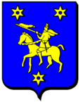
Vionville
| Vionville | ||
|---|---|---|

|
|
|
| local community | Rezonville-Vionville | |
| region | Grand Est | |
| Department | Moselle | |
| Arrondissement | Metz | |
| Coordinates | 49 ° 6 ' N , 5 ° 57' E | |
| Post Code | 57130 | |
| Former INSEE code | 57722 | |
| Incorporation | 1st January 2019 | |
| status | Commune déléguée | |
 Saint-Clément church |
||
Vionville is a village and a commune déléguée in the French commune of Rezonville-Vionville with 186 inhabitants (as of January 1, 2017) in the Moselle department in the Grand Est region (until 2015 Lorraine ).
geography
Vionville is located in the far west of the Moselle department, a few kilometers west of Metz near Gravelotte at an altitude between 240 and 307 m above sea level, the mean height is 291 m. The area is part of the Lorraine Regional Nature Park .
history
The village became famous through the battle of Vionville in the Franco-Prussian War on August 16, 1870. Until 1918 the place belonged to the German Empire as part of the realm of Alsace-Lorraine .
With effect from January 1, 2019, the former parishes of Rezonville and Vionville were merged to form Commune nouvelle Rezonville-Vionville and have the status of a Commune déléguée in the new municipality . The administrative seat is in Rezonville. It belonged to the arrondissement of Metz and the canton of Les Coteaux de Moselle .
Population development
| year | 1910 | 1962 | 1968 | 1975 | 1982 | 1990 | 1999 | 2007 |
| Residents | 316 | 167 | 167 | 142 | 151 | 129 | 145 | 162 |
Attractions
- Church St-Clément with choir tower of the 13th century.
