List of streets and squares in Berlin-Wedding

The list of streets and squares in Berlin-Wedding describes the street system in the Berlin district of Wedding with the corresponding historical references. At the same time, this compilation is part of the lists of all Berlin streets and places .
overview
Street situations
The most important streets in the district of Wedding are included in the Berlin road network as a higher-level road connection ( Category II ).
- the Seestrasse as part of the ring road around the inner city of Berlin, which represents the connection between Prenzlauer Berg , Gesundbrunnen and the federal highway 100 ; Added to the Berlin road network as a higher-level road connection ( Category II )
- the street Föhrer Strasse , Luxemburger Strasse , Schulstrasse as a connection between Gesundbrunnen and Moabit ,
- the street Fennstrasse , Reinickendorfer Strasse , which branches off at Nettelbeckplatz into Pankstrasse , as connections to Reinickendorf and Gesundbrunnen is part of the federal highway 96 ,
- the Müllerstraße , connects an extension of the Friedrichstrasse / Chausseestraße the central Berlin with Reinickendorf and Tegel ;
- other important connecting roads are Torfstrasse , Amrumer Strasse and Afrikanische Strasse .
As regional road connections, Aroser Allee , Barfusstrasse , Sellerstrasse and Transvaalstrasse are subordinate to these main roads in the road development plan (StEP). In addition, the B 96 runs from the Mitte district on the Seller- / Müller- / Reinickendorfer Straße, Louise-Schroeder-Platz at 2,650 meters through Wedding to the Reinickendorf district.
Development of roads
The area of the Wedding area was uninhabited until the 18th century; around 1800 the only routes through this area were the later Seestraße as a connection between the castles of Charlottenburg and Schönhausen , which was probably built in the early 18th century, and the Ruppiner Heerweg as a connection between old Berlin and Tegel , which was later named Müllerstrasse. The Vorwerk Wedding , located near today's Nettelbeckplatz , was accessible via the route to Oranienburg (Reinickendorfer Strasse andgerichtstrasse). The plantation road goes back on an old dirt road. The Triftstrasse, Tegelerstrasse and Fennstrasse also existed as early as the 18th century. Liebenwalder Straße was built in 1827 to develop the plots that were parceled out according to the first development plan for the area around Berlin.
After Moabit, Wedding and Gesundbrunnen had been incorporated into Berlin in 1861, the Hobrecht Plan came into force on July 26, 1862 , and was the basis of urban planning until 1918 . On the map, Wedding was given the designation Department X, 1 , the Gesundbrunnen area and the Rosenthaler Vorstadt became Departments IX and X, 2 . First of all, the area east of Seestraße up to Müllerstraße was built on, parts of the Brussels neighborhood and houses on Müllerstraße. It was not until 1900 that residential and factory buildings were built west of Seestrasse. The development on Seestrasse and Kameruner Strasse and between Türkenstrasse and Dubliner Strasse took place around 1910.
In 1915, part of the Plötzensee manor district was incorporated, so that the Plötzensee and the cemeteries on Seestrasse south of Afrikaner Strasse have been part of the Wedding district since then.
With the formation of Greater Berlin in 1920, the borders were redefined. They now ran along the Berlin-Spandau shipping canal and west of the Rehberge park. This park belonged entirely to the newly established Wedding district . On the other hand, the area of the Moabit power plant on Friedrich-Krause-Ufer came to Moabit . The African Quarter and the Schillerpark Estate were built in the 1920s and 1930s . The Brussels neighborhood was completed in 1930 with the Ostender Strasse residential complex.
Another border correction took place in 1938, when the area east of Tegeler Weg / Spandauer Weg (since 1954 Kurt-Schumacher-Damm) and parts south of Holländer Straße came to Wedding. In the 1950s, the arbor area east of the Schillerpark was built on with the "Schillerhöhe" settlement, with a deviation from the original Hobrecht plan.
With the redesign of Luxemburger Strasse during the construction of underground line 9 , the building of the Gauß State Engineering School was built there from 1960 to 1964 and the Grashof building of the building department of the Technical University of Applied Sciences from 1973 to 1976.
Wedding has 86,806 inhabitants (as of December 30, 2019) and includes the zip code areas 13347, 13349, 13351, 13353 and 13407. Some locations such as the Brussels Kiez , the Sprengelkiez or the Friedrich-Ebert-Siedlung have their own articles.
Street names
In 1888, on the occasion of the 200th birthday of Friedrich Wilhelm I , who had received his baptism of fire as Crown Prince in the Netherlands , the magistrate of Berlin decided to name a number of Weddinger streets after the events and personalities of the War of the Spanish Succession (1701-1714) (Amsterdam , Turiner and Utrecht Strasse, Leopoldplatz and Malplaquetstrasse).
To the north of Müllerstrasse, Prinz-Eugen-Strasse is reminiscent of the Turkish wars , as are Hungarian, Turks, Barfus Strasse and Ofener Strasse. English , Scottish and Irish place names were chosen for all other streets north of Müllerstrasse on the occasion of the state visit of the British King Edward VII in 1909 .
The English Quarter is the African quarter over. Kameruner Straße and Togostraße were the first street names in 1899 to refer to German colonies in Africa . The other streets were named after landscapes and cities in these and other colonies. People from German colonial history were also godparents.
South of the Müllerstraße were Belgian street names awarded (Brussels, Ostend, Antwerp and Luxembourg road). On the north bank, Pekinger Platz , Samoa and Kiautschoustraße refer to German colonialism in Asia and Oceania .
At the end of the 19th century, the city of Berlin assigned Swedish and Norwegian street names such as Drontheimer Strasse and Stockholmer Strasse. Christianastraße (since 1938 Osloer Straße) and Oskarplatz (since 1958 Louise-Schroeder-Platz) got their names on the occasion of the visit of the Swedish King Oskar II in 1905 to Berlin.
Overview of streets and squares
The following table gives an overview of the streets and squares in the district as well as some related information.
- Name / location : current name of the street or square. Via the link Location , the street or the square can be displayed on various map services. The geoposition indicates the approximate center of the street length.
- Traffic routes not listed in the official street directory are marked with * .
- Former or no longer valid street names are in italics . A separate list may be available for important former streets or historical street names.
-
Length / dimensions in meters:
The length information contained in the overview are rounded overview values that were determined in Google Earth using the local scale. They are used for comparison purposes and, if official values are known, are exchanged and marked separately.
For squares, the dimensions are given in the form a × b for rectangular systems and for (approximately) triangular systems as a × b × c with a as the longest side.
If the street continues into neighboring districts, the addition ' in the district ' indicates how long the street section within the district of this article is. - Name origin : origin or reference of the name.
- Notes : further information on adjacent monuments or institutions, the history of the street and historical names.
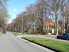
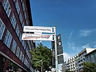
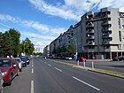
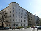
- Image : Photo of the street or an adjacent object.
| Name / location | Length / dimensions (in meters) |
Origin of name | Date of designation | Remarks | image |
|---|---|---|---|---|---|
|
Adolfstrasse
( Location ) |
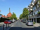
370 | Adolf , male first name | 22 Sep 1872 | When new it was named Straße 53, Section X / 1 of the development plan. It runs from Richtstrasse to Schererstrasse and turns into Maxstrasse. |
|
| African road
( Location ) |
1800 | Africa , continent | Sep 15 1906 | It was created as street 20a, section X / 1 of the development plan. African Street connects Müllerstrasse with Seestrasse and leads through the African Quarter with Ludwig Mies van der Rohe's residential complex between Sambesi and Tangastrasse as well as the two complexes of the Friedrich-Ebert-Siedlung . The Sansibarstrasse residential complex from 1929 is also a listed monument. |

|
| Allée du Stade
( Location ) |
700 | Stade Napoléon, a former French armed forces sports field | around 1983 | The Allée du Stade connects the Cités Joffre and Pasteur with the sports field of the former Quartier Napoléon (Stade Napoléon), today's Julius-Leber-Kaserne . It serves as access to the parking lots of the central fairground. |

|
| At the fairground
( Location ) |
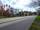
130 | Access to the central fairground of Berlin | Apr 25, 2006 | Access to the central fairground. The naming was only made with the new location of the fairground and enables better orientation even for those unfamiliar with the location. The short traffic route is the access to the parking lots of the central fairground and has a stop for buses and taxis. |
|
| At the north harbor
( Location ) |
230 | former north port of the Berlin-Spandau shipping canal | 1856 | The street already existed from 1856 north of Sellerstraße in the Wedding district. On November 28, 1900, place A, section X / 1 of the development plan in the former Tiergarten district between Heidestrasse and Kieler Brücke was also given this name. In 1971 the street in Tiergarten was pulled in by the construction of the north port bridge and the associated ramps. The part of the street in the Wedding district was open to motor vehicles until 2015. After the private rededication, the street was made accessible to the public again in 2016 as part of the newly created Nordhafenpark, excluding motor vehicle traffic. It connects Sellerstraße with Fennstraße. |

|
| Amrumer Strasse
( Location ) |
560 | Amrum , German North Sea island | Apr 10, 1899 | It was laid out as Straße 88, Section X / 1 of the development plan and connects Seestraße with Föhrer Straße as an extension of African Straße. The Rudolf Virchow Hospital is located on the southwest side . On the northeast side are the architectural monuments of the Ostender Strasse residential complex and the Institute for the Sugar Industry, which is currently used by the German Heart Center Berlin after the sugar museum has moved out.
On the west side of the street, with a possible start of construction in 2019, the establishment of a bike path protected by bollards was announced. |

|
| Amsterdam street
( Location ) |
360 | Amsterdam , capital of the Netherlands | 4th July 1904 | When it was built, it was Street 42, Section X / 1 of the development plan. The street connects Müllerstrasse with Malplaquetstrasse. The corner house at Amsterdamer Straße 17 / 17a and Turiner Straße 42-44 is a listed building monument. |

|
| At the Kiel bridge
( Location ) |
90 (in the district) |
Kieler bridge that here on the Berlin-Spandau Canal leads | 1st of March 2013 | The access road for the newly created housing estate was originally part of Kieler Strasse (no. 20–30) and Scharnhorststrasse. With the rededication of the middle section of Kieler Straße as a riverside promenade and part of the Berlin Wall Trail , both sections of Kieler Straße were perceived as independent streets. Therefore, the section was renamed "At the Kiel Bridge". The road between the promenade and the former Scharnhorststrasse is in the Wedding district , the land belongs to the Berlin-Mitte district . |

|
| Antonstrasse
( Location ) |
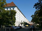
480 | Anton , male first name | Sep 18 1871 | It was created as Straße 50, Section X / 1 of the development plan and connects Müllerstraße with Maxstraße. The two school buildings located here are listed architectural monuments. |
|
| Antwerp Street
( Location ) |
480 | Antwerp , port city in Belgium | Sep 15 1906 | It connects Seestrasse with Ostender Strasse and Zeppelinplatz. It was laid out as Straße 16, Section X / 1 of the development plan. Originally it led to Triftstraße, but on the map from the 1950s it is already shortened to Limburger Straße. |

|
| Armenian street
( Location ) |
310 | Armenia , state in the Middle East | Aug 9, 1929 | Due to construction work in the "Schillerhöhe" settlement in the 1950s, the alignment of the Armenian Road was almost completely changed, which is why it was renamed on March 8, 1957. Before that, it was street 35b of the development plan. |

|
| Aroser Allee
( Location ) |
240 (in the district) |
Arosa , place in the canton of Graubünden in Switzerland | Apr 10, 1931 | The northern section of the street is in the Reinickendorf district and forms an axis of the White City . From 1909 to 1929 it was called Schillerpromenade (see picture from 1906), from 1929 to 1931 Greulichpromenade after the Swiss politician Hermann Greulich (1842–1925). |

|
|
Augustenburger Platz
( Location ) |
110 × 80 (triangular shape) |
Augustenburg , city in Denmark | Jan. 9, 1901 | Before that it was Platz A3 and Straße 15a, Section X / 1 of the development plan. Here is the entrance to the Rudolf Virchow Hospital . |

|
|
Barefoot Street
( Location ) |
910 | Hans Albrecht von Barfus (1635–1704), Brandenburg-Prussian field marshal | March 8, 1894 | Before that, it was Straße 46, Section X / 1 of the development plan. Its extension, Thuner Strasse , was also renamed Barfusstrasse on April 28, 1932. This part of Barfusstraße - it was withdrawn before 1938 - was the continuation of Barfusstraße to Vierwaldstädter Weg in Reinickendorf. It connects Müllerstrasse with Aroser Allee. The chapel in the St. Johannes-Evangelist-Kirchhof is a listed building monument. To the north of Edinburger Strasse, Barfusstrasse leads through Schillerpark . |

|
| Belfast Street
( Location ) |
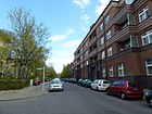
540 | Belfast , capital of Northern Ireland | Aug 9, 1929 | When they were built, it was Street 89, Section X of the development plan. It connects Müllerstrasse with Holländerstrasse. |
|
| Brienzer Strasse
( Location ) |
330 (in the district) |
Brienz , place in the canton of Bern in Switzerland | around 1909 | Originally it was part of Hennigsdorfer Straße , which ran between Schäfersee and Maxstraße, but was renamed Brienzer Straße between 1907 and 1910 in the section between Schäfersee and Walderseestraße. On March 11, 1937, the part of Hennigsdorfer Strasse up to Seestrasse was included in Brienzer Strasse. The northern section of the road is in the Reinickendorf district . The community center of the Kapernaum community is located at Brienzer Straße 22 . |

|
| Bristol Street
( Location ) |
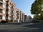
390 | Bristol , port city in England | Sep 1 1926 | Bristol Street connects Dublin Street with Barefoot Street. Located on the north side settlement Schiller Park by Bruno Taut is part of the UNESCO World Heritage . The Schillerpark is on the south side . |
|
|
Brussels Street
( Location ) |
720 | Brussels , capital of Belgium | Sep 15 1906 | It was laid out as Street 19a, Section X / 1 of the development plan. Brusseler Strasse runs parallel to Seestrasse from Amrumer Strasse at the Rudolf Virchow Hospital to Müllerstrasse . The anti-war museum is located in house number 21 . Today's residential building No. 32 was built by Bewag in 1928 as a Zeppelin power supply base and is a listed building. | |
| Buchstrasse
( Location ) |
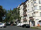
200 | Leopold von Buch (1774–1853), geologist | March 8, 1892 | It was originally the street 12a, section X / 1 of the development plan and connects the Föhrer street with the north bank. House No. 3 is a listed building monument. |
|
| Burgsdorfstrasse
( Location ) |
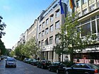
270 | Konrad von Burgsdorff (1595–1652), statesman from Brandenburg | Apr 2, 1891 | It was laid out as Straße 6, Section X / 1 of the development plan. It connects Müllerstrasse with Sparrplatz. Here is the Prime Time Theater . |
|
|
Cambridge Street
( Location ) |
390 | Cambridge , university city in England | Oct 6, 1958 | The street was created during the construction of the settlement in the English Quarter. It runs slightly arched and connects Greenwicher Straße with Belfaster Straße. |

|
| Carl Suffering Path *
( Location ) |
Karl Leid (1867–1935), local politician and district mayor of Wedding | after 1935 | The Parkweg is located in the Rehberge Park and is not a dedicated street. The Rathenaubrunnen, rebuilt in 1987, is remarkable . |

|
|
| Charles Corcelle Ring
( Location ) |
2450 | Charles Corcelle (1907–1993), French politician, recipient of the Ernst Reuter Medal | Dec. 1, 2000 | The street borders the Julius-Leber-Kaserne on the south and east sides. Her first name was Allee Camille St. Saëns . It is located in the Cité Joffre, which was inhabited by French military personnel until the French troops withdrew.
Charles Corcelle was the French liaison officer in Schöneberg Town Hall for a long time . |

|
|
Chausseestrasse
( Location ) |
260 (in the district) |
Chaussee, previously a common name for a paved country road | around 1800 | Chausseestrasse was part of the country road from Berlin to Oranienburg . Only house numbers 76–83 belong to Wedding. The house numbers 67-75 are in Gesundbrunnen . Most of the street is in the Mitte district . |

|
| Corker Street
( Location ) |
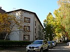
390 | Cork , city in Ireland | Aug 9, 1929 | Before that it was street 40b of the development plan. On November 13, 1954, its extension, Straße 37 , was also given this name. The street is in the English Quarter and runs through the Schillerpark housing estate . |
|
|
Damara Street
( Location ) |
210 | Damaraland , settlement area of the Damara in Namibia | Aug 6, 1937 | Previously it was street 26c of the development plan. It opens up the Friedrich-Ebert-Siedlung in the African Quarter . |

|
| Dohna rack
( Location ) |
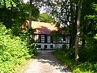
1210 | Dohna , a noble family from Saxony | before 1910 | The road runs from Seestrasse to Transvaalstrasse as a driveway and then continues as a footpath between Volkspark Rehberge and the cemeteries to the south to Charles-Corcelle-Ring. The building , erected in 1937 as the Hitler Youth Home, is located between Seestrasse and Transvaalstrasse and has been used as a meeting place for Lebenshilfe Germany since the late 1990s . |
|
| Dualastrasse
( Location ) |
220 | Douala , city in Cameroon | July 6, 1927 | At first it was road 111 of the development plan. The traffic route, which is built with residential buildings, connects African Street with Senegal Street in the African Quarter. |

|
| Dublin Street
( Location ) |
790 | Dublin , capital of Ireland | June 1, 1910 | At first it was Straße 86 and Straße 86a, Section X / 1 of the development plan. On May 13, 1929, another section of Dubliner Strasse, previously Strasse 86d, Section X / 1 , was given this designation. It runs from Müllerstrasse to Holländerstrasse in the English Quarter. The DeGeWo residential complex from 1930, south of Edinburger Straße, is a listed building monument. |

|
|
Eckernförde Platz
( Location ) |
380 × 150 (triangular shape) |
Eckernförde , town in the Rendsburg-Eckernförde district in Schleswig-Holstein | Jan. 9, 1901 | It was laid out as place A2, Section XI of the development plan. It is located between Seestraße , Sylter Straße and the north bank, which runs here as a footpath along the canal bank. Part of the space is taken up by the tram's turning loop . |

|
| Edinburger Strasse
( Location ) |
920 | Edinburgh , capital of Scotland | June 1, 1910 | The street was built as Straße 30 and Straße 31, Section X / 1 of the development plan. It leads from Ungarnstrasse on the south side of Schillerpark to Londoner Strasse. The part between Liverpooler Strasse and Londoner Strasse is a footpath over the cemeteries there. The main workshop Seestrasse of the subway and the professional fire station Schillerpark are located between Türkenstrasse and Ungarnstrasse . |

|
| Elise-and-Otto-Hampel-Weg
( Location ) |
170 | Named after Elise and Otto Hampel | 23 March 2018 | Section of Limburger Strasse between Genterstrasse and Müllerstrasse, which as a pedestrian path leads past the Rathauskantine. | |
|
Fehmarner Strasse
( Location ) |
270 | Fehmarn , German Baltic Sea island | Jan. 9, 1901 | When they were built, the traffic route was called Straße 12b, Section X / 1, according to the development plan . In 1901 the street that connects the north bank with Föhrer Straße was renamed Fehmarner Straße. |

|
| Fennstrasse
( Location ) |
730 | Fenn , a swampy, swampy lowland or moor in the Low German region | 1827 | The road was built in 1827 when the weddings were parceled out and led through swampy areas. As an extension of Perleberger Straße, it is an important north-south connection. The street leads through the premises of Schering AG , on which the “Comptoir and warehouse building and main laboratory” is located, which is used as a museum and research facility. |

|
|
Foehrer Strasse
( Location ) |
470 | Föhr , German North Sea island | Aug 4, 1897 | It was laid out as Straße 12, Section XI of the development plan and connects the Moabit district via the Föhr bridge . The buildings of the Rudolf Virchow Hospital are on the west side and the Robert Koch Institute on the east side . |

|
| Frauenfelder Weg
( Location ) |
280 | Frauenfeld , municipality and the capital of the Swiss canton of Thurgau | March 6, 1957 | The street was created in the course of the new development areas Schillerhöhe. It runs from Brienzer Strasse to Makrstrasse, where it merges into a branch of Markstrasse. |

|
|
Ghent Street
( Location ) |
840 | Ghent , capital of the Belgian province of East Flanders | Sep 15 1906 | It was laid out as Straße 17, Section X / 1 of the development plan. From 1933 to 1974 it was called Fritz-Schulz-Straße after a supporter of the Nazi movement who died here in a political conflict. Genter Straße runs parallel to Müllerstraße from Triftstraße to Seestraße . |

|
|
Court Street
( Location ) |
490 (in the district) |
Hochgericht , which was there in the 18th and 19th centuries | 1827 | When the Wedding lands were parceled out, the path was redesigned and its name is reminiscent of local history. The street was already marked by name on a map from 1827. The eastern section of the road runs in the Gesundbrunnen district . The Panke is crossed by means of a bridge . The street is divided in front of the urn cemetery on Richtstrasse so that through traffic is no longer possible. Berlin's first crematorium from 1910 is located in the cemetery. The former post office N65 is also a listed building. |

|
| Ghanastrasse
( Location ) |
340 | Ghana , state in West Africa | Oct 8, 1958 | It was created as Straße 21 and Straße 21c of the development plan as part of the further redevelopment in the African Quarter as the last street to be named after an African state. The occasion was the state visit of the Ghanaian head of state Kwame Nkrumah in Berlin in 1958. |

|
| Glasgower Strasse
( Location ) |
470 | Glasgow , port city in Scotland | June 1, 1910 | When it was built, it was Street 30a, Section X / 1 of the development plan. It runs from Barfusstraße to Liverpooler Straße. The residential complex is a listed building monument. |

|
| Greenwich Street
( Location ) |
210 | Greenwich , borough of London | Oct 8, 1958 | The street was created as part of a new construction project in the 1950s. It goes from Belfaster Straße as a dead end street. |

|
| Groninger Strasse
( Location ) |
460 | Groningen , capital of the province of Groningen in the Netherlands | July 31, 1947 | Before that, it was part of Straße 39, Section X / 1 of the development plan. From 1876 to 1937 it formed a section of Hennigsdorfer Strasse , and from 1937 to 1947 Utrecht Strasse. Here is the former Osram plant B. |

|
| Guinea Street
( Location ) |
550 | Guinea , state in West Africa | 5th Sep 1903 | When it was built, it was Street 25a, Section X / 1 of the development plan. It runs from the Transvaalstrasse to the Seestrasse . The school complex here is a listed building monument. |

|
| Gustave Courbet Street
( Location ) |
400 | Gustave Courbet (1819–1877), French realism painter | Dec. 1, 2000 | The previous names were Rue François Voltaire (1956-2000) and Rue Gustave Courbet (1956-2000), which were merged on December 1, 2000 to Gustave-Courbet-Straße. It is located in the Cité Joffre, which was inhabited by relatives until the withdrawal of the French troops. |

|
|
Hans Schomburgk Promenade *
( Location ) |
1280 | Hans Schomburgk (1880–1967), Africa explorer and wildlife filmmaker | after 1995 | The Hans-Schomburgk-Promenade is a footpath leading around the Plötzensee and not a dedicated street. |

|
| Hochstädter Strasse
( Location ) |
270 | Höchstädt on the Danube city in Bavaria and site of two battles in the War of the Spanish Succession | Jan. 18, 1892 | When it was built, it was Strasse 49, Section X / 1 of the development plan. As an extension of Nazarethkirchstrasse, it connects Maxstrasse with Liebenwalder Strasse. |

|
| Holländerstrasse
( Location ) |
1590 (in the district) |
Dutch , name for a trough used in paper production | Apr 10, 1861 | The street, which is located near the Holzstrasse and the Papierstrasse in Gesundbrunnen , was probably given its name in connection with the paper mill that was still working in Papierstrasse in 1839. The road area and the north side of the road are in the Reinickendorf district , to which it forms the border from Gotthardstraße to Brienzer Straße. |

|
|
Indian street
( Location ) |
220 | India , state in South Asia | July 26, 1927 | When it was built, it was street 32b of the development plan. On April 10, 1931, its extension between Seestrasse and Oudenarder Strasse was given the same name. On March 10, 1995, this part of the Wilhelm-Hasenclever-Platz was renamed Oudenarder Straße. |

|
| Iranian street
( Location ) |
240 (in the district) |
Iran , state in the Middle East | 27 Sep 1935 | When the Weddinger fields were separated in 1827, the entire section between Seestraße and Badstraße was named Exerzierstraße . On December 8, 1934, the part between Seestrasse and Schulstrasse was separated under the name Persische Strasse, after the state of Persia . In 1934 the country officially adopted the name Iran and in 1935 it was renamed Iranische Straße. The part between Reinickendorfer Straße and Seestraße runs as a footpath in front of the former children's hospital and was redesigned as a street in the 1960s. The part between Reinickendorfer Straße and Exerzierstraße is traffic-calmed and is located in the Gesundbrunnen district . |

|
|
Cameroon Street
( Location ) |
690 | Cameroon , a state in Central Africa and a former German colony | Apr 30, 1899 | It was laid out as Straße 25, Section X / 1 of the development plan and connects Müllerstraße with Afrikanische Straße. |

|
| Kapweg
( Location ) |
250 | Cape of Good Hope , promontory in South Africa | May 30, 1953 | From 1887 to 1953 it was part of the Spandauer Weg (today: Kurt-Schumacher-Damm). The road area and the north side of the road are in the Reinickendorf district . The Kapweg and the Scharnweberstraße, which belongs to Reinickendorf, are characterized by the Clou shopping center . |

|
| Kiautschoustraße
( Location ) |
350 | Kiautschou , former German colony in China | 13 Sep 1905 | Created as Straße 7b, Section X / 1 of the development plan, it connects Tegeler Straße with Torfstraße. The part on Beijing Square is traffic-calmed. |

|
| Congo Road
( Location ) |
470 | Congo , a state in Central Africa and a former Belgian colony | December 19, 1912 | The previous name was Straße 24a, Section X / 1 of the development plan. It leads from Müllerstrasse to Guineastrasse, whereby the part between Togo and Guineastrasse is just a footpath. The name alluded to the expansion of the German colony of Cameroon to the Congo River through the Morocco-Congo Treaty of 1911. |

|
| Kurt-Schumacher-Damm
( Location ) |
1870 (in the district) |
Kurt Schumacher (1895–1952), SPD chairman and resistance fighter | Nov 7, 1953 | The road area and the north side of the road are in the districts of Tegel and Reinickendorf . |

|
|
Leopoldplatz
( Location ) |
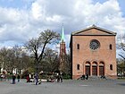
480 × 90, divided by a road | Leopold I (1676–1747), Prince of Anhalt-Dessau and Prussian general | Apr 2, 1891 | 1862 landscaped space, the first space J said. Designed in three stages according to plans by Hermann Mächtig, modified several times in the 20th and 21st centuries. The development with two churches, the Old and the New Nazareth Church, is striking . |
|
| Liebenwalder Strasse
( Location ) |
610 | Liebenwalde , town in the Oberhavel district in Brandenburg | Jan. 7, 1874 | Established in 1827 as Neue Straße , later Straße 8, Section X / 1 of the development plan. From 1874 Liebenwalder Strasse. It connects Malplaquetstrasse with Reinickendorfer Strasse. The former zinc foundry at No. 2/3 is the last example of suburban development in Wedding. The former Osram plant B is also located here . |

|
| Limburger Strasse
( Location ) |
590 | Limbourg , city in the Belgian province of Liege | July 18, 1907 | When it was built, it was Street 15, Section X / 1 of the development plan. It leads from Müllerstrasse to Amrumer Strasse. The parts of the street at the Wedding Town Hall and in front of the TFH are pedestrian zones. |

|
| Lindower Strasse
( Location ) |
280 | Lindow , town in the Ostprignitz-Ruppin district in Brandenburg | Dec. 7, 1864 | The first name was Straße 55, Section XI of the development plan. It runs from Müllerstraße at Wedding S-Bahn station to Nettelbeckplatz , where it ends as a dead end. |

|
| Liverpool Street
( Location ) |
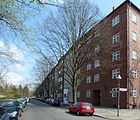
270 | Liverpool , port city in England | June 1, 1910 | Liverpooler Straße was laid out as Straße 86c, Section X / 1 of the development plan. It connects Müllerstrasse with Edinburger Strasse on the east side of the cathedral cemetery. The residential complex is a listed building monument. |
|
| London street
( Location ) |
640 | London , capital of the United Kingdom | June 1, 1910 | When it was built, it was Street 29, Section X / 1 of the development plan. On March 15, 1939, the part south of Müllerstrasse was renamed Petersallee . |

|
|
Louise-Schroeder-Platz
( Location ) |
180 × 90 | Louise Schroeder (1887–1957), Lord Mayor of Berlin | June 4th 1958 | It was created as space H, section X / 2 of the development plan. From 1905 to 1958 it was called Oskarplatz after King Oskar II of Sweden . It is on both sides of Markstrasse. |

|
|
Lüderitzstrasse
( Location ) |
870 | Adolf Lüderitz (1834–1886), entrepreneur and colonialist | 23 Aug 1902 | It was laid out as street 27a, section X / 1 of the development plan. On September 23, 1938, the part of Lüderitzstrasse between African Strasse and Petersallee was deleted as a name due to the change in the alignment. It runs from Seestraße to Otawistraße. Following a resolution in April 2018, Lüderitzstrasse will be renamed Cornelius-Frederiks- Strasse, honoring one of the leaders in the Nama uprising against the German colonial occupation. |

|
|
Liège Street
( Location ) |
480 | Liège , provincial capital in Belgium | Sep 15 1906 | Before it was named, it was Street 14, Section XI of the development plan. It runs from Seestraße to Luxemburger Straße, the part in front of the TFH is traffic-calmed. The Beuth House of the Technical University of Applied Sciences and the Ernst Schering Comprehensive School are listed architectural monuments. |

|
| Luxemburger Strasse
( Location ) |
800 | Luxembourg , capital of the Grand Duchy of Luxembourg or Luxembourg , Belgian province | Jul 18, 1907 | At first it was Street 13, Section X / 1 of the development plan. Originally, the road only extended to Trift, Liège and Samoa roads. Due to the construction of the technical college, street layouts were changed and on April 3, 1963 the extension to Amrumer Straße was named as well. The motive for naming the street is not entirely clear. On July 18, 1907, several streets in this area were named after geographical names in Belgium . It is therefore possible that the Luxemburger Strasse was named after the south-east Belgian province in Wallonia. The Gauß building of the TFH from 1964 is a listed building monument. |

|
| Lynarstrasse
( Location ) |
710 | Rochus zu Lynar (1525–1596), officer and builder | Apr 2, 1891 | It was laid out as Straße 5, Section X / 1 of the development plan and connects Müllerstraße with the north bank of the Stadtbahn Viaduct. There are other Lynar streets in the Berlin districts of Grunewald and Spandau . |

|
|
Malplaquetstrasse
( Location ) |
500 | Malplaquet, village in northern France, 1709 site of the Battle of Malplaquet in the War of the Spanish Succession | Apr 2, 1891 | At its facility at Straße 45, Section X / 1 of the development plan, it leads from Seestraße to Nazarethkirchstraße. On the corner of Liebenwalder Straße is the Karl Schrader House , built between 1904 and 1906, which is one of the exemplary cooperative reform housing developments of the early 20th century. It was named after the founder of the Berliner Baugenossenschaft eG Karl Schrader . | |
| Markstrasse
( Location ) |
360 (in the district) |
Mark Brandenburg | before 1877 | The road area and the east side of the road are in the Reinickendorf district . On March 8, 1957, a parallel section between Frauenfelder Weg and Ungarnstrasse was named as well in the course of the development of the "Schillerhöhe" settlement. |

|
|
Max-Josef-Metzger-Platz
( Location ) |
160 × 160 (triangular shape) |
Max Josef Metzger (1887–1944), theologian and resistance fighter | Apr 21, 1994 | At the facility, place C, section X / 1 of the development plan. From December 3, 1887 to April 21, 1994 Place Courbière . Gerhard Schultze-Seehof's rubble stele is located on the triangular square between Müllerstrasse and Richtstrasse to commemorate the building work of the rubble women . |

|
| Maxstrasse
( Location ) |
420 | Max , male first name | 22 Sep 1872 | The first name was Street 52, Section X / 1 of the development plan. It runs from Groningerstrasse to Adolfstrasse. The most striking building is the former Wittler bread factory from 1928, which is now used as a health and care center. |

|
|
Mettmannplatz
( Location ) |
170 × 120 (triangular shape) |
Mettmann , district town of the district of the same name in North Rhine-Westphalia | July 11, 1986 | Mettmannplatz is a green space between the north bank, Tegeler Strasse and the Stadtbahn Viaduct, which was laid out in the 1980s as part of the waterfront on the Berlin-Spandau shipping canal . It is crossed by the railway bridge of the north-south long-distance railway , the so-called high - flyer . |

|
| Mohasistraße
( Location ) |
110 | Mohasisee (Lake Muhazi), lake in Rwanda | Aug 6, 1937 | It is an access road of the Friedrich-Ebert-Siedlung branching off from Swakopmunder Straße . | |
|
Müllerstrasse
( Location ) |
3700 | around 25 mills, which stood mainly around today's Weddingplatz and served the millers there | 1827 | The connection, previously known as Ruppiner Heerweg and renamed Müllerstraße in 1827, is one of the three main roads through the district. It extends from the southeast (continuation of Chausseestrasse ) to Scharnweberstrasse in the northwest in the Reinickendorf district . The U6 line passes under the street along its entire length . The stations Reinickendorfer Straße , Wedding , Leopoldplatz , Seestraße , Rehberge and Afrikanische Straße with the main underground workshop are located in Müllerstraße (from south to north) . The southern part is dominated by the office complex of Bayer Schering Pharma (formerly Schering AG ). After crossing under the Berlin-Wedding S-Bahn station, there are only residential and commercial buildings. Many infrastructure facilities are located here, such as the Wedding Town Hall , the Müllerhalle , the Paul-Gerhardt-Stift or the Center Culturel Français . At the northern end is the Friedrich-Ebert-Siedlung . |

|
|
Nachtigalplatz
( Location ) |
150 × 110 | Gustav Nachtigal (1834–1885), Africa researcher and colonial politician | May 12, 1910 | It was laid out as place Z, section X of the development plan. It is crossed by the African Strait. It interrupts Togostraße and Petersallee and is the center of the African quarter of the Friedrich-Ebert-Siedlung . The expansion of the settlement, which was built between 1937 and 1939, corresponds to the traditional ideas of the National Socialist era. To cover up the rows of houses in the Friedrich-Ebert-Siedlung, a development was built on Togostraße. According to a decision in April 2018, Nachtigalplatz is to be named after Emily and Rudolf Duala Manga Bell , who played a central role in the Duala's resistance against German colonial rule. |

|
| Nazarethkirchstrasse
( Location ) |
490 | Old Nazareth Church | Nov 29, 1876 | In the development plan, it was Straße 48, Section X / 1 . It connects Müllerstrasse with Hochstädter Strasse on the northwest side of Leopoldplatz . |

|
|
Nettelbeckplatz
( Location ) |
120 × 80 (triangular shape) |
Joachim Nettelbeck (1738–1824), seaman, writer, merchant in Kolberg and German folk hero | May 1, 1884 | It was laid out as place M, Section X / 2 of the development plan. From 1981 to 1987 the square was redesigned and the traffic routing of Reinickendorfer Straße was swiveled into part of Pankstraße. Pankstrasse previously also led to Nettelbeckplatz. Court Street was also closed to through traffic.
The fountain with the figure group Tanz auf dem Vulkan forms the center of the square today . |

|
| North bank
( Location ) |
1270 + 830 | Northern embankment of the Berlin-Spandau shipping canal | June 6, 1870 | U At first it was Street 30, Section XI , of the development plan. As the northern Ufer-Strasse on the Berlin-Spandau shipping canal , the street was given its name at the suggestion of the police headquarters. It originally ran from Tegeler Weg (today Kurt-Schumacher-Damm, near the Hinckeldey bridge) to Fennstrasse, but was later shortened. From 1926, its western part only runs between Plötzensee lido and Seestrasse . To the east of Seestrasse, it is first interrupted by Eckernförde Platz . The Robert Koch Institute, established in 1897, is located on Föhrer Straße . and the residential complex built by the Berliner Spar- und Bauverein between Buchstrasse, Nordufer and Fehmarner Strasse. The street is traffic-calmed at Beijing Square . Furthermore, the part between the S-Bahn viaduct and Fennstrasse is also a footpath. |
 |
|
Ofener Strasse
( Location ) |
270 | Ofen , German name of the city of Buda , since 1873 part of Budapest in Hungary | March 8, 1892 | It was laid out as Straße 84, Section X / 1 of the development plan. It connects Müllerstrasse with Edinburger Strasse. The road in front of the Winkelried and Hans Bredow Oberschule school complex here is closed to through traffic. The sports field in the block is shared with the Lessing grammar school. |

|
| Ostend Street
( Location ) |
750 | Ostend , port city in Belgium | June 28, 1907 | When it was first named, it was Street 18a, Section X / 1 of the development plan. It leads from Amrumer Strasse to Müllerstrasse. The Ostender Strasse residential complex is a listed building monument. |

|
| Otawistrasse
( Location ) |
500 | Otavi , place in Namibia | Oct 16, 1911 | It was laid out as Straße 22a, Section X of the development plan and leads from Müllerstraße to Afrikan Straße. The residential complex from 1929, located in the Otawi, Togo, Zanzibar and African Streets block, is a listed building monument. |

|
| Oudenarder Strasse
( Location ) |
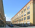
520 | Oudenaarde , city in Belgium, 1708 site of the Battle of Oudenaarde in the War of the Spanish Succession | June 24, 1893 | When it was built, it was Street 32a, Section X / 1 of the development plan. The part of the Indian Road between Seestrasse and Oudenarder was also given this name on March 10, 1995 as part of the Wilhelm-Hasenclever-Platz. On both sides of the street are parts of OSRAM Plant B, which was built in several construction phases and has been used as a commercial center since the 1990s. |
|
| Oxford Street
( Location ) |
140 | Oxford , university city in England | Sep 1 1926 | It was built as Straße 85, Section X of the development plan in the Schillerpark housing estate . The gardens are also a listed building monument. |

|
|
Pasewalker Strasse
( Location ) |
160 | Pasewalk , town in the district of Vorpommern-Greifswald in Mecklenburg-Western Pomerania | Apr 2, 1891 | The first name was Straße 53a, Section X / 1 of the development plan. It connects the Richtstrasse with the Plantagenstrasse. |

|
|
Beijing Square
( Location ) |
120 × 70 (triangular shape) |
Beijing , capital of China | 13 Sep 1905 | At his facility he was place A IV, section XI of the development plan. The name recalls the military occupation of Beijing ( Boxer Rebellion ) by troops of the great powers in the autumn of 1900. |

|
| Petersallee
( Location ) |
500 | Hans Peters (1896–1966), lawyer, politician and resistance fighter | July 23, 1986 | It was originally part of London Street. In 1939 the name was changed to Petersallee after the colonial politician Carl Peters . On April 15, 1986, the district assembly decided to change the basis for naming. On July 23, 1986 the civil engineering office in Wedding put up the explanatory signs on which the namesake Hans Peters is named. There was no actual renaming. The street leads from Müllerstraße to Windhuker Straße through the Friedrich-Ebert-Siedlung . According to a decision in April 2018, the north-eastern section towards Müllerstrasse is to be named after the Namibian independence activist Anna Mungunda ; the southwestern section towards Windhuker Straße will be called Maji-Maji-Allee and thus remind of the Maji-Maji uprising . |

|
| Plantation road
( Location ) |
420 | a tree nursery that used to exist here , called a plantation | 1827 | It runs from Ruheplatzstraße to Reinickendorfer Straße. She was already listed by name on the map from 1827. |

|
| Prinz-Eugen-Strasse
( Location ) |
330 | Prince Eugene of Savoy (1663–1736), Austrian field marshal | Apr 12, 1889 | When it was built, it was Straße 51, Section X of the development plan. It connects Schulstrasse with Plantagenstrasse. |

|
|
Reinickendorfer Strasse
( Location ) |
1900 | Reinickendorf , part of Berlin, until 1920 an independent municipality | around 1861 | It was previously listed as the route to Oranienburg in a map from 1701. On the map from 1877, Markstrasse was drawn in its northern route up to the then unnamed Oskarplatz (since 1958 Louise-Schroeder-Platz). On January 1, 1986, part of Pankstrasse was included in Reinickendorfer Strasse as part of the redesign of Nettelbeckplatz. The east side of the street is in the Gesundbrunnen district . |

|
| Ruheplatzstrasse
( Location ) |
360 | cemeteries located here | around 1827 | The street was created when Weddings were parceled out around 1827. The street's name was already marked on the map from 1827. On the east side of the urn cemetery, it connects Richtstrasse with Schulstrasse. Building No. 3 is a listed building monument. |

|
|
Zambezi Street
( Location ) |
230 | Zambezi , river in southern Africa | July 6, 1927 | The street in the African Quarter was laid out as street 113 of the development plan. It connects the African Road and the Senegal Road. |

|
| Samoa Street
( Location ) |
360 | German Samoa , former German colony in the western part of the Samoa Islands | 23 Aug 1905 | When it was built, it was Street 7c, Section X / 1 of the development plan. There is a warehouse there on the map from 1897. The most striking building is the Easter Church from 1911. |

|
| Zanzibar Street
( Location ) |
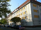
540 | Zanzibar , part of Tanzania in East Africa | December 19, 1912 | The first name was Street 28b, Section X / 1 of the development plan. The street connects the African street with the Müller street. The residential complex from 1925 is a listed building monument. |
|
| Scharnweberstrasse
( Location ) |
140 (in the district) |
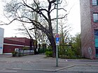
Georg Scharnweber (1816–1894), lawyer and district administrator of the Niederbarnim district | before 1888 | From the 18th century to 1888 it was called Tegeler Chaussee . Most of the street is in the Reinickendorf district . Only house numbers 159 and 160 belong to Wedding with the existing school environment center and the dune Wedding . |
|
| Schererstrasse
( Location ) |
150 | Wilhelm Scherer (1841–1886), Germanist and writer | June 18, 1907 | It was created as Straße 54, Section X / 1 of the development plan and connects Maxstraße with Reinickendorfer Straße. |

|
| Schillerhof
( Location ) |
130 | Friedrich Schiller (1759–1805), poet | after 1925 | It was created when the Schillerhof settlement was built between 1925 and 1927. |

|
|
Schöningstrasse
( Location ) |
270 | Hans Adam von Schöning (1641–1696), Governor of Berlin Field Marshal General | Jan. 18, 1892 | The street between Müllerstrasse and Edinburger Strasse was created as Strasse 85, Section X / 1 of the development plan. The Lessing-Gymnasium on this street is a listed building monument. |

|
| Schulstrasse
( Location ) |
790 (in the district) |
first elementary school in Wedding, built in 1821 | around 1827 | The road was built in 1827 when the land was parceled out, initially as a dirt road, which was not partially paved until 1890. The north-eastern section of the road runs in the Gesundbrunnen district . Schulstrasse is the northern continuation of Luxemburger Strasse . At the end of the Second World War in 1945 during the Battle of Berlin, Schulstrasse, Seestrasse and Badstrasse formed the main battle line for days, almost all buildings were destroyed or badly damaged. |

|
| Schwyzer Strasse
( Location ) |
720 | Schwyz , canton in Switzerland | March 28, 1958 | The street was built when the "Schillerhöhe" settlement was built in the 1950s. The original Hobrecht plan for this area was abandoned as early as the 1920s. The street runs from Barfusstraße to Brienzer Straße. The Upper School Health 1 is located here . The St. Aloysius Church, built in 1956, is a listed architectural monument. |

|
|
Seestrasse
( Location ) |
2780 (in the district) |
Plötzensee | around 1827 | The road was laid out when the combing heather was parceled out. She is already mentioned by name on the map from 1827. Construction began around 1907. On November 15, 1957, the part of Seestrasse in Reinickendorf from Oskarplatz (now Louise-Schroeder-Platz) to Letteallee was renamed Reginhardstrasse. The western section of the street runs in the districts of Moabit and Charlottenburg Nord . The 3.2 kilometer long Seestrasse is the most important north-south connection in Wedding and part of the open road ring around Berlin city center. Its southern end at the Westhafen merges into the A 100 .
Architectural monuments are the former Osram factory B, the Kapernaum church , the fermentation institute, the tenement Seestrasse 99 and the kiosk Seestrasse 93. Eleven victims of the uprising of June 17 are buried in the urn cemetery Seestrasse , and probably the first in the neighboring municipal cemetery Fatality at the Berlin Wall Ida Siekmann . At the end of the Second World War in 1945 during the Battle of Berlin, Schulstrasse, Seestrasse and Badstrasse formed the main battle line for days, with almost all buildings being destroyed or badly damaged. |
|
| Sellerstrasse
( Location ) |
480 | Seller pond that used to exist here | 1827 | The road was created when the land was parceled out in 1827 and was previously called Am Sellerteich . It connects Müllerstrasse over the Nordhafenbrücke with Heidestrasse in Moabit and is part of the B 96 . In 1859 the first part of the III. Municipal gas works put into operation. The Erika-Heß-Eisstadion, completed in 1967, is located here . The laboratory building of Schering AG and the substation of BEWAG are listed monuments. |

|
| Senegal Street
( Location ) |
330 | Senegal , state and river in West Africa | July 6, 1927 | The street in the African Quarter was street 106 of the development plan. It connects Transvaalstrasse and Tangastrasse. |

|
|
Sparrplatz
( Location ) |
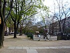
230 × 50 | Otto Christoph von Sparr (1599–1668), Brandenburg General Field Marshal and Imperial Count | Aug 4, 1897 | In its layout it was place B and street 4a, section XI of the development plan. On both sides there is a carriageway of Sparrstrasse. There is a neighborhood management program for the area around Sparrplatz, the Sprengelkiez . |
|
| Sparrstrasse
( Location ) |
240 | Otto Christoph von Sparr (1599–1668), Brandenburg General Field Marshal and Imperial Count | Jan. 8, 1892 | It was created as Straße 8, Section X / 1 of the development plan. In the course of redevelopment measures, the western side of the street and the section between Sprengelstrasse and Triftstrasse were de-designated. The eastern side of the street ends as a dead end. |

|
| Sprengelstrasse
( Location ) |
600 | Christian Konrad Sprengel (1750–1816), educator and botanist | Aug 4, 1897 | It was created as Straße 7, Section XI of the development plan. On September 13, 1905, the section Straße 7a , Section X / 1 of the Sprengelstraße development plan was named. It runs from Torfstraße to the traffic-calmed Sparrstraße and ends there as a dead end. The Easter Church from 1911 is a listed building monument. |

|
| Swakopmund Street
( Location ) |
450 | Swakopmund , city in Namibia | June 1, 1910 | It was created as Straße 21a, Section X / 1 of the development plan in the African Quarter and leads from Afrikaner Straße to Volkspark Rehberge , where it merges into Windhuker Straße. It opens up the Friedrich-Ebert-Siedlung . |

|
| Sylter Strasse
( Location ) |
350 | Sylt , German North Sea island | Aug 4, 1897 | It was laid out as street 10b, section X of the development plan as a connection between Seestrasse and the north bank. |

|
| Syrian street
( Location ) |
220 | Syria , state in the Middle East | July 6, 1927 | It was built as street 32c of the development plan between Seestrasse and Ungarnstrasse. Its extension west of the Ungarnstrasse was also named Syrische Strasse on April 10, 1931. This part was withdrawn when the Gottfried Röhl primary school was built. It is located in the "Schillerhöhe" settlement built in the 1950s. |

|
|
Tangastrasse
( Location ) |
190 | Tanga , city in Tanzania | July 6, 1927 | The street in the African Quarter was street 107 of the development plan. It connects the African Road and the Senegal Road. |

|
| Tegeler Strasse
( Location ) |
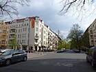
810 | Tegel , a district of Berlin, was an independent municipality until 1920 | Aug 12, 1864 | The road already existed before the development plan was published. It connects Triftstrasse with Fennstrasse. The Brothers Grimm Primary School from 1910, which is here, is a listed building monument. The TELUX adventure playground and the Weddinger children's farm are located on Luxemburger Strasse. |
|
| Ticino Way
( Location ) |
120 | Canton Ticino in Switzerland | Nov 28, 1959 | The Tessiner Weg is a short residential street to develop the house blocks in the “Schillerhöhe” settlement, which branches off from Winkelriedstraße. |

|
| Themsestrasse
( Location ) |
600 | Thames , river in England | 26 Sep 1929 | It was laid out as street 73 of the development plan. It originally ran from Belfast Street to London Street. On October 27, 1965, Street 86 , the south side of London Street, was also named that way. It now led from Holländer Strasse to Müllerstrasse. The original part at the rear of the Müllerstraße tram depot was redesigned when it was converted into a bus depot and has since served as a parking and turning area for the buses. When the Center Culturel Français was built, the part on Müllerstrasse was converted into a car park and the course of the street turned to Londoner Strasse. |
|
| Togostraße
( Location ) |
1240 + 290 | Togo , former German colony in West Africa | Apr 30, 1899 | It was built as Street 26A, Section X / 1 of the development plan in the African Quarter and runs from Seestrasse to Swakopmunder Strasse. It is interrupted by the Nachtigalplatz and the sports field between Kongostraße and Transvaalstraße. It leads through the Friedrich-Ebert-Siedlung and through the residential complex Sansibarstrasse. |

|
| Peat road
( Location ) |
320 | peat meadows that used to be in this area | 1832 | The road was laid out in 1832, and in 1836 it was marked by name on a map. It belonged to the parish in front of the Rosenthaler Tor. On August 6, 1872, the street, which at that time led from Triftstraße to Invalidenstraße , was divided: from Triftstraße to the railway, it kept the name Torfstraße, from Fennstraße to Invalidenstraße it was named Lehrter Straße . This uniform street was connected by the Torfstrasse Bridge over the Berlin-Spandau shipping canal . The main part of Torfstrasse is still in Wedding today. The road in Moabit was reduced more and more by railway and operating facilities , so that the remaining piece was connected to the adjacent Friedrich-Krause-Ufer on May 1, 1988 with plots 32–33. The bridge, which was badly damaged in World War II , was replaced by a new building in 1968, but it was demolished again in 1980. A little to the west, the Torfstrasse footbridge was built in 1979/80 . |
|
| Tourcoing Street
( Location ) |
240 | Tourcoing , twin town of the Wedding district in northern France | Dec. 1, 2000 | It is located between Allee du Stade and Charles-Corcelle-Ring in Cité Joffre, which was inhabited by French military personnel until the French troops withdrew. The spelling of the street name does not correspond to the rules of German spelling. |

|
| Transvaalstrasse
( Location ) |
1260 | Transvaal , Former Republic, British Colony and South African Province | Jun 28, 1907 | It was laid out as street 28a, section X / 1 of the development plan between Müllerstraße and Afrikanischer Straße. On January 30, 1933, the part between Dohnagestell and Afrikanischer Strasse, Strasse 114 , was also named that way. This leads through the Rehberge park . |

|
| Triftstrasse
( Location ) |
940 | Magistratstrift , which used to stretch as far as this | 1827 | It already existed as a dirt road in the 18th century and was paved as a clay road in 1823. The name was chosen after the then existing large municipal strip to which this street led. It is already marked by name on the map from 1827. At that time, however, much longer than today, it ran from the Vorwerk Wedding, across Torfstrasse to Moabit . Around 1700 the road was called Weg nach Fehrbellin and Ruppin . Before the widening of Luxemburger Strasse as part of the construction of underground line 9 , Triftstrasse was the main thoroughfare. In the 1970s it was closed to through traffic on Torfstrasse. |

|
|
Türkenstrasse
( Location ) |
270 | Turkey , state in the Middle East and Europe | Apr 13, 1904 | It was laid out as Straße 33, Section X / 1 of the development plan and connects Müllerstraße with Edinburger Straße. The main underground workshop is located in this block . |

|
| Turin Street
( Location ) |
600 | Turin , capital of the Italian region of Piedmont | March 17, 1893 | When it was built, it was called Straße 44, Section X / 1 of the development plan. It connects Seestrasse with Schulstrasse. The former garrison cemetery Müllerstraße is located at No. 9-17. |

|
|
Uganda road
( Location ) |
200 | Uganda , state in East Africa | July 6, 1927 | The street in the African Quarter was street 109 of the zoning plan. It connects the African Road and the Senegal Road. |

|
| Hungary Street
( Location ) |
1290 | Hungary , state in Central Europe | 23 Aug 1905 | When it was first named, it was called Straße 36, Section X / 1 of the development plan and ran from Müllerstraße to Syrische Straße. When the "Schillerhöhe" settlement was built, it was extended to Markstrasse and named on March 8, 1957. The main underground workshop is on Müllerstraße . The Schillerpark is followed by the soccer field of SV Nord Wedding 1893 (formerly Rapide Wedding ) and the Gottfried-Röhl-Grundschule from 1964. At the northeastern end is the Kombibad Seestrasse. |

|
| Usambara Street
( Location ) |
170 | Usambara Mountains , mountain range in East Africa | 23 Sep 1938 | The short access road between Afrikanischer Straße and Petersallee was created during the construction of the residential complex on Nachtigalplatz. |

|
| Utrecht Street
( Location ) |
550 | Utrecht , provincial capital in the Netherlands | May 12, 1893 | It was laid out as Straße 43, Section X / 1 of the development plan and initially runs from Müllerstraße to Turiner Straße. On September 13, 1905, the street 43a, Section X / 1 between Turiner and Maxstraße was also named Utrecht Street. On July 27, 1933, Utrecht Strasse was renamed Wagnitzstrasse, after a Hitler Youth member who was killed in a dispute in a pub on New Year's Eve 1932/1933. On July 31, 1947, it got its original name back. The Rübezahl-Grundschule and Karl-Bröger-Hauptschule from 1918 located here are listed buildings. |

|
|
Walderseestrasse
( Location ) |
300 | Alfred von Waldersee (1832–1904), Prussian field marshal and politician | before 1897 | It was built between 1889 and 1897 and was then still in Reinickendorf . It was only after the district reform of 1938 that the southern part became part of the Wedding district . Today it forms the border to the district of Reinickendorf , to which the road area and the north side of the road belong. |

|
| Wedding place
( Location ) |
120 × 80 (triangular shape) |
Vorwerk and Dorf Wedding | 5th Sep 1835 | It was known as the church square from the beginning of the 19th century until 1835. In 1835 it was given its current name because it was in the area of the former Vorwerk Wedding. The Thank You Church, built in 1972 by Fritz Bornemann , is located on the square between Fennstrasse, Reinickendorfer Strasse and Müllerstrasse . | |
| Wilhelm-Hasenclever-Platz
( Location ) |
50 × 50 (triangular shape) |
Wilhelm Hasenclever (1837–1889), social democratic publicist and politician | July 12, 1994 | The previously unnamed square was created by de-dedicating Oudenarder Strasse between Seestrasse and Indischer Strasse and at the same time incorporating this part of Indian Strasse into Oudenarder Strasse. |

|
| Willdenowstrasse
( Location ) |
360 | Carl Ludwig Willdenow (1765–1812), botanist | March 17, 1891 | It was created as Straße 2, Section X / 1 of the development plan and is the connection between Lynarstraße and Triftstraße . The two “Hermann-Herzog-” and “Trift-Grundschule” on Willdenowstraße and Trift- / Müllerstraße are listed buildings. |

|
| Windhoek Street
( Location ) |
270 | German name of Windhoek , capital of Namibia | June 1, 1910 | When it was built, it was Street 21a, Section X / 1 of the development plan. It runs from Afrikaner Strasse at Volkspark Rehberge to Swakopmunder Strasse through the Friedrich-Ebert-Siedlung . |

|
| Windsor Street
( Location ) |
130 | Windsor , city in England | Aug 9, 1929 | It was built as Straße 85a, Section X of the development plan in the Schillerpark housing estate and connects Bristolstraße with Corker Straße. |

|
| Winkelriedstrasse
( Location ) |
250 | Arnold Winkelried († allegedly 1386), Swiss national hero | Aug 4, 1930 | Winkelriedstrasse was created when the Schillerhof estate was built. |

|
|
Zeppelinplatz
( Location ) |
120 × 100 | Ferdinand von Zeppelin (1838–1917), airship pioneer | June 1, 1910 | It was called Platz D, Dept. X / 1 of the development plan. By naming a traffic route or a square after Graf Zeppelin, the Berlin magistrate wanted above all to commemorate the airship disaster in Echterdingen in August 1908, in which the airship LZ 4 was destroyed. |

|
Other locations in Wedding
Housing estates
- African quarter
- Friedrich-Ebert-Siedlung
- Schillerpark settlement is a UNESCO World Heritage Site
- "Schillerhöhe" settlement (Ungarnstrasse - Brienzer Strasse - Schwyzer Strasse)
- Brussels neighborhood
- Sprengelkiez
Allotment gardens (colonies)
Almost 75 percent of the allotment gardens in the Mitte district are located in the district in terms of area and 70 percent in terms of the number of plots . The allotment gardens are listed with a sorting number in the allotment garden development plan (KGEP) and with a street number in the regional reference system (RBS) with reference as a postal address.
- Colony 'Berg und Tal' (Belfaster Straße 34/36, KGEP: 103, RBS: 6197, Lage ): The 13 plots on 4,964 m² of state-owned leased land are entered in the development plan as permanent allotments. The facility is located to the west of the KGA 'Nordpol' and 'Sonntagsfreude'.
- BLW - Gesundbrunnen sub-district, Wedding Group (Lynarstrasse, KGEP: 1200, RBS: 6538, location ): The railway agriculture with 24 parcels on 3,970 m² is located north of the railway line at Sparrplatz , at the junction of the Ringbahn and Hamburger Bahn.
- Colony 'Freudental 1908' (Dubliner Straße 69, KGEP: 1005, RBS: 6333, location ): the permanent allotment garden is located on the district border with Reinickendorf as an extension of Domfriedhof II with 106 plots on 37,450 m² of land. The KGA is located in the English Quarter, "visitors can enjoy the beauty of the gardens on three public paths."
- Colony 'Cameroon' (Afrikanische / Kameruner Straße, KGEP: 1008, RBS: 6477, location ): This small permanent allotment garden with 15 plots is located on the north-west corner of the Cameroonians with the Afrikanische Straße on 4086 m² of land owned by the country. May one
- Colony 'Klein Afrika' (Afrikanische / Windhuker Straße, KGEP: 1009, RBS: 6499, location ): This facility is located between Afrikanischer Straße and Möwensee (Volkspark Rehberge) with 29 lots on 8,012 m², so that the main path is an extension of Windhuker Straße . The permanent allotment garden is on leased land in Berlin.
- Colony 'Lüttich' (Lütticher Straße 9, KGEP: 1010, RBS: 6339, location ) on 2,853 m² with 13 plots, it is a small permanent facility that is located behind the properties within the Karrees Lütticher, Brusseler, Amrumer, Seestraße.
- Colony 'North Pole II' (Londoner Straße, KGEP: 1012, RBS: 16204, Lage ) is a permanent allotment garden with 66 plots on 23,210 land. This KGA is located around Mövenweg in the northeast of the garden area with the KGA 'Berg und Tal' and 'Sonntagsfreude'. The colony 'Nordpol' was renamed to KGA 'Nordpol II' on December 29, 1988 for delimitation .
- Colony 'Plötzensee' (north bank 33/34, KGEP: 1015, RBS: 6623, location ) The KGA is located on the southern edge of the district along the Hohenzollern Canal between the canal and the cemetery at Plötzensee and St. Johannis and Heilandskirchhof. The 61 parcels on 34,256 m² of private leased land are classified as highly secured allotments according to the development plan. The colony still includes 136 parcels on 49,144 m² of state-owned land with the status of a permanently secured fictitious facility. The KGA 'Napoleon' joins the private garden paths Extended North Bank (lengthways as the main path), Carnation, Narcissus, Thorn, Dahlia Path and Im Winkel (across), Margaritenweg (parallel to it) and to the northwest in the Cité Joffré.
- Colony 'Quartier Napoleon' (Charles-Corcelle-Ring, KGEP: 1016, RBS: 9201, Lage ) south of the Julius-Leber-Kaserne to the Stade Napoleon in the Cité Joffré there are 190 plots of the permanent allotment garden on 74,785 m² of land. The garden paths are private paths from west to east: ant, birch, cedar, badger, oak, fox, cricket, hare, hedgehog, hunter, pine, lark, marten, walnut tree -, otter, oriole path. A plot of 208 m² was organized as an eco-plot in the 'Quartier Napoleon' colony. The colony was renamed KGA 'Quartier Napoleon' on August 4, 2004.
- Rehberge Colony (Swakopmunder Straße, KGEP: 1017, RBS: 6634, location ): This facility is located between Schwarzer Graben, west of the Rehberge Park, on land owned by the state. On 141,529 m², 476 parcels are secured as fictitious permanent allotment gardens.
- Colony 'Sonntagsfreude' (Londoner Straße 33, KGEP: 1021, RBS: 6714, ) is a permanently secured KGA with 43 lots on 15,730 m² of land. It is located in the southwest of the allotment gardens between Belfast and Londoner Straße on the northern edge of the district.
- Colony 'Steinwinkel' (Charles-Corcelle-Ring, KGEP: 1022, RBS: 6647, location ) offers 23 parcels of land on 7,610 m² of state-owned land. This fictional permanent colony lies in an arch from the Schwarzen Graben to the west of the wild boar enclosure in the Rehberge Park and borders the Julius Leber barracks .
- Colony 'Togo' (Müllerstrasse 102–122, KGEP: 1023, RBS: 6769, location ): This permanent facility has 167 plots on a state-owned area of 59,169 m². It is located between Müllerstrasse and Togostrasse as well as Petersallee and Otawistrasse on the inner area behind the residential buildings. The "Permanent Colony Togo eV" is named after Togostraße, but until 1939 was called "To the happy Rehberge".
- The 'Virchow' colony (Luxemburger Straße, KGEP: 1024, RBS: 6785, location ) is located southeast of the Luxemburger in an angle to Tegeler Straße. The 23 plots on 5,450 m² are listed in the allotment garden development plan in the security level of the temporary allotment gardens.
Parks and other facilities
- Erika Hess ice rink
- Goethe Park
- Schiller Park
- Sprengelpark
- Rehberge public park
- Campus Virchow-Klinikum (CVK) of the Charité
- Julius Leber barracks
- Central fairground
See also
- List of cultural monuments in Berlin-Wedding
- List of stumbling blocks in Berlin-Wedding
- List of cinemas in Berlin-Wedding
literature
- Landesdenkmalamt Berlin (Ed.): Monuments in Berlin Mitte district - Wedding and Gesundbrunnen districts. Michael Imhoff Verlag Petersberg 2004. ISBN 3-937251-26-X
Web links
- Map of Berlin 1: 5000 with district boundaries. Senate Department for Urban Development Berlin, 2009, accessed on January 11, 2011 .
- Street directory Wedding. kaupert media GmbH, accessed on February 25, 2011 .
- Website of the Weddinger Heimatverein. Weddinger Heimatverein eV, accessed on December 18, 2011 .
- Berlin-Brandenburg Statistics Office: List of streets and squares in the Mitte district (as of February 2015); pdf
- Hermann Jansen: Development proposal for African Street, Berlin-Wedding
Individual evidence
- ↑ Housing complex on the African Street
- ↑ a b Friedrich-Ebert-Siedlung, Block I and Block II
- ↑ a b c d e f Friedrich-Ebert-Siedlung with residential complexes on Nachtigalplatz
- ↑ a b c d Sansibarstrasse residential complex
- ↑ Start of construction work to redesign the “Am Nordhafen” park. January 26, 2015, accessed April 3, 2020 .
- ↑ a b Rudolf Virchow Hospital
- ↑ a b Ostender Strasse residential complexes
- ↑ Institute for the Sugar Industry
- ↑ Peter Neumann: New Senate List: The next bollard cycle paths are to be built here. February 27, 2019, accessed on March 3, 2019 (German).
- ^ Kauperts: Amsterdamer Strasse
- ↑ Corner house Amsterdamer Strasse 17 / 17a and Turiner Strasse 42–44
- ↑ Antonstrasse school complex
- ↑ 75th Community School and 14th and 72nd Community School
- ↑ Pharus city map from 1954 ( Memento of the original from January 1, 2016 in the Internet Archive ) Info: The archive link was inserted automatically and has not yet been checked. Please check the original and archive link according to the instructions and then remove this notice.
- ^ Kauperts: Barefoot Street
- ↑ Chapel of St. John Evangelist Churchyard
- ↑ a b c d Schiller Park with bastion, lavatories, Polyhymnia monument and Schiller monument
- ↑ Kapernaum-Gemeinde Community Center Schillerhöhe
- ↑ a b c d e Schillerpark settlement
- ↑ Zeppelin power supply base
- ↑ House Buchstrasse 3
- ↑ Rathenaubrunnen
- ↑ a b c d e Friedrich-Ebert-Siedlung, Block III
- ↑ a b c Dubliner Strasse residential complex
- ↑ Fire station Edinburger Strasse
- ↑ https://eople.tagesspiegel.de/mitte/unter-nachbarn/2018/07/18/51618/
- ↑ Schering AG & Comptoir- and storage building & main laboratory (M021)
- ↑ Wedding urn cemetery
- ↑ Crematorium at the Wedding urn cemetery
- ↑ Post office N 65
- ↑ a b c d Siegmund Bergmann Glühlampen AG & Osram GmbH (from 1935)
- ↑ Rehberge Primary School and Goethepark Primary School
- ↑ a b Exerzierstrasse. History of parade route. In: Kaupert's street guide through Berlin. Kaupert Media GmbH, accessed on November 28, 2013 .
- ↑ Iranian Street. History of Iranian Road. In: Kaupert's street guide through Berlin. Kaupert Media GmbH, accessed on November 28, 2013 .
- ↑ Zinc foundry
- ↑ a b c Laura Hofmann: New street names for the African Quarter found. In: Der Tagesspiegel . April 11, 2018, accessed April 12, 2018 .
- ↑ 53rd and 300th Community School & Diesterweg Realschule & Technical Middle School
- ↑ Ernst Schering Comprehensive School
- ^ Kauperts: Luxemburger Strasse
- ↑ State engineering school Gauss
- ↑ Karl Schrader House
- ↑ Berlin building cooperative
- ↑ Wittler bread factory
- ↑ Berliner-Lindenblatt Where the mills turned in the wind .
- ↑ a b c Main underground workshop of Nord-Südbahn AG
- ↑ Wedding Town Hall
- ↑ Paul Gerhardt pen
- ↑ Center Culturel Français
- ↑ a b Housing complexes on Nachtigalplatz
- ↑ Plötzensee outdoor pool
- ↑ Royal Prussian Institute for Infectious Diseases & Mausoleum for Robert Koch & Robert Koch Institute
- ↑ Residential complex with courtyard gardens north bank 15–19
- ↑ Gardens of the Am Schillerpark housing estate (construction sections I, II) with public green space on Oxford Street
- ↑ Ruhplatzstraße 3 workshop & country house
- ↑ Map from 1897: Samoastraße ( page no longer available , search in web archives ) Info: The link was automatically marked as defective. Please check the link according to the instructions and then remove this notice.
- ↑ a b Easter church with parish and rectory
- ↑ a b Schillerhof settlement
- ↑ 262nd and 276th community schools
- ↑ a b Chronicle of Wedding. 1920-1945
- ↑ St. Aloysius Church
- ↑ Kapernaumkirche, parish and parish house
- ↑ Institute for Fermentation Industry and Biotechnology
- ↑ Tenement Seestrasse 99
- ↑ Seestrasse 93 kiosk
- ↑ General housing gazette for Berlin for the year 1825 : Sellerteich, Am
- ↑ Schering AG, laboratory building (S 105/106)
- ↑ Scharnhorst substation with high-performance test facility building
- ↑ District management Berlin: QM Sparrplatz
- ↑ sparrplatz-quartier.de
- ↑ 285th and 295th community school & Brothers Grimm primary school
- ↑ sparrplatz-quartier.de: TELUX adventure playground
- ↑ Reinhard Arf: From "Mül" to "M". 80 years of trains and buses from Wedding . In: Verkehrsgeschichtliche Blätter . Issue 1, 2008, pp. 11-13 .
- ^ Kauperts: Torfstrasse
- ^ Kauperts: Triftstrasse
- ↑ Gottfried Röhl Elementary School
- ↑ Berliner Bäderbetriebe Kombibad Seestrasse
- ↑ 273rd and 291st community school & Rübezahl-Grundschule & Karl-Bröger-Hauptschule
- ^ Luise: Dankeskirche
- ↑ 39th and 183rd as well as 196th community school
- ^ Wedding district association of allotment gardeners
- ↑ Allotment garden development plan: inventory in the Mitte district ( memento of the original from October 23, 2014 in the Internet Archive ) Info: The archive link has been inserted automatically and has not yet been checked. Please check the original and archive link according to the instructions and then remove this notice.
- ↑ Address search of KGA in the district of Wedding
- ↑ a b c d e f g h i Permanently secured allotment gardens • Level V a: Allotment garden areas that are defined as permanent allotment gardens by the development plan.
- ↑ Level Ib: Allotment gardens on land owned by Deutsche Bahn AG that are leased to the railroad farm, smaller groups of gardens near railway tracks.
- ↑ Berliner Zeitung : The English Quarter in Wedding , May 6, 2000
- ↑ Level IV: allotment garden areas which, according to the FNP, should be preserved. For allotment gardens on private land, procedures for binding planning law security are required or in some cases are already being processed.
- ↑ a b c Level Vb: Fictitious permanent allotment gardens * according to §§ 16 and 20a BKleingG. The fictitious permanent allotment gardens are additionally protected by the representation in the FNP as green areas - allotments.
- ↑ a b According to the Federal Allotment Garden Act , “fictitious permanent allotment gardens” are other allotment gardens if the municipality is the owner of the land and the lease contracts are to be treated like contracts for permanent allotment gardens.
- ↑ “Can an allotment garden also be called a colony? There was heated discussion about it at the weekend in Wedding. ”Berliner Zeitung: Togo or: Gardens in Berlin. Can an allotment garden also be called a colony? , April 26, 2004
- ↑ Level III a: Fictitious permanent allotment gardens which, according to the FNP, are to be used for another purpose.


