List of bridges in Berlin / N
Explanation
- (Sample bridge ) = in brackets : unnamed bridges.
- Sample bridge = in italics : former bridges. (See in detail: Structure of the lists )
| photography | Name of the bridge | District | Remarks | location |
|---|---|---|---|---|

|
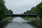
Nathan Bridge | Wannsee | The Nathan Bridge leads the Königsweg over the Teltow Canal at kilometer 3.78 of the artificial waterway. It connects the Düppel forest with the Kohlhasenbrück settlement . The bridge used to be called "Königswegbrücke". It bears its current name after Louis Nathan, a member of the Teltow Canal Construction Commission and a member of the Teltow District . | cards |

|
Neheimer Bridge | Tegel | The Neheimer Brücke leads Neheimer Straße over the connecting canal from Tegeler See to the former port of the Tegel gasworks. | cards |

|
Nennhauser Damm Bridge | Staaken | The Nennhauser-Damm-Bridge leads the Nennhauser Damm over the Lehrter Bahn to the Finkenkruger Weg . The entrances to the Staaken regional train station lead from the bridge . In the RBS street list, the structure is listed under the name Bahnhofsbrücke Staaken with the street number 17485, while the NNennhauser-Damm-Brücke is listed in the map of the district surveying offices of Berlin 1: 5000. The bridge was built as a new construction at the end of the 1990s when the railway line was expanded. Previously, due to the proximity of the street in the area of the Berlin Wall, there was no renovation possibility for many years. | cards |

|
New bridge | Spandau | over the Mühlengraben | cards |

|
New Fahlenberg Bridge | Müggelheim | The Neue Fahlenbergbrücke leads Gosener Straße over the Gosener Canal . |
cards
|

|
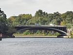
New Späthbrücke | Britz | The New Späthbrücke over the Teltow Canal (at kilometer 28.80 of the artificial waterway) is a modern steel tied arch bridge with a steel composite plate. The span is approx. 57 m. When it was commissioned, the bridge was given the name Neue Späthbrücke . In order to be able to connect the Späthstraße to the A 113 it was necessary to relocate the old Späthstraße between the Haarlemer Straße and the Königsheideweg over a length of one kilometer and to build two new bridges in the course of the new route. Immediately following to the northeast, the “Anna-Nemitz-Brücke” leads over the motorway. The old Späthbrücke over the Teltow Canal will be preserved as a listed building, but without transport links and also without traffic use. | cards |

|
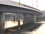
Neukölln Bridge | Neukölln | The Neuköllnische Bridge leads the Lahnstraße / Neukölln Allee over the Neukölln shipping canal . The arch bridge is located at the northern end of the Unterhafen Neukölln . Immediately to the south runs parallel a nameless bridge of the port railway and to the north a nameless railway bridge of the connecting line Baumschulenweg – Neukölln (S-Bahn) over the canal. | cards |

|
Nikolai E. Bersarin Bridge | Marzahn / Hellersdorf | The Nikolai E. Bersarin Bridge is a bridge over the Wuhle . Landsberger Allee leads over the bridge and continues to the east as Landsberger Chaussee. To the west of the bridge is the Landsberger Tor residential area, which was built in the 1990s . Initially run as Landsberger-Chaussee-Brücke (49792), it was renamed Nikolai-E.-Bersarin-Brücke (9251) on April 22, 2005. | cards |

|
Nonnendamm Bridge | Charlottenburg-North | The Nonnendamm Bridge is a road bridge completed in 2003 over the lock canal in the underwater of the Spree - Charlottenburg lock . | cards |

|
Nordgrabensteg | Wittenau | This footbridge is also called the Anstaltsbrücke. It is a 16 meter long pedestrian bridge over the north trench. It connects the street Am Nordgraben at the level of the Peter-Witte-Grundschule with the Peter-Witte-Park on the north side. It is officially registered with the street number 07485. The name goes back to the Karl Bonhoeffer Psychiatric Clinic in the south, formerly the Dalldorf insane asylum, [17] and the bridge gave the connection from the "institution". | cards |

|
Nordgrabensteg | Wittenau | It is a 16 meter long pedestrian bridge over the north trench. It connects the street Am Nordgraben with the north side. | cards |

|
Nordgrabensteg | Wittenau | It is a 16 meter long pedestrian bridge over the north trench. It connects the street Am Nordgraben at the level of the Peter-Witte-Grundschule with the Peter-Witte-Park on the north side. | cards |

|
North Harbor Bridge | Moabit / Wedding | Connects Sellerstrasse ( B 96 ) with Heidestrasse across the water of the northern harbor ( Berlin-Spandauer Schifffahrtskanal , km 10.67). | cards |

|
Northern border trench bridge | Lichtenberg | The northern Grenzgrabenbrücke leads the avenue of cosmonauts over the Marzahn-Hohenschönhauser Grenzgraben. The addition Nördliche on the official city map is misleading, however, because further north the Nördliche Rhinstraßenbrücke leads over the same border ditch (see below). The border ditch ends a few meters further from the bridge described here in a retention basin. | cards |

|
Northern Rhinstrasse Bridge | Marzahn | The northern Rhinstrasse Bridge leads the Rhinstrasse over the Marzahn-Hohenschönhauser Grenzgraben. | cards |

|
Northern Sea Road Bridge | Moabit / Wedding | The bridge crosses the Berlin-Spandau shipping canal south of Plötzensee as part of the Seestrasse. It was built in 1859 as a wooden girder bridge. In 1911 it was replaced by a 19 m wide bridge with an 11 m wide roadway. The bridge was built in its current form in 1949/1950. It has been named after Seestrasse since 1859. | cards |
Literature and web links
Individual evidence
- ↑ 100 years of the Teltow Canal 1906–2006 - commemorative publication of the Federal Waterways and Shipping Administration. Wasser- und Schifffahrtsdirektion Ost (Ed.), Magdeburg 2006, p. 52
- ↑ FIS-Broker map display map of Berlin 1: 5000 (K5 color edition)
- ↑ Map 1: 5000