List of streets and squares in Berlin-Staaken

The list of streets and squares in Berlin-Staaken describes the street system in the Berlin district of Staaken with the corresponding historical references. At the same time, this compilation is part of the lists of all Berlin streets and places .
overview
Staaken has 46,607 inhabitants (as of December 30, 2019) and includes the postal code areas 13591 and 13593. In the district there are 178 dedicated federal, city and residential streets and a named place. The roads have a total length of 81.8 kilometers. Of the streets in the district, 20 (with the same number in the Berlin street directory) continue in the neighboring districts or only partially belong to Staaken.
The street system of the district goes back to the parish village of Staaken and several street names reflect the historical connecting routes to the neighboring towns. The population increase for the employees of the Spandau armaments factories between 1914 and 1917 in the garden city of Staaken with around 450 newly furnished single and multi-family houses required the construction of new roads. A major change came in 1945 due to the swap of territory between the British and Soviet allies . Roads in " West Staaken " first came to the Soviet sector and thus to East Berlin . In the 1950s, until October 1990 , the independent "community Staaken" in was the district Nauen of the former GDR - district Potsdam formed. The names of new streets in the district were given between 1950 and 1990 by different administrative units, for example, after 1990 there were two streets with the name "Neue Straße". The streets between the western Berlin city limits and the western edge of the Finkenkruger Weg / Nennhauser Damm as far as Brunsbütteler Damm belonged to West Staaken, along the Bullengraben , the western edge of Bergstrasse , crossing Heerstrasse and west of the Hahneberg pond to the southern city limit (postcode since 1993: 13591). The adjoining streets of West Staakens were in the restricted area of the Berlin Wall ; in some cases the border on the Berlin Wall was in the middle of the street. Through an agreement between the Berlin Senate and the GDR on March 31, 1988, the entire street width came to West Berlin , as was the case with Nennhauser Damm . Since the demarcation line crossed Staaken station, there were two Staaken stations . Major changes in the course of the road took place after 1990, especially in West Staaken, both through the use of the border strip and in the industrial area after the GDR operations Quarzschmelze and VEB Plaste on the air base premises.
Staaken's road system is supported by Bundesstraße 5 , Heerstraße (also: Hamburger Chaussee). From Spandau this is supplemented by the Brunsbütteler Damm , which is led to the B 5 via the southern part of the Nennhauser Damm. The federal road also brings the connection to the Berliner Ring and the Hamburg autobahn . Until the 1970s, Fernstraße 5 (F 5) for transit to Hamburg was located here from the Staaken border crossing point (at the level of Fort Hahneberg ) and the Staaken station had a border control function in transit traffic. Other main streets in the district are the streets Seegefelder Strasse / Seegefelder Weg (only south side) ( Spandau - Dallgow-Döberitz ) and Magistratsweg / Klosterbuschweg ( Falkenhagener Feld - Wilhelmstadt ).
Overview of streets and squares
The following table gives an overview of the streets and squares in the district as well as some related information.
- Name / location : current name of the street or square. Via the link Location , the street or the square can be displayed on various map services. The geoposition indicates the approximate center of the street length.
- Traffic routes not listed in the official street directory are marked with * .
- Former or no longer valid street names are in italics . A separate list may be available for important former streets or historical street names.
-
Length / dimensions in meters:
The length information contained in the overview are rounded overview values that were determined in Google Earth using the local scale. They are used for comparison purposes and, if official values are known, are exchanged and marked separately.
For squares, the dimensions are given in the form a × b for rectangular systems and for (approximately) triangular systems as a × b × c with a as the longest side.
If the street continues into neighboring districts, the addition ' in the district ' indicates how long the street section within the district of this article is. - Name origin : origin or reference of the name.
- Notes : further information on adjacent monuments or institutions, the history of the street and historical names.
- Image : Photo of the street or an adjacent object.
| Name / location | Length / dimensions (in meters) |
Origin of name | Date of designation | Remarks | image |
|---|---|---|---|---|---|
|
Adelheid-Poninska-Strasse
( Location ) |
280 | Adelheid Poninska (1804–1881), social reformer and urban planner ( pseudonym "Arminius") | Feb 21, 1997 | The road between Wiesenweg and Bergstraße was rebuilt around 1997, until then the open space was near Bergstraße as a result of the wall strip (here westwards). |

|
| Ahlbeerensteig
( Location ) |
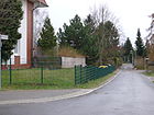
190 | Bilberry , soft fruit | Jan. 30, 1933 | The 3.50 meter wide street is located between Torweg and Eichholzbahn and was run as private street A when it was laid out. Its name was based on a botanical term beginning with the letter “A”, so that the neighboring streets were sorted alphabetically. As a result of the Allied agreements on an exchange of territory from 1945 to 1990, this road was in West Staaken (Albrechtshof colony) in the area of the border strip . |
|
| Albrechtshofer Weg
( Location ) |
550 | Albrechtshof , part of West Staakens | Aug 4, 2006 | The street previously run as street 347 in the Albrechtshof colony is located between Finkenkruger Weg and Alfons-Loewe-Straße, over which it continues as a cul-de-sac . The name was given after a survey of residents. |

|
| Alfons-Loewe-Strasse
( Location ) |
320 | Alfons Loewe (1868–1938), lawyer in Spandau | Feb. 1, 1999 | The street, previously street 342 in the Albrechtshof colony, between Seegefelder and Albrechtshofer Weg, was renamed after the Jewish professional banned victim in an official ceremony on October 27, 1999. |

|
| At the old gas works
( Location ) |
230 | Spandau gasworks | July 15, 1998 | The road, before it was a new road out is between Brunsbütteler dam and railway land on the site of the former oxygen plant the Zeppelin works in West-Staaken , when the area around 1976. GDR - Circle Nauen belonged, she was a new road has been named, the renaming took place because there was already a street with this name in the Spandau district. At the north end of the street there is a pedestrian tunnel through the railway line to the Oberdorfer Steig. |

|
| At the fort
( Location ) |
810 | Artillery Fort Hahneberg | Aug 3, 2000 | The previously as road 334 led street in West Staaken between Buschower way and over the cross walk as access road . This area belongs to the part of Staaken that belonged to the GDR until 1990 when the Allies swapped territory to the Soviet-occupied area . The street, which has not yet been properly developed, is located on the outskirts of the city and is predominantly built with single-family houses. |

|
| On the Heideberg
( Location ) |
650 | Heideberg, field name | Sep 9 1931 | Lewaldstrasse , which has been running here since 1916, was renamed when it was extended in 1931. It lies between Tor- and Finkenkruger Weg. |

|
| At the Kiesteich
( Location ) |
180 (in the district) |
Kiesteich , water-filled gravel pit from the 1950s | July 6, 1995 | In 1995 the street 394 was named, which lies in the district between Seegefelder Weg and Wolfshorst. The road continues north in the neighboring district of Falkenhagener Feld . |

|
| At the small square
( Location ) |
150 | adjoining space of small size | around 1916 | The street in the garden city of Staaken was named after the small square at the Protestant church, which is not named itself. It is located between Beim Pfarrhof and Am Krummen Weg. |

|
| At the jug
( Location ) |
170 | Krug , old name for the village restaurant | around 1916 | The small street between Am Langen Weg and Am Heideberg in the garden city of Staaken was laid out after 1914 and an inn was planned when the settlement was built, the "Krug" was not built until the 1960s. |

|
| On the Krummen Weg
( Location ) |
270 | after the curved road system | around 1916 | The street between Hackbuschstraße and Am Kleiner Platz was named after the course in the garden city Staaken, built between 1914 and 1917, in keeping with the long and short walk nearby. |

|
| On the short way
( Location ) |
200 | after the shortness of the road | around 1916 | The street between Eichholzbahn and Torweg was named after the length in the garden city Staaken, built between 1914 and 1917, to match the long and crooked path nearby. |

|
| On the long way
( Location ) |
400 | according to the length of the street | around 1916 | The street between Tor- and Ungewitterweg was named after the length in the garden city Staaken, built between 1914 and 1917, to match the crooked and short path nearby. |

|
| At the rain
( Location ) |
130 | Rain , the verge of a field | around 1970 | The road goes as a cul-de-sac east from Buschower Weg to Feldrain. As a result of the Allied swap of territory in 1945, road 418 was in the West Staaken area, initially in the Soviet-occupied area and subsequently belonged to the GDR . Around 1970 it was named Am Rain by a resolution of the Staaken municipality . |

|
| At the sun hill
( Location ) |
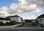
270 | Sonnenhügel, as an advertising location | Jan 15, 2010 | The road was newly laid out in 2010 and runs south of Heerstraße as a ring road from Am Staakener Kirchengelände to the east. |
|
| At the Staakener church grounds
( Location ) |
170 | Parish soil | Jan 15, 2010 | The road was rebuilt in 2010 and leads south from Heerstraße. The building site was provided by the Protestant parish Staaken on land owned by the church under heritable building rights. |

|
| At the grove
( Location ) |
530 | Adjoining spruce and pine trees | around 1970 | The road 426 between Talweg and today's city limits of Berlin was in the area of West Staaken, which was created in 1945 by the Allied exchange of territory. This numbered street was named by the council of Staaken in the GDR - Nauen district around 1970 because of the surrounding woods of this type. |

|
| At the Zeppelin Park
( Location ) |
770 | Zeppelin Park, local business park | Aug 15, 2007 | The street lies between the Brunsbütteler dam, which has been extended to the city limits, and the Nennhauser dam. It is a (new in the 2010s) road that in the southern part (from Nennhauser Damm) encloses a commercial area with a parallel branch, which is referred to in some sources as Berolinapark. Initially, the Werkstrasse on the industrial site was run as Berolinastrasse . This area of the former Staaken airfield was spun off from Spandau in 1945 as West Staaken, then came to the GDR and was used for industry and hospital and, after the dissolution in 1990 and the reorganization of Staaken, is in the zoning plan as an industrial park area. The current name of the business park refers to the Staaken airfield founded around 1915 by Luftschiffbau Zeppelin GmbH . Since 2000 it has been operated by "Zeppelin Gewerbepark GmbH & Co". | |
| At the Karolinenhöhe
( Location ) |
200 (in the district) |
Karolinenhöhe, a 52 meter high mountain south of the road | June 14, 1988 | The road between Weinmeisterhornweg and Gruberzeile was laid out south of Heerstraße to develop the building site. The street is in Wilhelmstadt , the northwestern plots 1–13 (odd) belong to the district. |

|
| At the top
( Location ) |
340 | Point between Nennhauser Damm and Heerstraße | around 1970 | The street is a cul-de-sac in the old street layout of Nennhauser Damm, which met at an acute angle with Heerstraße. It is located in the West Staaken area of the Allied area swap of 1945 and was created by the Staaken community around 1970 as access to clinker buildings from the 1930s and panel houses from the 1950s. |

|
| Anschützweg
( Location ) |
190 | Ottomar Anschütz (1846–1907), photographer | Oct 11, 1955 | The street 398 between Meydenbauerweg and as a cul-de-sac over Messterweg was named in 1955 after pioneers of photo and film technology, just like the surrounding streets. These street names were caused by the Staaken film works, which were founded in 1924. |

|
| Aumetzer way
( Location ) |
240 | Aumetz , place in Lorraine, France | Apr 5, 1934 | The street between Nidecksteig and Fachinger Straße in the residential estate in the West Staaken area was named in 1934 from the street 308 . |

|
| Aumühler Strasse
( Location ) |
200 | Aumühle , municipality in Schleswig-Holstein, district of the Duchy of Lauenburg | Feb. 18, 1955 | The road goes south from Pinneberger Weg as a dead end . The street 376 , which was laid out in the 1930s, was named after places in the Hamburg area to match the surrounding streets. |

|
|
Baedekerweg
( Location ) |
190 | Karl Baedeker (1801–1859), founder of the Baedeker publishing house in Stuttgart | May 25, 1962 | The street goes east from Leubnitzer Weg and is the access road to the adjacent two-story apartment buildings. |

|
| Baluschekweg
( Location ) |
730 | Hans Baluschek (1870–1935), painter and writer | Oct 22, 1956 | The road 368 was named in 1956 and is located between Maulbeerallee and Kerrweg in the settlement area. |

|
| Barmbeker Weg
( Location ) |
290 | Barmbek , district of Hamburg | Apr 3, 1962 | The street belongs to the Louise Schröder settlement built between 1961 and 1967 and is located between Brunsbütteler Damm and Spandauer Straße. |

|
| Bauer field line
( Location ) |
70 | Walther Bauersfeld (1879–1959), engineer and physicist, Zeiss projection planetarium | Nov 18, 1965 | The street that branches off to the southeast of Vogelzeile is in the residential area with streets named after pioneers of optics. |

|
| At the rectory
( Location ) |
260 | Vicarage near the church | around 1916 | The street is in the garden city of Staaken between Torweg and Am Kleinen Platz. |

|
| Mountain road
( Location ) |
490 | Hahneberg | before 1923 | The street is between Heerstrasse and Hauptstrasse. As a result of the Allied exchange of territory in 1945, the area west of Bergstrasse first came to the Soviet sector and thus to East Berlin , and later as an independent municipality to the Nauen district of the GDR . The Bergstrasse remained in West Berlin , but the border to West Staaken was on the western edge of the road and the checkpoint (later border crossing point) Staaken was at the intersection of Bergstrasse and Heerstrasse. |

|
| Billstedter path
( Location ) |
180 | Billstedt , district of Hamburg | July 1, 1974 | A spur road east of Winterhuder Weg that was laid out in 1973/1974 in the new Louise Schröder estate. |

|
| Pear path
( Location ) |
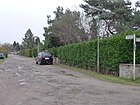
340 | Pear , pome fruit | Jan. 30, 1933 | The street is parallel to Torweg and Eichholzbahn and before it was named as a private street B, the neighboring streets were sorted alphabetically by choosing a botanical term with “B”. This area belonged to West-Staaken from 1945 to 1990 on the basis of Allied agreements on an exchange of territory from Staakener to Groß Glienicker Flur, initially to East Berlin, later in the GDR as the municipality of Staaken in the Nauen district. |
|
| Blankeneser way
( Location ) |
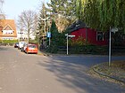
210 | Blankenese , a residential suburb of Hamburg | Feb. 18, 1955 | The street lies between Spandauer Straße and over Am Alten Gaswerk as a dead end street . |
|
| Blankensteinweg
( Location ) |
120 | Hermann Blankenstein (1829–1910), architect | Aug 1, 1966 | Planned as Straße 385 in the 1930s, it was rebuilt in 1966 and is located between Kerrweg and Ernst-Bruch -zeile. |

|
| Blasewitzer ring
( Location ) |
670 (in the district) |
Blasewitz , eastern district of Dresden, Saxony | Apr 1, 1972 | The street was laid out with the development and lies in an arc to the east between Sandstraße and Seeburger Weg. The street itself and the lots with an odd number are in the district, the even numbered lots on this street on the outside of the ring belong to Wilhelmstadt . |

|
| Bolteweg
( Location ) |
390 | Johannes Bolte (1858–1937), literary scholar and narrative researcher | Oct 22, 1956 | It was laid out in the Rudolf-Wissell-Siedlung as Straße 366 and is located between Maulbeerallee and Rellstabweg. |

|
| Breddiner way
( Location ) |
360 | Breddin , place in Ostprignitz-Ruppin | Jan. 24, 1938 | The street is located in the residential estate as street 320 between Ferbitzer and Zeestower Weg. The road came to the Soviet sector in 1945 through the allied swap of territory, thereby to East Berlin and later to the Nauen district until it was reintegrated into the Spandau district . |

|
| Brunsbütteler Dam
( Location ) |
3120 | Brunsbüttel , town in Dithmarschen | March 11, 1937 | The road lies between the suburbs and the city limits and continues eastwards in Spandau . When renaming in the 1930s due to multiple street names in Greater Berlin , Hamburger Strasse in the Klosterfelde area of the Spandau district and Berliner Strasse in the Staaken district in 1937 were combined to form Brunsbütteler Damm. In 2005, the Am Industriegelände and parts of Staakener Feldstrasse , which were previously located in West Staaken , were included. The new four-lane route created in the western section has ended at the city limits since 2005. However, a route on Brandenburg territory in the solar park located there on the former airship port of Staaken was kept free for a possible extension to the motorway connection and to federal highway 5 . The wide thoroughfare on the southern side is built on with residential buildings, after the train station there is a large industrial belt with discounters and a hardware store up to Prisdorfer Straße . Heavy goods traffic has been banned from Magistratsweg and the street is less burdened by traffic noise for residents. The green corridors of the Bullengraben to the south and the specter green corridor to the north of the street provide recreational and sports areas. The four-lane continuation was laid out over the state border for 700 meters for the connection to Landesstraße 20 (Brandenburg). The 1.6 kilometers on the Berlin side - now a dead end street - had been built for six million euros, but there was no planning and “no need” on the Braneburg side. For Staaken, the Spandauer Strasse, which runs parallel to the north, would relieve some of the traffic. Negotiations between the state administrations are to begin in 2016 following pressure from a citizens' initiative. |

|
| Buschower Weg
( Location ) |
920 | Buschow , municipality in Havelland | Feb. 19, 1938 | The road on the outskirts of the city in the forest is mostly built with single-family houses and lies between Nennhauser Damm and the city limits, the part south of Heerstraße was called Friedhofsstraße until 1938 after the location . The northern part was named Am Fliegerhorst in 1938 because of its location at the Staaken airship port . By belonging to West Staaken, both streets were united in 1951. |

|
|
Christrosensteig
( Location ) |
140 | Christmas roses , flowering ornamental plant | Jan. 30, 1933 | The road is located between gateway and Eichholzbahn and previously as a private road C out. The letter "C" was retained in the name selection, so that the neighboring streets are sorted alphabetically. This area belonged to West-Staaken from 1945 to 1990, in the GDR to the municipality of Staaken in the Nauen district on the basis of allied agreements on the exchange of territory from Staakener to Groß Glienicker Flur . |

|
| Cosmarweg
( Location ) |
1910 | Alexander Cosmar (1805–1842), Berlin writer and theater poet | Nov 8, 1955 | Laid out in the 1930s as Road 360 and named in 1955, it lies between Lutoner and Bergstraße. |

|
|
Deniszeile
( Location ) |
160 | Paul Camille von Denis (1796–1872), French engineer and railway pioneer | May 18, 1965 | The road between Meyerweg and Rowanweg is located in the then newly created "Neues Heim" settlement north of the Lehrter Railway with streets named after railway pioneers. |

|
| Thistle path
( Location ) |
200 | Thistle , various plant species | Jan. 30, 1933 | The street lies between Torweg and Eichholzbahn and was previously run as a private street D , the renaming was based on the letter "D" so that the neighboring streets are sorted alphabetically. This area belonged to West-Staaken from 1945 to 1990, in the GDR to the municipality of Staaken in the Nauen district on the basis of allied agreements on the exchange of territory from Staakener to Groß Glienicker Flur . |

|
| Döberitzer Weg
( Location ) |
1280 (in the district) |
Connection path to the neighboring town of Döberitz to the west | before 1800 | Döberitzer Weg is located between Nennhauser Damm and the city limits. However, the road is only expanded via Heerstraße to Fahrlander Straße and continues to the south-east as an unpaved road, 500 meters of which as a dirt road between fields and forest. In itself, the Heerstraße in the Brandenburg outskirts to the former military training area Döberitz, which is why it was named Döberitzer Weg in the 18th century. The section of road in the Staaken district is located in the area that came from the British sector of Berlin to the Soviet-occupied area in 1945 on the basis of Allied agreements . West Staaken became an independent municipality in the GDR and came back to Berlin in 1990. |

|
| Dörbeckweg
( Location ) |
180 | Franz Burchard Dörbeck (1799–1835), German-Baltic caricaturist and painter | Jan. 12, 1960 | The cul-de-sac to the west of Magistratsweg was laid out as road 311 . |

|
|
Eckenerweg
( Location ) |
300 | Hugo Eckener (1868–1954), airship pioneer | June 1, 1968 | Previously named as Straße 329 , it lies east of Hackbuschstraße towards the Neuland colony. |

|
| Eduard-Bernstein-Weg
( Location ) |
130 | Eduard Bernstein (1850–1932), social democratic politician | Dec. 1, 1966 | The street 384 was named in 1966 and lies between Kerrweg and Ernst-Bruch -zeile. |

|
| Eichholzbahn
( Location ) |
1520 | Forest area "Großes Eichholz" west of Staakens | Sep 9 1931 | The street already existed as Lehrter Straße in 1870, directly on the northern side of the Lehrter Railway , before it was renamed Berlin-Lehrter Railway in 1931. Due to the Allied exchange of territory in 1945, the territorial border crossed this road. As a result, it was divided in the area of Staaken station by the former wall strip , so there are two sections, west (property 118–196, straight) between Neukircher Straße (city limits) and Ahlbeerensteig and east (2–114, straight) between Finkenkruger Weg and Klosterbuschweg. Only a footpath from the dead-end road leads to Klosterbuschweg . The connection at Finkenkruger Weg is laid on the Nennhauser Damm bridge, which leads over the railway here; from the western section to the beginning of the bridge ramp, a footpath leads over the 90 meter wide green space of the former wall area. | |
| Pea trail
( Location ) |
140 | Pea , butterflies | Jan. 30, 1933 | The street in a residential area lies between Eichholzbahn and Torweg and was called Privatstraße E before it was named . The letter "E" led to the choice of the street name. During the Allied exchange of territory in 1945, this road came to West Staaken and the Soviet sector of Berlin, and then to the GDR until 1990 . |

|
| Erna-Sack-Strasse
( Location ) |
200 | Erna Sack (1898–1972), chamber singer born in Spandau | Feb 21, 1997 | The street is a cul-de-sac to the north from Adelheid-Poninska-Straße. The name of this newly created one goes back to a suggestion list with women's names that was compiled by the Working Group of Social Democratic Women (ASF) for the renaming of streets in Spandau. |

|
| Ernemannzeile
( Location ) |
60 | Heinrich Ernemann (1850–1928), entrepreneur and inventor | Nov 18, 1965 | The cul-de-sac to the east of Vogelzeile is named after pioneers of photo and film technology, matching the other streets in this residential area. |

|
| Serious Break Line
( Location ) |
360 | Ernst Bruch (19th century), statistician | Aug 1, 1966 | The street between Baluschek- and Magistratsweg, previously Straße 382 , is named after Bruch who published the first scientific analysis of Berlin road traffic in 1867 and who criticized the deficiencies of the Berlin development plan in 1870. |

|
| Ernst-Lange-Strasse
( Location ) |
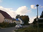
350 | Ernst Lange (1927–1974), church reformer, pastor in Berlin-Spandau | Jan 15, 2010 | The street was newly laid out in 2010 and is at the height of Heerstraße 657-695 on the edge of the city and goes to the west as a ring road from Am Staakener Kirchenfeld. |
|
| Eschenwinkel
( Location ) |
240 | Ash , as an avenue and park tree | around 1914 | The street is located in the garden city of Staaken between Hackbuschstraße and Am Kurzen Weg. |

|
|
Fachinger Strasse
( Location ) |
810 | Fachingen , part of the local community Birlenbach an der Lahn | Sep 9 1931 | The street is in the residential estate between Torweg and Straße 339, previously as Straße 4 . Due to the allied swap of territory, it was in West Staaken. |

|
| Fahrlander way
( Location ) |
1040 | Fahrland , municipality near Potsdam to the west, (Brandenburg) | Sep 9 1931 | The street lies between Döberitzer Weg and the city limits. The street in West Staaken, which in 1945 became part of the Soviet-occupied area through the Allied swap of territory and later belonged to the GDR . In September 1931, Seeburger Strasse was renamed Fahrlander Weg. In 1960 the council of the Staaken municipality decided to name it Seeburger Weg and two days before West Staaken was reintegrated to Berlin on October 1, 1990, it was renamed Fahrlander Weg again. |

|
| Fig dough
( Location ) |
280 | Fig , useful plant in the Mediterranean area | Jan. 30, 1933 | The street lies between Torweg and Löwenmaulsteig and was previously run as a private street F , the renaming was based on the letter "F" so that the neighboring streets are sorted alphabetically. This area belonged to West-Staaken from 1945 to 1990, in the GDR to the municipality of Staaken in the Nauen district on the basis of allied agreements on the exchange of territory from Staakener to Groß Glienicker Flur . |

|
| Ferbitzer way
( Location ) |
770 | Ferbitz , former municipality in Osthavelland, Mark Brandenburg | Sep 9 1931 | The street is in the housing estate between Plum Path and Street 339, previously as Street 17 . Due to the allied swap of territory, it was in West Staaken. |

|
| Filmwerkeweg
( Location ) |
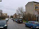
180 | Staakener Filmwerke | Jan. 1, 1976 | The path is in the Neu-Staaken area between Brunsbütteler Damm and Oldesloer Weg. |
|
| Finkenkruger way
( Location ) |
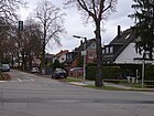
1640 | Finkenkrug , neighboring town, today part of the town of Falkensee in Havelland, Brandenburg. | Sep 9 1931 | The road between Eichholzbahn and the city limits was created by merging Bahnhofstrasse to the south and Staaken-Falkenhagener Chaussee , as multiple street names in Greater Berlin were dissolved in the 1930s. When West Staaken was formed in 1945, the street remained part of Berlin but later became Randstrasse by the Berlin Wall until 1990 . |
|
| Flottbeker Weg
( Location ) |
180 | Flottbek , Groß- and Klein-Flottbek, district of Hamburg | Feb. 18, 1955 | The previous road 438 between Magistrats- and Blankeneser Weg is in a settlement area north of Brunsbütteler Damm, previously Hamburger Straße , in which streets are named after Hamburg districts. |

|
|
Gardening ring
( Location ) |
1110 | local horticultural companies | 3rd June 1966 | This street between Heerstraße (partly parallel to it) and Cosmarweg, it was gradually developed in several street sections as the development progressed. The first larger section of this road runs in a semicircular shape through an area in which many horticultural companies were located. |

|
| Honeysuckle path
( Location ) |
390 | Honeysuckle , genus of ornamental plants | Jan. 30, 1933 | The street lies between Isenburger Weg and Feigensteig and was previously run as a private street G , the renaming was based on the letter "G" so that the neighboring streets are sorted alphabetically. This area belonged to West-Staaken from 1945 to 1990, in the GDR to the municipality of Staaken in the Nauen district on the basis of allied agreements on the exchange of territory from Staakener to Groß Glienicker Flur . |

|
| Georg-Schroeder-Strasse
( Location ) |
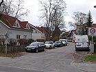
490 | Georg Schroeder (1904–1944), electric welder, blacksmith, resistance fighter against the Nazi regime | Aug 15, 2002 | The previous road 345 between Seegefelder and Albrechtshofer Weg was named in 2002. |
|
| Gruberzeile
( Location ) |
280 | Otto von Gruber (1884–1942), photogrammeter and geodesist | Apr 8, 1964 | The street between Mareyzeile and Sandstraße is located in a residential area built in the 1960s with streets named after pioneers of photo and film technology. |

|
|
Haarmannweg
( Location ) |
400 | August Haarmann (1840–1913), railway engineer and iron and steel specialist. | May 18, 1965 | The street lies between Hartwigzeile and Meyerweg and, like other streets in the “Neues Heim” settlement north of the Lehrter Railway in the 1960s, bears the name after a pioneer and expert in the railway industry. |

|
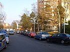
| Haberlandweg
( Location ) |
210 | Georg Haberland (1861–1933), building contractor | Aug 1, 1965 | The road between Brunsbütteler Damm and Südekumzeile in the Louise Schröder settlement was rebuilt in 1965. |
|
| Hackbuschstrasse
( Location ) |
700 | Hermann Hackbusch (1895–1933), businessman and sports pilot. | Nov 4, 1935 | The street between Eichholzbahn and Seegefelder Weg in the garden city of Staaken has been called Scheidtstrasse since around 1915 and was renamed by the Nazis in order to remove the name Scheidt from the street scene. | |
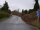
| Hahnebergweg
( Location ) |
790 | Hahneberg | Feb 13, 1958 | The path starts from the Weinmeisterhornweg as a dead end to the west. Only the first 40 to 50 meters are driveway, further there is a paved path closed to all traffic (sign 250) which leads directly to Fort Hahneberg . Until 1990 the road ran through the wall strip to West Staaken . |
|
| Buttercup Path
( Location ) |
400j | Buttercup , species-rich plant genus used as ornamental plants | Jan. 30, 1933 | The road lies between the honeysuckle and plum path and was previously run as a private road H , the renaming was based on the letter "H" so that the neighboring streets are sorted alphabetically. This area belonged to West Staaken , municipality of Staaken in the district of Nauen , on the basis of allied agreements on the exchange of territory from Staakener to Groß Glienicker Flur from 1945 to 1990 . |

|
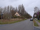
| Hamburger Street
( Location ) |
520 (in the district) |
Free and Hanseatic City of Hamburg , port city at the mouth of the Elbe | May 4, 2000 | The street lies between Seegefelder Weg and the city limits, it continues under this name in the neighboring town of Falkensee to Spandauer Straße. The street had previously been laid out in the 1930s as street 341 in the Albrechtshof colony. An objection filed against the designation was rejected. On the Falkensee side, the remains of the Falkensee satellite camp can be found as a historical park. Elsewhere, between 1899 and 1937, the western part of Brunsbütteler Damm was called Hamburger Strasse . |
|
| Harburger way
( Location ) |
260 | Harburg , district of Hamburg | Feb. 18, 1955 | The street between Brunsbütteler Damm and Pinneberger Weg was laid out as street 377 as early as 1935 . Almost all streets in this settlement area north of Brunsbütteler Damm - previously: Hamburger Straße - bear the names of Hamburg districts or places in the vicinity of Hamburg. |

|
| Hartwichzeile
( Location ) |
290 | Emil Hermann Hartwich (1801–1879), railway engineer | May 18, 1965 | The street between Meyerweg and Straße 354 in the newly created "Neues Heim" settlement north of the Lehrter Railway was named after pioneers of the railway industry , like the surrounding streets. |

|
| Main road
( Location ) |
680 | old street of the village of Staaken | around 1900 | The road between Bergstrasse and Staakener Feldstrasse, over which it continues as a spur road , is located in West Staaken , which came to Soviet-occupied territory due to the Allied exchange of territory in 1945 and then belonged to the GDR as the Staaken municipality until 1990 . |

|
|
Heerstrasse
( Location ) |
3630 | Heerstraße , overland connection road for the rapid movement of the army | 1908 | The street with the federal highway 5 lies between the district and city limits in the district, to the west it continues in Wilhelmstadt and further in the district of Charlottenburg-Wilmersdorf . Heerstraße was built between 1903 and 1911 to provide a direct connection for the Berlin garrison between Berlin and the military training area in Döberitz to the west, which was created in 1897, bypassing the core of the independent city of Spandau. The street on Spandauer Flur was laid out 1903–1911 and was named Heerstraße around 1908, at least in Staaken it was called Döberitzer Heerstraße until 1921 . The total length of today's Heerstraße is 10.8 kilometers. The New Jerusalem settlement is incorporated with the properties 342–342a on the abolished street 387 , as well as 655a – 655e and 645a – 645h for the abolished street 388 and street 389 . |

|
| Heidebergplan
( Location ) |
110 | Heideberg or Heidelake, field name | Sep 9 1931 | It lies between Am Heideberg and Am Krug. The name market place existed until 1931 |

|
| Helma bow
( Location ) |
210 | after the client Helma Eigenheim AG | May 1, 2008 | The street in the arch from and to the Wiesengrund was redesigned in 2008. |

|
| Helmut Käutner Way
( Location ) |
200 | Helmut Käutner (1908–1980), director and actor | March 7, 1986 | The street was called Straße 369 until it was named and is located between Ernst-Bruch -zeile and Rellstabweg. |

|
| Hensoldtweg
( Location ) |
120 | Moritz Hensoldt (1821–1903), pioneer of optics for binoculars | Nov 1, 1971 | It goes from the Messterweg to the south as a spur road . The road 39 was aptly named other streets in this residential area after pioneers of optics, photo and film technology. |

|
| Hohenloher way
( Location ) |
250 | Hohenlohe , region in the northeast of Baden-Württemberg | Jan. 1, 2007 | The path in Albrechtshof near the city limits ( Seegefeld , City of Falkensee ), which had not been laid out by 2015 (street number: 9378), is located in an area designated as building land. The planned tour is the southern crossing between the Öhringer and the Ingelfinger Weg with a feed to the Hamburger Straße next to their property 3.Until 2015, in this Staaken outskirts on the city limits in the square Hamburger and Seegefelder Straße to the forest area south of the Panzersee ( Große Lake) still no construction activity [out of date] . In the Berlin street list it is assigned to the RBS class STRA, has level V (without category) in the street development plan and the OKSTRA class : "N". |

|
|
Basically
( Location ) |
510 | Terrain structure in the grove | around 1970 | This cul-de-sac from the valley path to the outskirts was in West-Staaken, and there, road 428 was named by the municipality council . |

|
| Immergrünsteig
( Location ) |
420 | Evergreen , genus of plants of which two species are used as ornamental plants | Jan. 30, 1933 | The street lies between Torweg and over Melonensteig and was previously run as a private street J , the renaming was based on the letter "I" so that the neighboring streets are sorted alphabetically. On the basis of Allied agreements from 1945 on the exchange of territory from Staakener to Groß Glienicker Flur from 1945 to 1990, this area belonged to West Staaken and in the GDR to the municipality of Staaken in the Nauen district . |

|
| Ingelfinger Weg
( Location ) |
120 | Ingelfingen , town in the Hohenlohe district, Baden-Württemberg. | Jan. 1, 2007 | The path (street number: 9381) in Albrechtshof near the city limits, which has not yet been created by 2015, is located south of the Künzelsauer Weg to Hohenloher Weg . The surrounding area at the city limits ( Seegefeld , Stadt Falkensee ) is intended as building land. Up until 2015 there was still no [out of date] construction activity in this Staaken outskirts of the Hamburger and Seegefelder Straße square with the forest area south of the Panzersee (Große Lake) . In the Berlin street list it is assigned to the RBS class STRA, has level V (without category) in the street development plan and the OKSTRA class : "N". |

|
| Isenburg way
( Location ) |
930 | Isenburg , town near Neuwied, Rhineland-Palatinate | Sep 9 1931 | The road lies between Eichholzbahn and Zeestower Weg. The street 9 was named in 1931. It is located in West Staaken and came to the Soviet-occupied area through the Allied exchange of territory in Staaken and Kladow in 1945 and thus became part of the GDR as a municipality of Staaken and was named Ernst-Thälmann-Straße in 1956 . On October 1, 1990 - two days before German reunification - the council of the Staaken municipality decided to rename it to Isenburger Weg. |

|
|
Jänickendorfer Weg
( Location ) |
370 | Jänickendorf , place in Teltow-Fläming, today part of the Nuthe-Urstromtal community | Jan. 24, 1938 | The street in the residential estate in the West-Staaken area is between Fachinger Straße and Zeestower Weg and was called Straße 321 before it was named . |

|
|
Käthe-Heinemann-Weg
( Location ) |
90 | Käthe Heinemann (1889–1975), music teacher | around 1996 | The road goes north as a cul-de-sac from Adelheid-Poninska-Straße. The name was given on the basis of a list of suggestions for women's names from the Working Group of Social Democratic Women (ARSP). |

|
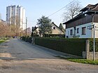
| Kerrweg
( Location ) |
380 | Alfred Kerr (1867–1948), writer and journalist | May 19, 1959 | The street lies between Baluschek- and Magistratsweg and was called Straße 383 before it was named . |
|
| church Square
( Location ) |
80 × 60 | Staakener Church | around 1915 | The square between An den Giebeln and Heidebergplan got its name from the garden city around 1915, the church was then built in 1922. |

|
| Klosterbuschweg
( Location ) |
700 | Klosterbusch, old field name; the area belonged to the "monastery freedom", ie the property of the Benedictine convent Spandau , which existed from 1239 until the 16th century. | Dec. 1, 1965 | The street to the east of the Klosterbüsche settlement lies between Seegefelder Weg and the railway bridges of the Hamburger Bahn . The street 351 was named in 1965, to the south the Magistratsweg follows and to the north Am Kiesteich. In 1989 the Brandwerderweg was included in the Klosterbuschweg. |

|
| Knotweed trail
( Location ) |
400 | Knotweed , genus of plants | Jan. 30, 1933 | The road lies between the honeysuckle path and over the Melonensteig to the Heidelakegraben. It was previously run as a private road K , when renaming a botanical term with "K" was used, so that the neighboring streets are sorted alphabetically. This area belonged to West-Staaken from 1945 to 1990, in the GDR to the municipality of Staaken in the Nauen district on the basis of allied agreements on the exchange of territory from Staakener to Groß Glienicker Flur . |

|
|
Köhlbrandweg
( Location ) |
180 | Köhlbrand , Elbe arm between Hamburg and Harburg | Oct 22, 1956 | The street between Oldesloer and Wandsbeker Weg, previously Straße 421 , is located in the Louise Schröder settlement, which was built north of Brunsbütteler Damm - the former Hamburger Straße. |

|
| Kretzer line
( Location ) |
180 | Max Kretzer (1854–1941), writer | Jan. 29, 1958 | The line, previously Straße 365 , lies between Rellstab- and Cosmarweg.
The Kretzerzeile is to be renamed according to a resolution of the Spandau district council from January 2015, because Max Kretzer had openly sympathized with the National Socialists . |

|
| Künzelsauer Weg
( Location ) |
200 | Künzelsau , district town of the Hohenlohe district, Baden-Württemberg. | Jan. 1, 2007 | The path in Albrechtshof near the city limits (street number: 9380), which has not yet been created by 2015, is located between Hamburger Straße and the city limits ( Seegefeld , city of Falkensee ) and the surrounding area is intended as building land. Up until 2015, there was still no [outdated] construction activity on the outskirts of Staaken on the outskirts of the Hamburger and Seegefelder Straße square with the forest area south of the Panzersee (Große Lake) . In the Berlin street list it is assigned to the RBS class STRA, has level V (without category) in the street development plan and the OKSTRA class : "N". |

|
|
Leubnitzer Weg
( Location ) |
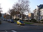
230 | Leubnitz , district in the east of Dresden , Saxony | Aug 1, 1972 | It is located between Maulbeerallee and Baedekerweg. The sand road east of the Rudolf-Wissell-Siedlung consisted of two sections with no direct connection, so the smaller, northern section, adapted to surrounding streets, was renamed with names after Dresden districts and suburbs. |
|
| Leuthingerweg
( Location ) |
100 (in the district) |
Nikolaus Leuthinger (1554–1612), theologian, chronicler and poet | Feb. 18, 1955 | The road between Seegefelder Weg and the district boundary at the level of the allotment garden, the district includes plots 33-39, the district boundary runs on the road that continues eastwards in Falkenhagener Feld . It was laid out as Road 493 in the 1930s . |

|
| Lohr path
( Location ) |
320 | Lohr am Main , town in the Main-Spessart district, Bavaria. | Apr 5, 1934 | The street in the West Staakener area was called Straße 305 before it was named and is located between Torweg and Fachinger Straße. |

|
| Loschwitzer way
( Location ) |
420 | Loschwitz , district in the east of Dresden, Saxony | Nov 11, 1968 | The street between Pillnitzer and Magistratsweg was newly laid out in the Rudolf-Wissell-Siedlung and, like the surrounding streets, was named after the eastern suburbs of Dresden. |

|
|
Löwenmaulsteig
( Location ) |
230 | Snapdragon , genus with ornamental plants | Jan. 30, 1933 | The street lies between Finkenkruger Weg and Hahnenfußpfad and was previously run as a private street L , the renaming was based on the letter "L" so that the neighboring streets are sorted alphabetically. This area belonged to West-Staaken from 1945 to 1990, in the GDR to the municipality of Staaken in the Nauen district on the basis of allied agreements on the exchange of territory from Staakener to Groß Glienicker Flur . |

|
|
Löwenstammstrasse
( Location ) |
330 | Arthur Löwenstamm (1882–1965), educator and rabbi | Aug 15, 2002 | Before the name was given, the street between Seegefelder and Albrechtshofer Weg was street 343 in the Albrechtshof colony. The name of the previously numbered street was chosen together with Georg-Schroeder- and Alfons-Loewe-Straße after Jewish victims of National Socialism. |

|
| Luchweg
( Location ) |
540 | Luch , swamp meadow. | Nov 1, 2004 | The Luchweg was laid out as street 344 in the Albrechtshof colony in the 1930s. It is located between Seegefelder Weg and the city limits. |

|
| Luftschifferweg
( Location ) |
280 | Leader of an airship | Oct 1, 1965 | The street in the garden city of Staaken was called Straße 328 before it was named. The street with reference to the Staaken airship port is located east of Hackbuschstraße as a cul-de-sac to KGA Neuland. |

|
|
Magistratsweg
( Location ) |
1910 | Magistrate of Berlin , competent authority for the street | before 1893 | The street lies between Heerstraße and the railway bridge. It was created when the city of Spandau in the east of the Staakener Feldmark was assigned land and served to develop these municipal lands. The name of this street, which was laid out around 1830, is not known, the name is first found in 1893. In 1934 the street was extended to Heerstraße, which included the Weinbergsweg . |

|
| Mareyzeile
( Location ) |
220 | Étienne-Jules Marey (1830–1904), French physiologist, inventor and photography pioneer | Aug 26, 1965 | The streets between Meydenbauerweg and Gruberzeilein are located in the residential area south of Heerstraße , where streets are named after pioneers of photo technology. |

|
| Mulberry Avenue
( Location ) |
800 | Mulberries , for sericulture | before 1909 | The road between Seeburger and Magistratsweg was laid out around 1880 with the Lazarus settlement as an access road and was named Maulbeerallee as early as 1909. The route of the Maulbeerallee was changed in 1968 when the old settlement was cleared in favor of the Rudolf Wissell settlement and the street name was reassigned on September 1, 1971. |

|
| Melon dough
( Location ) |
280 | Melons , cultivated plants with large, juicy berry fruits | Jan. 30, 1933 | The street lies between Isenburger Weg and Hahnenfußpfad and was previously run as a private street M , the name was changed using the letter "M" so that the neighboring streets are sorted alphabetically. This area belonged to West-Staaken from 1945 to 1990, in the GDR to the municipality of Staaken in the Nauen district on the basis of allied agreements on the exchange of territory from Staakener to Groß Glienicker Flur . |

|
| Messterweg
( Location ) |
210 | Oskar Meßter (1866–1943), film pioneer, camera for aerial photographs. | Oct 22, 1956 | The street 402 between Semmelländer and Anschützweg got its name in 1956 according to the streets in the residential area south of the Heerstraße after the names of pioneers in the fields of optics, photo and film technology. |

|
| Meydenbauer way
( Location ) |
360 (in the district) |
Albrecht Meydenbauer (1834–1921) civil engineer and founder of architectural photogrammetry | Aug 27, 1963 | The road lies between Anschützweg and Sandstraße and continues eastward in Wilhelmstadt . The street 401 was included in the newly created street in 1963 and, like other streets in this residential area south of the Heerstraße, bears the name after pioneers in the fields of photo and film technology (see also: Filmwerk in Staaken ). |

|
| Meyerweg
( Location ) |
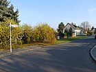
490 | Joseph Meyer (1796–1856), publisher and founder of the Bibliographical Institute | May 18, 1965 | The road, newly laid out in 1965, lies between Haarmannweg and Klosterbuschweg. |
|
| Möthlower Strasse
( Location ) |
390 | Möthlow , municipality in Havelland, Brandenburg | Apr 21, 1932 | The street, previously street 46 , in the West-Staakens area lies between Seegefelder Weg and Georg-Schroeder-Straße, the spur road beyond that leads to the wall strip , which was initially a fallow area after 1990 . |

|
| Mühlenbachring
( Location ) |
410 | Windmill that was previously located here | Nov 15, 2001 | The street is located in the newly developed Mühlenviertel south of the Staakener Feldstraße as a ring. |

|
| Mühlendorfstrasse
( Location ) |
150 | Windmill that was previously located here | Nov 15, 2001 | The street lies between Staakener Feldstrasse and Mühlenbachring in the newly created Mühlenviertel. A windmill is still shown on a map from 1924. The clay half-timbered barn of the mill farmhouse, built around 1850, is now at Schulstrasse 62. |

|
|
Daffodil path
( Location ) |
140 | Daffodils , genus of plants with ornamental and garden plants | Jan. 30, 1933 | The road lies between Finkenkruger Weg and Orangensteig and was previously run as a private road N , when the name was renamed, the letter "N" was used for a botanical term, so that the alphabetical context of the settlement was retained. This area belonged to West-Staaken from 1945 to 1990, in the GDR to the municipality of Staaken in the Nauen district on the basis of allied agreements on the exchange of territory from Staakener to Groß Glienicker Flur . The road was in the western section in the area of the border strip . |

|
| Nennhauser dam
( Location ) |
2200 | Nennhausen , municipality in Havelland, Brandenburg | Sep 9 1931 | Before 1900, Bahnhofstrasse was laid out here near the center of the still independent municipality of Staaken, and Königstrasse to the south of it . During the naming campaign in 1931 , both streets south of the train station to Nennhauser Damm were merged and renamed. On October 1, 1990, the Kurz Strasse , built in 1937/1938, also became part of the Nennhauser Damm. With the opening of the border in 1990, all road access came back to Berlin. As a result of the separation from West Staaken due to the Allied agreement of 1945, the Nennhauser Damm was partly in West Berlin and the southern branch initially belonged to East Berlin and then to the Nauen district . At that time, parts of Staaken (around the Staaken airfield) were assigned to the Soviet zone as compensation for the transition of parts around Gatow, in order to allow the British armed forces unhindered access to Gatow airfield in the British sector . For many years the border ran in the middle of the street along the Berlin Wall . With the agreement between the Berlin Senate and the GDR on March 31, 1988, the entire road area came to West Berlin . |

|
| New street
( Location ) |
160 | after the new construction of the road | around 1900 | It was the access road for a new small housing estate built at the end of the 19th century when the first larger industrial companies emerged on what was then Hamburger Straße. The street lies between Blankeneser and Magistratsweg. |

|
| Neunkircher Steig
( Location ) |
600 (in the district) |
Neunkirchen in Saarland | Apr 5, 1934 | The street in the residential estate between Eichholzbahn and Ferbitzer Weg was known as street 324 before it was named . It lies along the city limits, the road and eastern properties belong to the district, and the Falkensee waterworks are on the west side. In 1945 this West Staaken area came under Allied agreements to West Staaken (1945 to 1990 outside Berlin). The naming can be seen in the recovery of the Saarland . The fact that Neunkirchen was the birthplace of Erich Honecker as a SED functionary was left behind while the street was part of the GDR . |

|
| Nidecksteig
( Location ) |
400 | Nideck , ruined castle in the Vosges, France | Apr 5, 1934 | The street between Fachinger Straße and Aumetzer Weg in the residential estate in West Staaken was called Straße 307 before it was named . |

|
|
Oberdorfer Steig
( Location ) |
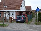
390 | Bad Oberdorf , district of Hindelang in Oberallgäu, Bavaria | Sep 9 1931 | The path, previously Straße 6 , between Eichholzbahn and Fachinger Straße (here as a dead-end street ) in the Staaken residential estate is in the West Staaken area . The pedestrian tunnel leads south through the railway line. |
|
| Avenue of fruit
( Location ) |
600 | Fruits , edible fruits and seeds | around 1880 | The street between Magistratsweg and Sandstraße was built around 1880 and was called Obstallee from the start. When the Rudolf-Wissell-Siedlung was built after 1970, the street was partially re-guided. It was confirmed again as Obstallee on February 1, 1973, mistakenly as a new street. |

|
| Öhringer way
( Location ) |
140 | Öhringen , large district town in the Hohenlohe district, Baden-Württemberg. | Jan. 1, 2007 | The path (street number: 9379) in Albrechtshof near the city limits of Seegefeld (city of Falkensee ), which was not yet laid out by 2015, forms the western boundary of the area designated as building land. It is located from Künzelsauer Weg southwards to Hohenloher Weg . Up until 2015 there was still no [out of date] construction activity at the city limits in this Staaken peripheral area in the Karree Hamburger and Seegefelder Straße with the forest area south of the Panzersee (Große Lake) . In Brandenburg, on the other hand, the neighboring Seegefeld residential area was built with several residential buildings. To the south, the plan area in Albrechtshof is bounded by a commercial building (discounter Seegefelder Straße 466) at the Albrechtshof regional train station . In the Berlin street list, the route is assigned to the RBS class STRA, has level V (without category) in the street development plan and the OKSTRA class : "N". |

|
| Oldesloer way
( Location ) |
640 | Bad Oldesloe , district town in Stormarn, Schleswig-Holstein | Feb. 18, 1955 | The street between Magistrats- and Filmwerkeweg lies in the Louise-Schröder-Siedlung and was called Straße 427 before it was named . |

|
| Orange dough
( Location ) |
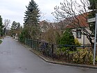
420 | Orange , evergreen tree that bears oranges | Jan. 30, 1933 | The street lies between the Narcissus Path and across the Plum Path and was previously run as a private street O. When it was renamed, the letter “O” was used, so that the neighboring streets are sorted alphabetically. This street in the residential estate was named after the plant name and belonged to West Staaken . |
|
| Orelzeile
( Location ) |
70 | Eduard von Orel (1877–1941), Austrian cartographer and inventor | Nov 18, 1965 | When it was laid out in 1965, the street as a cul-de-sac going east from Vogelzeile was named after a pioneer of photo technology, like the surrounding streets. |

|
|
Pastor-Theile-Strasse
( Location ) |
490 | Johannes Hermann Max Theile (1892–1964), theologian, resistance fighter against the Nazi regime | Feb 7, 1997 | The road is between the gardening ring and Cosmarweg. |

|
| Plum path
( Location ) |
190 | Plum , stone fruit from the rose family | Jan. 30, 1933 | The street lies between the Orangensteig and extends the Ferbitzer Weg, it was previously run as a private street P , the renaming was based on the letter "P" so that the neighboring streets are sorted alphabetically. This area belonged to West-Staaken from 1945 to 1990, in the GDR to the municipality of Staaken in the Nauen district on the basis of allied agreements on the exchange of territory from Staakener to Groß Glienicker Flur . |

|
| Philipp-Gerlach-Weg
( Location ) |
270 | Philipp Gerlach (1679–1748), architect | Feb. 1, 2003 | The street was replaced by the Staakener Feldstraße. It leads north from the main road to the Bullengraben . |

|
| Phöbener Steig
( Location ) |
250 | Phöben , municipality north of Werder, Brandenburg | Sep 9 1931 | The street in the Albrechtshof ( West-Staaken ) housing estate was called Straße 19 before it was named . It lies between Ferbitzer and Zeestower Weg. |

|
| Pietschweg
( Location ) |
150 | Ludwig Pietsch (1824–1911), painter, art writer and columnist | Jan. 29, 1958 | The street was previously listed as street 364 and is located between Rellstabweg and Cosmarweg. |

|
| Pillnitzer way
( Location ) |
510 | Pillnitz , district of Dresden, Saxony. | Nov 11, 1968 | The street is in the part of the Rudolf-Wissell-Siedlung, in which the streets are named after Dresden districts, between Heerstraße and Magistratsweg. |

|
| Pinneberger way
( Location ) |
250 (in the district) |
Pinneberg , district town in Schleswig-Holstein | Feb. 18, 1955 | The street 373 and street 501 were named together in 1955 in Pinneberger Weg. The street lies between Blankeneser Weg and the Neustaakener Graben in the district and continues eastwards behind the ditch in Spandau to Prisdorfer Straße. In this residential area north of Brunsbütteler Damm, the former Hamburger Straße, several streets are named after places in and around Hamburg. |

|
| Pulfrichzeile
( Location ) |
90 | Carl Pulfrich (1858–1927), physicist and optician, Pulfrich refractometer | Nov 18, 1965 | The street starts east of Vogelzeile, in a residential area south of Heerstraße , where the streets are named after pioneers of optics. |

|
|
Cross way
( Location ) |
120 | At right angles to the settlement axis | around 1970 | The street southeast of Fort Hahneberg , previously street 333 , was named Querweg by the council of Staaken in 1970. It is located in West Staaken between Buschower and Siedlungsweg. |

|
| Quince dough
( Location ) |
130 | Quince , pome fruit | Jan. 30, 1933 | The street is north of the plum path and was previously run as a private street Q , the renaming was based on the letter "Q" so that the neighboring streets are sorted alphabetically. This area belonged to West-Staaken from 1945 to 1990, in the GDR to the municipality of Staaken in the Nauen district on the basis of allied agreements on the exchange of territory from Staakener to Groß Glienicker Flur . |

|
|
Räcknitzer Steig
( Location ) |
250 | Räcknitz , southern district of Dresden, Saxony | Sep 1 1971 | The street goes south from the Maulbeerallee as a cul-de-sac , in a residential area, where the surrounding streets are named after Dresden districts. |

|
| Reckeweg
( Location ) |
300 + 490 (in the district) |
Otto Karl Louis Recke (1844–1922), pastor from Spandau | Feb. 18, 1955 | The Reckeweg is a spur road to the west of the Seegefelder Weg parallel to it and opens up to those behind with a footpath at the western end; interrupted by a green area, the road is eastward between road 603 and the district boundary on road 396. Eastward it continues to Falkenhagener Feld . The street was laid out and built on as street 390 in the 1930s parallel to Seegefelder Weg. |

|
| Reimerweg
( Location ) |
260 | Moritz Gerhard Reimer (1816–1867), landowner | March 1, 1963 | The road between Heerstraße and Weinmeisterhornweg west of Amalienhof was unofficially called Elsenweg and was officially named after Reimer in 1963. He was the owner of the Staakener Vorwerk, which was renamed Amalienhof at his request. Reimer's wife was called Amalie. |

|
| Rellstabweg
( Location ) |
760 | Ludwig Rellstab (1799–1860), poet and music critic | Nov 8, 1955 | The road 359 between Baluschek- and Cosmarweg was named in 1955. |

|
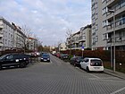
| Richard-Münch-Strasse
( Location ) |
500 | Richard Münch (1889–1968), Spandau Mayor, City Elder of Berlin | Feb 7, 1997 | The road is between nursery ring and Cosmarweg, over the latter as a spur road going on. |
|
| Rowanweg
( Location ) |
180 | William Rowan (around 1845–1900), British railway engineer (steam powered rail car). | May 18, 1965 | The street lies between Klosterbuschweg and Deniszeile and, like the surrounding streets, was named after a railway pioneer. |

|
|
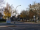
Sand road
( Location ) |
490 (in the district) |
former local sand pits | around 1888 | The street lies between Gruberzeile and Obstallee, whereby the street and eastern properties belong to Wilhelmstadt , the western, odd-numbered properties belong to the district along the entire length of the street. The name Sandstrasse was officially mentioned for the first time around 1888, but it was probably used before. The road consisted of two sections and so on August 1, 1972, the smaller, northern section was renamed Leubnitzer Weg. |
|
| Schulstrasse
( Location ) |
780 | new school building of the rural community Staaken from 1897/1898 | around 1900 | The street is located in the West Staaken area between Nennhauser Damm and Am Zeppelinpark (Berolinastraße). |

|
| Schwebelweg
( Location ) |
400 | Gotthardt Emil Robert Oskar Schwebel (1845–1891), theologian, local researcher | Oct 22, 1956 | The street was laid out in the north of the Rudolf-Wissell-Siedlung as Straße 367 and lies between Rellstabweg and Maulbeerallee. |

|
| Seeburger Weg
( Location ) |
70 (in the district) |
Seeburg , neighboring municipality to the east | 1857 | The road area north of Maulbeerallee Maulbeerweg is located in Wilhelmstadt , only around 60 meters on the western edge of the road (southern end) with lots 34 and 36 in the Staaken area. As late as the 1950s, the Seeburger Weg led as a local connection in continuation of Seeburger Strasse in (almost) straight line to the municipality of Seeburg. Structural changes, in particular the construction of the Rudolf-Wissell-Siedlung, interrupted the old course, which ended in 1961 at the city border with the GDR . So parts were canceled and the section south of Heerstraße was renamed Semmelländer Weg on January 1, 1972 . |

|
| Seegefelder Weg
( Location ) |
2070 (in the district) |
Seegefeld, in 1923 the eastern neighboring town merged with Falkenhagen to form Falkensee , Havelland in Brandenburg | Dec 13, 1934 | The path is parallel to the railway line between the district and the city limits; the road continues eastward in Spandau and there in Seegefelder Strasse. The naming of the western continuation of the Spandauer Seegefelder Straße in 1934 probably followed the name used up to then. The road continues westward in Falkensee, but is also called Seegefelder Strasse there, and is consistently designated as the main thoroughfare. |

|
| Semmelländerweg
( Location ) |
580 | Roll land, old field name | Jan. 1, 1972 | The street lies between Heerstraße and Weinmeisterhornweg. The Seeburger Weg originally ran here, although it had lost its continuation across the city limits to Seeburg in the 1950s. Due to extensive construction work after 1970, it was interrupted several times and road sections were canceled. The section between Heerstraße and the Hahneberg green area remained and was named Semmelländerweg in 1972. |

|
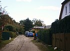
| Settlement path
( Location ) |
150 + 50 (side street) |
Settlement on the Hahneberg | around 1970 | It is located south of Fort Hahneberg and continues the crossing path, both the direct continuation and the crossing path are named the same. |
|
| Spandauer Strasse
( Location ) |
1220 | historical route from Staaken to Spandau | before 1909 | It is located between Nennhauser Straße and Blankeneser Weg, but on Magistratsweg there are no access roads on both sides. The street name Spandauer Straße for this connecting route is proven from 1909. |

|
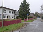
| Spieroweg
( Location ) |
200 | Heinrich Spiero (1876–1947), Germanist and literary historian. | Jan. 29, 1958 | The path lies between Springerzeile and Bullengraben and was called Straße 363 before it was named in 1958 . |
|
| Springer line
( Location ) |
840 | Robert Springer (1816–1885), writer and publicist | Jan. 29, 1958 | The street in the north of the Rudolf-Wissell-Siedlung was called Straße 358 before it was named and is located between Baluschek- and Spieroweg. |

|
| Staakener Strasse
( Location ) |
440 (in the district) |
Staaken (from Spandau) | around 1878 | It is located between Klosterbuschweg and the suburbs near the street 357 in the district and continues in the larger section eastwards to Spandau to Seegefelder Straße. The traffic of the section in the district takes place as a spur road westwards from Spandau, since the connection to Klosterbuschweg south of the industrial area on property 68 from the turning hammer between the railway bridges is only possible as a secret route. The street was the former route from Spandau to the neighboring town of Staaken, from which the name derives. |

|
| Staakener Feldstrasse
( Location ) |
190 | delimiting field road, leading to the field | Oct. 1, 1990 | Today the street goes from Nennhauser Damm to the west and as a footpath with connection to Brunsbütteler Damm. The street is located in the area of West Staaken, which from 1945 to 1990 on the basis of Allied agreements belonged to the Soviet-occupied area and later to the GDR . On October 1, 1990 - two days before West Staaken was reintegrated into Berlin - the Staaken municipality decided to merge Feldstrasse and Erich-Meier-Strasse as Staakener Feldstrasse. On February 1, 2003, the section between Hauptstrasse and Bullengraben was renamed Philipp-Gerlach-Weg. |

|
| Stieglakeweg
( Location ) |
540 | Stieglake, old field name east of the village of Staaken | Sep 1 1973 | The street 411 was named 1973 and is located between Spandauer Straße and Südekumzeile, above it as a dead end street . |

|
| Street 331
( Location ) |
120 | Numbering in the development plan | after 1930 | The road lies between Eichholzbahn and Zörgiebelweg, as a footpath to Ungewitterweg. |

|
| Street 339
( Location ) |
310 (in the district) |
Numbering in the development plan | after 1930 | It is located in Albrechtshof between Ferbitzer and Zeestower Weg along the city limits to Falkensee . The plots to the east are evenly numbered, fallow land is located in the Falkensee district . |

|
| Street 354
( Location ) |
200 | Numbering in the development plan | after 1930 | Street is south of Rowanweg going over the Neustaakener Graben to the railway line . |

|
| Street 357
( Location ) |
240 | Numbering in the development plan | after 1930 | The street is north of Staakener Straße along Neustaakener Graben and then bends to the southwest. |

|
| Street 393
( Location ) |
190 | Numbering in the development plan | after 1930 | The street is completely in the district between Seegefelder Weg and Wolfshorst and includes house numbers 1–14. The street Am Kiesteich in the district of Berlin-Falkenhagener Feld connects to the north . |

|
| Street 396
( Location ) |
150 (in the district) |
Numbering in the development plan | after 1930 | The road was laid out in the 1930s and the length of the border with Falkenhagener Feld runs along it . It lies between Wolfshorst and Seegefelder Weg. |

|
| Street 603
( Location ) |
180 | Numbering in the development plan | 1938 | It leads from Seegefelder Weg northwards over the Reckeweg as a spur road to the border of the district, with the properties 8, 10 and 16. In the Berlin address book 1943 is the street 603 between the railway and the Volkspark, across the street 390 and the Seegefelder Weg two developed plots and 44 construction sites indicated. The road continues as a footpath and bike path across the Spektelake and ends at An der Felgenlake. |

|
|
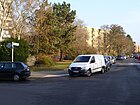
South front line
( Location ) |
610 | Albert Südekum (1871–1944), journalist and politician | Sep 1 1965 | The street lies between Magistratsweg and Zweiwinkelweg. |
|
| Sulzbacher Steig
( Location ) |
170 | Sulzbach / Saar , industrial city in the Saarbrücken city association, Saarland | Apr 5, 1934 | The street in the Staakener Eigenheimsiedlung was laid out as street 323 and is located in the Weststaaken area between Neunkircher Steig and Lohrer path. |

|
| Sundhauser Gang
( Location ) |
120 | Sundhausen , municipality near Bad Langensalza in the Unstrut plain | Apr 21, 1932 | Before 1932 the street in the Staakener Eigenheimsiedlung was called Straße 22 and belonged to Werst-Staaken , it goes eastward from the Neunkircher Steig. |

|
|
Valley path
( Location ) |
450 | Valley west of Fort Hahneberg | June 19, 1968 | The street is located in the Weststaaken area and belonged to the GDR until 1990, so street 322 was named Talweg according to the council decision of the Staaken community ( Nauen district ) of June 19, 1968. The road lies between Fahrlander Weg and Am Fort and leads from the height of Fort Hahneberg into the neighboring valley to the west. The road on the outskirts in the forest is mostly built with single-family houses. |

|
| Gateway
( Location ) |
2200 | gate-like porches of houses on part of the street | Sep 9 1931 | The street lies between Klosterbuschweg and Neunkircher Steig and was formed in 1931 from Delbrückstraße and Straße 2 . On October 1, 1965, the street 327 was included as an eastern extension and on July 23, 1979 a newly laid street section up to Hackbuschstraße. The section of the Torweg west of the Finkenkruger Weg belonged to the Soviet sector of Berlin on the basis of Allied agreements and later came to the GDR in the Nauen district . The area in the area of the border strip of the Berlin Wall is built on with homes. |

|
|
crossing
( Location ) |
90 | at the railway site | Sep 1 1973 | It lies between Wittfeldstrasse (railway line) and Seegefelder Weg and was previously called Strasse 392 |

|
| Thunderstorm path
( Location ) |
850 | Curt Ungewitter (1891–1927), pilot in Johannisthal, crashed near Staaken | Nov 4, 1935 | The street in the garden city of Staaken lies between Finkenkruger Weg and across Hackbuschstrasse as a cul-de-sac . Until 1935, the street laid out after 1914 was called Russenweg . |

|
|
Bird row
( Location ) |
320 | Hermann Wilhelm Vogel (1834–1898), photo chemist (Handbook of Photography) | Aug 26, 1965 | The street is located between Meydenbauerweg and Gruberzeile in the residential area south of Heerstraße and was named after the pioneers of optics, photo and film technology. |

|
| Voigtländer line
( Location ) |
70 | Voigtländer (1812–1878), Austrian optician | Nov 18, 1965 | The line goes eastward from Vogelzeile and, like this one in the residential area south of Heerstraße, was named after a pioneer in the field of optics. |

|
|
Wandsbeker Weg
( Location ) |
220 | Wandsbek , district of Hamburg | Oct 22, 1956 | The road between Köhlbrand- and Barmbeker Weg was planned, laid out and named in 1956 as road 420 . The streets in this settlement area north of Brunsbütteler Damm - the former Hamburger Straße - were named after Hamburg suburbs and places in the Hamburg area. |

|
| Pasture path
( Location ) |
340 | Pasture , economically used grassland | around 1970 | The path is between Heerstrasse and Nennhauser Damm. It was named after the parallel meadow path and in memory of the proximity to the former village. The previous street 386 located here , with the numbering according to the development plan, was named Weidenweg by the Staaken municipality around 1970. At that time the road was in West Staaken outside Berlin, this situation arose in 1945 through an agreement between the British and Soviet allies due to their use of the Gatow and Staaken airfields . |

|
| Vineyard height
( Location ) |
380 + 370 | formerly took place here wine | after 1950 | The Weinbergshöhe consists of two parallel roadways that leave the Weinmeisterhornweg in the south and lead to a hill built with private homes and open up the plots 1–43 of the Weinbergshöhe settlement there. They end on the Wall Trail outside the city limits to Seeburg and are connected by this in the south, behind the sign 250 traffic ban. Weinbergshöhe is shown twice as a road sign, the names Akazien- and Rebenweg ( location ) are no longer officially shown in the statistics and are probably given up in favor of the current name, as both street names also exist in other parts of Berlin. The elevation lies between the Hahneberg (68 m) and the Karolinenhöhe (52 m). To the southeast of the settlement lies the border with the Wilhelmstadt district , to the northwest it is enclosed by the “ Hahneberg neighborhood and recreation area ”. In the 19th century viticulture was practiced in the area. | |
| Weinmeisterhornweg
( Location ) |
1370 (in the district) |
Weinmeisterhorn, headland in the Scharfen Lanke (Havelbucht) | Sep 9 1931 | The road between highway and the district boundary to Wilhelm city , but is not connected to the highway, making it the north from Reimerweg Hahneberg an impasse is. The transition to the neighboring district is on the eastern edge of the Weinbergshöhe settlement and until An der Karolinenhöhe, the north side still belongs to the district. The path already existed in its course in the Middle Ages and before 1900 the Stiftstraße was part of this street, the name of which was related to the Amalienhof. In 1931 Weinmeisterhornstraße , Straße 46 and In den Weinbergen were included in the new name Weinmeisterhornweg in Wilhelmstadt . |

|
| Weißenstadter Ring
( Location ) |
580 | Weißenstadt , town near Wunsiedel in the Fichtel Mountains, Bavaria | Dec. 1, 1961 | The road from Magistratsweg to the east opens up the multi-storey apartment buildings within the ring and the two-storey flat residential buildings outside of the ring as an access road. |

|
| Meadow ground
( Location ) |
260 | neighboring meadow in the ground | around 1970 | The road lies between Wiesenweg and Bergstraße, the eastern part is developed and built up as a road, the western section leads through grassland. The short cul-de-sac was named Straße 372 and was named in 1970 by the Staaken municipality council. At this point in time, the site was in West Staaken near the border installations of the Berlin Wall that lay to the west on Bergstrasse; the extension of the road over this fallow land, which was created after 1990, took place on August 1, 2007 |

|
| Meadow path
( Location ) |
440 | Meadow , adjacent green area | around 1970 | The road between Nennhauser Damm and Heerstraße is parallel to Weidenweg. As a result of allied agreements, the street was in West Staaken outside of Berlin and so street 370 was renamed around 1970 by the Staaken municipality council. |

|
| Winterhuder Weg
( Location ) |
200 | Winterhude , district of Hamburg | July 1, 1962 | The road between Spandauer Straße and Eichholzbahn was rebuilt in 1962 in the Louise Schröder settlement. To the north of the Billstedter path, the street continues for a while as a cul-de-sac and then turns into a footpath and the ICE route and its noise protection is crossed by the Winterhuder Steg, a pedestrian bridge. The street name has been adapted to the surrounding streets (formerly north of Hamburger Straße ) |

|
| Wittfeldstrasse
( Location ) |
470 | Gustav Wittfeld (1855–1923), engineer | Sep 1 1973 | The street lies between Leuthingerweg and the transition, the plots 28-38 are up to the Klosterbuschweg. Before being named after a pioneer of the railway industry, it was called Straße 526 . |

|
| Wolfshorst
( Location ) |
140 (in the district) |
Wolfshorst, old field name. | March 1, 1963 | The road 391 was named in 1963 and is located on the district edge to Falkenhagener field between road 396 and road 393 over which it still as a spur road goes. Until Kiesteich only the southern plots 1–33a without the street belong to the district, west of the street Am Kiesteich (formerly: Strasse 394 ) the district boundary runs along the street and includes the plots 52-56 (straight) with the southern is here the KGA Felkenlake. The turning hammer at the west end of the street is (north) outside of the district. |

|
|
Zeestower way
( Location ) |
1200 | Zeestow , municipality in Havelland, Brandenburg. | Sep 9 1931 | The street between Straße 339 and Isenburger Weg was planned as Straße 18 in the north of the Staakener residential estate . Between 1945 and 1990 it was located in West Staaken and at that time outside the Spandau district, the cause of the Allied agreements on Gatow and Staaken airports. |

|
|
Zörgiebelweg
( Location ) |
320 | Karl Zörgiebel (1878–1961), politician, police chief in Berlin | March 1, 1964 | The street was laid out in the southern garden city of Staaken as Straße 326 and named in 1964, it is located between Hackbuschstraße and Straße 331. |

|
| Two-angle way
( Location ) |
320 | Zigzag road (twice) | Oct. 1, 1969 | The road between Südekumzeile and Brunsbütteler Damm was rebuilt in the Neu-Staaken residential area. |

|
| Between the gables
( Location ) |
130 | Gable to the street side | around 1914 | The street between Torweg and Kirchplatz lies in the western part of the garden city of Staaken. The architecture of the adjoining houses with the striking bell gables is modeled on the Dutch Quarter in Potsdam (1732–1742). |
Some planned and former streets
Only named streets are taken into account in the table, the numbered streets are only noted in the "Comments" column in the overview above. The address book from 1943 contains the following streets that were officially managed at that time (some of them were listed under the unofficial name)
- Street 325 , Street 326 , Street 329 , Street 330 , Street 339 ,
- Strasse 341 (Markauer Weg) , Strasse 342 (Satzkorner Strasse) , Strasse 343 (Priorter Weg) , Strasse 344 (Geltower Weg) , Strasse 345 (Falkenrehder Weg) , Strasse 347 (Betmatenweg) ,
- Street 351 , Street 358 , Street 359 , Street 360 , Street 363 , Street 364 , Street 365 , Street 366 , Street 367 , Street 368 , Street 369 ,
- Street 373 , Street 375 , Street 376 , Street 377 , Street 378 , Street 379 ,
- Street 382 , Street 384 , Street 385 , Street 386 , Street 389 , Street 390 , Street 393 , Street 397 , Street 398 ,
- Street 401 , Street 402 , Street 418 , Street 420 , Street 421 , Street 427 , Street 438 ,
- Street 603 .
Renaming and re-naming in West Staaken are due to the hive-off (Lex Geltow) of this area from the British Sector Berlin in the Soviet Zone in 1945 by the Allies , with parts of Groß Glienicke being placed in the British sector at the same time, as there is space around Gatow Airport was needed for the Royal Air Force . With the change in the administrative organization in this part of Staaken, street names have also been changed (more in the article of the district )
| Old names | from | to | renamed | Remarks |
|---|---|---|---|---|
| At the stall | Jan. 29, 1958 | Oct 3, 1972 | canceled | The stable was a piece of land (see also Upstallgraben) on which the farmers kept the cattle overnight in paddocks. |
| At the air base | Feb. 19, 1938 | 1951 | → Buschower Weg | The street was named after the Staaken airfield , which operated from 1916 to 1948. Originally the Friedhofstraße between the town center and the cemetery, it was divided in 1938 and the section north of Heerstraße was named after the air base. 1951 in West Staaken , the entire length was named Buschower Weg. |
| On the industrial site | after 1990 | Feb 25, 2005 | → Brunsbütteler Damm | After the industrial site was closed on the site of the former Staaken Zeppelin Square, the street was initially set up as a plan street and then as a public street. In the event of changes and changes in ownership of the commercial areas and road expansion, the run was included in the Brunsbütteler Damm, which was extended to the West-Stakener area. |
| At the market square | around 1915 | Sep 9 1931 | → Heidebergplan | The market square was set up in the planning of the architect Paul Schmitthenner in the years 1914–1917 as the central square in the garden city of Staaken . The square was renamed Heidebergplan in 1931, as the formation of Greater Berlin resulted in more streets of the same name. |
| Bahnhofstrasse | before 1931 | Sep 9 1931 | → Finkenkruger Weg → Nennhauser Damm |
The road ran directly at Staaken train station , which was established in 1900. When multiple names of Berlin streets were eliminated for the first time in 1931 , the street section south of Staaken station was named Nennhauser Damm together with Königstrasse. On the same day, the section of road north of the train station was merged with Staaken-Falkenhagener Chaussee to become Finkenkruger Weg. |
| Berlin street | before 1900 | March 11, 1937 | → Brunsbütteler Damm | The road that was laid out in 1828 to connect to Hamburg was named Berliner Straße in the Staaken community at the end of the 19th century , as it ran from Staaken to Berlin. In the course of the elimination of multiple names of streets in Greater Berlin , Berliner Straße became the western part of Brunsbütteler Damm in 1937. |
| Berolinastrasse | 1998 | Aug 15, 2007 | → At the Zeppelin Park | Temporary street name on the site of the former airfield, which results from the Latinized name of Berlin. The name of the street goes back to a Berolinapark that was built on the site that became vacant in the 1990s, but was replaced by the operator of the Zeppelin (commercial) park. |
| Brandwerderweg | Jan. 29, 1958 | 1989 | → Klosterbuschweg | Brandwerder is a field name for an area east of the street. The previous name short street was changed due to duplication in Greater Berlin . Due to its short length, this path was included in 1989. According to a communication from the Spandau Civil Engineering Office dated June 27, 1989, the name was omitted in 1989 and the street was included in Klosterbuschweg. |
| Delbrückstrasse | around 1914 | Sep 9 1931 | → Doorway | The street was named after Clemens von Delbrück (1856-1921), a member of the Reichstag, Prussian minister and deputy chancellor. In 1931 it was renamed Torweg together with Straße 2 . |
| Döberitzer Heerstrasse | before 1908 | around 1934 | → Heerstrasse | The Heerstraße was laid out to move the Berlin garrison quickly to the Döberitz military training area. In the 1920s, or by 1934 at the latest, the entire street was then also called Heerstraße . In the area of the Spandau district, Heerstrasse was laid out between 1906 and 1910 and was named Döberitzer Heerstrasse around 1908. Its extension in the direction of Berlin to the intersection Preußenallee / Kaiserdamm was also mentioned in Döberitzer Heerstraße. On the map from 1912 it was marked by name as Döberitzer Heerstraße. |
| Elsenweg | around 1920 | March 1, 1963 | → Reimerweg | The street on the western edge of the Amalienhof was designated as Elsenweg in the official register as early as 1920 , according to a Spandau register from 1920 it was not an official name, but a private street of the Amalienhof. In the Berlin address book of 1922 and 1943, the path is shown as undeveloped, between Magistratsweg and Weinmeisterhornweg and leading over Straße 360 and Heerstraße. In 1963 it was named Reimerweg after the previous owner of the Amalienhof. |
| Erich-Meier-Strasse | around 1960 | Oct. 1, 1990 | → Staakener Feldstrasse | The street is located in the West-Staaken area, which was spun off from Berlin in 1945 through an area swap . Around 1960 the newly laid road was named after Erich Meier (1910–1933), a victim of the Nazi regime, by the Staaken municipality . On October 1st, 1990 - two days before the reintegration of West Staaken to Berlin - it was named together with Feldstrasse in Staakener Feldstrasse. |
| Ernst-Thalmann-Strasse | 1956 | Oct. 1, 1990 | → Isenburg Way | Ernst Thälmann (1886–1944), Hamburg politician of the Communist Party of Germany. Before 1956 and after 1990 the street was called Isenburger Weg. |
| Fahrlander way | Sep 9 1931 | around 1960 | → Seeburger Strasse | The street named after Fahrland in 1931 was in West Staaken and was renamed Seeburger Weg in 1960 by the Staaken municipality . On October 1, 1990, the Staaken council was renamed Fahrlander Weg because there was already a street in the Spandau district called Seeburger Weg. |
| Feldstrasse | before 1920 | Oct. 1, 1990 | → Staakener Feldstrasse | The road once led from the village of Staaken to the fields . The name was changed because when West-Staaken was reintegrated into Spandau in Spandauer Neustadt there was already a field road. |
| Friedhofstrasse | before 1938 | Feb. 19, 1938 | → Buschower Weg → At the air base |
The road was the way from the village to the Staaken cemetery. After the Staaken military airfield went into operation , the old Friedhofstrasse was named in two sections. On February 19, 1938, the part to the south of Heerstraße was named Buschower Weg and the part to the north of Heerstraße was named Am Fliegerhorst . |
| Gärtnerallee | before 1910 | 1969 | canceled | It was located between the districts of Spandau and Seeburger Weg, Weinbergsweg and Maulbeer en allee in the Lazarus settlement in Staaken-Amalienhof. When the Rudolf-Wissell-Siedlung was built in the 1960s, the street was built over and removed. |
| Gustav-Döring-Strasse | around 1980 | Oct. 1, 1990 | → Street 341 | Gustav Döring (1885–1944) came to Staaken in 1915 and worked as a taxi and truck driver. As a member of the KPD he worked for the trade union and the consumer association and was murdered as a resistance fighter against the Nazi regime. In 1990 the street was initially renamed to the number form Straße 341 , in 2000 it was renamed → Hamburger Straße (in the new course). |
| Hamburger Street | 1899 | March 11, 1937 | → Brunsbütteler Damm | The street in the direction of Hamburg was laid out in 1828 and named in the area of the city of Spandau and the municipality of Staaken in 1899. With the renaming in the 1930s due to duplications since the formation of Greater Berlin , it was renamed together with Staakener Berliner Straße in 1937 to Brunsbütteler Damm. |
| Isenburg way | Sep 9 1931 | 1956 | Ernst-Thalmann-Strasse | The route, which was named after Isenburg as early as 1931 , was located in the GDR because it was assigned to West Staaken . The street was renamed on the occasion of Ernst Thälmann's 70th birthday . |
| Kirschallee | before 1890 | before 1910 | canceled | The Kirschallee was laid out in the area of the Lazarusian settlement together with the mulberry and fruit avenue, but was probably built over and moved in at an early stage. |
| Koenigstrasse | before 1900 | Sep 9 1931 | → Nennhauser Damm | The Königstraße, after the Prussian king, was renamed in the course of the elimination of multiple names of streets in Greater Berlin in 1931 with the section of Bahnhofstraße south of Staaken station in Nennhauser Damm. In 1922, the street was shown as an extension of Bahnhofstraße to Heerstraße / Dallgow district, i.e. it ran westwards. |
| Short street | 1938 | Oct. 1, 1990 | → Nennhauser Damm | The short street was between Schulstraße and Nennhauser Damm, with the reintegration of West-Staaken it was included (as a short cross street), as there was already a second street of the same name in the Spandau district. The plots were renumbered 128a – e and 130–134a (partly newly built) on Nennhauser Damm. |
| Short street | around 1930 | Jan. 29, 1958 | → Klosterbuschweg | The street in Staaken was between Spandauer Strasse 73 and 74 and the Berlin-Lehrter Railway . The Kurz Straße, which ran on the border of the Staaken district, was renamed Brandwerderweg in 1958 . In 1989 this was included in the Klosterbuschweg. |
| Lehrter Strasse | around 1870 | Sep 9 1931 | → Eichholzbahn | Lehrte , the street lies directly along the railway line of the Berlin-Lehrter Railway and was furnished with this and built on the north side with properties of the Gartenstadt Staaken eGmbHb between Am Kurzen Weg and Scheidstraße . |
| Lewaldstrasse | 1916 | Sep 9 1931 | → On the Heideberg | The street in the garden town of Staaken, built between 1914 and 1917 and intended as a housing estate for workers in the armaments factories in Spandau, bore the name of Friedrich Lewald (1860-1947), lawyer, sports official in the IOC and at the 1936 Olympic Games. |
| New street | around 1976 | July 15, 1998 | → At the old gas works | The street in the West-Staaken area, which from 1945 to 1990 on the basis of Allied agreements belonged to the Soviet-occupied area and later to the GDR , this "new" street on the gasworks site was named Neue Straße by the Staaken municipality in 1976 . Since there was already a street with this name when the Staakener territories were merged on October 3, 1990 , THEN in 1998 the West Staakener was given the name Am alten Gaswerk. |
| Ring road | around 1970 | after 1996 | canceled | The street was laid out and named in West Staaken on the barracks area of the former air base (at the time it was named hospital). It ran in a ring around the former Staaken hospital, now the operating site of the Havellandklinik Nauen. |
| Russenweg | after 1914 | Nov 4, 1935 | → Thunderstorm path | The street in the northwest of the garden city Staaken was named Russenweg during the First World War. The street name refers to the Russian prisoners of war who were housed here during the First World War and who were used for earthworks in Staaken. |
| Scheidtstrasse | after 1914 | Nov 4, 1935 | → Hackbuschstrasse | The street, laid out between 1914 and 1916, was named after Adolf Scheidt and renamed in 1935, because some residents, as members of the NSDAP, took offense at the street name. |
| Seeburger Strasse | before 1900 | May 9, 1931 | → Fahrlander Weg | Seeburg is the southeastern neighbor to which the road led. The Seeburger street was renamed in 1931 in driving Lander way because yet another avenue in Spandau was named Seeburger road. |
| Seeburger Weg | around 1960 | Oct. 1, 1990 | → Fahrlander Weg | Fahrlander Strasse in West Staaken , which leads to the neighboring southeastern town of Seeburg, was renamed Seeburger Weg in 1960 by the Staaken municipality ( GDR ). On October 1, 1990 - also by the council of the municipality of Staaken - the name was renamed Fahrlander Weg, because there was already a Seeburger Weg in the Spandau district. |
| Staakener Feldstrasse (partially) | Oct. 1, 1990 | Feb 25, 2005 | → Brunsbütteler Damm | The Staakener Feldstrasse was named because of the duplication of the Feldstrasse. With the design of the adjacent industrial site and the search for girders, the course of the street was shortened and a section of residential development, the “Mühlenviertel”, remained under this name. |
| Staaken-Falkenhagener Chaussee | before 1900 | Sep 9 1931 | → Finkenkruger Weg | The road led from Staaken to Falkenhagen and was named after the expansion to the Chaussee . In 1931 it was merged with the section of Bahnhofstrasse north of the train station to Finkenkruger Weg. |
| Stiftstrasse | before 1900 | Sep 9 1931 | → Weinmeisterhornweg | The street was south of Heerstrasse at Amalienhof, where the British International School is now. In 1931 the entire street from Stiftstraße , In den Weinbergen , Straße 46 and Weinmeisterhornstraße , which continued in Wilhelmstadt , was given the name Weinmeisterhornweg. |
| Street 387 Street 388 Street 389 |
after 1923 | after 1996 | → Heerstrasse | The streets were laid out with the construction of the New Jerusalem settlement , which was named after the Bauhaus-style construction. The streets were between Nennhauser Damm and Heerstraße (387) and south of Heerstraße (388 and 389) and were incorporated into Heerstraße by renumbering the properties at the end of the 1990s and repealed as streets. |
| Weinbergsweg | before 1900 | 1934 | → Magistratsweg | The street was in Staaken-Amalienhof between Maulbeerenallee and Döberitzer Heerstrasse across the Gärtner-, Obstallee. According to information in the Berlin address book from 1922, there are buildings south of Obstallee. The Berlin address book 1938 contains the note "Renamed Magistratsweg when going to press." |
| Werkstrasse | after 1955 | 1998 | Berolinastrasse | The street was in West Staaken in the area of the former Staaken airfield, some of which were used by the Nauen hospital. |
Further locations of Staaken
Allotment gardens
Roads within the colonies are only given internal names and are therefore not included in the list above. By post, they count as a unit and therefore each have their own address. The situation is different with the housing estates that since the foundation and create or from a colony that is not in accordance with the provisions of the Small School Act were reshaped should be treated and on request of the settlers. Settlement areas on the outskirts belong here, such as the "Siemens workers' suburban housing estate"
- KGA Am Baluschekweg (Baluschekweg 28/62, Lage ), permanent allotment garden with 62 plots on 21,169 m² of state-owned leased land.
- KGA Amalienhof I (Weinmeisterhornweg 224, Lage ), permanent allotment garden with 107 plots on 41,105 m² of state-owned leased land.
- KGA Amalienhof II (Heerstraße 463/491, Lage ), permanent allotment garden with 100 plots on 38,456 m² of state-owned leased land.
- FOAG - sub-district Neuland Staaken (Torweg / Klosterbuschweg, Lage ), 246 parcels on 85,956 m² of leased land owned by the railway.
- KGA Felgenlake (Strasse 393 No. 13, Lage ), permanent allotment garden with 20 plots on 7,210 m² of private property
- KGA Gartenbauverein Staaken (Nennhauser Damm 11, Lage ), permanent allotment garden 68 plots on 28,554 m² of state-owned leased land.
- KGA Neue Hoffnung (Mareyzeile / Anschütz- / Hensoldweg, Lage ), permanent allotment garden with 53 plots on 18,362 m² of state-owned leased land.
- FOAG - Staaken sub-district Spandauer Strasse group (Spandauer Strasse 99, Lage ), rail agriculture 72 parcels on 25,509 m² of railroad area.
Parks and urban greenery
- Fort Hahneberg ( location )
- Amusement park Hahneberg ( location ), also only managed as a local and recreational area Hahneberg.
- Stadthauspark Staaken ( location )
- State-owned Staaken cemetery (Buschower Weg, Lage ), Alleefriedhof on 25,254 square meters.
- Weekend settlement Semmelländerweg ( Lage ), a former allotment garden colony that has been redesigned as a weekend settlement and is no longer subject to the Federal Allotment Garden Act.
See also
literature
- Gesellschaft Wirtschaftshof Spandau eV (Hrsg.): Street chronicle with signposts through the Spandau economy . H. Born & Co Spandau, Berlin 1957.
Web links
- Street directory Staaken. kaupert media GmbH, accessed on September 29, 2012 .
- Prussian military center Spandau at the confluence of the Spree and Havel rivers. (PDF; 3.2 MB) Exhibition on the museum ship “Kurier” in the historic port of Berlin, 2007, archived from the original on February 14, 2010 ; Retrieved September 29, 2012 .
- Office for Statistics Berlin-Brandenburg: List of streets and squares in the Spandau district (as of February 2015); pdf
- Map of Berlin 1: 5000 with district boundaries. Senate Department for Urban Development Berlin, June 2012, accessed on September 29, 2012 .
- Measuring table sheet from 1936 - Dallgow-Döberitz - 1: 25000. Reichsamt für Landesaufnahme, 1936, accessed on October 8, 2012 .
- BA Spandau: Beplanliste090.html
- Map of the exchange of territory in 1988, Staaken in map center left (PDF; 3.8 MB)
Individual evidence
- ↑ Map of Spandau 1943 with the eastern Staaken ( page no longer available , search in web archives ) Info: The link was automatically marked as defective. Please check the link according to the instructions and then remove this notice.
- ^ "The area of West Staaken near Berlin was transferred to the administrative sovereignty of the Democratic Magistrate on February 1, 1951. Due to treaties, West-Staaken has been under the protection of the security organs of the GDR as a Soviet area of interest. "According to the photo entry from February 8, 1951 (Federal Archives Image 183-09587-0004, West-Staaken, edition of food cards.jpg)
- ↑ Series “Brokers Favorite Places”: Where the West became the unloved East . In: Berliner Morgenpost , December 5, 2009.
- ^ West Staaken . In: Berliner Zeitung , November 7, 1994
- ↑ We kiek who comes . In: Hannoversche Allgemeine , August 20, 2010.
- ↑ a b c d Big Berlin city map from 1961 ( page no longer available , search in web archives ) Info: The link was automatically marked as defective. Please check the link according to the instructions and then remove this notice.
- ↑ Staaken location with demarcation according to plan 1955
- ^ Building boom in West Staaken . In: Berliner Morgenpost , December 11, 2002.
- ↑ West-Staaken industrial area: B-plans VIII-431 / VIII-432a and 432b: former Staaken airfield in Berlin-Spandau. Avoidance and compensation measures, client: Spandau Nature Conservation and Green Areas Office (2005)
- ↑ a b c d e f Street situation based on a Berlin city map from 1955
- ^ About Loewe and the naming of the street
- ↑ Am Fort, Berlin-Spandau (Staaken)
- ↑ a b c d e f g work card zoning plan , marked as residential building area, W4 (GFZ up to 0.4) interspersed with green space
- ↑ a b Gartenstadt Staaken prototype with pictures and maps (online)
- ^ A b Karl Kiem: The garden city of Staaken . In: Andres Lepik, Anne Schmedding: The XX. Century. A century of art in Germany. Architecture in Berlin . Cologne 1999, pp. 26-28
- ↑ Why the Brunsbüttler Damm is a four-lane dead end. In: BZ Berlin, March 8, 2016
- ↑ The German Nightingale . In: Berliner Zeitung , July 29, 1996
- ↑ On the person of Georg Schroeder
- ^ About Hackbusch
- ↑ New Jerusalem is slowly falling into decline . In: Berliner Zeitung , November 22, 1996
- ↑ a b c d Information from the list of the Berlin regional maps
- ↑ a b c d e f g h i j k l m n o p More information under FIS Broker Map of Berlin 1: 5000 (K5 color edition) of the Berlin land surveying offices
- ↑ A musical child prodigy . In: Berliner Zeitung , August 2, 1996
- ↑ Joachim Pohl: The Spandau Benedictine Monastery of St. Marien in its urban and rural relationships. In: Kaspar Elm (Hrsg.): Wichmann yearbook of the Diözesangeschichtsverein Berlin. New episode 4, XXXVI. Year 1996/1997, pp. 47–94, here p. 86.
- ↑ Spandauer Volksblatt, January 28, 2015, p. 2.
- ^ On the person of Arthur Loewenstamm
- ↑ On the person of Orel
- ↑ On the person of Pastor Theile
- ^ About Recke as a person
- ↑ Reimer as a person
- ↑ On the person of Schwebel
- ↑ a b Large Berlin City Map. Verlag Richard Schwarz Nachf. / Berlin W 30, Spandau around 1961 ( page no longer available , search in web archives ) Info: The link was automatically marked as defective. Please check the link according to the instructions and then remove this notice.
- ↑ Semmelländer is said to have been derived from the Slavic word "semlja" (country).
- ↑ Street 603 . In: Berliner Adreßbuch , 1938, administrative district Spandau> Staaken, Tiefwerder, p. 1273.
- ↑ a b Administrative district Spandau> Staaken, Tiefwerder> Straße 603 . In: Berliner Adreßbuch , 1943, IV. Part, p. 1277. "(Railway) / Left side: 1, 3 construction sites (Seegefelder Weg) 5–11 construction sites // Right side: 2, 4 construction sites (Seegefelder Weg) 6: Construction site, 8: commercial Employee F. Rummlsberger, 10: worker Ch. Jungrichter, 12: construction site (Strasse 390) 14, 16: Nastellen (Volkspark) ”.
- ↑ On the person of Curd Ungewitter
- ↑ On the local viticulture and the structure of the terrain ( Memento of the original from July 8, 2012 in the Internet Archive ) Info: The archive link has been inserted automatically and has not yet been checked. Please check the original and archive link according to the instructions and then remove this notice. , accessed October 14, 2012.
- ↑ Gartenstadt Staaken (1913–1917) - The variation of types by Paul Schmitthenner , p. 291 f (PDF; 9.5 MB)
- ^ Street 325 to Street 603 (pages 1275, 1276, 1277) . In: Berliner Adreßbuch , 1943, Part IV .. " Strasse 325 : Kurz Strasse / Reichsbahngelände / Eichholzbahn, Hackbuschstrasse / Strasse 331 / Ackerland / Feldweg // Strasse 326 : Hackbuschstrasse / Projektierte Strasse // Strasse 32 7: Hackbuschstrasse / Strasse 331 / / Straße 328 : Hackbuschstraße / Straße 449 // Straße 329 : Hackbuschstraße / Straße 449 // Straße 330 : Hackbuschstraße (Feldmark, Reichsbahngelände) / Straße 449 // Straße 332 : Buschower Weg, undeveloped // Straße 333 : Buschower Weg, undeveloped / / Straße 335 : Left side: Feldmark / Straße 333 / right side: Straße 333 (16 houses) Hahneberg // Straße 339 : Post Spandau, Eigenheim housing estate, left side to the Dallgow and Falkensee districts / right side: Ferbitzer Weg, Fachiger Straße, Zeestower Weg, Berlin-Hamburg Railway, Seegefelder Weg, railway area, Feldmark // Strasse 351 : Heerstrasse, Gut Amalienhof, opposite. Forst, district Seeburg // Straße 353 : Feldmark, left side three houses, right side four houses, Lehrter Bahn // Straße 358 : Straße 368, Straße 369, Magistratsweg, Straße 363 (left odd 1–65 and right even 2–62 ), in total: 30 housing estates, a garden center (46-52), 15 as construction sites, nine as parcels, a summer house // Strasse 359 : left side: Strasse 368, 367, 366, Magistratsweg, Strasse 365, 364 / right side ( straight): Straße 369, Magistratsweg, Straße 360 // Straße 360 : left side (odd) Straße 368, Straße 367, Straße 366, Magistratsweg, Feldmark / right side (even) Straße 368, Straße 367, Straße 366, Magistratsweg, Feldmark , Strasse 365, Strasse 364, Strasse 359, Bergstrasse // Strasse 363 : Strasse 358, Feldmark // Strasse 364 : Strasse 360, Strasse 359 // Strasse 365 : Strasse 360, Strasse 359 // Strasse 366 : Maulbeerallee, Strasse 360 / / Strasse 367 : Maulbeerallee, Strasse 360, Strasse 359 // Strasse 368 : Maulbeerallee, Strasse 360, Strasse 359, Strasse 358, Strasse 382 , Strasse 383, Bullengraben, Strasse 378 // Strasse 369 : Strasse 359, Strasse 358, Strasse 382 // Strasse 373 : Bullengraben, district Spandau, Strasse 377, Strasse 376, (still on the right) Strasse 375 // Strasse 375 : Feldmark, Neue Strasse, Strasse 438, Strasse 373, Spandauer Strasse // Strasse 376 (Post Spandau): Feldmark, Strasse 373 // Strasse 377 : Brunsbütteler Damm, passage to Strasse 375, Strasse 373 // Strasse 378 (undeveloped): Brunsbütteler Damm, Strasse 380, Strasse 381, Bullengraben, Strasse 368 // Strasse 382 : District Spandau, Strasse 384, Strasse 385, Strasse 368, Strasse 369, Magistratsweg // Strasse 384 : Strasse 382, Strasse 383 // Strasse 385 : Strasse 382, Strasse 383 // Straße 386 (formerly Hahnebergweg: Nennhauser Damm), Heerstraße // Straße 389 (undeveloped): Nennhauser Damm, Heerstraße // Straße 390: (1–33 go to Spandau) District Spandau, Straße 352, Straße 393, Straße 603, Seegefelder Strasse // Strasse 393 : Seegefelder Weg, Strasse 352 (right), Strasse 390 // Strasse 397 : Feldmark, Strasse 402 // St Strasse 398 : Heerstrasse, Strasse 401, Strasse 402, Feldmark // Strasse 401 : Heerstrasse, Strasse 398 // Strasse 402 : Strasse 398, Seeburger Weg, Strasse 397 // Strasse 418 : Am Fliegerhorst, Feldmark // Strasse 420 : Strasse 421 , Feldmark // Strasse 421 : Strasse 427, Strasse 420 // Strasse 427 : Magistratsweg, Strasse 421, Feldmark // Strasse 438 : Strasse 375, Magistratsweg // Strasse 603: Railway, Seegefelder Weg, Strasse 390, Volkspark ”.
- ↑ a b c d e f g h i Elsenweg . In: Berliner Adreßbuch , 1922, administrative district Spandau> Staaken, Staaken = Amalienhof, Staaken = Gartenstadt, p. 1198.
- ↑ Only the name reminds of the zeppelins. In: Berliner Zeitung of October 19, 000
- ↑ Luise Berlin: Brandwerderweg
- ↑ also: Pharus Plan Berlin (large edition with suburbs) from 1921 ( page no longer available , search in web archives ) Info: The link was automatically marked as defective. Please check the link according to the instructions and then remove this notice. , Name in the middle of the card on the left margin, accessed October 10, 2012
- ↑ On the person of Erich Meier
- ↑ Gustav Döring
- ^ On the person of Lewald
- ^ Luise-Berlin: Ringstrasse
- ↑ Weinbergsweg . In: Berliner Adreßbuch , 1934, administrative district Spandau> Staaken, Tiefwerder, p. 1246.
- ↑ Allotment garden development plan for the Spandau district ( Memento of the original from September 29, 2013 in the Internet Archive ) Info: The archive link was inserted automatically and has not yet been checked. Please check the original and archive link according to the instructions and then remove this notice. (PDF; 26 kB)
- ↑ Siemenswerke advertising leaflet for the settlements
- ↑ a b c d Fictitious permanent allotment gardens according to §§ 16 and 20 a BKleingG, through the representation in the land use plan as green space - allotment gardens additionally protected. Highly secured allotments.
- ↑ a b Allotments on land owned by Deutsche Bahn AG that are leased to the railroad farm and are close to track systems.
- ↑ a b Allotment garden areas that are defined as permanent allotment gardens by the B-Plan.
- ↑ List of state-owned cemeteries (pdf; 37 kB)


