
Berlin-Staaken
|
Staaken district of Berlin |
|
|---|---|
  |
|
| Coordinates | 52 ° 31 '57 " N , 13 ° 8' 29" E |
| surface | 10.884 km² |
| Residents | 46,607 (Dec. 31, 2019) |
| Population density | 4282 inhabitants / km² |
| Incorporation | Oct. 1, 1920 |
| Post Code | 13591, 13593 |
| District number | 0504 |
| Administrative district | Spandau |
Staaken is a part of the fifth Berlin administrative district Spandau .
The district
location
Berlin-Staaken lies in the natural area of the Zehdenick-Spandauer Havel lowlands . In the northeast Staaken borders on the Falkenhagener Feld , in the east Klosterfelde lies between Staaken and the core of the Spandau district (districts Spandau and Wilhelmstadt ). In the west and south, the district forms the Berlin city limit to the state of Brandenburg ( Havelland district ), in the northwest to the city of Falkensee , in the southwest to Dallgow-Döberitz and in the south to Seeburg .
While the historical part of Staaken around the old village in the north and south is predominantly characterized by single-family housing estates and the garden city of Staaken , the eastern part and Neu-Staaken mainly consist of large settlements that were built in several construction phases from the late 1950s to the 1970s are.
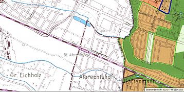
Albrechtshof
- Area north of the train station
Land use planning
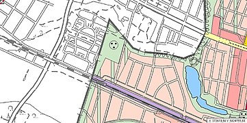
Zoning plan

Road situation planned in 2007

Aerial photo from March 2014


_Deutsche_Teilung4.jpg)
The location Albrechtshof is in the western part of Staaken. It is limited to the east by the Finkenkruger Weg, to the north and west by the city limits to Falkensee and to the south by the Hamburger Bahn . It is characterized above all by the development with single-family houses, which give it a rural character. A part of Albrechtshof is also still in Brandenburg near Seegefeld .
In December 1961, the local situation hit the headlines of the press, after the train driver Harry Deterling and a stoker together with several families with a tank locomotive of the 78 series and eight passenger cars from Oranienburg on the main line Hamburg– Berlin successfully dared to flee to West Berlin . Not a single shot was fired by the border authorities. A total of 25 people fled the GDR on the train that evening, whose media then reported that it had been a “criminal attack on the interzonal train from Hamburg”. On the night of December 7, 1961, the trains were diverted via Wannsee , the route for interzonal traffic between Berlin and Hamburg was interrupted and finally shut down. Work parties were observed removing rails and gravel 20 meters from the border with West Berlin. The escape was documented in 1963 in the film Breakthrough Locomotive 234 (in contrast to the real situation, a class 38 steam locomotive [locomotive number: 38 3239] breaks through the border installations under spectacular barrage by the GDR border organs).
Staaken garden city

The original area of the Garden City of Staaken extends on an area between the Lehrter Bahn and the Hamburger Bahn, i.e. between the northern and southern railway lines and is delimited to the east by Hackbuschstrasse and to the west by Finkenkruger Weg. This area has 350,000 m², which was arable land. The development of the area according to the planning of the architect Paul Schmitthenner in the years 1914 to 1917 forms the core of the garden city Staaken. The Staaken Garden City Cooperative was founded on June 27, 1913 and now has residential units outside this area. The lease agreement originally negotiated between the cooperative and the Prussian Ministry of the Interior turned out to be problematic . It was only limited in time until the end of 1999 and thus the future of the Staaken garden city was considered uncertain beyond this period. The Gartenstadt Staaken eG housing cooperative was able to purchase the site before the lease ended. The houses are under monument protection .
Staaken village

The actual center of Staaken extends along the Nennhauser Damm, south of the Brunsbütteler Damm. On the main street is the Staaken village church , which is known as the village church Alt-Staaken.
New Jerusalem settlement
The Neu-Jerusalem settlement is located west of the Staaken town center, just before the Berlin city limits on both sides of Heerstrasse . The listed settlement owes its name to its cubic architecture.
New Staaken

Allotment gardens and individual farms that were located south of the Lehrter Bahn had to increasingly give way in the 1960s and 1970s to the construction of multi-family houses in the Louise Schroeder settlement - named after the mayor of Berlin in the years 1947–1949, Louise Schroeder . In the mid-1960s, houses with mostly four floors were built in the area north of Brunsbütteler Damm / Oldesloer Weg. At the end of this decade, the development was extended to the areas of southern Brunsbütteler Damm, Südekumzeile and Zweiwinkelweg.
From 1962 onwards, the Obstalleesiedlung and the Rudolf-Wissell-Siedlung were built in the new development area Heerstraße Nord , with the number of floors constantly increasing from construction section to construction section. Almost half of Staaken's residents now live in the approximately 8,000 apartments in the Heerstrasse Nord area. The formerly rural Staaken became a small town within the Spandau district.
Hahneberg settlement
The Hahneberg settlement area, characterized by one and two family houses, is located southwest of the old Spandau Fort Hahneberg . It is bounded by Heerstrasse in the north, the "old" Hahneberg (65 meters above sea level ) in the east and the Berlin city limits in the south and west. The subdivision of the settlement area already took place at the turn of the 20th century, but at that time Staaken and Spandau did not yet belong to Berlin, so that no immediate development followed. The first settlements before the Second World War remained without continuity during the war and after the war . During the Cold War , the settlement area was part of the West Staaken restricted area, which was separated from West Berlin , because of its proximity to the Berlin Wall . After German reunification and the administrative relocation of West Staakens to Berlin, building activity began on the largely undeveloped land in the 1990s, which gave rise to an open settlement character in just a few years. This openness ensures a continuous transition into the field and forest landscape in the neighboring state of Brandenburg.
history
Staaken was first mentioned on March 26, 1273 as a village in Stakene . The name comes from the Middle Low German To den staken and means "place where clubs, thick sticks, stakes are."

The village was founded shortly after 1200 by German newcomers as a street village "from wild roots", because Slavic archaeological finds are not yet available.
From 1295 to 1872 Staaken was ruled by the city of Spandau. From 1273 to 1420 eight Hufen belonged to the Benedictine Monastery of Spandau , from 1420 until the Reformation twelve Hufen belonged to the Heilig-Geist-Spital, then eleven Hufen to the city council of Spandau. In 1273 Staaken was designated as a parish village; the Staaken village church was an independent mother church. In the Country Book of Charles IV. (1375) Staaken is not mentioned because the Marquis there had no more rights. In 1624 the total number of hooves in the village was first mentioned as 59 hooves.
On October 1, 1920, on the basis of the Greater Berlin Act, the previous village of Staaken was incorporated into Berlin and assigned to the Spandau district .
After the end of the Second World War, Staaken was split up on August 31, 1945 as part of an exchange of territory between the British and the Soviets . The western part was assigned to the Soviet occupying power. This part was initially administered from the Spandau town hall . So the residents of West Staaken could still take part in the elections for the West Berlin House of Representatives on December 3, 1950 . The eastern part of Staaken remained - like the entire Spandau district - part of the British sector . The reason for this unusual division of Staaken among the Allies - deviating from the Berlin district borders - was that the British victorious power needed the airfield in Gatow for its sector in Berlin. The Gatow airfield was originally located partly on Soviet-administered Brandenburg territory. The two allied powers agreed to give West Staaken the Soviets and the British in return parts of the community of Groß Glienicke and the so-called "Seeburger Zipfel" (a narrow strip of territory at the level of the Brandenburg community of Seeburg , which is relatively far into the British sector of Berlin protruded into it) in the southwest of Spandau, which enabled the British to make better use of Gatow airfield. The border between the Soviet West Staaken and the British Staaken in West Berlin ran in a line from north to south in the middle of the streets Finkenkruger Weg, Nennhauser Damm and Bergstraße.

On February 1, 1951, West Staaken was occupied by the GDR People's Police and initially ruled from the East Berlin district of Mitte . On June 1, 1952, the management of the to was DDR associated community (from 1961 city) Falkensee ( county Nauen , District Potsdam ) transfer; however, West Staaken continued to belong to Greater Berlin until January 1, 1961, when it was incorporated into Falkensee. On January 1, 1971, it was spun off again and from then on formed the Staaken community in the GDR. The population at that time was 4,146.

Despite belonging to the Potsdam district, there were some special features. The cadastre documents for West Staaken remained with the responsible land surveying office of the Spandau district. In the absence of other documents, the property service of the Mitte district (East Berlin) prepared a rather rudimentary cadastral map on a scale of 1: 4000. Later, the cadastral management was handed over to the real estate service of the Nauen district, which only after laborious negotiations released the documents it had kept in 1991 to the Spandau district, which was responsible again after reunification . The telephone connections were recorded in the telephone directory of East Berlin until the late 1980s . For a telephone call between East Berlin and West Staaken (area code "572") the local tariff applied. According to the 1989 telephone directory, Staaken could no longer be reached as a local call on "572". The telephone connections were now registered in the Potsdam district telephone directory .
Shortly after the evening of the Berlin Wall on 9 November 1989, the inner city Berlin border crossings had been opened, and the border crossing was the same night at 0:32 highway opened. As part of the reunification, the separate districts were merged again on October 3, 1990 in the Berlin district of Spandau, West Staaken is part of the accession area .
Staaken Airfield / Zeppelin Works

On the industrial site around the western end of the Brunsbütteler Damm road, the former Staaken airfield developed over the course of its forty-year history (1915 to 1953) from a shipyard for the Zeppelin works to the main shipyard of what was then Deutsche Lufthansa AG . During the Second World War, most of the forced laborers employed by Lufthansa were exploited in this Lufthansa shipyard, including a large number of children and young people. Judging by the large number of factory and transfer flights from the mid-1930s onwards, Staaken airfield corresponded to a major airport by the standards of the time, albeit with the peculiarity that Lufthansa passenger traffic in Berlin had been handled at the Tempelhof central airport since the 1930s . This peculiarity led to the fact that the Staaken airfield was very quickly no longer in the public eye after the Zeppelin era in the 1920s, so that after its closure at the end of 1953 it was almost forgotten.
After the end of the Second World War , the area was initially used as a military airfield for a few years by the air forces of the Soviet Union . This is documented, among other things, by an airplane accident on April 5, 1948 between a Vickers Viking of the BEA , which was en route to Gatow airfield , and a Jak-3 of the Soviet Army , which wanted to land in Staaken.
Even today, individual airfield buildings in the southern part of the former airfield (including the tower , hangars and administration building of the former Zeppelin works) as well as the well-recognizable runway system and the compensating disc are more or less well preserved. However, these historic airfield properties are only accessible to a limited extent as they are largely private property.
Cinematographic works
On July 31, 1923, Filmwerke Staaken AG was founded with a share capital of 525 million marks , the opening balance of which on January 1, 1924 was 100,000 marks. Hans Neumann used the airship halls, which had been vacant since the end of the First World War, and which, with a floor area of up to 6000 m² and a height of up to 42 meters, made it possible to build roofed film structures with a height of 28 meters. From then on, monumental films such as Metropolis by Fritz Lang (only scenes with expansive backdrops), INRI A Film of Humanity , The Threepenny Opera , Jealousy , Two Kinds of Morals , The Schimmelreiter , Women of Passion , Mata Hari , I had a comrade , Ariane and Der were made here holy mountain shot with Leni Riefenstahl . After a financial crisis in November 1929, ownership of the film works changed. The owner now became the DLS-Studio GmbH, which belonged to the Deutsche Lichtspiel-Syndikat AG. In 1934, however, work in the studios was completely stopped.
DEMAG tank factory
The plant was originally built in 1938 in connection with the planned expansion of Berlin to become the world capital Germania as a Reichsbahnausbesserungswerk (RAW) for the S-Bahn . From 1942 until the end of World War II, tanks were manufactured in the approximately 14 hectare plant between the Albrechtshof settlement and the outskirts of Falkensee, the " DEMAG tanks" are known as Bergepanther . From the end of 1943, parts of the site were used as an alternative location for the Alkett tank production. For the forced laborers who were needed for production during the war years , a satellite camp of the Sachsenhausen concentration camp with 14 wooden barracks was opened nearby - already in the city of Falkensee - on July 10, 1943 . It was originally laid out from 1938 to 1939 as a camp for 650 railway workers, but from 1939 it was rented to the army administration, which housed prisoners of war there. Nine of these barracks were used to house the 2,500 prisoners. The site of this camp is now a memorial (Hamburger Strasse opposite the Herlitz settlement ). On April 26, 1945 the plant was occupied by the Red Army and the camp was liberated. The remaining ruins of the dismantled and then blown up plant are in the south of Hamburger Straße (formerly Straße 341 and in GDR times Gustav-Döring-Straße ). An extensive residential area as well as the spacious building complex of a furniture market determine the image of the former company premises in the city of Falkensee. On the city limits to Falkensee there is still the "Panzersee", in which tanks produced here were tested during underwater trips.
Economy and industry
Staaken mainly has medium-sized companies. Since German reunification, attempts have been made to find a major investor to set up a business park ("Zeppelin Park") on the site of the former airfield . In 2011, a solar park was built on the runway system that still exists today and the surrounding area of the Dallgower part of the then airfield . By spring 2012, further parts of the site, including the well-preserved parts of the building and hangars in the southern part, could be used for commercial purposes.
Waterworks
The Staaken waterworks , built at the beginning of the 20th century , whose drinking water treatment plant was extensively renovated and rebuilt between 2005 and 2008 (investment volume: ten million euros), has its access from the Neunkircher Steig in Staaken, but is located in the area of Dallgow-Döberitz . The Staaken waterworks supplies around 80,000 residents in Falkensee , Dallgow-Döberitz with Seeburg , Schönwalde-Glien and Hennigsdorf . In 2015, new connection lines were laid at the water storage basins (pointing to the south side of the site).
education
During the political division of Staaken, the foreign trade university existed in the part that belonged to the GDR. Numerous people who later made careers in the civil service of the GDR were trained here, for example the politician Christa Luft and the economic functionary Alexander Schalck-Golodkowski . Later the university became the Staaken hospital.
traffic
The most prominent traffic arteries leading through Staaken are Heerstraße as Bundesstraße 5 for road traffic and the two railway lines Berlin - Hanover (southern route ) and Berlin - Hamburg (northern route) for rail traffic . All three connections run in an east-west direction.
Rail transport
Staaken was connected to the Lehrter Bahn network in the south from mid-August 1900 . Initially equipped with only two side platforms, the Staakener Bahnhof also got a central platform after the four-track expansion in 1908 .
From 1951 to 1980 Staaken was connected to the electric Berlin S-Bahn , whose station Berlin-Staaken was on the Lehrter Bahn east of the bridge of the Nennhauser Damm - that is, still in West Berlin area - while the turning facility was already in West Staaken and thus lay in the GDR.
After West Staaken was occupied by the East German People's Police on February 2, 1951 , the Staaken S-Bahn station was right on the sector border. To the west of it, the GDR put another Staaken station into operation shortly afterwards for suburban traffic to Wustermark , which closed again in March 1976 and was replaced by another new station for passenger traffic to and from Staaken - another 700 meters further west which went into operation in September 1976.
On the other hand, after the Wall was built in 1961 , the southern railway line was initially only available for goods traffic across borders . With the construction work in 1976, cross-border passenger traffic came about again: further west than the GDR suburban train station itself, an additional second train station was built, which, although actually no longer in Staaken, was called "Staaken" and was used exclusively as a control station served for the interzonal train traffic. The rail transit traffic to and from Hamburg therefore no longer had to take place via Wannsee, which significantly shortened travel times.
A second Staaken train station - the Albrechtshof train station - was located at the same level as the regional train station of the same name on the Hamburger Bahn and was connected to the Berlin S-Bahn. Their trains ran either from Staaken station or from 1950 from Falkensee via Albrechtshof and Spandau-West in the direction of downtown Berlin.
After a successful escape with a steam locomotive over this route, the S-Bahn traffic to and from Falkensee via Albrechtshof was stopped after the Wall was built in 1961 and has not been resumed since then. In the course of the expansion of the Hamburg railway in the early 1990s, the Albrechtshof station was completely rebuilt.
A renewed S-Bahn connection to Staaken is planned, but its implementation is still open and the Staaken district is therefore only connected to the rail network by regional trains for the time being.
Transportation
In 1933, between the former Spandau (was S-Bahnhof Stresow ) and the Garden City Staaken O bus decorated -line A31. After an interruption due to the war, trolleybus operations were resumed shortly after the Berlin blockade ended on August 1, 1949. However, since the line ran along the Nennhauser Damm exactly on the border between West and East Staaken and thus between the GDR and West Berlin , the trolleybus service was discontinued on December 18, 1952. The contact line systems were dismantled by 1956 and used as spare parts on other trolleybus lines. Otherwise, bus lines open up the district, including the M32 line, which in Staaken partly takes the same route as the former A31 trolleybus line.
Private transport
Until the completion of the federal motorway 24 (Berlin – Hamburg) and the commissioning of the Heiligensee / Stolpe border crossing on January 1, 1988, one of the Berlin border crossings for road traffic was in Staaken on Heerstraße on the transit route into the federal territory ( West Germany ). This crossing then served as a simple border crossing to enter the GDR until 1989.
Attractions

- Hahneberg
- Fort Hahneberg
- Staaken garden city
- Bullengraben green corridor
- New Jerusalem settlement
- Staaken airfield
Personalities
- René Hecht (* 1961), volleyball player
- Karen Heinrich (* 1968), handball player
- Jörn Pachl (* 1964), expert on railways
- Katarina Witt (* 1965), figure skater
See also
Web links
- Commons: Flugplatz Staaken - Album with further pictures
- Site of the district management Heerstraße, information on the history of the large estate in Staaken and current news from the district
Individual evidence
- ↑ Town center Staaken FIS broker (map of Berlin 1: 5000 (K5 color edition)) of the Senate Department for Urban Development and Environment Berlin
- ^ New Jerusalem FIS Broker (map of Berlin 1: 5000 (K5 color edition)) of the Senate Department for Urban Development and Environment Berlin
- ↑ Reinhard E. Fischer : The place names of the states of Brandenburg and Berlin. (= Brandenburg Historical Studies. Vol. 13), on behalf of the Brandenburg Historical Commission. be.bra Wissenschaft verlag, Berlin / Brandenburg 2005, ISBN 3-937233-30-X , p. 161.
- ↑ City map of Berlin on histomapberlin ( Memento from November 9, 2015 in the Internet Archive ): Sheet 4265 from the years 1929, 1946 (without border line), 1974 (border line in the middle of the road), 1981, 1988 (border line at the roadside), 1991 and current ( Spandau)
- ↑ Location of the boundary on the city map of Berlin from 1955
- ↑ for Weststaaken there was the note on maps issued in the GDR from the 1960s: belongs to the democratic sector (Mitte district)
- ↑ StBA Area: changes from 01.01. until December 31, 1990
- ^ Accident. Archived from the original on July 21, 2009 ; Retrieved August 21, 2009 .
