List of streets and squares in Berlin-Waidmannslust

The list of streets in Berlin-Waidmannslust shows the streets in the Berlin district Waidmannslust with their historical references. At the same time, this compilation is part of the list of all Berlin streets and squares .
overview
Waidmannslust has 10,973 inhabitants (as of December 30, 2019) and includes the postal code area 13469.
In the district there is an (officially named) square and 45 dedicated streets, eight of which also belong to the neighboring districts. The total length of all city streets and federal highway 96 in Waidmannslust is 15.3 kilometers. The Oraniendamm leads the federal road in a north-south direction through the district. In an east-west direction, the main street in the street Zabel-Krüger- / Waidmannsluster Damm runs through the district that lies between Tegeler Fliess in the north and Packereigraben in the south. Based on the name of the district, themes from hunting and forestry give the streets its name. The designation 'line' in the Rollberge settlement between Zabel-Krüger-Damm and Schluchseestrasse refers to the access roads to the high-rise buildings from the late 1960s and early 1970s, which were built parallel to the buildings in the Märkisches Viertel .
Overview of streets and squares
The following table gives an overview of the streets and squares in the district as well as some related information.
- Name / location : current name of the street or square. Via the link Location , the street or the square can be displayed on various map services. The geoposition indicates the approximate center of the street length.
- Traffic routes not listed in the official street directory are marked with * .
- Former or no longer valid street names are in italics . A separate list may be available for important former streets or historical street names.
-
Length / dimensions in meters:
The length information contained in the overview are rounded overview values that were determined in Google Earth using the local scale. They are used for comparison purposes and, if official values are known, are exchanged and marked separately.
For squares, the dimensions are given in the form a × b for rectangular systems and for (approximately) triangular systems as a × b × c with a as the longest side.
If the street continues into neighboring districts, the addition ' in the district ' indicates how long the street section within the district of this article is. - Name origin : origin or reference of the name.
- Notes : further information on adjacent monuments or institutions, the history of the street and historical names.
- Image : Photo of the street or an adjacent object.
| Name / location | Length / dimensions (in meters) |
Origin of name | Date of designation | Remarks | image |
|---|---|---|---|---|---|
|
Albtalweg
( Location ) |
150 + 90 + 90 | Albtal , region between Bad Herrenalb, Marxzell, Waldbronn, Ettlingen and Karlsruhe on the edge of the northern Black Forest. | May 11, 1935 | The path was created by merging roads 168, 169, 170, 171, and 172 . It consists of a cul-de-sac from Benekendorffstrasse and a dead end street from Zabel-Krüger-Damm. Both parts of the street are connected by a footpath. |

|
| At the seat
( Location ) |
100 | High seat , high seat hunt also refers to the hunt starting from a seat attendant | Oct 1, 1977 | The street between Waidmannsluster Damm and Dianastraße, to which no properties are assigned, forms the eastern boundary of the (not officially named) Anthonyplatz. |

|
| Antony Square
( Location ) |
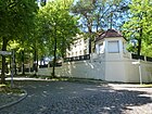
100 | Antony , French commune south of Paris in the Hauts-de-Seine department in the Île-de-France region , twin town of the Reinickendorf district | Oct 12, 2001 | The square between Dianastraße and Waidmannsluster Damm opposite the former residence of the High Commissioner of the French Republic for Germany was inaugurated on October 12, 2001 on the occasion of the 35th anniversary of the partnership. |

|
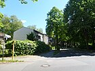
| At Dianaplatz
( Location ) |
180 | After the eponymous Dianaplatz. | before 1922 | It was laid out as street 4 of the development plan and is already shown by name on a map of the Reinickendorf district from 1922. It connects Dianastraße with Waidmannsluster Damm. |
|
| At the Leitbruch
( Location ) |
130 | Leitbruch , a branch half an arm's length, freed from the bark between the needles or leaves, points with the grown tip in a certain direction. | Oct 1, 1977 | The footpath connects Waidmannsluster Damm and Bondickstrasse. |

|
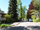
| At the change
( Location ) |
150 | Game passes , paths that animals use regularly | Apr 10, 1961 | The dead end street running from Dianastraße was created as street 377 of the development plan. |
|
| Artemis Street
( Location ) |
590 (in the district) |
Artemis , in Greek mythology the goddess of the hunt, the forest and the guardian of women and children. | Jan. 9, 1961 | The street lies in a north-south direction between Waidmannsluster Damm and the district boundary (middle of the Tegeler Fließ ). In Hermsdorf , another 30 meters lead to the ring of Brandtstrasse, but the name-changing street sign is on the north bank of the local bridge over the Tegeler Fließ. From 1902 to 1961 it was called Kurhausstrasse after the Kurhaus "Bergschloß" on a hill on Waidmannsluster Damm 178. |

|
|
Benekendorffstrasse
( Location ) |
900 (in the district) |
Franz Ulrich von Benekendorff (1848–?), Owner of the Kühn brickworks founded in Lübars in 1854 . | before 1922 | The street is located in Waidmannslust with lots 1–83 (odd) and 2–82 (even) between Düsterhauptstraße and the suburbs in Büchenbronner Steig. The road continues to Lübars and leads there in the eastern part as a footpath and bike path through the LSG Tegeler Fließ to Alt-Lübars. The street originally only ran from Düsterhauptstraße to Oraniendamm. On January 18, 1936, the Ziegeleiweg, which led from Oraniendamm (Waidmannslust) to main street in Lübars (today Alt-Lübars), was renamed Benekendorffstraße. The existing Benekendorffstrasse was thus extended to Lübars. Previous names were Hermsdorfer Weg (before 1925-1934), Ziegeleiweg (after 1911-1936), Triberger Straße (before 1925-1934) |

|
| Bondickstrasse
( Location ) |
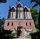
850 | Ernst Bondick (1836–1892), forester, innkeeper, founder of the country house colony Waidmannslust. | before 1902 | The road runs from "Nach der Höhe" to Steinbergpark . It is already listed in the Berlin address book from 1902. |
|
| Büchenbronner Steig
( Location ) |
170 (in the district) |
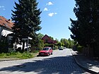
Büchenbronn , municipality on the edge of the Black Forest, since 1974 part of Pforzheim , Baden-Württemberg | Apr 10, 1961 | The street lies with the western, odd numbered plots 3 and 5 in the district, the even plots on the eastern edge of the road and the road land belong to Lübars . The paved road lies between Beneckendorffstraße and Zehntwerderweg and leads unpaved under this name to Hauptwanderweg 13 ( Barnimer Dörfer Weg ) on Lake Hermsdorfer See, the adjacent area to the west is part of the Ziegeleibecken grassland, the eastern properties and the path are in Lübars. The street was laid out as street 177 according to the development plan and carried this name until 1961. |
|
|
Dianaplatz
( Location ) |
80 × 80 | Diana , in Roman mythology the goddess of the hunt, the moon and childbirth, protector of women and girls | before 1902 | It was laid out as place A of the development plan and was already listed in the Berlin address book from 1902. The small square is between Dianastraße and “Am Dianaplatz”. |

|
| Dianastrasse
( Location ) |
1040 | Diana , in Roman mythology the goddess of the hunt, the moon and childbirth, protector of women and girls | before 1902 | Dianastraße is located between Oranien- and Waidmannsluster Damm in a north-east-south-west direction. It leads through the railway bridge, turns to the east and continues over the Oraniendamm in Zehntwerder Weg. It is already listed in the 1902 address book. |

|
| Gloomy Main Street
( Location ) |
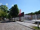
850 | Düsterhaupt, 19th century, partner in Benekendorff, owner of the brickworks founded in 1854, was one of the founders of the Waidmannslust country house colony around 1890 | before 1902 | The street already noted in the address book of 1902 runs from Oraniendamm to Dianastraße. Between Oraniendamm and Waidmannsluster Damm, it runs as a private road over the hardware store there. Together with the commercial area on Oraniendamm, it is the only commercial street in Waidmannslust. |
|
|
Egidystrasse
( Location ) |
80 (in the district) |
Moritz von Egidy (1847–1898), German lieutenant colonel, pacifist social ethicist, writer | before 1904 | The street itself and the land adjacent to it on both sides lie entirely in Tegel . The district boundary runs to the rear of the eastern properties and only one access between the Tegeler properties 42 and 44 leads to Waidmannsluster Flur, here at Egidystraße 42b is the KGA Fließal in Waidmannslust. In the 1904 address book for Berlin and the suburbs, Egidystraße is the only street in the "Freie Scholle" estate belonging to Tegel. The owner of the houses is given as the “Freie Scholle” cooperative, founded in 1895 by Gustav Lilienthal with the participation of “Freilandgruppen” from Berlin. Their founding concept envisaged joint ownership of land for the “capitalless worker”, who should thus have a permanent home. Construction of the house began in 1899 and the first four apartments were ready a year later. |

|
| Ettenheim path
( Location ) |
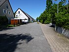
350 | Ettenheim , town in the Ortenau district in Baden-Württemberg. | Oct. 27, 2000 | The street as a 30s zone is with lots 4–66 (even) on its west side between Zabel-Krüger-Damm and Höllentalweg and is only accessible to the public via the last one, there are no lots on the (uneven) east side. It leads from the Höllentalweg to the Zabel-Krüger-Damm, up to which it is not carried out, but ends as a dead end. |
|
| Eutinger way
( Location ) |
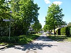
170 | Eutingen im Gäu , municipality in the Freudenstadt district in Baden-Württemberg | Apr 10, 1961 | It was created as street 2 of the development plan and leads from Oraniendamm to Gutachstraße. |
|
|
Florastrasse
( Location ) |
100 | Flora , goddess of blossom and spring in Roman mythology | before 1922 | It leads from the Düsterhauptstrasse to the Oraniendamm. |

|
| Fürst-Bismarck-Strasse
( Location ) |
220 | Otto von Bismarck (1815–1898), German politician, Chancellor of the German Empire | before 1908 | The cul-de-sac from Dianastraße was already noted on a map from 1908. It leads to the Catholic school Salvator. |

|
|
Gutachstrasse
( Location ) |
430 | Gutach , municipality in the Ortenaukreis in the central Black Forest | before 1922 | It was called Straße 31 at the plant and leads from Zabel-Krüger-Damm to Zehntwerderweg. |

|
|
Halali Street
( Location ) |
150 | Halali , both greeting and hunting call from the hunter's language as well as hunting customs. | before 1912 | It leads from Artemisstraße to Hubertusstraße. |

|
| Hochjagdstrasse
( Location ) |
250 | Hunt , term from the hunter's language, hunt for all huntable ruminants. | Jan. 9, 1961 | From 1912 to 1961 it was called Kirchstrasse after the Queen Luise Church located here . It leads from Waidmannsluster Damm to Nimrodstraße and Avenue Charles de Gaulle. |

|
|
Höllentalweg
( Location ) |
180 | Höllental , valley in the southern Black Forest in Baden-Württemberg | Nov 1, 1968 | It was created as Straße 200 and connects Schluchseestraße with the Ettenheimer path. Another part runs parallel to the Ettenheimer path to develop the properties there. |

|
| Horber Street
( Location ) |
200 | Horb am Neckar , town in the southwest of Baden-Württemberg | Jun 1, 1996 | It leads from Zabel-Krüger-Damm to Zehntwerderweg and Wolfacher path. |

|
| Hubertusstrasse
( Location ) |
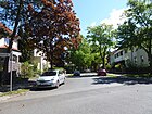
320 | Hubertus von Lüttich (~ 656– ~ 727), Saint Hubertus, patron saint of hunters | before 1908 | It is already shown on a map from 1908 and leads from Waidmannsluster Damm to Dianastraße. |
|
|
Lahr path
( Location ) |
350 | Lahr / Black Forest , city in the west of Baden-Württemberg | May 11, 1938 | It was created as street 16 of the development plan and leads from Zabel-Krüger-Damm to Benekendorffstraße, as well as a footpath south of Zabel-Krüger-Damm. |

|
| Lierbacher way
( Location ) |
200 | Lierbach , district of Oppenau in Baden-Württemberg. | May 11, 1938 | It connects the Zabel-Krüger-Damm with the Benekendorffstraße. |

|
|
According to the height
( Location ) |
220 | South of the street is the Wittenauer Steinberg . | before 1922 | The street leads from Waidmannsluster Damm and Hubertusstraße to Nimrodstraße. It is first mentioned in the 1922 address book. |

|
| Nagold path
( Location ) |
270 | Nagold , town in Baden-Württemberg | May 11, 1938 | It was created as street 4a of the development area and connects Oraniendamm and Horber Straße. |

|
| Nimrodstrasse
( Location ) |
1050 | Nimrod , ancient oriental mythical hero and king mentioned in the Bible and the Koran, great hunter | before 1902 | It leads from Jean-Jaurès-Straße to Waldhornstraße and ends there as a dead end. It is already listed in the 1902 address book. |

|
|
Oraniendamm
( Location ) |
990 | Orange , name of the ruling royal family of the Netherlands. The name Orange originally comes from the Provencal county of Orange, later the Principality of Orange in what is now France | before 1922 | The Oraniendamm lies between the border with Wittenau am Packereigraben (at the level of Straße 199) and the border with the hamlet of Hermsdorf on the bridge over the Tegeler Fließ and is therefore completely in Waidmannslust. The Oraniendamm is a section of the federal highway 96 . |

|
|
Pforzheimer Strasse
( Location ) |
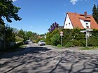
415 | Pforzheim , city in the north-west of Baden-Württemberg | Dec 17, 1959 | It leads from Benekendorffstraße to Tiefenbronner Weg and from there as a footpath to Wolfacher path. |
|
|
Schluchseestrasse
( Location ) |
1100 (in the district) |
Schluchsee , reservoir in the southern Black Forest | Nov 1, 1968 | It was created by merging roads no. 165 and 9 and leads from Zabel-Krüger-Damm and Schonacher Strasse to Öschelbronner Weg and Am Osrücke. The street opens up the "Rollberg settlement" that was built between 1966 and 1972 and is also known as the "Black Forest settlement" because of the street names named after Black Forest locations. |

|
| Schonacher Strasse
( Location ) |
340 | Schonach in the Black Forest , municipality in the Schwarzwald-Baar district, Baden-Württemberg | before 1922 | It was called Straße 29 at its facility and leads from Zabel-Krüger-Damm and Schluchseestraße to Zehntwerderweg. |

|
| Street 167
( Location ) |
150 | still existing designation of the development plan | after 1936 | The street lies between Höllentalweg and Straße 199 and then ends in a southerly direction as a dead end. |

|
| Street 199
( Location ) |
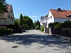
170 | still existing designation of the development plan | after 1936 | It leads from Oraniendamm to road 167. |
|
|
Tegernau line
( Location ) |
160 | Tegernau (Kleines Wiesental) , part of the municipality Kleines Wiesental, Loerrach district, Baden-Württemberg | Nov 1, 1968 | The access road starting from Titiseestraße as a spur road was created as road no. 452 . |

|
| Tiefenbronn way
( Location ) |
190 | Tiefenbronn , municipality in the Enzkreis in Baden-Württemberg | Dec 17, 1959 | It was laid out as Straße 175 and leads from Benekendorffstraße to Pforzheimer Straße. |

|
| Titiseestrasse
( Location ) |
710 | Titisee , lake in the southern Black Forest in Baden-Wuerttemberg | Nov 1, 1968 | Before street 451 of the development plan. The street in the "Rollberg-Siedlung" leads from Schluchseestrasse to Zabel-Krüger-Damm. |

|
| Todtnauer line
( Location ) |
170 | Todtnau , town in the southern Black Forest in the district of Loerrach, Baden-Wuerttemberg | Nov 1, 1968 | The access road in the "Rollberg-Siedlung" branching off from Titiseestrasse as a spur road was created as road no. 453 . |

|
| Driver path
( Location ) |
390 | Drivers , scare away people when hunting game | Nov 1, 1968 | The street with a second arm that leads off Dianastraße ends as a dead end. It was created from parts of Street 4a and Street 7 . |

|
|
Waidmannsluster dam
( Location ) |
1590 (in the district) |
Waidmannslust , part of the Reinickendorf district | Aug 6, 1937 | In the district, the street lies between Egidystraße (east of their property number 19) and Oraniendamm with properties 81–193 (odd) and 82–190 (even). It continues as a two-lane road to the west in the Tegel district. It was created in 1937 from Waidmannstrasse and Hermsdorfer Strasse (from 1898 to around 1907 Hermsdorfer Weg ). |

|
| Waldhornstrasse
( Location ) |
250 | French horn , brass instrument | Apr 1, 1962 | It runs from Nimrodstraße to Waidmannsluster Damm. The previous name was Waldstrasse from before 1925 to 1962 . The road led through a wooded area. Today there is the Steinbergpark, which was created between 1924 and 1933 on part of Ernst Bondick's forest property. |

|
| Waldshuter line
( Location ) |
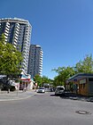
140 | Waldshut-Tiengen , twin town in the southwest of Baden-Württemberg | Nov 1, 1968 | The access road starting from Titiseestraße as a spur road was created as road 454 in the "Rollberg-Siedlung". The 22-storey double high-rise on Titiseestrasse from 1971 was designed by Hans Scharoun . | |
| Wolfach path
( Location ) |
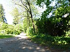
330 | Wolfach , city in the central Black Forest in the Ortenaukreis in Baden-Württemberg | Nov 1, 1964 | It emerged from streets no.184 and 201 . As a continuation of Horber Straße, it goes in a curve from Zehntwerderweg. |
|
|
Zabel-Kruger Dam
( Location ) |
920 (in the district) |
Wilhelm August Zabel-Krüger (1834–1915), landowner, local politician | Aug 6, 1937 | The road leads from the busy Oraniendamm intersection to Alt-Lübars in the Lübars district . The plots 1–69 (odd) and 12a – 70 (even) are located in the district between Oraniendamm and the district boundary at Erlenbruchgraben. From before 1922 to 1937 and 1945/1946 it was called Platanenstrasse . In the years 1966–1972, the "Rollberge-Siedlung", a new residential complex with over 2000 apartments, was built between the Zabel-Krüger-Damm along the Schluchsee- and Titiseestrasse, the exterior of which is similar to the rental housing in the Märkisches Viertel . Various architects such as Josef Paul Kleihues , Heinrich Moldenschardt u. a. designed individual buildings. The 22-storey twin high-rise on Titiseestrasse was designed by Hans Scharoun |

|
| Zehntwerderweg
( Location ) |
1070 (in the district) |
Zehntwerder, old hallway name | July 10, 1933 | The street lies between Oraniendamm / Dianastraße and Deilingeweg, of which in the district between Oraniendamm and the district boundary on Elsenbruchgraben (Büchenbronner Steig) with lots 3–89 (odd) and 8–100 (even) and continues east in Lübars . The previous name was Street 160 . On March 15, 1936, the extension, roads No. 1, 173 and 181 , was also named Zehntwerderweg. |

|
Other locations in the district
Allotment gardens
- Garden association 'Fließal' (street code according to RBS: 09194) whose access is only possible from Egidystraße in Tegel, so it has the postal address Egedystraße 42b. The allotment garden 12024 (according to the development plan) with 42 plots is located on 15,956 m² of state-owned leased land and has the status of a fictitious permanent plant.
- KGA 'Steintal' is located between Schluchseestrasse and Packereigraben and borders the Wittenau district there . The fictitious permanent allotment garden 12062 has the address Schluchseestrasse 52-54 and is located in 43 plots on 13,831 state-owned leased land.
Parks
- Albtalpark (road code according to RBS: 08175) which continues over the district boundary at Erlenbruchgraben to Lübars. In the park is the Bräuningbecken into which the Ziegeleigraben flows, which comes from the Lahrer path.
- Waldpark Steinberg (road code according to RBS: 07988): It is located in the southwest of the district, south of Wilhelmsruher Damm and Nimrodstrasse and is bounded in the south (and west) by the Packereigraben to the district of Wittenau, with the trench in Waidmannslust.
- The LSG Tegeler Fließal is located with its eastern part in the district, north of Waidmannsluster Damm / Dianastraße. It is demarcated by the Tegeler Fließ to the district of Hermsdorf . On the south bank of the Tegeler Fließ coming from Hermsdorf and on to Lübars through the LSG Fliessal, the Barnim Dörferweg, No. 13 of the 20 green main routes in Berlin, leads.
See also
Web links
- Streets in Waidmannslust. Retrieved August 10, 2012 .
- Map of Berlin 1: 5000 with district boundaries. Senate Department for Urban Development Berlin, 2009, accessed on August 10, 2012 .
- Office for Statistics Berlin-Brandenburg: Directory of streets and places in the Reinickendorf district (as of February 2015); pdf
Individual evidence
- ↑ Angelika Giorgis: Francophiles in Reinickendorf. Berliner Zeitung , April 4, 2001, accessed on May 5, 2014 .
- ↑ FIS-Broker map display map of Berlin 1: 5000 (K5 color edition)
- ^ Luise Kurhausstrasse
- ↑ Förderkreis Reinickendorf ( Memento of the original from March 11, 2014 in the Internet Archive ) Info: The archive link was inserted automatically and has not yet been checked. Please check the original and archive link according to the instructions and then remove this notice.
- ↑ Benekendorffstrasse near Kaupert
- ↑ Egidystraße near Kaupert
- ^ Catholic school Salvator Waidmannslust
- ↑ a b compare street 169 . In: Berliner Adreßbuch , 1937, Reinickendorf → Tegelort administrative district, Waidmannslust with Lübars, Wilhelmsruh, Wittenau (including Borsigwalde), p. 2459.
- ↑ a b Basics of allotment garden law: on the term fictitious ( memento of the original from March 19, 2013 in the Internet Archive ) Info: The archive link was inserted automatically and has not yet been checked. Please check the original and archive link according to the instructions and then remove this notice. (PDF; 465 kB)
- ↑ a b Security level Vb: Fictitious permanent allotment gardens in accordance with Sections 16 and 20a of the Federal Allotment Garden Act, which are additionally protected by being shown in the land use plan as "green areas - allotments".
- ↑ The paths in detail: Barnimer Dörferweg,
- ↑ Senate Department for Urban Development: 20 main green paths


