
List of streets and squares in Berlin-Pankow


The following can be seen: The course of the Stettiner Bahn
from Anger (today: Breite Straße)
South : Mühlenstraße and Berliner Straße
North : Schloßstraße and Schönholzer Straße
(South- ) West : Wollankstraße
East : Damerowstraße to Pasewalker Straße.
The list of streets and squares in Berlin-Pankow describes the street system in the Berlin district of Pankow with the corresponding historical references. At the same time, this compilation is part of the lists of all Berlin streets and places .
overview
The district of Pankow includes the postal code areas 13187 and 13189. According to the official street directory, the public road network includes 116 dedicated streets with a total length of 56.7 kilometers. 64,945 people live in the residential buildings along these streets (as of December 30, 2019). 9.3 percent of the 604.7 kilometers of the entire Pankow district (including all 13 districts) are in the district. In addition to the Steglitz-Zehlendorf district (635.4 km) and the Treptow-Köpenick district (628.1 km), the district has one of the longest road systems in the capital.
In 1875, however, the Berlin address book (suburbs) only shows eleven streets for Pankow. With the growth of the imperial capital Berlin, the importance and immigration to the rural community of Pankow increased.
Pankow is connected to the trunk road system in a north-south direction. The B 109 , as Prenzlauer Promenade with connection to the A 114 , limits the district to the east. The B 96a , along the southern Berliner Straße, the Mühlenstraße (as a bypass) and the Schönholzer Straße, leads through the district between Prenzlauer Berg and Niederschönhausen. In addition to Mühlenstrasse, the northern section of Berliner Strasse is the main thoroughfare and leads directly to Breiten Strasse, the Pankower Anger. This route was adapted to the increasing traffic in 2009–2011 with the widening of the railway bridge. From the center of Pankow the traditional street system leads with Damerowstrasse to the east and Wollankstrasse to the west. This cross-connection in the north of Berlin is supplemented by Granitzstrasse, which leads south of the Stettiner Bahn and through Heinersdorf to Weißensee . In the 1950s this was the connecting route ( popularly : "Zeiser-Allee") from the small town of Niederschönhausen to Lichtenberg . This connection lost its importance in the 1960s when the politicians' homes were moved to the " Waldsiedlung Wandlitz ". A planned expansion on the Heinersdorfer side was omitted. On the southern edge of the district, east-west traffic runs over Wisbyer Straße, which has taken over traffic between Lichtenberg and Reinickendorf and to the city motorway again since the fall of the Berlin Wall in 1989 .
" Pankow , a parish village in the Niederbarnimer district [...] has 36 houses and 350 inhabitants, the Elisabethstift and many country houses [...] A road with an avenue of linden trees leads there."
In Pankow, different quarters can be distinguished according to the time they were built. The central area from Wollankstrasse in the west over the Anger to the beginning of Damerowstrasse belongs to the original area of the rural community. With the Szczecin Railway and the Northern Railway , the areas around today's S-Bahn stations Wollankstraße and Pankow were opened up for settlement, and property owners gave land for the new streets. In return, the streets were given the name of the owner, such as Gaillardstrasse.
As the settlement continued, the road system was expanded around the end of the subway on Vinetastraße. While there were still windmills on Mühlenstrasse around 1900, the northern side of Wisbyer Strasse, which belongs to Pankow, was expanded through settlement in the Nordic Quarter on the outskirts of Berlin. The expansion to the east along Damerowstrasse and the project planning in the Tyrolean quarter followed. By inflation and the First World War delayed the expansion followed the streets around the hospital Pankow. This current quarter north of Bleicheroder Straße and the Kissingenviertel (street name 1930) have monument status. The Kissingenviertel also shows how the events of the time led to the planning change; streets were planned and already named, the route of which was never realized.

In the 1950s, war damage was first repaired and areas filled. In the 1960s, new prefabricated buildings were built on open spaces such as in the Tyrolean quarter. The open space north of Elsa-Brändström-Strasse up to Binzstrasse was built on in the 1970s, followed in the 1980s by the development between the hospital district around Galenusstrasse and Pasewalker Strasse in the northeast. In the 2010s there was still free space in Pankow (such as at Garbatyplatz or between Flora- and Gaillardstraße) to close gaps, and this was followed by a residential estate on Killisch-von-Horn-Weg next to the Bürgerpark.
The naming of the streets gives the residents names for their district , especially since these streets were set up at the same time, as for the "Tyrolean Quarter" west of Mühlenstrasse on the southern edge of Pankow with street names after places in Tyrol. The expansion from the Pankow town center to the east, north of Damerowstrasse with street names to Harzorten north of Bleichroder Strasse, partly with single-family houses and partly with multi-family houses, began around 1905 and will continue along Galenusstrasse with the streets named after doctors around the former Pankow hospital in the north-east of the district . The Kissingenviertel south of Granitzstrasse, in which the streets are named after places in Franconia , has been planned and built on at a uniform time since 1930 and is listed as a unit in the list of monuments . In the south-east, in continuation of the Nordic Quarter, across Wisbyer and Bornholmer Strasse, there is a street system with reference to Scandinavia , both to people and to places, this source of naming in the new buildings south of Arnold-Zweig-Strasse since the 1980s has been recorded. The names also reflect temporal relationships: in the town center, the old connecting routes between Wollankstrasse and Stettiner Bahn are named after Pankow personalities, for the streets that were newly laid out shortly after 1900 on the borderline of Berlin (east of Berliner Strasse, south of Vinetastrasse) are locations giving its name to Rügen .
Overview of streets and squares
The following table gives an overview of the streets and squares in the district as well as some related information.
- Name / location : current name of the street or square. Via the link Location , the street or the square can be displayed on various map services. The geoposition indicates the approximate center of the street length.
- Traffic routes not listed in the official street directory are marked with * .
- Former or no longer valid street names are in italics . A separate list may be available for important former streets or historical street names.
-
Length / dimensions in meters:
The length information contained in the overview are rounded overview values that were determined in Google Earth using the local scale. They are used for comparison purposes and, if official values are known, are exchanged and marked separately.
For squares, the dimensions are given in the form a × b for rectangular systems and for (approximately) triangular systems as a × b × c with a as the longest side.
If the street continues into neighboring districts, the addition ' in the district ' indicates how long the street section within the district of this article is. - Name origin : origin or reference of the name.
- Notes : further information on adjacent monuments or institutions, the history of the street and historical names.
- Image : Photo of the street or an adjacent object.
| Name / location | Length / dimensions (in meters) |
Origin of name | Date of designation | Remarks | image |
|---|---|---|---|---|---|
|
Achtermannstrasse
( Location ) |
540 | Achtermannshöhe , mountain in the Harz | Jan. 16, 1925 | The street runs between Mendel- and Vesaliusstraße.
Housing complex and courtyard, 1927 (monument), complete complex Achtermann- / Bleicheroder Straße, 1922/1923 |

|
| At the wet angle
( Location ) |
380 | Moist corner , a parcel, now also the local allotment garden | June 5, 2001 | The street connects the Prenzlauer Promenade with the federal highway 14 at the southern connection. |

|
| At the castle park
( Location ) |
800 (in the district) |
Palace gardens at Schönhausen Palace in Niederschönhausen | 1800 | The road was first referred to as the Schwarzer Weg and was a much-used connection to French Buchholz . The road forms the district boundary to Niederschönhausen , the area north of the road belongs to the Niederschönhausen Castle Park and is undeveloped.
Pankow Music School, 1893 (monument). |

|
|
Amalienpark
( Location ) |
120 | Amalie of Prussia , Princess of Prussia | 1897 | The site was acquired by the Landhaus-Baugesellschaft Pankow and built on with a residential ensemble of multi-storey rental apartments (No. 1–8) according to plans by the secret building councilor Otto March . When it was completed in 1897, the residential complex was a novelty because it consisted of multi-storey houses in individual buildings, each surrounded by small gardens. The Amalienpark 4/5 house was partially destroyed in the Second World War.
Despite the park in its name, it is a street that runs in a U-shape from and to Breite Straße and encloses an 80 × 60 meter green space of the same name. |

|
| Andreas-Hofer-Platz
( Location ) |
120 × 110 | Andreas Hofer (1767–1810), Tyrolean freedom fighter from 1809 | around 1910 | The square, located on the Esplanade, was listed in the address book as vacant until 1928. Since in 1930 "jewelry plant" is specified, it must have been designed as a square around 1929 . The current appearance corresponds to a park on the flat Brennerberg, which is characterized by trees and bushes. To the north it is bounded by the Tiroler Straße, to the east by the Toblacher and west by the Brixener Straße. The place is popularly called “Der Brenner”. |

|
| Arkonastrasse
( Location ) |
240 | Arkona , foothills on Rügen | before 1905 | The street branches off from Kissingenstrasse. The development along the traffic route began in the 1920s; In 1929 there were eight developed properties. It is a cross street from Borkumstrasse. |

|
| Arnold-Zweig-Strasse
( Location ) |
760 | Arnold Zweig (1887–1968), writer | Feb. 8, 1978 | It was created when designing the open space south of Binzstrasse on both sides of Neumannstrasse. The development as a street from the 1980s is not completed. |

|
| Asta-Nielsen-Strasse
( Location ) |
220 | Asta Nielsen (1881–1972), Danish actress | Jan. 14, 1999 | Before it was renamed, the street was part of Arnold-Zweig-Straße, which had not yet been laid out here. |

|
|
Baumbachstrasse
( Location ) |
330 | Max Baumbach (1859-1915), sculptor working in Berlin (statues of rulers, for example in Siegesallee ) | 1909 | The name that was valid between 1895 and 1909 was Behnsenstrasse . |

|
| Benjamin-Vogelsdorff-Strasse
( Location ) |
150 | Benjamin Vogelsdorff (1881–1961), Pankow-based dentist and Jewish victim of the Nazi regime | Nov 9, 1994 | The comparatively short street, set up as street 22 , lies between Duseke and Mühlenstraße; embassies and residences were built on it in the mid-1970s . |

|
|
Berlin street
( Location ) |
1570 (in the district) |
Access road to Berlin | around 1650 | From the 17th century to around 1895 the street was called Berliner Weg (but more in the alignment of Mühlenstraße ). From 1824 to around 1895 the still valid street layout developed as Berliner Chaussee , which connected Pankow and the Niederschönhausen Castle in a north-south direction with old Berlin . At the northern end this street meets the eastern tip of the Breite Straße. Ossietzkystraße can be seen as a continuation with a slight bend; south it merges into Schönhauser Allee .
No. 12/13; Post office , built in 1924 according to plans by Carl Schmidt (monument). Special feature: a piece of the earlier Berlin pneumatic tube system has been preserved here. Litter box with bus shelter and newspaper kiosk around 1914 (monument) The beer publisher E. Willner ran a brewery on the grounds of Berliner Straße 80 / Prenzlauer Straße 53-55 (WBB - Willner Brewery Berlin). The preserved buildings are listed and were opened on May 1, 2013 as a new "Kulturbrauerei". The complex belongs to Nicolas Berggruen , who leased it to an artist group. Culture of all kinds should be offered in the buildings such as theater, fashion shows, performances. An exhibition from the history of the brewery is shown in the historic brewery. No. 120/121: Former Jewish orphanage from 1912 (monument), used as the embassy building of the Republic of Cuba during the GDR era . It has been reconstructed and has housed the Janusz Korczak library of the Pankow district since the late 1990s . No. 122/124: Complex of several buildings as a factory based on a design by Paul Überholz built towards the end of the 19th century No. 126/127: Villa Garbáty, 1876 (monument) No. 161: Switching house , around 1900 (monument) The road was thoroughly repaired and expanded between 2010 and 2012. |
![Post office Pankow I from 1919 [18]](https://de.wikipedia.org/wiki/Datei:Postamt_Pankow_I_(2010).jpg)
|
| Binzstrasse
( Location ) |
980 | Binz , place on Rügen | around 1905 | A street at the level of Binzstrasse can be found in the Hobrecht plan from 1862. |

|
| Bleicheroder Strasse
( Location ) |
540 | Bleicherode , town near Nordhausen, Thuringia | around 1911 | The dominant complex is the residential complex built according to plans by Carl Fenten and Rudolf Klante from the years 1922/1923 (monument). |

|
| Borkumstrasse
( Location ) |
550 | Borkum , East Frisian island | 1905 | Originally, it was planned to run like Binzstrasse from Berliner Strasse to Prenzlauer Promenade. However, due to planning changes, it ends at Neumannstrasse. |

|
| Brehmestrasse
( Location ) |
770 | Albert Brehme (1837–1913), master stonemason from Pankow , provided building land here | 1892 | From 1895 to 1901 there was the Central Station of the Electric Railway Pankow – Gesundbrunnen (1st Pankow tram station) on the property at Brehmestrasse 21/22. From around 1963 to 1990 there was a back-up system for the Berlin Wall on this street behind the southern row of houses from Wollankstrasse . |

|
| wide street
( Location ) |
600 | Dorfstrasse (Anger) of the former rural community, was given a descriptive name when the village was settled by Berlin citizens |
around 1876 (with interruption) |
It was initially Dorfstrasse , from June 26, 1971 to November 15, 1991 it was called Johannes-R.-Becher-Strasse . Part of Schulstrasse was also included in this renaming. It leads in two lanes in a west-east direction around the still clearly recognizable Anger. On it is the village church from the 15th century, expanded in the 19th century. Now the listed church is called the old parish church "To the four evangelists" . Under the house numbers 2 / 2a, 3a / 3b, 32 and 41 some houses have been preserved as architectural monuments. In addition, the Pankow town hall, built in the early 20th century, is located at the western end of Breite Straße. |
.jpg)
|
| Brennerstrasse
( Location ) |
220 + 220 | Brenner , alpine pass in Tyrol | around 1911 | About halfway along it is interrupted by Andreas-Hofer-Platz. |

|
| Brixener Strasse
( Location ) |
560 | Brixen , the oldest city in Tyrol | around 1911 | The development took place with the establishment of the Tyrolean Quarter, to the esplanade in the north and next to the plateau of the Andreas-Hofer-Platz further residential buildings were added in the 1960s. |

|
|
Crusemarkstrasse
( Location ) |
350 | Crusemark, one of the first settlers in Pankow | Aug 4, 1930 | The street is between Wolfshagener Straße ( Amalienpark ) and Am Schloßpark . The plan name until 1930 was Straße 5 IV .
As a citizen of Berlin, Crusemark was enfeoffed in 1438 with two courtyards, a farmyard and the associated arable land . The development of the street was planned by Hermann Jansen . |

|
|
Damerowstrasse
( Location ) |
1190 | Wilhelm Damerow (1802-1891), Pankow landowner and local politician | around 1885 | Before 1885 it was called Heinersdorfer Weg . Here there is a gazebo from 1895 and the second Pankow tram station used between 1901 and 1930 (plot 9-11), both of which are historical monuments. |

|
| Dettelbacher way
( Location ) |
420 | Dettelbach , Lower Franconian town near Kitzingen | Aug 4, 1930 | The entire development of Dettelbacher Straße belongs to the listed housing estate Kissingenviertel, 1925–1936, including the courtyard-like formations of Birkenhof , Kastanienhof , Tannenhof , 1930–1931. |

|
| Dolomite Road
( Location ) |
830 | Dolomites , a mountain range of the southern Limestone Alps in Trentino-South Tyrol | around 1910 | A planned extension via Mühlenstraße with a connection to Borkumstraße (Straße 1) was abandoned around 1925. |

|
| Dusekestrasse
( Location ) |
320 | old resident Slavic family Duczek (Duseke) | Aug 4, 1930 | It connects Schulstrasse across Benjamin-Vogelsdorff-Strasse with Florastrasse.
No. 43: Park Sanatorium , 1899–1900 (monument) |

|
|
Eintrachtstrasse
( Location ) |
150 | Eintracht was the choice of name after disputes over competence between Pankow construction companies | 1905 | The street runs from Breiten Straße to Wolfshagener Straße.
Eintrachtstraße 2–4, 7–9, apartment building group with front gardens 1904–1905 (No. 2–4, 7–9, BD) |

|
| Elisabethweg
( Location ) |
200 | Elisabeth Christine (1715–1797), Queen of Prussia | before 1898 | At first it was called Feldweg zu den Pankewiesen . It connects Parkstrasse with Ossietzkystrasse in a bent north-west route. In the address book of the year 1898, an inn at the Pankgrafen is given here. |

|
|
Elsa-Brändström-Strasse
( Location ) |
1030 | Elsa Brändström , Swedish philanthropist in Russian prison camps of World War I worked | March 27, 1936 | Before 1910 until March 27, 1936 it was called the Lindenpromenade . It forms the connection from Berliner Straße to Prenzlauer Promenade . At the corner of Brändströmstrasse and Trelleborger Strasse is the Evangelical Hope Church , built in 1912–1913 according to plans by Walter Köppen and consecrated in 1913. |

|
| Eschengraben
( Location ) |
1240 | after the Eschengraben originally present here | Nov 26, 1925 | Planned before naming as Straße 25 between Berliner Straße and Prenzlauer Promenade. In its current route, it turns north in the new development area in front of the Prenzlauer Promenade. |

|
| Esplanade
( Location ) |
1000 (one side in the district) |
Esplanade : originally an open area in front of a citadel . It was a frequently used street name in the early days . | after 1877 | The street forms the border with the Prenzlauer Berg district , to which the southern development belongs. |

|
| Flora promenade
( Location ) |
370 | Flora , Roman goddess of flowers and youth | 1912 | It got its name after the previously named Florastraße, from which the promenade runs as a cross street to the south; today it extends to the Szczecin Railway. At number 4 there is a four- story clinker cladding building from 1926/1927, in which the AOK Pankow had its administration. During the GDR era, the building was still used for the state social insurance. |

|
|
Florastrasse
( Location ) |
1130 | Flora , Roman goddess of flowers and youth | around 1892 | The road was laid out in sections as the main connecting road between the eastern and western Pankow. It was originally intended to be extended beyond Wollankstrasse. Because the street led through nurseries and flower fields, the name of the flower goddess Flora was chosen. At the level of the Berlin-Pankow S-Bahn station, it touches Garbátyplatz . Most of the well-preserved and listed residential buildings date from the beginning of the 20th century. A striking feature of Florastraße is the train station with Florastraße 22. |

|
| Forchheimer Strasse
( Location ) |
310 | Forchheim , Upper Franconian district town, old royal town | Aug 4, 1930 | Forchheimer Strasse is only built on on the west side. The houses (1–27 odd) belong to the building ensemble (see picture) Kissingenviertel, 1925–1936, which is listed as a monument. |

|
|
Gaillardstrasse
( Location ) |
490 | Karl Friedrich Heinrich (Charles Frédéric Henri) Gaillard (1859–1911), Pankow landowner and local politician, made building land available from his property | 1903 | From 1887 to 1903 the street was called Communicationsweg . According to the address book from 1894, the houses at the corner of Florastraße and Communicationsweg belonged to the merchant Gaillard. The 'Second Pankower Community Cemetery' (which has been closed since 2000) is on this street (plot 3). Next to it was the Pankow poor house around 1900 . |

|
| Galenusstrasse
( Location ) |
740 | Claudius Galenus (called Galēn , around 129–199 or 216), Greek physician | 1906 | The street is located at the former Pankow Municipal Hospital .
The inner courtyard and front gardens of the Krankenhausviertel residential complex , 1924–1927, are architectural monuments. |

|
|
Garbáty Square
( Location ) |
130 × 50 | Josef Garbáty (1851–1939), Jewish cigarette manufacturer whose company was located on Berliner Strasse | Jan. 23, 2001 | It is the forecourt to the Pankow S-Bahn station along Florastraße, which was previously unnamed. Reserved for the planned extension of the subway to Nordend, the sides of the square were developed in 2011. From 2011 to 2012 there was a mobile exhibition building on the subject of "Schaustelle Berliner Straße | History-Present-Future". The container was dismantled in mid-2012 and gave way to a retail and medical center with modern architecture. When this was completed, there were protests about the dark facade, which ended with a compromise in 2013. |

|
| Gemündener Strasse
( Location ) |
400 | Gemünden am Main , Lower Franconian town in the Main-Spessart area | May 17, 1930 | The building on both sides of the street (house 1–42) belongs to the Kissingenviertel residential complex (see picture), 1925–1936 (monument) |

|
|
Görschstrasse
( Location ) |
400 | Heinrich Görsch (1840–1919), Pankow nursery owner, who parceled out his asparagus fields for building purposes in the 1880s | after 1888 | In 1898 some of the eight parcels were already built on. The traffic route connects Wollankstrasse with Florastrasse.
A house built in the 21st century (house number 38) was awarded the German Facade Prize in 2009. |
 
|
| Granitzstrasse
( Location ) |
1280 | Granitz , a wooded ridge in the southeast of the island of Rügen | around 1906 | Granitzstrasse is only built on the south side with residential houses, the newer commercial buildings on the northeast corner belong to the Prenzlauer Promenade. The houses 9–42 continuously belong to the building ensemble of the Kissingenviertel residential complex, 1925–1936 (monument) Granitzstraße along the Bernauer Bahn was initially a private railway road and was expanded to a public street in 1912, after which it became a residential street. After the war years it became important in East Berlin as a connection from Pankow to Lichtenberg and, since the fall of the Wall, as a replacement for the missing northern bypass. The residential buildings were built by the “Gemeinnützige Baugesellschaft” (9–28) and “Stadt und Land” (29–42). In 1936 Granitzstrasse 7 and 8 were owned abroad and number 38 was the Kastanienhof children's home. The gardens gave the blocks their names after the tree species cultivated: Kastanienhof 29–32, Birkenhof 34–37, Tannenhof 39–42. In the 2000s, the apartment blocks that were open to the street were redensified with the residential houses at the end facing the street. |

|
| Greta Garbo Street
( Location ) |
240 | Greta Garbo (1905–1990), Swedish film actress | March 15, 1999 | Laid out and partly built on in the 1980s, it connects the Trelleborg with Neumannstrasse. |

|
| Grunowstrasse
( Location ) |
275 | The Grunow family long-established in Niederbarnim, a Pankow family member made land available for road construction in Pankow | around 1906 | It lies between Schulstrasse (north) and Florastrasse (south).
No. 8–11: Health center, 1926–1928 (monument) No. 17: 2nd community school Pankow, 1903 (monument), |

|
|
Hadlichstrasse
( Location ) |
630 | Heinrich Julius Hadlich (1844–1889), doctor in Pankow, chairman of the citizens' association | around 1906 | From 1903 to 1906 it was called the Stettiner Weg . The Weißenseer Weg was also part of the traditional street course before 1906 . The proposal to name the street after Garbaty had not been approved.
No. 2: Evangelical parish hall, 1895 (monument) The extensive garages of the Garbaty cigarette factory were located on Hadlichstraße 3, which belonged to the Evangelical parish until 1920. Hadlichstrasse 40 (previously 31) belonged to the doctor Simon Adler, who died in 1921, since 1904, the son-in-law of the Pankow doctor Mendel. After this Adler was the director of the Pankow hospital. The property has belonged to Garbaty-Rosenthal since the 1920s. |

|
| Hallandstrasse
( Location ) |
570 | Halland , historical province in Sweden, on the coast of the Kattegat | March 11, 1938 | In the south Halland borders on Schonen (Skåne), like here the Schonensche Straße as a parallel street. Before (probably since 1910) it was called Prinz-Heinrich-Straße . |

|
| Hardangerstrasse
( Location ) |
120 | Hardanger : Region in the Norwegian province of Hordaland | Nov 19, 1926 | The street was initially laid out as street 29 . |

|
| Harzburger Strasse
( Location ) |
100 + 100 | Bad Harzburg , town in the Harz region, Lower Saxony | around 1906 | In today's course it has remained incomplete compared to earlier planning; it begins / ends at the square on Klaustaler Strasse. |

|
| Harzgeroder Strasse
( Location ) |
120 | Harzgerode , town in the Harz, Saxony-Anhalt | 1904 | This road was not laid out as planned; it begins / ends at the square on Klaustaler Strasse. |

|
| Hasseroder Strasse
( Location ) |
100 | Hasserode , district of Wernigerode , Saxony-Anhalt | 1907 | The traffic route goes east from the square on Klaustaler Straße. It opens up the residential area in terms of traffic. |

|
| Hassfurter Weg
( Location ) |
190 | Haßfurt , Lower Franconian town near Bamberg | Aug 4, 1930 | The residential development on both sides (houses 1–18) belongs entirely to the building ensemble of the Kissingenviertel residential complex (see picture), 1925–1936 (monument) |

|
| Heinz-Knobloch-Platz
( Location ) |
165 × 75 | Heinz Knobloch (1926–2003), writer and columnist, lived and worked in Pankow | March 3, 2005 | Along with the naming of the town square, a memorial stone for Knobloch was unveiled. The square between the Samland and Masurian Roads contains playgrounds and resting areas. It is bounded to the west by Mühlenstrasse and to the east by Berliner Strasse. |

|
| Herthastrasse
( Location ) |
170 | Germanic goddess Nerthus (mother of the earth) at Tacitus as Hertha | 1908 | Located north of Wisbyer Straße in the southeast of the district, the development took place in the 1910s together with the Nordic Quarter (Prenzlauer Berg). |

|
|
Heynstrasse
( Location ) |
370 | Fritz Heyn (1849–1928), Berlin cane chair manufacturer and deputy mayor in Pankow | 1891 | Heynstrasse runs between Florastrasse and the former route of the Szczecin Railway . Heyn had bought large areas along what would later become the street and had them built on (according to the 1900 address book, he still owned 23 properties).
There are numerous architectural and garden monuments on this street, including No. 8: garden courtyard with arbor, fountain and garden sculptures from around 1900 behind the residential building, in which the 'Pankower District Chronicle' used rooms until 1989. The building belongs since moving home history collection (from 2001, Friends of the Chronicle of Pankow e. V. ') for Dietzgenstraße 42 in the district Niederschonhausen as location Heynstraße the Museum Association Pankow. The home-style living area of the Heyn family is shown here on the first floor, while there are changing special exhibitions on the ground floor. The chair factory was in the neighborhood, Heynstrasse 10–15. No. 21–24: A building from 1910, which was built as a residential area and has a spacious inner courtyard. |

|
| Hiddenseestrasse
( Location ) |
300 | Hiddensee , island west of Rügen | around 1910 | It runs between Borkumstrasse and Kissingenstrasse. In 1911 it had 16 parcels, with the reference to construction sites (1–14) or new construction by Diana Grunderwerbs-Gesellschaft mbH. |

|
|
In the flora gardens
( Location ) |
220 | The name refers to the proximity of the Florastraße in which it emphasizes the garden settlement | July 6, 2012 | It is a cross street of Gaillardstrasse on the site of the former electrical ceramic factory. The street opens up a new housing estate and goes from Gaillardstraße to the east to the housing developments and Görschstraße. This settlement is located behind the property on Florastrasse between Gaillardstrasse and Görschstrasse. The naming of the private road occurs at the request and expense of the owner of the construction site for the new residential location typical of the environment with the name “Floragärten Berlin-Pankow”. The Urbanspaces group of companies developed the building project for the Kondor Wessels Group at Florastraße 5-7, Gaillardstraße 33-44 and Görschstraße 17. The private road serves as a ring road for the inner development of the area with one short spur road to the north and two south branching roads. The designation serves to ensure sufficient orientation possibilities , in particular through the inclusion in the system of fire brigade, police, line companies, navigation systems and other public bodies. The query at the other offices did not reveal the same designation intentions. The naming procedure was carried out in accordance with Section 5 (1) sentence 2 of the Berlin Roads Act. The residential buildings 4–30 (even) and 3–41 (odd) belong to the street; it is not included in the Berlin street directory as an owner's private street. In 1928 the continuous Rettigstraße was planned in the area, in 1937 as Rettichweg. Of that, the stump of Görschstraße remained, which fits the new street but is cordoned off from the flora gardens. | |
| Insel-Rügen-Weg
( Location ) |
710 | Baltic Sea island of Rügen with direct reference to the garden complex "Insel Rügen" eG Berlin-Pankow | Jan. 20, 2013 | The Insel-Rügen-Weg opens up the 'Insel Rügen' gardens, which are located behind the residential buildings in the square Borkum- / Neumann- / Binz- / Berliner Straße within the residential area. The branch of the Rosa Luxemnuer Oberschule and the Selva elementary school are located on the northeast corner of Borkumstrasse. Access to the newly named private road is via Binzstraße between 53a / 54a and 61a / 62a (cadastral properties 127 and 136). House numbers 1–82 (odd, 26/34, 62, 68 missing due to the system edge) and 1–81 (odd, without 19, 25/35, 65) were assigned to the garden parcels . The name comes from the district of Pankow for the existing main path of settlement and community garden, Rügen ' dedicated . “The designation intention was noted as a template on December 12, 2012 in the district assembly without discussion. […] The previously unnamed private road was named at the request of the owner, the 'Insel Rügen' eG in Berlin-Pankow. “Previously - sufficient for the requirement of the existing registration in the register of residents - the address of the facility (Binzstrasse 61b) Addition of the parcel number recorded. With the nationwide introduction of the ALKIS program system into the real estate cadastre, a connection between the automated real estate book (ALB) and the automated real estate map (ALK) is necessary. With the " georeferenced building address ", building reference points are formed according to uniform rules throughout the Federal Republic of Germany. The basis for the requirements of the secondary users (fire brigade, police, water company, Gasag, planning offices) according to the latest state of the art is a comprehensive proof with officially determined property numbers. A building address is made up of the street name and house number . Thus, the naming of the private road serves the optimal orientation within the meaning of § 5 Abs. 1 Satz 2 Berliner Straßengesetz (BerlStrG). This private road was not included in the Berlin road register, so the gardening cooperative is responsible for all requirements. | |
|
Jenny-Lind-Strasse
( Location ) |
250 | Jenny Lind (1820–1887), Swedish opera singer | March 14, 1999 | To the east of Neumannstrasse, development was only carried out on the south side in the 1980s in connection with the design of the area around Arnold-Zweig-Strasse; the street itself was formed by renaming part of Elsa-Brändström-Strasse. |

|
|
Karlstadter Strasse
( Location ) |
360 | Karlstadt , district town in Lower Franconia | Aug 4, 1930 | The residential development on both sides (houses 1–44) belongs entirely to the building ensemble (see picture) Kissingenviertel residential complex, 1925–1936 (monument). |

|
| Cavalier Street
( Location ) |
440 | Cavalier , belonging to the castle were the cavalier houses | before 1898 | From 1889 to 1897 it was called Lindenweg , then Cavalierstraße in historical spelling with "C". According to the address book at the time, it has had its current name since 1904 with a "K".
Kavalierhaus, around 1765 (monument) Apartment houses Kavalier- corner Wolfshagener Straße by Emil Böttcher: No. 9 (monument) and No. 11 |

|
| Killisch-von-Horn-Weg
( Location ) |
188 | Hermann Killisch-Horn (1821–1886), Pankower personality, bought a piece of land on the Panke in 1856 and had a park set up, today's Bürgerpark | Sep 9 2008 | The path is a side street of Wilhelm-Kuhr-Straße opposite the Bürgerpark, a traffic-calmed residential street with residential buildings, interrupted towards Pichelswerder Straße. |

|
| Kissingenplatz
( Location ) |
105 × 70 | Bad Kissingen , Lower Franconian district town | 1906 | Kissingenplatz is roughly in the middle of Kissingenstrasse and is dominated by the Georgskirche, consecrated in 1909 (see picture). Houses 1–13 on the north side around the church belong to the building ensemble of the Kissingenviertel residential complex, a monument from the years 1925–1936 (monument). |
 |
| Kissingenstrasse
( Location ) |
1050 | Bad Kissingen , district town in Lower Franconia | 1906 | It served as a further connection between Berliner Straße and Prenzlauer Promenade and was laid out around 1900, but remained largely undeveloped until the 1920s.
Only in the period 1925–1936 were all streets in the area built on with residential houses in a uniform plan and form the Kissingenviertel residential complex (monument), whereby only the buildings 21a – 24a and 29–36 of Kissingenstrasse have consecutive monument status. Under number 5/6 there is a massive building in the form of the Franconian Baroque , which was built in 1902–1906 according to designs by Paul Thoemer and Rudolf Mönnich as the Pankow City Court (see picture). No. 12: Here is another listed school building, built in 1906/1907 as a secondary school. |
 |
| Klaustaler Strasse
( Location ) |
650 |
In 1929 the spelling considered preferable (removal of the outdated “th” and the Romanesque “C”) from Clausthal , a mountain town in the Harz Mountains |
around 1929 | From 1911 to around 1929 it was called Clausthaler Straße . The residential development of this street consists in the northern part of multi-family houses, south of the Bleicheroder street there is a residential development and around the square-like extension south of the Harzburger street there are again multi-family houses, with the development from north to south. |
 |
| Kreuzstrasse
( Location ) |
450 | Pankow's first community cemetery with chapel is located here | around 1880 | The Kreuzstrasse is “an ancient connection road leading diagonally from Wollankstrasse to Schönholzer Strasse to the Castle Niederschönhausen. A similar Richtestrasse to the Niederschönhausen Castle is on Berliner Strasse, Mühlenstrasse. "
It is a one-way street on Schönholzer Straße in the south leading to the confluence with Parkstraße. On the northwest section, it touches the Pankow public park . Pankow's birth house is located in one of the residential wings on the east side. “The Kreuzstrasse is likely to get its name from the fact that it was definitely the first street that crossed Dorfstrasse and the old Triftweg to Jungfernheide, now Breite Strasse, and Wilhelm-Kuhr-Strasse, formerly Spandauer Strasse, in the west of the village of Pankow . But it is also possible that it was named because of the cemetery next to it, on which many iron crosses were erected according to old custom. ” |

|
| Short street
( Location ) |
220 | according to the length of the street | before 1898 | The street between Wisbyer Straße and Thulestraße crosses Schonensche Straße. The development took place in connection with the Nordic Quarter between Pankow and Prenzlauer Berg before the First World War . In the 1900 address book it is mentioned as undeveloped. “A really short street, this connecting street between Kaiser-Wilhelm-Straße and Wisbyer Straße. Coal yards, a milking parlor and garages make up the entire street, which was laid out in 1906. a. the well-known company Zuntz sel. Widow owns property. (1936) " |

|
|
Laudaer Strasse
( Location ) |
380 | Lauda , wine town in the wine region historically known as Tauberfranken | Aug 4, 1930 | The southern residential development (houses 2–40 straight) belongs to the building ensemble of the Kissingenviertel residential complex (see picture), 1925–1936 (monument) |

|
| Lauterbachstrasse
( Location ) |
130 | Lauterbach , part of the town of Putbus on Rügen | 1910 | It is between Kissingenstrasse and Borkumstrasse. |

|
| Lohmestrasse
( Location ) |
130 | Lohme , municipality on Rügen | around 1904 | It is between Kissingenstrasse and Borkumstrasse. |

|
| Lunder Street
( Location ) |
120 | Lund , city in the historic province of Skåne, Sweden | Aug 4, 1930 | The street lies between Thulestrasse and Eschengraben. The development took place in connection with the Nordic Quarter between Pankow and Prenzlauer Berg before the First World War . |

|
|
Masuria Street
( Location ) |
200 | Masuria , a region in former East Prussia , today Poland | 1906 | The name was given at the request of the then Pankow mayor Kuhr, who came from East Prussia. The traffic route runs between Mühlenstrasse (west) and Berliner Strasse (east). Only the north side of the street is built on, the south side touches Heinz-Knobloch-Platz. |

|
| Max-Koska-Strasse
( Location ) |
140 | Max Koska (1865–1936), first chairman of the civil servants housing association in Berlin | 1912 | The street, which was built on behalf of the housing association, runs from Wisbyer to Spiekermannstrasse; house no. 4 is also part of it and, together with the back of Spiekermannstrasse, forms the boundary of the green spaces in the courtyard. One source says: “[...] and was created in 1919. All houses were built by the civil servants' housing association in Berlin eGmbH (1936). The street bears your name after privy councilor Max Koska, b. on August 2, 1865 in Berlin, currently residing in Potsdam, the first chairman of the aforementioned association. - A nice, quiet residential area has been created here. " |

|
| Max-Lingner-Strasse
( Location ) |
370 | Max Lingner (1888–1959), painter, graphic artist and resistance fighter against the Nazi regime , honorary grave at Pankow III cemetery | Feb. 8, 1978 | The street begins on Binzstraße and goes into the new building district Arnold-Zweig-Straße. |

|
| Maximilianstrasse
( Location ) |
660 | Maximilian I von Habsburg , called The Last Knight (1459–1519), German Emperor | after 1877 | It was the access road to the Tyrolean quarter, the construction of which began around 1880, in 1885 just three houses were completed, which were named after their owners Cohn, Schönburg and Taubenheim. In 1890 the road ended in an open field. In 1900 it was built up to plot number 15. Between 1925 and 1930 the Pankower Heimstätten-Gesellschaft had the residential wings 16-25 (and others in Dolomitenstrasse and Brixener Strasse ) built as four-story, ocher-tinted apartment buildings. |

|
| Mendelstrasse
( Location ) |
670 | Emanuel Mendel (1839–1907), a Jewish doctor from Pankow, influenced the construction of the Pankow district hospital | 1893 | From September 17, 1938 to July 30, 1947 it was called Elmstrasse after the Elm ridge in Lower Saxony . The name was changed during the Nazi era because Mendel was a Jew .
No. 41: garden courtyard with fountain, front garden and enclosure, around 1900 (garden monument) overall complex from 1922 to 1923 (monument) |

|
| Miltenberger way
( Location ) |
270 | Miltenberg , district town in Lower Franconia | May 17, 1930 | The residential development on both sides (houses 1–21) belongs entirely to the listed building ensemble of the Kissingenviertel residential complex (see picture), 1925–1936. |

|
| Mühlenstrasse
( Location ) |
1350 | There were windmills here until 1900 | 1875 | Until 1875 it was called Mühlenweg and was the original connection road from old Berlin to the northern area. Around 1900 there were still windmills in the area of Ötztaler Straße until the areas were developed. Mühlenstrasse is part of the B 96a , the bypass of the Pankower center.
No. 11: Former wholesale warehouse and malt house of the Schultheiss brewery from the 1880s, which extends to Neue Schönholzer Straße. No. 24: Caragiale Library , 1896 (architectural monument). |

|
|
New Schönholzer Strasse
( Location ) |
410 | Schönholz , western location in the Pankow district | before 1900 | It runs in north-south direction between Breite Strasse and Florastrasse, and in 1900 between Breite Strasse and Wollankstrasse. Plots 1 to 8 belonged to the gardener A. Bullrich at the time.
Three buildings are historical monuments in the 21st century: No. 10: formerly auxiliary school from the school complex Görschstraße , No. 32: upper secondary school and gymnasium, 1898–1900 (until 1989 high school 'Caesar Horn' ) and No. 36: an extension to the town hall Pankow . |

|
| Neumannstrasse
( Location ) |
1650 | Friedrich Neumann (1825–1908), Pankow butcher master , last honorary mayor of the Pankow district | after 1889 | The road ran between the Weichbild boundary and Kaiser-Friedrich-Strasse . All of the building land was owned by Immobilien-Verkehrs-Bank around 1898 .
The residential development on both sides north of Kissingenstrasse and the eastern development north of Laudaer Strasse as well as the corner house no. 16 there (houses 16–54) belong to the building ensemble of residential complex Kissingenviertel, 1925–1936 (monument). |

|
| Nordbahnstrasse
( Location ) |
400 (in the district, one side) |
The Berlin Northern Railway runs on the embankment directly on the northern edge of the road | around 1887 | Only the railway system on the embankment directly next to the road belongs to the district. The Nordbahnstraße belongs to Reinickendorf from the Pankebrücke to Wilhelm-Kuhr-Straße . Up to Wollankstrasse, footpaths and driveway including the southern development belong to the district Gesundbrunnen , the northern side of the street to the district Pankow (railway line on a storey-high masonry embankment). The Wollankstrasse S-Bahn station is on Pankower Flur, the station exit leads to Nordbahnstrasse, in particular the exit on Wollankstrasse is directly in line with the embankment. Until the Wall was built, the entire station was in East Berlin ; abandoned, it became a footpath in West Berlin . The only building on the north side of the street is the (to the west) S-Bahn exit Sternstraße, which is also in Gesundbrunnen. |

|
|
Obernburger Weg
( Location ) |
130 | Obernburg , town in Lower Franconia | Aug 4, 1930 | Houses 12 and 13 bordering on Laudaer Strasse belong to the building ensemble of the Kissingenviertel residential complex, 1925–1936 (monument). |

|
|
Ötztaler Strasse
( Location ) |
200 | Ötztal , side valley of the Inn in Tyrol | Jan. 16, 1925 | Before it was named, it was listed as Straße 5 . The street is interrupted by the area of a daycare center. |

|
| Ossietzkystraße
( Location ) |
480 | Carl von Ossietzky (1889–1938), journalist, writer and pacifist | May 25, 1948 | From around 1877 to May 25, 1948 it was called Schloßstraße . The street leads from Breite Straße to the entrance to the palace gardens. |

|
|
Pankgrafenstrasse
( Location ) |
170 | Pankgraf , member of the "Old Pankgrafen Association of 1381" | around 1912 | The monument 'Orangery' from 1855 has been preserved under number 1. |

|
| Paracelsusstrasse
( Location ) |
440 | Paracelsus (1493–1541), doctor, alchemist and philosopher | Feb. 18, 1927 | The street is close to the Pankow district hospital. |
 |
| Parkstrasse
( Location ) |
700 | after the proximity to the castle park of Niederschönhausen | after 1872 | It was laid out parallel to the Panke for the purpose of residential development and runs between Schönholzer and Ossietzkystraße. It is built on with city villas, mainly from the Wilhelminian era. A memorial plaque for Paul Nipkow , inventor of the Nipkow disk , is installed at Parkstraße 5 . The Catholic Sacred Heart Chapel is also located here , today a monument that was created from a former garden house. |

|
| Pasewalker Strasse
( Location ) |
500 (in the district) |
Pasewalk , town in Western Pomerania near Greifswald, Mecklenburg-Western Pomerania | around 1830 | From 1788–1906 the entire length of the traffic route was called Prenzlauer Chaussee . The Pasewalker Straße belongs to the Pankow district up to the Spoon Bridge over the Panke, including the southern development of the last 50 meters of the Niederschönhausener Schloßallee. |

 |
| Pestalozzistrasse
( Location ) |
470 | Pestalozzi (1746–1827), Swiss educator, school and social reformer | 1872 | Pestalozzistraße connects Schloßstraße with Parkstraße; the first Pestalozzistift was built here in 1850 on ten acres . |
.JPG)
|
| Pfarrer-Jungklaus-Strasse
( Location ) |
130 | Rudolf Albert Felix Jungklaus (1882–1961), Protestant theologian (pastor: Church of Hope). | March 15, 1999 | The name was given in connection with the construction of a new road system in the 1980s for further residential buildings. |

|
| Pichelswerderstrasse
( Location ) |
100 | Pichelswerder , Havel peninsula in Spandau | around 1914 | The street in the rural community of Pankow was named a little later than the street of the same name in Spandau, which was still independent at the time. |

|
| Pradelstrasse
( Location ) |
150 | Gustav Pradel (1860–1912), Pankow community representative and owner of the Willner wheat beer brewery | around 1914 | The western cross street to Wollankstraße to Rettigweg belongs to the original development from the Wilhelminian era east of Wollankstraße to the center of Pankow. A striking building is the 'Lutherhaus' at number 11, which was built in 1930 according to plans by Rudolf Klante with the collaboration of Ernst Christian Pfannschmidt. With its large hall and the design with biblical motifs, it was used as the parish hall of the Evangelical Lutheran Church. |

|
| Prenzlauer Promenade
( Location ) |
3000 (one side in the district) |
Prenzlau , district town in the Uckermark, Brandenburg | 1912 | From 1788 to 1906 it was called Pasewalker Straße , until 1908 Uckermärkische Straße , until 1912 Uckermarkstraße . It is an entry and exit road towards Prenzlau.
Up to Thulestrasse only the western development of the Pankow district belongs, the street is in Weißensee . From Thulestrasse to the start of the autobahn, the lanes belong to Pankow, the eastern development to the Heinersdorf district . The western development from Binzstrasse to Granitzstrasse (houses 107–144) form part of the building ensemble Kissingenviertel, 1925–1936 (BD.) In the list of monuments, houses no. 129–153 are listed separately as the 'Zeppelin' residential complex with open spaces, from 1930–1931 (monument). |

|
| Prießnitzstrasse
( Location ) |
570 | Vincenz Franz Prießnitz (1799–1851), Silesian naturopath, cold water cure | Feb. 18, 1927 | The road was laid out in 1911 but not marked. It is located near the Pankow district hospital. |

|
|
Rettigweg
( Location ) |
140 | Ernst Carl Theodor Rettig (1820-1892), Pankow pastor | May 20, 1937 | From around 1908 to 1937 it was Rettigstrasse . The name change took place on the same day as the renaming of the former Mühlenstraße (today Dominicusstraße) to "Reppichstraße" in the Schöneberg district , so that the possibility of acoustic confusion may have motivated the change of the name Rettigstraße. On the map from 1894 it is included as a side street of the Communicationsweg . |

|
| Retzbacher way
( Location ) |
400 | Retzbach , part of the market in Zellingen in Lower Franconia | Dec 15, 1930 | Retzbacher Weg is built on both sides to the north of Kissingenstrasse and only on one side to the south on the eastern side, as the Kissingen Stadium is opposite. The entire development (houses 4–86 even and 39–83 odd) belongs to the Kissingenviertel building ensemble (see picture), 1925–1936. |

|
|
Samland road
( Location ) |
160 | Samland , peninsula in the Baltic Sea | around 1910 | The street lies between Mühlenstrasse and Berliner Strasse south of Heinz-Knobloch-Platz , which was named in the 2000s . |

|
|
Schönholzer Strasse
( Location ) |
290 | Schönholz , location in the west of Niederschönhausen , Pankow district | 1862 | The road to Schönholz belongs to the founding area of the rural community of Pankow and is accordingly built on on both sides with houses from the Wilhelminian era . |

|
|
Schönhauser Allee
( Location ) |
70 (one side in the district) |
Schönhausen, location in Niederschönhausen | Dec. 27, 1841 | Apart from houses 91 and 92 on the eastern side of the street, the street belongs to the Prenzlauer Berg district . To the north of the corner of Schonensche Strasse, the street turns into Berliner Strasse (house numbers 93 to 95 do not exist). |

|
| Schonensche Strasse
( Location ) |
620 | Skåne , historical province in the south of Sweden | Sep 15 1906 | In the 1906 address book it is mentioned as street 32b with four construction sites. In 1907 it is registered with its name like the surrounding streets, it ended at Behnsenstraße (today: Baumbachstraße). The name was given to match the Nordic Quarter, the development along Wisbyer Straße. |

|
| Schulstrasse
( Location ) |
360 | The old school in Pankow was south of the former village green | around 1899 | The Pankow community school with teachers' apartments was located in house number 3 around 1894.
No. 26: Tenement house, 1906 (monument) The street was completely renovated in 2012/2013, the tree population supplemented, the water pipes replaced and car parks designed. |

|
| Schulzestrasse
( Location ) |
390 | Wilhelm Schulze (1808–1885), Pankow gravel pit owner, his sons filled the pits again and from 1886 on they built a private road. | 1888 | It connects Wilhelm-Kuhr-Strasse with Wollankstrasse. House No. 2 was built in 1891/1892 according to a design by the architect Ferdinand Schäfer and is a listed building monument. |

|
| Sellinstrasse
( Location ) |
130 | Sellin , Ostseebad and municipality on the island of Rügen | before 1910 | It is a cross street from Borkumstrasse. When it was first mentioned in the address book in 1910, it was still undeveloped. |

|
| Selma-Lagerlöf-Strasse
( Location ) |
270 | Selma Lagerlöf (1858–1940), Swedish writer, was the first woman to receive the Nobel Prize for Literature in 1909 | Jan. 14, 1999 | The residential and commercial buildings located here date from the 1990s. The street was laid out on a previously undeveloped part of Arnold-Zweig-Strasse east of Neumannstrasse. |

|
| Spiekermannstrasse
( Location ) |
390 | Ferdinand Spickermann (1812–1880, also Spieckermann ), Berlin doctor and Pankow landowner | around 1906 | During the development of the building areas between Berlin and the city of Pankow, this street was laid out in 1906 in what is now the Pankow district and received its name, which is still valid today. |

|
| Stiftsweg
( Location ) |
360 | The street led to the second building of the Pestalozzi monastery in 1865 | around 1902 | The street takes on the tram traffic in the direction of Pasewalker Straße, the car traffic is led over the Damerowstraße to the Autobahn 114 .
From 1862 the extension of the Pestalozzi Foundation was in the area of Mendel-, Achtermann-, Klaustaler and Bleicheroder Straße. |

|
| Stubnitzstrasse
( Location ) |
310 | Stubnitz , forest landscape on Rügen | around 1911 | Before the development of the Kissingenviertel (around 1925), the Stubnitzstraße was planned to Prenzlauer Allee as a parallel street between Granitzstraße and Friedrichshafener Straße. In 1911 the route was given between Kissingenstrasse and Strasse 10 . It had numerous construction sites, but was already parceled up to number 92.
Houses 1–24 at the eastern end of Stubnitzstraße belong to the listed building ensemble Kissingenviertel, 1925–1936. |

|
|
Valley road
( Location ) |
280 | The administration referred to the course of the ash ditch as valley . | after 1899 | Because of its use as a secret traffic route, a green central island was set up at the Spiekermannstrasse intersection around 2005. |

|
| Thulestrasse
( Location ) |
980 | Thule , old name for Scandinavia | Feb. 19, 1938 | This traffic route was laid out around 1890 together with neighboring streets directly on the border with old Berlin and named Kaiser-Friedrich-Straße in honor of the German Emperor Friedrich III in 1891 . Two Nuremberg bankers had acquired the site, but could only build on it step by step. In the 1890s, some residential buildings and a schoolhouse (between property number 2 and Prenzlauer Chaussee) had already been completed. Extensive construction work did not begin until the 1920s, with compact blocks of flats in the New Building style and another school building (No. 49/50). |

|
| Tiroler Strasse
( Location ) |
750 | Tyrol , region in the Alps | around 1910 | The construction along this street did not take place until the 1920s. The street goes from Mühlenstraße and is eponymous for the 'Tyrolean Quarter'. |

|
| Toblacher Strasse
( Location ) |
180 | Toblach , municipality in the South Tyrolean Puster Valley | around 1910 | The street is in the Tyrolean quarter and is a cross street of the Esplanade. On the eastern side it was built from the 1920s. It borders Andreas-Hofer-Platz on the western side of the street . |

|
| Trelleborger Strasse
( Location ) |
970 | Trelleborg , city in the historical province of Skåne in southern Sweden | June 28, 1907 | From 1898 to 1905 it was called Thurmstrasse and between 1905 and 1907 Pfarrstrasse , probably with reference to the Hope Church at the northern end. |

|
| Trient Street
( Location ) |
290 | Trento , capital of Trentino, region of Trentino-South Tyrol | around 1912 | In 1902, the street from Kaiserplatz was indicated as going north from the esplanade, but was not laid out in this way. It is already mentioned in the Berlin address book in 1912. |

|
|
Upsalaer Strasse
( Location ) |
140 | Uppsala , large city in the Swedish historical province of Uppland (German spelling without double p) | Aug 4, 1930 | The street lies between Eschengraben and Hallandstraße. The development took place in connection with the Nordic Quarter between Pankow-Süd and Prenzlauer Berg before the First World War . |

|
|
Vesaliusstrasse
( Location ) |
440 | Andreas Vesalius (1514–1564), Flemish anatomist | Aug 4, 1930 | The street is located near the Pankow district hospital. A branch opens up to the ten-story striking high-rise buildings from the 1970s. |
|
| Vinetastrasse
( Location ) |
860 | Vineta , fabulous city on the southern Baltic coast | around 1910 | The street, originally intended between Berliner Straße and Prenzlauer Promenade, has ended since the development along and east of Neumannstraße at Eschengraben. The Vinetastraße underground station located here was the terminus of today's U2 line until 2000 . |

|
|
Westerlandstrasse
( Location ) |
280 | Westerland , part of the municipality of Sylt | before 1910 | In its course from Berlin to Vinetastraße it is part of the northern route in Pankow-Süd. When it was first mentioned in the address book in 1910, it was still undeveloped. |

|
| Wetterseestrasse
( Location ) |
140 | Wettersee , German name of Vättern, the second largest lake in Sweden | Aug 4, 1930 | The street lies between Eschengraben and Hallandstraße. The development took place in connection with the Nordic Quarter between Pankow-Süd and Prenzlauer Berg before the First World War . |

|
| Wilhelm-Kuhr-Strasse
( Location ) |
700 (in the district) |
Wilhelm Kuhr (1865–1914), administrative lawyer and municipal civil servant, from 1906 to 1914 mayor of the Pankow community. | 1915 | From 1877 to 1915 it was called Spandauer Strasse . The road continues beyond the railway bridge in the Gesundbrunnen district . It forms the western extension of the former village green.
Architectural or garden monuments are here: Bürgerpark Berlin-Pankow , the Pankow Community Cemetery I, laid out in 1841, rebuilt in 1908 and in front of the Bürgerpark to the east (garden monument), the pumping station, 1891-1892 and a two-storey residential building at number 1 at the corner of Schönholzer Strasse . |

|
|
Wisbyer Street
( Location ) |
1000 (one side in the district) |
Wisby, German name for Visby , city on the Swedish Baltic island of Gotland | 23 Aug 1905 | Only the north side of the street with the footpath belongs to the district of Pankow; the two lanes, including the median with the tram line and the southern development, belong to the Prenzlauer Berg district.
No. 41/42: together with the building wings in Talstraße, Spiekerstraße and Max-Koska-Straße, apartment blocks were built by the civil servants' housing association in Berlin until 1910 according to plans by Paul Mebes . No. 43/44: Garden courtyard, around 1910 (monument) No. 59–65: Around 1930, this extensive residential row was built as five-storey plastered buildings. |

|
| Wolfshagener Strasse
( Location ) |
960 | Wolfshagen in the Harz Mountains , climatic health resort and district of Langelsheim near Goslar | May 20, 1937 | From 1900 to 1937 it was called Hartwigstrasse . Hartwig is a Germanic given name meaning "boldly in battle".
Garden courtyard with fountain, front garden and enclosure, around 1900 (garden monument) |

|
| Wollankstrasse
( Location ) |
760 (in the district) |
Friedrich Adolph Wollank (1833–1877), Berlin lawyer, landowner and Pankow mayor. | after 1882 | Between 1703 and 1877 it was called Prinzenweg , then until 1882 Prinzenstraße . The street is south of the railway bridge in Gesundbrunnen . The street in continuation of Breite Straße was the connection route from Pankow to neighboring Wedding, to Gesundbrunnen and further to the west of Berlin. The street name given in 1882 honors the Wolläncke family , who had lived in Berlin since the 16th century and owned vineyards. With the acquisition of the estate in the village of Pankow in 1859 the economic boom began in the place.
Old bakery (house, bakery and stable) from 1860 (monument), Franciscan monastery, 1876–1900 (monument), bank, 1906 (monument) |

|
| Würtzstrasse
( Location ) |
200 | Felix Würtz (1510–1590), Swiss surgeon and surgeon | Apr 8, 1930 | Before it was 51 V ; it is located near the Pankow district hospital. |
 |
|
Zeiler way
( Location ) |
480 | Zeil am Main , wine town in Lower Franconia, near Haßfurt | Aug 4, 1930 | Zeiler Weg runs parallel between Kissingenstrasse and Granitzstrasse and, together with the entire residential area (houses 1–45 odd and 12–46 even), belongs to the building ensemble of the Kissingenviertel residential complex (see picture), 1925–1936 (monument) |
 |
| Zellerfelder Strasse
( Location ) |
190 | Clausthal-Zellerfeld , mountain town in the Harz Mountains | around 1912 | The street is parallel to Klaustaler Straße, in 1924 the mining towns of Clausthal (old spelling: Klausthal ) and Zellerfeld were united. |

|
| Zellinger way
( Location ) |
140 | Zellingen , market town in Lower Franconia | Aug 4, 1930 | The corner houses No. 11 and 12 on Laudaer Straße belong to the building ensemble of the Kissingenviertel residential complex, 1925–1936 (monument) |

|
| Zillertalstrasse
( Location ) |
570 | Zillertal , southern side valley of the Inn Valley in Tyrol | around 1911 | When it was first mentioned in the address book, the street was called Zillerthaler Straße . It is a cross street of the Esplanade and runs between Maximilianstrasse and Tiroler Strasse. To the north it is connected to Mühlenstraße. The western limit of the Dolomitenstrasse was between 1961 and 1990 in the area of the Berlin Wall . |

|

.jpg)
.jpg)


Some old or planned streets and squares
The following are notes on historical street names that are not described in the table. In 1875 the Berlin address book (suburbs) shows only eleven streets for Pankow.
The following streets and squares have been part of the Gesundbrunnen district since the reform of the district boundaries in 1938 and are included in the corresponding street list. In 1894 they belonged to the rural community of Pankow, the suburb outside the Weichbild boundary, which ran along the Eschengraben south of the esplanade.
| Surname; possibly picture; location | Origin of name | when named | when changed | Remarks; Link to the current name |
|---|---|---|---|---|
| At the Schönholzer Bridge | Schönholz Bridge | before 1890 | unknown | This official street name appeared in the address book around 1890. The rescue house 'Siloah' was named as an important resident; The owner of the area was the Magdalenenstift from Plötzensee . |
| Behnsenstrasse | A reliable indication of the origin of the name has not yet been found. But the Berlin address book 1894 contains J. Behnsen bank director . Possibly he was director of the Immobilien-Verkehrs-Bank and had the new street named after him. | 1895 | 1909 | In 1901 the Immobilien-Verkehrs-Bank owned three properties . → Baumbachstrasse |
|
Biesalskistraße
|
Konrad Biesalski (1868–1930), orthopedist | Aug 4, 1930 | March 20, 1939 | It was a 200 meter long traffic route planned as Road 53 IV . The road was planned as a connection between Galenusstrasse and Achtermannstrasse, but was not built. Today the location is built over with WBS-70 blocks . |
|
Blekinger Weg ( location )
|
Blekinge, a coastal landscape in southeastern Sweden around Karlskrona | around 1932 |
repealed around 1960 |
According to the development plan, it was laid out as Straße 28, Dept. I in the 1920s . It was still undeveloped in 1943. The name and the route were canceled around 1961. Since the buildings erected in Thulestrasse in the 1960s, a nameless footpath has been preserved. |
| Communicationsweg ( location ) | At the end of the 19th century, communications routes were mostly routes into the fields or gardens on the outskirts of towns | before 1875 | 1903 | In the address book of 1894, Communicationsweg is a cross street from Florastraße. In Pankow, the street led to the "Nassen Dreieck", which had been delimited by the Szczecin Railway since the 1850s and the Northern Railway in the 1860s . In 1900 a passage to Brehmestrasse is mentioned. → Gaillardstrasse |
| Elmstrasse | Elm , ridge in the Harz foreland | 17 Sep 1938 | July 30, 1947 | The → Mendelstraße , named after the Jewish doctor, was renamed during the Nazi era. A reference to the naming of the surrounding streets was chosen. The renaming of the street near the Pankow hospital after the doctor took place after the end of the Nazi regime in 1947. |
| Friedrichshafener Strasse ( location ) | Friedrichshafen , city on Lake Constance | around 1900 | around 1920 | The planned 650-meter-long road was roughly in line with today's Zeiler Weg between Kissingenplatz and Prenzlauer Promenade. During the project planning and planning of the Kissingenviertel, the development plans were changed and the course completely abandoned. The Stubnitzstrasse planned in parallel, however, was shortened. |
| Hartwigstrasse ( location ) | Hartwig , name of several bishops and count palatine | before 1900 | May 20, 1937 | It is a 960 meter long street that was renamed in 1937. → Wolfshagener Strasse . |
| Heinersdorfer Weg | Direction to the former Berlin suburb of Heinersdorf | before 1877 | 1890 | As early as the 1870s, some residential buildings were built here that had not been numbered, but were named after their owners. → Damerowstrasse |
|
Johannes-R.-Becher-Strasse ( location ).
|
Johannes Robert Becher , poet and politician | June 26, 1971 | Dec 5, 1991 | The → Breite Straße (the Pankower Anger) was given the name of Becher in GDR times because he lived in the former city district and wrote the text of the national anthem, among other things. After a resolution by the Senate, it was renamed, although there were / are several Breite Strasse in Berlin. |
| Kaiser-Friedrich-Strasse ( location ) | Emperor Friedrich | 1891 | Feb. 19, 1938 |
→ Thulestrasse . |
|
Konstanzer Strasse ( location )
|
Constance , largest city on Lake Constance | before 1912 | before 1930 | The road was planned diagonally from Kissingenplatz to the southeast, but was not laid out. It was canceled with the planning in the Kissingenviertel before 1930. It is still shown on maps from 1926, but in 1932 there is a “playground” on maps at this point. Today the Kissingen Stadium is located in the area of the planned street, bounded to the east by the one-sided Retzbacher Weg. |
| Linden promenade | Linden trees , first planting | around 1909 | March 27, 1936 | Around 1910 between Berliner Strasse and Trelleborger Strasse there were already residential houses on three of the six parcels. |
| Lindenweg | Linden trees | around 1889 | 1904 | → Kavalierstrasse |
| Pfarrstrasse | "Pfarracker", parcel | 1905 | June 28, 1907 | Pfarrstrasse and Thurmstrasse were given the common name of → Trelleborger Strasse in 1907 as streets merging into one another . |
| Prinz-Heinrich-Strasse ( location ) | Heinrich of Prussia | before 1912 | March 18, 1938 | → Hallandstrasse |
| Prinzenweg , Prinzenstrasse | Prince , term for the descendants of a ruler. | around 1703 |
1877 (path) 1882 (road) |
At the end of the 17th century, the path to the castle was named Prinzenweg. After it was fortified, it was called Prinzenstrasse. Here the prince's path from the small animal enclosure in Wedding to Castle Niederschönhausen was named after its users. The enclosure in the area of today's district of Wedding was in the route of Bellermann-, Stettiner- and Grüntaler Straße and existed only a few years. → Wollankstrasse |
| Schlossstrasse ( location ) | Access to Schönhausen Palace | before 1875 | May 25, 1948 | It is mostly located in the Niederschönhausen area and was called the Dorfstrasse to Niederschönhausen from 1791 until the end of the 19th century . → Ossietzkystraße . |
| Spandauer Strasse | Berlin-Spandau , direction | before 1877 | 1915 | Located south of the northern line, it belonged to the rural community of Pankow around 1900 (in contrast to the later district division and thus the location in the Gesundbrunnen district) → Wilhelm-Kuhr-Straße |
| Steegerstrasse | Fritz Steeger (1844–1915), entrepreneur and landowner in Pankow | 1900 | around 1930 | In 1900 the street was laid out as a dead end from Wollankstraße. She only had a piece of land. In 1918 it was continued up to Gesundbrunnen . Since the multiple changes to the district boundaries, it has belonged entirely to Gesundbrunnen, → Steegerstraße . |
| Szczecin Way | Szczecin , related to the Szczecin Railway | around 1903 | 1906 |
→ Hadlichstrasse |
| Stiftweg | Elsabeth pen | before 1908 | unknown | The path began on Damerowstrasse and was not yet built on in 1908. |
| Thurmstrasse | Water tower , which was built in 1892 on the corner of Kaiser-Friedrich-Strasse (today Thulestrasse). | around 1898 | June 28, 1907 |
→ Trelleborger Strasse |
|
Wilhelmplatz ( location )
|
Kaiser Wilhelm II. | around 1890 | canceled | It was planned around 1890 as an extension of the esplanade (200 meters east of the Szczecin Railway). The place name honored Wilhelm II, who was residing at the time of project planning. The square was roughly at today's intersection with Trienter Strasse and Esplanade. However, it was not designed as a square, but at the latest when the Tyrolean quarter was planned. |
| Weißenseer Weg | Weißensee , direction to the neighboring community | handed down | around 1905 | The route ran from Pankow to Weißensee , crossing Prenzlauer Chaussee, on Rothenbachstraße through Heinersdorf to Rennbahnstraße in Neu-Weißensee. → Hadlichstrasse |

![Location of the Blekingerweg [124]](https://de.wikipedia.org/wiki/Datei:Blekinger-1943-OSM.png)


Further locations of Pankow
Allotment gardens

The former association colonies (allotment garden facilities; KGA) in Pankow predominantly have the status of allotment garden facilities (KGA) according to the Federal Allotment Garden Act and are mostly part of the district association of Gartenfreunde Pankow e. V. organized. Some KGAn originally located in the district had to give way to various construction projects. The Kissingen colony was closed in 1926 because of the residential buildings in the Kissingenviertel and re-established as KGA 'Kissingen II' in Rosenthal in 1928. There were other allotment gardens before the development of the areas in the Arnold-Zweig-Strasse area between Prenzlauer Promenade and Neumannstrasse. Systems are still located in neighboring districts, such as on the eastern side of the Prenzlauer Promenade (district Heinersdorf) or such as the KGA 'Parkidyll-Schüßler' and 'Pankeglück' on the Niederschönhauser Flur.
- KGA, Am Schloßpark I ', KGEP 03044 (Wolfshagener Straße 129, Lage ), founded in 1912, 36 parcels, 15,000 m² area. The entire complex consists of the KGA Schloßpark I, KGA Schloßpark II and the KGA Möbius, from the outdoor pool to Mendelstraße, each from Wolfshagener Straße to Am Schloßpark. A facility on private land secured by the zoning plan.
- KGA, Eschengraben '( Lage ), founded in 1976, five parcels. It is located behind the houses on Trelleborger Straße between Hallandstraße and Eschengraben and is not included in the allotment garden development plan.
- KGA, Famos' (KGEP 030062) (Brehmestrasse 28, Lage ), founded in 1921, 72 parcels. It consists of the part Dolomitenstrasse to Maximilianstrasse along the railway line ( location also KGA Maximilianstrasse with 6,000 m²) and the area north of the embankment on both sides of Brehmestrasse (west of Heynstrasse / Maximilianstrasse), bounded to the south by the embankment of the no longer existing connecting track Schönholz– Pankow. The facility is located on private land, 40 of which are secured, while 33 plots on 13,764 m² are unsecured allotments.
- KGA 'Schüßler', KGEP 03106, (Schloßallee 2, Lage ), founded in 1919, 117 parcels on 47,039 m² of state-owned leased land. The KGA is located on both sides of the Panke from Schloßparkbrücke III to Strauchwisenbrücke on a protruding area of the district up to the Niederschönhauser Schloßstraße. It is a permanently protected facility. In the regional reference system, the KGA is assigned to the district of Niederschönhausen with the street code 08837. According to the map 1: 5000, the KGA is in the Pankow district.
Housing estates
- Settlement and garden community, Insel Rügen '( location ), between Binzstrasse and Borkumstrasse. With an area of 35,998 m², it forms a green area that interrupts the cross streets of Binzstrasse and Borkumstrasse. The community, which was previously operated as an allotment garden, is no longer included in the allotment garden development plan (2014 edition). At the request of the allotment gardeners, the status was changed so that the facility can be changed according to building law and is not subject to the restrictions of the Federal Allotment Garden Act. Due to this change in status, the private road on the site of the “Insel Rügen” eG in Berlin-Pankow was named “Insel-Rügen-Weg”.
Parks and other open spaces

The district of Pankow has extensive open and green spaces and public playgrounds due to its location further from the city center, including the parts of the Pankeweg (section of the north-south path ) and the Wall Trail in the district .
- Bleichröderpark ( Lage ), south of the Pankower Angers named after the Jewish banking family Bleichröder . The park roughly encompasses the grounds of the family's former property, which was expropriated in the 1930s. The park opened on April 25, 2003.
- Bürgerpark ( location ), on the western edge of the district, the green area leads to cemetery III and the former Schönhauser spruce trees . Named by the citizens of the community of Pankow, in contrast to the neighboring castle park Niederschönhausen.
- Paule-Park, named after the Pankow painter Paul Schultz-Liebisch . ( Location ), It was set up in connection with the construction work on the Rathaus-Center Pankow between Pestalozzistraße 1–4 and behind the center in Breiten Straße and opened in 2006.
- A nameless public park ( location ) Wisbyer Strasse, numbers 56, 57 and 58 / Baumbachstrasse, numbers 1 and 2 / Schonensche Strasse, numbers 16 and 17 / Kurz Strasse, numbers 1 and 3 with an area of 6,300 m².

- The two disused cemeteries Pankow I ( location , cemetery park) on Kreuzstrasse and Pankow II ( location , subsequent burials are still possible) on Gaillardstrasse are located on the Pankow site, and were created as the "first and second Pankow municipal cemetery". On Kreuzstrasse, the cemetery administration secured some old gravestones against foreign currency before they were sold, so this cemetery also has the character of a cemetery due to its location next to the Bürgerpark.
- The 400-meter-long, nameless green strip that arose on the surface of the Berlin Wall is of historical importance . Starting at the Panke retention basin, it leads from Wilhelm-Kuhr- and across Wollankstraße along the S-Bahn line. Behind the houses on Schulzestrasse, it can be reached from the Sternstrasse S-Bahn exit at Wollankstrasse station through the northern exit. Between 1961 and 1989, the Berlin Wall stood here on the Pankower side as well as 400 meters behind the houses on Brehmestrasse on the courtyard grounds. For the wall, transverse buildings were demolished at the beginning of the 1960s to create construction space for the border fortifications. The (accessible) Kolonnenweg behind the houses on Schulzestrasse reminds of this situation. A design of the Mauerweg green corridor is planned.
- The "wet triangle" ( location ) between the tracks of the Nordbahn and the Szczecin Railway north of the Esplanade railway bridge belongs to Pankow. From 1897 a freight connecting track ran from the Schönholz freight yard to the Szczecin Railway marshalling and freight yard, the course of which today marks the southern border of the KGA Famos. The triangular area is 350 meters east-west and 415 meters with south-east sides and 370 meters south-west, thus 41,800 m². This area was not accessible at the time of the Wall. In the southern corner there are railway power supply facilities; Around 1900 there was a Siemensbahn depot between Gesundbrunnen and Pankow. The now cased Eschengraben flowed through the southern tip until the beginning of the 20th century. After the fall of the Wall , a shredder system for wall segments was installed there. Planned as an open landscape in the 1990s, it is still wasteland and an unofficial dog exercise area in the 2010s .

- Shunting yard and freight yard of the Szczecin Railway ( location ): The area between the S-Bahn line Pankow − Heinersdorf and Granitzstraße, which was desolate and cleared in the 2010s, is planned as building land and development area by 2025: Project Pankower Tor (city park, Shopping, school). The area with a length of 1500 meters and a maximum width of 200 meters continues beyond the motorway bridge with the disused locomotive shed and leads to the street Am feuchten Winkel.
- Parts of the federal motorway 114 run in the district :
- AS Prenzlauer Chaussee: Entrance from Prenzlauer Chaussee with a length of 210 meters, road code according to RBS: 99352, in level III (local road connection)
- AS Prenzlauer Chaussee: main carriageway to the north with a length of 170 meters, road code according to RBS: 99350, in level I (extensive road connection)
See also
literature
- Ines Rautenberg: Street names in Berlin-Pankow. Origin and history. Kulturamt Pankow and Friends of the Chronicle Pankows, Berlin 1999, DNB 960005862 .
- Institute for Monument Preservation (Ed.): The architectural and art monuments of the GDR. Capital Berlin-II . Henschelverlag, Berlin 1984, p. 20-59 .
Web links
- Map of Berlin 1: 5000 with district boundaries. Senate Department for Urban Development Berlin, 2009, accessed on January 11, 2011 .
- Street directory Pankow. kaupert media GmbH, accessed on February 25, 2011 .
- Office for Statistics Berlin-Brandenburg: List of streets and places in the Pankow district (as of February 2015); pdf
- List of monuments Pankow (pdf; 2.2 MB) . Retrieved January 9, 2012.
Individual evidence
- ^ Pankow civil engineering department
- ↑ a b Berlin address book for the year 1875> Suburbs> Part V, C. Pankow
- ↑ JG Helling: Historical-statistical-topographical pocket book of Berlin and its immediate surroundings . HAW Logier, Berlin 1830, p. 293 ( preview in Google Book search).
- ↑ a b Development plan Kissingenviertel from 1909 In: deutschefotothek.de .
- ↑ Achtermannstrasse 38-48 .
- ↑ a b c Achtermannstrasse 1–7, Bleicheroder Strasse 31–37, Mendelstrasse 28–38 (straight)
- ↑ Am Schloßpark 20
- ↑ The architectural and art monuments ... II, p. 27.
- ^ Andreas-Hofer-Platz for the first time in the address book in 1911.
- ↑ Andreas-Hofer-Platz> undeveloped . In: Berliner Adreßbuch , 1928, part IV, p. 2124., Andreas-Hofer-Platz> Schmuckanlage . In: Berliner Adreßbuch , 1930, Part IV, p. 2163.
- ↑ Arkonastraße (for the first time in the address book) . In: Berliner Adreßbuch , 1905, Part V, p. 211.
- ^ Edition Luisenstadt 13189
- ^ Testimony of a former post office worker who was employed here.
- ^ Stefan Strauss: The new culture brewery. In: Berliner Zeitung . April 30, 2013, p. 24.
- ↑ a b The architectural and art monuments ... II, p. 28.
- ^ Website of the Pankower Library , accessed on January 9, 2012.
- ↑ a b Press release Berlin.de of November 2, 2012
- ↑ Entry in the Berlin State Monument List
- ↑ hobrechtplan.jpg from 1862 ( page no longer available , search in web archives ) Info: The link was automatically marked as defective. Please check the link according to the instructions and then remove this notice.
- ↑ historie / 1_Hobrecht_1862_gr.pdf Hobrechtplan on www.stadtentwicklung.de
- ^ Bleicheroder Straße (for the first time in the address book) . In: Berliner Adreßbuch , 1912, Part V, p. 390.
- ↑ kauperts.de: Brehmestrasse
- ↑ a b Pankowverkehr
- ↑ a b Suburbs> Pankow> List of all houses with details of the owners and tenants . In: Berliner Adreßbuch , 1877, Part V, pp. 53, 54.
- ↑ The architectural and art monuments ... II, pp. 22–26.
- ↑ Development plan for the north-eastern part of the rural community Pankow. Established in February 1909. Civil engineering office.
- ↑ Hermann Jansen (1869–1945): Development on Straße 5 IV, Berlin-Pankow (1911)
- ^ Edition Luisenstadt, Kaupert media
- ↑ a b Pankow> Streets . In: Berliner Adreßbuch , 1885, Part III, Appendix, p. 70.
- ↑ Damerowstrasse 15> Gazebo
- ↑ a b c d e f g h i j k l m n o p q Houses around Kissingenstrasse including Dettelbacher Weg
- ↑ Circle of Friends of Chronik Pankow e. V. ( Memento of the original from September 16, 2012 in the Internet Archive ) Info: The archive link was inserted automatically and has not yet been checked. Please check the original and archive link according to the instructions and then remove this notice.
- ↑ Dusekestrasse 43
- ^ Edition Luisenstadt
- ↑ Eintrachtstrasse
- ^ Kauperts.de: Edition Luisenstadt
- ↑ Elisabethweg . In: Address book for Berlin and its suburbs , 1898, Part V, p. 118.
- ^ The architectural and art monuments ... II, p. 47/48.
- ↑ Architecture of the Hope Church Pankow
- ↑ Florastraße at kauperts.de
- ↑ berlingeschichte.de - c174.htm , accessed on October 7, 2011.
- ↑ a b c d communication path . In: Berliner Adreßbuch , 1894, Part V, p. 132.
- ↑ Galenusstrasse 6-16
- ↑ a b c d e f g h Hermann Jansen: Development on Straße 5 IV, Berlin-Pankow (1911)
- ^ Website on the German Facade Prize for Görschstrasse 38 , accessed on January 12, 2012.
- ↑ BD Main Customs Office Görschstrasse 45/46
- ↑ BD 5th Community School for Boys & Higher Daughter School & 1st Community School for Girls, Görschstrasse, 1910
- ^ The architectural and art monuments ... II, pp. 34–38.
- ↑ Carl Giessmann, Otto Jacobi (editor): Big city made of small stones. A contribution to the history of the 19th Berlin administrative district (Pankow) . Emil Protz Nachf., Berlin-Pankow 1936. Page 154. "The great dying of the elm had made itself uncomfortable for a long time, now the road has been given an appearance corresponding to the green Pankow by replanting trees on the railroad side."
- ↑ BD Health Center Grunowstrasse 8–11; 1926/28
- ↑ BF school building at Grunowstrasse 17
- ^ A b Carl Giessmann, Otto Jacobi (editor): Big city made of small stones. A contribution to the history of the 19th Berlin administrative district (Pankow) . Emil Protz Nachf., Berlin-Pankow 1936. Page 157, → Hadlichstrasse.
- ↑ Hadlichstrasse 2
- ↑ a b c d e f Pharus Plan Berlin (large edition with suburbs), 1921, grid square K1
- ^ Obituary for Heinz Knobloch with details on the naming of places , accessed on September 13, 2011.
- ↑ Heynstraße 8 garden monument
- ↑ Homepage Pankower Chronik ( Memento of the original from December 19, 2015 in the Internet Archive ) Info: The archive link was inserted automatically and has not yet been checked. Please check the original and archive link according to the instructions and then remove this notice. , accessed December 16, 2011.
- ↑ Pankow. Innovative • creative • active. 2011 edition, aperçu * Verlagsgesellschaft mbH in cooperation with the Pankow district office of Berlin (economic development); Apartment building next to chair tube manufacturing. P. 85.
- ↑ Hiddenseestrasse . In: Berliner Adreßbuch , 1911, Part V Suburbs, p. 372.
- ↑ In the Flora Gardens FIS Broker (map of Berlin 1: 5000 (K5 color edition)) of the Senate Department for Urban Development and Environment Berlin
- ↑ Printed matter - VII-0147: Designation of a private road in the Pankow district in "In den Floragärten"
- ↑ The length is made up of the continuous main path with the two access parts from Binzstraße and a U-shaped access path to the northwestern property.
- ↑ a b Printed matter - VII-0347: Designation of a private road in the system of the settlement and garden community “Insel-Rügen” eG Berlin-Pankow, in the district of Pankow, in “Insel-Rügen-Weg” from January 13, 2013
- ↑ Island Rügen_Weg FIS Broker (Map of Berlin 1: 5000 (K5-color output)) , the Senate Department for Urban Development and Environment Berlin
- ^ Cavalierstrasse . In: Address book for Berlin and its suburbs , 1898, Part V, p. 117.
- ↑ 45 Broad Street
- ↑ Wolfshagener Strasse 74 / Kavalierstrasse 9
- ↑ Wolfshagener Strasse 75 / Kavalierstrasse 11
- ↑ berlin.kauperts.de
- ↑ The architectural and art monuments ... II, p. 49/50.
- ↑ The architectural and art monuments ... II, p. 50.
- ↑ Kreuzstrasse . In: Berliner Adreßbuch , 1880, Part V, p. 220.
- ^ A b Carl Giessmann, Otto Jacobi (editor): Big city made of small stones. A contribution to the history of the 19th Berlin administrative district (Pankow) . Emil Protz Nachf., Berlin-Pankow 1936. Page 175
- ↑ Kreuzstrasse 4
- ↑ Wilhelm-Kuhr-Straße 6–8 at the corner of Kreuzstraße
- ↑ Kreuzstrasse 16
- ↑ Short Street (for the first time in the address book); undeveloped . In: Address book for Berlin and its suburbs , 1898, Part V, p. 119.
- ↑ a b c Carl Giessmann, Otto Jacobi (editor): Big city made of small stones. A contribution to the history of the 19th Berlin administrative district (Pankow) . Emil Protz Nachf., Berlin-Pankow 1936.
- ↑ kauperts.de
- ^ Max-Koska-Straße , on www.morgenpost.de; accessed on April 17, 2019.
- ↑ The architectural and art monuments ... II, p. 55.
- ↑ Edition Luis City: Mendelstraße
- ↑ alt-berlin.info ( page no longer available , search in web archives ) Info: The link was automatically marked as defective. Please check the link according to the instructions and then remove this notice.
- ↑ Elmstraße on www.stadtgeschichte.de
- ↑ Mendelstrasse 41 / Wolfshagener Strasse 137
- ^ Meyers Konversations-Lexikon . A reference work of general knowledge . 5th, completely revised edition (1893–1897), map of the area around Berlin . Bibliographical Institute in Leipzig. Digitized
- ^ Brockhaus Konversations-Lexikon. 14th edition. Map: Berlin and the surrounding area
- ↑ BD Caragiale library, built as a Jewish home for apprentices; Mühlenstrasse 24
- ↑ Neue Schönholzer Strasse . In: Address book for Berlin and its suburbs , 1900, Part V, p. 142.
- ↑ New Schönholzer Strasse 32
- ^ Edition Luisenstadt: Neumannstrasse
- ↑ Pankgrafenstrasse 1
- ↑ Herz-Jesu-Kapelle (former garden house)
- ↑ a b Pestalozzi pen
- ↑ The architectural and art monuments ... II, p. 42/43.
- ↑ Prenzlauer Promenade 129–143 and the corner of Kissingenstrasse
- ↑ Schulstrasse 26
- ^ Edition Luisenstadt: Schulzestrasse
- ↑ Schulzestrasse 2
- ↑ Sellinstrasse . In: Berliner Adreßbuch , 1910, Part V, p. 342.
- ↑ Stubnitzstrasse . In: Berliner Adreßbuch , 1911, Part V, p. 379.
- ↑ Carl Giessmann, Otto Jacobi (editor): Big city made of small stones. A contribution to the history of the 19th Berlin administrative district (Pankow) . Emil Protz Nachf., Berlin-Pankow 1936, page 164 f.
- ^ The architectural and art monuments ... II, p. 56.
- ↑ berlin.kauperts.de
- ↑ Westerlandstrasse . In: Berliner Adreßbuch , 1910, Part V, p. 343.
- ↑ Garden monument cemetery Wilhelm-Kuhr-Straße 6–8 at the corner of Kreuzstraße
- ↑ BD Pankow pumping station, Wilhelm-Kuhr-Strasse 65
- ↑ Wilhelm-Kuhr-Strasse 1 at the corner of Schönholzer Strasse 14, residential building, around 1860
- ↑ The architectural and art monuments ... II, p. 59.
- ↑ Wisbyer Strasse 43/44
- ^ Pharus Plan Berlin (large edition with suburbs), 1921, grid square K1
- ↑ Mendelstrasse 41 / Wolfshagener Strasse 137
- ↑ Homepage of the old bakery with details
- ↑ Wollankstrasse 130
- ↑ Wollankstrasse 18
- ↑ Wollankstrasse 132
- ↑ Edition Luis City: Wuertzstrasse
- ^ Zillerthaler Strasse . In: Berliner Adreßbuch , 1911, Part V, p. 381.
- ↑ Berlin address book 1904> Overview of streets, bridges and train stations
- ^ Pankow> At the Schönholzer Bridge . In: Berliner Adreßbuch , 1890, Part V, p. 89.
- ↑ Luise Berlin Behnsenstraße on www.berlingeschichte.de
- ↑ Behnsenstrasse . In: Address book for Berlin and its suburbs , 1901, Part V, p. 143.
- ↑ luise-berlin.de
- ^ A b Westermann's plan of Berlin 1932, scale 1:17 500. Georg Westermann, Berlin W 40 and Braunschweig
- ^ Blekinger Weg (for the first time in the address book) . In: Berliner Adreßbuch , 1933, Part IV, p. 2218.
- ↑ Title: Pharus-Plan Berlin from 1943 ( page no longer available , search in web archives ) Info: The link was automatically marked as defective. Please check the link according to the instructions and then remove this notice. . Retrieved August 17, 2011.
- ↑ berlingeschichte.de - c174 , accessed on October 7, 2011.
- ↑ Elmstrasse at luise-berlin.de
- ↑ Heinersdorfer Weg . In: Berliner Adreßbuch , 1875, Vororte, p. 219.
- ↑ Sanwald Plan Berlin 1926, property of Karl Sanwald, cartographic. Edited by August Schneider, Munich.
- ^ Linden promenade . In: Berliner Adreßbuch , 1911, Part V, p. 373.
- ↑ Prinzenweg on www.berlingeschichte.de
- ↑ luise-berlin - p299
- ^ Suburbs> Pankow> Spandauer Straße . In: Address book for Berlin and its suburbs , 1900, V, p. 143.
- ↑ Steegerstraße at www.berlingeschichte.de
- ↑ Stiftweg . In: Berliner Adreßbuch , 1908, Part V, p. 300.
- ↑ luise-berlin.de
- ^ Supplement to the Berlin address book 1893, plan of Berlin with all suburbs and complete city and ring railways, edited and edited by Julius Straube. Geographical Institute and Map Publisher, Julius Straube, Berlin SW, Gitschinerstraße 109
- ↑ Gartenfreunde Pankow ( Memento of the original from October 14, 2011 in the Internet Archive ) Info: The archive link was inserted automatically and has not yet been checked. Please check the original and archive link according to the instructions and then remove this notice.
- ^ Allotment gardens Kissingen II e. V. ( Memento of the original from January 22nd, 2015 in the Internet Archive ) Info: The archive link was inserted automatically and has not yet been checked. Please check the original and archive link according to the instructions and then remove this notice.
- ↑ a b Level IV: Allotment garden areas which, according to the presentation of the land use plan, are to be retained.
- ↑ a b Allotment garden development plan Textteil_2004.pdf ( Memento of the original from March 19, 2013 in the Internet Archive ) Info: The archive link was inserted automatically and has not yet been checked. Please check the original and archive link according to the instructions and then remove this notice.
- ↑ Level I a: Allotment gardens on private areas which, according to the FNP, are intended for another use. A termination is possible at any time in compliance with the allotment garden regulations.
- ↑ Level V b: Fictitious permanent allotment gardens according to Sections 16 and 20a of the Federal Allotment Garden Act. The fictitious permanent allotment gardens are additionally protected by the representation in the FNP as green areas - allotments.
- ↑ Allocation of districts and clarification of the situation with FIS broker map display Map of Berlin 1: 5000 (K5 color edition) , accessed on January 21, 2013.
- ↑ Attachment to the portrait of the VI Pankow Zentrum district region ( Memento of the original from April 16, 2014 in the Internet Archive ) Info: The archive link was inserted automatically and has not yet been checked. Please check the original and archive link according to the instructions and then remove this notice. (PDF; 414 kB)
- ↑ Development plan (layout) 3 35 plan drawing.pdf ( Memento of the original from March 11, 2014 in the Internet Archive ) Info: The archive link was inserted automatically and has not yet been checked. Please check the original and archive link according to the instructions and then remove this notice.
- ↑ Press release of the BA Pankow from April 15, 2003 ( Memento from March 11, 2014 in the Internet Archive )
- ↑ paule-park-reminds-of-pankower-painter
- ↑ Live beautifully in the center too - “Wet Triangle” in future as a green area. In: Berliner Zeitung . February 28, 1994. Accessed September 27, 2011.
- ↑ Landscape planning Mauergruenzug ( Memento from June 3, 2012 in the Internet Archive )
- ^ Pharus Plan Berlin 1925. Pharus Verlag GmbH, Berlin SW 68
- ↑ a b Hartmut Seefeld: From the history of the "wet triangle" in Pankow. ( Memento of the original from April 14, 2016 in the Internet Archive ) Info: The archive link was inserted automatically and has not yet been checked. Please check the original and archive link according to the instructions and then remove this notice. (PDF; 2 MB) In: VorOrt. P. 13.
- ↑ Land use plan 2004 (PDF; 312 kB)
- ^ Pankower Tor-the project
- ↑ FIS Broker Detail Network (regional reference system)

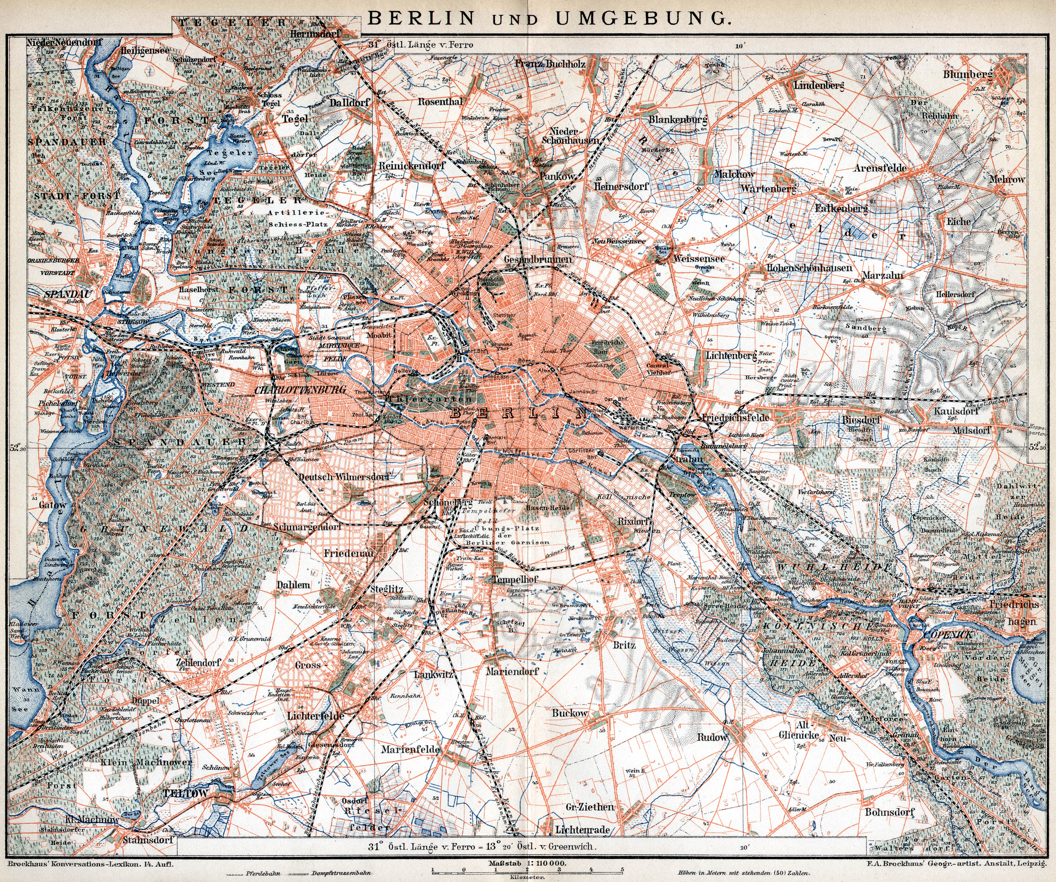
Adlershof | Altglienicke | Alt-Hohenschönhausen | Alt-Treptow | Baumschulenweg | Biesdorf | Blankenburg | Blankenfelde | Bohnsdorf | Borsigwalde | Britz | Book | Buckow | Charlottenburg | Charlottenburg-North | Dahlem | Falkenberg | Falkenhagener Feld | Fennpfuhl | French Buchholz | Friedenau | Friedrichsfelde | Friedrichshagen | Friedrichshain | Frohnau | Gatow | Gesundbrunnen | Gropiusstadt | Grünau | Grunewald | Hook field | Halensee | Hansaviertel | Haselhorst | Heiligensee | Heinersdorf | Hellersdorf | Hermsdorf | Johannisthal | Karlshorst | Karow | Kaulsdorf | Kladow | Konradshöhe | Köpenick | Kreuzberg | Lankwitz | Lichtenberg | Lichtenrade | Lichterfelde | Lübars | Mahlsdorf | Malchow | Mariendorf | Marienfelde | Märkisches Viertel | Marzahn | Middle | Moabit | Müggelheim | Neu-Hohenschönhausen | Neukölln | Niederschöneweide | Niederschönhausen | Nikolassee | Oberschöneweide | Pankow | Plänterwald | Prenzlauer Berg | Rahnsdorf | Reinickendorf | Rosenthal | Rudow | Rummelsburg | Schmargendorf | Schmöckwitz | Schöneberg | Siemensstadt | Spandau | Staaken | Malchow suburban settlement | Steglitz | Tegel | Tempelhof | Zoo | Adventure | Wannsee | Wartenberg | Wedding | Weissensee | Westend | Wilhelmsruh | Wilhelmstadt | Wilmersdorf | Wittenau | Zehlendorf