
Berlin-Gesundbrunnen
|
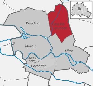
Gesundbrunnen district of Berlin |
|
|---|---|
  |
|
| Coordinates | 52 ° 32 '55 " N , 13 ° 23' 25" E |
| height | ≈ 52 m above sea level NN |
| surface | 6.13 km² |
| Residents | 95,175 (Dec 31, 2019) |
| Population density | 15,526 inhabitants / km² |
| Start-up | Jan. 1, 2001 |
| Postcodes | 13347, 13353, 13355, 13357, 13359, 13409 |
| District number | 0106 |
| Administrative district | center |
Gesundbrunnen is a district in the Mitte district of Berlin . In 1861 Gesundbrunnen and the neighboring Wedding were incorporated into Berlin. With the Greater Berlin Act of 1920, both places in the Wedding district went up. The current district of Gesundbrunnen was created with a different definition as part of the 2001 administrative reform through the division of the old Wedding district.
The reform combined the former administrative districts of Wedding, Mitte and Tiergarten in a new district Mitte, which consists of the districts Wedding, Gesundbrunnen, Mitte , Tiergarten , Moabit and Hansaviertel .
Location and development

In the west, Gesundbrunnen borders the district of Wedding (the new border line from 2001 roughly follows Reinickendorfer Straße), in the north to the districts of Reinickendorf and Pankow with its district of Prenzlauer Berg - in the east . In the south of the district is center of the eponymous district center .

One of the main traffic axes is the Badstrasse and Brunnenstrasse , which crosses the district from north to south. In the south the Gesundbrunnen ends on Bernauer Straße and in the north and east on the line Louise-Schroeder-Platz - Reginhardstraße - Ritterlandweg - Provinzstraße - Kühnemannstraße - S-Bahn-Trasse ( Northern Railway ) - Mauerpark . There are three urban areas named Gesundbrunnen in the Mitte district: the district, the LOR forecast area and the LOR planning area.
The south-eastern part is called the Brunnenviertel and in the north is the Badstrasse neighborhood . The most important station for local and long-distance public transport in the district is the Gesundbrunnen transfer station .
In terms of urban planning, the Berlin districts have been subdivided into lifeworld-oriented spaces (LOR) since 2006 , including forecast spaces , district regions and planning spaces . The latter are based on the neighborhoods. The Mitte district consists of four forecast rooms, ten district regions and 41 planning rooms. The forecast area “03 Gesundbrunnen”, which is not identical to the district, occupies the north-east of the district. It is divided into the northern district region “31 Osloer Straße” (010331) and the southern “32 Brunnenstraße Nord” (010332). Corresponding planning rooms for 31 are “01 Soldiner Straße” (010331 01) and “02 Gesundbrunnen” (010331 02). The southern region includes "01 Brunnenstrasse" (010332 01), "02 Humboldthain Süd" (010332 02) and "03 Humboldthain Northwest" (010332 03). For the planning areas of Berlin, data on the number of inhabitants and their breakdown by age, nationality and social status are published every six months by the administration and have been archived in an accessible manner since 2008. The western triangle of the district Gesundbrunnen between Reinickendorfer, Osloer Straße, Prinzenallee / Pankstraße belongs to the district region “Wedding Zentrum (42)” and is (related to the district Gesundbrunnen) divided transversely by Heinz-Galinski / Schulstraße: to the north as “03 Leopoldplatz "(010442 03) and south as" 01 Reinickendorfer Straße ".
| Planning space | Area (in ha ) |
residential use |
Mixed use | Commercial Industry Retail |
Green space | Community facilities special use |
Traffic area |
|---|---|---|---|---|---|---|---|
| Soldiner Strasse 010331 01 |
170.49 | 36% | 12% | 2.5% | 23.7% | 10.0% | 0.7% |
| Gesundbrunnen 010331 02 |
65.55 | 28% | 16% | 0.0% | 14.5% | 8.6% | 2.6% |
| Brunnenstrasse 010332 01 |
85.11 | 46% | 0% | 22.0% | 3.9% | 11.4% | 17.3% |
| Humboldthain South 010332 02 |
110.34 | 21% | 6% | 19.4% | 22.3% | 11.0% | 2.4% |
| Humboldthain Northwest 010332 03 |
143.31 | 17% | 17% | 12.6% | 9.8% | 8.9% | 9.6% |
The street areas take up between 15% and 29%. Special features in Humboldthain Northwest are 4728 m² of water and 7302 m² for the town square. For the latter category also 4082 m² in the (Kiez) Brunnenstrasse.
The Panke flows through the Gesundbrunnen district , in relation to the Gesundbrunnen district (only) in the Soldiner Straße planning area.
History and Development
Naming

The name "Gesundbrunnen" goes back to a mineral-rich spring discovered near the later Luisenbad , which is said to have healing and youth-sustaining properties. Due to heavy building activity in the area around the source, the settlement grew into its own district.
The locals say “I live on”, “in” or “in the Gesundbrunnen”. In the vernacular of Berlin , the Gesundbrunnen is also affectionately called Plump (derived from the Berlin term for 'water pump'), even if this term is only used by the long-established residents. Due to the cultural development, the Gesundbrunnen is considered the second nucleus of the former Wedding district.
Origin and first settlement
A document from 1251 documents the first settlement here. The whereabouts of the village of Weddinge can no longer be proven: it disappeared without it being known why this happened and whether it was in today's district of Wedding or Gesundbrunnen.
Only around 1600 is there evidence that concerns the Vorwerk Wedding. In the area of Gesundbrunnen it was about arable and meadow land as well as “sheep and dairy justice”. The management of the area may have been linked to the Mühlenhof office. This was responsible for supplying the entire needs of the royal court with wood and food. With the increasing expansion of the court, it was also necessary to expand the rulers' management.
1751: Discovery and development of a healing spring
The fact that the district was named Gesundbrunnen has to do with the discovery of a spring. The ferruginous spring was first mentioned in 1748. The local court pharmacist Wilhelm Behm had the spring water examined by the chemist Andreas Sigismund Marggraf in 1751 , who attested it had healing properties. In the same year, Behm acquired the royal privilege to set up a sanatorium and bathing establishment here. He let the king know that the properties of this spring surpass those in Bad Freienwalde (Oder) and Bad Pyrmont . Frederick II then arranged for the Obercollegium Medicum to examine the report . Because the water did not freeze during light frosts, which can be attributed to the effects of the salts it contains, the king approved financial support for the construction of a well and a bathhouse on the site. He only promised further support if the Gesundbrunnen was accepted by visitors and Berliners. After the royal sponsor, the district was initially named Friedrichs-Gesundbrunnen .
Behm began to build the Gesundbrunnen in the course of 1758: the water outlet was set in brick and a hexagonal well house with large arched windows and a curved roof was built above it . For advertising purposes, Behm published a small advertising pamphlet in 1760 with the title Preliminary Message from the Healthy Well , in which he linked the discovery of the source with a legend concerning the king and his crown prince. At his own expense, Behm had a spacious garden laid out around the fountain with a drinking hall and foyer as well as lodgings for visitors who stayed outside longer.
The healing spring, which annually provided the water for more than 1000 bathtubs, attracted numerous guests to the place, up to 40 spa guests could spend the night here and receive relief for chronic and rheumatic diseases and eye ailments. The king himself stayed here with his entourage when he came to inspect the nearby artillery training areas. Moses Mendelssohn was also one of the spa guests. Nevertheless, there was no further funding from the king, so that no further expansion took place and the heirs of Behm, who died in 1780, had to sell the spa facility.
In 1808 the successful "Medicinal Assessor" and bookseller Christian Gottfried Flittner bought the fountain and renovated the now dilapidated facility, the English-style garden. The relationship of Flittner's sister-in-law Friederike Bethmann-Unzelmann to the court led to Queen Luise becoming the (new) namesake. Luise wrote a letter of congratulations from her exile in Königsberg for the upcoming baptism of the bath:
"Her Majesty the Queen takes pleasure in fulfilling the request of a senior medical assessor, Mr. Flittner, and therefore would like to approve that a comrade to be elected witness the baptism as a witness in the highest name. In the future, high-earners will hear with special sympathy about the happy physical and merry development of their little daughter, and sincerely wish her a happy future out of the times of misery in which she saw the light of day. Your well-made Queen Luise "
It must be doubted whether the namesake was ever at the Gesundbrunnen. But according to a more recent source it says “On the occasion of the naming and unveiling of a bust of Luise , the queen personally visited the new spa.” The medicinal assessor Flittner was followed by other owners of the spa: first Ludwig Graßhoff ; After expansion measures such as a new bathhouse and the establishment of a refreshment point for retired officers, the decorative painter Carl Gropius became the owner. Despite all the investments, the spa area did not develop as desired, but in the long term the area around the Luisenbad became the second root of Wedding's settlement.
In 1805 105 people in 23 households lived on the Gesundbrunnen . The gallows for public executions on Gartenplatz was only demolished in June 1842.
1876: New destination in the north of Berlin
From the middle of the 18th century the Gesundbrunnen increasingly developed into a spa and bathing resort. The location of the fountain was in the area of the backyard of what will later be Badstrasse 38/39, a few meters from today 's Pankstrasse underground station . In 1876 master carpenter Carl Galuschki inherited the spa facility. In order to bring the spring to better use again, he had the water laid by pipes in the basement of his house, which had just been completed. Here the healing water should be bottled and sent to interested parties in Berlin and throughout Germany. Carl and his brother Emil did here complete new buildings like a Comptoir or coffee kitchen and a dance hall in the style of neo-classicism building, the establishment was renamed Marienbad .
The spring was accidentally drilled when the sewer system on Badstrasse was being built in 1891 and therefore only gushed sparingly from the pipe. It could no longer be used and no longer exists today. The remaining buildings of the Marienbad are on the corner of Badstrasse and Travemünder Strasse. When Badstrasse cut through the former grounds of the spa complex, one third of a larger building owned by the Galuschki brothers had to be demolished. To commemorate the history of the healing spring, they created a relief on the gable wall that was created showing the fountain house demolished in 1908 and containing the inscription "In fonte salus" ( In the spring there is healing ). In addition, the history of the place should be remembered on a marble plaque and the busts of the three patrons, Friedrich I, Friedrich II and Queen Luise should be placed on consoles. The work that had already been commissioned for this memorial site had to be canceled because the Galuschkis could no longer pay for it. Carl Galuschki finally committed suicide in 1910.

Since 1995, the district central library at the Luisenbad has been housed there in combination with new buildings after the renovation in accordance with the listed buildings according to the plans of the architects Chestnut / Niess .
From the middle of the 19th century, the innkeepers had discovered the popularity of the spring as an excursion destination for Berlin's urban population. In the course of time, many beer gardens and excursion restaurants have sprung up on Badstrasse. During this time, both gambling and prostitution found their way into Gesundbrunnen. It turned into an entertainment district.
After the incorporation, a workers' district was created here
It was incorporated into Berlin in 1861. Together with Wedding, Gesundbrunnen formed the district of Wedding and Gesundbrunnen from then on . At the end of the 19th century the Gesundbrunnen developed into a working-class district due to the ongoing rural exodus. The workers lived tightly packed in so-called " tenements ". The worst outgrowths of this urban juggernaut originated in Meyers Hof (Ackerstraße 132). This tenement is still considered a unique example of extremely compressed and speculative development.
Transport links
The Gesundbrunnen transfer station was built in 1900 at its current location as a long-distance, ring and suburban train station with a stately reception building and what was then the longest covered and glazed pedestrian bridge in the greenhouse style after the route of the Berlin-Szczecin Railway had been swiveled into the Berlin Ringbahn . To bridge the railway line along the Swinemünder Straße, the Swinemünder Brücke - known in Berlin as the “Million Bridge ” - was built as a suspended steel framework construction on two pylons . The popular name is said to either go back to the amount of the construction costs of more than one million marks at the time (today: around 7 million euros) or the number of rivets sunk in the bridge is rumored. The welding of bridge components was not established at the time of construction.
After the subway line D ("GN-Bahn", Gesundbrunnen-Neukölln, today's U8 ) was completed in 1930 , the station quickly developed into the busiest transfer station in the Berlin S-Bahn network .

Politics and sport
During the Weimar Republic , Wedding was also a stronghold of the workers' parties and was known as "Red Wedding". On May 1, 1929, there was a bloody clash between police and demonstrators known as the " Blood May ". 19 people were killed at the corner of Wiesenstrasse and Uferstrasse (memorial stone on the spot).

The Hertha BSC football club comes from the district . In 1904, he moved to Schebera-Platz on Behmstrasse , his first permanent sports field with a clubhouse, which had already been established here in 1900. In 1923, the stadium at Gesundbrunnen ( popularly derived from the district, also known as "Plumpe") was built on the opposite side of the street . Hertha celebrated its two German championships in 1930 and 1931 in the clubhouse on the square. The venue offered 35,239 spectators. After bombs hit the stadium badly in April 1945, it was demolished in 1974. In its place, one of the few West Berlin prefabricated housing estates with exposed aggregate concrete facades was built in the following years on the site between Behmstrasse, Swinemünder Strasse, the railway line and the Berlin Wall .
1933–1945: National Socialist period

During the time of National Socialism there was strong resistance in this part of the city , in which many people lost their lives. In the Reichstag elections on March 5, 1933 , Wedding was the Berlin district in which the fewest votes for the NSDAP (25.9%) came together. The KPD, on the other hand, came in at 39.2%. The SPD came to 22.8%.
In the Volkspark Humboldthain a flak tower with a guide bunker was built from October 1941 to April 1942 with the involvement of numerous forced laborers .
During the Second World War , almost all churches as well as numerous houses and streets in Gesundbrunnen were destroyed in the Allied air raids and the Battle of Berlin , and many residents were killed. Following the order issued by General Weidling on the morning of May 2, 1945 to end the fighting in Berlin - the German surrender came into force six days later - the soldiers of the Red Army ruled the entire city until the end of June 1945 . In the early days there were numerous attacks, looting and innumerable rapes.
Development after 1945
First the British and then the French replaced the Soviets in Gesundbrunnen as the occupying power in 1945 . The attempt of the Soviets in 1948/49 to seize the whole of Berlin through the Berlin blockade led to the fact that the Western Allies became friends and protectors of the Berliners through their airlift ; - a friendship that developed here in Wedding and Gesundbrunnen, especially with France, and which lasted until the Allied troops withdrew from Berlin in 1994.

After the Second World War, Badstrasse was one of the largest and most famous Berlin shopping streets. There was also the Lichtburg at Gesundbrunnen , at the time the largest cinema in Berlin, which was built together with the Atlantic residential complex in the 1930s according to plans and under the direction of Rudolf Fränkel .
In the years before the Wall was built, this shopping street was of interest to many Berliners from East Berlin because it is only one stop on the S-Bahn from Schönhauser Allee station. Easily accessible with the suburban trains from the Berlin area , agricultural products were sold on the station forecourt or the opposite Blochplatz . As a result, Gesundbrunnen is often equated with the train station and its immediate surroundings. With the construction of the Wall in 1961, the flow of visitors stopped abruptly.
Gesundbrunnen was now isolated from its neighboring districts to the east and south by this bulwark. Many apartments had a poor standard of equipment, but were cheap to rent. From 1961 on, German companies recruited 678,702 men and 146,681 women, a total of 825,383 people, as Turkish guest workers on the basis of the recruitment agreement between Germany and Turkey . Many of them found their new home in Gesundbrunnen. This explains the steady, relatively high proportion of migrants in this district.
The Ernst-Reuter-Siedlung was built between 1953 and 1955 as the first demonstrative building project of the post-war period as part of social housing and initiated urban renewal in West Berlin , which was characterized by demolition and new construction . In January 1963 the Berlin Senate decided to initiate the first redevelopment of Berlin on an area of 186 hectares around Brunnenstrasse. In the following years, the necessary land was acquired and the mostly poorly equipped old buildings demolished. Numerous residents from these blocks were relocated to the newly built Märkische Viertel .
The Kiez got its present appearance mainly in the 1970s, when it became the largest redevelopment area in Europe. One of the city planners commissioned with the redesign of the quarter was Heinrich Suhr . He made sure that from 1972 until the 1980s, individual blocks of the redevelopment area were built over or supplemented with modern apartment blocks. This principle of demolition and new construction at that time largely destroyed the existing working and living conditions. Unlike, for example, in Kreuzberg , there was no significant resistance from citizens' initiatives in Gesundbrunnen .
The current line U8 of the Berlin subway , which from 1930 to 1977 had its northern terminus at Gesundbrunnen, was expanded from 1977 by the additional stations Pankstraße (at the same time expanded to a nuclear bunker ) and Osloer Straße . From 1987 the line was continued to today's terminus, the Wittenau train station .

Fall of the wall in 1989 - reunification
On November 9, 1989, the Bösebrücke ( colloquially also called Bornholmer Brücke ) at the Bornholmer Straße S-Bahn station was a scene of political change . At this border crossing point to what was then the Prenzlauer Berg district , the inner-German border was opened for the first time without border controls on the night of the fall of the Wall .
Since the fall of the Wall , the flow of visitors to Berlin has increased continuously and with it - due to the junction of the underground station and the converted S-Bahn station as well as the Gesundbrunnen long-distance station - the transport connections to and from Gesundbrunnen. The Gesundbrunnen Center, which opened in 1997, developed into a focal point of the quarter as a shopping center .


Industry


In the area of today's Gesundbrunnen numerous industrial companies were located up until the 1980s. Most important of all was AEG , which operated the four production facilities of the railway factory, the large equipment factory, the small motor factory and the converter factory in the Brunnenstrasse plant. The entrance gate (" Official Gate ") has been preserved. There was also the AEG Apparatewerk Ackerstraße , the “device factory” Schwedenstraße built by Telefunken between 1939 and 1941 and the Hydrawerk AG building on the adjacent Tromsöer and Drontheimer Straße - both AEG subsidiaries. Then there was the Rotaprint printing machine factory and Berliner Maschinenbau AG ( Louis Schwartzkopff ). In the Gesundbrunnen district today there are no longer any major industrial companies.
Since the beginning of the 21st century
The most important green area in the district is the Volkspark Humboldthain, planned by the garden architect Gustav Meyer, to the southwest of the train station, with its rose garden, which is still well cared for today, and the climbing wall at the bunker. The memorial for the reunification of the two halves of the city was erected on one of the flak towers in 1961 , known in Berlin as the "plump pimple".
The Social Atlas Berlin 2009 (Monitoring Social Urban Development) shows that out of a total of 447 planning areas (LOR, urban areas oriented towards the world of life ), the district of Gesundbrunnen occupies the lower ranks overall. All of the planning rooms in Gesundbrunnen are at the bottom of the ranking. The area around Reinickendorfer Strasse (01044201) occupies place 431, Humboldthain Nordwest (01033203) takes place 429, Soldiner Strasse (01033101) takes place 426, the Gesundbrunnen planning area (01033102) takes place 422, the area Brunnenstrasse (01033201) Rank 416 and the planning area Humboldthain Süd (01033202) rank 391.
The Berlin Social Atlas 2010 abandons the previous ranking of planning areas (LOR) and only describes the “Status Index” and the “Dynamic Index”, i.e. the further development of the previous urban areas. This shows that, according to the indicators of the study, none of the urban areas in Gesundbrunnen showed any social rise. All of the aforementioned urban spaces have been marked with the status of "very low" development.
The Social Atlas Berlin 2011 and the Social Atlas Berlin 2013 also show that the planning areas continue to be characterized by a very high density of problems and that an overall “very low” development can be established. With the Social Atlas Berlin 2015 and the Social Atlas Berlin 2017 it is determined that the planning areas Gesundbrunnen (01033102) and Humboldthain Süd (01033202) show an improvement in status with "low development", while the other planning areas continue to be characterized by "very low development".
The Social Atlas Berlin 2017 shows that serious social problems can still be found in the district. The situation is characterized by high unemployment and an extremely high proportion of under 15-year-olds who are dependent on government aid.
If groups of young people in Gesundbrunnen and Wedding still immortalize themselves with the number "65" in graffiti on house walls or wear this number as a distinguishing mark on their clothing, this indicates their local origin. The identification of youth groups with these numbers is only visible in the districts of Wedding and Gesundbrunnen with the number "65", in Kreuzberg with the " 36 " and in Neukölln with the "44". These numbers relate to the old Berlin postal districts used from 1862 : "N (= North) 65", later "Berlin 65" is the designation of the delivery post office for the area around Weddinger Schulstrasse, which until 1993 was the postcode of today's postal delivery districts 13347– 13359 served (see Postal History and Postage Stamps Berlin's # Post Offices in Berlin (West) ).
Residents
| year | Changes |
|---|---|
| 1st half of 2019 | + 152 |
| 2018 | + 1137 |
| 2017 | + 1125 |
| 2016 | + 1274 |
| 2015 | + 1560 |
| 2014 | + 1553 |
| 2013 | + 1911 |
| 2012 | + 1126 |
| 2011 | + 2043 |
| 2010 | + 17 (the population figures were updated by adjusting the population register ) |
| 2009 | + 1443 |
| 2008 | + 421 |
| 2nd half 2007 | + 411 |
With 95,175 inhabitants (as of December 30, 2019), the district is the most populous in the Mitte district after the Mitte district. In addition, with an average age of under 38, he is one of the youngest in Berlin. In the 2010s the population increased significantly. Thus 2.54% of all residents of Berlin live in the district Gesundbrunnen.
The proportion of the foreign population in Gesundbrunnen is 38.8%, the highest of all Berlin districts. In the entire Mitte district, the proportion of foreigners is 34.2%, the Berlin average is 20.2%. Almost two thirds (64%) of the residents in Gesundbrunnen have a migration background .
Personalities
_Gewachsen_auf_Beton_United_2013.jpg)
- Theodor Plievier (1892–1955), writer, memorial plaque: Wiesenstrasse 29
- Otto Nagel (1894–1967), painter, lived temporarily at Badstrasse 62
- Georg Benjamin (1895–1942), pediatrician, resistance fighter against National Socialism, memorial plaque: Badstrasse 40
- Hans Bierbrauer (stage name: Oskar ) (1922–2006), caricaturist
- Hans Rosenthal (1925–1987), entertainer and presenter, born in the Jewish hospital
- Harald Juhnke (1929–2005), actor and entertainer, grew up on Stockholmer Straße, memorial stone on Fordoner Straße
- Cornelia Froboess (* 1943), actress and pop singer, spent her childhood at Gottschalkstrasse 27
- Tilo Jung (* 1985), blogger and journalist, lives on Schwedenstrasse
Significant buildings

District Court Wedding
The District Court Wedding is in Gesundbrunnen Central dunning court for Berlin and Brandenburg . The Albrechtsburg in Meißen served as a model for the building . The imposing building is located on Brunnenplatz and was built from 1901 to 1906 in the neo-Gothic style. It is a listed building .
St. Pauls Church
At the corner of Badstrasse 50/51 and Pankstrasse 53 is the Protestant St. Pauls Church , which was built from 1832 to 1835 in the classical temple style according to the plans of the architect Karl Friedrich Schinkel . In 1889/1890 the church got a campanile . The church was damaged in a bombing raid in 1943 and burned down completely in street fighting in 1945. It was restored on the outside by 1957. The interior was designed in a modern way from 1952 to 1957 by Hans Wolff-Grohmann . The church has been a listed building since 1971 as a testimony to the architecture of the 1950s (interior). There is a war memorial next to the church.
Rotaprint factory
The Rotaprint factory stretched between the Uferstrasse on the Panke and Gottschedstrasse . The corner building on the corner of Bornemannstrasse and Gottschedstrasse , built from 1957 to 1959 by Klaus Kirsten, is striking . This was strictly based on the ideal of modernity . After the acquisition of the site as a leaseholder this object by the nonprofit ExRotaprint gGmbH listed status restored.
Stephanus church
on the corner of Prince Avenue / Soldinerstrasse is the Stephen Church .

Peter-Behrens-Halle
The hall named after the German architect Peter Behrens is located on Gustav-Meyer-Allee on the former AEG site . The building from 1912 symbolizes a new type of construction for the industrial age in the early 20th century.
Further buildings under monument protection
Infrastructure and traffic
Streets and squares
Public transport
Rail transport
At the station Gesundbrunnen meeting metro line U8 and the Berlin ring road and the north-south rail of the train together, besides, it's an important connection point for local and long-distance traffic. With the adjacent Gesundbrunnen Center and further large-scale retail stores with shops until midnight ( Kaufland ) as well as a new station concourse with a kiosk and snack bar, the station gained a similar importance as it did as a feeder for customers from all over the surrounding area before the wall was built 1961 for the Badstrasse shopping street.
Long-distance and regional trains
Gesundbrunnen train station is the only long-distance and regional train station in the district; trains stop here on the way to

- Stralsund ( RE3 , RE5 , ICE15 , ICE28 , EC27 , IC32 , IC65 )
- Rostock ( RE5 , ICE28 , IC28 )
- Schwedt ( RE3 )
- Szczecin ( RE66 )
- Rheinsberg ( RB54 )
- Eberswalde ( RE3 , RE66 , ICE15 , ICE28 , EC27 , IC32 , IC50 )
- Ruhr area ( Cologne , Düsseldorf ...) ( ICE10 , IC32 )
- Leipzig ( ICE28 )
- Hall / Salle ( ICE15 , IC28 , RE5 )
- Dresden ( EC27 )
- Prague ( EC27 )
- Munich ( ICE28 , IC28 )
- Frankfurt / Main ( ICE15 )
- Hanover ( ICE10 , IC32 )
Train
Six S-Bahn lines stop at Gesundbrunnen station:
- Line S1 Oranienburg - Wannsee ( North-South , Wannsee and North Railway )
- Line S2 Bernau - Blankenfelde (North-South, Dresden and Szczecin Railway )
- Line S25 Hennigsdorf - Teltow Stadt ( North-South , Anhalter and Kremmener Bahn )
- Line S26 Waidmannslust - Teltow ( North-South , Anhalter and North Railway )
- Line S41 Berliner Ringbahn via Ostkreuz - Südkreuz - Westkreuz
- Line S42 Berliner Ringbahn via Westkreuz - Südkreuz - Ostkreuz
Other S-Bahn stations in Gesundbrunnen are Bornholmer Strasse station (lines S1, S2, S25, S26, S8 and S85) and Wollankstrasse station (S1, S25 and S26), which are located on the former sector border between Gesundbrunnen and Pankow, as well as the Humboldthain train station (S1, S2, S25 and S26).
Subway
Two underground lines run through the district :
-
Line U8 ( Wittenau - Osloer Straße - Gesundbrunnen - Alexanderplatz - Jannowitzbrücke - Kottbusser Tor - Hermannplatz - Hermannstraße )
During the time of the Berlin Wall , theU8 line wasa transit line, which means that it ran from Voltastraße (Gesundbrunnen) underground station without stoppingto the Moritzplatz ( Kreuzberg ) underground station through East Berlin . -
Line U9 ( Osloer Straße - Leopoldplatz - Westhafen - Turmstraße - Zoologischer Garten - Spichernstraße - Berliner Straße - Walther-Schreiber-Platz - Rathaus Steglitz )
The U9 line was built after the Second World War. In the north it should be extended to Pankow and in the south to Lankwitz and later to Marienfelde to Waldsassener Straße .
tram
After the political change , Gesundbrunnen was connected to the Berlin tram network again :
- Line M10 ( S + U Hauptbahnhof - S + U Warschauer Straße )
- Line M13 (Wedding, Virchow-Klinikum - S Warschauer Straße)
- Line 50 (Wedding, Virchow Clinic - French Buchholz, Guyotstrasse)
Bus transport
Several bus lines run through Gesundbrunnen , including a Metrobus line (M) and three night lines (N):
- Line M27 S + U Pankow - S + U Jungfernheide
- Line 125 Frohnau, Invalidensiedlung - U Osloer Straße
- Line 128 Flughafen Tegel - U Osloer Straße
- Line 150 ( S Buch -) Alt-Karow - U Osloer Straße
- Line 247 S Nordbahnhof - U Leopoldplatz
- Line 250 S + U Pankow - U Franz-Neumann-Platz
- Line 255 Weissensee, Schwarzelfenweg - U Osloer Straße
- Line N8 S + U Hermannstraße - Wittenau, Wilhelmsruher Damm
- Line N9 S + U Rathaus Steglitz - U Osloer Straße
- Line N52 Niederschönhausen, Pastor-Niemöller-Platz - U Osloer Straße
education
There are a large number of different educational institutions in the district, as the following table shows.
| School No. | School name | School branch | address |
|---|---|---|---|
| 01B03 | OSZ communication, information and media technology | Vocational high school | Osloer Strasse 23-26 |
| 01B03 | OSZ communication, information and media technology | Vocational school | Osloer Strasse 23-26 |
| 01P07 | Lazarus Schools of the Hope Valley Foundation Lobetal | Vocational school | Bernauer Strasse 115–118 |
| 01P24 | IB-GIS mbH - Medical Academy Berlin | Vocational school | Richtstrasse 27 |
| 01P46 | DDA Destiny Diversity Academy GmbH | Vocational school | Brunnenstrasse 110d |
| 01B03 | OSZ communication, information and media technology | Vocational high school | Osloer Strasse 23-26 |
| 01B03 | OSZ communication, information and media technology | professional school | Osloer Strasse 23-26 |
| 01B03 | OSZ communication, information and media technology | Technical college | Osloer Strasse 23-26 |
| 01P07 | Lazarus Schools of the Hope Valley Foundation Lobetal | Technical college | Bernauer Strasse 115–118 |
| 01P07 | Lazarus Schools of the Hope Valley Foundation Lobetal | Technical school | Bernauer Strasse 115–118 |
| 01P24 | IB-GIS mbH - Medical Academy Berlin | Technical school | Richtstrasse 27 |
| 01S01 | School at Zille-Park | Funding focus on learning | Ravenéstrasse 10-12 |
| 01G25 | Rudolf Wissell Primary School | primary school | Ellerbeker Strasse 7/8 |
| 01G27 | Gesundbrunnen primary school | primary school | Prinzenallee 8 |
| 01G29 | Wilhelm Hauff Primary School | primary school | Gotenburger Strasse 8 |
| 01G32 | Carl Kraemer Elementary School | primary school | Zechliner Strasse 4 |
| 01G35 | Humboldthain Elementary School | primary school | Grenzstrasse 7 |
| 01G36 | Andersen Elementary School | primary school | Kattegatstrasse 26 |
| 01G37 | Heinrich Seidel Elementary School | primary school | Ramlerstrasse 9/10 |
| 01G38 | Gustav Falke Elementary School | primary school | Strelitzer Strasse 42 |
| 01G39 | Vineta Primary School | primary school | Demminer Strasse 27 |
| 01G43 | Albert Gutzmann School (primary school) | primary school | Orthstrasse 1 |
| 01P13 | Free school at Mauerpark (elementary school) | Primary school (private) | Wolliner Strasse 25/26 |
| 01P18 | Bilingual school Phorms Berlin Mitte | Primary school (private) | Ackerstrasse 76 |
| 01P18 | Bilingual school Phorms Berlin Mitte | Gymnasium (private) | Ackerstrasse 76 |
| 01Y09 | Diesterweg School (high school) | high school | Böttgerstrasse 2-6 |
| 01K01 | Willy Brandt School | Integrated secondary school | Grüntaler Strasse 5 |
| 01K03 | Ernst Reuter School | Integrated secondary school | Stralsunder Strasse 57 |
| 01K06 | Herbert Hoover School (Integrated Secondary School) | Integrated secondary school | Pankstrasse 18/19 |
| 01P49 | Quinoa School Free Secondary School Berlin Wedding | Integrated secondary school (private) | Kühnemannstrasse 26 |
| 01S01 | School at Zille-Park | Integrated secondary school | Ravenéstrasse 10-12 |
| 01S06 | Albert Gutzmann School | Integrated secondary school | Orthstrasse 1 |
| 01S06 | Albert Gutzmann School | Other funding priorities | Orthstrasse 1 |
Others
Gesundbrunnen is a herbal liqueur produced by the Wedding liquor factory for Eschenbräu .
See also
- List of cultural monuments in Berlin-Gesundbrunnen
- List of cinemas in Berlin-Gesundbrunnen
- List of stumbling blocks in Berlin-Gesundbrunnen
- List of street fountains in Berlin's Mitte district : sorting of districts
literature
- Carl-Peter Steinmann : Sunday walks 2 . Transit Buchverlag, 2013, ISBN 978-3-88747-286-3 , pp. 7–32: Gesundbrunnen.
- Gerhild HM Komander : The Wedding. On the way from red to colorful. Berlin-Story-Verlag, Berlin 2006, ISBN 3-929829-38-X .
- Ralf Schmiedecke: Wedding - in the middle of life. (= The series of archive images ). Sutton-Verlag, Erfurt, 2001, ISBN 3-89702-366-0 .
- Ute Langeheinecke: Wedding as a rural settlement. On the urban development of the Wedding district, 1720 to 1840. Mann, Berlin 1992, ISBN 3-7861-1658-X .
- Harald Reissig: Luisenbad. Badstrasse 38/39. In: Helmut Engel u. a. (Ed.): Berlin history landscape. Places and Events, Volume 3: Wedding. (= Publication of the Historical Commission in Berlin ; Berlin History Landscape. 3). Nicolai, Berlin 1990, ISBN 3-87584-296-0 , pp. 265-282.
- Folkwin Wendland: Berlin's gardens and parks from the founding of the city to the end of the nineteenth century. (= Classic Berlin ). Propylaeen, Berlin 1979, ISBN 3-549-06645-7 , pp. 281-286.
- Süssenguth Verlagsgesellschaft Berlin: Wedding - then and now. a home booklet edited and edited by Friedrich Krüger, Hauptschulrat auf dem Wedding and a working group of Wedding teachers, no year.
- Klaus Neukrantz: Barricades on Wedding. The novel of a street from the Berlin May days 1929. Proletarian-revolutionary novels 1. Oberbaumverlag, Berlin 1970. First publication of the series Der Rote 1-Mark-Roman. Internationaler Arbeiter Verlag, Berlin 1931.
Web links
- Information on the Gesundbrunnen district, Central District Office of Berlin
- Where does the name Gesundbrunnen come from?
- Katja Reichgardt: When the Brunnenviertel was reborn . In: Berliner Abendblatt . September 8, 2018.
- Aro Kuhrt, Birgit Gebhardt: From Rosenthaler Tor to Gesundbrunnen
Individual evidence
- ↑ The edge of the Gesundbrunnen prognosis area coincides with the Pankow district border to the north and east. Also included is the street running of Brunnenstrasse to the west (planning area center) and Gartenstrasse to the north (excluding the Nordbahnhog), Liesenstrasse, Chausseestrasse, Boyenstrasse, Scharnhorstrasse (both without the street area). At the Kiel bridge and the footbridge over the Spree are in the planning area, the edge of which then crosses Müllerstraße along the north bank of the northern port / Berlin-Spandau shipping canal and northwest of the railway line. The north-east line of houses on Müllerstrasse follows as a boundary up to a bend to the east, excluding the line of houses on the north edge of Richtstrasse. Nettelbeckplatz and its north triangle is in the planning area. The LOR edge stretches across Reinickendorfer Strasse along the line of houses on Pankstrasse (crossing Badstrasse) and Prinzenallee to over Osloer Strasse. The Osloer Straße to the west without its road area and without Louise-Schröder-Platz, the Soldiner Kiez with Reginhard and without road area is led by Ritterland and provincial roads along the Reinickendorf district border. Kühnemannstrasse is included in the Gesundbrunnen planning area, along with the cableway on the Panke. Along the Nordbahnstraße, the district border to Pankow then runs "inside" the railway line to Gesundbrunnen station.
- ↑ The Gesundbrunnen planning area includes the width of Osloer Straße, borders the western edge of the railway site and includes the Gesundbrunnen Center and the station forecourt and includes the Badstraße road to the west and Prinzenallee to the north. The entire intersection of Prinzenallee / Osloer Strasse is part of it.
-
↑ * Population structure in the "lifeworld oriented planning area" (LOR 01033101) Soldiner Straße
* Population structure in the "lifeworld oriented planning area" (LOR 01033101) Gesundbrunnen
* Population structure in the "lifeworld oriented planning area" (LOR 01033201) Brunnenstrasse
* Population structure in the "lifeworld oriented planning area" LOR 01033202) Humboldthain South
* Population structure in the "lifeworld-oriented planning area" (LOR 01033203) Humboldthain Northwest - ↑ Land use of the planning areas (living environment-oriented rooms - LOR) based on the usage mapping of the information system city and environment / environmental atlas (SenStadt III F), data status December 31, 2010.
- ↑ Two planning rooms in the Wedding forecast area belong to the Gesundbrunnen district but not to the Gesundbrunnen forecast area
- ↑ park / green area; Allotment gardens and allotment-like uses; graveyard
- ↑ 10331 01: 15.1% // 010331 02: 27.4% // 10332 01: 28.8% // 010332 02: 18.3% // 010332 03: 19.8%
- ^ Steinmann: Sunday walks. Gesundbrunnen ... p. 16.
- ^ Steinmann: Sunday walks. Gesundbrunnen ... p. 17.
- ↑ Where the original remains unclear, photo in the Wedding City Planning Office.
- ^ Steinmann: Sunday walks. Gesundbrunnen ... p. 18.
- ↑ a b Steinmann: Sunday walks. Gesundbrunnen ... p. 18/19.
- ↑ Steinmann: Gesundbrunnen, p. 19.
- ^ Steinmann: Gesundbrunnen. P. 8/9.
- ^ Statistics Berlin
- ↑ http://www.luise-berlin.de/ Brunnenviertel
- ↑ taz.de of January 11, 2013: Wedding was a test area
- ^ Wedding redevelopment area .
- ↑ Report Monitoring Social Urban Development 2009
- ↑ Monitoring - Social Urban Development 2010 (PDF; 1.4 MB)
- ↑ Monitoring - Social Urban Development 2011 (PDF; 1.4 MB)
- ↑ Monitoring - Social Urban Development 2013 (PDF; 38 kB)
- ^ Report on Monitoring Social Urban Development 2015
- ↑ Report Monitoring Social Urban Development 2017
- ↑ Statistical report, residents in the state of Berlin by districts and age groups on June 30, 2018 (PDF)
- ↑ Statistical report, residents in the state of Berlin on June 30, 2019 (PDF; 4.3 MB)
