
Berlin-Prenzlauer Berg
|
Prenzlauer Berg district of Berlin |
|
|---|---|
  |
|
| Coordinates | 52 ° 32 '21 " N , 13 ° 25' 27" E |
| height | Max. 91 m above sea level NN |
| surface | 10.955 km² |
| Residents | 165.003 (Dec. 31, 2019) |
| Population density | 15,062 inhabitants / km² |
| Start-up | Oct. 1, 1920 |
| Postcodes | 10119, 10247, 10249, 10369, 10405, 10407, 10409, 10435, 10437, 10439, 13187, 13189 |
| District number | 0301 |
| Administrative district | Pankow |
| Source: Berlin-Brandenburg Statistics Office | |


Prenzlauer Berg is a district in the Berlin district of Pankow . From its founding in 1920 to the merger with the neighboring districts of Weißensee and Pankow during the administrative reform in 2001 , it was an independent district (1952–1990: "City District").
location
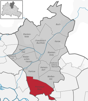
The district of Prenzlauer Berg is part of the Pankow district in northeast Berlin and borders the Mitte district in the west and southwest, the Friedrichshain-Kreuzberg district in the south, the Lichtenberg district in the east and the Weissensee and Pankow districts in the north .
Geologically, the district lies completely on the base moraine area of the Barnim and borders to the southwest (to the Mitte district) on the Berlin glacial valley , which was formed during the Ice Age .
The highest point of the district is now 91 meters above sea level in the northeast in the Volkspark Prenzlauer Berg . This mountain was created after the Second World War as one of the mountains of rubble when rubble was piled up from the city center and then greened.
Cityscape

Prenzlauer Berg is characterized by old buildings, most of which date from the turn of the 20th century (1889–1905). Over 80 percent of all apartments in the area were built before 1948, the oldest building still in existence at Kastanienallee 77 is from 1852/1853. In the Second World War, relatively few buildings were destroyed in comparison to other districts, but the area was neglected during the GDR era and the last ruins were only removed in the early 1970s. After the political turnaround , the dilapidated building fabric was largely renovated, vacant lots had been closed since the mid-1980s.
Today Prenzlauer Berg is an almost homogeneous old building area. Over 300 buildings are listed , such as the Stadtbad Oderberger Straße , the brewery in Milastraße or the brewery in Knaackstraße. The part close to the city center is characterized by restaurants and bars. Typical Berlin gastronomy is particularly concentrated in Kastanienallee , around Kollwitz - and around Helmholtzplatz . The center of the nightlife is the area around the Eberswalder Straße underground station , where Schönhauser Allee , Danziger- / Eberswalder Straße and Kastanien- / Pappelallee intersect. This intersection and the Kiez are called "Corner Schönhauser". This older Berlin name was used as the title for the DEFA cult film of the same name from 1957 and therefore more generally known.
“Young Germany meets every day under the subway arch on the corner of Schönhauser Allee. The adults are disturbed by the group of young people, the youngsters, without asking why they are looking for their freedom on the street. "

v. l. To the right: confluence with Eberswalder Straße, Schönhauser Allee to the north (with high station), Pappelallee, confluence with Danziger Straße, Schönhauser Allee to the south, Kastanienallee


In terms of urban planning, the district offers a relatively uniform image, it is predominantly characterized by five-storey residential buildings in closed block construction . The blocks are in most cases very large due to the great depths of the property and numerous backyard uses, some are more than one kilometer in circumference.
Outstanding buildings are the large churches in the district, of which the Gethsemane Church by August Orth on Stargarder Strasse (built: 1891–1893) is the best known. Its 66 meter high tower is surpassed by the 79 meter high tower of the Segenskirche on Schönhauser Allee and the 68 meter high tower of the Immanuelkirche on Prenzlauer Allee. Representative school buildings, mostly designed by Ludwig Hoffmann , also stand out from the residential areas.

Germany's largest synagogue is located on Rykestrasse . Construction work began at the end of 1903 and the building was consecrated on September 4, 1904. It was not completely destroyed during the Reichspogromnacht because it was surrounded by “ Aryan ” buildings. In contrast, the synagogue was desecrated and expropriated in April 1940. It was inaugurated again on August 30, 1953 and, after the fall of the Wall, was renovated according to the original version from 1904. The Jewish cemetery in Schönhauser Allee , which opened in 1827, has over 22,500 graves and 750 family tombs, including the graves of David Friedländer , Max Liebermann , Leopold Ullstein , Ludwig Bamberger , Eduard Lasker and Giacomo Meyerbeer .
A landmark of Prenzlauer Berg is the former water tower ("Dicker Hermann") on the corner of Ryke and Knaackstrasse from 1877, the first water tower in Berlin. Another eye-catching building is the Zeiss large planetarium , which opened in 1987 on Prenzlauer Allee.
In the west of the district to the west of the Jahn-Sportpark (see: Sport ) is the Mauerpark . This public green space remained because the building of the wall between Nordkreuz and Bernauer Straße had occupied the area of the former freight station and so it was not used for another 40 years.
geography

Naming
The term Prenzlauer Berg refers to the Barnim plateau, seen from old Berlin , which rises over the entire width . Since Berlin in the north was limited to the flat Berlin glacial valley until the 19th century , the area has always been referred to by Berliners as a "mountain" - mostly as a windmill mountain . Since the district name Prenzlauer Tor, established in the Greater Berlin Act 1920, indicated a building that had not existed for 50 years at that time, the name of the increase at the beginning of Prenzlauer Allee, a central arterial road that leads directly into the approx 90 km north to Uckermark city Prenzlau led, applied to the entire district. The name Prenzlauer Berg was first documented in a letter dated May 1826.
The part of Friedensstrasse between Prenzlauer Allee and Greifswalder Strasse ( Neue Königstrasse ) was named Prenzlauer Berg in 1913 . This section between the burial places of the St. Georgen parish and the St. Marien, Kloster and St. Nicolai parishes leads over a mountain (near Prenzlauer Tor ): Prenzlauer Allee ( 42.33 m above sea level ) - highest Point ( 47.82 m above sea level ) -Greifswalder Strasse ( 38.76 m above sea level ).
In Daniela Dahn's book Prenzlauer Berg-Tour from 1987, Prenzlauer Berg is always used with an article. This is how you live “ in Prenzlauer Berg” and not “ in Prenzlauer Berg”.
structure
Due to the large arterial roads and ring roads, the district is easily understandable divided into “ quarters ”, which are locally called “ Kieze ”. These subdivisions have no regulatory relevance.

| South of the Danziger Strasse street | |
| 01 | the Teutoburger Platz area, which is closely connected to the Rosenthaler Vorstadt , with the northern Kastanienallee |
| 02 | the Kollwitzkiez around the Kollwitzplatz |
| 03 | the Winsviertel around Winsstrasse |
| 04 | the Bötzowviertel around Bötzowstrasse and Arnswalder Platz |
| Between Danziger / Eberswalder Straße and Ringbahn | |
| 05 | the Gleimviertel around Gleimstraße and Falkplatz as well as Jahn-Sportpark and Mauerpark |
| 06 | the Helmholtzkiez to the Helmholtz square and the avenue of poplars, even LSD quarter - after L ychener, S chliemann- and D unckerstraße - named. |
| 07 | the Thälmannpark with the residential area built in the 1980s |
| 08 | the green city with the residential area built in the 1930s and the Anton-Saefkow-Park , which is named after the resistance fighter Anton Saefkow . |
| 09 | the area at the Velodrom on Conrad-Blenkle-Straße. This is named after the resistance fighter Conrad Blenkle . |
| 10 | the area of the old slaughterhouse |
| North of the Ringbahn | |
| 11 | the Nordic Quarter around Arnimplatz |
| 12 | the area around Humannplatz and Stahlheimer Straße |
| 13 | the Ostsee- / Grellstrasse residential area, which dates from the 1920s to 1950s |
| 14th | the large housing estate on Greifswalder / Michelangelostraße |
| 15th | the flower district around Syringenplatz, which is built on with single-family houses in the western part near the Volkspark Prenzlauer Berg . |
Development

In the Prenzlauer Berg area there are a total of 8,169 buildings with 5.5 million m² of living space (as of December 31, 2000). There are a total of 88,544 apartments in the district. Only 195 residential buildings (2.4%) contain one or two apartments, the majority are houses with 30 to 40 apartments, mostly built in urban perimeter block development .
With an average of 3.2 rooms, the apartment size is one of the lowest in Berlin, the same applies to the area with an average of 62.7 square meters.
The rents in all locations are above the Berlin average, as is the housing cost ratio (share of the household net income that is spent on rent including heating).
population
Prenzlauer Berg as a district with 165,003 inhabitants (December 30, 2019) has the dimensions of a large city of its own on the relatively small area of 10.955 km². The population density is one with 15,062 inhabitants / km² the highest in Berlin. In some areas - for example around Helmholtzplatz - it is even higher; over 25,000 inhabitants / km² live here.
Social structure
The social structure of the area has been in upheaval since the fall of the Wall. The original Berlin working class is increasingly being displaced. The "alternative scene" that followed slowly begins to give way to higher income groups - not least because of the rising rents in the course of extensive renovations ( gentrification ). There are around 40,000 arrivals and departures in the district every year. According to estimates, 80% of the population changed from the fall of the Berlin Wall until 2007. Less than 30% of the population have lived in their apartment for over ten years, in Berlin as a whole this is over 40%. The area became the type locality of the " Bionade-Biedermeier ".
Since the early 1990s, the number of residents with a university entrance qualification has doubled, and in the most expensive areas around Kollwitzplatz and Helmholtzplatz, three quarters of the adult residents are now academics. The average income in Prenzlauer Berg in the early 1990s was 20% below the East Berlin average and in 2007 it was 5% above the overall Berlin average.
At the end of 2012, the unemployment rate was 7.3%, below the Berlin average of 8.6%. Here, too, it can be seen that there are major differences between the areas: In the southwest around Teutoburger Platz and Kollwitzplatz, the unemployment rate is only 5.6 and 5.7%, respectively, whereas it is in the areas with prefabricated buildings around Volkspark Prenzlauer Berg Northeast is more than twice as high at 13.7%. In the newly built area of the old central cattle and slaughterhouse , unemployment is only 2.2%.
The proportion of gay residents has also risen sharply. The gay "Eastern scene" around Greifenhagener Strasse is booming and competes with the traditional gay neighborhood in Schöneberg around Nollendorfplatz .
| Year (December 31st) |
Foreigners | Proportion of foreigners |
|---|---|---|
| 1991 | 2,309 | 1.6% |
| 1992 | 4,024 | 2.7% |
| 1995 | 8,373 | 5.8% |
| 2003 | 13,215 | 9.8% |
| 2006 | 17,257 | 12.0% |
| 2008 | 17,973 | 12.4% |
| 2009 | 14,431 | 10.1% |
| 2014 | 24,760 | 15.8% |
Berlinish , which was spoken by most of Prenzlauer Berg's residents before the fall of the Berlin Wall, has been pushed back by the increasing mix of the population with newcomers in recent years. Berlinisch is still the colloquial language among long-established residents.
The proportion of foreigners is 15.8% and thus just below the Berlin average (16.1%). This is a lot by East Berlin standards, but other central areas have far more foreigners ( Kreuzberg : 29.6%; Wedding : 33.9%). The proportion fluctuates from 9.6% in the east to 21.1% in the southwest of Prenzlauer Berg. 23.6% of the residents have a migration background , which is also below the Berlin average (28.6%).
After the political change in 1989, the number of foreign residents grew continuously from 2,309 (end of 1991) to just under 18,000 at the end of 2008. In 2009 there was a decrease to 14,400 registered foreigners for the first time, since then the proportion has risen sharply to currently 24,760 (December 31, 2014). Their composition differs considerably from other districts: The largest group is made up of French , followed by Italians , Americans , British , Spaniards and Danes ( Turks : 0.3%).
Around 27% of the residents of Prenzlauer Berg are members of the Protestant or Catholic Church, so the district next to Mitte is the one in the eastern part of Berlin with the highest percentage of members of these churches. However, the overall Berlin average is higher at 29.2%.
age structure

A relatively large number of young people live in Prenzlauer Berg: people between the ages of 20 and 44 in particular are represented above average compared to the rest of Berlin (see graphic). Accordingly, there is also an above-average proportion of children under three years of age. 47.9% of the population are between 25 and 45 years old (Berlin: 30.5%; Germany: 25.8%). This is also due to the high proportion of one and two-room apartments (70% compared to, for example, 60% in the neighboring district of Weißensee or 50% in the neighboring district of Pankow ). The proportion of single people (1991: 46.2%) is high.
The birth development in Prenzlauer Berg was even discussed in the national press at times. The starting point was, on the one hand, the visibly high number of pregnant women and small children in the inner city area, which was also statistically reflected. According to a report by the Berlin Institute for Population and Development, the debate turned into the opposite, and the birth boom in Prenzlauer Berg was described as a “journalist's fairy tale”. The institute relied on the number of newborns per 1,000 women between the ages of 15 and 45. The birth rate calculated in this way was 1.0 children per woman in 2003, below the Berlin average. The high number of births in Prenzlauer Berg is therefore due to the high number of young women who live here. 71% of the parents of the children who started school in Prenzlauer Berg in 2007 have at least the technical college entrance qualification - for Helmholtzplatz it is even 82%.
history
Beginnings

In comparison to Berlin, Prenzlauer Berg has a short history. Although farmers cleared most of the area's forests as early as the 13th century, the use did not go beyond the use of agricultural land. For example, viticulture was relatively important for the region until the very cold winter of 1740/1741. At the turn of the 19th century, there were only fields and a few windmills on the site , which the king in particular had built more and more for several decades. But settlements did not arise. The only development on the site was the Royal Vorwerk , which was built on the king's decree on March 31, 1708. The first extensions outside the old customs and excise wall were cemeteries: in 1802 the St. Marien and St. Nicolai parishes laid out what is now known as the old cemetery in front of Prenzlauer Tor . The city wall was still being expanded at this time. The cemetery of the Georgengemeinde, laid out in front of the Königstor in 1814, remained outside the walls of Berlin.
The area came under Berlin's sphere of influence only after November 19, 1808, when a new city ordinance was issued in Prussia . According to this city code, the surrounding area of a city remained independent, but the city law and thus the entire legislation and tax law now also applied there. The area thus belonging to a city was called Weichbild . In Berlin, the fields to the north were included in this soft pattern in 1831/1832. The first map showing these boundaries dates from 1840. The area did not change in the period that followed.
The Stein and Hardenberg reforms (1807–1810) also freed the peasants north of Berlin from manorial rule . Between 1822 and 1826 their land was transferred to them as free property if they either gave up half of their area or paid 18 times the annual income. At the same time, jointly cultivated areas were separated, so they were divided among the farmers and the areas redistributed. The farmers were given contiguous areas for cultivation. The main winners were the three families Griebenow, Büttner and Bötzow , which together now owned more than two thirds of the area.

Small farmers, on the other hand, had no chance of surviving economically. Either by ceding half the area, their fields became too small to be able to farm economically on the sterile soil, or they had to go into debt. In the years that followed, these farmers specialized primarily in the processing of agricultural products. Agricultural land was turned into building land. The royal mills were sold in 1826 to the Bötzow family, whose operation they increasingly stopped with the industrialization. The number of private windmills on the so-called “Windmühlenberg” (today between Schönhauser Allee and Prenzlauer Allee) rose temporarily, and some schnapps distilleries were set up . The Windmühlenberg was the most important mill location in Berlin . In 1872 the last two windmills burned down. Other farmers began to brew beer, and so in the middle of the 19th century Prenzlauer Berg was also the most important brewery base in the city. Not only was the water quality of the wells excellent, there was also a thick layer of clay to create underground cooling rooms. This is how many excursion restaurants, carousels and a bowling alley were created (for example the Prater on Kastanienallee ). The waterworks on the Windmühlenberg, which was commissioned by the English company Berlin-Waterworks-Company in 1856 and which became the property of the city of Berlin in 1873, developed into an important commercial enterprise. The facilities from 1856 were not finally shut down until 1914 and the water tower was in service until 1952.
First plans

In 1827 the Berlin magistrate decided that a development plan should be drawn up for the surrounding area , as the city grew rapidly within the walls. The Prussian Ministry of the Interior, which had just completed plans for the previous urban area, was responsible for this. The responsible senior building officer, Johann Carl Ludwig Schmid , divided the area around Berlin into five plan sections, which were numbered clockwise. The area of today's Prenzlauer Berg fell completely into Plan I. This was based on the Chausseen that were built in the 18th century (today's Schönhauser Allee , Prenzlauer Allee and Greifswalder Strasse ), but provided for a doubling of the street width. The size of the planned plots suggests that a loose development with small gardens was planned. Schmid developed the plan until 1829 and King Friedrich Wilhelm III. approved him the following year. Since the plan provided for many large streets and squares and the necessary land areas were to be provided by the farmers without compensation, the plan failed in the following years due to their resistance.
The areas in northeast Berlin that make up Prenzlauer Berg today were incorporated into Berlin in 1829–1831. The area east of Prenzlauer Allee was assigned to the historic Königsstadt district and the area west of Prenzlauer Allee was transformed into a new district, Rosenthaler Vorstadt .
As the city's population continued to grow rapidly between 1830 and 1840 (from 250,000 to 330,000 inhabitants), the city council published a plan by landscape architect Peter Joseph Lenné in 1840 , which envisaged a large ring boulevard just a few hundred meters north of the existing city walls. As a landscape architect, Lenné planned very large areas without thinking about the economic interests of the landowners. So this plan was doomed to failure. Just a few years later, the first railway lines cut the planned boulevard, and industrialization once again accelerated the growth of the city, which grew from 330,000 to 430,000 inhabitants in the 1840s.
The Hobrecht plan for the area around Berlin

At the beginning of the 1850s, the then building inspector Köbicke then compiled all of the older plans. He found that there were many inaccuracies and that the division of the surrounding area into five plan areas was not sufficient. Köbicke divided the surrounding area into 14 plan departments. He transferred the old Department I to Departments XI, XII and XIII. The current area “Prenzlauer Berg” extends from the eastern area of department XI to the western area of department XIII (XIII – 1). In 1859 James Hobrecht succeeded Köbicke and published the Hobrecht Plan in 1862 . In this area, an expansion of the city to the limits of the soft area and a coarse road network with road widths of 19 to 68 meters were planned in the areas now belonging to Berlin .
For the most part, open spaces were planned on municipal areas. Nevertheless, many places had to be downsized or given up in the following years, as the landowners were again to remain unpaid and therefore resisted. In addition to the existing highways, which were to be widened, Hobrecht expanded a dirt road that had existed since 1822, which was previously called Communication . Together with Warschauer Strasse and Petersburger Strasse, it was to become part of a ring around the city . However, this ring was never extended beyond this street - today's Danziger Straße - to the west.
A second ring should run on the border of the Weichbild in the north (today: Osloer , Bornholmer , Wisbyer and Ostseestraße ). The population criticized this because it was hard to imagine that the city could ever grow by then. This plan was approved in 1862 and would form the basis for the district's growth in the decades that followed. The planning was limited exclusively to the public areas and there were no restrictions on the type of development.
First developments

Since the 1840s, the first Berliners began to build the areas close to the city with small, two-story houses, the top floors of which they later expanded to create additional living space. But by the end of the 1850s, these buildings were extended to the entire width of the property, built deeper and raised to four floors. In the 1860s, the last gaps slowly closed, so that up to 300 meters away from the city wall, closed rows of four-story houses were built. During this time, the remaining individual buildings were gradually torn down and replaced by larger buildings. The facades were simple with few decorations and only rarely balconies. Farm buildings and workshops were built behind the front buildings, which in the following time were extended to two floors and connected to the front building via a side wing. The authorities still largely prohibited their use as living space. It was not until the 1870s that multi-storey rear buildings and side wings became common as living space. However, they only reached their full height in the 1880s and this type of construction was standard until the turn of the century.
The early days: rapid growth
.jpg)
The city grew steadily in the 1870s, not least due to the five billion gold francs in war compensation after the Franco-German War and the appointment of Berlin to the imperial capital in 1871. While 800,000 people lived in Berlin in 1870, the city was able to expand in the second half of the 1870s years into one of the world's seven megacities count. The extensive construction activity was driven by so-called "terrain companies", which financed themselves with capital previously collected, prepared the construction sites, traded with them, but usually did not build themselves. The German-Dutch Actien-Bauverein acted as an exception, which accelerated construction activity by building itself and attempting to industrialize the work otherwise done by many individual companies in a thoroughly rationalized process. Among other things, he built his own brick factory on the site of today's Helmholtzplatz. In this way, an entire plot of land could be built on five floors in just six months, from the groundbreaking ceremony for the rear building and side wing to the completion of the front building.
Brief recession and urban construction

From 1870 the authorities only issued building permits if the road was paved and paved. In 1873 there was a big stock market crash ( Gründerkrach ) with the following recession . The construction activity in Prenzlauer Berg then decreased rapidly. The German-Dutch Actien-Bauverein was able to complete 34 houses around what is now Kollwitzplatz between 1873 and 1876, although it too went bankrupt in 1875. Since they had recognized their own failures in the settlement of the area, and in order to stimulate the construction industry, the city began in the late 1870s to develop what would later become Prenzlauer Berg. Following the Ringbahn , which was completed in this area in 1867, the city's IVth gas station was built on a 20- hectare site between Ringbahn and Danziger Strasse . The first gas tank was completed in 1874, and five more followed by 1900.
Between 1878 and 1881, the magistrate built the Central Vieh- und Schlachthof , also with a rail connection, on an area of almost 48 hectares east of Landsberger Allee . For many decades it was one of the most modern European systems of its kind. In 1883 a fire department depot was built on Oderberger Straße, which later became the Prenzlauer Berg fire station . In 1886 the municipal hospital (since 1934 Prenzlauer Berg district office ) and the municipal shelter as an emergency shelter followed on Prenzlauer Allee . In 1889 13 market halls were built in the city to move sales to central locations and thus to monitor the quality of the goods. Market hall XIII was built in Knaackstrasse, but it was too large and very poorly used due to the high stall fees. As early as 1916 the building was used for other purposes. James Hobrecht also dealt with the issue of sewerage - his sewerage plan was implemented from 1873. The large avenues in Prenzlauer Berg were canalised around 1885, but this took a few decades longer in the smaller streets.
Despite the increased public construction activity, the construction industry only recovered slowly in the 1880s. The apartments built during the boom turned out to be too big for the average wage earner, and so now mainly houses with smaller apartments were built.
Another upswing
The construction industry recovered in the mid-1890s and development reached Danziger Strasse at the turn of the century . The investors had the newly developed plots built very densely, so that they were forced to issue some restrictions in the building regulations at the end of the 19th century. In 1887 the magistrate banned the building of basement apartments (there were around 100,000 apartments of this type in all of Berlin), and in 1897 there were regulations for larger courtyards for the first time, so that two neighboring properties now usually shared an inner courtyard in order to meet the requirements. The widespread practice of converting a courtyard with two side wings was thus stopped. Nevertheless, two thirds of the property was still allowed to be built on, and this limit was even three quarters for already built properties.
In the years around the turn of the century there was again a lot of construction activity. Between 1895 and 1910, around 100 new houses were built every year, and the side streets were also densely built up. During this time, the houses became more and more similar, and the typical Prenzlauer Berg house emerged: the 18-meter-wide property was built over the full width with a five-story front building, on the ground floor of which there were shops. Above that there were two apartments on each floor, one of which had an elongated room that protruded into the side wing and received light from a window there; Today these rooms are known as the " Berlin Rooms ". A backyard was shared with the neighboring property - probably the most typical sign of the so-called “ tenement barracks ”, of which there are still over 3000 in Prenzlauer Berg today. In the rear building there were usually four apartments per floor for poorer sections of the population. In total, such a house consisted of one or two shops and 30 to 40 apartments. The more alike the structure of the houses, the more they were individually decorated. The emerging industrial production of various standardized and therefore matching tiles ensured that every house looked different.

Driving construction activity forward

The landowners often pushed building activity in these areas. The already mentioned families Griebenow, Büttner and Bötzow did a lot to be able to sell their properties. They now voluntarily gave up land for roads to the city and donated land for the construction of churches. The Immanuelkirche on Prenzlauer Allee was built in 1893 in a completely undeveloped area, and the Gethsemane Church , which was inaugurated in the same year, was still not built up at that time. The large landowners donated both properties to the parishes: the Immanuelkirche came from the Bötzow family, the Gethsemanekirche from Griebenow's widow, Caroline von Griebenow. Both donations should be profitable, as the surrounding areas were completely built up by the end of the 1890s. Furthermore, there is also the Roman Catholic Ss.-Corpus-Christi church built by Max Hasak in 1904 with the heroic altar (1916) by Martin von Feuerstein .
The Ringbahn , which was completed in 1877 , now assumed a new meaning. Erected as a connection between the Berlin terminal stations and the suburbs, it has now become part of the inner-city local traffic. After passenger traffic between Moabit and Schöneberg began on January 1, 1872 , the north ring was expanded to four tracks in 1890 in order to separate goods and passenger traffic. Since the inner-city industrial companies - which triggered the strong growth of Prenzlauer Berg - gradually moved to the outskirts of Berlin, the volume of traffic increased further. The train was already used by 30 million passengers in 1892.
Construction industry downturn

At the turn of the century, Berlin's population had reached the two million mark and continued to grow by around 50,000 per year. The city had growth under control, schools and other public facilities were built, and in 1908 the sewer system was finally completed. In the years before the First World War , Prenzlauer Berg lost its importance. The poor connection to the city center contributed to this, because although there was the ring train, there was no rapid transit train to the center. There were only slow horse-drawn bus routes. They were later expanded into horse-drawn railroad lines, but they were still too slow for the mobile population. Plans for an elevated railway from Alexanderplatz to the Ring had existed since the beginning of the century, but the residents of Schönhauser Allee resisted the design of the railway as an elevated railway instead of an underground railway . In February 1906 , the magistrate decided against these votes to build it as an elevated railway, but the residents continued to resist by not selling the land necessary for the construction of the station. So the line could only be opened on July 27, 1913. The mobility-dependent population therefore moved to the well-developed western suburbs of Schöneberg , Charlottenburg and Wilmersdorf .
Construction activity in Prenzlauer Berg declined at the beginning of the 1910s and came to a complete standstill in 1914 with the outbreak of World War I. When the war ended in 1918, there was once again a great housing shortage. The economy was in shambles and many of the war returnees were drawn to the big cities. The previously little used homeless asylum on Prenzlauer Allee, the Palme (so called because a palm tree is said to have stood in a bucket at the entrance), reached the limits of its capacity - more than 4,000 people often stayed here. The new social democratic government also tried to make housing construction more social by tightening building laws and setting maximum rents. Due to this state regulation, there were hardly any new buildings until the early 1920s.
The merger to form Greater Berlin

October 1st, 1920, was decisive for the history of Berlin when - after more than ten years of struggle - Greater Berlin was founded. The old Berlin and seven other municipalities, 59 rural municipalities and 27 manor districts combined the law on the formation of a new urban municipality Berlin now also organizationally into one city after they had already grown together. The new Berlin had become the second largest city in the world after Los Angeles in terms of area and, with 3.8 million inhabitants, was the third largest city in the world after London and New York . The city was divided into 20 districts, one of which was Prenzlauer Tor (District IV) with around 10 km² and 300,000 inhabitants. Just one year later, the district was renamed Prenzlauer Berg .
Since hardly anyone was building due to the state restrictions, a housing construction program was started in the Weimar Republic after the inflation of 1923 . Because real estate assets, unlike financial assets, were not reduced by inflation and the homeowners had benefited from inflation, they now had to pay a house interest tax on rents they received . This money went to the newly founded housing welfare society, which provided cheap loans for new homes. From the mid-1920s onwards, construction activity increased again, especially north of the Ringbahn, but vacant lots were also closed in other places.

The buildings from this time are very different from the buildings from the time before the First World War . When designing the new buildings, particular attention was paid to social aspects; they were designed with the aim of improving the living conditions of the people living there. The architects of the younger generation developed the forms of modern, “ new building ”. The ornaments from the pre-war period were dispensed with, the houses were characterized by simple, undecorated exterior. While each property used to stand out with its individual building front, there were now standardized, serialized structures. The pitched roof previously used was replaced by flat roofs. Thousands of new apartments were built in Prenzlauer Berg at the end of the 1920s. Among the best-known Berlin settlements of this time are the GEHAG settlement built by Bruno Taut and Franz Hoffmann in 1927/1928 (see photo) between Greifswalder, Grellstrasse and Rietzestrasse near the Greifswalder Strasse S-Bahn station and the residential town of Carl Legien (Bruno Taut and Franz Hillinger , 1928 to 1930), also on Erich-Weinert-Strasse (between Gubitzstrasse and Sältstrasse). The latter, together with five other settlements, is a UNESCO World Heritage Site, Settlements of Modern Berlin . Further examples are Taut's residential complex on Paul-Heyse-Straße in the eastern part of the district (1926/1927) as well as the area of the northern Dunckerstraße (Gudvanger Straße to Wisbyer Straße) built between 1926 and 1928 by Paul Mebes , Paul Emmerich , Eugen Schmohl and another, one of the most modern residential areas in Berlin to date.
Since urban growth had meanwhile shifted to more remote areas, the population of Prenzlauer Berg remained constant, and the new apartments were used to reduce the previous overcrowding.
The end of construction

The global economic crisis reached Germany at the end of the 1920s . One of the emergency ordinances of Reich Chancellor Heinrich Brüning cut the house interest tax, so that the main engine of the housing program ceased to exist. This also ends the chapter on massive development. At that time, over 325,000 people lived in 100,000 apartments in Prenzlauer Berg - experts assume that Prenzlauer Berg was one of the most densely populated areas in the world at that time, even though a quarter of the area was still undeveloped and earmarked for development was. Statistics from the beginning of the century show how densely Berlin was populated. In London there were an average of eight people per house, in New York 17 - in the whole of Berlin there were 76 and in Prenzlauer Berg around 110. An end to the heavy building activity in Berlin was not in sight at the time - exist from 1913 Housing planning for Berlin for 21 million people.
Even after Hitler's " seizure of power " nothing changed in the massive decline in construction. The cityscape of Prenzlauer Berg hardly changed in the 1930s. Some temporary buildings were replaced by new buildings, the settlements between Eberswalder and Topsstraße (1937) and on today's Anton-Saefkow- and John-Schehr-Straße (1939) were built, and many streets and sidewalks were renovated. With the beginning of the Second World War , construction work came to a complete standstill.
During this time perpetrated Nazis their atrocities in Prenzlauer Berg. On the site of the water tower in the center of the district, a so-called "wild concentration camp" was built for a few months to torture and murder opponents of the regime. The number of Jewish residents fell from over 20,000 by 1939 to less than 10,000. Roads named after Jews were renamed by those in power. Jewish children were no longer allowed to attend public schools, which is why the number of pupils in the Jewish school founded in 1904 on Rykestrasse rose from 170 to 750 until it too had to close in 1941.
After the Second World War


Immediately after the Second World War, the new administration had a damage balance drawn up and each house classified. Since Prenzlauer Berg did not have to endure any area bombardment, this balance was relatively favorable in contrast to other districts. Around 10% of the buildings were considered completely destroyed, 7% severely damaged and 11% "recoverable". 72% of the buildings, on the other hand, were not at all or only slightly damaged and habitable. Other inner-city districts such as Mitte and Tiergarten suffered a 50% loss of building fabric, while Friedrichshain , which is similar in terms of development, suffered a 40% loss . Strategic targets, i.e. the gas works, railway systems, important access roads and z. B. the block between Schönhauser Allee, Franseckystraße (today: Sredzkistraße), Tresckowstraße (today: Knaackstraße) and Wörtherstraße, inside of which there was an air force school.
Further destruction resulted from the fighting at the end of April / beginning of May 1945. The buildings in the block between today's Volkspark Friedrichshain, Danziger and Kniprodestrasse were blown up by the SS in order to achieve a better field of fire from the flak bunkers in Friedrichshain. Numerous corner buildings in which the SS and Wehrmacht had holed up (shelling of the street lines) were destroyed by artillery fire.
The homeowners began to repair the damage and fill in gaps relatively quickly. They proceeded cautiously so that the Wilhelminian style was retained. Facades were mostly restored in a simplified manner, but new buildings fit in well with the cityscape in terms of size and shape.
In May 1945, the Soviet headquarters for Prenzlauer Berg took their seat in the buildings of the district office on Prenzlauer Allee. The district was henceforth in the Soviet sector . The NKVD secret service set up a pre-trial detention center in the basement of the former health department, "House 3" . In contrast to the practice in the zones of the Western Allies , people who were neither Nazi ringleaders nor war criminals, but who had made anti-Soviet statements, also came to the Soviet special camps . From 1946, there were hardly any former National Socialists among those arrested for the purpose of being transferred to the special camps. The detention center developed into part of the Soviet system of repression. After the Soviet offices left, the district administration was only able to return to half of the buildings. The other half along Prenzlauer Allee was administered by the State Security for Greater Berlin . The detention cellar was used by the State Security until 1956, the entire complex until October 1985. Today an artistic memorial (see: Prenzlauer Allee ) reminds of this chapter in German history.
In the 1950s, the construction of row-filling houses and housing estates was continued, with the as yet undeveloped areas, for example north of the residential town of Carl Legien, being used. In the area of Ostseestrasse , a residential complex in the style of socialist classicism was built between 1950 and 1955 , which is classified as a monument due to its special architecture.

The construction of the Berlin Wall on August 13, 1961 made a deep cut in the urban structure . The districts of Wedding and Prenzlauer Berg, which remained closely connected in everyday life despite the division of Berlin, were separated overnight. A blocking belt was created along the border.
With the Berlin concept of concentrating on the center around Alexanderplatz , the GDR leadership promoted the large Chausseen Schönhauser Allee, Prenzlauer Allee and Greifswalder Straße. She did not devote herself to the residential areas in between. The ignorance of the dilapidated condition of many old buildings meant that in some cases it was no longer even known which apartments were still habitable or which were inhabited. The population sank rapidly - especially young families with children left the district in order to move into a modern prefabricated building assigned to them. In general, apartments in Berlin were scarce and with a little effort and perseverance, you could find your own apartment faster in Prenzlauer Berg than anywhere else. During this time the alternative flair developed in the district, which was carried by artists and the self-employed.
Demolition and renovation intentions
The maxim of the GDR housing policy to strive for the "solution to the housing question" through a gigantic new building program meant that the old buildings continued to deteriorate, even in Prenzlauer Berg. Year after year, the number of uninhabitable dwellings increased. The few repairs could not even begin to compensate for this. Instead, the plan was to tear down the entire district, or at least the south, in order to build prefabricated buildings - similar to what happened in West Berlin in Wedding in the 1960s . In the mid-1970s, however, the plan was put on hold due to the acute housing shortage, and the city planning offices were now instructed to find quick solutions. A short time later, the first pilot project started around Arnimplatz. The overbuilding was reduced by demolishing side wings and transverse buildings, and playgrounds were created on the open spaces. The remaining buildings have been completely refurbished. The number of apartments fell by 15 percent during this period due to gutting and enlargement of the floor plan. Nevertheless, the GDR planners did not see the project as a success, because no new apartments were created, and alternative apartments had to be kept free for the residents. The "complex modernization" here as well as on Arkonaplatz in Mitte remained individual measures; the overdue renovation was not carried out for the large majority of the old building stock because the state funds were insufficient, in addition to the urban renewal through new buildings (especially in Marzahn and Hellersdorf ) an old building renovation on a large scale perform.

Instead, the gasworks on Danziger Strasse, which had been shut down in May 1981 and had long been a stinking nuisance for residents, were torn down in order to implement the plan to build a public park that had already existed in the “ Third Reich ”. The listed gasometers - practically the district's landmark - were blown up on July 28, 1984 under the pretext of static problems, against the resistance of monument conservationists and one of the citizens' initiatives that are rare in the GDR . The civil resistance , which was strong for GDR times , spoke out in favor of cultural use, but was ignored. A newly built planetarium on Prenzlauer Allee should calm the mind. On the site of the former gasworks, next to the " Ernst-Thälmann-Park " including a huge Ernst-Thälmann monument, a residential complex in prefabricated construction with 1,300 apartments was built. The official inauguration was on April 15, 1986. A prefabricated housing estate was also built on undeveloped garden plots east of Greifswalder Strasse.
As part of the preparations for Berlin's 750th anniversary in 1987, the beginning of the 1980s began to intensify the renovation of old buildings. Husemannstrasse on Kollwitzplatz was intended to show the area around the turn of the century as a kind of open-air museum, and the renovation was carried out in a correspondingly complex and authentic manner. The number of renovations also increased in other streets. The backlog compared to the renovation of old buildings in West Berlin , where around 1980 there was still a strong need for renovation in Kreuzberg, Neukölln and Charlottenburg, however, could not be made up until the political turnaround . In addition, major demolition work on dilapidated old buildings was still being planned, for example in the Rykestrasse area for 1989. The financial means for a swift, comprehensive renovation of the old buildings were lacking, not least because of the heavily subsidized rents in the GDR, with which the construction costs only could be recovered to a fraction. In demolition areas, more cost-effective prefabricated buildings should be built. In the minutes of the deliberations, there are clear notes that this should be done in the short term so that resistance in the population does not stand a chance. For example, the magistrate should be bypassed. Only the political change in the country never made these plans a reality.
GDR opposition (autumn 1989)


The political turnaround in the GDR also began in Prenzlauer Berg in 1989. In the 1970s and 1980s a center of the GDR opposition developed there. The environmental library and other opposition groups from Prenzlauer Berg organized the demonstrations against the fraudulent elections in May 1989 and the vigil in the Gethsemane Church in October 1989. From October 2, 1989 this stood for an uninterrupted vigil for the political prisoners open in the GDR. On November 9, 1989, the border crossing on Bornholmer Strasse was the first to open.
After the fall of the Wall: extensive renovation work
At the time of the fall of the Wall, despite the new construction of prefabricated housing estates such as the housing estate in Ernst-Thälmann-Park , almost 145,000 people still lived in Prenzlauer Berg - only half as many as in the late 1920s and 100,000 fewer than in 1950. One reason for the further decline in population even after the end of the war was, among other things, the previously described neglect of the building structure by the GDR leadership. Many parts of the building, especially the side wings and transverse buildings, had become uninhabitable and stood empty. Lead water pipes were just as in need of renovation as leaky gas pipes, which killed countless street trees. Many apartments still had to be heated with coal and in the early 1980s there were over 16,000 toilets in Prenzlauer Berg. At the beginning of the 1990s, Prenzlauer Berg was considered the largest contiguous redevelopment area in Europe. This was formed from five advertised redevelopment areas in the southern area of the former district, in which the redevelopment of 32,202 residential units was funded with public funds. The number of apartments fell further by increasing the area (e.g. to install indoor toilets), from 1981 to 1991 by 2,000 and by 1995 again by 3,000 to 86,435 residential units. Today, large parts of the district have been redeveloped and form the largest Wilhelminian-style area in Germany - 67% of all apartments date from the decades between the founding of the Empire in 1871 and the beginning of the First World War in 1914.
While the historic building fabric could be preserved through the renovation, the central aim of the renovation of not having the traditional residents displaced by the renovation was not achieved in the redevelopment areas. At the end of 2008, only 17.3% of the population from before 1993 lived in the Kollwitzplatz redevelopment area, for which € 131 million alone had been spent in public funding. The social change is also reflected in the fact that the household income of around 7,000 households in this area Area in 2008 with 2332 euros equaled the values of Steglitz-Zehlendorf . Another study on renovation in the Winsstrasse area confirms these trends, but also shows that 40% of the residents from the end of 2008 had previously lived in a different part of Prenzlauer Berg. In the " Schwaben dispute " with high profile poster campaigns of the left-autonomous scene against gentrification prominent in Prenzlauer Berg as actors Schwaben are not statistically detectable in this neighborhood as newcomers.
Regarding the dispute as to whether in Prenzlauer Berg and especially the area around Kollwitzplatz there has been a displacement of the original residents due to rising rents or an increase in condominiums or a moderate change, said the well-known sociologist and recognized expert on gentrification Hartmut Häußermann that the social Change in the neighborhood was relatively moderate, even if that contradicts the general perception. Unlike his student Andrej Holm , he refuses to speak of gentrification at all - that has become a “political battlefield”. The majority of those who had moved away left voluntarily. There are also displaced people who have been bullied or bought out of their homes. There are many individual cases, but not the rule. The trend towards fancy condominiums is driving up rents. That endangers the social mix and, in the long term, the colorful, attractive life in the neighborhood.
Younger people love the lively mix of pubs and culture in the southern neighborhoods and, to the surprise of local politicians and journalists, have moved to the district with their small children over the past ten years. In the mid-1990s, the departure of families with children was publicly complained about, but today the area around Helmholtzplatz and Kollwitzplatz is considered to be the area with the most children in the city. In 2008, the school councilor in charge called for construction to be halted for new apartments, as the number of school enrollments is growing by double digits and , on average, a new elementary school would be needed every year in the Pankow district over the next few years. In fact, these schools existed in Prenzlauer Berg until the late 1990s. It was only in these years that the predecessors of the city school councilor closed them against parental protests.
Since the mid-2000s, the demand for living space in Prenzlauer Berg has risen sharply, so that even the last available building space is used for new residential buildings. A development plan is currently being prepared for the area of the Puhlmann-Lichtspiele between Schönhauser Allee 148 and Kastanienallee 97-99, which was demolished in 1963 despite violent protests .
The residential buildings of the 1920s and 1930s in the north and east, such as the Carl Legien residential area (80 percent two-room apartments), have also been renovated since the mid-1990s. The completely different social structure here as well as in the prefabricated buildings of Ernst-Thälmann-Park with many older and lower-income residents ensures that the Prenzlauer Berg district as a whole still shows average social indicators (such as the birth rate) in many statistics.
Life - culture - subculture


Even in the GDR era, students, cultural initiatives and writers shaped the image of Prenzlauer Berg. After the fall of the wall , Prenzlauer Berg developed into a trendy district and is best known for its distinctive nightlife and the large number of pubs, cafes and clubs.
There are many different restaurants and cafés, especially at Kollwitzplatz and Helmholtzplatz. In the Kastanienallee there are also many smaller shops, the independent art house cinema Lichtblick and the Dock11 theater. The Kulturbrauerei is a center of cultural life in Prenzlauer Berg. It is located in the building complex of the former Schultheiss brewery on Schönhauser Allee / Danziger Strasse, which was renovated from September 1998 to January 2001. There are cinemas, restaurants and theaters here: the Russian Chamber Theater , founded in Berlin as early as 1922, and the RambaZamba theater , in which the Sonnenuhr e. V. works with mentally handicapped artists. There are also event rooms, clubs and the Berlin Literature Workshop on the site .
The commercial center of the district is at the Schönhauser Allee S-Bahn station , where the "Schönhauser Allee Arcaden", a shopping center based on the typical pattern of the East German post-reunification years, also attract customers from the original Pankow. Small, autonomous shops are typical for Prenzlauer Berg .
Among the many clubs in Prenzlauer Berg are the regular clubs of many Berlin bands such as Rammstein , the Beatsteaks , In Extremo or Rosenstolz . Important clubs are, for example, in the Kulturbrauerei next to the Frannz club , the boiler house , the Club Soda, the Wednesday Club in Copenhagen Street and five other clubs. Furthermore Pfefferberg, Prater and Steinhaus . The Knaack Club , which was closed on December 31, 2010, was also known .
In a former administration and residential building of the Berliner Städtische Gasanstalt (used until 1981), located at Danziger Strasse 101 on Ernst-Thälmann-Park, after renovation and renovation in 1986, the theater under the roof , a professional theater association , moved into . The house has 99 seats and some rehearsal rooms.
Personalities


The people who shaped Prenzlauer Berg are primarily artists. On August 20, 1892, Max Skladanowsky recorded his brother Emil doing gymnastic exercises in the corner house at Schönhauser / Kastanienallee: these are the first ever German film recordings. Skladanowsky used the attic for filming purposes for many years. Gustav Langenscheidt founded his publishing house in one of the first houses on Schönhauser Allee as early as 1856 . The cabaret artist, entertainer and presenter Hans Rosenthal also grew up in Prenzlauer Berg, on Winsstrasse.
Max and Charlotte Konnopke also became known beyond the boundaries of the district. On October 4, 1930, they founded their first food stand as a tray tray. After the Second World War, they bought a sausage cart in 1947. 1960 to its present location at the Schönhauser Allee corner Danzigerstraße built a concession stand. Since then, the best-known Konnopke product, the currywurst with ketchup based on a secret family recipe, has been sold. The booth is a tourist attraction and a celebrity favorite alike.
Until the early 1940s, many Jewish people lived and worked in Prenzlauer Berg. The synagogue on Rykestrasse reopened in 2007 and is the largest synagogue in Germany. The Szlama Rochmann family ran their Problem cigarette factory at Greifswalder Straße 212/213 with the Muslim brand, which was well known in the city until the 1930s .
During the Nazi era , the workers' district was a stronghold of resistance . Famous anti-fascists such as Anton Saefkow , Käthe Niederkirchner and Heinz Kapelle operated from Prenzlauer Berg. But even they could not prevent many Jewish residents of Prenzlauer Berg, such as the later President of the Central Council of Jews, Heinz Galinski , from being deported . The Jewish painter Max Liebermann died in 1935 and was buried in the Jewish cemetery at Schönhauser Allee . Few dared to go to the funeral. One of them was Käthe Kollwitz . She lived since 1891 with her husband, the physician Karl Kollwitz , in a house at today named after her Kollwitzplatz . Her house and many of its works were destroyed in a bomb attack in November 1943.
After the Second World War , it was primarily artists who shaped the district again. In the 1950s and 1960s, the writers Jurek Becker , Bruno Apitz ( Naked Among Wolves ), Peter Hacks , Heinz Kahlau , Herbert Nachbar and Dieter Noll lived here , as well as the singer Fredy Sieg . Eva-Maria Hagen lived with daughter Nina on Zelterstrasse. Nina Hagen later moved into a shop on Kastanienallee . In the 1970s and 1980s, the writer Annemarie Bostroem (Paul Heyse Strasse), the writers Klaus Schlesinger (Dunckerstrasse), Klaus Kordon , Uwe Kolbe (Schliemannstrasse), Paul Alfred Kleinert (Winsstrasse), Andreas Koziol , Frank-Wolf Matthies , Jan Faktor , Johannes Jansen , Bert Papenfuß-Gorek , Stefan Döring , Ulrich Zieger , the song singer and publicist Ekkehard Maaß (Schönfließer Straße), the songwriter Gerhard Schöne (Winsstraße), the photographer Helga Paris (Winsstraße), the painter Konrad Knebel (Pasteurstraße) , the sculptor Wieland Förster (Senefelderplatz), the Slavist Fritz Mierau (Metzer Straße), Wolfgang Thierse (Kollwitzplatz) and his predecessor as chairman of the SPD of the GDR Ibrahim Böhme at Prenzlauer Berg. At the end of the 1980s, Angela Merkel lived on Schönhauser Allee. The civil rights activist Bärbel Bohley lived on Teutoburger Platz for a long time and returned to her apartment there in 2008. In 1994 Wolfgang Hilbig moved to Metzer Strasse and lived there until shortly before his death.
Even today, many artists live and work here, including the visual artists Olaf Nicolai , Elke Pollack , Nicolaus Schmidt and Cornelia Schleime , the cartoonist Flix , the musician and front man of Tocotronic , Dirk von Lowtzow , the singer and lyricist of the band Rammstein, Till Lindemann , the rapper MC Bomber , the actors Louis Hofmann , Heike Makatsch , Katharina Wackernagel , David Bennent , Daniel Brühl , Kurt Krömer , Tom Schilling and Matthias Schweighöfer , the filmmakers Tom Tykwer and Andreas Weiß , the playwright René Pollesch , the writers Wladimir Kaminer , Tanja Dückers and Detlef Opitz , the children's book illustrator Nadia Budde , the moderators Alfred Biolek , Sarah Kuttner , Sandra Maischberger and Benjamin Tewaag as well as the artist Christoph Schlingensief , who died in 2010 and who lived on Schwedter Strasse for a long time .
traffic
Streets and squares

Prenzlauer Berg is well developed. The most important streets are the former Chausseen leading out of town ( Schönhauser Allee , Prenzlauer Allee , Greifswalder Straße , Landsberger Allee ) and the large streets running at right angles to them ( Danziger Straße , Bornholmer Straße , Wisbyer Straße , Ostseestraße ), which were once designed as rings around the city were. The road network with 192 streets has a length of 92 kilometers, due to the block structure comparatively little. Important places are Arnimplatz, Falkplatz, Helmholtzplatz (“Helmi”), Humannplatz, Kollwitzplatz (“Kolle”), Senefelderplatz , Teutoburger Platz , Stadtplatz Marie and Arnswalder Platz as well as the Volkspark Prenzlauer Berg .
Transportation

Prenzlauer Berg is very well served by local public transport with the S-Bahn-Ring, an U-Bahn line, nine tram lines and some bus lines .
The ring line of the S-Bahn has five stations in the area of the district ( Schönhauser Allee , Prenzlauer Allee , Greifswalder Straße , Landsberger Allee and Storkower Straße ). You can change to the tram at the first four train stations and to the underground at Schönhauser Allee.
The U2 line of the Berlin subway runs with three stations ( Senefelderplatz , Eberswalder Straße and Schönhauser Allee) in Prenzlauer Berg partly under and mainly as an elevated train above Schönhauser Allee, the most important shopping street in the district.
The tram line M1 runs on Kastanien- and Schönhauser Allee, line 12 on Kastanien- and Pappelallee and Stahlheimer Straße, M2 on Prenzlauer Allee, M4 on Greifswalder Straße, M10 on Danziger and Eberswalder Straße and M13 on Wisbyer and Bornholmer Strasse. At the intersection of Schönhauser Allee / Danziger Straße there is a "star" with tracks in five directions.
In the east on Landsberger Allee the tram lines M5, M6 and M8 run. In this area, some bus routes (156, 200) also cross the area, even if bus traffic is generally insignificant due to the good expansion of the rail network in Prenzlauer Berg.
Bike lanes
Prenzlauer Berg is also integrated into the network of long-distance cycle paths. The Berlin – Usedom long-distance cycle route comes from Museum Island up Schönhauser Allee, then turns into Schwedter Straße and leads through Mauerpark . It continues to the Pankow Castle Park and to Karow and Buch. The Berlin Wall Trail , which follows the course of the Berlin Wall , corresponds to it between the districts of Prenzlauer Berg and Gesundbrunnen .
Flora and fauna
From west to east, Prenzlauer Berg, which is characterized by Wilhelminian style buildings, is interspersed with numerous green spaces, especially in the southern half. The Mauerpark near the former border is the youngest green area, while the Jewish cemetery on Schönhauser Allee is one of the historic green areas. The connection between all green zones, from the Jewish cemetery to the water tower area and Ernst-Thälmann-Park to the Prenzlauer Berg park , now offers numerous bird species that were not originally cultural followers a permanent, sufficiently large and diverse habitat. This ecological connection between the larger areas of the parks and cemeteries (e.g. old cemetery in front of Prenzlauer Tor ) is created by the backyards of the residential and commercial buildings, which are now largely green. In the course of the renovation after 1990, areas sealed with concrete and asphalt were broken open and greened again on a large scale.
Among the native to the southern neighborhoods birds are among woodpecker , warbler , Kleiber , nightingale , robin , long-tailed tit , goldfinch , buzzard , hawk and kestrel . While the population of these species continues to increase, conversely, as a result of the renovation of old buildings, the population of animal species that lived in the niches and unused rooms of the dilapidated old buildings has declined sharply. These species, which are now threatened here, include the common swift , the various bat species and the stone marten , which was spotted on the roofs of the Kollwitzkiez until 2005.
politics
Since the Berlin district reform of January 1, 2001, Prenzlauer Berg is no longer an independent district, but a part of the merged district of Pankow . The name was discussed controversially before and after the reform , but in the end the name “Prenzlauer Berg” was only retained for one district.
Since the district was founded in 1920, the predominant political force in Prenzlauer Berg has been social democracy ( USPD 29 out of 61 seats; SPD 12). Until 1933 it was the strongest parliamentary group in the district parliament and the mayor, z. B. from 1926 to 1933 Otto Ostrowski . From 1933 the NSDAP ruled here as well . Immediately after the Second World War, the Soviet occupation authorities commissioned loyal communist functionaries with the reconstruction. But the first elections for the Berlin House of Representatives and the District Assembly (BVV) on October 20, 1946, were won by the SPD, each with over 45 percent of the vote. In 1948 the SPD mayor had to vacate his seat, and during the GDR era only the candidates on the National Front's unified list could be elected.
District Mayor / City District Mayor
Between 1921 and 2000 there were 17 district mayors, of whom Harry Gnilka held this post the longest (25 years).
| Period | Surname | Political party |
|---|---|---|
| April 1921 - September 1925 | Paul John | SPD |
| September 1925 - January 1926 | Happy (temporary) | SPD |
| February 1926 - March 1933 | Otto Ostrowski | SPD |
| March 1933 - February 1934 | Arnold Kruger | |
| February 1934 - April 1945 | Karl Bombach | NSDAP |
| May 1945 - October 1946 | Gustav Degner | KPD / SED |
| December 1946 - October 1947 | Ella Kay | SPD |
| January 1948 - November 1948 | Kurt Exner | SPD |
| December 1948 - March 1949 | Richard Döling | SED |
| March 1949 - February 1953 | Robert Hensel | SED |
| February 1953 - February 1956 | Änne Saefkow | SED |
| March 1956 - February 1964 | Horst Hilbert | SED |
| March 1964 - March 1968 | Willi Jahnke | SED |
| April 1968 - May 1989 | Harry Gnilka | SED |
| May 1989 - May 1990 | Wolfgang Schulze | SED |
| June 1990-1995 | Manfred Dennert | SPD |
| February 1996 - December 2000 | Reinhard Kraetzer | SPD |
Bundestag elections
In the first free Volkskammer elections in the GDR on March 18, 1990, Prenzlauer Berg had the lowest voter turnout in eastern Berlin, at 87.0%. The result: SPD (37.7%) ahead of PDS (23.3%), CDU (19.1%) and Alliance 90 (8.5%). The good Berlin result of Bündnis 90 (the GRÜNE-UFV also had 3.4%) showed a big-city green trend, which also persisted in the election for the city council on May 6, 1990 (13.8%).
This profile increased after German reunification . In Prenzlauer Berg, the SPD was the strongest force in federal elections for a long time, with values around 35%, before it (following the German trend) lost almost half in the 2009 election and was only the third strongest force with less than 19% before she was able to improve her result a little in the 2013 election (23.1%). The Greens were able to improve continuously up to 2009, from 10.3% (1990) to 28.6% (2009) - in 2013, however, only 21.1% could be achieved. The PDS / Left Party consistently achieved second votes between 20% and 25% (exception 1994: 29.8%). The CDU initially deteriorated continuously from 25.0% (1990) to 10.2% (2005), but was able to increase slightly in 2009 to 12.7% and in 2013 get 17.8% of the votes. The FDP only achieved more than 5% of the second vote in 1990, 2005 and 2009. The Pirate Party , which appeared for the first time in 2009, won 5.4% of the votes in the district straight away, and in 2013 this result fell slightly to 5.1%.
Four times, the Greens in eastern Prenzlauer Berg, which belongs to the constituency of Friedrichshain-Kreuzberg-Prenzlauer Berg Ost , won the only direct mandate in federal elections. In the elections in 2002 , 2005 , 2009 and 2013, Hans-Christian Ströbele received the most first votes in the constituency of Friedrichshain-Kreuzberg-Prenzlauer Berg Ost . In a polling station on Helmholtzplatz, the Greens achieved their best result in Berlin in 2005 with 42% of the vote. The western part of the district with Kollwitzplatz and Schönhauser Allee belongs to constituency 77 Berlin-Pankow. In 2009, Stefan Liebich won the direct mandate for the Left , including against former Bundestag President Wolfgang Thierse ; In 2013 Liebich won the direct mandate again.
Berlin elections
In elections to the Berlin House of Representatives , the SPD won around 19% in both 1995 and 1999, the Greens were stable at 17.5%, the PDS improved from 30% to almost 35% in this period. In the early 1990s, the CDU achieved results above 20%. In 1999, a year after the CDU received 11.5% of the vote in the federal election, this party received 20.7% of the vote, which is due to the high level of sympathy for the then governing mayor Eberhard Diepgen . In the early elections in 2001 after the end of the grand coalition, the CDU suffered heavy losses in Prenzlauer Berg. The CDU slumped to 8.3%. The winner was the PDS, which gained 7.4 percentage points to 42.1%, the SPD improved by 5.5 points to 24.0%. The Greens lost slightly and achieved 15.9%, the FDP - up to now around 1% insignificant - achieved its best result with 4.8%.
After the PDS took over government responsibility as a coalition partner of the SPD after the 2001 election, many voters in the 2006 election were disappointed by the party's politics, which has been a Left Party since 2005. Their result in the state fell by nine percentage points, in the east of Berlin from 47.6% to 28.1%. In Prenzlauer Berg, the party was already below the East Berlin average in 2001 and even had to cast more than half of the votes. The winners of this election in Prenzlauer Berg were the Greens (23.9%), the SPD (30.6%) and smaller parties that did not move into the House of Representatives. The CDU only reached 7.8%, the FDP also lost to 4.5%.
In the 2006 Berlin election, the district was divided into four constituencies. In two of them a candidate of the SPD won, in the other two the direct candidate of the Greens prevailed, which means that for the first time in the eastern part of Berlin green politicians won direct seats in the House of Representatives. Overall, more green votes are voted in the western part of Prenzlauer Berg (more than 30%, in several polling stations over 40%) than in the eastern part of the district (only about 16%, one polling station in the northeast even below 1%).
economy

Besides the gas works , breweries ( Schultheiss , Landré, Pfeffer, Bötzow and Groterjan) were the most important companies in the district.
Today gastronomy , culture , retail and medium-sized businesses predominate . Above all, the potential of gastronomy seems inexhaustible. In 1991 there were 231 restaurants and bars, today there are over 600.
During the Internet boom at the turn of the last century, numerous small and medium-sized web service providers also settled in Prenzlauer Berg. In the residential neighborhoods away from the main axes there are numerous galleries and shops of resident artists, artisans and fashion labels.
In the Schönhauser Allee, the northern Prenzlauer Allee (between Danziger Straße and the train station) and the Greifswalder Straße in the area of the Ringbahnhof you will find the usual retail mix of medium-sized and smaller district centers. The largest organic market in Europe is located on Senefelderplatz.
In the south-eastern part of the district in the area of the old central cattle and slaughterhouse on Landsberger Allee, a commercial area with over 250,000 m² of commercial space and several hundred apartments is to be created. During the implementation, however, a number of the dreams of the Senate planning have already burst, well-announced settlements have been canceled. Here, too, mainly service providers (engineers, lawyers, etc.) settle. A workshop for disabled people for 260 disabled people and 60 trainers has already been built . A specialist retail center with a hardware store, garden center and furniture store was built on the site at the Storkower Strasse S-Bahn station.
education
In Prenzlauer Berg there are 16 primary schools with around 4,500 students, two of which are private schools. At secondary schools there is a Hauptschule (260 students), three public and one private Realschule (altogether 850 students), three grammar schools (3500 students) and two comprehensive schools with altogether 1200 students. There are also two special schools (170 pupils) and 14 - mainly private - artistic schools, language schools, business and administration schools and vocational schools.
An evening grammar school and an adult education center serve adult education .
There are three Waldorf kindergartens , which is relatively unusual in such a small space.
Sports
The sporting center of the district is concentrated in the west at the Friedrich-Ludwig-Jahn-Sportpark . The Jahn-Sportpark on the Cantianstraße was on August 3, 1951 as "Berliner Sports Park" for the World Youth Festival opened. On October 15, 1952, on the occasion of the 100th anniversary of the death of “gymnastics father” Friedrich Ludwig Jahn, it was given its current name. On June 22nd, 1963 the first Olympic day of athletics took place here, an international athletics comparison based on the model of the International Stadium Festival (ISTAF) now taking place in the western part of Berlin . This event took place at this location annually until 1989. Several world records were achieved here; Among other things, Uwe Hohn exceeded the 100 meter mark on July 20, 1984 as the first javelin thrower in the world (even if the display only showed “4.80” instead of “104.80”). Between 1951 and 1990, ten international football matches for the GDR national team took place in the stadium, and the stadium was also the venue for the GDR record champions BFC Dynamo . The current user is SV Empor Berlin . As in all sports facilities, many cultural events (including a concert by Michael Jackson ) took place here.
The adjacent Max-Schmeling-Halle was built in the course of Berlin’s application for the Olympic Games for the year 2000 and was inaugurated by Max Schmeling on December 14, 1996 . The multi-purpose hall was the home ground of the Bundesliga basketball club ALBA Berlin until the 2007/2008 season . It is also used for other sporting events, events and concerts.
The same applies to the velodrome at Landsberger Allee S-Bahn station. The Velodrom stands on the site of the former Werner-Seelenbinder-Halle , in which numerous SED party conventions and cultural events (including concerts by Udo Lindenberg and Rio Reiser ) took place. With 12,000 spectator seats, the cycling sports hall is the second largest event hall in Berlin after the Mercedes-Benz Arena (17,000 spectators).
The swimming and diving hall in the Europa Sportpark is located right next to the Velodrome . Several German swimming championships and in 2002 the European swimming championships took place in the swimming pool . Both buildings were also built in the course of the Berlin Olympic bid.
The Berlin Bundesliga club Hertha BSC also originally comes from Prenzlauer Berg. It was founded as Hertha in 1892 in a restaurant on Kastanienallee. The first games took place near today's Friedrich-Ludwig-Jahn-Sportpark. In 1904 the association moved to the nearby Gesundbrunnen . Today, Hertha amateurs use part of the Friedrich-Ludwig-Jahn-Sportpark.
See also
- List of streets and squares in Berlin-Prenzlauer Berg
- List of cultural monuments in Berlin-Prenzlauer Berg
- List of stumbling blocks in Berlin-Prenzlauer Berg
- Art in public space in Berlin-Pankow
- List of cinemas in Berlin-Prenzlauer Berg
- Prenzlauer Berg Literature Prize
literature
- Peter Böthig , Klaus Michael (Ed.): Power games. Focus on literature and state security Prenzlauer Berg (= Reclams Universal Library , 1460). Reclam, Leipzig 1993, ISBN 3-379-01460-5 .
- Alexander Haeder, Ulrich Wüst: Prenzlauer Berg - viewing a legend. edition q, Berlin 1994, ISBN 3-86124-140-4 .
- Daniela Dahn : Prenzlauer Berg Tour. ISBN 3-87134-430-3 .
- Bernt Roder, Bettina Tacke: Prenzlauer Berg through the course of history - life around Helmholtzplatz. be.bra, Berlin 2004, ISBN 3-89809-051-5 .
- Marina Kirk, Peter Kurch, Johnny Norden, Frank Richter, Beate Seyfarth: The Berlin district of Prenzlauer Berg. Institute for Social Data Analysis, Berlin 1995, ISBN 3-89626-008-1 .
- Klaus Grosinski: Prenzlauer Berg. A chronicle. 2nd Edition. Dietz, Berlin 2008, ISBN 978-3-320-02151-1 .
- Hartmut Häußermann , Andrej Holm , Daniela Zunzer: Urban renewal in the Berlin Republic. Modernization in Berlin-Prenzlauer Berg. Leske + Budrich, Opladen 2002, ISBN 3-8100-3440-1 .
- Jürgen Hohmuth, Kathrin Schmidt 1055 Berlin. Prenzlauer Berg 1980–1990 . Edition Braus, Berlin 2011, ISBN 978-3-86228-151-0 .
Web links
- History of Prenzlauer Berg at the district office of Berlin-Pankow
Individual evidence
- ^ Postcodes at Kauperts
- ↑ LDL Berlin Kastanienallee 77
- ↑ Progress-Filmvertrieb ( Memento from July 19, 2011 in the Internet Archive )
- ↑ Directory of the streets of Berlin… In: Berliner Adreßbuch , 1913, III., P. 242. “Friedenstraße: 1–15 and 103–112 NO.43 / 16–73 and 83–102 NO.18 / 74–82 O. 34 ". and directory of the streets of Berlin… In: Berliner Adreßbuch , 1915, III., p. 687. “NO 43 Prenzlauer Berg: ← Greifswalder Strasse → Lands 1.2–12 ← Prenzlauer Allee → Lands 13.14–22 ← Neue Königstrasse →“ (An administrative district was not yet named, Berlin is divided into post districts.).
- ^ Daniela Dahn : Prenzlauer Berg Tour. Berlin 1987/2001, ISBN 3-87134-430-3 .
- ↑ Housing Market Report Berlin 2017 (PDF) pp. 48–51
- ↑ Pankow Health and Social Report 2005 ( Memento from August 19, 2011 in the Internet Archive ) (PDF)
- ↑ a b Henning Sußebach: Bionade-Biedermeier. In: Die Zeit , No. 46/2007, ZEITmagazin Leben .
- ↑ Residents in Berlin in LOR planning rooms according to length of residence on December 31, 2010 . Berlin Open Data
- ↑ Population of the capital: Berlin is rebuilding. In: Der Tagesspiegel . November 4, 2007 ( online ).
- ↑ Monitoring Social Urban Development 2013. Index indicators according to status and dynamics - proportional values - at LOR levels on December 31, 2012 . (PDF) Senate Department for Urban Development.
- ↑ Proportion calculated according to district regions, data from: Statistical report: Inhabitants in the State of Berlin on December 31, 2014 (PDF).
- ↑ The shared faith. In: Der Tagesspiegel ( online ).
- ↑ Church membership figures 2007. (PDF) Evangelical Church in Germany
- ↑ Data for Prenzlauer Berg and Berlin: residents registered under registration law at the location of their main residence in Berlin on December 31, 2012, district, residents by age group, gender, nationality. Office for Statistics Berlin-Brandenburg. Data for Germany: population by age group, marital status and religious affiliation. ( Memento of November 13, 2013 in the Internet Archive ) Federal Statistical Office
- ↑ Enrollment examinations for the 2007/2008 school year. ( Memento from May 16, 2013 in the Internet Archive ) (PDF) District Office Pankow of Berlin
- ↑ Herbert Schwenk: "Lexikon der Berliner Stadtentwicklung", Haude and Spener, Berlin 2002, p. 119
- ↑ Development of the urban area. In: Luisenstädtischer Bildungsverein : Stadtentwicklung. 2004 ( online ).
- ^ J. F. Geist , K. Kürvers : The Berlin tenement house 1862-1945. Munich 1984, p. 318 ff. ( Online , see illustration in Kollwitz52.de).
- ↑ JF Geist, K. Kürvers: The Berlin tenement house 1862-1945. Munich 1984, p. 320 f.
- ↑ On the use of the district office building from 1889 to 1989 see Berlin-Brandenburgische Geschichtswerkstatt (Ed.): Prenzlauer, corner Fröbelstrasse. Hospital of the Reich capital, place of detention for the secret services, Prenzlauer Berg district office. 1889-1989 . Lukas-Verlag, Berlin 2006, ISBN 978-3-936872-98-9
- ↑ Dieter Hanauske: The "solution to the housing question" . In: Berlin monthly magazine ( Luisenstädtischer Bildungsverein ) . Issue 6, 2001, ISSN 0944-5560 , p. 35 ( luise-berlin.de ).
- ↑ a b Dieter Hanauske: The "solution to the housing question" . In: Berlin monthly magazine ( Luisenstädtischer Bildungsverein ) . Issue 6, 2001, ISSN 0944-5560 , p. 32 ( luise-berlin.de ).
- ↑ youtube.com
- ^ Berlin: Das Milljöh in: GEO 4/1978
- ^ Press and Information Office of the State of Berlin: Berlin Handbook. Berlin 1992, p. 943.
- ↑ Population in Berlin 1939, 1950, 1961, 1970, 1987 by district ( Memento from November 25, 2009 in the Internet Archive )
- ^ Mathias Bertram (ed.), Bernd Heyden: Berlin - corner Prenzlauer. Leipzig 2008, p. 5.
- ↑ Building vacancy management Berlin ( Memento from May 24, 2009 in the Internet Archive ) Information on the Pankow district, Prenzlauer Berg district (accessed on January 7, 2010)
- ↑ a b Kollwitzplatz: Precarious Paradise. In: Der Tagesspiegel , April 29, 2009 ( online ).
- ↑ Stefan Strauss: 131 million euros for a neighborhood without philistines. In: Berliner Zeitung , September 6, 2008.
- ↑ Study by the community work and urban district planning GmbH on behalf of the Pankow district, spring 2009, quoted from: “On site” - urban renewal in Prenzlauer Berg, Weißensee and Pankow. Ed. Mieterberatung Prenzlauer Berg, Gesellschaft für Sozialplanung mbH, December 2009, p. 8 f.
- ↑ Prenzlauer Berg expects lack of space in schools. In: Der Tagesspiegel , April 3, 2008 ( online ).
- ↑ Primary school children are threatened with lessons in containers. In: Welt Online , April 3, 2008.
- ↑ Parents protest 1997 against school closure . In: Berliner Zeitung , February 26, 1997.
- ^ "On site" - urban renewal in Prenzlauer Berg, Weißensee and Pankow. December 2008. ( Memento from February 2, 2014 in the Internet Archive ) (PDF) Tenant advice Prenzlauer Berg, Gesellschaft für Sozialplanung mbH, p. 13.
- ↑ Berliner Woche , December 30, 2009, p. 1.
- ^ Website of the Senate Department for Urban Development ( Memento from March 22, 2017 in the Internet Archive )
- ^ Anne Brüning: Baby boom on the outskirts . In: Berliner Zeitung , November 11, 2009.
- ↑ Louis Hofmann: "I didn't care where I live, the main thing was in Berlin." In: Berliner Zeitung , April 11, 2016.
- ↑ Documented: Berlin's district mayor . In: Berlin monthly magazine ( Luisenstädtischer Bildungsverein ) . Issue 7, 1997, ISSN 0944-5560 ( luise-berlin.de ).
- ↑ a b Berlin election results
- ↑ Europe's largest organic department store opens . In: Berliner Kurier , April 30, 2007.


Middle (1) | Tiergarten (2) | Wedding (3) | Prenzlauer Berg (4) | Friedrichshain (5) | Kreuzberg (6) | Charlottenburg (7) | Spandau (8) | Wilmersdorf (9) | Zehlendorf (10) | Schöneberg (11) | Steglitz (12) | Tempelhof (13) | Neukölln (14) | Treptow (15) | Köpenick (16) | Lichtenberg (17) | Weissensee (18) | Pankow (19) | Reinickendorf (20) | Marzahn (21) | Hohenschönhausen (22) | Hellersdorf (23)