
Berlin-Karow
|
Karow district of Berlin |
|
|---|---|
  |
|
| Coordinates | 52 ° 36 '52 " N , 13 ° 28' 11" E |
| surface | 6.65 km² |
| Residents | 19,679 (Dec. 31, 2019) |
| Population density | 2959 inhabitants / km² |
| Post Code | 13125 |
| District number | 0305 |
| Administrative district | Pankow |


Berlin-Karow [ ˈkaːʁoː ] is a district of Berlin in the Pankow district . Karow was first mentioned as a village in 1375. When it was incorporated into Greater Berlin in 1920, the rural community only had 949 inhabitants. Despite lively settlement activity in the years before the Second World War, it has retained its village character to this day. As a result of a large, closed new building project in the north of Karow (1992–1996), the number of inhabitants rose sharply again. Karow is very different in its population and settlement structure, so that a homogeneous district has not yet emerged.
history
So far there are no archaeological findings from the late Slavic period. It is therefore assumed that Karow was created "from wild roots" around 1230, perhaps as early as the late 1220s. The Karow village church was built around 1250. The first documentary mention dated in 1244 indirectly through Fridericus de Kare . In the land book of Emperor Charles IV of 1375, Kare appeared with a jug and 42 hooves , 4 of which were parish hooves and 6 knights hooves . The latter was a fiefdom of the Margrave of Brandenburg an Deren von der Groeben . These had bought themselves free from the vassal service and passed the knight's court on to the von Kare brothers ( de Kare ) as an after-fief . The council family from Berlin was not of aristocratic origin, but they sat “in Kare”, came “from Kare”. The margrave only did the cart service in the village , so that numerous landlords as his feudal lords received taxes from the remaining 32 Hufen . By 1572 at the latest, von Röbel zu Buch held the Ritterhof with 4 1 ⁄ 2 hooves.
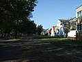
The center of the original street village is on the Alt-Karow street. In addition to the church, the former school building and the parish hall, there are still numerous farmhouses from the 19th century.
With the construction of the Karow station in 1882, the town received a railway connection via the Szczecin Railway to Berlin and in the opposite direction to Bernau . The outer areas of Karow were mostly built in the 1920s and 1930s, especially around the S-Bahn station in the northwest. There were almost exclusively smaller settlement houses on land for partial self-sufficiency.
The Alt-Karow primary school has existed since 1932.
On the former sewage fields in the north and on some wet meadows in the southern and eastern part of the district, many single and multi-family houses and multi-storey apartment blocks were built between 1992 and 1996. There were also other kindergartens, schools, a church meeting center, shops, restaurants and a central business center with a weekly marketplace . The old citizens of Karow often call the settlement Neu-Karow, with which they express a certain distance from the modern, rather urban appearance of the settlement.
nature
In the northwest of Karow there are the Karow ponds , which form a large, connected nature reserve . In the east, between the town center and the Berlin city limits, there are areas of the Barnim Landscape Park that are mainly used for agriculture.
traffic
The main traffic axis in Karow is the Blankenburger Chaussee - Alt-Karow - Bucher Chaussee road. In addition to the district, it connects the B 109 in Weißensee ( Prenzlauer Promenade ) with the B 2 in Bernau . To the west of Karow is the Bucher Strasse junction of the A 114 . It is a partial connection point .
The district is connected to the Berlin S-Bahn network (S-Bahn line 2) via the Karow train station . The regional train line RB27 of the Niederbarnimer Eisenbahn (NEB) to Groß Schönebeck begins in Karow.
The BVG bus routes 150 and 158 connect Karow with Buch and Blankenburg . The ring line 350 opens up the district.
The Karower Kreuz is located south of the Karow train station . Here the Szczecin Railway runs over the Berlin outer ring with connecting curves between the two routes. The Karower Kreuz station , which is planned as a tower station , is to be built at the intersection from 2026 .
Construction planning
As early as the 1990s there were plans to develop three areas that had previously been mainly used for agriculture. The procedure was initially discontinued due to the low demand, but was resumed due to the population growth. There are no plans to develop the adjacent single and multi-family house area, but rather a higher building density. Effects on currently less frequented residential streets as well as open and green spaces are expected. The already existing capacity problems are also a problem.
Based on these facts, the Pankow urban development office commissioned a master plan . It should analyze current problem situations and work out the need for action. The focus is on the traffic situation of the place.
Attractions
- Karow village church, the late Romanesque building, was built in the middle of the 13th century as a three-part apse church made of carefully hewn stone masonry . It is considered to be the oldest building on the Barnim in Berlin.
- Karow Picture Bible in the village church Karow: 33-part picture cycle of different and unexplained provenance from 1617 with scenes from the Old and New Testaments
- old school building (Alt-Karow 15: Karow community school, 14th elementary school), inaugurated in 1516, closed since 1934, restored from 2006–2009
- old fire brigade syringe house (Alt-Karow 10/11), built 1904, restored 2004–2006
- 19th century farmhouses along the Alt-Karow street
- Berlin-Karow station , a standard type from the late 19th century
- Karow Imperial Oak
- Wind turbine Enercon E-82 on the B 2 , one of two Berlin systems in the Pankow district
Alt-Karow

Wind turbine on the B 2


Schools and youth institutions
- Robert Havemann High School
- Primary school Alt-Karow (Blankenburger Chaussee 1, Bahnhofstrasse 32)
- Youth facility K14 in Karow North
See also
literature
- Martin Pfannschmidt : History of the Berlin suburbs Buch and Karow . Verlagbuchhandlung Fr. Zillessen, Berlin December 1927 (there is a reprint from 1994).
- Johannes Schultze (Hrsg.): The land book of the Mark Brandenburg of 1375 (= Brandenburg land books. Volume 2; Publications of the historical commission for the province of Brandenburg and the imperial capital Berlin . Volume VIII, 2). Commission publisher von Gsellius, Berlin 1940, Barnym. Districtus Berlin. Kare, p. 121 ( digitized version in Potsdam University Library ).
- Adriaan von Müller : nobleman, citizen, farmer, beggar man. Berlin in the Middle Ages. Berlin 1979.
- Historical local lexicon for Brandenburg, Part VI (Barnim). Potsdam 2011 (reprint of the first edition from 1980).
- Ulrich Schöntube: Gallery picture cycles in the Mark Brandenburg. A contribution to the Lutheran image program of the 16th – 18th centuries. Century. Lang, Frankfurt am Main a. a. 2008, ISBN 978-3-631-56861-3 , pp. 76–80: II. Description of the picture cycles: 1.5. Berlin-Karow: village church (1617); Pp. 282-291: III. Source history: 2.5. Johann Teuffel's biblical woodcuts as the source of the Old Testament images in Karow; P. 336 f .: 3. Biblical picture cycles of individual templates: 3.3. Templates of the cycles in Großthiemig, Jüterbog, Wusterhausen, Wutike, Tangermünde, Senzke, Karow and Mehlsdorf: 3.3.6. The New Testament pictures in Karow (Zugl .: Berlin, Humboldt-Univ., Diss., 2006).
Web links
Individual evidence
- ↑ Johannes Schultze (ed.): The land book of the Mark Brandenburg from 1375 . Commission publisher von Gsellius, Berlin 1940, Barnym. Districtus Berlin. Kare, p. 121.
- ↑ Karower Kreuz S-Bahn in the northeast will be interrupted in summer In: Berliner Zeitung Online , April 16, 2018.
- ^ Karow framework plan. District Office Pankow, accessed on July 24, 2020 .
- ↑ Claudia Rückert: The Picture Bible is celebrating its anniversary. In: The Church . No. 35, August 27, 2017, p. 15 ( The famous cycle of pictures in the Karow village church is celebrating its 400th anniversary this year: The 33 paintings from the Old and New Testament have adorned the gallery and the elders' stalls in the choir of the late Romanesque field stone church since 1617 ).
