Karower ponds
|
Karower ponds
|
||
|
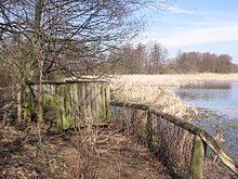
Information board about the nature reserve |
||
| location |
Buchholz and Buch , Pankow district , Berlin |
|
| surface | 128.6 ha | |
| Identifier | Berlin NSG 21 | |
| WDPA ID | 164028 | |
| Geographical location | 52 ° 37 ' N , 13 ° 28' E | |
|
|
||
| Sea level | from 47.5 to 55.0 m above sea level NN | |
| Setup date | June 20, 1994 | |
| Framework plan | Regulation, PDF; 155 kB | |
| administration | Urban development Berlin | |
| particularities | Viewing platforms, part of the Barnim Nature Park |
|
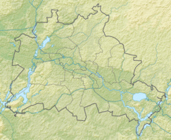
The Karower Teiche are a nature reserve in the northeast of Berlin . The namesake was the neighboring district of Karow to the east . As a habitat for amphibians , dragonflies and water birds , it is of supraregional importance.
Size and location
The 128.6 hectare area is located in the Barnim Nature Park . The ponds, which together measure 14.6 hectares, are only one meter deep on average. The flowing Lietzengraben separates the Pankow districts of French Buchholz in the south and Buch in the north. The eponymous Karow has no share. The area is bounded by the Panke in the east, Pankgrafenstrasse in the south , Bucher Strasse in the west and Bundesautobahn 10 in the north , the Berliner Ring runs exclusively between Karow and Buch for almost six kilometers directly through the Berlin urban area, and the Niederbarnimer regional train route 27 Railroad .
history
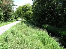
The Karower ponds are located at the transition from Barnim to Berlin's glacial valley . The Panke and Lietzengraben , coming from the loamy-sandy plateau , dug meltwater channels through the sander up to ten meters deep after the last cold period . Later, these channels silted up and were formed fens . In the 19th century, the two streams were straightened and peat mining began . This created the island pond in the northwest and the willow pond in the southwest, the duck pond in the northeast and the reed pond in the southeast were dug in 1911 for fish farming .
After the founding of the Berliner Rieselgüter in Blankenfelde in 1890 and in Buch in 1898, Berliner Rieselfelder was created in the neighborhood and in the area itself . The Karow ponds were used for secondary clarification or direct discharge of the wastewater . Because of the high pollution levels, fish farming had to be given up in the 1920s and the inflow from the Lietzengraben closed in 1980. The now exclusive feeding by precipitation and underground seepage water led to a lowering of the water level . The situation was exacerbated by the discontinuation of the sewage field management in 1985, and some ponds even fell dry at times. The Lietzengraben was dammed in 1986 to preserve the wetland so that a partial stream flows through the ponds.
The Pankow Society for Nature and Environment began recording bird species as early as the mid-1960s . For the 750th anniversary of the capital in 1987, the East Berlin administration took the decision in 1984 to create recreational forests on a large part of the floodplain, including here. Due to the heavy metal contamination of the soil and the wrong choice of species, only a few trees grew. Until 1990 the waters were managed by fishing. On June 20, 1994 the area was placed under nature protection, supplemented in 1997 by a maintenance and development plan (PEP). Now the focus was on preserving the ponds and the semi-open landscape. The concept only envisaged a forest of local trees as a buffer zone outside. On November 30, 2007, protection status was withdrawn from 0.4 hectares along the motorway. The introduction of purified water from the Schönerlinde sewage treatment plant into the Buch forest also improved the water balance of the Karow ponds. The problem of digested sludge remains unresolved .
flora
The ponds have extensive reed beds on stocks that from broadleaf cattail , reeds and water vapors exist. Typical plant species of the humid and drier tall herbaceous corridors grow on the silting zones . B. Real bindweed , common water dost , cuckoo's light carnation , marsh marigold , marsh goose thistle , meadow sorrel and meadow foam herb . On the damp and wet locations, especially on the western ponds, alder - gray willow bushes and alder forests grow thick . In the former sewage farm parcels spread mainly ruderale half- dry grassland with couch grass and Windhalm out in some places develop species-rich oat grass meadows.
On the afforestation areas, there is a semi-open landscape with small trees (including fruit trees ), hedges , tall perennials and meadows . A larger forest was only able to establish itself to the northeast of the duck pond, which , in addition to a few common oaks typical of the area , mainly contains non-native species such as ash-maple and poplar hybrids . So far (as of June 2009) 334 wild plants have been registered in the nature reserve, including 44 species that are on Berlin's Red List .
| Surname | Duck pond | Island pond | Reed pond | Willow pond | Karower ponds |
| image | 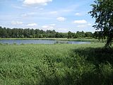 |
 |
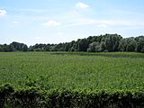 |
 |

|
| Coordinates | 52 ° 37 ′ 21 ″ N , 13 ° 27 ′ 46 ″ E | 52 ° 37 '25 " N , 13 ° 27' 39" E | 52 ° 37 ′ 13 ″ N , 13 ° 27 ′ 40 ″ E | 52 ° 37 '16 " N , 13 ° 27' 32" E | 52 ° 37 ′ 20 " N , 13 ° 27 ′ 37" E |
fauna
The nature reserve is home to 90 of 151 breeding bird species in Berlin, including many endangered species . Of particular importance are the breeding here and latching water and reed birds, these include Bartmeise , spoon , Heron , Gadwall and pochard , gray goose , mute swan , pipe and dwarf bittern , reed warbler species, marsh harrier , hood , Rothals - and little grebe , spotted marsh grouse and water rail . The nests of the bag -titans hang in the trees near the shore . In addition, thousands use swallows and starlings the reed belt during the train season in late summer as a place to sleep. The semi-open areas are used as hunting grounds for various birds of prey , red-backed killer and black hawk warbler. Tree pipit , garden warbler and oriole can be found in the less species-rich poplar and maple forests . The gray wagtail dives regularly for prey in the Panke . When the ponds run dry in summer with little rain, the black stork and great egret chase after the fish. Other species such as the common brown or stonechat are native here.
The Karow Ponds are a spawning area for amphibians of national importance. Toad tunnels on Pankgrafenstraße support you on your hike. Common (up to 2,500 animals during mating), garlic and green toads as well as grass , bog (population of 20 to 50 animals) and pond frogs are more common. Of the reptiles , only grass snakes and sand lizards occur regularly. The latter offer the dry slopes of the bird street with half- dry grass and blackberry -Gebüschen a good habitat . Due to the inadequate water quality and the occasional drying out of the ponds, the fish population is small in species and numbers. Three-spined stickleback , gable and crucian carp naturally migrated over the Lietzengraben . The 22 dragonfly species detected so far include the banded demoiselle , the common winter dragonfly , the great king dragonfly , the wedge-shaped damsel and the small garnet-eye . The most important biotope for the dragonfly larvae is the willow pond.
tourism
From the train station in Berlin-Karow it is only a twenty to thirty minute walk to the Karow ponds, which are particularly popular on the weekends. Most of the area is inaccessible and fenced off. Over the Pankeweg , here also the long-distance cycle route Berlin – Usedom , the crossing Barnim Dörferweg , and parallel to the above. Roads can be circled around the area once. The actual pond path leads between the northern and southern ponds. Four approximately half a meter high viewing platforms made of massive planks provide a glimpse into the world of birds and amphibians without disturbing them.
literature
- Carsten Rasmus, Bettina Rasmus: Berlin area north. 1st edition. KlaRas-Verlag, Berlin 2005, ISBN 3-933135-16-8 , p. 63 ff.
- Klaus-Detlef Kühnel, Roland Lehmann and others: Karower Teiche nature reserve. In: Senate Department for Urban Development Berlin, State Commissioner for Nature Conservation and Landscape Management Berlin (Ed.): Of course Berlin! Nature conservation and Natura 2000 areas in Berlin. 2nd corrected edition. Verlag Natur und Text, Rangsdorf June 2009, ISBN 978-3-9810058-9-9 , pp. 52–57, (digital edition in: Stadtentwicklung Berlin , short version ).
Web links
Individual evidence
- ↑ J. Gerstenberg: Terrain heights scale 1: 50000. (PDF; 14.8 MB) In: Berlin Environmental Atlas. Stadtententwicklung Berlin, 2010, p. 01.08 , accessed on June 28, 2015 (long loading time).
- ↑ a b c d e f g h i j Klaus-Detlef Kühnel, Roland Lehmann: Karower Teiche nature reserve. In: Of course Berlin! 2nd Edition. Verlag Natur und Text, Rangsdorf 2009, ISBN 978-3-9810058-9-9 , pp. 52–57.
- ^ NSG Karower Teiche / Nature Conservation in Berlin / State of Berlin. Retrieved July 24, 2020 .
- ^ A b Senate Department for Urban Development Berlin: Ordinance on the Karower Teiche nature reserve in the Pankow district of Berlin. Berlin June 20, 1994 with amendment November 30, 2007, stadtentwicklung.berlin.de (PDF; 155 kB).
- ↑ a b Senate Department for Urban Development and the Environment (Ed.): Flyer Karower Teiche Nature Reserve. stadtentwicklung.berlin.de (PDF; 3.7 MB).
- ↑ a b Katrin Koch: Protected areas in the Lietzengrabenniederung. In: 100 years of Hobrechtsfelde. A village for the Berlin water. Berlin 2009, pp. 24–27, NABU Berlin, berlin.nabu.de (PDF; 3.2 MB).
- ↑ Sjut Rohlfs: sewage farms. Blankenfelde, Mühlenbeck, Schönerlinde, Buch, Hobrechtsfelde. In: Environmental Atlas. Urban development Berlin, 1992, accessed on July 5, 2015 .
- ↑ Kerstin Schlopsnies, Hannelore Sigbjoernsen: Karower Teiche. In: Kulturring in Berlin e. V. (Ed.): Pankower landscapes. On tour between the old Panke hiking trail and the Barnim village trail. Berlin 2004, pp. 8–9.
- ↑ Katrin Koch, Horst Prochnow, Brigitte Wahlmann-Japp, Olaf Zeuschner: Forest. In: Interest group Bucher Chronik (ed.): From one hundred years of Bucher history 1898–1998. 1st edition. Berlin 1998, ISBN 3-00-002655-X , pp. 141–150.
- ↑ Fish fauna. Karower ponds. In: Environmental Atlas. Urban development Berlin, 2014, p. 02.08 , accessed on July 5, 2015 .
- ^ NSG Karower Teiche / Nature Conservation in Berlin / State of Berlin. Retrieved July 24, 2020 .

