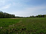
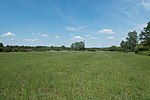
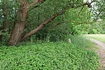
Spandau Forest
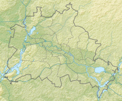
The Spandau Forest with 1,347 hectares total area of the largest forest areas in Berlin . It is located on the northwestern outskirts of the district hook field of Spandau . Three sub-areas in and around the Spandau Forest are designated as a nature reserve, and the entire forest is protected as a landscape protection area and is part of the Natura 2000 network as an FFH area and bird reserve .
location

The Spandau Forest extends along the border of Berlin to the places Falkensee and Schönwalde-Glien . This delimits the forest area to the north and west. In the east, Landstrasse 172 (Niederneuendorfer Allee) and in places the Havel form the border of the area, while residential areas, allotment garden settlements and the In den Kisseln cemetery are located immediately south of the forest . Landstrasse 16 (Schönwalder Allee) runs through the middle of the Spandau Forest and leads from the center of Spandau to Schönwalde. Part of the Osthavelländische Eisenbahn , which was shut down in 1950 and whose tracks have been partially preserved to this day, also ran through the southern Spandau Forest.
Historical development
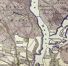
The forest area belonging to the Berlin glacial valley originally belonged to the independent city of Spandau and was known there as Stadtheide . For centuries it was used by the citizens of Spandau for agricultural purposes, for hunting and for firewood. Although a forester (also known as "Heideknecht" or "Oberförster") is said to have monitored the use of the forest since the Middle Ages, the agricultural use of the forest in particular had a negative effect on the natural cycle. In addition, drainage measures for the forest were initiated in the 18th century in order to gain further usable areas. In the 1730s, for example, the Nieder Neuendorfer Canal was laid through the forest.
At the end of the 19th century, the Spandau waterworks south of the forest went into operation, which mainly used groundwater in the forest area for drinking water treatment . As a result, the groundwater level in the forest fell by over 70 cm until the 1970s. This led to the extensive silting up of several smaller bodies of water, the drying up of the moors and consequently to the impoverishment of the flora and fauna in their area. Measures for compensatory irrigation were only introduced in the Spandau Forest in the 1980s. For example, ditches and artificial lakes were laid through the forest, through which a good 30,000 m³ of water from the Havel is fed into the forest every day.
In addition, the forest was declared a bird sanctuary and, in 1987 and 1988, two nature reserves were established within the forest: the Teufelsbruch and the Großer and Kleiner Rohrpfuhl. All maintenance and protection measures for the Spandau Forest are carried out by the Spandau Revierforsterei and the nature conservation authorities.
Flora and fauna
In today's Spandau Forest, thanks to the protective measures taken since the 1970s, a rich population of partly rare plants and animals has developed. The forest area is largely a deciduous forest , the trees of which are mainly oak , birch , elm and ash . Overall, the forest with its numerous bodies of water and moors offers a variety of habitats for insects, birds and mammals. The endangered stag beetle can be found in the trees , while pond frogs , common toads , grass snakes as well as numerous water beetles and fish can be found in the forest lakes and moors .
The bird world of the Spandau Forest is also very numerous, where species such as kingfisher , little grebe , goshawk , snipe or woodcock find good living conditions.
Mouse weasels , polecats , wild boars , raccoons , foxes and badgers can be found in the extensive forest areas . Otters and beavers occasionally find their way into the forest waters via the moats leading from the Havel .
Protected areas
Teufelsbruch nature reserve and side moors
The nature reserve "Teufelsbruch und Nebenmoore" covers an area of 48 hectares . It is located in the eastern part of the forest near Niederneuendorfer Allee. In the 19th century, today's Teufelsbruch represented a lake and was then called the Teufelssee (not to be confused with the Teufelssee in the Grunewald forest ).
Until the early 20th Century silted up , however, the Devil's due to the drainage, the addition by the construction of the nearby running Osthavelländischen Railway was accelerated, almost completely. The silting process continued into the 1980s, although the Teufelsbruch was first placed under nature protection as early as 1933. Since the irrigation measures carried out for the rest of the Spandau Forest were not sufficient for the Teufelsbruch, a network of underground water pipes was specially laid in 1986 to enrich the Teufelsbruch with water from the Havel. Due to the very nutrient-rich water from the Havel, the moor does not have any typical peat bog vegetation. To the east of the Bötzowbahn there is the Kleine Teufelssee as an extension of the Teufelsseekanals . Until the end of World War II, there was a connection between the Teufelsseekanal and Teufelsmoor under the Bötzowbahn. This was used by pike that spawned in the Teufelsmoor. The connection was later finally closed. Previously, this also had the important function of flooding the Teufelsmoor in spring. In the wider area of the moor, housing developments have emerged such as those on the former Schönwalde air base , the Fahle Horst , the Wurtland or the Schulzen Dienstland .
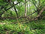
Today the Teufelsbruch is an extensive moor overgrown with forest and bushes , in which, among other things, around 240 species of mushrooms as well as over 550 species of beetles and 150 species of spiders have been registered. The habitat of the moor frog, which previously almost disappeared from the Spandau Forest, has been restored through irrigation measures . Thanks to a network of hiking trails, the Teufelsbruch can be easily visited without disturbing the flora and fauna. In the nearby residential area of Aalemannufer in Hakenfelde, which was built in 1994 , a street was named Am Teufelsbruch .
Legend of the origin of the name
In the late 18th and 19th centuries, the lake was mainly used for fishing, which is described in a legend about this lake as follows:
“Instead of the lake there is supposed to have been a village that sank into the water through the work of the devil. Many years later the top of the church tower could still be seen under the surface of the water, where the fishermen's nets were often torn. The curiosity did not let the residents rest, they tried to fathom the lake bed and, above all, the depth of the lake, but their plumb bobs were always too short. After catching a particularly large perch, ghost voices rang out from the depths demanding that the fish be returned, otherwise people would fare badly. After some hesitation they carried their catch back and the perch disappeared into the lake with one big leap. Since then, no accident has happened to the fishermen, nor have they ever landed such a big fish again. The ghost voices, however, have fallen silent and nobody has seen the church tower since then. "
The Großer and Kleiner Rohrpfuhl nature reserve
The "Großer und Kleiner Rohrpfuhl" nature reserve, which was also placed under protection for the first time in 1933, covers an area of 30.5 hectares and surrounds the eponymous, partially silted-up waters. Similar to the Teufelsbruch, today's Rohrpfuhle emerged from a lake that was increasingly silted up as a result of the construction of a drainage ditch and the Spandau waterworks. It has been possible to stop this process since the 1980s with an irrigation system, which - unlike the Teufelsbruch - does not consist of water pipes, but of water ditches that were previously created for drainage purposes. Here too, irrigation led to a loss of the raised bog vegetation. The forest path, which had been heaped up through the silted Großer Rohrpfuhl in the 1930s, was dismantled in 1996 to protect the habitats. Since then, the Rohrpfuhle have only been accessible from the outside.
Eiskeller and Spandauer Luchwald nature reserve
In December 2017, the northern part of the forest, bordering the meadows in Eiskeller, was removed from the landscape protection area as the "Eiskeller und Spandauer Luchwald nature reserve" and placed under protection as a nature reserve. The vermoorte lowlands with a very high water table provides a habitat represents for many endangered animal and plant species. The Luchwald is considered rare oak-hornbeam forest, periodically wet meadows in ice cellar are partly due to the Kuhlake irrigated. The northeast of the Schönwalder Avenue location Laßzinssee heard as Stretch also a protected area.
Spandau Forest Natura 2000 area
The Spandau Forest is part of the European nature reserve network Natura 2000 consisting of the EU bird sanctuary Spandau Forest and the FFH area Spandau Forest, which are congruent. In addition to the actual Spandau Forest, the area wears down the entire ice cellar , except for the buildings . In the west it goes over the Niederneuendorf Allee to the district border on the Havel, in the north bounded by the state border and in the south by the site of the former Oberhavel power station. The city park south of the Berlin-Spandau Johannesstift freight station and the park west of Schönwalder Allee are also part of the protected area, as are the seepage basins of the Berliner Wasserbetriebe .
EU bird sanctuary Spandau Forest
|
EU bird sanctuary Spandau Forest
|
||
|
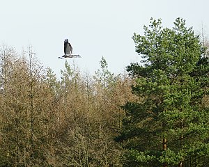
Crane couple above the Spandau Forest |
||
| location | In the district of Hakenfelde in the northwestern Berlin district of Spandau , ( Germany ) | |
| surface | 13.4732 km² | |
| Geographical location | 52 ° 35 ' N , 13 ° 11' E | |
|
|
||
| administration | Supreme nature conservation authority | |
The EU bird sanctuary Spandauer Forst is a European bird sanctuary ( SPA area ). The English-language name of the area is SPA Spandauer Forst , where SPA stands for Special Protection Area ('special protection area').
The protection goal is to maintain the populations of the following bird species:
| photo | German name | Scientific name |
|---|---|---|
| Great Reed Warbler | Acrocephalus arundinaceus | |
| kingfisher | Alcedo atthis | |
| Woodlark | Lullula arborea | |

|
crane | Grus grus |
| Middle woodpecker | Dendrocopos medius | |
| Red backs | Lanius collurio | |
| oriole | Oriolus oriolus | |
| Marsh harrier | Circus aeruginosus | |

|
Black woodpecker | Dryocopus martius |
| Sparrowhawk Warbler | Sylvia nisoria | |
| Corn Crake | Crex crex | |
| Honey buzzard | Pernis apivoru | |
| Miniature Flycatcher | Ficedula parva |
FFH area Spandau Forest
The already described area around the Spandau Forest is protected together with it as a flora-fauna-habitat area. Of the habitat types that are worthy of protection according to Annex I of the Habitats Directive, the following occur in the area:
Others
Memorial stone Crown Prince and Prince Heinrich beech
Almost at the end of the course of the Kuhlake in the north of the Spandau Forest, a memorial stone commemorates the (no longer existing) Crown Prince and Prince Heinrich beech, which was later created on the occasion of the extinguishing of a forest fire by the two namesake Heinrich von Prussia and Friedrich Wilhelm Emperor Friedrich III. , was planted on April 16, 1881.
For details see under memorial stone Crown Prince and Prince Heinrich beech .
Ice cellar
At the westernmost tip of the Spandau Forest, right on the state border with Brandenburg , is the so-called Eiskeller , an area of over 50 hectares that is considered the coldest place in Berlin. During the division of Germany after the Second World War , it formed almost an exclave of West Berlin for decades , which could only be reached from the rest of the city via a narrow connecting road. Through an exchange of territory with the GDR , a broader access was created in 1972. Before the 1970s, the ice cellar was mainly used for agriculture.
Kirsten Sahling
On June 20, 2009, the psychologist Kirsten Sahling was stabbed to death in the Spandau Forest near the Kuhlake at around 8:50 a.m. She died a little later in the intensive care unit of a hospital. A memorial stone at the scene of the crime commemorates her.
Wall victims
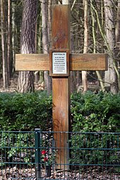
In the northeast of the forest between the two nature reserves is a memorial cross for the West Berlin victim at the Berlin Wall Adolf Philipp . He was shot dead by a member of the GDR border troops when he was arrested while armed with a gas pistol in an earth bunker in this border area. The memorial cross stands on the Berlin side near the border with the state of Brandenburg at the point where his bicycle was found, with which he had visited the place.
See also
literature
- Senate Department for Urban Development Berlin (Ed.): Of course Berlin! Nature conservation and NATURA 2000 areas in Berlin . Verlag Natur & Text, Berlin 2007, ISBN 978-3-9810058-3-7 , pp. 86-99.
Web links
- Senate Department for Environment, Transport and Climate Protection Berlin: NATURA 2000 area Spandau Forest and Spandau Luchwald
- Senate Department for Environment, Transport and Climate Protection Berlin: NSG Teufelsbruch und Nebenmoore
- Senate Department for Environment, Transport and Climate Protection Berlin: NSG Großer and Kleiner Rohrpfuhl
- Senate Department for Environment, Transport and Climate Protection Berlin: NSG Eiskeller and Spandauer Luchwald
Individual evidence
- ↑ Berlin Moor Soils in Climate Change - Devil's Break Adjacent Moors
- ↑ The location of the former Teufelssee on the cover picture of the PDF document; Retrieved April 9, 2010
- ↑ In: The Stralauer Fischzug. Legends, stories and customs from old Berlin. Verlag Neues Leben Berlin 1987, ISBN 3-355-00326-3 , p. 102
- ↑ Official Journal of the European Union DE3445301 L 198/41, accessed on March 5, 2017
- ↑ List of areas that meet the criteria for the Birds Directive (Directive 2009/147 / EU) (Special Protected Area) , Senate Department for Urban Development and the Environment, Berlin, (July 2014), accessed on March 5, 2017
- ↑ Natura 2000 areas , Berlin Senate Department for Urban Development, August 26, 2005, accessed on March 5, 2017

