| Territory name
|
Image / Commons
|
BfN ID
|
WDPA ID
|
EEA ID
|
since
|
location
|
District / city
|
Area ha
|
Remarks
|
|
Acher lowland
|
|
DE7314441
|
555537888
|
DE7314441
|
2001
|
⊙
|
Rastatt
district of Ortenaukreis
|
001029.80
|
RA (654.6)
OG (375.2) Meadow lowlands
of Black Forest tributaries in the Rhine plain
|
|
Adelegg
|

|
DE8226441
|
555537957
|
DE8226441
|
2001
|
⊙
|
Isny im Allgäu
Leutkirch im Allgäu
|
002861.85
|
RV
Alpine predominantly wooded mountain range
|
|
Albtrauf Heubach
|

|
DE7225401
|
555537878
|
DE7225401
|
2006
|
⊙
|
Heubach
|
000426.77
|
AA
Albtrauf with extensive beech forests, interspersed juniper heaths and rock formations
|
|
Albuch
|
|
DE7226441
|
555537879
|
DE7226441
|
2006
|
⊙
|
Königsbronn
Steinheim am Albuch
Heidenheim an der Brenz
Bartholomä
Essingen
Oberkochen
Böhmenkirch
|
008644.71
|
HDH (5669.3)
AA (2596.4)
GP (379.0) Extensive
contiguous forest area
|
|
Baar
|

|
DE8017441
|
555537935
|
DE8017441
|
2001
|
⊙
|
Black Forest-Baar
district Tuttlingen
district Breisgau-Hochschwarzwald
district Rottweil district
|
037701.59
|
VS (30987.8)
TUT (3808.7)
RW (1861.9)
FR (1043.2)
Plateau between the Black Forest and the Swabian Alb
|
|
Krauchenwies / Zielfingen quarry ponds
|

|
DE7921401
|
555537927
|
DE7921401
|
2006
|
⊙
|
Krauchenwies
Mengen
Sigmaringen
Sigmaringendorf
|
000750.13
|
SIG quarry pond
landscape along the Ablach
|
|
Dossenheim-Schriesheim mountain road
|
|
DE6518401
|
555537800
|
DE6518401
|
2004
|
⊙
|
Rhein-Neckar district
|
000370.72
|
HD
vineyards, meadows and orchards with dry stone walls and allotments
|
|
Blitzenreuter Lake District with Altshauser Weiher
|
|
DE8123441
|
555537944
|
DE8123441
|
2006
|
⊙
|
Fronreute
Wolpertswende
Altshausen
Eichstegen
|
001626.09
|
RV
moor complexes, lakes and ponds
|
|
Bodanrück
|

|
DE8220402
|
555537953
|
DE8220402
|
2001
|
⊙
|
Allensbach
Bodman-Ludwigshafen
Reichenau
Constance
Radolfzell on Lake Constance
|
006310.93
|
KN Forest-
rich molasse ridge with mixed and deciduous forests
|
|
Bodenmöser
|
|
DE8325441
|
555537964
|
DE8325441
|
2001
|
⊙
|
Argenbühl
Isny in the Allgäu
|
000917.51
|
RV
Larger moor and meadow complex
|
|
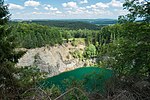
Dump
|
|
DE7617401
|
555537909
|
DE7617401
|
2001
|
⊙
|
Oberndorf am Neckar
|
000009.88
|
RW
part of the upper Neckar valley
|
|
Bremgarten
|

|
DE8011441
|
555537933
|
DE8011441
|
2006
|
⊙
|
District of Breisgau-Hochschwarzwald
|
000520.08
|
FR
Former military airfield
|
|
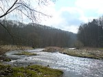
Donauried
|
|
DE7527441
|
555537907
|
DE7527441
|
2006
|
⊙
|
Asselfingen
Langenau
Rammingen
Sontheim an der Brenz
Niederstotzingen
Herbrechtingen
|
004253.18
|
HDH (1510.4)
UL (2742.6)
Extensive marshy lowland
|
|
Elz lowland between Kenzingen and Rust
|

|
DE7712402
|
555537915
|
DE7712402
|
2006
|
⊙
|
District of Emmendingen
Ortenaukreis
|
001084.97
|
EM (800.0)
OG (285.0) Water
meadows, farm meadows, fields, strips of hedges, field trees
|
|
Enztal Mühlhausen - Roßwag
|
|
DE7019441
|
555537863
|
DE7019441
|
2000
|
⊙
|
Mühlacker
Illingen
Vaihingen an der Enz
|
000539.75
|
LB (246.3)
PF (293.5)
Meandering river with alluvial forest, meadows and oxbow lakes
|
|
Eriskircher Ried
|

|
DE8323401
|
555537962
|
DE8323401
|
2006
|
⊙
|
Eriskirch
Friedrichshafen
Langenargen
|
000603.52
|
FN
reed areas and litter meadows between the Schussen and Rotach estuaries
|
|
Eselsburger valley
|
|
DE7327441
|
555537891
|
DE7327441
|
2007
|
⊙
|
Herbrechtingen
Gerstetten
|
000327.69
|
HDH
Deeply cut river valley of the Brenz
|
|
Federseeried
|

|
DE7923401
|
555537928
|
DE7923401
|
2006
|
⊙
|
Biberach district
|
002929.85
|
BC
Ried landscape with eutrophic Flachsee
|
|
Felsenberg
|
|
DE6618402
|
555537816
|
DE6618402
|
2004
|
⊙
|
Rhein-Neckar district
|
000005.86
|
HD
old sandstone quarry with a wide wall
|
|
Gottswald
|
|
DE7513442
|
555537905
|
DE7513442
|
2006
|
⊙
|
Ortenau district
|
002208.32
|
OG
Large forest complex
|
|
Grienwiesen and Wernau quarry ponds
|
|
DE7322401
|
555537889
|
DE7322401
|
2007
|
⊙
|
Wernau (Neckar)
Unterensingen
Wendlingen am Neckar
Koengen
|
000068.59
|
ES
former gravel pits on the Neckar with siltation zones
|
|
Hardtwald north of Karlsruhe
|

|
DE6916441
|
555537856
|
DE6916441
|
2004
|
⊙
|
District of Karlsruhe
Karlsruhe
|
004742.39
|
KA (3043,2)
KA
Pine forest with old stocks of English oak and abandoned gravel pit
|
|
Heaths and forests Tauberland
|
|
DE6323441
|
555537761
|
DE6323441
|
2004
|
⊙
|
Königheim
Werbach
Külsheim
Tauberbischofsheim
Hardheim
|
001117.34
|
MOS (139.2)
TBB (978.1) Heath, poor
and dry grasslands on steep limestone slopes
|
|
Hohenlohe level east of Wallhausen
|
|
DE6726441
|
555537831
|
DE6726441
|
2004
|
⊙
|
Satteldorf
Wallhausen
|
000538.88
|
SHA
Important corridor for bird migration
|
|
Hohentwiel / Hohenkrähen
|

|
DE8218401
|
555537951
|
DE8218401
|
2006
|
⊙
|
Hilzingen
Mühlhausen-Ehingen
Singen (Hohentwiel)
|
000150.41
|
KN
Important corridor for bird migration
|
|
Höwenegg
|
|
DE8018401
|
555537936
|
DE8018401
|
1998
|
⊙
|
Immendingen
|
000020.74
|
TUT
volcanic complex, geological document
|
|
Jagst with side valleys
|
|
DE6624401
|
555537817
|
DE6624401
|
2000
|
⊙
|
Hohenlohekreis
District Heilbronn
District Schwäbisch Hall
Neckar-Odenwald-Kreis
Ostalbkreis
|
000852.18
|
AA (6.3)
KÜN (312.0)
HN (250.1)
SHA (267.1)
MOS (16.7)
Incised river valley with near-natural hillside forests
|
|
Johanniterwald
|
|
DE7712403
|
555537916
|
DE7712403
|
2008
|
⊙
|
Kenzingen
Rheinhausen
|
000057.55
|
EM
oak-hornbeam forests
|
|
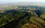
Kaiserstuhl
|
|
DE7912442
|
555537925
|
DE7912442
|
2006
|
⊙
|
District of Breisgau-Hochschwarzwald
District of Emmendingen
|
007922.78
|
FR (5314.9)
EM (2607.9)
Large vine terraces, small vine terraces
|
|
Kälberklamm and Hasenklamm
|

|
DE7016401
|
555537861
|
DE7016401
|
2001
|
⊙
|
Ettlingen
Waldbronn
Karlsruhe
|
000021.27
|
KA
Two Kerbbach systems with natural sources
|
|
Kammbach lowland
|
|
DE7413441
|
555537894
|
DE7413441
|
2007
|
⊙
|
Ortenau district
|
001834.90
|
Upper floor
meadow lowlands with a high proportion of wet meadows
|
|
Kinzig-Schutter lowland
|
|
DE7513441
|
555537904
|
DE7513441
|
2006
|
⊙
|
Ortenau district
|
002821.85
|
OG
mosaic of wet meadows, fields, remnants of litter meadows and large sedge
|
|
Stove with side valleys
|

|
DE6823441
|
555537850
|
DE6823441
|
2004
|
⊙
|
Hohenlohekreis
District Heilbronn
District Schwäbisch Hall
|
000888.40
|
SHA (401.5)
HN (85.2)
KÜN (401.7)
Bottom valley of the cooker with natural sections
|
|
Kochhartgraben and Ammertal slopes
|

|
DE7419401
|
555537897
|
DE7419401
|
2006
|
⊙
|
Ammerbuch
Rottenburg am Neckar
|
000053.58
|
TU
cultural landscape with lawn complexes, fringing societies, sheep pastures, hedges and orchards
|
|
Constance bay of Lake Constance
|

|
DE8321401
|
555537961
|
DE8321401
|
2006
|
⊙
|
Constancy
|
000311.12
|
KN
water surface with shallow water zones
|
|
Cork forest
|
|
DE7313442
|
555537887
|
DE7313442
|
2006
|
⊙
|
Ortenau district
|
002826.72
|
OG
Large forest complexes with old oak and hornbeam forests
|
|
Lappen near Walldürn
|
|
DE6422401
|
555537786
|
DE6422401
|
2003
|
⊙
|
Neckar-Odenwald district
|
000062.58
|
MOS
meadows with alternating moisture in a hollow
|
|
Lindenweiher
|
|
DE7924401
|
555537929
|
DE7924401
|
2006
|
⊙
|
Hochdorf
|
000046.33
|
BC
Artificially dammed pond in the area of the low terrace gravel of the Riss valley
|
|
Mindelsee
|

|
DE8220403
|
555537954
|
DE8220403
|
2001
|
⊙
|
Radolfzell on Lake Constance
Allensbach
|
000409.12
|
KN
Ice age lake with wooded steep banks and silting zones
|
|
Middle Swabian Alb
|

|
DE7422441
|
555537899
|
DE7422441
|
2001
|
⊙
|
Alb-Danube
district Esslingen
district Göppingen
district Reutlingen
district Tübingen
Zollernalb district
|
039597.26
|
RT (18988.2)
GP (12642.5)
ES (5804.5)
TÜ (1696.8)
BL (310.6)
UL (154.7)
Diverse cultural and natural landscape
|
|
Middle Rammert
|
|
DE7519401
|
555537906
|
DE7519401
|
2001
|
⊙
|
Rottenburg am Neckar
Ofterdingen
Dusslingen
Tübingen
|
002749.54
|
TÜ
orchards, allotment gardens and natural oak and beech forests
|
|
Middle Black Forest
|

|
DE7915441
|
555537926
|
DE7915441
|
2001
|
⊙
|
Black Forest-Baar-District
Emmendingen
District Breisgau-Hochschwarzwald
Ortenaukreis
District Rottweil
|
021665.69
|
VS (10677.9)
FR (3051.9)
OG (2398.0)
EM (5319.5)
RW (218.3) High
forest areas
|
|
Moss forests near Freiburg
|

|
DE7912441
|
555537924
|
DE7912441
|
2004
|
⊙
|
District of Breisgau-Hochschwarzwald
District of Emmendingen
Freiburg im Breisgau
|
003617.41
|
FR (950.1)
EM (65.2)
FR
Mostly wooded alluvial fan of the Dreisam
|
|
Northern Black Forest
|

|
DE7415441
|
555537895
|
DE7415441
|
2006
|
⊙
|
District of Calw
District of Freudenstadt
District of Rastatt
District of Rottweil
Ortenaukreis
Baden-Baden
|
036045.11
|
OG (17414.1)
OG (5451.0)
RA (9248.7)
CW (2588.3)
RW (977.5)
BAD Natural
mountain mixed forests
|
|
Eastern alb eaves near Aalen
|
|
DE7126401
|
555537872
|
DE7126401
|
2006
|
⊙
|
Bask
|
000561.47
|
AA
Wooded ridge of the Härtsfeld
|
|
Pfrunger and Burgweiler Ried
|

|
DE8022401
|
555537937
|
DE8022401
|
2000
|
⊙
|
Ostrach
Wilhelmsdorf
Riedhausen
Königseggwald
Guggenhausen
|
002825.81
|
RV (1392,4)
SIG (1433,4) Bog
complex of raised, intermediate and fens
|
|
Pleidelsheimer Wiesental with Altneckar
|
|
DE7021401
|
555537864
|
DE7021401
|
2001
|
⊙
|
Ludwigsburg district
|
000042.07
|
LB
Former quarry pond in the Neckar valley
|
|
Rench lowlands
|
|
DE7313441
|
555537886
|
DE7313441
|
2006
|
⊙
|
Achern
Renchen
Rheinau
Appenweier
|
001855.81
|
Upper floor
lowland with various uses
|
|
Rhine valley Altlußheim-Mannheim
|

|
DE6616441
|
555537813
|
DE6616441
|
2006
|
⊙
|
Rhein-Neckar district of
Mannheim
|
004451.83
|
HD (4033.6)
MA (city) (418.3)
Rhine lowland landscape with old Rhine and old Rhine islands
|
|
Rhine valley Breisach-Sasbach with Limberg
|
|
DE7911401
|
555537923
|
DE7911401
|
2006
|
⊙
|
District of Breisgau-Hochschwarzwald
District of Emmendingen
|
001115.97
|
FR (647.3)
EM (468.6)
Dammed Rhine, Bastardaue, former floodplain
|
|
Rhine valley Elchesheim-Karlsruhe
|

|
DE7015441
|
555537860
|
DE7015441
|
1999
|
⊙
|
Karlsruhe
district Karlsruhe
district Rastatt
|
002165.19
|
KA (448.3)
KA (city) (954.8)
RA ( 762.1) Flood plains accompanying the
river
|
|
Rhine valley Haltingen - Neuchâtel with foothills
|

|
DE8211401
|
555537950
|
DE8211401
|
2006
|
⊙
|
Neuenburg am Rhein
Efringen-Kirchen
Bad Bellingen
Schliengen
Weil am Rhein
|
001475.45
|
FR (576.3)
LÖ (899.2)
Near-natural river with rapids and gravel banks
|
|
Rhine valley Karlsruhe-Rheinsheim
|

|
DE6816401
|
555537845
|
DE6816401
|
2000
|
⊙
|
Karlsruhe
District of Karlsruhe
|
005115.67
|
KA (4876.1)
KA (city) (239.6)
Altaue, current floodplain in meander zone
|
|
Rhine valley Kehl-Helmlingen
|
|
DE7313401
|
555537885
|
DE7313401
|
2006
|
⊙
|
Ortenau district
|
002133.79
|
Upper floor
dammed Rhine with barrage Gambsheim, former floodplain
|
|
Rhine valley Neuenburg-Breisach
|
|
DE8011401
|
555537932
|
DE8011401
|
2001
|
⊙
|
District of Breisgau-Hochschwarzwald
|
002782.11
|
FR
Rest of the Rhine with rapids and gravel banks
|
|
Rhine valley Nonnenweier - Kehl
|

|
DE7512401
|
555537903
|
DE7512401
|
2001
|
⊙
|
Ortenau district
|
003900.76
|
OG
dammed Rhine, former floodplain, extensive old Rhine system
|
|
Sasbach-Wittenweier Rhine valley
|

|
DE7712401
|
555537914
|
DE7712401
|
2003
|
⊙
|
Ortenaukreis
district of Emmendingen
|
004718.89
|
EM (3241.2)
OG (1477.6)
Dammed Rhine, former floodplain, extensive old Rhine system
|
|
Rhine valley from the Rench to the Murg estuary
|

|
DE7114441
|
555537868
|
DE7114441
|
2006
|
⊙
|
Rastatt district
|
003105.40
|
RA
dammed Rhine with former floodplain
|
|
Riedmatten and Schiftunger Bruch
|
|
DE7214441
|
555537877
|
DE7214441
|
2006
|
⊙
|
Rastatt district
|
000375.08
|
RA
Meadow lowlands of Black Forest tributaries in the Rhine plain
|
|
Rohrsee
|

|
DE8125441
|
555537945
|
DE8125441
|
1994
|
⊙
|
Bad Wurzach
|
000110.52
|
RV
Larger natural eutrophic groundwater lake
|
|
Saalbach valley near Hambrücken
|
|
DE6817441
|
555537849
|
DE6817441
|
2004
|
⊙
|
District of Karlsruhe
|
000384.86
|
KA
Niederung, traversed by the canalised Saalbach
|
|
Salem monastery pond
|
|
DE8221401
|
555537956
|
DE8221401
|
2001
|
⊙
|
Salem
Uhldingen-Mühlhofen
|
000136.51
|
FN
Several managed fish ponds with reed stocks
|
|
Salenberg
|

|
DE7425401
|
555537900
|
DE7425401
|
2001
|
⊙
|
Lonsee
|
000028.08
|
UL
Juniper heather on a western slope in the White Jura
|
|
Schischemtal
|
|
DE7717401
|
555537917
|
DE7717401
|
2001
|
⊙
|
Epfendorf
Dietingen
|
000217.95
|
RW
valley with Umlaufberg and Schischemklamm
|
|
Schmiechener See
|

|
DE7624402
|
555537910
|
DE7624402
|
2006
|
⊙
|
Schelklingen
Allmendingen
|
000073.60
|
UL
Almost silted-up lake in an old original Danube loop
|
|
Schönberg near Freiburg
|
|
DE8012441
|
555537934
|
DE8012441
|
2006
|
⊙
|
District of Breisgau-Hochschwarzwald
Freiburg im Breisgau
|
000068.68
|
FR (4.9)
FR (city) (63.7)
Mosaic with various uses on the north slope of Schönberg
|
|
Schönbuch
|

|
DE7420441
|
555537898
|
DE7420441
|
2006
|
⊙
|
District of Tübingen
District of Böblingen
District of Reutlingen
District of Esslingen
|
015362.03
|
TÜ (8024.6)
BB (5384.6)
RT (1381.6)
ES (571.2)
Beech forest area with orchards on the edge
|
|
Schwarzensee and piston moss
|
|
DE8324441
|
555537963
|
DE8324441
|
2007
|
⊙
|
Wangen in the Allgäu
|
000055.72
|
RV
Natural eutrophic lake with silting vegetation and reed belt
|
|
Schwetzinger and Hockenheimer Hardt
|
|
DE6617441
|
555537814
|
DE6617441
|
2004
|
⊙
|
Neckar-Odenwald district
|
001436.22
|
MOS
pine forest, open and wooded sand dunes
|
|
Leimen quarry
|

|
DE6618401
|
555537815
|
DE6618401
|
2004
|
⊙
|
Rhine-Neckar district of
Heidelberg
|
000022.02
|
HD (18.1)
HD (city) (4.0)
Shell limestone quarry with tunnel system
|
|
Orchards and vineyards between Geradstetten, Rudersberg and Waldhausen
|

|
DE7123441
|
555537871
|
DE7123441
|
2006
|
⊙
|
Rems-Murr-Kreis
Lorch
|
002073.59
|
WN (2026.8)
AA (46.8)
Orchards and vineyards
|
|
Stromberg
|
|
DE6919441
|
555537857
|
DE6919441
|
2004
|
⊙
|
Enzkreis
District Heilbronn
District Ludwigsburg
|
010305.67
|
LB (6158.1)
PF (1970.9)
HN (2176.7) Zeugenberg complex
cut up by stream valleys
|
|
Southern Black Forest
|

|
DE8114441
|
555537942
|
DE8114441
|
2006
|
⊙
|
Freiburg im Breisgau
district Breisgau-Hochschwarzwald
district Lörrach
district Waldshut
|
033515.91
|
WT (13807.7)
FR (9477.8)
LÖ (9900.7)
FR (city) (329.7)
Natural area of the Black Forest between Höllental and Hochrhein
|
|
Southwest Alb and Upper Danube Valley
|

|
DE7820441
|
555537921
|
DE7820441
|
1999
|
⊙
|
Rottweil
district Sigmaringen
district Tübingen
district Tuttlingen district
Zollernalbkreis
|
043030.98
|
BL (18470.6)
TUT (16816.6)
SIG (6416.9)
TÜ (1185.8)
RW (141.1)
Cultural and natural landscape of the Swabian Alb
|
|
Valleys of the Middle Area Alb
|

|
DE7624441
|
555537911
|
DE7624441
|
2006
|
⊙
|
Alb-Danube
district Biberach
district Reutlingen district
Ulm
|
005692.36
|
UL (4034.6)
RT (1519.5)
UL (city) (132.0)
BC (6.3) Valley
landscapes of the Swabian Alb
|
|
Tierstein with hillside forest and Eger spring
|
|
DE7127401
|
555537873
|
DE7127401
|
2006
|
⊙
|
Bopfingen
|
000002.77
|
AA
viewpoint of the Eastern Alb
|
|
Tüllinger Berg and Gleusen
|
|
DE8311441
|
555537960
|
DE8311441
|
2007
|
⊙
|
District of Loerrach
|
000581.86
|
LÖ
cultural landscape with orchards, vines, grasslands
|
|
Überlinger See of Lake Constance
|
|
DE8220404
|
555537955
|
DE8220404
|
2001
|
⊙
|
Allensbach
Bodman-Ludwigshafen
Constance
Sipplingen
Ueberlingen
Uhldingen-Mühlhofen
|
002555.78
|
KN (1108.1)
FN (519.2) Part of
Lake Constance with steep banks
|
|
Lower Remstal
|

|
DE7121442
|
555537870
|
DE7121442
|
2006
|
⊙
|
Waiblingen
Fellbach
Remseck am Neckar
|
000571.42
|
WN (411.5)
LB (159.9)
Kerbtal of the Rems with large loops
|
|
Untersee of Lake Constance
|

|
DE8220401
|
555537952
|
DE8220401
|
2006
|
⊙
|
Constance
Radolfzell on Lake Constance
Singen (Hohentwiel)
Allensbach
Gaienhofen
Moos
Öhningen
Reichenau
|
005915.33
|
KN
Large flat water lake
|
|
Max-Eyth-See bird island
|
|
DE7121441
|
555537869
|
DE7121441
|
2006
|
⊙
|
Stuttgart
|
000003.01
|
S
island in a former quarry pond
|
|
Foreland of the central Swabian Alb
|

|
DE7323441
|
555537890
|
DE7323441
|
2007
|
⊙
|
Esslingen
district Göppingen district
|
017003
|
GP (5765.3)
ES (11237.6)
Small- scale cultural landscape with extensive orchards
|
|
Wachenberg near Weinheim
|
|
DE6418401
|
555537784
|
DE6418401
|
2006
|
⊙
|
Rhein-Neckar district
|
000023.31
|
HD
porphyry quarry, surrounded by deciduous and mixed forest
|
|
Wagbach lowlands
|
|
DE6717401
|
555537830
|
DE6717401
|
2012
|
⊙
|
District of Karlsruhe
Rhein-Neckar-Kreis
|
001041.89
|
KA (862.9)
HD (179.0)
low moor in the meandering Rhine zone
|
|
Pond near Maulbronn
|
|
DE7018401
|
555537862
|
DE7018401
|
2004
|
⊙
|
Enzkreis
|
000142.73
|
PF
former monastery pond with reeds and reeds
|
|
Meadow landscape near Balingen
|
|
DE7718441
|
555537918
|
DE7718441
|
2001
|
⊙
|
Balingen
Geislingen
|
000969.45
|
BL
Meadow landscape with individual orchards
|
|
Meadow Harrier Taubergrund
|

|
DE6425441
|
555537787
|
DE6425441
|
2001
|
⊙
|
Creglingen
Igersheim
Wittighausen
|
001692.19
|
TBB
Agricultural foothills of the Ochsenfurt Gäu landscape
|
|
Wurzacher Ried
|

|
DE8025401
|
555537938
|
DE8025401
|
2003
|
⊙
|
Bad Wurzach
|
001798.32
|
RV
Large bog complex
|
|
Wutach and Baaralb
|
|
DE8116441
|
555537943
|
DE8116441
|
2006
|
⊙
|
Blumberg
Bräunlingen
Donaueschingen
Huefingen
Bonndorf in the Black Forest
Stühlingen
Wutach
Löffingen
Friedenweiler
Lenzkirch
|
014002.46
|
VS (8640.1)
WT (3607.4)
FR (1755.0)
Gorge valley of the Wutach with tributaries
|
|
Ziegelberg
|

|
DE7418401
|
555537896
|
DE7418401
|
2006
|
⊙
|
Nagold
|
000055.55
|
CW
Natural, richly structured landscape
|


.jpg)


_-_Feldsee_005.JPG)


