
Oberkochen
| coat of arms | Germany map | |
|---|---|---|

|
Coordinates: 48 ° 47 ' N , 10 ° 6' E |
|
| Basic data | ||
| State : | Baden-Württemberg | |
| Administrative region : | Stuttgart | |
| County : | Ostalbkreis | |
| Height : | 496 m above sea level NHN | |
| Area : | 23.57 km 2 | |
| Residents: | 7895 (Dec. 31, 2018) | |
| Population density : | 335 inhabitants per km 2 | |
| Postal code : | 73447 | |
| Area code : | 07364 | |
| License plate : | AA, GD | |
| Community key : | 08 1 36 050 | |
| LOCODE : | DE OKO | |
City administration address : |
Eugen-Bolz-Platz 1 73447 Oberkochen |
|
| Website : | ||
| Mayor : | Peter Traub (Free Voters Ostalbkreis) | |
| Location of the city of Oberkochen in the Ostalb district | ||
  |
||


Oberkochen is a town in the Ostalbkreis in Baden-Württemberg .
Surname
The name Oberkochens is derived from the Kocher , a tributary of the Neckar, which flows through the village in a northerly direction . The origin of the cooker is south of the city. The name of the river (795 mentioned as "Cochane", 1024 as "Chochina") is probably of Celtic origin. The Indo-European word root kuk stands for to bend , to bend . The cooker would be the winding river.
The area around the 12th century Cooking Castle , named after the river, was called Cooking at that time . In 1335 the settlement "above" on the Kocher was first mentioned as Oberkochen . The neighboring village of Unterkochen , which lies further down, is now part of Aalen .
geography
Geographical location
Oberkochen lies between Albuch in the west and north and Härtsfeld in the east in and above the valleys of the Schwarzen Kocher and the Gutenbach that flows into it there . The highest point of the mark is on the summit of the Volkmarsberg ( 744 m above sea level ).
A little southwest of the city lies at 499.2 m above sea level. NHN the origin of the black stove . From this powerful karst spring, the Kocher flows through the urban area in a north-easterly direction and has the following tributaries there:
- The red cooker , which is only 150 meters long and which is completely diluted from its source in the oil pond , which is located on the Leitz company premises .
- The Katzenbach rises 735 meters southwest of the municipal cemetery , the lower course of which is verdolt from the Feigengasse.
- The 3.1 kilometer long Gutenbach , whose sources are in the Wolfertstal.
- The 700 meter long Edlenbach , which is the only one of the four to come from the right side of the Härtsfeld field and which has its source in the nursery in the long pond .
The city essentially consists of two separate settlement parts, the inner city, with which the Spitztal, Lenzhalde and Brunnenhalde settlement areas have grown, and the north-eastern district of Heide, which is around 100 m higher. The "Heide" was originally a community-owned sheep pasture, was reforested into a spruce forest around 1900 and cultivated from 1970 onwards.
City structure
The town of Oberkochen includes the district of Heide and the hamlet of Kreuzmühle, as well as the abandoned towns of Zwerenberg, Kreutzheim, Echmannsweiler, Tiefentalhäuschen, slag washing , Bilz , Schleifmühle and Ziegelhütte .
Division of space

According to data from the State Statistical Office , as of 2014.
history
overview
At first glance, Oberkochen, inconspicuous, can look back on historical events that are unique in this form - in addition to finds from the Late Bronze Age that are three thousand years old and later traces of settlement by the Celts , Romans and Alemanni .
- From the late Middle Ages to the time of Napoleon , the village was lordly divided for around 500 years. After the Reformation , this division was exacerbated for around 250 years by a denominational split, which was even negotiated before the highest court of the Holy Roman Empire and in this context also attracted the attention of the then emperor .
- In the second half of the 19th century, Oberkochen became a center for industrial drill making . The most important legacy from this time is Leitz GmbH & Co. KG , which has developed into one of the international market leaders for woodworking tools.
- After the Second World War , the Carl Zeiss company settled in Oberkochen, which is today one of the most important German high-tech companies and the global technology leader in various areas of photonics . The associated quadrupling of the population within twenty years was an important reason for Oberkochen's making a city in 1968.
Bronze Age, Celts, Romans and Alemanni

Finds from the late phase of the Bronze Age in the Keltenstraße in 1956 indicate that there was already around 1000 BC. Was a settlement. Finds from the Latène period suggest that a later Celtic settlement around the time of the birth of Christ is possible. In 1971 a Roman cellar from the 2nd or 3rd century was excavated, which is believed to be part of a rest stop on a Roman road through the Brenz-Kocher valley. In 1980, an Alemannic burial ground from the 7th century with rich grave goods was discovered in a construction pit in Frühlingsstraße .
Development of the medieval village
In 2017 excavations between the Catholic Church and the city library at the "Bühl", the highest and therefore flood-proof place between the Katzenbach and Gutenbachtal, mine houses from the 10th / 11th. It was discovered in the 19th century, which was then used as a cellar. Numerous post holes could be detected from the associated wooden houses , as well as a larger fireplace, which indicates a craft practiced there. This is likely to be the settlement that was already suspected on the basis of the Alemannic burial ground about three hundred meters to the west.
The lower part of the tower of today's Catholic Church of St. Peter and Paul , which has been preserved from the High Middle Ages , suggests that a larger Romanesque church already stood at this point by the beginning of the 13th century at the latest. Humpback blocks , which are built into various modern walls in the area of the church and probably come from the Staufer period, are possibly remains of a secular stone building from the 12th or 13th century.
Manorial division of the village
In 1240, Count Hartmann IV. Von Dillingen, lord of the Brenzgau and landlord of Cooking, bequeathed part of today's Oberkochen to the Benedictine monastery of Ellwangen .
He bequeathed the other part to his sister, through whose son Ulrich von Helfenstein it came to King Albrecht I in 1303 . The king founded the Königsbronn monastery in the same year . By 1358, the Cistercians from Königsbronn based on the earlier Helfensteiner areas and purchased goods in Ower-Cooking , who u. a. belonged to a knight Otte von Kaltenburg, incorporated the non-Ellwangian part of Oberkochen. The village thus had two authorities: around two thirds in the north belonged to the Ellwangen monastery since 1240, the remaining third in the south to the Königsbronn monastery.
Most of the estates of the two manors of Königsbronn and Ellwangen were held as fiefdoms in the hands of a few ministerials , of whom only the Lords of Cooking were knighted . Even if they were vassals themselves , these were the masters of the place.
First mention of Oberkochen

The oldest documented mention of Oberkochen can be found in the Ellwanger camp book , a handwritten list of the possessions and the related income of the Ellwang monastery. Two documents made of parchment with preserved wax seals , dated St. Anthony's Day (January 17th) 1335, deal with the sale of arable and forest land to the Ellwang Abbot.
- With the first certificate, Ulrich von Ahelfingen , known as von Ybach, and Fritz, the son of his late brother Konrad, sold various forests and fields belonging to the “ Kocherburg ” ( Kocherburg in Unterkochen ), some of which were “towards Oberkochen”, for £ 26 Heller to the Prince Abbot Kuno von Gundelfingen in Ellwang .
- With the second certificate, Ulrich undertook not to give up his brother's sons their inheritance until they had vowed to recognize this contract of sale for the properties located, among other things, “towards Oberkochen”.
Iron smelting and slag washing
In 1551, a blast furnace for iron smelting was built at the origin of the Black Cooker south of Oberkochen . The blast furnace was given up during the Thirty Years' War , mainly due to a lack of wood, demolished in 1644, including the bell, and rebuilt in Unterkochen . In 1646, a slag washer was set up at the source of the stove and operated until the middle of the 18th century.
Additional denominational division of the village

The lordship of Heidenheim, to which the Königsbronn monastery belonged, came to the county of Württemberg in 1448 , fell to Bavaria in 1450 and was bought back in 1504 by Duke Ulrich von Württemberg . In 1534 Ulrich joined the Reformation . His son Duke Christoph von Württemberg pushed through the Reformation in Königsbronn in 1553 and converted the monastery into a school. The part of Oberkochen, which belonged to the former Königsbronn monastery, also became Lutheran and the residents had to accept the confession of their ruler on the basis of the Augsburg religious peace of 1555.
The Ellwangen Monastery was converted into a canon monastery, the Prince Provost of Ellwangen , in 1460 . This remained with the Catholic Church.
From 1553, the divided Oberkochen was not only subordinate to two sovereigns, the Duke of Württemberg and the Prince Provost of Ellwangen, but was also split by two denominations. There were two mayors, two council rooms, two parish coffers and from 1581, when a Protestant church was completed, two churches. The lower jurisdiction lay with the respective sovereign, the high jurisdiction for the entire place with the prince of Ellwangen. In 1562 the two sovereigns agreed on a common order for Oberkochen, which was replaced in 1578 by a common forest and police order with a total of 64 articles.
.png)
On a map of the Heidenheim Forest from 1590 you can see “Ober Cooking” with the red dotted border that ran through the village at that time. The Catholic Church (left), the Protestant Church (right), the "Langenhart" (Langert), the "Kochensuhrsprung" (Kocher origin) with "Eisenschmidt" (ironworks) and the "Eegerthof" (Seegartenhof) can be recognized there was a lake at that time.

According to the rules of the Augsburg Religious Peace, the existence of two denominations in one place was only permitted in free and imperial cities . A village like Oberkochen with a few hundred inhabitants did not come under this rule. This precedent was finally brought before the Reich Chamber of Commerce in Speyer . The occasion was the Protestant church, which was completed in 1581 without the consent of the Catholic prince provost of Ellwang. The prince provost initially argued that part of the disputed church was in the Catholic part and was therefore illegal. Since they could not agree on the exact course of the border, the prince provost filed a complaint with the Reich Chamber of Commerce. This was decided in 1600 that the building plot was entirely on Protestant territory. Now the prince provost argued that because of the high level of jurisdiction he was entitled to, the entire place had to be Catholic. This was contradicted by the Protestant side, because of the lower jurisdiction to which it was entitled, it also had the right to decide on religion in its domain. In 1618 even Emperor Matthias commented on this legal case and exhorted both parties to rest and moderate. The judges in Speyer could not make up their minds and so the decades-long legal dispute fizzled out after the parties had apparently lost interest in the course of the Thirty Years' War .
Oberkochen was one of the areas hardest hit by the aftermath of the Thirty Years War and lost over eighty percent of its population. Of more than six hundred, only a hundred or so remained.
In 1731, high-ranking delegations of the Duke of Württemberg and the Prince Provost of Ellwangen met in Aalen to work out a new regulation for the common village, in which there were repeated religious disputes. After eighteen years they signed the Aalen Protocol of 1749 with numerous regulations on living together and practicing religions. Among other things, it was stipulated that every head cook was free to choose and practice his religion.
End of the manorial division of the village
Under Napoleon , on the basis of the Reichsdeputationshauptschluss of 1803, the Prince-Provostei Ellwangen was dissolved and fell to the Duchy of Württemberg. This brought the centuries of dual rule in Oberkochen to an end.
Administrative affiliation in the Württemberg period
Since the founding of the Kingdom of Württemberg , Oberkochen has belonged to the Aalen District Office in accordance with the new administrative structure . The administrative reform during the time of National Socialism in Württemberg led to the affiliation to the district of Aalen in 1938 .
View of the old village in the pre-march

The oldest known town view from the year 1847 was made in the period of Vormärz and shows the Brunnenhalde (left), the Volkmarsberg (middle) and the Langert with Langertstein (right) in the background. The Protestant church at that time, today the city library, had a roof turret and the Catholic Church of St. Peter and Paul had the tower that still exists today, but at that time with a baroque hood. The Ottilien Chapel and the Scheerermühle can be seen in the front row of buildings. The place is surrounded by an otter fence. In the right foreground the meadow chapel, which was demolished in 1950.
industrialization

In 1860, the drill maker and mechanic Jakob Bäuerle founded a drill shop, which resulted in other company founders in Oberkochen starting the industrial production of wood drills : Four former employees of Bäuerle - Albert Leitz (1876), Jakob Schmid (1882), Wilhelm Grupp (1890) and August Oppold (1896) - as well as the former Leitz apprentice Karl Wannenwetsch (1903).
While the Bäuerle company, which later also manufactured woodworking machines and temporarily employed over a thousand people, had to cease operations in 1974 due to economic difficulties, the global company Leitz GmbH & Co. KG , which specializes in woodworking tools, emerged from the founding of Albert Leitz . The company founded by Wilhelm Grupp, later known under its brand name WIGO , as well as KWO Werkzeuge GmbH, which goes back to Karl Wannenwetsch, were incorporated into Leitz GmbH & Co. KG in 1984 and 1994. Jakob Schmid GmbH & Co. KG produces today in Neresheim- Elchingen and the company founded by August Oppold operates today in Oberkochen as Oppold System International GmbH.
Industrialization in the last third of the 19th century was strongly promoted from 1864 by the Brenzbahn , a railway line of the Württemberg State Railways between Aalen and Heidenheim, which ran via Oberkochen and continued from Heidenheim to Ulm in 1876. As with the “Precision Drawing and Shaft Factory” founded by Gottlieb Günther in 1893, whose buildings were taken over by Bäuerle in 1929, the water power from the cooker was still used to operate the machines, but steam turbines were also used.
The electrification began in 1906 and was founded in 1916 by the overland station Jagstkreis AG acquired (UJAG).
According to the 1939 census, Oberkochen had residents and 1003 industrial jobs in 2011, 500 of them commuting from outside the country.
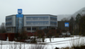
The most decisive impetus for growth for Oberkochen came from the Carl Zeiss company . After the Second World War, at the instigation of the American occupying forces, this split off from the Jena-based mother, later VEB Carl Zeiss Jena, and settled in Oberkochen in 1946, initially under the name Opton Optische Werke Oberkochen GmbH . After German reunification , the VEB's core optical business came through the Treuhandanstalt to Carl Zeiss Jena GmbH, which was taken over by Carl Zeiss in Oberkochen. Today, Carl Zeiss AG, based in Oberkochen, is a world market leader in photonics in many areas .
time of the nationalsocialism
In the Reichstag election on November 6, 1932 , the last before the seizure of power , the NSDAP in Oberkochen achieved a below-average result with 23.3 percent of the vote. The Center Party won the election with 55.1 percent. The KPD got 13.1 percent and the SPD only got 1.2 percent of the vote.
As part of the DC circuit whose local councils were replaced by members of the Nazi Party in July 1933 after the dissolution of the Center Party. In December 1933, Mayor Richard Frank was retired and Otto Heidenreich (NSDAP) was appointed administrative administrator. Heidenreich was mayor of Oberkochen from July 1934 until the end of World War II in 1945.
The company Fritz Leitz Maschinen- und Apparatebau GmbH, created in 1938 from a split of the Gebrüder Leitz company, was the first company in Oberkochen to start manufacturing armaments. Before the end of the war, almost a thousand people were employed at Leitz in Oberkochen and around five hundred more in the two branch plants in Giengen an der Brenz and Burgrieden, manufacturing aircraft components and apparatus. Fritz Leitz (born October 13, 1882; † November 20, 1942) was appointed military manager and his company was named a "NS model company". In 1944, the Leitz company built an extensive tunnel system in the mountain to the west of its company premises in order to protect parts of the production from potential air raids. The project, which was intended for 52 machines for the production of aircraft parts, came to a standstill at the end of 1944 due to bottlenecks in the cement supply . The Fritz Leitz company buildings were taken over by Zeiss in 1946. The production tunnels that were never used were sealed in 1994.
The companies Wilhelm Grupp and J. Adolf Bäuerle also switched to armaments production. Bäuerle manufactured a. a. Carriages for guns.
In the Dreißental, in the Turmweg, in the Volkmarsbergstraße and in the Keltenstraße, new living space for the growing population was created from 1937. In 1939, the Hitler Youth built an imposing HJ home on the heights of the Turmweg, the only one in the Aalen district. The building is used today by the Sonnenberg School.
From 1941, prisoners of war came to Oberkochen, initially French and later Russians and other citizens. They were housed in the previous building of the TVO gym, which was demolished after the war, as well as in barracks fenced with barbed wire on the company premises of Fritz Leitz, Grupp, Bäuerle and Oppold, where they were used as forced laborers .

The first air raid on Oberkochen took place on April 1, 1945. American planes attacked a train with sixty wagons that had just arrived near the station, in which concentration camp prisoners were on their way from the Neckarelz concentration camp to Ulm . Although the attack was halted when prisoners escaped from the cars, seven prisoners and one security guard were killed. On April 11th, while German troops were fighting through, another fighter-bomber attack occurred, which hit three adjacent buildings and killed three Oberkochen women with four children who had sought refuge in the basement. On April 24, after heavy artillery and aircraft fire, which killed several buildings, American ground troops marched into Oberkochen without encountering any resistance.
In place of Mayor Heidenreich, a few politically unaffected citizens initially took over the official business until the American military government reinstated the former Mayor Richard Frank. Heidenreich was sentenced to two ¾ years in a labor camp on April 20, 1948 as an “incriminated person” , even if the judgment chamber in Ludwigsburg confirmed that he was “correct administration”. Since he had been detained since May 9, 1945, this sentence had been served by the time the sentence was pronounced.
The Second World War cost Oberkochen with one hundred and sixty dead, fifty-eight missing and the seven victims of the air raid of April 11, 1945 the lives of a total of 225 citizens, i.e. more than a tenth of the population at the time.
From village to city
After the end of the Second World War, Oberkochen became part of the American zone of occupation in 1945 and thus belonged to the newly founded state of Württemberg-Baden , which was dissolved in the current state of Baden-Württemberg in 1952.
In the post-war period, Oberkochen's population quadrupled from around 2,000 to almost 8,000 in 1961, mainly due to the settlement of the Carl Zeiss company. A large part of the new citizens were former employees of the VEB Carl Zeiss Jena with their families and predominantly Protestant denominations. In 1956 the number of 4,381 new jobs created at Zeiss within a decade was already more than twice as high as that of all long-established Oberkochen industrial companies combined, which employed a total of 1949 employees.
| company | Jobs |
|---|---|
| Carl Zeiss | 4381 |
| J. Adolf Bäuerle | 758 |
| Wilhelm Grupp | 420 |
| Gebr. Leitz | 293 |
| Fritz Leitz | 125 |
| Cold rolling mill | 113 |
| Jakob Schmid | 102 |
| August Oppold | 98 |
| Günther & Schramm | 40 |
In 1964, the population was expected to double again to around 16,500 in 1974.
Against this background, Oberkochen was elevated to the status of town in 1968. At the same time, a new town hall with a town hall hotel, the new Protestant Church of Reconciliation and, from 1970, the new development area Heide , where, according to the original plan, living space for 5,500 residents was to be created in a compact design.
In 1968 Oberkochen had around 8,600 inhabitants and offered 7,000 jobs. After reaching a maximum of 8,682 inhabitants in 1969, however, the population of Oberkochen fell against expectations. After adapting the development plans accordingly, the new development area Heide with almost 1,500 inhabitants was completely and largely settled with single-family houses. The Heidehochhaus at the entrance to the district, completed in 1975, is a landmark that is reminiscent of the originally planned compact construction.
Through the district reform in 1973 , the city of Oberkochen became part of the Ostalb district .
| year | 1600 | 1650 | 1854 | 1925 | 1939 | 1950 | 1961 | 1969 | 1980 | 1990 | 2000 | 2010 | 2019 |
|---|---|---|---|---|---|---|---|---|---|---|---|---|---|
| population | 600 | 100 | 1201 | 1524 | 2011 | 3753 | 7979 | 8682 | 8118 | 8446 | 8271 | 7799 | 8363 |
| source |
In 2000, the intermunicipal industrial area Oberkochen-Königsbronn and the industrial area Oberkochen-Süd I were developed, where the companies Carl Zeiss SMT and Carl Zeiss Meditec are located today.
In 2016, the Oberkochen Süd II industrial area was developed, following the Märzenbuckel (→ Lage) , a lookout point at 664 m above sea level located directly above on a bare hilltop. NHN, also called Am Märzenbuckel . After the company OWEMA, which belongs to the Nagel Group , had already settled there, a large part of the area was sold to the South Korean company YG-1 in 2017 , which wants to build a technology center for metalworking tools here.
Leitz GmbH & Co. KG

Carl Zeiss (1957)

Carl Zeiss (2008)

District Heide from the southwest. The wind turbines in the background are less than ten kilometers away near Waldhausen .

Heidehochhaus

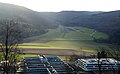
Industrial area South I (right, completely built on by Zeiss) and South II (left center, still undeveloped in 2019) from a north-westerly direction


Religions
From the 14th century onwards, Oberkochen was divided into rulers: the larger part belonged to the Ellwangen monastery , the smaller part to the Königsbronn monastery . During the Reformation , the Königsbronn part of the place with Württemberg became Protestant , while the Ellwang part remained Catholic . As a result, the division of the village repeatedly led to legal problems and disputes, which were resolved in the so-called Aalen Protocol in 1749 , a contract between Ellwangen and Württemberg.
A separate parish with the benefice of St. Peter is occupied from 1345. The current Roman Catholic St. Peter and Paul Church was consecrated on October 25, 1900. The neo-Romanesque building replaced a Romanesque church from the 13th century, which was later rebuilt in Gothic and Baroque styles, but then became too small and also dilapidated.
The first Protestant church was completed in 1581 and received a pastor in 1583. In 1875, it was replaced by a new building that today houses the city library. When many Protestant Christians moved in after the Second World War , this church too became too small. The Protestant parish of Oberkochen therefore built the Reconciliation Church, consecrated in 1968, on Mayor-Bosch-Strasse.
politics
Municipal council
The SPD , CDU , Free Voters and Greens are represented in the Oberkochen municipal council. The free voters originally called themselves Bürgergemeinschaft Oberkochen (BGO). After the Free List Oberkochen (FLO) split off in 1994, BGO and FLO merged five years later under the name Freie Bürger Oberkochen (FBO). The local elections since the city elevation in 1968 had the following percentages:
| year | SPD | CDU | BGO | FLO | FBO | Green |
|---|---|---|---|---|---|---|
| 1971 | 35.0 | 30.0 | 26.0 | |||
| 1975 | 31.0 | 35.0 | 34.0 | |||
| 1980 | 43.0 | 35.0 | 22.0 | |||
| 1984 | 39.2 | 37.0 | 23.8 | |||
| 1989 | 36.5 | 38.5 | 25.0 | |||
| 1994 | 34.8 | 31.1 | 19.1 | 9.8 | 5.1 | |
| 1999 | 33.5 | 39.1 | 21.2 | 6.2 | ||
| 2004 | 32.9 | 37.0 | 18.7 | 11.4 | ||
| 2009 | 33.4 | 37.1 | 16.7 | 12.8 | ||
| 2014 | 32.5 | 36.9 | 17.8 | 12.8 | ||
| 2019 | 30.41 | 30.39 | 20.5 | 18.7 |
In the local elections on May 26, 2019 , the SPD won back first place after twenty-five years with a lead of twelve votes (18,103 versus 18,091 votes for the CDU). The result was the following:
| Parties | 2019 | 2014 | ||||
|---|---|---|---|---|---|---|
| proportion of | Seats | ± proportion | ± seats | proportion of | Seats | |
| SPD | 30.41% | 6th | −2.1% | ± 0 | 32.5% | 6th |
| CDU | 30.39% | 5 | −6.5% | −2 | 36.9% | 7th |
| FBO | 20.5% | 4th | + 2.7% | +1 | 17.8% | 3 |
| GREEN | 18.7% | 3 | + 5.9% | +1 | 12.8% | 2 |
| voter turnout | 58.0% | + 7.1% | 50.9% | |||
Mayor and mayor since 1803

| year | title | Surname |
|---|---|---|
| 1803-1809 | Mayor | Johann Sebastian Gold (Ellwangen) and Kaspar Scheerer (Württemberg) |
| 1809-1830 | Kaspar Scheerer (alone) | |
| 1830-1849 | Sigmund Jonathan Maier ( surgeon ) | |
| 1849-1889 | Michael Wingert ( master mason ) | |
| 1889-1901 | Johannes Betzler | |
| 1901-1903 | Alois Butscher | |
| 1903-1905 | Franz Anton Bucher | |
| 1905-1933 | Richard Frank | |
| 1933-1945 | mayor | Otto Heidenreich ( NSDAP ) |
| 1945-1946 | Richard Frank (identical to Otto Heidenreich's predecessor) | |
| 1946-1948 | Rudolf Eber (CDU) | |
| 1948-1977 | Gustav Bosch (CDU) | |
| 1977-1993 | Harald Gentsch (SPD) | |
| 1993– | Peter Traub (Free Voters Ostalbkreis) |
coat of arms

The blazon of the coat of arms reads: "In blue three (2: 1) golden roses." The coat of arms was introduced in 1968 with the city elevation.
The Lords of Boiling , first mentioned in 1136 , demonstrably had three wheels in their coat of arms from 1380 until their extinction towards the end of the 15th century, as can also be found in the coat of arms of neighboring Unterkochen . But one of them, the knight Görig von Cooking, developed a special shape for himself in 1404 with three roses. These were the template for the new Oberkochen coat of arms. The colors were chosen arbitrarily because no historical colors were known.
The original Oberkochen coat of arms from 1927 was divided with a five-pronged stag pole on a gold background in the upper part and a beech tree and two blue plowshares on a silver background in the lower part.
Twin cities
-
 Dives-sur-Mer ( France ) since 1984
 -
 Montebelluna ( Italy ) since 1992
 -
 Mátészalka ( Hungary ) since 2008
Economy and Infrastructure
traffic
Oberkochen is located on Bundesstraße 19 , which was expanded in 1959 to become a non-crossing bypass . It is the natural traffic axis of the Kocher - Brenz - breakthrough valley through the Ostalb between Aalen in the north and Heidenheim an der Brenz in the south. The next motorway junction Aalen-Oberkochen on the federal motorway 7 ( Flensburg - Füssen ) can be reached north and then east via the B 19 and the L 1084 after about 11 km at Ebnat .
The Brenzbahn , a single-track, non-electrified main railway line between Aalen and Ulm, runs between Bundesstraße 19 and the town. At the breakpoint at the former train station of Oberkochen keep all the trains running on the route Regional - and InterRegio Express trains.
The Hohenlohe-Ostalb-Weg leads as a long-distance cycle path from Rothenburg ob der Tauber through Oberkochen via the Swabian Alb to Ulm on the Danube.
The Volkmarsberg in Oberkochen is one of the highlights of the Swabian Alb North Rim Trail . This 365-kilometer long-distance hiking trail run by the Swabian Alb Association leads from Donauwörth to Tuttlingen , following the Albtrauf .
A section of the Way of St. James leads from Neresheim via Oberkochen to Rottenburg am Neckar . The Way of St. James from Oberkochen to Santiago de Compostela has a total length of exactly 2,400 kilometers .
Companies
Carl Zeiss is the city's largest employer with around 4,000 jobs. In Oberkochen, the company manufactures optical components for civil use only. Defense technology, most recently part of Carl Zeiss Optronics GmbH, was majority acquired in 2012 by Cassidian , a division of EADS GmbH, and merged with the Hensoldt Group in 2017 . Optical devices ranging from medieval glasses to space optics can be seen in the Optical Museum on Carl-Zeiss-Straße. Since 2006, Carl Zeiss SMT has been producing optical systems for semiconductor production in a new factory in the Oberkochen Süd I industrial area . Carl Zeiss Meditec has also been based there since April 2013 .
Another global company with headquarters in Oberkochen is the woodworking tool specialist Leitz , which has been producing here since 1876 .
CD Wälzholz produces cold-rolled flat steel wound on rolls in Oberkochen and specializes in phosphated strip steel . Founded in 1907 under the name "Carl J. Walther Metal Drawing and Cold Rolling Mill", the plant belonged to Röchling's iron and steel works from 1928 until it was taken over by CD Wälzholz in 2007.
Founded in 1993, 3E Datentechnik GmbH belongs to the youngest generation of companies in the area and has developed into a leading provider of ERP software for the window construction industry with branches in Switzerland, France and China.
Oberkochen has more jobs than able-bodied residents, so it is a commuter town .
Authorities
In Oberkochen there is a branch of the quality test center of the Bundeswehr . See also: List of Bundeswehr locations in Germany .
Educational institutions
The Dreißentalschule, a former elementary and secondary school , has been a primary and community school since 2012 , where a middle school leaving certificate can be taken. It was originally housed in the brick building built in 1900 as a Catholic schoolhouse. The new building from 1951 was expanded with an extension in 1958. The Dreißentalschule and the Tiersteinschule, built in 1965 as an additional elementary school, have been organizationally merged since 2016.
At the Ernst-Abbe-Gymnasium , a science-oriented high school that is also a center school for molecular biology and a MINT-EC school , the Abitur can be taken. The building was built in 1962 with a gym and swimming pool. The swimming pool is no longer part of the school and has been converted into the municipal leisure pool "aquafit". In the 2018/2019 season, the high school was the only school in German-speaking countries that was able to send a FIRST Tech Challenge team to Detroit for the FIRST World Cup .
The Sonnenbergschule, a special needs school , has existed since 1970 in the Bergheim, which was built in 1939 as a HJ home.
The music school Oberkochen / Königsbronn is housed in the former old building of the Dreißentalschule (brick building).
Four facilities are available for childcare: Catholic day care center St. Michael, Kinderhaus Gutenbach, Kinderhaus Wiesenweg and Kindergarten Heide.
Leisure and sports facilities

- "Aquafit" leisure pool
- Carl Zeiss Stadium (two grass pitches and one artificial turf pitch)
- Three sports halls and a gym and festival hall
- Miniature golf course (in the Heide district)
- Tennis courts
- Ski lift on the Volkmarsberg
Culture and sights
Buildings

- Schiller House Between 1860 and 1938 the Schillerhaus was a Protestant schoolhouse and teachers' residence. It was named after Friedrich Schiller without any historical reference ; it has been a local history museum since 1997.
- Former station built in
1863 by Georg von Morlok in the historicism style and used as the Brenzbahn station until 2005 . In 2007 it was bought by a private investor and restored, and there has been a restaurant on the ground floor since 2009. - City Library
Former Protestant church from 1875 in place of a previous church from 1581. The church, in which the city library has been located since 1981, originally had a roof turret in which three church bells hung. This was reinforced in 1952 to accommodate a fourth bell. Since the church roof began to vibrate dangerously when they were put into operation, the roof turret was removed and the current church tower was built in 1953, in which the four bells could be rung safely. The missionary and Africa explorer Christian Hornberger was born there in 1831 . He was the son of the Protestant pastor Johann Christian Hornberger, who lived with his family in the parish apartment, which was located directly above the church of the previous church. - Scheerermühle
The oldest documented mention of the Lower Mill is said to come from 1357. It was rebuilt in 1877 by the miller Kaspar Scheerer and has been a listed building since 1979. The Mühlenverein Oberkochen, founded in 2004, restored the mill and made it fully functional again. She has been the foam mill of the Mühlenverein Oberkochen since 2014. Opposite the former farm building, today the Scheerer-Mühle inn . - Catholic parish church of St. Peter and Paul The neo-Romanesque building, consecrated on October 25, 1900, replaced a predecessor church built at the latest at the beginning of the 13th century and essentially Romanesque , which was originally called St. Peter. The square tower base dates back to this time and is by far the oldest building in Oberkochen.
- Fuchsbau
Today's music school in Oberkochen Königsbronn is located in a red brick building in Dreißentalstrasse, which is called the Fuchsbau because of its color. It was built in 1900 on what was then the western outskirts of Oberkochen as a new Catholic school. This resulted in the Dreißentalschule, which today only uses the neighboring, younger building from 1951 and 1958. - Evangelical Church of Reconciliation The Reconciliation Church, consecrated on December 15, 1968, has a campanile and is characterized by the contemporary building materials concrete, wood and glass.
- Town hall built in
1967 as part of the upcoming urban elevation on the then newly built Eugen-Bolz- Platz, extensively restored between 2009 and 2011. Next to it is the Vilotel, a new hotel from 2018 in place of the former Rathaushotel from 1968. In the course of the redesign of Eugen-Bolz-Platz, the sundial created in 1968 by Ernst Wanner and donated by Carl Zeiss was moved to the opposite side of the street. - Edith-Stein-Haus built in
1755 next to the Catholic Church of St. Peter and Paul as a Catholic schoolhouse, named after Edith Stein without historical reference , new building in 1997 with an almost identical facade, today a Catholic rectory. - Josefskapelle
The chapel dedicated to Saint Joseph stands on a section of the Way of St. James leading through Oberkochen . It was built in 1987 on a private initiative and only with subsequent building permission at the foot of the Rodstein. - Heidemauer
In the summer of 2012, a 90 meter long and two meter high wall on the road to the Heide district was painted with a fantasy landscape with flowers, birds and insects. Lars Oschatz ( Berlin ) and Martina Fuchs ( Altstätten ) used a mixed technique with spray cans and airbrush . - New center
Between the city library and St. Peter and Paul, a 1,100 square meter multifunctional square was completed in May 2020, which is called “New Center” and also includes the stove below.

Schillerhaus, today a local history museum

Former train station

Town center with the fool's tree of the Oberkochen fools' guild "Schlagga-Wäscher", city library and St. Peter and Paul

Former Protestant parish church, today the city library

Memorial plaque in memory of Christian Hornberger , who was born here, at the city library

Former Scheerermühle, in the background St. Peter and Paul

Restored mill wheel of the Scheerermühle

Former farm building of the Scheerer mill , today the Scheerer mill

St. Peter and Paul, in front of it the Edith Stein House

Fuchsbau, today a music school

Evangelical Church of Reconciliation

Eugen-Bolz-Platz with the town hall (right) and the hotel "Vilotel", in the foreground the sundial created by Ernst Wanner in 1968

Relief on Eugen-Bolz -Platz at the entrance to the town hall

Josefskapelle at the foot of the Rodstein
90 meter long airbrush on the road to the Heide district (2012)

New center seen from Rodstein


.jpg)


Fountain
- Lindenbrunnen
The fountain, which was built in 1922 to commemorate those who fell in World War I , is today a memorial for those who died in both world wars. It originally stood on a traffic island that no longer exists at the confluence of Katzenbachstrasse with Aalener Strasse / Heidenheimer Strasse. As part of a city center renovation, it was moved around ten meters to its current location in 1989 using a hydraulic press. - Goose fountain
The fountain with a goose shepherd, built in 1962 on the initiative of the then mayor Gustav Bosch in Katzenbachstrasse, is a reminder that there used to be a goose garden with a drinking trough where the villagers' geese were tended . - Bohrermacherbrunnen
The fountain by Karl Ulrich Nuss erected in the city center in 1990 is a reminder of the industrial foundations of Oberkochen. A well drill is shown. According to the engraving in the round base plate, it was donated by the Leitz company and cast in Süßen at Strassacker.

Linden Fountain (1922)

Goose Fountain (1962)

Bohrermacherbrunnen (1990)


Museums
- Carl Zeiss Optical Museum and Exhibition Center
- Local history museum in the Schillerhaus
- Schaumühle Scheerermühle
Gravesites
The Catholic and Evangelical cemeteries were originally located next to the two parish churches on Aalener Straße. In 1851, for health reasons, both cemeteries were relocated from the former residential area of Oberkochen to today's Bahnhofstrasse and Katzenbachstrasse. In 1957, the municipal cemetery on Kapellensteige was opened as the third cemetery.
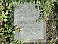
In the Evangelical Cemetery in Katzenbachstrasse, the area around which is now built, there are historically significant graves of entrepreneurs who laid the foundations for the industrialization of Oberkochen in the 19th century: Jakob Bäuerle (1834–1891), Albert Leitz (1854–1916), Gottlieb Günther (1855–1928) and Wilhelm Grupp (1863–1943). The grave of Kaspar Scheerer (1821–1908), who rebuilt the Scheerer mill in 1877, has also been preserved.

Jakob Bäuerle (1834-1891)

Albert Leitz (1854–1916) with father, wife, brother and descendants
Gottlieb Günther (1855–1928)

Wilhelm Grupp (1863–1943) with wife and son with wife

Kaspar Scheerer (1821–1908) with his wife


Archaeological monuments
- Roman cellar In the Weilfeld district of Gewann, students from the local grammar school excavated the foundation walls of a Roman cellar, which dates from the second or third century AD, under professional guidance . The original thesis that it was an outbuilding of a villa rustica was refuted by geophysical measurements by the State Office for the Preservation of Monuments in Baden-Württemberg in 2011. The cellar is now believed to be part of a rest stop on Römerstrasse, which led through the cross valley formed by Kocher and Brenz through the Swabian Alb .
- Bilzhaus Since the 17th century, the "Bilz", a settlement about 3 km west of Oberkochen, has been documented by entries in the birth registers of the Oberkochen parishes. After the Thirty Years' War , immigrants from Carinthia , Styria , Tyrol and the then Prince-Archbishopric of Salzburg received permission to settle there. The settlement was abandoned at the beginning of the 19th century, but a stone building was still in use until 1830. The foundations of this Bilzhaus were excavated between 1989 and 2003 with the support of the Baden-Württemberg State Office for Monument Preservation as part of school projects.

Roman cellar

Bilzhaus


Nature and landscape protection areas
- Volkmarsberg with observation tower With a height of 743 m above sea level. NHN, the Volkmarsberg is the "local mountain" of the city of Oberkochen. The Volkmarsbergturm, inaugurated in 1930, is located in the midst of a heathland, a lookout tower of the Swabian Alb Association , from which you can see the Alpine chain when the visibility is good . The hilltop, a former sheep pasture that was partially recaptured by the forest, is a nature reserve.
- Tiefes Tal The Hubertus spring is located in the
3 km long valley in the south of Oberkochen (→ Lage), also known as the Tiefental . At the end of the valley, which is designated as a landscape protection area, there is a station on the karst spring path .

Volkmarsberg with observation tower from the south-east
Deep valley, in the foreground the industrial area Oberkochen Süd I


Natural monuments
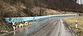
- Origin of the black stove The origin of the Kocher lies south of the city on the Albuch side of the Urbrenz valley . It consists of several springs that cut deeper and deeper into the mountainside. With an average discharge of 680 l / s, this is the largest karst spring in Oberkochen. From 1551 to 1644 there was an ironworks at the origin of the Kocher . After its destruction in the Thirty Years War , a slag washer was operated there. Dark cinder residue in the river bed is said to be the reason that this Kocher main spring arm is called the Schwarzer Kocher. The weaker pouring origin of the Weißen Kocher is about 7 km northeast of Unterkochen as the crow flies .
- Rodstein
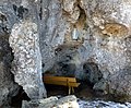
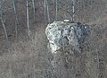
The rock formation of the "Upper Rodstein", also known as Rotstein, lies to the east above Oberkochen on the Härtsfeld side at 685 m above sea level. NHN (→ location) . On the mass limestone rock there is a lookout point with a crucifix with a gilded figure of Christ, which, according to the inscription, was erected in 1880. The rock plateau is almost two hundred meters above the valley and is also used as a launch site for hang-gliders and paragliders . There is a Marian grotto in the rock below the lookout point. The “Untere Rodstein” (→ Lage) , just under a hundred meters away, is a smaller mass limestone rock , also with a viewpoint and cave. - Griebigenstein cave
The Griebigenstein cave is located on the Griebigenstein south of the Rodstein (→ Lage) . It is fifty-five meters long. - Big wool hole The Große Wollenloch is a 54 meter deep natural shaft that is located on the Wollenberg about 3.3 km southwest of Oberkochen. It is one of the deepest natural shafts in the Swabian Alb. A direct connection with the Ziegelbach spring near Königsbronn could be established with contrast water studies.

Origin of the black stove

Rocks of the Upper and Lower Rodstein
Mariengrotte in Upper Rodstein

Cave in the Lower Rodstein

Entrance to the Griebigenstein cave

View into the large Wollenloch


Other natural attractions
- Langertstein
This rock in Wolfertstal above the Langertbach (→ Lage) offers at 610 m above sea level. NHN a view of the Wolferts and Kocher valleys. In the west wall of the rock is the entrance to the Langertstein cave, the passage of which leads about ten meters into the rock. - Karst Quellenweg The Karstquellenweg on the districts of Oberkochen and Königsbronn is an almost thirty-kilometer-long nature trail that connects the most important waterfalls in the upper Brenz and Kocher valleys on both sides of the European watershed at fifteen stations .
Langertstein

Entrance to the Langertstein cave
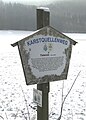
Karstquellenweg - information board at station 14 in the Tiefental

Hunger well in Wolfertstal on the Karstquellenweg


Regular events

- Pentecost market on Whit Monday (since 1817)
- Weekly market on Saturday (since 1961)
- City festival with cultural events, Palio car race and street festival
- Mask dusting and fool tree setting , ceremonial meetings, town hall tower and carnival parade of the fool's guild Oberkochenener (NZO) "Schlagga-Wäscher"
- Heidefest of the volunteer fire brigade Oberkochen
- International Jazz Festival Oberkochen by Jazz Lights GmbH
- Oberkochen dell´ Arte of the community foundation Oberkochen with concerts, cabaret events, exhibitions and readings by authors
societies
- Local Workers Welfare Association Oberkochen
- Boxing Club Oberkochen (BCO)
- ChorVision Oberkochen, former singer association
- German Red Cross Local Association Oberkochen
- Evangelical Nursing and Diakonie Support Association
- Volunteer fire brigade Oberkochen
- Trade and Commerce Association (GHV) Oberkochen
- Heimatverein Oberkochen (HVO)
- Catholic church choir Oberkochen
- Catholic Nursing Association Oberkochen
- Musikverein Stadtkapelle Oberkochen
- Friends of nature Oberkochen local group
- Mill Association Oberkochen
- Narrenzunft Oberkochen (NZO) "Schlagga-Washer"
- Swabian Alb Association Oberkochen local group
- TSV Oberkochen 1903
- Association for town twinning Oberkochen
wine growing

In spring 2020, the city of Oberkochen planted a six hundred square meter, south-facing vineyard with 99 vines of the Souvignier gris variety on the slope above the Tiersteinschule (→ Lage) . Previously had Federal Institute for Agriculture and Food , this new planting for the wine field Oberer Neckar in the wine-growing region Württemberg approved. The aim is to wine in 2023 up to 200 liters keltern .
Personalities
Honorary citizen
- Karl Fröhner (1844–1898), chief forester
- Franz Breitenbach (1819–1900), pastor
- Emil Bucher (1870–1949), pastor
- Carl Weiger (1843–1911), chief forester
- Josef Schmid (1887–1960), manufacturer
- Albert Bäuerle (1901–1979), manufacturer
- Gerhard Kühn (1902–1990), member of the board of directors at Carl Zeiss
- Heinz Küppenbender (1901–1989), member of the board of directors at Carl Zeiss
- Gustav Bosch (1914–1979), mayor
- Gert Littmann (* 1927), member of the board of directors at Carl Zeiss
- Dieter Brucklacher (1939–2016), entrepreneur
- Bruno Balle (* 1936), businessman
- Dietrich Bantel (1935–2018), high school professor
- Gerda Böttger (* 1947), secretary
- Georg Brunnhuber (* 1948), politician
Born in Oberkochen
- Christian Hornberger (1831–1881), Protestant missionary
- Anton Balluff (1846–1924), opera singer
- Caspar Pfaudler (1861–1889), German-American master brewer
- Georg Hengstberger (1884–1952), District Administrator in Böblingen
- Anton Bezler (1909–1944), Turner
- Willibald Mannes (* 1925), master carpenter, architect and specialist book author
- Dieter Brucklacher (1939–2016), entrepreneur
- Georg Brunnhuber (* 1948), politician (CDU), Member of the Bundestag (1990–2009)
- Markus Elmer (* 1952), soccer player (VfB Stuttgart, Bayer 04 Leverkusen)
- Marianne Thomann-Stahl (* 1954), politician (FDP)
- Thomas A. Vilgis (* 1955), physicist
- Katrin Böhning-Gaese (* 1964), biologist
- Daniel Lück (* 1991), soccer goalkeeper
literature
- Christhard Schrenk : Alt-Oberkochen. Stories and reports from Oberkochen's past . Oberkochen 1984.
- City of Oberkochen, Mayor Harald Gentsch (Ed.): Oberkochen - history, landscape, everyday life . Oberkochen 1986, ISBN 3-9801376-1-9 .
- Oberkochen . In: Konrad A. Theiss: Kunst- und Kunstdenkmale im Ostalbkreis , Aalen 2000, ISBN 3-8062-1542-1 , pp. 260-264.
- City of Oberkochen (Ed.): Oberkochen . Oberkochen 2018, ISBN 978-3-00-059479-3 .
Web links
- Detail map of Oberkochen and its surroundings on: State Institute for the Environment Baden-Württemberg (LUBW) ( information )
- Oberkochen website
Individual evidence
- ↑ State Statistical Office Baden-Württemberg - Population by nationality and gender on December 31, 2018 (CSV file) ( help on this ).
- ↑ Dieter Berger: Geographical Names in Germany (= Duden pocket books , volume 25). 2nd Edition. Dudenverlag, Mannheim (among others) 1999, ISBN 3-411-06252-5 , p. 16.
- ^ Karl Schurr: Field names in Oberkochen . In: City of Oberkochen, Mayor Harald Gentsch (Ed.): Oberkochen - history, landscape, everyday life. Oberkochen 1986, pp. 242-259, here: p. 249.
- ^ The state of Baden-Württemberg. Official description by district and municipality. Volume IV: Stuttgart district, Franconian and East Württemberg regional associations. Kohlhammer, Stuttgart 1980, ISBN 3-17-005708-1 , pp. 769-770.
- ↑ State Statistical Office, area since 1988 according to actual use for Oberkochen.
- ^ City of Oberkochen (Ed.): Oberkochen . Oberkochen 2018, pp. 18–23.
- ↑ Dietrich Bantel: Sensational under the "Hirsch". Alemannic high medieval pit houses. on heimatverein-oberkochen.de. Retrieved February 6, 2019.
- ↑ Oberkochen (2018) p. 218.
- ↑ Dietrich Bantel: Staufer humpback cuboid in Oberkochen. on heimatverein-oberkochen.de. Retrieved January 28, 2019.
- ↑ a b Oberkochen (2018) pp. 24–27.
- ↑ Rudolf Heitele: history of the Catholic parish of St. Peter and Paul in Oberkochen . In: City of Oberkochen, Mayor Harald Gentsch (Ed.): Oberkochen - history, landscape, everyday life . Oberkochen 1986, pp. 40-61, here: p. 43.
- ↑ Dietrich Bantel: Oberkochen is 2 years older. on heimatverein-oberkochen.de. Retrieved January 10, 2019.
- ↑ State Archives Ludwigsburg , document B 389 U 1682 from January 17, 1335. Oberkochen is named there in the middle of the sixth line.
- ↑ State Archives Ludwigsburg , document B 389 U 1683 from January 17, 1335. Oberkochen is mentioned there at the end of the fifth line (upper) and at the beginning of the sixth line (“cooking”).
- ↑ Manfred Thier: History of the Swabian Hüttenwerke. A contribution to the economic history of Württemberg. 1365-1802. Aalen / Stuttgart 1965, p. 45.
- ↑ Thier pp. 188-189.
- ↑ Royal statistical-topographical Bureau (ed.): Description of the Aalen Oberamt . Stuttgart 1854, p. 92 .
- ↑ a b c d Oberkochen (2018) pp. 28–38.
- ^ Heidenheimer Forst in: Chorographia description of the praiseworthy principality of Württemberg on leo-bw.de.
- ↑ a b c Christhard Schrenk : Alt-Oberkochen. Stories and reports from Oberkochen's past. Oberkochen 1984, p. 81.
- ↑ Oberkochen (2018) pp. 44–46.
- ↑ Oberkochen (2018) pp. 64–65 and 186-191.
- ↑ Oberkochen (2018) p. 182.
- ↑ Oberkochen (2018) p. 207.
- ↑ Christhard Schrenk : Timeline up to the end of the Second World War . In: City of Oberkochen, Mayor Harald Gentsch (Ed.): Oberkochen - history, landscape, everyday life . Oberkochen 1986, pp. 456-466, here: p. 466.
- ↑ Dietrich Bantel: The III. Rich in Oberkochen. In: City of Oberkochen, Mayor Harald Gentsch (Ed.): Oberkochen - history, landscape, everyday life . Oberkochen 1986, pp. 169–205, here: p. 169.
- ↑ Bantel (III. Reich) pp. 170-174.
- ↑ Bantel (III. Reich) p. 196.
- ↑ Oberkochen (2018) pp. 90–91 and pp. 186–187. The day of birth and death of Fritz Leitz according to the grave stone of the Leitz family in the Evangelical Cemetery in Oberkochen.
- ↑ Dietrich Bantel: The Leitz tunnel (1) underground production facility and air raid tunnel 1944/45 , continuation: Part 2 , Part 3 and Part 4 on heimatverein-oberkochen.de. Retrieved August 4, 2019.
- ↑ Oberkochen (2018) p. 90.
- ↑ Schrenk (1984) p. 77.
- ↑ Oberkochen (2018) pp. 90–91.
- ↑ Bantel (III. Reich) p. 192.
- ↑ Oberkochen (2018) pp. 94–95. - The seven victims of the air raid: Our dead in the world war 1939/1945 . In: Oberkochen (1986), pp. 206-209, here: p. 209.
- ↑ Bantel (III. Reich) pp. 197-198. Oberkochen (2018) pp. 94–99.
- ↑ Names on the mortuary tablets at the war victims memorial in the municipal cemetery. The seven victims of the air raid on April 11, 1945 (Theresia Fischer, Bruno and Maria Winter as well as Josef, Maria, Mathilde and Paul Brunnhuber) are also listed among those who died in World War II. - To compare the First World War: 51 killed, 5 missing.
- ↑ After the war - A village is bursting at the seams. on heimatverein-oberkochen.de. Retrieved August 4, 2019.
- ↑ Oberkochen (2018) p. 132.
- ^ Marika and Joachim Kämmerer: From the village to the industrial community . In: City of Oberkochen, Mayor Harald Gentsch (Ed.): Oberkochen - history, landscape, everyday life. Oberkochen 1986, pp. 129–162, here: p. 149.
- ↑ Oberamt Aalen p. 291 .
- ↑ a b c Population figures in Oberkochen on heimatverein-oberkochen.de. Retrieved February 6, 2019.
- ↑ a b c d e f State Statistical Office Baden-Württemberg - municipality area, population and population density since 1961 city of Oberkochen (Ostalbkreis).
- ↑ https://www.oberkochen.de/de/Stadt-Buerger/Unsere-Stadt/Stadtportrait/Zahlen-und-Daten
- ↑ Christhard Schrenk : 400 years 1583–1983 Evangelical parish of Oberkochen . South d. Newspaper service, Aalen 1983 (publisher: Protestant parish of Oberkochen).
- ↑ Heitele pp. 42–43 and P. 49.
- ↑ Oberkochen (2018) pp. 222–225.
- ↑ Oberkochen (2018) pp. 239–241.
- ↑ Election results 1971–2009: Local elections 2009 on spd-oberkochen.de. Retrieved June 9, 2019.
- ↑ Election results 2009–2014: Baden-Württemberg State Statistical Office at baden-wuerttemberg.de.
- ↑ a b c election result 2019: CDU Oberkochen loses two seats . Schwäbische Post from May 28, 2019, p. 24.
- ↑ Oberamt Aalen p. 295 .
- ↑ Dietrich Bantel: The Oberkochen coat of arms. New insights. on heimatverein-oberkochen.de. Retrieved January 10, 2019.
- ↑ Illustration of the Oberkochen coat of arms from 1927 on heimatverein-oberkochen.de. Retrieved January 10, 2019.
- ↑ a b c d Website of the association for town twinning e. V. Oberkochen
- ↑ Location table Jakobsweg Neresheim - Rottenburg on jakobswege-europa.de. Retrieved April 28, 2019.
- ↑ Quality test center of the Bundeswehr in Oberkochen on meinestadt.de.
- ↑ a b c Volkmar Schrenk: History of the Oberkochen schools . In: City of Oberkochen, Mayor Harald Gentsch (Ed.): Oberkochen - history, landscape, everyday life . Oberkochen 1986, pp. 84-107.
- ↑ Oberkochen (2018) p. 239.
- ↑ The Scheerer mill (lower mill) and its history on muehlenverein-oberkochen.de. Retrieved August 4, 2019.
- ↑ Sundial now on Gutenbach . Gmünder daily mail from July 25th 2011.
- ↑ Ralf Schäfer: Freundeskreis is happy about 25 years of the Josefskapelle am Rodstein. on schwaebische.de. Retrieved April 22, 2019.
- ↑ Heidemauer Oberkochen on mfuchsairbrush.de. Retrieved March 9, 2020.
- ↑ Heidemauer completely different. Bürger und Gemeinde, Official Gazette of the City of Oberkochen, No. 25 (2012) of June 22, 2012, p. 413.
- ↑ Kurt Latzer: Where imagination knows no limits. St. Galler Tagblatt from July 20, 2012.
- ↑ Oberkochen (2018), p. 79 u. 134.
- ↑ Dietrich Bantel: s'Geesbrünnele. on heimatverein-oberkochen.de. Retrieved May 11, 2019.
- ^ Karl Wannenwetsch: The drill maker. on heimatverein-oberkochen.de. Retrieved January 10, 2019.
- ^ Mühlenverein Oberkochen - Scheerermühle. Retrieved January 16, 2016 .
- ^ Albert Bahmann: Town hall and municipal facilities . In: City of Oberkochen, Mayor Harald Gentsch (Ed.): Oberkochen - history, landscape, everyday life . Oberkochen 1986, pp. 419-435, here: pp. 430f.
- ↑ There is a representative family grave of the immediate descendants of Jakob Schmidt in the municipal cemetery. His grave and the graves of the company founders August Oppold and Karl Wannenwetsch can no longer be found in any of the three cemeteries.
- ^ Dietrich Bantel: News from the Romans in Oberkochen. Römerkeller is not »Villa Rustica« but a street station. Kocher origin = Roman spring sanctuary? on heimatverein-oberkochen.de. Retrieved January 10, 2019.
- ↑ Dietrich Bantel: The Bilz. A mysterious and historic Oberkochen forest area. In: Ostalb Einhorn No. 91, September 1996, pp. 192-200.
- ↑ Profile of the Volkmarsberg nature reserve of the State Institute for the Environment, Measurements and Nature Conservation Baden-Württemberg (LUBW).
- ↑ Profile of the nature reserve Tiefes Tal of the State Institute for Environment, Measurements and Nature Conservation Baden-Württemberg (LUBW).
- ↑ Dietrich Bantel: "Rodstein" or "Rotstein"? on heimatverein-oberkochen.de. Retrieved January 10, 2019.
- ^ Lothar Schell: Mariengrotte under the Rodstein . on heimatverein-oberkochen.de. Retrieved July 19, 2020.
- ↑ Caves on the Oberkochen marker on heimatverein-oberkochen.de. Retrieved November 2, 2019.
- ↑ Geotope profile (PDF, 359 KByte) on: Map server of the State Office for Geology, Raw Materials and Mining (LGRB) ( information )
- ↑ a b Oberkochen (2018) p. 196.
- ↑ Website of the Narrenzunft Oberkochenener (NZO) "Schlagga-Wäscher"
- ↑ a b Website of the Oberkochen volunteer fire brigade
- ^ Website of Jazz lights GmbH
- ^ Website of the community foundation Oberkochen or Oberkochen dell 'Arte
- ↑ Oberkochen (2018) p. 167.
- ↑ Oberkochen (2018) pp. 213–214.
- ↑ Oberkochen (2018) pp. 50–53.
- ↑ Oberkochen (2018) pp. 165–166.
- ↑ Oberkochen (2018) pp. 216–217.
- ↑ Oberkochen (2018) p. 53.
- ↑ Oberkochen (2018) pp. 257–258.
- ↑ Oberkochen (2018) pp. 48–50.
- ↑ Oberkochen (2018) pp. 115–117.
- ↑ Oberkochen (2018) pp. 164–165.
- ↑ Oberkochen (2018) pp. 214–216.
- ↑ Oberkochen (2018) pp. 258–259.
- ↑ Oberkochen (2018) pp. 256–257.
- ↑ Oberkochen (2018) pp. 110–112.
- ↑ Oberkochen (2018) pp. 113–115.
- ↑ Oberkochen grows its own wine . Citizens and municipality, Official Gazette of the City of Oberkochen, No. 19 (2020) of May 8, 2020, p. 361.
- ^ Volkmar Schrenk: The first honorary citizen of Oberkochen, chief forester Karl Fröhner. Part 2 - From the life of Karl Fröhner (1844–1898). on heimatverein-oberkochen.de. Retrieved January 13, 2019.
- ↑ Dietrich Bantel: Oberkochen's »forgotten« honorary citizen Pastor Franz Breitenbach (1819–1900). Pastor at the then still old church of St. Peter and Paul in Oberkochen from 1867 - 1897. on heimatverein-oberkochen.de. Retrieved January 13, 2019.
- ^ Dietrich Bantel: Royal Forester Carl Weiger May 11, 1943 - December 18, 1911. Another forgotten honorary citizen of Oberkochen. on heimatverein-oberkochen.de. Retrieved January 13, 2019.
- ^ Dietrich Bantel: Mayor Gustav Bosch. on heimatverein-oberkochen.de. Retrieved January 13, 2019.
- ↑ Lothar Schell: Dietrich ("Didi") Bantel is an honorary citizen of Oberkochen. on heimatverein-oberkochen.de. Retrieved January 13, 2019.

Basking | Abtsgmünd | Adelmannsfelden | Bartholomä | Böbingen an der Rems | Bopfingen | Durlangen | Ellenberg | Ellwangen (Jagst) | Eschach | Essingen | Göggingen | Gschwend | Heubach | Hypocrites | Hüttlingen | Iggingen | Jagstzell | Kirchheim am Ries | Lauchheim | Leinzell | Lorch | Mögglingen | Mutlangen | Neresheim | Newbie | Obergröningen | Oberkochen | Rainau | Riesbürg | Rosenberg | Ruppertshofen | Schechingen | Schwäbisch Gmünd | Spraitbach | Stödtlen | Panel red | Tannhausen | Unterschneidheim | Waldstetten | Westhausen | Words