
Nightmare

Albtrauf referred to northwest oriented steep drop in Baden-Wurttemberg and Bavaria located Swabian Alb . In Albbereich it is the most remarkable and in several coating steps subdivided steps slope of Südwestdeutsche layer levels country and extends approximately from southwest to northeast.
The Albtrauf finds its geological continuation in the northeast in the stepped slope of the Franconian Alb and in the southwest and west in the Jura stepped slopes of Baaralb , Hegaualb , Randen , Klettgau , Aargau and the Tafeljura around Basel , the Ajoie and the French layered plain .
In geology and geomorphology , however , eaves only mean the edge in the intersection of the step slope and step surface (not formed in hip steps).
Geographical course

Like the entire Alb, the Albtrauf runs roughly from southwest to northeast and roughly follows the line Donaueschingen - Lemberg - Balingen - Reutlingen - Kirchheim unter Teck - Gingen an der Fils - Unterkochen . In detail, it is strongly dissected by many deeply eroded valleys.
The protruding witnesses mountains known wear highly visible castles like the Burg Hohenzollern , the Hohenneuffen Castle or the Castle Teck . Important traffic routes from the Alb foreland to the Albtrauf are called Albaufstieg , of which the Geislinger Steige is the best known.
geology


Rocks from the Upper Brown Jura and the Lower and Middle White Jura are involved in the construction of the Alb eaves . As a basis of this coating pack - so as the top, often only weakly pronounced step of Albvorlands - function the harder layers of the brown Jura in regional different forms: Sandflaserschichten ( Quenstedtsche structure B β) in the Alb and Blaukalke (B γ) in the middle Alb, oolithic Limestone marl (B δ) in the western Alb. The lower portion of the stepped slope take the following, up to the final Ornatenton as shales a formed brown Jura layers; This is followed by the first white Jura layer, the likewise soft limestone marl (W α). Hard limestones suitable as stepping stones can be found on the one hand in W β (in the West Alb as reef limestone , otherwise as a wall - like well-layered limestone formation ), on the other hand in W δ (reef limestone occurs throughout the area, increased in the younger layers), in between turn a marl complex (W γ) switched on.
geomorphology


The mean slope of the Alb eaves is around 35 degrees. In the area of the Erms valley and near Balingen it reaches an average height of almost 400 m . The eaves edge is in the southwest at around 1000 m above sea level. NHN , in the northeast at around 650 m above sea level. Above sea level.
In the Eastern Alb and parts of the Middle Alb (up to the Bad Urach area ), the W β does not appear as a step-builder, but at most as a bend in the slope that rises in one go to the W δ edge. In the Reutlingen to Mössingen area , the W β and (around 100 m high) W δ stage are clearly pronounced. Further to the west, the W β forms both the forehead of the Alb eaves and an adjoining step area several kilometers wide; the W δ stage (with upstream witness mountains, e.g. Kornbühl ) recedes further.
As a result of receding erosion , the Alb eaves (as it has done for millions of years) recede a few millimeters to the southeast on average each year, which explains the strongly ragged and lobed course. Also, landslides and rockslides contribute to this process. The treasure trove of forms includes stepped bays, face valleys, protrusions, spurs, protrusions and mountains of witnesses . The best-known witness mountains without a stepped area include from northeast to southwest Ipf , Hohenstaufen , Achalm and Hohenzollern (Zoller) . The most impressive witness mountains with stepped areas include Kaltes Feld , Michelsberg , Farrenberg , the plateau of Burgfelden (Böllat-Heersberg) and Plettenberg .
Others
The vegetation consists mainly of beech forest , occasionally (e.g. on the Jusi ) you can also find the juniper heaths typical of the plateau of the Swabian Alb , which are usually under nature protection. Weak oaks grow on the rock head. In the area of the Hohe Schwabenalb , spruce and fir forests can also be found due to forestry use that is not typical for the location . The white rocky outcrops of reef limestone protruding from the forest are also characteristic. Because of the pale blue shimmering that can be observed from a distance, the night eaves were poetically named "Blue Wall". The term was coined by Eduard Mörike .
The Swabian Alb North Edge Path (main hiking trail 1, HW 1) of the Swabian Alb Association opens up the Albtrauf from Donauwörth to Tuttlingen .
Picture gallery

Albtrauf at the Hossinger ladder
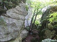
Split rock on Schafberg

View from the Hochmark near Frommenhausen to the Albtrauf

View of the Albtrauf from the Farrenberg on the left and the Hohenzollern Castle to the Plettenberg on the right

View from Wackerstein ( 825.9 m ) south of Reutlingen with witnesses mountains : Left Scheibenbergle in center Gaisbühl and George Mountain , right in the north of Pfullingen and Reutlingen with Scheibengipfel and Achalm

View from the Hangenden Stein ( 922.9 m ) on the Albtrauf north of Onstmettingen over the Dreifürstenstein , Jungingen and the Himberg


literature
- Reiner Enkelmann, Dieter Ruoff, Wolfgang Wohnhas: Der Albtrauf. Nature and culture between Ries and Randen . Silberburg-Verlag , Tübingen and Lahr / Schwarzwald 2010. ISBN 978-3-87407-892-4
- Otto F. Geyer and Manfred P. Gwinner: Introduction to the geology of Baden-Württemberg . Stuttgart 1964, p. 60 ff. And p. 148 ff.
- Klaus Eberhard Bleich: The age of the night eaves . In: Annuals of the Association for Patriotic Natural History in Württemberg 115 , Stuttgart, November 1, 1960, pp. 39–92
Web links
Individual evidence
- ↑ A. Kerner, M. Geisel: Forest mapping. Forestry Experimental and Research Institute Baden-Württemberg (FVA) . Ed .: FVA. Freiburg August 30, 2010, p. 73 .