
Hüttlingen (Württemberg)
| coat of arms | Germany map | |
|---|---|---|

|
Coordinates: 48 ° 54 ' N , 10 ° 6' E |
|
| Basic data | ||
| State : | Baden-Württemberg | |
| Administrative region : | Stuttgart | |
| County : | Ostalbkreis | |
| Height : | 408 m above sea level NHN | |
| Area : | 18.71 km 2 | |
| Residents: | 6099 (December 31, 2018) | |
| Population density : | 326 inhabitants per km 2 | |
| Postcodes : | 73460, 73434, 73453 | |
| Area code : | 07361 | |
| License plate : | AA, GD | |
| Community key : | 08 1 36 033 | |
| Address of the municipal administration: |
Schulstrasse 10 73460 Hüttlingen |
|
| Website : | ||
| Mayor : | Günter Ensle | |
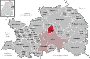
| Location of the municipality of Hüttlingen in the Ostalb district | ||
  |
||

Hüttlingen is a municipality in Baden-Württemberg and belongs to the Ostalb district .
geography
Geographical location
Hüttlingen is located on the edge of the eastern Swabian Alb at an altitude of 400 to 503 meters at Kocherknie , about 7 km from the district town of Aalen .
Neighboring communities
The community borders on Neuler in the northwest , Rainau in the northeast and the district town of Aalen in the south.
Community structure
The municipality of Hüttlingen includes the village of Hüttlingen, the hamlets of Albanuskling, Mittellengenfeld, Niederalfingen, Oberlengenfeld, Seitsberg and Sulzdorf, the farms of Lachenschafhaus, Obersiegenbühl, Unterlengenfeld and Untersiegenbühl and the houses of Fuchshäusle, Haldenschafhaus, Straubenmühle and Zanken as well as the abandoned villages of Aus .
Division of space

According to data from the State Statistical Office , as of 2014.
history
antiquity
The Upper Germanic-Raetian Limes (ORL) ran on the Hüttlinger district , a section of the former outer border of the Roman Empire , which made a bend in a field on the Hochfeld road opposite the Wasserstall residential area. By means of geophysical prospecting , the remains of two Limes towers were located in 2012.
Around 260 AD, the Romans withdrew from the area south of the Limes to the right of the Rhine and the left of the Iller, which Tacitus called the Dekumatland , back to Lake Constance, so that from then on the entire left bank of the Rhine formed the new border of the Roman Empire. The ending “ingen” in the name of Hüttlingen indicates that the family of an Alemannic clan leader named “Hutilo” could have founded the first settlement at Kocherknie during the period that followed .
middle Ages
In the High Middle Ages, the area of Hüttlingen was in the northern border region of the tribal duchy of Swabia .
The first documentary mention of Hüttlingen took place in 1024 in a document with which Emperor Heinrich II declared the forest of the Ellwangen monastery called "Virigund" a ban forest . This certificate was issued on February 5, 1024 in Bamberg. Niederalfingen was first mentioned in a document in 1475. The place Hüttlingen was part of the castle and rule Niederalfingen .
Modern times
In 1551 the Fuggers acquired Niederalfingen Castle. At that time there were about 21 farmers, 15 mercenaries , 14 cottagers and also some craftsmen, two landlords and a mill in Hüttlingen . So Hüttlingen was mainly determined by agriculture. The Fuggers were local lords of Hüttlingen until mediatization. Even after the Reformation, the place remained predominantly Catholic until the end of the Second World War.
As a result of the mediatization, Hüttlingen came to the Kingdom of Württemberg and initially belonged to the Oberamt Ellwangen and from 1810 to the Oberamt Aalen . During the district reform during the Nazi era in Württemberg , Hüttlingen came to the Aalen district in 1938 . In 1945 the place became part of the American zone of occupation and thus belonged to the newly founded state of Württemberg-Baden , which was incorporated into the current state of Baden-Württemberg in 1952. In the course of the district reform of 1973 , Hüttlingen was in the Ostalb district.
Religions
In Hüttlingen there is a Roman Catholic and a Protestant church community. The Catholic community Heilig Kreuz belongs to the deanery Ostalb . The Protestant parish of Wasseralfingen-Hüttlingen is part of the Evangelical State Church in Württemberg .
politics
Municipal council
Result of the local elections on June 7, 2009:
- Citizens' list 54.0% (+2.3) - 10 seats (+1)
- CDU 46.0% (- 2.3) - 9 seats (± 0)
Source: Baden-Württemberg State Statistical Office
The municipal council election on May 26, 2019 led to the following result (with changes to the 2014 election):
| Party / list | Share of votes | +/-% p | Seats | +/- |
| Citizen List | 51.0% | - 0.3 | 8th | ± 0 |
| Active citizens and CDU | 49.0% | + 0.3 | 8th | ± 0 |
mayor
- 1948 to 1978: Albert Brobeil
- until 2002: Gert-Günter Schulz
- since 2002: Günter Ensle, he was re-elected in January 2010 with 97.7% of the vote. After the election in January 2018, in which he was re-elected with 87.9 percent of the valid votes, he was able to take up his third term.
Administrative community
The community is a member of the agreed administrative community of the city of Aalen.
Partnerships
Hüttlingen maintains partnership relationships with the Italian municipality of Cotignola ( province of Ravenna ).
Culture and sights


The Rhaetian Limes ran right through Hüttlingen. Replicas of various architectural styles of palisades and parts of the wall can be viewed in the Limes complex on the Kocher .
The Marienburg in the Niederalfingen suburb is used today as a youth education center, leisure center and school camp. The bailiwick building below the castle houses the local history museum of the community of Hüttlingen.
There is also a natural swimming pool in Niederalfingen . There are some soccer fields and chapels in the municipality.
societies
The Hüttlingen local group of the Swabian Alb Association , founded in 1896, was awarded the Eichendorff plaque in 1996.
Economy and Infrastructure
traffic
Hüttlingen is located at the junction of federal highways 19 ( Eisenach - Oberstdorf ) and 29 ( Aalen - Nördlingen ), near the motorway connection to the A 7 ( Ulm - Würzburg ).
Trains on the Aalen – Crailsheim ( Obere Jagstbahn ) and Aalen – Donauwörth ( Riesbahn ) lines stop at Goldshöfe station, around 2 km from the center of Hüttlingen .
Local public transport rail and bus lines can be used at the tariffs of the OstalbMobil transport cooperative as well as at the tariffs of the respective transport company.
Long-distance cycle routes
Several cycle paths lead through the village :
- The German Limes Cycle Route follows the Upper German-Raetian Limes over 818 km from Bad Hönningen on the Rhine to Regensburg on the Danube .
- The Kocher-Jagst-Radweg is a 340 km long circular cycle path that runs along the Kocher and Jagst rivers in Baden-Württemberg . The two rivers are only a few kilometers apart.
Long-distance hiking trails
The Limes hiking trail of the Swabian Alb Association , a section of the German Limes hiking trail , crosses the Kocher near Hüttlingen .
education
With the Alemannenschule there is a primary and technical secondary school in town; the Werkrealschule classes 5–7 are taught in the Neuler branch, the classes 8–10 in Hüttlingen. There are also four Catholic kindergartens.
energy
To the east of Hüttlingen is the Goldshöfe 380/220/110 kV substation .
Personalities
Sons and daughters of the church
- Josef Wolfsteiner (1911–1978), wood sculptor
literature
- Wikisource: Hüttlingen in the description of the Oberamt Aalen from 1854 - sources and full texts
- Albert Schenk: 950 years of Hüttlingen. Chronology of the church up to the present. Hüttlingen 1974
Web links
Individual evidence
- ↑ State Statistical Office Baden-Württemberg - Population by nationality and gender on December 31, 2018 (CSV file) ( help on this ).
- ^ The state of Baden-Württemberg. Official description by district and municipality. Volume IV: Stuttgart district, Franconian and East Württemberg regional associations. Kohlhammer, Stuttgart 1980, ISBN 3-17-005708-1 . Pp. 674-676
- ↑ State Statistical Office, area since 1988 according to actual use for Hüttlingen.
- ↑ Norbert Acker: Hüttlinger Limes is being carefully examined. Archaeologists use soil studies to determine the exact course of the border system . In: Schwäbische Zeitung from April 17, 2012
- ^ History of Hüttlingen according to a description on the website of the municipality on the Internet, accessed on June 2, 2020
- ↑ Baden-Württemberg State Statistical Office - Results of the 2019 municipal council elections: Hüttlingen , accessed on January 5, 2020
- ↑ http://www.schwaebische.de/region_artikel,-Huettlinger-waehlen-Guenter-Ensle-klar-wieder-_arid,4040482_toid,8.html
- ^ State gazette Baden-Württemberg - Mayor election Hüttlingen , accessed on January 5, 2019
- ^ Community Hüttlingen: Alemannenschule Hüttlingen , accessed on April 12, 2011

Basking | Abtsgmünd | Adelmannsfelden | Bartholomä | Böbingen an der Rems | Bopfingen | Durlangen | Ellenberg | Ellwangen (Jagst) | Eschach | Essingen | Göggingen | Gschwend | Heubach | Hypocrites | Hüttlingen | Iggingen | Jagstzell | Kirchheim am Ries | Lauchheim | Leinzell | Lorch | Mögglingen | Mutlangen | Neresheim | Newbie | Obergröningen | Oberkochen | Rainau | Riesbürg | Rosenberg | Ruppertshofen | Schechingen | Schwäbisch Gmünd | Spraitbach | Stödtlen | Panel red | Tannhausen | Unterschneidheim | Waldstetten | Westhausen | Words