
Limes hiking trail (Swabian Alb Association)
| Limes hiking trail | |
|---|---|
 Information stand at the Rotenbach hiking car park in Schwäbisch Gmünd |
|
| Data | |
| length | approx. 245 km |
| location | Baden-Württemberg , Bavaria |
| Supervised by | Swabian Alb Association |
| Markers |
stylized Roman watchtower |
| Starting point |
Miltenberg 49 ° 42 '14 " N , 9 ° 15' 52" E |
| Target point |
Wilburgstetten 49 ° 1 ′ 41 ″ N , 10 ° 23 ′ 31 ″ E |
| Type | Long-distance hiking trail |
| Level of difficulty | easy |
| season | all year round |
The Limes hiking trail is the main hiking trail 6 (HW 6) of the Swabian Alb Association . It follows the course of the Upper Germanic-Rhaetian Limes within Baden-Württemberg . The route begins in Miltenberg am Main and ends in Wilburgstetten an der Wörnitz . The total length is 245 km.
Route
The Limes hiking trail begins in Miltenberg and initially runs in a south-south-east direction along the Upper German Limes. The eastern Odenwald and the building land are hiked through. Via Walldürn and Osterburken you reach the Hohenlohe plain and cross the Jagst at Jagsthausen and the Kocher at Sindringen .
Via Öhringen you get to the Swabian-Franconian Forest . The hiking trail crosses Mainhardt and Murrhardt . You finally get to Lorch im Remstal via Welzheim .
Here the Roman provinces of Upper Germany and Raetia bordered one another. The Upper German Limes merges into the Raetian Limes, and the Limes hiking trail bends at right angles to the east-northeast. You walk through Schwäbisch Gmünd and cross the Kocher a second time near Hüttlingen and the Jagst a second time near Rainau .
Finally, in Wilburgstetten, the hiker reaches the border of today's state of Baden-Württemberg and the end of main hiking trail 6.
The section from Miltenberg to Osterburken is managed as the Eastern Limes Trail by the Odenwald Club.
Connection to other Limes routes
The path is part of a whole series of Limes hiking trails , which, as the German Limes hiking trail, open up the entire length of the Upper German-Rhaetian Limes to hikers.
In the Limesweg of the Franconian Alb Association (route 46), the route from Wilburgstetten continues for around 39 kilometers to Gunzenhausen . Further east, the covers Limes hiking trail in the nature park Altmühltal from the rest of the Limes route to the Danube.
The northern portion of the Limes of Lindschied about Bad Ems to Rheinbrohl as Limes trail marked.
mark
Continuous marking is a stylized Roman watchtower in black with a red bar at the bottom. Occasionally one also comes across simplified markings according to the scheme of the main hiking trails of the Swabian Alb Association: a red crossbar on a white background. Usually, but not always, the text "HW 6" can be found in black below or above the bar.

Alternative signpost of HW 6
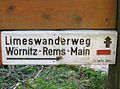
Signpost of the Limes hiking trail
.PNG)

Sights along the way
The most important sight is of course the Limes itself. With its tracks on the ground, reconstructed watchtowers, palisades , ditches and remains of walls, it represents an impressive testimony to the past. The UNESCO has the Upper Germanic-Rhaetian Limes in 2005 as a World Heritage classified.
Almost all of the larger towns through which the hiking trail passes originated from Roman castles . Remnants of it can be found in Miltenberg, Walldürn, Osterburken, Jagsthausen, Öhringen (even two forts: Bürg and Rendel), Mainhardt, Murrhardt, Welzheim (also two forts), Lorch and Rainau, as well as in a few smaller towns.
The Limes Museum Aalen is not far away .
literature
- Willi Beck, Dieter Planck : The Limes in Southwest Germany. Limes hiking trail Main-Rems-Wörnitz. Konrad Theiss Verlag , Stuttgart 1980, ISBN 3-8062-0242-7 .
- Thorsten Lensing: Limesweg. Bergverlag Rother , Munich 2013, ISBN 978-3-7633-4432-1 .
- Upper Germanic-Rhaetian Limes in Baden-Württemberg. State Surveying Office Baden-Württemberg , Stuttgart 2005, ISBN 9783890217451 . Also included in: Official map set 1: 50,000 UNESCO World Heritage Site Upper Germanic-Raetian Limes. State Office for Geoinformation and Rural Development Baden-Württemberg , Stuttgart, ISBN 978-3-89021-777-2 .
Web links
- Limes sides - The Romans in Baden-Württemberg
- Main hiking trail 6 at the Swabian Alb Association
- Route at OpenStreetMap
- Eastern Limes hiking trail on the Wandersüden.de website
Individual evidence
- ↑ Main hiking trail 37 Limesweg ( memento from April 7, 2015 in the Internet Archive ).
- ↑ http://www.limesstrasse.de/deutsche-limes-strasse/wanderweg/
- ^ Path 46: Limes path of the Franconian Alb Association
HW 1: Swabian Alb North Edge Path | HW 2: Swabian Alb South Rim Trail | HW 3: Main-Neckar-Rhein-Weg | HW 4: Main-Danube-Bodensee-Weg | HW 5: Black Forest-Swabian-Alb-Allgäu-Weg | HW 6: Limes hiking trail | HW 7: Swabian-Alb-Upper Swabian Way | HW 8: Frankenweg | HW 9: Heuberg-Allgäu-Weg | HW 10: Stromberg-Swabian Forest Path | Georg-Fahrbach-Weg (GFW) | Württemberg Wine Trail (WWW) | Neckarweg | Lake Constance circular route | Main-Danube-Way | Upper Swabian Way of St. James | Franconian-Swabian Way of St. James
Limes hiking trail in the Westerwald and Taunus : Rheinbrohl - Lindschied | Limesweg ( Wetterau ): Langenhain-Ziegenberg - Großkrotzenburg | Limesweg ( Spessartbund ) | Limes hiking trail ( Swabian Alb Association ): Miltenberg - Wilburgstetten | Limesweg ( Franconian Alb Association ): Wilburgstetten– Gunzenhausen | Limes hiking trail ( Altmühltal Nature Park ): Gunzenhausen– Bad Gögging