
Freimühle small fort
| Freimühle small fort | |
|---|---|
| limes | ORL NN ( RLK ) |
| Route (RLK) | Rhaetian Limes, route 12 |
| Dating (occupancy) | by no later than 260 AD |
| Type | Small fort |
| size | 53 m × 55 m (= 0.29 ha) |
| Construction | stone |
| State of preservation | Walling clearly visible as elevation in the ground |
| place | Schwäbisch Gmünd |
| Geographical location | 48 ° 47 '29.4 " N , 9 ° 45' 49.4" E |
| height | 348 m above sea level NHN |
| Backwards | Schirenhof Castle (southwest) |
| Upstream |
Small fort Kleindeinbach (northwest) Small fort Hintere Orthalde (northeast) |
The small fort Freimühle was a Roman fortification of the Rhaetian Limes , which was granted UNESCO World Heritage status in 2005 . The small fort was built around 750 meters south of the Roman border. The remains are located northwest of Schwäbisch Gmünd in the Ostalb district in Baden-Württemberg .
location


The small fort Freimühle was on a slightly protruding spur of the Rotenbachtaler eastern slope in the Vogelhau forest . From there, both the Rotenbachtal and a section of the Remstal could be seen. Only 750 meters to the north, but already unusually far away for a small fort, the east-west facing palisade of the Upper German Limes , apparently built in AD 164, ran down into the Rotenbachtal. On this slope, around 90 meters west of the Rotenbach, on the border of the Roman provinces Germania superior (Upper Germany) and Raetia ( Raetia ), the stony section of the Limes began, which stretched as far as the Danube. From the Freimühle small fort, it was possible to see both the Kleindeinbach small fort, located around one kilometer northwest on the western slope of the Rotenbachtal, and the watchtower above this fortification. The unit stationed there was also able to keep an eye on another section of the Remstal.
Research history
Until its discovery in 1901, neither folk tradition nor field names indicated a fort in the bird house . Only a hurricane-like storm that swept across the country at that time, which uprooted several trees, brought to light remains of walls and Roman ceramic shards, which two forest officials discovered while working up the windbreak in winter 1901/1902. The Mayor of Schwäbisch Gmünd, Paul Möhler, initiated excavations that soon uncovered the remains of the foundation wall of a Roman building. Major Heinrich Steimle , route commissioner of the Reich Limes Commission (RLK), then examined the fortifications and the interior of the facility in 1902 and recognized the remains of the wall as a fort. Thanks to generous subsidies from the Württemberg Ministry of Culture, thanks to the commitment of Eugen Gradmann (1863–1927), then state curator of the state collection of patriotic art and antiquity monuments, Steimle's excavations could be carried out in greater detail than would otherwise have been possible.
When the Limes was declared a World Heritage Site in 2005, the fort site was prospected geomagnetically and geoelectrically, the forest on the fort area was cleared and the walls were clearly visible. Excavations did not take place, but the place was re-documented. In 2006 Dieter Planck , then President of the State Office for the Preservation of Monuments in Baden-Württemberg , inaugurated this facility. An information pavilion was opened in May 2009 immediately below the ancient fortifications. Around 800 meters south of the course of the Limes, an attempt to reconstruct the meeting of the Upper Germanic palisade with the moat and the Rhaetian Limes wall.
Building history
The 52.10 × 54.86 meter (= 0.29 hectare) complex had rounded corners and a 1.22 meter wide enclosure wall. The track commissioner found that the broken stone masonry, which was only partially preserved, could still be up to 0.80 meters high in the areas that had been preserved. In the areas that had been preserved, a base profile could be found that protruded by around a hand's breadth. A trapezoidal corner tower stood in each of the four rounded corners of the surrounding wall. The findings made in 1902 also included the east gate, which was up to 0.80 meters high at the time and was flanked by two gate towers. The single-lane passage was between 3.24 and 3.66 meters wide. On both sides of the gate flanks, niche-like wall openings were still preserved for placing the open gate leaves. The second, almost completely destroyed gate was in the west, here Steimle could observe "a lot of charred remains of beams". The system was preceded by a six-meter-wide pointed ditch, which, after Steimle, was suspended at the gates.
During the investigations of the interior development in 1902 it was found that the ground had been ransacked beyond measure. Today it is assumed that the interior construction was made of wood. The search for this development was possibly unsuccessful for the RLK due to the excavation techniques that were not so advanced at the time. However, it was found that behind the stone defensive wall there was a heaped-up earth ramp on which the guards patrol. As brick stamps from Freimühle testify, the fortification was built by soldiers from the Cohors I Raetorum stationed in the Schirenhof cohort fort . The fort is in an almost identical orientation to the Schirenhof fort, which was built on the opposite side of the Rems .
It is assumed that the Freimühle small fort could have belonged to the Haselburg type near Walldürn . Because of its location, science is unclear about the importance of this fortification, about 100 meters below the Limes and exactly between the Schirenhof and Kleindeinbach small fort. Dieter Planck expressed the opinion
- "... that this small fort was built to monitor the presumed demarcation. The troops stationed here were presumably subject to the Schirenhof fort, with which there was a direct line of sight. "
Perhaps the troops encamped in Freimühle had only a secondary connection with the Limes defense. To the south-west of the small fort, Roman settlement remains and graves were uncovered at the bottom of the valley when the Rotenbach emerged from the Rotenbach valley during road and rail bridge construction work. Perhaps this indicates the possible independence of a unit that is stored here for a longer period of time. It was therefore assumed that the small fort Freimühle was perhaps the base of the Roman road police , who had to monitor the trunk road in the Rems valley, which crossed the border between the provinces Germania superior and Raetia near the mouth of the Rotenbach into the Rems .
The border area between Germania superior and Raetia in the Limes area is unusually densely occupied with Roman military bases. The proximity of the Lorch cohort fort on the edge of the Germania superior province and Schirenhof in Raetia also seem to confirm this impression. Perhaps a certain independent action of those responsible for the provincial administration becomes visible here. The expansion of the imperial border in Stein, which was only carried out in Raetia, could be evidence of this.
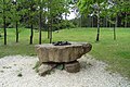
- The fort square, visible since 2006

View over the camp area

The originally stone surrounding wall is indicated as an earth wall.
Model of the fort in the former center of the camp


Fort bath
Around 50 meters southwest of the fortification, its small fort bath was examined, which had been built on the slope leading down to the Rems valley. It was this building that the forest officials discovered first after the storm. Steimle found the building badly destroyed in 1902. Today the building stands out as a weak unevenness in the landscape. Evidence of such a thermal bath shows that even with these small systems, a remarkably developed infrastructure can be expected.
Monument protection
The Freimühle small fort and the aforementioned ground monuments have been part of the UNESCO World Heritage as a section of the Upper Germanic-Rhaetian Limes since 2005 . In addition, the facilities are cultural monuments according to the Monument Protection Act of the State of Baden-Württemberg (DSchG) . Investigations and targeted collection of finds are subject to approval, and accidental finds are reported to the monument authorities.
See also
literature
- Christian Fleer: Typification and function of the small buildings on the Limes. In: Egon Schallmayer (Ed.): Limes Imperii Romani. Contributions to the specialist colloquium “Limes World Heritage Site” in November 2001 in Lich-Arnsburg. (= Saalburg writings 6). Bad Homburg v. d. H. 2004, ISBN 3-931267-05-9 , pp. 75-92.
- Dieter Planck , Willi Beck: The Limes in Southwest Germany . 2nd completely revised edition, Theiss, Stuttgart 1987, ISBN 3-8062-0496-9 , p. 101.
- Andreas Thiel: Pre- and Early History. In: The art monuments in Baden-Württemberg. City of Schwäbisch Gmünd, Volume I: City history, city fortifications, Heiligkreuzmünster . Deutscher Kunstverlag, Munich / Berlin 2003, ISBN 3-422-06381-1 , p. 15.
- Heinrich Steimle : Numerus fort Freymühle. In limes leaf. Notifications from the route commissioners to the Reichslims Commission. 1892-1903 (1903), col. 950-954.
Remarks
- ↑ Route of the Limes wall through the valley floor at 48 ° 47 ′ 53.9 ″ N , 9 ° 45 ′ 33.8 ″ E ; Limes course at 48 ° 47 '54.8 " N , 9 ° 45' 50.34" E ; Limes course at 48 ° 47 '59.5 " N , 9 ° 46" 14.95 " E
- ↑ Bernd Becker : Felling dates of Roman construction timbers based on a 2350 year old South German oak tree ring chronology. In: Find reports from Baden Württemberg Volume 6, Theiss, Stuttgart 1981, ISBN 3-8062-1252-X , pp. 369–386.
- ↑ fortlet small Your stream at 48 ° 47 '51.11 " N , 9 ° 45' 15.53" O .
- ↑ a b c Dieter Planck (Ed.): The Romans in Baden-Württemberg. Theiss, Stuttgart 2005, ISBN 3-8062-1555-3 , p. 314.
- ^ Heinrich Steimle : Numerus-Kastell Freymühle In Limesblatt. Notifications from the route commissioners to the Reichslims Commission. 1892-1903 (1903), col. 950-954; here: Col. 950–951.
- ^ Georg Stütz: Heimatbuch für Gmünd and further surroundings. Volume II: Walks in the home. Schwäbisch Gmünd 1924, p. 74 f.
- ↑ a b Heinrich Steimle : Numerus-Kastell Freymühle In Limesblatt. Notifications from the route commissioners to the Reichslims Commission. 1892-1903 (1903), col. 950-954; here: col. 953.
- ↑ Jürgen Obmann (Ed.): Limesentwicklungsplan Baden-Württemberg. Protection, development and research of the world heritage. State Office for Monument Preservation in the Stuttgart Regional Council, Esslingen 2007. p. 42.
- ↑ Conquer the Limes in a chariot . In: Gmünder Tagespost . May 8, 2006.
- ↑ Manfred Laduch: Unique on the entire Limes route . In: Rems newspaper . May 18, 2009.
- ↑ a b c Heinrich Steimle : Numerus fort Freymühle In Limesblatt. Notifications from the route commissioners to the Reichslims Commission. 1892-1903 (1903), col. 950-954; here: col. 951.
- ↑ rounded size information (53 × 55 meters) from Andreas Thiel : Pre- and early history. In: The art monuments in Baden-Württemberg. City of Schwäbisch Gmünd, Volume I: City building history, city fortifications, Heiligkreuzmünster . Deutscher Kunstverlag 2003, ISBN 3-422-06381-1 , p. 14.
- ↑ a b c Heinrich Steimle : Numerus fort Freymühle In Limesblatt. Notifications from the route commissioners to the Reichslims Commission. 1892-1903 (1903), col. 950-954; here: col. 952.
- ↑ Hans Ulrich Nuber : Schwäbisch Gmünd in early historical times . In: History of the City of Schwäbisch Gmünd. Theiss, Stuttgart 1984, ISBN 3-8062-0399-7 , p. 32.
- ^ Richard Strobel: The art monuments of the city of Schwäbisch Gmünd. Volume 1. Deutscher Kunstverlag, Berlin / Munich 2003, ISBN 3-422-06381-1 , p. 15.
- ↑ Kastell Schirenhof at 48 ° 47 '12.1 " N , 9 ° 46' 36.9" O .
- ^ Dieter Planck, Willi Beck: The Limes in Southwest Germany . 2nd edition, Theiss, Stuttgart 1987, ISBN 3-8062-0496-9 , p. 108.