
Black Forest-Swabian-Alb-Allgäu-Weg
| Black Forest-Swabian Alb-Allgäu-Weg | |
|---|---|
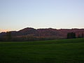
 View from Hohengundelfingen into the Lautertal |
|
| map | |

|
|
| Data | |
| length | 311 km |
| location |
Baden-Wuerttemberg , Heckengäu , Schönbuch , Swabian Alb , Upper Swabia , Allgäu |
| Supervised by | Swabian Alb Association |
| Markers |
Red crossbar |
| Starting point | Pforzheim copper hammer 48 ° 52 ′ 38.4 " N , 8 ° 41 ′ 58.5" E |
| Target point |
Black ridge 47 ° 41 ′ 32.3 ″ N , 10 ° 7 ′ 32.3 ″ E |
| Type | Long-distance hiking trail |
| Height difference | 860 m |
| The highest point | 1118 m above sea level NN ( Black Ridge ) |
| Lowest point | 258 m above sea level NN (Pforzheim copper hammer) |


The Black Forest-Swabian Alb-Allgäu-Weg , also called Hauptwanderweg 5 or HW 5 for short , is a 311-kilometer long- distance hiking trail of the Swabian Alb Association . It leads from Pforzheim to the Black Ridge . Here it first crosses the edge of the northern Black Forest , then the Schönbuch , the Swabian Alb and Upper Swabia . It ends in the Allgäu in Württemberg .
Route
Section Northern Black Forest - Schönbuch - Neckar
The Black Forest-Swabian Alb-Allgäu-Weg begins in Pforzheim -Kupferhammer near the point at which the three major hiking trails of the Black Forest Association ( West , Middle and East ) begin. The path is initially based on the Würm valley , and also leads over the Black Forest rim plate ; The first 13 kilometers run in the Black Forest natural area , but the path only leads along the edge of the low mountain range. In the Heckengau and Schlehengäu , the hiker arrives at Weil der Stadt , and from there on to Bebenhausen in the heart of the Schönbuch nature park . The cities of Herrenberg and Tübingen can be visited with side trips. The Schönbuch is left at Lustnau , where HW 5 leads over the Neckar .
Neckar - Alb - Danube section
After crossing the Neckar, which flows at an altitude of about 310 m near Lustnau , the path climbs again and leads up to the Lias plateau : after Pfullingen , the ascent to the Swabian Alb begins. At the same time, the path meets the Swabian Alb biosphere area , which was recognized by UNESCO in 2009. The HW 5 leads over the striking Schönberg tower on the Albtrauf to Lichtenstein Castle at a height of 817 m . There the HW 5 meets the Swabian-Alb-Nordrand-Weg , the HW 1. The left edge of the Echaz valley is left. There is another ascent, up to the Sternberg with a height of 844 m . With its 32 m height, the Sternberg Tower gives hikers a distant view over the treetops. Now the main hiking trail 5 follows the valley of the Große Lauter , crosses the Swabian-Alb-Südrand-Weg and reaches Obermarchtal on the southern edge of the Alb.
Upper Swabia section
The Black Forest-Swabian Alb-Allgäu-Weg crosses the Danube near Obermarchtal and initially leads on the striking buses with its 767 m height. It now continues through the landscape of Upper Swabia to Biberach and Steinhausen with its famous pilgrimage church . The HW 5 then leads through the eastern districts of Bad Waldsee . The hiker arrives at Bad Wurzach via the Wurzacher Ried .
Section Westallgäu
The path leaves Upper Swabia and continues in the Württemberg Allgäu: From Leutkirch , the HW 5 leads up to the Adelegg , and there to the summit of the Black Ridge. At 1118 m , it is the highest mountain in the former state of Württemberg . The main hiking trail 5 ends here.
mark
The path is marked with a red crossbar in accordance with the main hiking trails of the Swabian Alb Association. Usually, but not always, the designation "HW 5" can be found in black below or above the bar on a white plaque.
Sights along the way
- Würmtal
- Büchelberg nature reserve
- Medieval cityscape of Weil der Stadt
- Medieval townscape of Herrenberg - accessible with a detour
- Schönbuch Nature Park
- Bebenhausen
- Tübingen - to be reached with a detour
- Käpfle
- Georgenberg
- Reutlingen - to be reached with a detour
- Nightmare
- Schönberg Tower
- Wackerstein
- Fog cave
- Casting stone
- Lichtenstein Castle in the style of historicism
- Alt-Lichtenstein ruins
- The great Lautertal
- Sternberg
- Hohengundelfingen ruins
- Derneck Castle
- Wartstein ruins
- Obermarchtal military cemetery
- Sweden Caves Reutlingendorf
- Fines
- Stations on the Upper Swabian Baroque Route : Obermarchtal Abbey Church and Steinhausen Pilgrimage Church
- Graben height
- Stations on the Swabian Baths Road : Bad Wurzach
- Wachbühl
- Adelegg
- Black ridge
Special stops on the way

Almost 1000 years of monastic culture make the area around the old Cistercian abbey Bebenhausen tangible, which affects HW 5.

The striking Schönberg tower with its 108 steps leading to the platform offers a special panoramic and panoramic view.

The Nebelhöhle in the neighborhood, on the other hand, leads into the depths of the karst mountains of the Swabian Alb.

The Sternberg is - at least when looking at the 844 vertical meters - the highlight in the section of the Swabian Alb. Here the wooden Sternberg tower.

Moors with dying trees can be experienced in Upper Swabia, especially in the Wurzacher Ried.
The Adelegg with the Black Ridge, destination of HW 5, leads to an altitude of over 1000 m and lets you experience the western Allgäu .


.jpg)


literature
- Willi Beck: HW 5 Black Forest Swabian Alb Allgäu , Konrad-Theiss-Verlag, Stuttgart 1984, ISBN 3-8062-0344-X . Available from the Swabian Alb Association. This hiking guide is now out of date in numerous places.
- Helmut Hecht: Burgen-Weg , Verlag des Schwäbischen Albverein , Stuttgart 2012, ISBN 978-3-920801-68-1 . This hiking guide describes the section from Reutlingen to Zwiefalten with minor deviations.
Individual evidence
- ↑ http://tuerme-wanderheime.albverein.net/aussichtstuerme/sternbergturm-bei-gomadingen-kreis-reutlingen so the homepage of the Swabian Alb Association, accessed on September 14, 2014
Web links
- Main hiking trail 5 at the Swabian Alb Association
- Main hiking trail 5 at OpenStreetMap
- https://jmos.net/wanderungen/hw5.rvt - private website for the route
HW 1: Swabian Alb North Edge Path | HW 2: Swabian Alb South Rim Trail | HW 3: Main-Neckar-Rhein-Weg | HW 4: Main-Danube-Bodensee-Weg | HW 5: Black Forest-Swabian-Alb-Allgäu-Weg | HW 6: Limes hiking trail | HW 7: Swabian-Alb-Upper Swabian Way | HW 8: Frankenweg | HW 9: Heuberg-Allgäu-Weg | HW 10: Stromberg-Swabian Forest Path | Georg-Fahrbach-Weg (GFW) | Württemberg Wine Trail (WWW) | Neckarweg | Lake Constance circular route | Main-Danube-Way | Upper Swabian Way of St. James | Franconian-Swabian Way of St. James