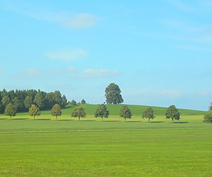
Wachbühl
| Wachbühl | ||
|---|---|---|
|
Wachbühl |
||
| height | 792.7 m above sea level NHN | |
| location | Baden-Württemberg , Allgäu foreland | |
| Mountains | Riß-Aitrach-Platten , Donau-Iller-Lech-Platte | |
| Coordinates | 47 ° 52 '23 " N , 9 ° 58' 16" E | |
|
|
||
| particularities | Lookout point and highest point in the former Oberamt Leutkirch | |
The Wachbühl is 792.7 m above sea level. NHN high vantage point in space stem Bad Wurzach in the district of Ravensburg .
Location and geography
The Wachbühl is the highest elevation in the Bad Wurzach area, the Zeiler gravel field and in the former Oberamt Leutkirch . The lookout is located on the district of Seibranz and granted on clear days, an overview of the entire chain of the Alps , the Allgäu foothills and Upper Swabia .
To the north you have a good overview of the heavily wooded Marstetter gravel plain , Danube valley and Swabian Alb . All rivers that arise in the Wachbühl area flow northwards are therefore drained via the Danube river system . Nearby is the tobel-like Teufelsloch. At least once a year a mountain mass or a mountain service is celebrated on the Wachbühl .
Five kilometers southwest of the terminal moraine from the Ice Age , at an altitude of 745 meters, is the residence of the princely family and former owner of the Hereditary Office of the Holy Roman Empire of Waldburg-Zeil , Zeil Castle . The palace complex is located on the district of Reichenhofen and thus belongs to the town Leutkirch im Allgäu .
Natural allocation
The Wachbühl is naturally assigned as follows:
-
(to 04 Donau-Iller-Lech-Platte )
-
(for 041 Riß-Aitrach plates )
-
(to 041.2 Altmoränenplatten between crack and Rottum )
- 041.22 Old moraine plates around the Wurzacher Ried
-
(to 041.2 Altmoränenplatten between crack and Rottum )
-
(for 041 Riß-Aitrach plates )
Within the unit 041.22, in the south of which it is located, the Wachbühl is the highest elevation.
literature
- Oskar Sailer (ed.): The district of Ravensburg . Theiss, Stuttgart 1976, ISBN 3-8062-0145-5
Web links
- Homepage of Bad Wurzach
- Weather station south: Recommended viewpoints in foehn weather conditions (PDF; 17 kB)
proof
- ↑ Map services of the Federal Agency for Nature Conservation ( information )
- ^ Hansjörg Dongus : Geographical land survey: The natural space units on sheet 188/194 Kaufbeuren / Mittenwald. Federal Institute for Regional Studies, Bad Godesberg 1993. → Online map (PDF; 6.4 MB)


