Rottum (Westernach)
| Rottum | ||
|
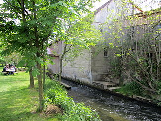
The Rottum near Zillishausen - Sägmühle Eiberle (2013) |
||
| Data | ||
| Water code | DE : 11374 | |
| location | Biberach district | |
| River system | Danube | |
| Drain over | Westernach → Danube → Black Sea | |
| confluence | in Ochsenhausen from Bellamonter (left) and Steinhauser Rottum (right) 48 ° 4 ′ 16 ″ N , 9 ° 57 ′ 8 ″ E |
|
| Source height | approx. 576 m above sea level NHN | |
| confluence | North of Laupheim with the Dürnach to Westernach Coordinates: 48 ° 15 '33 " N , 9 ° 52' 15" E 48 ° 15 '33 " N , 9 ° 52' 15" E |
|
| Mouth height | 490.3 m above sea level NHN | |
| Height difference | approx. 85.7 m | |
| Bottom slope | approx. 2 ‰ | |
| length | 43.8 km with Bellamonter Rottum |
|
| Catchment area | 137.347 km² | |
| Discharge at the Laupheim A Eo gauge : 135 km². Location: 8.3 km above the mouth |
NNQ (08/18/1998) MNQ 1974–2006 MQ 1974–2006 Mq 1974–2006 MHQ 1974–2006 HHQ (07/31/2002) |
498 l / s 827 l / s 1.59 m³ / s 11.8 l / (s km²) 14.3 m³ / s 24.5 m³ / s |
| Small towns | Laupheim , Ochsenhausen | |
| Communities | Mietingen | |
The Rottum is a 44 km long river in the district of Biberach with its longer left upper course . It flows north to north-west and flows a little down from Laupheim with the Dürnach coming from the left to form the Westernach , which flows into the Danube after just 7 km north .
course
The Rottum arises from the union of the left upper or Bellamonter Rottum and the right lower or Steinhauser Rottum in the urban area of Ochsenhausen ; The two upper reaches have almost the same catchment areas, but the Upper Rottum, with its 13.0 km length, is noticeably longer than the Lower Rottum, which is only 8.9 km, and is perhaps therefore sometimes converted into the Rottum.
It then flows north. It passes Goppertshofen and flows through Reinstetten to Schönebürg , from where it moves approximately north-north-west. Between Schönebürg and Mietingen near the Sägmühle, which already belongs to Mietingen, the 3.2 km long Reichenbach runs from the south , which drains the pond of the former Heggbach monastery at its upper course . The Rottum then crosses Mietingen, where two tributaries of similar length drain into it, then the Baustetten district of Laupheim and Laupheim itself, where the 7.9 km long basin trench is the longest tributary to the upper reaches. Around three kilometers north of the city, it then unites with the Dürnach coming from the south to form Westernach .
Individual evidence
- ↑ a b c d e f g h State Institute for the Environment Baden-Württemberg (LUBW) ( notes )
- ^ German Hydrological Yearbook Danube Region 2006 Bavarian State Office for the Environment, p. 94, accessed on October 4, 2017, at: bestellen.bayern.de (PDF, German, 24.2 MB).
literature
- District of Biberach: cycling and hiking map - with leisure information and the hiking trails of the Swabian Alb Association . (Scale 1: 50,000), 1997.


