
Dürnach
| Dürnach | ||
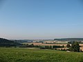
 The Dürnach in front of Maselheim |
||
| Data | ||
| Water code | DE : 113748 | |
| location |
Northern Alpine Foreland
|
|
| River system | Danube | |
| Drain over | Westernach → Danube → Black Sea | |
| source | southeast of Mittelbuch 48 ° 1 ′ 54 ″ N , 9 ° 53 ′ 54 ″ E |
|
| Source height | 660 m above sea level NN | |
| confluence | northwest of Laupheim with the right Rottum to Westernach Coordinates: 48 ° 15 '33 " N , 9 ° 52' 15" E 48 ° 15 '33 " N , 9 ° 52' 15" E |
|
| Mouth height | 490 m above sea level NN | |
| Height difference | 170 m | |
| Bottom slope | 5.3 ‰ | |
| length | 32.3 km | |
| Catchment area | 94.119 km² | |
| Drain the level Laupheim A Eo : 94.6 sq km range: 2.4 km above the mouth |
NNQ (08/11/1998) MNQ 1975–2006 MQ 1975–2006 Mq 1975–2006 MHQ 1975–2006 HHQ (09/29/1981) |
246 l / s 355 l / s 761 l / s 8 l / (s km²) 9.56 m³ / s 14.1 m³ / s |
| Left tributaries | Saubach | |
| Right tributaries | Kaltenbach , Rohrbach | |
The Dürnach is over 30 km long river in the district of Biberach , which is somewhat below Laupheim from the left and south with the coming of the east-southeast Rottum to Westernach flows together, then northward to the Danube runs.
course
The Dürnach origin is located between the places Mittelbuch , Rottum and Dietenwengen in a forest area. The stream flows here from east to west for a short distance before turning north. The middle book and ring neck are flowed through. Shortly before Wennedach the Kaltenbach flows into the Dürnach, shortly after Wennedach the Rohrbach . The stream then flows through Maselheim , Sulmingen and Baltringen and then along the edge of the Osterried . The Dürnach then passes the city of Laupheim to the west , before shortly afterwards, after 32.3 km in the Rappenwinkel, it joins the Rottum to form the Westernach .
Individual evidence
- ^ Hans Graul : Geographical land survey: The natural space units on sheet 179 Ulm. Federal Institute for Regional Studies, Bad Godesberg 1952. → Online map (PDF; 4.8 MB)
- ↑ a b State Institute for the Environment Baden-Württemberg (LUBW) ( information )
- ^ German Hydrological Yearbook Danube Region 2006 Bavarian State Office for the Environment, p. 93, accessed on October 4, 2017, at: bestellen.bayern.de (PDF, German, 24.2 MB).
literature
- District of Biberach (Ed.): Cycling and hiking map - With leisure information and the hiking trails of the Swabian Alb Association . (Scale 1: 50,000), 1997.

Dürnach at Ringschnait
Dürnachtal near Maselheim

Near Sulmingen


