Saubach (Dürnach)
| Saubach | ||
|
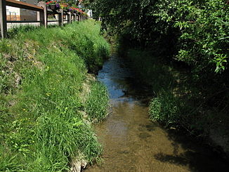
The Saubach in Äpfingen |
||
| Data | ||
| Water code | DE : 1137484 | |
| location | Biberach district | |
| River system | Danube | |
| Drain over | Dürnach → Westernach → Danube → Black Sea | |
| source | between two forest peaks south of Ellmannsweiler 48 ° 5 ′ 51 ″ N , 9 ° 51 ′ 48 ″ E |
|
| Source height | approx. 610 m above sea level NHN | |
| muzzle | north of the Osterried in the Laupheim-Naustetten district from the left into the Dürnach coordinates: 48 ° 12 '21 " N , 9 ° 51' 32" E 48 ° 12 '21 " N , 9 ° 51' 32" E |
|
| Mouth height | almost 505 m above sea level NHN | |
| Height difference | approx. 105 m | |
| Bottom slope | approx. 7.5 ‰ | |
| length | 13.9 km | |
| Catchment area | 23.654 km² | |
| Small towns | Laupheim | |
| Communities | Maselheim , Mietingen | |
The Saubach is an approximately 14 km long left tributary of the Dürnach in the urban area of Laupheim in the Baden-Württemberg district of Biberach , which drains north to the Danube via the Westernach .
course
The Saubach rises about one kilometer south of Ellmannsweiler . In this place it is then fed by an unnamed stream and flows further north along the K 7504 to Laupertshausen . Then on to Äpfingen and shortly after the town under the federal road 30 through into a plain that is called Ried in the region . The stream now touches the Obere Ried on the left and then runs between the Unterem Ried and Osterried . Then the stream reaches a road and follows it in an anthropogenically forced course to the northeast towards the Dürnach and soon flows into it from the left.
Individual evidence
literature
- District of Biberach (Ed.): Cycling and hiking map - With leisure information and the hiking trails of the Swabian Alb Association . (Scale 1: 50,000), 1997.

