
Bellamonter Rottum
|
Bellamonter Rottum Obere Rottum |
||
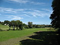
 The Bellamonter Rottum near Rottum |
||
| Data | ||
| Water code | DE : 11374 | |
| location |
Baden-Württemberg
|
|
| River system | Danube | |
| Drain over | Rottum → Westernach → Danube → Black Sea | |
| Headwaters |
Füramooser Ried southwest of Füramoos 47 ° 59 ′ 27 ″ N , 9 ° 53 ′ 14 ″ E |
|
| Source height | approx. 663 m above sea level NHN | |
| confluence | in Ochsenhausen with the right Steinhauser Rottum to the Rottum coordinates: 48 ° 4 ′ 16 ″ N , 9 ° 57 ′ 8 ″ E 48 ° 4 ′ 16 ″ N , 9 ° 57 ′ 8 ″ E |
|
| Mouth height | approx. 576 m above sea level NHN | |
| Height difference | approx. 87 m | |
| Bottom slope | approx. 6.7 ‰ | |
| length | 13 km | |
| Catchment area | 25.093 km² | |
The Bellamonter Rottum is a river in the Biberach district . After a roughly 13 km long run it flows approximately in a north-northeast direction in Ochsenhausen with the right Steinhauser Rottum coming from the south to the Rottum , which then runs north to northwest to the Danube tributary Westernach .
Alternatively, the Bellamonter Rottum is also called Obere Rottum , and accordingly the Steinhauser Rottum is also called Untere Rottum . Others beat the noticeably longer upper reaches of the Bellamonter Rottum, which has only a tad less catchment area than the Steinhauser Rottum, to the Rottum itself.
course
The origin of the Bellamonter Rottum is located around 800 meters southwest of Füramoos , a suburb of the Eberhardzell municipality , in the Füramooser Ried and then flows following its main direction through the village of Füramoos and then in a semicircular arc around Bellamont and the former Bellamont Castle . It is now heading towards the village of Rottum and crosses it before, following a natural course, it flows to Ochsenhausen . Here it joins after 13.0 km with the Steinhauser Rottum to the Rottum .
Individual evidence
literature
- District of Biberach (Ed.): Cycling and hiking map - With leisure information and the hiking trails of the Swabian Alb Association . (Scale 1: 50,000), 1997.

near Ochsenhausen
near Ochsenhausen

