Northern Black Forest

The Northern Black Forest is the northern third or - according to a division that is less common today - the northern half of the Black Forest .
Demarcation
The northern Black Forest extends between the Karlsruhe - Pforzheim in the north and Renchtal - Freudenstadt in the south. The northern boundary largely coincides with the emergence of the extensive, forested red sandstone from the agrarian Kraichgau , the southern boundary to the Central Black Forest (or if it is divided into two: to the southern Black Forest ) varies depending on the definition or the natural structure (see also Black Forest ). In the past, the northern Black Forest was the entire northern half of the mountains up to the Kinzig valley line , which divides the Black Forest east of Lahr . It is bounded to the west by the Upper Rhine Plain and to the east by the Gäu landscape.
The northern Black Forest is not congruent with the spatial planning region of the northern Black Forest , which covers the eastern area.
Characteristic
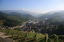
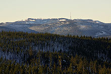
The northern Black Forest dominates the Rhine plain by more than 1000 m with rather angular, sometimes trapezoidal summit profiles , while the eastern roof runs gradually and with decreasing differences in altitude. The highest point is the Hornisgrinde at 1164.4 m above sea level. NHN . With an average share of 73% forest in the total area, the northern Black Forest is the most densely wooded part of the Black Forest. The Grinden , tree-free wet heaths , spread across the plateaus . Geologically prevails in the Black Forest of red sandstone front, with the strong zer talten West mainly the reason mountain base in gneisses and granites comes to light. The invading Granite (z. B. Forbach Granite ) and porphyries ( Karlsruher ridge ) and silicified Permian formations ( Battertfelsen ) stand out by special clip formations. The high areas of the northern Black Forest are among the regions with the highest rainfall in the German low mountain range (up to 2,200 mm / a). The most important rivers are Murg , Nagold , Enz , Alb , Acher , Rench , Oos and Wolf (only upper reaches).
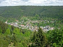
The Nature regions of the northern Black Forest distinguishes the three areas Northern Talschwarzwald on the western slope, Grindenschwarzwald and Enzhöhen with the central, red sandstone, Forest, Karen and bogs dominated altitude areas and the Black Forest boundary plates on the northern and eastern edge of narrow river valleys between the high areas where clearings with Waldhufen- or clustered villages lie.
Since 2014, an area of around 10,000 hectares in the high altitude area between the Black Forest High Road and Murg Valley has been designated as the Black Forest National Park . In addition, the Black Forest Middle / North Nature Park has been set up since 2001 , which includes the entire northern Black Forest.
The tourist resorts with the highest number of overnight stays are Baiersbronn and Baden-Baden , popular tourist destinations and winter sports areas away from the cities are the Black Forest High Road and Kaltenbronn .
Cities and municipalities in the northern Black Forest (selection)
- Altensteig
- Althengstett
- Baden-Baden
- Bad Herrenalb
- Bad Liebenzell
- Bad Peterstal-Griesbach
- Bad Teinach-Zavelstein
- Bad Wildbad
- Baiersbronn
- Bühl (Baden)
- Bühlertal
- Calw
- Chub
- Enzklösterle
- Freudenstadt
- Forbach
- Gaggenau
- Gernsbach
- Loffenau
- Lossburg
- Nagold
- Neubulach
- Neuenbürg
- Oberreichenbach
- Pforzheim
- Pfalzgrafenweiler
- Sasbachwalden
- Schömberg
- Seebach
- Weisenbach
Mountains (selection)
- Badener Höhe ( 1002.2 m )
- Battert ( 568.6 m )
- Amber ( 693.5 m )
- Fremersberg ( 525.1 m )
- Hochkopf ( 1038.5 m )
- High ox head ( 1054.1 m )
- Hohloh ( 988.8 m )
- Hornisgrinde ( 1164.4 m )
- Kniebis ( 970.6 m )
- Mahlberg ( 611.5 m )
- Mauzenberg ( 759.3 m )
- Mehliskopf ( 1008 m )
- Mercury ( 669 m )
- Schliffkopf ( 1055.8 m )
- Seekopf ( 1054.9 m )
- Sommerberg ( 836 m )
- Teufelsmühle ( 908.3 m )
- Vogelskopf ( 1056.2 m )
Lakes

Numerous cirque lakes in the northern Black Forest are traces of ice age glaciers. The best known is the Mummelsee on the Hornisgrinde. Other cirque lakes are Buhlbachsee , Ellbachsee , Herrenwieser See , Huzenbacher See , Sankenbachsee , Schurmsee and the Wildsee near Ruhestein. Many of them were also dammed up in order to provide splash water for the wood drift that was common until the 19th century . Other former cirque lakes have already silted up.
The Hohlohsee and the Wildsee near Gernsbach-Kaltenbronn are raised bog lakes on the plateaus between the Murg and Enz valleys, which are fed solely by local precipitation.
Several dams are located in the northern Black Forest. The Schwarzenbachtalsperre and the Murgtalsperre are part of the Rudolf-Fettweis-Werk , a pumped storage and run-of-river power plant in Forbach. The Nagoldtalsperre regulates the water level of the Nagold. The Kleine Kinzig dam is used to supply drinking water, regulate water and generate electricity.
See also
literature
- Rainer Hennl, Konrad Krimm (ed.): Industrialization in the Northern Black Forest. (= Upper Rhine Studies . Volume 34.) Jan Thorbecke Verlag, Ostfildern 2016, ISBN 978-3-7995-7835-6 .
- Sönke Lorenz (Ed.): The Northern Black Forest. From the wilderness to the growth region. Markstein-Verlag, Filderstadt 2001, ISBN 3-935129-01-7
- Rudolf Metz : Mineralogical and regional hikes in the northern Black Forest, especially in its old mining districts. 2nd, completely revised edition, Schauenburg , Lahr 1977, ISBN 3-7946-0128-9
- Movie
- Picture book Germany : The northern Black Forest. Documentation, 45 min., A film by Willy Meyer, SWR , first broadcast: March 5, 2006.
Individual evidence
- ↑ Northern Black Forest (natural area No. 152). In: LEO-BW . Retrieved April 27, 2019 .
- ↑ Grindenschwarzwald and Enzhöhen (natural area No. 151). In: LEO-BW . Retrieved April 27, 2019 .
- ↑ Black Forest edge plates (natural area No. 150). In: LEO-BW . Retrieved April 27, 2019 .
- ^ State Statistical Office of Baden-Württemberg (ed.): Baden-Württemberg 2000 - The new atlas for the entire state. Stuttgart 1999, ISBN 3-923292-96-1 , p. 140.


