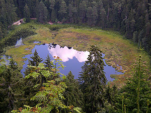
Huzenbacher See
| Huzenbacher See | ||
|---|---|---|

|
||
| Lake view from the Karwand | ||
| Geographical location | Baden-Württemberg | |
| Drain | Seebach → Murg | |
| Data | ||
| Coordinates | 48 ° 34 '28.7 " N , 8 ° 20' 55.3" E | |
|
|
||
| Altitude above sea level | 747 m | |
| surface | 2.7 ha | |
| length | 250 m | |
| width | 145 m | |
| Maximum depth | 7.5 m | |
The Huzenbacher See is a cirque lake in the northern Black Forest . It is located in the municipality of Baiersbronn around seven kilometers north of the center at an altitude of 747 m in the Black Forest National Park . It is shrouded in legend and today has yellow pond roses as a specialty . The flowering can be seen in mid to late July.
The lake was formed around 25,000 to 30,000 years ago. Since the 18th century it has been used as splash water . In 1895 a weir was built at the lake exit in order to better regulate the water level. This raised the lake by about two meters and now has a depth of seven to eight meters. Due to the increase in the water level, the previous area near the bank was detached from the ground and flooded, which still covers part of the lake surface as a network of mosses, roots and young trees. A similar phenomenon can also be found at the Nonnenmattweiher and Kleiner Arbersee .
On the night of July 1, 2012, a storm caused severe damage in the Baiersbronn forest district; the forest on the east bank of the Huzenbacher See was also destroyed.
Web links
- Huzenbach and the Huzenbacher See
- Stories and legends about the Huzenbacher See
- Huzenbacher See at the Environment Theme Park of the Ministry for the Environment, Climate Protection and the Energy Sector Baden-Württemberg
Individual evidence
- ↑ With rope cranes on the steep slope In: Schwarzwälder Bote from September 13, 2012
