Göggingen (Württemberg)
| coat of arms | Germany map | |
|---|---|---|

|
Coordinates: 48 ° 52 ' N , 9 ° 53' E |
|
| Basic data | ||
| State : | Baden-Württemberg | |
| Administrative region : | Stuttgart | |
| County : | Ostalbkreis | |
| Height : | 488 m above sea level NHN | |
| Area : | 11.38 km 2 | |
| Residents: | 2479 (December 31, 2018) | |
| Population density : | 218 inhabitants per km 2 | |
| Postcodes : | 73571, 73574 | |
| Area code : | 07175 | |
| License plate : | AA, GD | |
| Community key : | 08 1 36 024 | |
| Address of the municipal administration: |
Hauptstrasse 46 73571 Göggingen |
|
| Website : | ||
| Mayor : | Walter Weber (CDU) | |
| Location of the community of Göggingen in the Ostalb district | ||
Göggingen is a village and a municipality in Baden-Württemberg and belongs to the Ostalb district .
geography
Geographical location
Göggingen is located in the foothills of the eastern Swabian Alb on the southern edge of the Frickenhofer Höhe above the Lein , a small tributary of the Kocher , about 10 km northeast of Schwäbisch Gmünd .
Neighboring communities
The community borders in the north on Eschach , in the east on Schechingen and Heuchlingen , in the south on Iggingen and Leinzell and in the west on Täferrot .
Community structure
The municipality of Göggingen includes the village of Göggingen, the hamlets of Horn and Mulfingen and the courtyards Kleemeisterei, Mühle, Mühlhölzle and Pfaffenhäusle as well as the abandoned villages of Ostdorf and Hof Slot.
Division of space

According to data from the State Statistical Office , as of 2014.
history
Göggingen
Göggingen was first mentioned in the 13th century. The monastery Lorch , the monastery Gotteszell , the prince provost Ellwangen and the imperial city of Schwabisch Gmund had land and estates here. Up to the end of the Second World War , Göggingen was almost exclusively agricultural. In connection with the community jubilee of Leinzell there was a documentary mention of Göggingen. According to this, the origin of Göggingen can be dated to the year 1265.
Horn and Mulfingen
The Horn and Mulfingen suburbs belong to Göggingen.
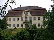
In Horn there is a castle that was completed in 1762 on the ruins of a historical castle complex. The castle was owned by the Alfingen family in the 14th century, and has belonged to the Lords of Horkheim since 1486 . In 1806 it came into the possession of Württemberg .
Mulfingen is older than Göggingen and was mentioned as Muniolfinga as early as 783 .
politics
Administrative association
The community is a member of the Leintal-Frickenhofer Höhe community administration association based in Leinzell.
mayor
In December 2015, Mayor Walter Weber was elected for a fourth term with 84.2%.
coat of arms
Blazon : In a split shield in front a blue sword in gold, behind in blue a golden abbot's staff.
The sword in the coat of arms refers to the former property of the local nobility of Göggingen and various other knightly families, while the abbot's staff refers to the spiritual owners of the village, primarily to the Lorch monastery .
The municipality flag is blue and yellow.
The coat of arms was established in 1922 by the municipality in cooperation with the Stuttgart archive office. The flag was awarded on February 18, 1981 by the Ostalbkreis district office.
Culture and sights
Buildings
- Horn Castle , in the Horn sub-community, a former manor. The castle dates from the middle of the 18th century.
- The Catholic Church of St. Nicholas was built in the second half of the 15th century. The tower once served as a defense tower. In 1971 the church received new stained glass windows made by the artist Gudrun Müsse-Florin .
Natural monuments
- To the west of Göggingen there is a small reservoir, the Götzenbach flood retention basin , also called Götzenbachsee. There is a maze east of the lake .
- The Federbach flood retention basin is located below the Horn suburb . The communal connection road Horn – Göggingen leads over the dam crest of the reservoir.
Personalities
Sons and daughters of the church
Anselm Reichlin von Meldegg (1679–1747), born at Horn Castle as Johann Christoph Wilhelm Reichlin von Meldegg, from 1728 to 1747 prince abbot in the Kempten monastery
Web links
Individual evidence
- ↑ State Statistical Office Baden-Württemberg - Population by nationality and gender on December 31, 2018 (CSV file) ( help on this ).
- ^ Community of Göggingen: Town Hall. Mayor. Retrieved May 8, 2020 .
- ^ The state of Baden-Württemberg. Official description by district and municipality. Volume IV: Stuttgart district, Franconian and East Württemberg regional associations. Kohlhammer, Stuttgart 1980, ISBN 3-17-005708-1 , pp. 742-743.
- ↑ State Statistical Office, area since 1988 according to actual use for Göggingen.
- ↑ Heinz Bardua: The communal coat of arms of the Ostalb district . Ostalb-Einhorn 10 (1983), pages 75-88.
- ↑ Heinz Bardua: District and community arms in Baden-Württemberg. Volume 1: The district and community coats of arms in the Stuttgart administrative region . Landesarchivdirektion Baden-Württemberg (ed.), Konrad Theiss Verlag Stuttgart, 1987, 158 pages, ISBN 3-8062-0801-8 .


