
Enzkreis
| coat of arms | Germany map |
|---|---|

|

Coordinates: 48 ° 54 ' N , 8 ° 42' E |
| Basic data | |
| State : | Baden-Württemberg |
| Administrative region : | Karlsruhe |
| Region : | Northern Black Forest |
| Administrative headquarters : | Pforzheim |
| Area : | 573.68 km 2 |
| Residents: | 198,905 (Dec. 31, 2018) |
| Population density : | 347 inhabitants per km 2 |
| License plate : | PF |
| Circle key : | 08 2 36 |
| NUTS : | DE12B |
| Circle structure: | 28 municipalities |
| Address of the district administration: |
Zähringerallee 3 75177 Pforzheim |
| Website : | |
| District Administrator : | Bastian Rosenau ( Free Voters ) |
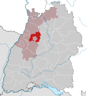
| Location of the Enzkreis in Baden-Württemberg | |
 .svg) |
|
The Enzkreis is a district in Baden-Württemberg . It belongs to the Northern Black Forest region in the Karlsruhe administrative district . Its area, like a ring open at the bottom, almost completely encloses the Pforzheim urban district , which is located in the middle of the district.
geography
location
The Enzkreis has a share in the northern Black Forest , Kraichgau , Stromberg and Heckengäu . The Enz , which gives it its name , flows through the district from the south , in whose catchment area most of the Enz district is located. In the northeast it leaves the district in the direction of Besigheim (Ludwigsburg district), where it flows into the Neckar . Smaller river catchment areas are those of the Pfinz in the west and northwest, the Alb in the southwest and the Saal and Kraichbach in the north, all of which flow into the Rhine . The highest elevation of the Enzkreis is 709.1 m above sea level. NHN the Heuberg , which is on the mark of the Neuenbürger district of Dennach .
Neighboring areas
The Enzkreis borders in a clockwise direction in the west on the districts of Karlsruhe , Heilbronn , Ludwigsburg , Böblingen and Calw .
Division of space

According to data from the State Statistical Office , as of 2015.
nature
There are the following nature reserves in the Enzkreis :
- Aalkistensee : 50.5 ha; City of Maulbronn and the municipality of Ölbronn-Dürrn
- Bauschlotter Au : 192.2 ha; Neulingen and Ölbronn-Dürrn municipalities
- Bauschlotter Schloßpark : 5.8 ha; Community newcomers
- At Steiner Mittelberg : 39.0 ha; Community Königsbach-Stein
- Betzenbuckel : 151.3 ha; City of Heimsheim and the communities of Friolzheim and Tiefenbronn
- Büchelberg : 48.6 ha; municipality Neuhausen
- Diefenbacher Mettenberg : 3.0 ha; Community Sternenfels
- Ellmendinger Roggenschleh : 22.0 ha; Keltern municipality
- Enztal between Niefern and Mühlacker : 123.0 ha; City of Mühlacker and the municipality of Niefern-Öschelbronn
- Erlen, Metten and Gründelbach lowlands (4 sub-areas): 165.0 ha; Municipalities of Ötisheim and Ölbronn-Dürrn
- Ersinger Springenhalde : 36.2 ha; community Kämpfelbach
- Essigberg : 134.5 ha; Municipalities Birkenfeld and wine presses
- Füllmenbacher Hofberg : 40.0 ha; Community Sternenfels
- Großglattbacher Riedberg : 24.1 ha; City of Mühlacker
- Klebwald : 21.6 ha; municipality Neuhausen
- Monbach, Maisgraben and St. Leonhardquelle (2 sub-areas): 42.0 ha; City of Bad Liebenzell (district of Calw) and community of Neuhausen
- Neulinger sinkholes : 12.5 ha; Community newcomers
- Roßweiher : 12.1 ha; City of Maulbronn
- Schützinger Spiegel : 15.1 ha; municipality Illingen
- Silberberg : 5.0 ha; municipality Tiefenbronn
- Tiefenbronner Seewiesen : 30.0 ha; municipality Tiefenbronn
- Weissacher Valley : 50.5 ha; City of Knittlingen
history
The Enzkreis was created by the district reform on January 1, 1973 . At that time the old Pforzheim district was combined with communities in the surrounding districts to form the Enzkreis. In detail, 17 communities in the old district of Vaihingen , twelve communities in the district of Calw and four communities in the old district of Leonberg were incorporated. The old district of Pforzheim was fully integrated into the Enz district with the exception of three places. However, on January 1, 1974 ( Büchenbronn ), January 1, 1975 ( Huchenfeld ) and September 20, 1975 ( Eutingen an der Enz ), three more communities were incorporated into the Pforzheim district.
The old districts of Vaihingen and Leonberg and the district of Calw go back to the former Württemberg upper offices, which in 1938 took over the upper offices of Maulbronn and Neuenbürg , which were then dissolved . The old district of Pforzheim emerged in 1939 from the Pforzheim district office in Baden, and the Pforzheim urban district was created at the same time.
Since then, Pforzheim is no longer part of the district, but remained the seat of the district administration until 1972 and became the seat of the new Enz district after the district reform. After the municipal reform has been completed, this will include 28 municipalities, including the five cities of Knittlingen , Maulbronn , Neuenbürg , Heimsheim and the large district town of Mühlacker . Based on the number of inhabitants, Mühlacker is the largest town and Wimsheim is the smallest.
Population development
The population figures are census results (¹) or official updates from the Baden-Württemberg State Statistical Office ( main residences only ).
|
|
politics

The district is administered by the district council and the district administrator. The district council is elected for five years by those entitled to vote in the district. This body elects the district administrator for a term of eight years. This is the legal representative and representative of the district as well as chairman of the district council and its committees. He heads the district office and is an official of the district. His area of responsibility includes the preparation of the district council meetings and its committees. He calls meetings, chairs them and implements the resolutions passed there. He has no voting rights in the committees . His deputy is the first state official.
District administrators
The district administrators of the Pforzheim district 1945–1972:
- 1945: Adolf Katz
- 1945–1959: Richard Dissinger
- 1959–1972: Werner Lutz
The district administrators of the Enzkreis since 1973:
- 1973–1995: Heinz Reichert
- 1995–2003: Werner Burckhart
- 2003–2018: Karl Röckinger
- since February 1, 2018: Bastian Rosenau
District council
The district council of the Enzkreis has 52 seats, and there are often compensatory seats. The members are elected by the electorate in the district for five years, each time at the same time as the municipal council elections. After the local elections on May 26, 2019 , the district council has 58 members (6 compensation seats; 2014: 55 members); Overall, the election led to the following result (in brackets: difference to 2014):
The turnout was 60.5% (+10.1).
coat of arms
- description
- A blue wave bar in gold, accompanied by two upright blue diamonds at the top and bottom (award of the coat of arms on August 16, 1976)
- meaning
- The wavy bar symbolizes the Enz , which gave the district its name, the four diamonds the four former districts to which the present-day municipalities of the Enzkreis belonged and the four landscapes ( Black Forest , Heckengäu , Kraichgau and Stromberg ) that make up the district area.
District partnerships
There has been a partnership since 1991 with the Altenburger Land district in Thuringia , Reggio nell'Emilia in Italy, the Polish cities / communities Myslowice , Chelm Slaski and Imielin, and since 2007 with the Hungarian Győr / Moson / Sopron county .
International partnership
The Enzkreis has a partnership with the Masasi district in Tanzania with the aim of improving the health system and the quality of training in Masasi and increasing the use of renewable energies.
traffic
The federal autobahn 8 Karlsruhe - Stuttgart , several federal highways as well as state and district roads run through the district .

The rail networks of two state railways bordered on each other in the town of Pforzheim, which used to belong to Baden. The Badische Staatsbahn established the first connection from Karlsruhe to Pforzheim in 1859/61 and extended it to Mühlacker in 1863, where it joined the Stuttgart – Bretten line of the Württemberg State Railway, which was completed ten years earlier . This company opened a branch line from Pforzheim to Wildbad in 1868 and a line to Calw – Horb in the Nagold Valley in 1874 . It was not until 1914 that the connecting line from Maulbronn West to the city was added.
The Badische Lokal-Eisenbahnen- Gesellschaft connected Karlsruhe with Pforzheim from 1900/01 onwards with a narrow-gauge railway via Ittersbach. It was electrified in 1912 after the city of Pforzheim had installed an electric tram the year before. In 1931 the city took over the section from Ittersbach on its own.
In the far northeast, the new Deutsche Bahn line has been crossing the district since 1990. There is a possibility of boarding in Vaihingen / Enz, in the immediate vicinity of Illingen / Enzkreis.
Mühlacker is an important rail hub . The circular area is supplied through the rail network Karlsruhe of Albtal traffic Society : The line S 5 leads from Karlsruhe Pforzheim and Mühlacker to Bietigheim-Bissingen , S 6 of Pforzheim to Bad Wildbad , the S 9 of Bruchsal about Bretten by precinct.
Together with the city of Pforzheim and the transport companies, the Enzkreis organizes public transport through the Verkehrsgesellschaft Pforzheim-Enzkreis (VPE). In addition, the KVV tariffs apply to journeys on the rail routes between the VPE area and the Karlsruher Verkehrsverbund (KVV) in the Enzkreis.
District facilities
The Enzkreis is responsible for the two vocational schools in Mühlacker, Ferdinand-von-Steinbeis-Schule (commercial school) and Georg-Kerschensteiner-Schule (commercial school) as well as the nursing school at the Mühlacker district hospital and the nursing assistant school at the Neuenbürg district hospital, as well as the two special needs education - and advisory centers (SBBZ) with a focus on learning Pestalozzi School Pforzheim and Comenius School Königsbach-Stein and the two SBBZ with a focus on intellectual development Gustav Heinemann School in Pforzheim and School am Winterrain in Ispringen .
The Enzkreis is also a partner in the Enzkreis-Kliniken non-profit GmbH, which belongs to the regional clinic holding Neckar-Schwarzwald, to which the clinics in the Ludwigsburg district also belong. The Enzkreis Clinics operate the Mühlacker Clinic, the Neuenbürg Clinic and the Mühlacker Geriatric Rehabilitation Clinic.
Other infrastructure
Telecommunications / broadcasting
The Mühlacker transmitter of the Südwestrundfunk is located in the Enzkreis . The Langenbrand transmission tower is also located about one kilometer outside of the district boundary, but visible from large parts of the Enzkreis due to its topographical location .
energy
There is a 220 kV substation in Pforzheim-Arlinger and a heating and power station in Pforzheim.
economy
In the Future Atlas 2016 , the district was ranked 104th out of 402 rural districts, municipal associations and independent cities in Germany, making it one of the regions with “future opportunities”. In the 2019 edition, it was ranked 160th out of 401.
cities and communes
(Residents on December 31, 2018)


License Plate
On January 1, 1973, the district was assigned the PF distinguishing mark , which had been valid for the Pforzheim district since July 1, 1956 . It is still issued today.
literature
- The state of Baden-Wuerttemberg - official description according to districts and municipalities (in eight volumes); Edited by the Baden-Württemberg State Archives Department; Volume V: Karlsruhe District; Stuttgart 1976, ISBN 3-17-002542-2 .
Web links
- Official website of the district
- Wiki Pforzheim / Enzkreis
- Link catalog on the subject of the Enzkreis at curlie.org (formerly DMOZ )
Individual evidence
- ↑ a b Statistisches Landesamt Baden-Württemberg - Population by nationality and gender on December 31, 2018 (CSV file) ( help on this ).
- ↑ neuebuerg.de: data and facts. Retrieved February 25, 2019
- ↑ Survey of land according to type of actual use in 2015
- ^ Federal Statistical Office (ed.): Historical municipality directory for the Federal Republic of Germany. Name, border and key number changes in municipalities, counties and administrative districts from May 27, 1970 to December 31, 1982 . W. Kohlhammer, Stuttgart / Mainz 1983, ISBN 3-17-003263-1 , p. 489 ff .
- ↑ Enzkreis: District election 2019 and district election 2014 ; accessed July 16, 2019.
- ↑ Climate partnership with the Masasi district. Accessed February 16, 2020 .
- ↑ 2007: The KVV tariff now applies to journeys between VPE and KVV on all rail routes in the VPE ( memento of August 26, 2010 in the Internet Archive ); accessed July 16, 2019.
- ↑ Route network map of the Karlsruhe Transport Association (PDF) ; accessed July 16, 2019.
- ↑ Future Atlas 2016. Archived from the original on October 2, 2017 ; accessed on March 23, 2018 . Info: The archive link was inserted automatically and has not yet been checked. Please check the original and archive link according to the instructions and then remove this notice.
- ↑ PROGNOS future atlas. Handelsblatt, accessed on December 10, 2019 .
Alb-Danube District | Baden-Baden | Biberach | Lake Constance district | Boeblingen | Breisgau-Upper Black Forest | Calw | Emmendingen | Enzkreis | Esslingen | Freiburg im Breisgau | Freudenstadt | Göppingen | Heidelberg | Heidenheim | Heilbronn (Land) | Heilbronn (city) | Hohenlohekreis | Karlsruhe (State) | Karlsruhe (city) | Constance | Loerrach | Ludwigsburg | Main-Tauber district | Mannheim | Neckar-Odenwald district | Ortenaukreis | Ostalbkreis | Pforzheim | Rastatt | Ravensburg | Rems-Murr-Kreis | Reutlingen | Rhein-Neckar District | Rottweil | Schwäbisch Hall | Schwarzwald-Baar district | Sigmaringen | Stuttgart | Tübingen | Tuttlingen | Ulm | Waldshut | Zollernalb district