
Hardheim
| coat of arms | Germany map | |
|---|---|---|

|
Coordinates: 49 ° 37 ' N , 9 ° 28' E |
|
| Basic data | ||
| State : | Baden-Württemberg | |
| Administrative region : | Karlsruhe | |
| County : | Neckar-Odenwald district | |
| Height : | 250 m above sea level NHN | |
| Area : | 87.02 km 2 | |
| Residents: | 6682 (December 31, 2018) | |
| Population density : | 77 inhabitants per km 2 | |
| Postal code : | 74736 | |
| Area code : | 06283 | |
| License plate : | MOS, BCH | |
| Community key : | 08 2 25 032 | |
| LOCODE : | DE HDH | |
| Community structure: | 8 districts | |
| Address of the municipal administration: |
Schlossplatz 6 74736 Hardheim |
|
| Website : | ||
| Mayor : | Volker Rohm ( Free Voters ) | |
| Location of the municipality of Hardheim in the Neckar-Odenwald district | ||
  |
||


Hardheim is a municipality on the northeastern edge of the Neckar-Odenwald district in Baden-Württemberg . It belongs to the European metropolitan region of Rhine-Neckar (until May 20, 2003 the Lower Neckar region and until December 31, 2005 the Rhine-Neckar-Odenwald region ).
geography
Geographical location
Hardheim lies in the middle of the Erftal, which is cut into the building land by the Erfa . Hardheim is divided by Bundesstrasse 27 . The municipality is partly in the Neckartal-Odenwald nature park . In a clockwise direction, Hardheim borders on Külsheim in the north and northeast , in the east on Königheim , in the south on Ahorn (all Main-Tauber-Kreis ), in the extreme southwest the municipal area meets Rosenberg , in the west Hardheim borders on Höpfingen and Walldürn (all three Neckar -Odenwald district) and in the north-west Hardheim also shares a border with Eichenbühl in Bavaria ( Miltenberg district ).
Protected areas
The European bird sanctuary Heiden und Wälder Tauberland (protected area identifier DE-6323-441) has included parts of the Hardheim district since 2007.
Community structure

The community consists of a center and eight surrounding districts:
| District | Residents (as of September 30, 2018) |
Incorporation |
|---|---|---|
| Hardheim | 4482 | - |
| Schweinberg | 702 | 08/01/1971 |
| Richtstetten | 617 | 01/01/1973 |
| Bretzingen | 399 | 08/01/1971 |
| Erfeld | 300 | December 01, 1971 |
| Dornberg | 68 | 01/01/1975 |
| Rudental | 72 | - |
| Rütschdorf | 45 | 01/01/1975 |
| Vollmersdorf | 34 | 01/01/1975 |
Only the villages of the same name belong to the districts of Bretzingen, Dornberg, Rütschdorf, Schweinberg and Vollmersdorf. The village of Erfeld and the house Erfelder Mühle belong to the district of Erfeld. The Richtstetten village and the Helmstheim homestead belong to the district of Richtstetten. The villages Hardheim and Rüdental, the village Baracken, the homestead Neumühle and the houses Breitenau and Wohlfahrtsmühle belong to the municipality of Hardheim within the boundaries of 1970.
The Stockheim desert is in the Bretzingen district, the Lindenmühle desert in the Hardheim district. In the district of Schweinberg are the desert areas Betzwiesen and Selhofen, which is only documented by a field name .
Coats of arms of the districts

Bretzingen

Dornberg

Erfeld

Richtstetten

Rütschdorf

Schweinberg

Vollmersdorf


history
The first settlement of today's municipality was probably before the turn of the century by the Celts ; this is indicated by a Keltenschanze in the district of Richtstetten. The Limes runs past Hardheim just a few kilometers west. This shows that Hardheim must have been just outside the borders of the Roman Empire . After the Romans withdrew from the building land , it was the Alemanni who settled this area, later the Franks .
Hardheim is called "Hartheim" around 1100, from Hart, Weidewald. The alleged first mention of Hardheim in 996 in a certificate from Emperor Otto III. is a fake. A certificate from Henricus von Hartheim from 1197 shows that nobles lived in Hardheim. In 1256 the parish of Hardheim was first mentioned in a document.
When knight Georg Wolf von Hardheim died in 1607 without leaving an heir, Hardheim fell back denominationally to the Catholic diocese of Würzburg . State sovereignty, which until then had been with the Archbishop of Mainz , was transferred to the Bishopric of Würzburg in 1656 . Hardheim was already the seat of an office there , the Office Hardheim . The change of sovereignty also resulted in a change from the Kurrheinische Reichskreis to the Franconian Reichskreis . After the Napoleonic reorganization of the German area ( Reichsdeputationshauptschluss ), Hardheim was first assigned to the Principality of Leiningen in 1803 and, after its mediatization, to the Grand Duchy of Baden in 1806 .
In 1911 Hardheim was connected to the railway network via a branch line from Walldürn . This strengthened Hardheim's position as a workplace for many people in the area. However, the railway line has been closed again since 1999 and has been dismantled since 2004.
In 1961, an American missile defense unit was stationed here. The Carl-Schurz-Kaserne was inaugurated in 1966 .
In the course of the municipal reform in Baden-Württemberg , Bretzingen and Schweinberg were incorporated on August 1, 1971. Erfeld followed on December 1, 1971. On January 1, 1973, Richtstetten was added. The municipal reform was completed on January 1, 1975 with the incorporation of Dornberg, Rütschdorf and Vollmersdorf.
In 2012, Defense Minister Thomas de Maizière announced that the Carl Schurz barracks would be closed and that Hardheim, with its 1,000 posts, would be abandoned as a Bundeswehr location. During the refugee crisis in Europe in 2015 , 650 refugees were housed in the barracks. In October 2017, this Bundeswehr location was reactivated.
Population development

Hardheim has 6,812 inhabitants, of which 50.6% are male. In Hardheim there are a total of 2,415 people in employment, 71% of them in the manufacturing industry.
Religions
Christianity
About 80 percent of the Hardheim population are Roman Catholic , 15 percent belong to the Protestant community in Hardheim.
Hardheim Jewish Community
From the Middle Ages to the time of the Third Reich there was a Jewish community in Hardheim that had existed for over 600 years . In 1318 Jews were first mentioned in Hardheim, who were pawned by Emperor Ludwig the Bavarian to the knights Werner and Reinhard von Hardheim. In 1349 there was also persecution of Jews in Hardheim during the plague. In 1451 Jews were mentioned again in the village. The Jewish community in Hardheim owned a synagogue , a religious school, a ritual bath and the Jewish cemetery in Hardheim . A separate religion teacher was employed, who was also active as a prayer leader and schochet . Since 1827 the Jewish community in Hardheim belonged to the district rabbinate Wertheim (later represented by the district rabbinate Mosbach ). In 1933 there were still 55 Jewish residents in Hardheim. From 1933 onwards, in the wake of National Socialism, there was increased reprisals and disenfranchisement as well as the economic boycott of Jewish businesses. In the years that followed, most members of the Jewish community moved away from Hardheim or emigrated. On October 22, 1940, the 17 Jews who remained in Hardheim were deported to Gurs , only five of them survived.
Of the Jewish people who were born in Hardheim or who lived in the town for a long time, 38 people can be shown to have died during the National Socialist era .
politics

mayor
Volker Rohm has been Mayor of Hardheim since August 1, 2014.
Municipal council
The parish council typically has 18 honorary members who are elected for five years. The number of members is often increased by compensating seats (total 2019: 19 seats). In addition, the mayor acts as the municipal council chairman with voting rights.
The guaranteed Spurious part choice of location the centers of a fixed number of seats: coming from the main town Hardheim (with Weiler Rüdental) at least eleven, porcine Berg and court Stetten at least two boards, from Bretz Bettingen, Erfeld as well as from the composite counted residential district Dornberg / Rütschdorf / Vollmer village each at least one local council.
The 2019 local elections led to the following result (in brackets: difference to 2014):
| Municipal Council 2019 | ||||
|---|---|---|---|---|
| Party / list | Share of votes | Seats | ||
| CDU | 43.7% (−3.2) | 8 (± 0) | ||
| FW Union | 39.8% (+7.1) | 8 (+2) | ||
| SPD / citizen list | 16.5% (+16.5) | 3 (+3) | ||
| Turnout: 63.7% (+6.7) | ||||
coat of arms
In red a silver (white) church with two hexagonal towers, on each of whose pointed roofs a silver (white) cross; between the towers on a silver (white) crescent moon in a golden (yellow) halo, enthroned the blue-clad, golden (yellow) crowned and nimbled Madonna, in her right a golden (yellow) scepter, with the left holding the golden (yellow) nimbly naked Jesus boy ; below an oval, quartered shield protruding into the church front with the upper half, in which field 1: divided by red and silver (white) by three points, field 2 and 3: in blue a silver (white) sloping bar covered with three blue rings, Field 4: in blue a diagonal red-silver (white) square flag on a golden (yellow) pole.
Partner communities
Hardheim has maintained partnerships with Müntschemier in the Swiss canton of Bern and Suippes in the French region of Grand Est since 1966 .
Culture and sights

Buildings
The townscape is shaped by the "Erfataldom", the Catholic Church of St. Alban. The foundation stone for this building was laid on July 12, 1891, the consecration of the church was Christmas 1894. A previous building in Gothic style was replaced, in which the last service was held on November 20, 1888, as it was in danger of collapsing.
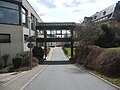
The Schlossplatz is surrounded by the Hardheimer Schloss , which today serves as the town hall, and the Erfatalhalle, a former tithe barn , which is now used, among other things, as an event room.

The town center is also formed by the so-called “Erfapark”, a building complex with various shops and apartments, and the Walter Hohmann school center . A 1: 4 scale model of the Ariane 5 rocket has been standing on Walter Hohmann Hill since 2012 in memory of the city's famous son .
On the southern edge of the town center there is also the “Stone Tower”, a former keep , which was left over from one of the oldest Hardheim castles, called Lower Castle , after it was destroyed.
The Josefskapelle is located on federal road 27 in the direction of Höpfingen .

Catholic Church

Protestant church

school

museum
School center

Erftalhalle

Former warehouse at the train station

Steinerner Turm ( keep of the Lower Castle )


Museums and cultural institutions
- Erfatal Museum on the top floors of the Erftalhalle
- Community library in primary school
- Catholic public library in the parish hall
theatre
The Badische Landesbühne performs several times a year in the Erftalhalle.
Regular events
Fairs / folk festivals:
- Josefs Market (mid-March)
- Summer party (mid June)
- Wendelinus Market (historical market, mid-October)
- Christmas market (first weekend in Advent)
Economy and Infrastructure
Companies
The largest employer in the community is the Bundeswehr , alongside the Gustav Eirich machine factory and Grammer Interior Components GmbH . With the Carl Schurz barracks and a material warehouse, it is still an important economic factor today.
Vleugels organ building workshop , which dates back to 1855, creates and restores many organs in German-speaking countries.
armed forces
In the Carl-Schurz-Kaserne on Alte Würzburger Strasse, the Bundeswehr had stationed the security battalion 12, which was newly established from the previously existing anti-tank gun battalion 12 and the light anti-aircraft missile battery 300, and a medical center. There is also a material warehouse on the Wurmberg, which is part of the material depot in Darmstadt. In 2011 there were a total of 980 posts here. As part of the Bundeswehr structural reform, the barracks should be closed in the 2nd quarter of 2017 and the material store, depending on the planning of further cooperation projects in the area of logistics, probably in 2019 and the location then given up completely. On October 1, 2017, the establishment of the staff and command support company SOCC (Special Operations Component Command) began in the Carl-Schurz-Kaserne, which - at least temporarily - will also be based there with up to 175 soldiers and directly to the Special Forces Command ( KSK) is subordinated.
On December 6, 2018, Defense Minister Ursula von der Leyen announced that in 2019 the 363 tank battalion would be set up again and stationed at the Carl Schurz barracks in Hardheim.
Educational institutions
In Walter Hohmann -Schulzentrum about 900 elementary and secondary school students are housed. There is another elementary school in Richtstetten. Hardheim and its districts together have four Roman Catholic and one communal kindergarten as well as a day care center.
Health facilities
As part of the Hardheim-Walldürn hospital association, Hardheim has a basic care hospital ( internal medicine , surgery and gynecology ) with 61 beds and around 110 employees. Emergency medical care is provided by an ambulance with an emergency doctor vehicle (NAW) from the DRK Kreisverband Buchen e. V., which is located directly at the hospital.
media
Sports and leisure facilities
- To the south of Hardheim there is an artificially raised hill (the so-called hang-glider mountain), which serves as a starting point for paragliders and hang-gliders . The Odenwald kite flying championship is held here every year.
- The Hardheim table tennis department plays with 3 active men's teams, 1 school team and 1 school girl team in the Buchen table tennis group.
- TV Hardheim maintains a handball team that has been playing in the Baden League since the 2012/13 season in the Baden Handball Association , as well as a second handball team in the Heilbronn / Franconia district league (as of 2018/2019).
- The football department of the TVH is represented by a team in the Buchen Kreisliga (as of 2012/2013).
Biking and hiking trails
The Odenwald-Madonnen-Weg , which begins in Tauberbischofsheim , leads via Königheim , Hardheim, Walldürn , Eberbach and Heidelberg to Speyer .
The Erftal-Mühlen-Radweg runs from the Hardheim district of Erfeld through the natural Erftal to Bürgstadt am Main. The length of this tour is about 31 km, the difference in altitude about 180 meters.
traffic
The federal road 27 ( Blankenburg (Harz) - Schaffhausen ) runs in a west-east direction through Hardheim and represents the main traffic artery. There are three junctions of the A 81 motorway in the direction of Würzburg and Heilbronn in about 20 to 25 kilometers . Hardheim is part of the Rhein-Neckar transport association . The Walldürn – Hardheim line was dismantled in 2004.
Personalities
literature
- Hardheim parish, Hardheim - Perle des Erfatales , home register of the parish, 1988
- Dieter Haas: Families and clans of the community of Erfeld 1585–1905, created according to the church books and registry office registers. Lahr-Dinglingen: Interest group Badischer Ortssippenbücher 2005 (= Badische Ortssippenbücher 116)
Web links
- Website of the Hardheim community
- History and genealogy of the Hardheim community
- Hardheim. LEO-BW, discover regional studies online, accessed on April 6, 2015 .
Individual evidence
- ↑ State Statistical Office Baden-Württemberg - Population by nationality and gender on December 31, 2018 (CSV file) ( help on this ).
- ↑ Ordinance of the Ministry of Food and Rural Areas establishing European Bird Protection Areas (VSG-VO) of February 5, 2010.
- ^ Hardheim in the Franconian Odenwald. Accessed January 30, 2019 .
- ^ The state of Baden-Württemberg. Official description by district and municipality. Volume V: Karlsruhe District Kohlhammer, Stuttgart 1976, ISBN 3-17-002542-2 . Pp. 275-280
- ↑ Hardheim. LEO-BW, discover regional studies online, accessed on April 8, 2015 .
- ^ Federal Statistical Office (ed.): Historical municipality directory for the Federal Republic of Germany. Name, border and key number changes in municipalities, counties and administrative districts from May 27, 1970 to December 31, 1982 . W. Kohlhammer, Stuttgart / Mainz 1983, ISBN 3-17-003263-1 , p. 474 f. and 485 .
- ↑ http://www.fnweb.de/region/neckar-odenwald/hardheim-hopfingen/kaserne-wird-mitte-2017- Closed- 1.607799
- ↑ http://www.rnz.de/nachrichten/buchen_artikel,-Fluechtlinge-in-Hardheim-660-Menschen-leben-jetzt-in-Carl-Schulz-Kaserne-_arid,130594.html
- ^ A b Alemannia Judaica: Hardheim (Neckar-Odenwald district) Jewish history / prayer room / synagogue . Online at www.alemannia-judaica.de. Retrieved May 26, 2015.
- ↑ Information based on the lists from Yad Vashem, Jerusalem.
- ↑ Information from "Memorial Book - Victims of the Persecution of the Jews under the National Socialist Tyranny in Germany 1933–1945".
- ^ Hardheim parish: main statute, §13 ; accessed June 30, 2019.
- ↑ State Statistical Office of Baden-Württemberg: Municipal council elections 2019, Hardheim ; Hardheim municipality : municipal council election 2019 ; accessed June 30, 2019.
- ↑ Rocket in honor of Walter Hohmann
- ↑ Lower Hardheim Castle at www.burgenwelt.de
- ^ Federal Ministry of Defense: The stationing of the Bundeswehr (October 2011). (PDF; 3.4 MB) bundeswehr.de, October 26, 2011, p. 43 , accessed on May 19, 2013 .
- ^ Deforestation in the Bundeswehr in the southwest , Badische Zeitung , accessed June 15, 2012
- ↑ Federal Ministry of Defense: Closing times of Bundeswehr properties: Baden-Württemberg. (PDF; 14 kB) (No longer available online.) June 12, 2012, archived from the original on June 19, 2012 ; Retrieved June 13, 2012 . Info: The archive link was inserted automatically and has not yet been checked. Please check the original and archive link according to the instructions and then remove this notice.
- ↑ Rhein-Neckar-Zeitung Hardheim has "his" soldiers back , from November 26, 2017 ( online )
- ↑ New tank battalion: Bundeswehr opts for Hardheim (plus photo gallery). Retrieved December 12, 2018 .
- ↑ http://www.tvhardheim.de/
- ↑ RadSüden.de: Odenwald-Madonnen-Radweg ( Memento of the original from April 3, 2018 in the Internet Archive ) Info: The archive link was inserted automatically and has not yet been checked. Please check the original and archive link according to the instructions and then remove this notice. . Online at www.radsüden.de. Retrieved December 8, 2016.
- ^ Hardheim in the Franconian Odenwald. Retrieved August 20, 2019 .

Bretzingen | Dornberg | Erfeld with Erfelder Mühle | Court Stetten with Helmstheim | Hardheim with barracks , Breitenau , Neumühle , Rüdental and welfare mill | Rütschdorf | Schweinberg | Vollmersdorf

Adelsheim | Aglasterhausen | Cheap home | Binau | Book | Elztal | Fahrbach | Hardheim | Hassmersheim | Höpfingen | Hüffenhardt | Limbach | Mosbach | Mudau | Neckargerach | Neckarzimmern | Neunkirchen | Obrigheim | Osterburken | Ravenstein | Rosenberg | Schefflenz | Schwarzach | Seckach | Waldbrunn | Walldürn | Zwingenberg