
Elztal (Odenwald)
| coat of arms | Germany map | |
|---|---|---|

|
Coordinates: 49 ° 23 ' N , 9 ° 11' E |
|
| Basic data | ||
| State : | Baden-Württemberg | |
| Administrative region : | Karlsruhe | |
| County : | Neckar-Odenwald district | |
| Height : | 198 m above sea level NHN | |
| Area : | 46.63 km 2 | |
| Residents: | 5861 (Dec. 31, 2018) | |
| Population density : | 126 inhabitants per km 2 | |
| Postal code : | 74834 | |
| Primaries : | 06261, 06293, 06267 | |
| License plate : | MOS, BCH | |
| Community key : | 08 2 25 117 | |
| LOCODE : | DE ELL | |
| Community structure: | 5 districts | |
| Address of the municipal administration: |
Hauptstrasse 8 74834 Elztal |
|
| Website : | ||
| Mayor : | Marco Eckl (independent) | |
| Location of the Elztal community in the Neckar-Odenwald district | ||
  |
||


Elztal is a municipality in the Neckar-Odenwald district in Baden-Württemberg , which was created in 1973 through the unification of the places Auerbach, Dallau, Muckental and Neckarburken and into which the place Rittersbach was incorporated in 1975 . It belongs to the European metropolitan region of Rhine-Neckar .
geography
Location and natural space
Elztal lies on the southern edge of the Baden Odenwald and the building land . The Elz , a right tributary to the Neckar, flows through the municipality . The district lies in the Neckartal-Odenwald Nature Park .
Community structure
The community consists of the five districts Auerbach, Dallau, Muckental, Neckarburken and Rittersbach .
The district of Dallau includes the town of Mariental and the houses An der Trienz and Obere Mühle. The Muckental village and the Rineck homestead belong to the district of Muckental . The Zinken Ziegelhütte belongs to the Rittersbach district .
From 1788 to 1850, the municipality of Rineck , which was later dissolved, also existed in what is now Elztal .
Current population figures
Dallau: 2455, Auerbach: 1240, Muckental: 545, Neckarburken: 1075, Rittersbach: 663
history
Early settlement and Roman times
The current municipality of Elztal was already settled in prehistoric times, of which a total of 14 burial mounds in the district indicate. The time of origin of these burial mounds is dated to the middle of the 1st millennium BC Dated. At the time of the Romans the Neckar-Odenwald-Limes ran through the Elztaler district. a. the forts of Neckarburken with surrounding farms ( villa rustica ) were created. There was also a Roman camp village ( vicus ) near Neckarburken .
The places are first mentioned in the Lorsch Codex
The Romans were followed by the Alamanni around 260 AD , and finally by the Franks from 497 AD , in the course of whose conquest the towns of Auerbach, Dallau, Neckarburken and Rittersbach arose. On the occasion of donations by wealthy Franconian nobles to the Lorsch Monastery , the four Franconian settlements were first mentioned in the Lorsch Codex : Dallau became 772 as Dalaheim (Talheim), Neckarburken 774 as Borocheim (Burgheim), Rittersbach 783 as Rodinsburon (Ruodis Bure) and Auerbach 791 mentioned as Urbach . In the 9th century, foundations were also made to the Cyriaksstift in Neuhausen and the diocese of Worms , which was able to increase its influence after a donation from Emperor Otto II , which included the imperial abbey of Mosbach with property in 23 locations.
Local rule in the high and late Middle Ages
In the high Middle Ages, a local nobility who had risen from the ministerial position appeared in Dallau . In 1336 the lords of Heinriet are mentioned as the owners of the fortress Dallau, who were also able to purchase goods in the surrounding areas, but then became impoverished and became robber barons . In the course of the extermination campaign of the Archbishop of Mainz Gerlach von Nassau in 1356 on behalf of Emperor Charles IV against the castle in Lohrbach of Albrecht Schenk von Limpurg , the castle in Dallau was "broken down in the name of the emperor and the empire and everything that belonged to it was devastated". Gerlach also received the right to re-establish a town in Dallau from the emperor, but this did not come about. After Gerlach's death in 1371, the lords of Heinriet again had their properties in Dallau, Aurbach, Muckental, Rittersbach and Sulzbach, which they sold to Cunz Münch von Rosenberg in 1380. On the occasion of this sale, Muckental was first mentioned in a document. In the 14th and early 15th centuries, the lords of Weinsberg , lords of Hirschhorn and Schenk von Limpurg also appear as owners.
Owned by the Teutonic Order and the Electoral Palatinate
In the 15th century, the Teutonic Order and the Count Palatinate of Pfalz-Mosbach in particular acquired shares in the villages of the Elz Valley. After the Palatinate-Mosbach line died out in 1499, its properties fell to the Electoral Palatinate . In future there was one electoral Palatinate and one Teutonic order mayor in Auerbach, Dallau and Rittersbach. A Teutonic Order bailiff sat in the Dallau Castle, who administered the order's possessions in all three of the named locations. The castle was devastated by rebellious peasants during the Peasants' War in 1525 , but was rebuilt by 1530. For this reason, the villages were in two imperial districts. The Deutschordensballei Franken belonged to the Frankish Empire , the Electoral Palatinate to the Kurrheinische Reichskreis .
During the Thirty Years' War , the Elztal villages suffered badly. The Dallau Castle was again devastated, as were the churches in Auerbach and Rittersbach, as well as the places themselves. Muckental, where there was a sheep farm, was temporarily depopulated because the population had fled. In 1668 the Teutonic Order exchanged its properties in the Elztal villages with the Electoral Palatinate for properties near Bad Mergentheim and Duttenberg Castle . The Elztal villages and their inhabitants became completely Electoral Palatinate.
Muckental was lent as an inheritance to Johann Heinrich Pettenkoffer and his descendants from 1694 to 1766, then divided into eight hubs and transferred to the farming families. In 1783 the place was raised to a separate municipality. From 1788 to 1850 there was also the community of Rineck , which was founded on the initiative of the Electoral Palatinate with resident traveling people, but whose inhabitants were relocated to America in 1849/50 because of their bad reputation.
Transfer to Leiningen 1803 and Baden 1806
In the years from 1793 onwards, the communities in the Elztal were heavily burdened by contributions and billeting as a result of the coalition wars. The loss of territory on the left bank of the Rhine by the wealthy aristocrats there led to a political reorganization in southwest Germany. Auerbach, Dallau, Neckarburken and Rittersbach came to the Principality of Leiningen in 1803 and to the State of Baden in 1806 .
Baden rural communities
In 1847 the road through the Elztal (today's B 27 ) was expanded, and the Neckarelz – Osterburken railway was built from 1862 to 1866 . For a long time, the places were predominantly agricultural and did not undergo the structural change to their present form until after the Second World War. Already during the war years and in the immediate post-war period, the places grew due to the reception of refugees from the destroyed larger cities. In 1939 there were 625 inhabitants in Auerbach, at the end of 1945 there were 696. In Dallau, the number of inhabitants rose from 1005 to 1120 in the same period, in Muckental from 372 to 395, in Neckarburken from 389 to 467, and in Rittersbach from 426 to 479.
Deportation of the Sinti to the Auschwitz-Birkenau extermination camp
In March 1943 the Kripo , "Dorfpolizei" and Mosbach police officers deported the Dallau Sinti family Reinhardt, who had to live in the former mutton house, via Mosbach together with other Sinti from the district to the extermination camp Auschwitz-Birkenau . On March 28, 1943, local police officers handed these Sinti over to the local SS on behalf of the Mosbach criminal police station . Karl Reinhardt, Maria Martha Reinhardt, Martin Reinhardt, Maria Reinhardt and the children Gustav (Josefle) Reinhardt, Thomas Reinhardt and Erika Reinhardt were murdered by the SS there or in subsequent concentration camps. Only two other women deported from Dallau, including Martha Guttenberger, née Reinhardt, the mother of "Josefle", and her brother Kaspar Reinhardt, who was also deported from Dallau, survived Auschwitz-Birkenau and the subsequent concentration camps. Her further life was severely impaired because of Auschwitz.
After 1945
In the post-war years, numerous displaced persons were taken in from the eastern regions. New building and commercial areas were designated and contributed to the structural change. In 1959 a major fire broke out in Neckarburken, in which numerous agricultural buildings were destroyed. The sports center in Dallau was built in 1967, the Elzberg Stadium in 1968, and a little later the Elzberg Hall. Leisure and sports facilities were also built in Rittersbach, Muckental and Auerbach by the mid-1970s.
Merger to form the Elztal community in 1973
On January 1, 1973 Auerbach, Dallau, Muckental and Neckarburken united to form the new Elztal community. On January 1, 1975 Rittersbach was incorporated. Until 1973 the communities of today's Elz Valley belonged to the district of Mosbach , with which they were absorbed in the course of the district reform in the new Neckar-Odenwald district . On January 1, 1975, the entire community had almost 5,000 inhabitants.
Religions
The area of today's Elz Valley has been predominantly evangelical since the Reformation . Even today there are Protestant communities in Dallau (also responsible for Auerbach) and Neckarburken, while Muckental is supplied by the community in Fahrenbach and Rittersbach by the community in Großeicholzheim . In the meantime there is also a Roman Catholic parish in town.
politics
Municipal council
The parish council normally has 19 honorary members who are elected for five years. Often the number of members increases through compensatory seats (total 2019: 20 seats; 2014: 19). In addition, the mayor acts as the municipal council chairman with voting rights.
The Unechte Teilorteschahl guarantees the districts a fixed number of seats: at least eight from Dallau, at least four from Auerbach, at least three from Neckarburken, and at least two from Muckental and Rittersbach each.
The 2019 local elections led to the following result (in brackets: difference to 2014):
| Municipal Council 2019 | ||||
|---|---|---|---|---|
| Party / list | Share of votes | Seats | ||
| CDU | 44.3% (+2.3) | 9 (+1) | ||
| FW Elztal | 28.5% (−1.2) | 6 (± 0) | ||
| SPD | 15.0% (−5.2) | 3 (−1) | ||
| GAL Elztal | 12.1% (+4.0) | 2 (+1) | ||
| Turnout: 63.3% (+4.9) | ||||
In all five districts, localities are set up within the meaning of the Baden-Württemberg municipal code, each with its own local council and local councilor as its chairman.
mayor
Before Karl Ludwig became mayor of Elztal in 1971, he was mayor of the independent community of Dallau, which is now the capital of Elztal, from 1954 to 1971. In 1971 Elztal initially consisted of the three districts Auerbach, Dallau and Neckarburken. The villages of Rittersbach and Muckental were incorporated into the municipality in 1973.
- 1971 - 1980: Karl Ludwig
- 1980 - 2012: Wilhelm Götz
- since 2012: Marco Eckel
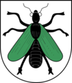
coat of arms
.png)
Blazon : Archangel Michael clad in blue (white) with blue wings, in the raised right hand a golden (yellow) sword, in the left holding a golden (yellow) balance, lower right a split oval shield, in the front in silver ( White) a black paw cross (Deutschordenskreuz), roughened diagonally behind of silver (white) and blue.
The Archangel Michael was the patron saint of the old church in Dallau. In the sign, the Teutonic Cross and the Palatinate-Wittelsbach diamonds are reminiscent of the historical dominance of the parts of the community. The coat of arms approved by the Baden-Württemberg Ministry of the Interior on January 20, 1975 is largely based on the former coat of arms of the community of Dallau.
The former coat of arms of Auerbach indicates the former importance of the place as a wine-growing area. The coat of arms of Muckental represents the name of the place as a talking coat of arms , likewise the coat of arms of Neckarburken. The coat of arms of Rittersbach shows the patron saint of the community, St. George.

Coat of arms of Auerbach
Muckental coat of arms

Neckarburken coat of arms

Rittersbach coat of arms


Economy and Infrastructure
traffic
In the districts of Neckarburken, Dallau and Auerbach there are three stops on the Neckarelz – Osterburken railway line , which is served by the RheinNeckar S-Bahn . The S1 line provides an hourly connection to Homburg and Osterburken . The narrow-gauge railway to Mosbach (Odenwaldexpress) was discontinued in 1974.
Elztal is crossed by two bus routes:
- Line 832 (only individual services) Dallau - Muckental - Limbach - Laudenberg - Langenelz - Mudau
- Line 841 (Neckarelz) - Mosbach - Neckarburken - Dallau - Muckental - Rittersbach - Heidersbach - Waldhausen - Einbach - Hollerbach - Oberneudorf - Buchen - Hainstadt - Walldürn - Höpfingen - Hardheim - Schweinberg
In the morning and noon there is also a separate school traffic that connects all five districts with the Dallau train station and all schools.
The federal highways 27 ( Blankenburg - Lottstetten / Schaffhausen ) and 292 ( Bad Schönborn - Lauda-Königshofen ) run through the municipality .
Established businesses
The OWR , a manufacturer of decontamination devices , is located in the Rittersbach district .
In the district of Dallau are the Spitzer Silo-Fahrzeugwerke GmbH, a manufacturer of silo trailers for trucks, and the Carmen Helm company, a construction company, and the Laub GmbH & Co, a printing company that operates far beyond the region.
August Mackmull GmbH, another construction company, is located in the Muckental district.
Maschinenfabrik Gerd Mosca AG has also settled in Muckental with a polypropylene and polyester tape production facility. One of the largest photovoltaic systems in the Neckar-Odenwald district is located on the roof of Mosca AG.
Educational institutions
Originally every district except Muckental had its own primary school, in Dallau there was also a secondary school. At the end of the 2011/2012 school year, the Rittersbach elementary school had to close, and from then on the students attended the Auerbach elementary school. With the opening of the community school on Schlossplatz in Limbach, the Dallau secondary school also closed, the building of the former secondary school will be renovated in 2020 and will then be converted into a primary school center at the beginning of the 2019/2020 school year. The students from Dallau and Neckarburken will therefore be taught in the primary school in Neckarburken for the duration of the renovation. The students from Muckental, Rittersbach and Auerbach continue to attend classes at the school in Auerbach.
When the planned primary school center in Dallau is completed, lessons for all primary school students will only take place centrally at the Elztal school in Dallau. The branch offices in Neckarburken and Auerbach will then have to be closed.
In addition to the Dallau primary and secondary school, there are also primary schools in Auerbach, Neckarburken and Rittersbach. There are also three Protestant and two Roman Catholic kindergartens.
In Dallau there is also a music school and a branch of the Mosbach adult education center
Culture and sights
Buildings

- Dallau Castle is the remainder of a former moated castle of the Teutonic Order , which was built in the middle of the 15th century on the site of the former castle of the Lords of Heinriet. A round corner tower and the hall with a medieval stepped gable have been preserved from the once extensive complex. The castle came into the possession of the municipality in 1974 and has been used mainly for cultural purposes since the renovation was completed in 1995. There is also a 16th century fountain nearby.
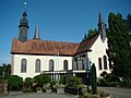
- In Dallau there is also a Protestant and a Catholic church in the immediate vicinity. The Catholic Church of St. Maria Immaculata was consecrated on May 9, 1737. From 1985 a transverse structure was added to the building and the choir was renewed. Since the historical glass windows in the old building had no connection with Mary, the new parts were provided with a baroque statue of the Virgin Mary and other symbols of the Virgin Mary. The church was consecrated again on May 10, 1987. The Evangelical Church was built in 1750 and expanded in 1857. The churches are surrounded by other historical buildings (Catholic rectory, ev. School house).
- Two Roman forts in Neckarburken , a cohort fort (west fort ) and a numerus fort .
- In Neckarburken, the half-timbered town hall and the Evangelical Church as a small baroque local church with a nave from 1775 and a tower from 1811 form a historical ensemble. Opposite is the former rectory from 1818. You will also find one of the very rare historical bread-baking locations (from 1809) and a historic lime kiln that was restored in 2006.
Catholic Church of St. Maria Immaculata Dallau

Church in Neckarburken

Historic bakery in Neckarburken

Roman foundations in Neckarburken


- The Evangelical Church , which was renovated in 1789, and the Catholic Church of St. Bartholomew as well as several historic half-timbered buildings are located in Auerbach . The buildings that characterize the town include the historic Lamm Inn , the old train station and the old schoolhouse.
- The Georgskirche in Rittersbach was built in place of an older building that already existed in the 14th century and was renovated in the 18th century in a neo-Romanesque style according to plans by Ludwig Maier . The church has copies of the frescoes of St. Georg in Reichenau-Oberzell , which are part of the world cultural heritage , which the copyist Fritz Kohlund created in 1888. After the simplification of the interior of the church during a renovation in 1969/70, the interior of the church was partially restored to its original state in the years after 2002.
- The Catholic Church of St. Josef in Muckental was built in 1890.

Interior of the Georgskirche in Rittersbach

Evangelical Church in Auerbach

Catholic Church in Auerbach

Old train station in Auerbach


Museums
- Neckarburken, Museum Elantia (Museum on the Odenwald Limes )
Sports
Each of the five districts has its own football club. However, none of the teams play in higher classes. SG Auerbach, SpVgg Rittersbach and SV Dallau play in the Mosbach district league. SV Muckental and SV Neckarburken play in the district class A Mosbach. There are also two tennis clubs, the TC Dallau and the TC Schwarz-Weiß Rittersbach, as well as the tennis department of SG Auerbach.
Sons and daughters of the church
- Karl Trunzer (1856–1927), teacher, railway pioneer and museum founder, born in Neckarburken
- Karl Ludwig (1923–1999), born in Dallau, politician (FDP / DVP), member of the state parliament
literature
- Bruno König: 1200 years of Auerbach , Elztal 1975.
- Department State Description of the General State Archives Karlsruhe (edit.), State Archives Directorate Baden-Württemberg in connection with the Neckar-Odenwald-Kreis (Ed.): The Neckar-Odenwald-Kreis . Sigmaringen 1992, ISBN 3-7995-6047-5 .
- Magdalena Guttenberger, Manuel Werner: "The children of Auschwitz sing so loud". The shaken life of the Sintiza Martha Guttenberger from Ummenwinkel , Norderstedt 2020, pp. 171–270, ISBN 978-3-7504-7043-9
Individual evidence
- ↑ State Statistical Office Baden-Württemberg - Population by nationality and gender on December 31, 2018 (CSV file) ( help on this ).
- ^ The state of Baden-Württemberg. Official description by district and municipality. Volume V: Karlsruhe District Kohlhammer, Stuttgart 1976, ISBN 3-17-002542-2 . Pp. 295-298
- ↑ Elztal municipality: Figures, data, facts. April 1, 2018, accessed November 18, 2018 .
- ↑ Minst, Karl Josef [transl.]: Lorscher Codex (Volume 4), Certificate 2806 July 3, 772 - Reg. 782. In: Heidelberg historical stocks - digital. Heidelberg University Library, p. 236 , accessed on April 15, 2015 .
- ↑ Minst, Karl Josef [transl.]: Lorscher Codex (Volume 4), Certificate 2903 June 27, 774 - Reg. 1042. In: Heidelberger historical stocks - digital. Heidelberg University Library, p. 261 , accessed on April 15, 2015 .
- ↑ Minst, Karl Josef [transl.]: Lorscher Codex (Volume 4), Certificate 2849 September 21, 783 - Reg. 1838. In: Heidelberger historical stocks - digital. Heidelberg University Library, p. 246 , accessed on April 15, 2015 .
- ↑ Minst, Karl Josef [transl.]: Lorscher Codex (Volume 4), Certificate 2618 October 22, 791 - Reg. 2347. In: Heidelberg historical stocks - digital. Heidelberg University Library, p. 186 , accessed on April 15, 2015 .
- ↑ Communications from the Württ. And Bad. State Statistical Office No. 2: Results of the population census on December 31, 1945 in North Baden
- ^ Quote from: Magdalena Guttenberger, Manuel Werner: "The children of Auschwitz sing so loudly". The shaken life of the Sintiza Martha Guttenberger from Ummenwinkel , Norderstedt 2020, p. 71.
- ↑ Magdalena Guttenberger, Manuel Werner: "The children of Auschwitz sing so loud". The shaken life of the Sintiza Martha Guttenberger from Ummenwinkel , Norderstedt 2020, pp. 54–91.
- ↑ Arno Huth: Persecution of the Sinti, Roma and Yeniche in the rural areas of the Kraichgau, the Neckar Valley, the Elz Valley and the building land, Mosbach-Neckarelz 2009, pp. 59–69
- ^ Adolf Krötz: The fire disaster 1959 in Neckarburken . In: Badische Heimat 2004. Heimatkalender for Neckartal, Odenwald, Bauland and Kraichgau , Heidelberg 2004, pp. 176–179
- ^ Federal Statistical Office (ed.): Historical municipality directory for the Federal Republic of Germany. Name, border and key number changes in municipalities, counties and administrative districts from May 27, 1970 to December 31, 1982 . W. Kohlhammer, Stuttgart / Mainz 1983, ISBN 3-17-003263-1 , p. 477 .
- ^ Federal Statistical Office (ed.): Historical municipality directory for the Federal Republic of Germany. Name, border and key number changes in municipalities, counties and administrative districts from May 27, 1970 to December 31, 1982 . W. Kohlhammer, Stuttgart / Mainz 1983, ISBN 3-17-003263-1 , p. 485 .
- ^ Elztal municipality: main statute, §15 ; accessed June 29, 2019.
- ^ State Statistical Office of Baden-Württemberg: Municipal elections 2019, Elztal ; Elztal municipality : municipal council election 2019 ; Rhein-Neckar-Zeitung , May 27, 2019: This is the new local council in Elztal (note on printing errors: FW recorded +1.2 instead of -1.2% of the votes, see: RNZ, May 27, 2014: local election in Elztal: These candidates were elected ); accessed June 29, 2019.
- ↑ Elztal elects new mayor . Franconian News , April 21, 2012
- ^ Rhein-Neckar Zeitung: Closure of the Rittersbach elementary school. In: https://www.rnz.de/nachrichten_artikel,-zzz-rnz-Odenwald-Grundschule-Rittersbach-wird-verbind-_arid,51397.html . Rhein-Neckar Zeitung, May 5, 2020, accessed on April 24, 2012 (German).
- ↑ Home. Retrieved on May 5, 2020 (German).
- ^ VHS Mosbach eV: Branch overview. Retrieved May 5, 2020 .
- ↑ Joachim Hennze: Catholic churches in the Heilbronn area from the end of the Old Kingdom to the First World War , in Heilbronnica 4, contributions to the city and regional history , Heilbronn City Archives 2008
Web links

Adelsheim | Aglasterhausen | Cheap home | Binau | Book | Elztal | Fahrbach | Hardheim | Hassmersheim | Höpfingen | Hüffenhardt | Limbach | Mosbach | Mudau | Neckargerach | Neckarzimmern | Neunkirchen | Obrigheim | Osterburken | Ravenstein | Rosenberg | Schefflenz | Schwarzach | Seckach | Waldbrunn | Walldürn | Zwingenberg