Lietzengraben
| Lietzengraben | ||
|
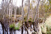
The Lietzengraben reaches the Bucher Forest |
||
| Data | ||
| Water code | DE : 582942 | |
| location | Brandenburg , Berlin , Germany | |
| River system | Elbe | |
| Drain over | Panke → Spree → Havel → Elbe → North Sea | |
| source |
Schönower Heide 52 ° 40 ′ 33 ″ N , 13 ° 31 ′ 1 ″ E |
|
| Source height | approx. 64 m above sea level NN | |
| muzzle | in Panke coordinates: 52 ° 37 ′ 18 ″ N , 13 ° 28 ′ 8 ″ E 52 ° 37 ′ 18 ″ N , 13 ° 28 ′ 8 ″ E |
|
| Mouth height | approx. 50 m above sea level NN | |
| Height difference | approx. 14 m | |
| Bottom slope | approx. 1.4 ‰ | |
| length | 10 km | |
| Left tributaries | Seegraben | |
| Big cities | Berlin | |
| Small towns | Bernau near Berlin | |
| Communities | Panke Valley | |
The Lietzengraben ( ) is a partially artificial river located on the northeastern outskirts of Berlin . Its headwaters are in the Schönower Heide , west of the Schönow district in the state of Brandenburg, which belongs to the city of Bernau near Berlin . After about 10 kilometers it joins the Panke on the right between Berlin-Buch and Berlin-Karow . The 45.3 square kilometer catchment area (14.8 km² on Berlin territory) includes the former sewage fields between Schönerlinde and Hobrechtsfelde , the Buch forest , which is designated as a landscape protection area, with the NSG Bogenseekette and Lietzengrabenniederung and the NSG Karower Teiche . The Lietzengraben is of particular importance for the preservation of the wetlands in the nature reserves.
Origin of name
The part of the word Lietzen , which can also be found in field names like Lietzow, Lützow, Lusce, has its origin in the Slavic word luccina , which means swamp or pool . The part of the word dig (from the verb dig : overturn the earth, make a depression in the ground, notch) indicates a course of water that has been changed by humans. Such interventions are particularly evident in the upper reaches (drainage) and in the lower part (irrigation) of the Lietzengraben.
geography
Natural space
The Lietzengraben is part of between Oranienburg situated and Bernau Barnim West, a mainly Sandern overprinted ground moraine , which was created by the Frankfurter season before 18,000 years ago. The gently undulating landscape is poor in water. These are found - in addition to isolated lakes ( Gorinsee , Mühlenbecker See , Summter See ) - primarily in the channel valleys through which the meltwater flowed south into the Berlin glacial valley . In the following years the higher western barnim also drained through these channels. The Panke, the Tegeler Fließ , the Lietzengraben and the tributaries connected to these brooks originally ran in a meander shape and formed river lakes and boggy banks. In the course of human settlement history, however, this originality of the river landscapes has largely been lost.
A particularly serious encroachment on the natural area along the Lietzengraben took place from the end of the 19th century to the 1980s through the disposal of sewage from the city of Berlin. The associated changes in the water and nutrient balance of the areas used as sewage fields shape the landscape and the character of the Lietzengraben up to the present day.
The Lietzengraben lies on the territory of the Barnim Nature Park .
source
The source of the Lietzengraben lies in the state of Brandenburg, west of the town of Schönow, a district of the city of Bernau. It takes its exit south of the Landesstraße 30, but receives the stronger water inflow from the pipe break adjacent to the north of the road , a wetland on the southern edge of the Schönower Heide.
course
After crossing under the L 30, the Lietzengraben flows westward through an area defined by pastureland, from which several drainage ditches flow towards it. The Lietzengraben itself also appears in this area largely as an artificially created drainage ditch. About 1.4 km northwest of Hobrechtsfelde, the ditch then reaches the now recultivated sewage field landscape. From here it runs further south, initially around 500 meters along the border between Berlin and Brandenburg, then on to Berlin territory on the edge of the Buch forest over a length of around 1.5 kilometers. In this section, the artificially created Seegraben branches off to the left, which additionally supplies the Bogensee lake in the NSG Bogenseekette and the three Buch carp ponds with water. These ponds were created from abandoned peat cuttings and serve as the fishing waters of the DAV . After leaving the Buch forest, the Lietzengraben reaches the Lietzengrabenniederung NSG about 250 meters north of Schönerlinder Chaussee. It crosses under the Chaussee and then divides into the Alte Lietzengraben and the artificially created (new) Lietzengraben. The old Lietzengraben forms an extensive wetland biotope northwest of the ponds. Both arms of the river cross under the route of the Heidekrautbahn at some distance from each other and - reunited again to form Lietzengraben - reach the BAB 10 and Bucher Straße (L 1135) around 400 meters south of the confluence , which are crossed one after the other. The Barnim Dörferweg leads over the Lietzengraben in the immediate vicinity .
muzzle
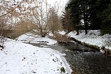
In its last section, the Lietzengraben flows southeast through the NSG Karower Teiche. After taking trench 1 Buch coming from the Bucher Moorlinse and crossing under the Berlin-Usedom long-distance cycle path , it finally flows into the Panke.
meaning
At the time of intensive use of the sewage fields, the Lietzengraben, integrated into an extensive system of ditches, drained a large part of the abundant amounts of water. With the cessation of sewage irrigation in the 1980s and the beginning of the renaturation of the former seepage areas, the water balance in the catchment area of the Lietzengraben changed significantly. It is not uncommon for the water-carrying trenches and, in some cases, the Lietzengraben itself to dry out in hot summers. A sufficient water supply for the surface waters of the Bogensee chain and the Karower ponds in the lower area of the trench was no longer given.
In 2005, the Berlin Senate and Berlin Forests started an extensive project to re-water the former sewage fields with funding from the European Union . A first important step was the transfer of around 5,000 cubic meters of purified wastewater from the Schönerlinde sewage treatment plant to three cleaning biotopes west of Hobrechtsfelde. The stabilization of the water balance achieved in the region is supplemented by a comprehensive hydrological concept, which aims to ensure "sustainable protection of the water-dependent, protected biotopes (bodies of water, silting areas, lowland moor, alder forest) in the catchment area of the Lietzengraben". Other planned measures are the construction of fish ladders , the dismantling and renewal of culverts and the reactivation of trenches.
The in Hobrechtswald applied Rieselwanderweg along the trench and the cleaning Lietz biotopes give a comprehensive picture of the hydrological action in the region.

The renaturation of the sewage fields in the last thirty years has led to the creation of a semi-open, partially bush-covered or re-forested landscape. The Lietzengraben with its wetland biotopes enriches this landscape and provides an additional habitat for many, sometimes rare, plant and animal species. At the same time, it is an essential part of the forest pasture project that has been running with robust cattle breeds and Konik horses since 2007 . Territories selected for grazing are distributed over almost the entire catchment area of the Lietzengraben. Visitors have the opportunity to walk through the freely accessible pasture areas on designated paths and thus experience the grazing directly.
Lietzengraben valley
The old Lietzengraben gives a picture of the original naturalness of the stream. Since the area was placed under protection in 2002, the water in this section has again become a natural meadow ditch, which also has a landscape-shaping effect. Its banks and the surrounding meadows have developed into the habitat of many rare and endangered species. The newly created bodies of water at the deepest points of the lowland are popular with swamp and water birds. The lapwing has one of its few breeding grounds in Berlin in the lowlands, the kingfisher finds habitat here, with sticklebacks living in the ditch serving as a source of food. In autumn, cranes can be seen regularly in the meadows.
literature
- Ino Weber: The Hobrechtswald. A newly developed landscape near Berlin-Buch. Books on Demand GmbH, Norderstedt 2010, ISBN 978-3-8391-6991-9 .
- Carsten Rasmus, Bettina Klaehne: Barnim Nature Park. Hikes, bike rides and walks. KlaRas Verlag, Berlin 2001, ISBN 3-933135-09-5 .
- Werner Ebert, Heinz Domnik: On the way with the heather railway from Berlin to the Schorfheide. Ed .: Municipal working group "Region Heidekrautbahn", Basdorf o. J.
Web links
- Berliner Rieselfelder with a focus on the fields in Buch , accessed February 2013.
- Bucher Forst, naturfotos (PDF; 1.2 MB), accessed February 2013.
- Hobrechtsfelde Rieselfeldlandschaft , accessed February 2013.
- National competition Idea.Natur Rieselfeldlandschaft Hobrechtsfelde (PDF; 8.7 MB), accessed February 2013.
- 100 years Hobrechtsfelde Festschrift (PDF; 3.3 MB), accessed February 2013.
Individual evidence
- ↑ River directory gewnet25 (Version 4.0, April 24, 2014) from the Ministry for Rural Development, Environment and Agriculture of the State of Brandenburg, accessed on May 4, 2015.
- ↑ Senate Department for Urban Development Berlin: Documentation of the implementation of the EU Water Framework Directive in Berlin (country report), Berlin 2004, p. 10, online ( Memento of the original from August 8, 2014 in the Internet Archive ) Info: The archive link was inserted automatically and not yet checked. Please check the original and archive link according to the instructions and then remove this notice. (PDF; 11.1 MB), accessed February 2013
- ↑ Irene Fritsch: Life on Lietzensee. edition Berlin in Metropol Verlag, Berlin 2001, ISBN 3-932482-90-5 , p. 12.
- ↑ Water balance studies in the catchment area of the Lietzengraben on behalf of the Senate Department for Urban Development, Section IE, p. 1.
- ↑ Press release of the Senate Department for Urban Development and the Environment from October 17, 2012, online , accessed February 2013
- ↑ Flyer of the Senate Department for Urban Development on the NSG Bogenseekette and Lietzengraben, online (PDF; 3.7 MB), accessed February 2013.


