
List of streets and squares in Berlin-Weißensee

The list of streets and squares in Berlin-Weißensee describes the street system in the Berlin district of Weißensee with the corresponding historical references. At the same time, this compilation is one of the lists of all Berlin streets and squares .
overview
Road system
The official street directory lists streets and places dedicated to the district 116. Some roads have the RBS class "PSTR" and are therefore accessible to public traffic, but as private roads are the responsibility of the owners (roads on the DGZ site, Zur Ringallee ). In the road development plan as part of the urban development plan , the federal highways B 2 (Berliner Allee) and B 109 ( Prenzlauer Promenade ) are divided as large-scale road connections. In terms of their importance as main streets, the higher-level road connections Buschallee , Hansa- , Indira-Gandhi and Rennbahnstraße follow . Regional (district) road connections (category III) are (partially) Am Steinberg , plus the lanes of Hamburger Platz and Mirbachplatz together with Pistoriusstraße and crossing Roelckestraße . The main road system ( Category IV ) of the district is supplemented by Falkenberger , Feldtmann , Giers , Gustav-Adolf- , Langhans- , Liebermann- , Nüßler- , Park- and Piesporter Straße (some only partially). In order to consolidate Neu-Weißensee as a spin-off of the manor district, 23 private streets were taken over by the community on September 17, 1875, including Antonplatz, Pistoriusstraße, Langhansstraße and the streets in the composer's quarter.
Location
The district is subdivided into some areas that emerged at different times. This includes:
- the former village of Weißensee along the former Provinzial-Chaussee Berlin– Bernau (today's Berliner Allee ),
- the Gründerviertel to the north of Berlin - initially called Neu-Weißensee - whose streets were initially simply numbered or provided with letters,
- the residential street area around the Kreuzpfuhl planned as a community center ,
- the later composers' quarter between Berliner Allee, Indira-Gandhi-Strasse , the Jewish cemetery and Gürtelstrasse (until March 1951: French Quarter , based on the scenes of the Franco-Prussian War of 1870/1871),
- the residential area around Buschallee ,
- the remaining unspecified quarters.
In the Berlin address book from 1900 there is a street overview of the terrain company Weißensee i.Liqu. showing both the projected road network and the buildings that have already been constructed. On November 1, 1874, the "Weißensee Aktiengesellschaft" was founded. On February 18, 1880, the formation of the community Neu-Weißensee within the manor district was decided after the community assembly Weißensee (village) had unanimously rejected the union with the manor district on February 28, 1879. On April 26, 1899, Baron von Recke applied for the first time to grant Neu-Weißensee city rights. After the municipal council of (Alt-) Weißensee had voted for the unification on March 3rd, 1903 (after rejection in 1902), Neu-Weißensee was united with the village on January 1st, 1905. On October 24, 1904, Kaiser Wilhelm II signed the decree merging Neu-Weißensee and Weißensee from January 1, 1905.
On April 14, 1881, the local government issued a first ordinance on “maintenance of the sidewalks and streets”. On December 3, 1881, instructions were given to put house numbers on the residential buildings. The street names were not spelled according to the rules of the spelling reform of 1901 until 1909 , so there were, for example, the spellings Charlottenburgerstrasse, Rölckestrasse, Gustav Adolph Strasse. The plots were numbered in the (consecutive) horseshoe numbering until the 20th century . This is mostly still preserved on the older streets, but there were some changes to the reciprocal orientation numbering , and the consecutive counting in the direction of some streets was changed (e.g. Charlottenburger Straße).
On April 1, 1912, according to imperial instructions, the place name Berlin-Weißensee was assigned and in 1920, with the formation of Greater Berlin, Weißensee, which until then belonged to the Niederbarnim district, was named XVIII. Administrative district incorporated into the new municipality. On April 1, 1938, there were minor changes to the territory of Berlin-Weißensee (area exchange with the Lichtenberg district ) due to a reorganization of administrative district boundaries .
On September 1, 1985, the districts of Hohenschönhausen , Wartenberg , Falkenberg and the eastern part of Malchow were spun off from the Weissensee district and merged into the independent Hohenschönhausen district. At the same time, the district of Weißensee was assigned the Pankow districts of Heinersdorf , Karow and Blankenburg . Ultimately, the independent district became part of the (greater) district of Pankow through the administrative reform in 2001 .
In the years up to 2010, the Pankow District Office had the composers' quarter extensively renovated, which resulted in an almost 30% population growth in this area. It is noticeable that there are eight different cemeteries on the relatively small area of the district.
Weißensee has 54,032 inhabitants (as of December 30, 2019) and includes the postcode areas 13051, 13053, 13086, 13088 and 13089.
Overview of streets and squares
The following table gives an overview of the streets and squares in the district as well as some related information.
- Name / location : current name of the street or square. Via the link Location , the street or the square can be displayed on various map services. The geoposition indicates the approximate center of the street length.
- Traffic routes not listed in the official street directory are marked with * .
- Former or no longer valid street names are in italics . A separate list may be available for important former streets or historical street names.
-
Length / dimensions in meters:
The length information contained in the overview are rounded overview values that were determined in Google Earth using the local scale. They are used for comparison purposes and, if official values are known, are exchanged and marked separately.
For squares, the dimensions are given in the form a × b for rectangular systems and for (approximately) triangular systems as a × b × c with a as the longest side.
If the street continues into neighboring districts, the addition ' in the district ' indicates how long the street section within the district of this article is. - Name origin : origin or reference of the name.
- Notes : further information on adjacent monuments or institutions, the history of the street and historical names.
- Image : Photo of the street or an adjacent object.
| Name / location | Length / dimensions (in meters) |
Origin of name | Date of designation | Remarks | image |
|---|---|---|---|---|---|
| Albertinenstrasse
( Location ) |
420 | Albertine Amalie Louise Steuen, m. Schön (1833–1904), sponsor of the land purchase in Weißensee and cousin of Gustav Adolf Schön | 17 Sep 1875 | Before 1875 a street had already been laid out as "not public". On the map from 1880, the road from König-Chaussee (→ Berliner Allee) crossed with Waldaustraße (→ Pistoriusstraße) to Amalienstraße is included. This situation has persisted ever since. In 1880 the area is marked as undeveloped and two thirds of the street length leads through the (castle) park. In the 1896 address book for Neu-Weißensee (which was first included in the Berlin address book) Albertinenstraße from König-Chaussee to Amalienstraße is shown. On both sides on plots 1–6 (east, continuous, 7–13: construction sites) and the opposite side 14–28 (continuous, on Pistoriusstraße) with owners. On the map from 1928, the total street width is given as 33.93 m and the lane width as 18.83 m. At this point in time, a street system was planned on the west side of Parkstrasse: Street 238 (starting from Amalienstraße 20) leads to a square (street cross) on Street 239 to the south (Pistoriusstraße 6), Street 236 to the north (Amalienstraße 26) and street 237 would lead to Parkstrasse 20. On the other hand, this area is partly built on, especially in the southern section of the Bethabara Foundation. Until 1954, a (plan) remnant of that street plan remained on Amalienstraße. The building ensemble of the Stephanus Foundation on Albertinenstrasse 20–23 from the years 1874–1912 is included in Berlin's list of monuments . The "Rathaus Weißensee" was located in Albertinenstrasse 6/7 (east side of the park) until 1921, after which Weißensee was incorporated into Greater Berlin as a "financial office". It was still reserved for public purposes, in the GDR after 1960 the VP Inspection Weißensee was housed. |

|
| At the Steinberg
( Location ) |
1540 | Even Steinberg, a 53 meter high elevation Heinersdorfer mountain called | Jan. 16, 1925 | The middle of the street forms the western border of the district Weißensee to Heinersdorf , the odd side to Heinersdorf. The traffic route was initially called Straße 212 , the northern part in Heinersdorf was named after the hill in 1925, it was not until 1936 that the southern part in Weißensee was also included in Am Steinberg and the street was widened. Accordingly, the odd-numbered plots are located in Heinersdorf and have so far remained allotment garden colonies ; in the district, the even-numbered plots were built on, but are partially assigned to the cross streets. To the southwest, the street continues in a straight line as Thulestrasse in the Pankow district . The southwest corner of Am Steinberg is on the tram traveled M2, which turns right at the intersection with Pistoriusstraße into Berliner Straße. 300 m of the road belong to the regional road connections in the Berlin road system . |
.JPG)
|
|
Amalienstraße
( Location ) |
1020 | Albertine Amalie Louise Steuen, (married Schön, 1833–1904), sponsor of the land purchase in Weißensee and cousin of Gustav Adolf Schön | 17 Sep 1875 | It lies between Albertinen- and Gustav-Adolf-Straße and continues in a straight line northwest as Günter-Litfin-Straße . In this course up to the Heinersdorfer Feldmark the course was originally planned. The street that had already been created was "not public" until the specified date. |

|
|
At the Feldtmann Gardens
( Location ) |
610 | New housing estate (Feldtmanngärten) near Feldtmannstrasse | June 17, 2003 | The new road with the settlement is located on a section of the old industrial railway line . The southern single-family houses and the road were built on the 25-meter-wide railway line. Since 2003, it has replaced the northern end of the Bertricher , Mayener , Kelberg and Polcher Weg and Perler Strasse with the residential buildings . As a five-meter-wide access road to the homes, it lies between Piesporter Straße (west) and the district boundary to Alt-Hohenschönhausen. At the east end of the course, Perler Straße is interrupted between the former railway line and Feldtmannstraße and its area belongs to the neighboring district, so An den Feldtmanngärten leads as a connection at right angles along the district border to Feldmannstraße. The developed plots 6–64 (south side, even) and 51–63 (north side, odd) are assigned to the street. The commercial buildings on the western north side belong to Feldtmannstrasse and Piesporter Strasse. The name of the street goes back to the name of the settlement on a railway line ( advertising for the marketing ). The reference to Feldtmannstrasse is inspired by the residential buildings on the north side and the “green touch gardens”. This was named after the entrepreneur and head of office, as well as registrar in Weißensee Heinrich Feldtmann (1838–1905), who was a member of the Provincial Parliament from 1894 and thus an essential local personality. |

|
| At the industrial railway
( Location ) |
440 | Industrial line , a connecting line for goods transport, closed in 1973 | July 26, 1927 | The street lies between Pasedagplatz and Roelckestrasse through an industrial area. The extension of Schönstrasse from Neu-Weißensee to the north via Rennbahnstrasse to the north at the Weissensee industrial station in the 1890s was initially called the Extended Schönstrasse . Due to the relocation of the industrial railway, larger factories such as the Ziehl-Abegg Elektrizitäts-Gesellschaft were established , some of which have been preserved and are listed buildings. |
.JPG)
|
|
Antonplatz
( Location ) |
45 × 35 (north part) 87 × 65 (south part) |
Anton Matthias Schön (1837–1922), brother of Gustav Adolf Schön; financed the purchase of land for the construction of Neuweißensee | around 1874 | At the beginning of the 20th century, a U-shaped street led around the northern area of the square, which was called Kaiser-Wilhelm-Platz from 1898 to 1903 . In the middle there was a monument to Wilhelm I as a sight that was removed around 1921. It has been redesigned several times. Due to the bomb damage on the south side, the area was expanded after 1945 and was last reconstructed in 2008. With the development of the previously only indirectly named square south of Berliner Allee, it was named after the book designer and illustrator Werner Klemke at the request of the Pirate Party faction in the Pankow district , as he worked and lived here in particular as a professor at the Weißensee art college in the district. The naming is not yet dedicated in 2015. The Chausseehaus to Bernau stood on Antonplatz. |

|
|
Arnold-Schönberg-Platz
( Location ) |
25 × 25 | Arnold Schönberg (1874–1951), Austrian composer | June 8, 1999 | The small square is at the southeast corner of the intersection of Bizetstrasse and Smetanastrasse . The corner property at Wörthstrasse 25/26 and Sedanstrasse, which was not yet built on in 1942, remained as a nameless corner until the end of the 1990s before it was specially redesigned by the district administration. The ceremonial public naming took place on June 18, 1999 after the construction work was completed. The B-planning procedure XVIII-44 ("construction of the planned town square Arnold-Schönberg-Platz") is suspended, so the construction took place in 1999 on the basis of a public law contract. The name given is based on the location of the composer's quarter . Schönberg, who came from a Jewish family, lived in Berlin from 1913 to 1915, which means that the place name correlates with the nearby Jewish cemetery . |

|
|
Behaimstrasse
( Location ) |
540 | Martin Behaim (pseudonym Behaim von Schwarzbach) (1459–1507), geographer | May 10, 1951 | The road is located between the district border to Prenzlauer Berg (30 m as a spur road from the Lehderstraße to south) and the Mirbachplatz and crosses Lehder-, scattering , Langhans- , Charlottenburg and Pistoriusstraße . The traffic route was in Neu-Weißensee (before 1888) as Wilhelmstrasse in honor of the German Emperor . The Catholic parish church of St. Josef , which was consecrated in 1899 and is a listed building, as well as two groups of tenement houses (house number ranges 26–30 and 46–50) are noteworthy . Peter Fechter lived in house number 11 , who was shot in 1962 while trying to escape to West Berlin . A memorial plaque was unveiled on the building on January 14, 2014. |
.JPG)
|
| Benfelder Strasse
( Location ) |
100 | Benfeld , place in the Bas-Rhin department in Alsace, France | May 13, 1929 | The short residential street is between Meyerbeer- and Gounodstraße in the composers ' quarter , with the houses in the block development being assigned to these streets and only the 1-4 and 5-8 between them are addressed (continuously) to Benfelder Straße. The areas to the west of the avenue of lime trees were initially unused when the "French Quarter" was built. In the 1929 address book, Street B between 47 (construction site) and 48 (tenement) is named for Straßburgstrasse , and Street C between tenement houses 50 and 51 . (Metzstraße construction sites). Pending the appointment in May 1929, the traffic route called road C , the direction lime avenue parallel street road B . A continuation of the block development to the west of Lindenallee (street A is missing) was not implemented. The name was given to a French town that was a theater of war in the Franco-German War of 1870/1871 . Due to its location east of Lindenallee, it was ignored during the 1951 renaming campaign in the (previously) “French Quarter”. |

|
|
Berliner Allee
( Location ) |
3500 | Old Berlin , direction of the traffic route | 1910 | The street was part of the old Berlin-Bernauer Chaussee, in the 18th century the long-distance trade route between Berlin and Bernau . In the area of the village of Weißensee on the east side of the White Lake, the name Dorfstraße was common and with the development of the rural community, the traffic route was given the name Berliner Straße . The term Königschaussee was used for the rural community of Neu-Weißensee ; this was between the Weichbild boundary with Berlin via Kaiser-Wilhelm-Platz and Bismarckplatz. This was followed by Berliner Straße (1884–1910) and after 1913 the name Berliner Allee came into use continuously on Weißenseer Terrain.
After the end of the Second World War, this street was named Klement-Gottwald-Allee on June 13, 1953 in the presence of the Lord Mayor of Prague , Vaclav Vacek . Gottwald was President of Czechoslovakia from 1948 until his death in March 1953. After the political change , on August 31, 1991, the previous name for the main thoroughfare of the district was taken up again. This street is a section of the B 2 , which continues southwest as Greifswalder Straße and north as Malchower Chaussee. Various buildings from the time they were built have been preserved here and are under monument protection. More information can be found under the own Lemma Berliner Allee . |

|
| Bernkasteler Strasse
( Location ) |
780 (in the district) |
Bernkastel, district of Bernkastel-Kues in Rhineland-Palatinate | around 1913 | The horseshoe- numbered street lies between Berliner Allee and the St.Bartholomäus-Friedhof. It's a one-way street from Neumagener to Wittlicher Straße. With the new layout around 1913, the traffic route was initially written on Berncasteler Straße . The development began around 1915, when the land company "Industriebahnhof Weißensee" acted as the client. The street connects Berliner Allee from its fork with Rennbahnstraße eastwards with Piesporter Straße and ends about 100 meters afterwards as a dead end. Here is the old cemetery of the Evangelical Church Community Weißensee, whose cemetery chapel is a listed building. To the east of the intersection with Wittlicher Strasse there are cemeteries in addition to residential lines 22-24a, first in front of the residential buildings is the Alte Friedhof Weißensee (No. 18) and across from the Adass Jisroel municipal cemetery (Wittlicher Strasse 14), the houses opposite the Neue Friedhof Weißensee ( Chapel No. 64, Administration No. 63). Right from the start, the road ended in front of the cemetery of the Saint Bartholomew Congregation. The Bernkasteler Strasse school was inaugurated on April 1, 1910 (architect CJ Bühring). The rail connection to the tram station (to the north, No. 79) was located from Berliner Allee until 2000 ; it was put into operation in October 1912. |
.JPG)
|
| Bertricher way
( Location ) |
80 | Bad Bertrich , health resort in Rhineland-Palatinate | Oct. 30, 1936 | In the development plan drawn up after 1930 for a settlement with four side streets between Piesporter Straße and Straße L (→ Perler Straße) it was called Straße 241 . It was located from Liebermannstrasse (then Franz-Joseph-Strasse ) northwards to the industrial railway , and since the 2000s on the new Feldmanngärten housing developments . Bertricher Weg is north of Liebermannstrasse with the residential buildings on plots 1–7 (odd, east) and 2–10 (even, west). 1 and 2 are at the end of the road across (originally adjacent to the embankment). Lot 10 belongs to Liebermannstrasse 121 and 9 has been replaced by Liebermannstrasse 125. |
.JPG)
|
| Bitburger Strasse
( Location ) |
620 (in the district) |
Bitburg , town in the Bitburg-Prüm district in Rhineland-Palatinate | July 10, 1933 | The (entire dedicated) street is located between Piesporter and Perler Straße in the district and continues in Alt-Hohenschönhausen on Kyllberger Weg and Hansastraße 70 m south of the border to the suburb of Malchow, east of Neu-Hohenschönhausen. Initially it was called Street A . Runs in a west-east direction between Piesporter Straße and Kyllburger Weg across the district boundary on Perler Straße. In the street directory, 360 m are entered as a footpath ( Okstra F ), these lead, used as a road, through the adjacent settlement and through (practically around) the Bitburger pond, with the side ponds on the property at Bitburger Strasse 7 (170 meters). On the south side are 127-139, where 129 is the water surface. The bypass of the pond is to the north. The 300 meters from Perler Strasse are officially recorded as a municipal road. |

|
|
Bizetstrasse
( Location ) |
1180 | Georges Bizet (1838–1875), French composer | May 31, 1951 | The southern parallel street to Berliner Allee is part of the composers quarter , it is located between Gürtel and Indira-Gandhi-Straße . With its direct parallel to König Chaussee, it was the closest to being built on. When it was first built before 1880, it was called Sedanstraße in the French Quarter and as development progressed, the eastern section to Lichtenberger Straße, which was only built later, was named Extended Sedanstraße , which was undeveloped in 1904. Sedan was a theater of war from 1870/1871. Accordingly, the area of the surrounding streets was called the "French Quarter" until 1951 and was part of Neu-Weißensee. Of the numerous preserved and now well restored first residential buildings, the buildings between house numbers 47 and 61 are listed as historical monuments. As part of the “Social Urban Renewal” funding program, 18 studio apartments were built during the renovation in the composers' quarter with the Bizetstrasse 100/102 project. |

|
| Blechenstrasse
( Location ) |
200 | Carl Blechen (1798–1840), painter and graphic artist | Apr 10, 1931 | During the expansion of the buildings to the north of the Holländerviertel, it was projected as street 233 with a width of 48 meters and a 5-meter walkway north and was drawn over the property at Parkstraße 81. It was laid out with a sidewalk 18 meters wide. It connects the Schönstraße with the Parkstraße and continues as a footpath in the named Park am Weißen See . The residential buildings 12–18 (even) and 19–21 (uneven) are located on the edge of the block development on Schönstraße. From 1929 to 1930 a school (middle and 10th elementary school, No. 1 and 13) was built on the eastern part. The elementary school on Weißen See is located in the listed complex (Blechenstrasse 1, 13, Parkstrasse 81/82, Amalienstraße 5-8) of the school and the teacher's residence. With the clearing of the war ruins Parkstrasse 80 and 78, area became free and used as allotment gardens. It was built on in the 2010s with the new Blechenstrasse 2-10 (straight) block and the connected residential building 10a. |
.JPG)
|
|
Börnestrasse
( Location ) |
420 | Ludwig Börne (synonym; actually Löb Baruch) (1786–1837), writer | May 10, 1951 | The street between Lehderstrasse and Charlottenburger Strasse is located in the founding quarter and was initially laid out as Friedrichstrasse . It was already planned before 1882 in Neu-Weißensee parallel to Behaimstrasse (then: Wilhelmstrasse ). The densely built-up inner-city residential street has little traffic and is mostly built with simple old buildings. It is located between Pistoriusstrasse and Lehderstrasse . The catholic "corrugated iron church" in Friedrichstrasse was consecrated on October 9, 1887. |
.JPG)
|
|
Borodinstrasse
( Location ) |
200 | Alexander Borodin (1833–1887), Russian composer and physician | 1935 | The street is in the composer's quarter between Bizet and Gounodstrasse . From the beginning of the alignment of the (formerly so-called) French Quarter, it was laid out in 1890 and named Kronprinzenstrasse . A connection via König-Chaussee to Antonplatz was not planned. In the address book from 1894, eleven of the 16 parceled properties (10 is divided) are already built on and occupied with residential buildings and one new building is noted. |

|
| Brauhausstrasse
( Location ) |
180 | Brauhaus , based on a wheat beer brewery that used to be on this street | 1897 | It connects Heinersdorfer Straße with Prenzlauer Promenade and got its name on the occasion of the completion of two breweries in 1897. In the 1904 address book on Brauhausstraße you can find the Vereinigte Weißbierbrauereien GmbH. After several changes of name and ownership of the brewery, it was finally liquidated between 1916 and 1918. Then a "military canning factory" was established in the buildings, managed by the factory owners Heinemann (from Wilmersdorf) and Rudolf Hanka (from Schöneberg) until 1921. The company continued to exist from 1922 as the "Meat Factory Rudolf Hanka". The properties in horseshoe numbering are counted from corner house 1/2 (1 is in Heinersdorfer Straße next to 38) to Prenzlauer Promenade 23 / Brauhausstraße 9 and back on the south side 10-17. The corner house is Heinersdorfer Straße 39. In 1928 15/16 there was no development, and it should be noted the redesign of the houses on plots 1–6 (6 as a rear building) with a smooth street front but acute-angled rear side design across Am Steinberg 6–18. |
.JPG)
|
| Brodenbacher way
( Location ) |
410 | Brodenbach , place on the Terrassenmosel in Rhineland-Palatinate | Oct. 30, 1936 | As street 27 it was traced behind the tram station to Piesporter Straße, whereby a sloping street would have created a space. From that crossing street, Dreieckplatz remained at the corner of Piesporter and Liebermannstraße. Residential development began around 1930, and the route through the (new) Neumagener Strasse was completely changed. The Brodenbacher Weg through the settlement area lay between Neumagener and Straße 257 . The latter through the allotment garden colony Alt-Weißensee (No. 31, 33, later KGA 'Frohsinn') and the Brodenbacher Weg ended in the south at the Israeli cemetery Adass Jisroel. With the dissolution of the adjacent part of the KGA and the construction of the "Primary School in the Moselviertel" (No. 31), the street was extended 80 meters and connected to Piesporter Straße with a footpath and a green area. |
.JPG)
|
|
Buhringstrasse
( Location ) |
430 | Carl James Bühring (1871–1936), architect and general planner for Weißensee | Aug 11, 1993 | The street is between Gustav-Adolf-Straße and Am Steinberg. During the project planning north of the "Colony New Berlin" along the land border to Heinersdorf since 1870, the Salomonstrasse route was given to the owner of the land. After 1905 it was officially listed as Küpper Straße . During the planning of the development (mid-1930s) northwest of Gustav-Adolf-Straße, the road 203 was planned at place D in the already routed location . It was initially unused. It continued to exist under this number designation and was laid out at the beginning around 1950 when the Berlin-Weißensee School of Art, founded in 1946 and expanded from 1956 (address Bühringstrasse 20), was built. On April 24, 1947, the SMAD gave order 27/315 to found the Weissensee School of Art. |
.JPG)
|
| Bundenbacher way
( Location ) |
250 | Bundenbach , place in the district of Birkenfeld , Rhineland-Palatinate | Oct. 30, 1936 | The street lies between Amalienstrasse and Großer Seestrasse . It was planned as road 51 and parceled out with plots 1–11 and 12–23 (consecutive counting). It was named when the construction of settlement houses began. In the address book of 1943, eight of the 24 plots (number 10 is divided) are inhabited by single-family houses, four are construction sites and the remaining parcels. (11 and 12 on Große Seestrasse do not exist.) |
.JPG)
|
|
Buschallee
( Location ) |
1270 | Felix Busch (1871–1938), Prussian politician, District Administrator of Niederbarnim ; Jurist; Victim of the politics of National Socialism | 1915 | Buschallee is located between Berliner Allee and the district border with Lichtenberg ( Alt-Hohenschönhausen district ) and the street continues as Suermondtstraße . The houses are numbered in horseshoe with 1 on the south side of Berliner Allee from to 49, on the north side back 50–110. Tennis courts are located on the north side at 50a. A gap in the row development between 93a and 94 stands for the unrealized project of a road 218 . The Garden Road crosses between 7b / 8 and 104/105, which Sulzfelder road goes south between 23 and 23 of the system before (Brillat-Savarin-school Oberstufenzentrum Hospitality) and crosses between 30/31 and 68/71, the two-lane also with central reservation Hansastraße , into which the tram line to Falkenberg turns. This latter intersection is named as place 30 . Here the former (Hohen-) Schönhauser Straße merged into the course of the existing Buschallee. In addition, a connection to road 220 (Piesporter Strasse) was planned to the north . At the northwest corner of the intersection with Hansastraße there is a loop of the tram to the west of Buschallee. The course of the district border at the east end of Buschallee is subordinate to the roadsides. On the south side of the Buschallee lies to the western edge of the (Lichtenberger Weg) Orankestrands , the width of which belongs to the Buschallee and the district continues on the northern edge of Suermondtstrasse. The original traffic route from the village of Weißensee to the village of Hohenschönhausen in the 1870s was nameless and did not follow the existing route. A connection called Schönhauser Straße (→ Hohenschönhauser Straße ) went from the Falkenberger over the Gartenstraße to the east, supplemented by a middle path (along the Buschallee) and the Orankeweg (from Lichtenberger Straße) over the open space at the Pfuhlen 1906 is on the Map a street south of the church between Berliner and Gartenstraße and then a course corresponding to the (later) Buschallee (south of Schönhauser Straße ) drawn in the planned street grid. In 1916, the new street layout at the western connection to Berliner Allee appeared in the official sources as street 118 . Between Hansastraße and Berliner Allee, rows of living quarters for working-class families were built from 1918 onwards according to designs by well-known architects such as Taut & Hoffmann , who are under monument protection. The Buschallee stadium is also located here, with the park at Faulen See on the north side. Buschallee has two lanes. At the end of the 1930s, the tram line was laid on the existing middle area, the trunk line that was initially created with the possibility of repositioning was extended to a single track to Hohenschönhausen in the 1950s. There is a track loop on the Buschallee 69 property. The Buschallee is one of the higher-level road connections in the Berlin road system . |
.JPG)
|
|
Caligariplatz
( Location ) |
65 × 25 | a title character from the silent film Das Cabinet des Dr. Caligari , which had its world premiere in the neighboring Delphi cinema in 1920 | June 17, 2002 | The irregularly shaped area at the " Weißenseer Spitze " was created by shortening Heinersdorfer Strasse at the junction of Gustav-Adolf-Strasse and Prenzlauer Promenade. It was initially unnamed, but the name was given on the initiative of the Brotfabrik cultural center , which was built in the late 1990s on the site of a former bread factory that was located here. The design of the square was carried out after an internal competition by two landscape architecture students in the sense of earlier decorative spaces. They had chosen a two-tone, distorted checkerboard pattern that gives the square an optical swing and leads directly to the bread factory. An old tree on the Prenzlauer Promenade dominates the square ensemble, which is also still used as a weekly market. |

|
| Caseler Street
( Location ) |
120 | Casel , place in the district of Trier-Saarburg , Rhineland-Palatinate | around 1914 | The street connects Berliner Allee with Trierer Straße . The residential complex on the corner of Berliner Allee, built according to plans by Carl James Bühring until 1914, is a listed building. The corner houses of the block development are on Berliner Allee (196, 198) and Trierer Straße (9, 11). Block 1–2 is on the south side, 3–5 opposite, the residential building between No. 2a and 4a bridges the street. |
.jpg)
|
|
Charlottenburger Strasse
( Location ) |
1630 | Roelcke, a co-founder of Neu-Weißensee , owned his nursery in Charlottenburg as an art gardener | 17 Sep 1875 | Charlottenburger Strasse is located between Heinersdorfer and Parkstrasse and is parallel between Langhansstrasse and Pistorisstrasse to the longitudinal streets (based on the Berlin border) in the founding district (Neu-Weißensee). The road was laid out before 1874 and was declared public under this name on September 17, 1875 . In 1880, on the map of Berlin, Charlottenburger Strasse is shown in this location from Parkstrasse (then Lüdersdorffstrasse ) to Gustav-Adolph Strasse, the western connection to the road to Heinersdorfer (as Chaussee) is still called Schülerstrasse . With the development of the western part, the latter was included in Charlottenburger Strasse in 1878 (alternatively it was called Magnusstrasse ). The plot of land in horseshoe numbering from 1 from Parkstraße back to the southeast corner with 142 (74 to 75 on Heinersdorfer Straße) was created when the road was laid out, but was shifted along the length of the road in the parcelling. The residential developments under house numbers 1–3, 91, 93, 94, 106a – 110a and 141/142 are listed as historical monuments. The buildings were built between 1886 and the 1920s according to plans by well-known architects. Noteworthy individual buildings are a former post office (No. 140 at the corner of Tassostraße) and the historic building of the Allgemeine Ortskrankenkasse (used as a polyclinic during GDR times) (No. 27/28). The streets in the founding district were named after people from the region who had made a contribution to the expansion of Weißensee. The art gardener Roelcke earned the fortune for his Weißenseer soil speculation as the owner of a nursery in Charlottenburg. Presumably, the name of the street was based on his influence. |

|
|
Chopin Street
( Location ) |
590 | Frédéric Chopin (1810–1849), Polish composer | Nov 16, 1962 | It is located between Smetanastraße and Indira-Gandhi-Straße, at the exit of which it becomes two-lane to join the beginning Hansastraße. It was routed as a nameless access road in the Israelite workers' colony , until the 1940s the Lost Way crossed the areas that had been used as an allotment garden colony since the 1930s. The extended Kniprodestrasse was planned in the existing street in the 1920s , the course of which was planned through the Jewish cemetery, which is why one strip was kept free of funerals. This construction project to bypass the Weißensee center was delayed by inflation, the global economic crisis and was not tackled even during the Nazi era . During the GDR era, it was taken up again and started to direct traffic from Mitte to the new Hohenschönhausen district around Weissensee on Hansastraße. However, it met resistance from the Jewish community (West Berlin) and was canceled. The building on the southeast corner belonged to the Israelite workers' colony and was later used by the Weißensee district office. After the allotment garden colony "Harmonie" on the north side and south of the KGA "Feldschlösschen", both were called "Colony Tannenberg" in the 1940s, residential development on the north side of this street began in the late 1960s and 1970s in free blocks, not connected Street, as it corresponded to the town planning of that time. The area south of Chopinstrasse was used for the beverage company. Its own sources gave so much water that from there (if necessary high evaporation) it could be fed into the inflowless White Lake. |

|
|
DGZ ring
( Location ) |
810 | Ringstrasse to the DGZ ( D ienstleistungs- and G ewerbe- Z Entrum) | Dec. 1, 1995 | The access road is located in the new residential and commercial area on Gustav-Adolf-Straße opposite the St. Georgen cemetery. The western connection is between Gustav-Adolf-Straße 131 and 132 and leads through the buildings on Bühringstraße (2–14, straight), followed by the art college, and the DGZ buildings 300 meters from the KGA Hamburg. There are 100 meters of street along the facility. The north-eastern connection leads to Gustav-Adolf-Straße 125 between residential new buildings on Wigandstaler Straße and the western commercial buildings. Buildings are counted in the same direction from Wilhelm-Wagenfeld-Straße 3-14 (consecutive, inside), 1 and 2 are an open space on Johannes-Itten-Straße and, due to the vacancy that has arisen, should become a green area (or a playground, intercultural garden ) be redesigned. From Herbert-Bayer-Straße there are houses 15 and 16 .. This complex is also called DGZ-Stadt for advertising purposes and is located on the north-western border of the district. All the new traffic areas in the ring were named after artists, thanks to the proximity to the Berlin-Weißensee School of Art . The commercial buildings were also named after artists. There is a branch of the Robert Koch Institute at DGZ-Ring 1/2 . The DGZ-Ring is shown in the street directory as a private road (RBS class: PSTR, OKSTRA class P). On August 27, 1998, the “Water Gate” fountain was inaugurated on the open space called the “Piazza des DGZ-Geländes”. |
.JPG)
|
|
Eilveser Strasse
( Location ) |
60 | Eilvese , district of Neustadt am Rübenberge , Hanover region , Lower Saxony | Sep 9 1931 | The short access road is located in the residential area on Langhansstrasse between Goyastrasse and Scharnweberstrasse and forms a U-shaped street network north of Langhansstrasse and over Etterburger Strasse to Charlottenburger Strasse. The original name Voigts-Reetz-Strasse (also written Voigt-Rhetzstrasse ) was named after a general in the 19th century. renamed due to typing difficulty. In the 1910 address book, Voigt-Rhetz-Straße from Goebenstraße is mentioned with a pig fattening farm on property 18/19. On de, city map from 1928 between the half-width Goebenstrasse and the partially built-up Scharnweberstrasse, the planned course of Voigt-Reetz-Strasse on fallow land is recorded, of which road 50 is planned to the north . In the 1937 plan, the north side is built with 1–13 (odd), the south side with 10, 12. In the address book, R. Karstadt AG Wilmersdorf is named as the owner (and builder) of the new buildings. Lot 6/8 was undeveloped in the 1930s and was built on together with the block in Scharnweberstraße in the early 1950s. The residential complex designed by Molitz in 1928 and built in 1929/1930, which also includes Eilveser Straße 3–13, is a listed building. |
.JPG)
|
| Else-Jahn-Strasse
( Location ) |
350 |
Else Jahn (1901–1945), worker, resistance fighter | March 20, 1964 | The street leads from Gartenstraße to Sulzfelder Straße . At the corner of Gartenstrasse, in a green area, is the bronze sculpture Father with Two Children , which was designed by Stephan Horota in 1976 . On the south side of the street there are five blocks of flats across the street, each with four three-story houses (2–5, 10–13, 14–17, 23–26, 27–30), at No. 39 is a disused department store and at 40 and 41 day care centers on the corner of Sulzfelder Straße (Kita an den Pappeln). On the north side there is a garage on plot 1, three apartment blocks with four houses parallel to the street (6–9, 18–21, 35–38) and two apartment blocks across (31–34, Sulzfelder Strasse 8–14, straight numbered) to the street, as 22 a low building of the cooperative is added. The houses of type Q3A were embedded in a park in the residential area between 1964 and 1966. Since the 1930s, Street 215 was planned parallel to the houses built on Buschallee south . It was only laid out, named and built on in the 1960s, and the numbering of the plots is set consecutively across the street. The area in the south of the apartment blocks on Else-Jahn-Straße was supplemented with the expansion of the St. Joseph Hospital in the 1970s. |
.JPG)
|
| Ettersburger way
( Location ) |
90 | Ettersburg , hunting lodge near Weimar in Thuringia | Apr 10, 1931 | The area north of Goebenstrasse and Scharnweberstrasse, which was still empty in 1928, was selected in 1928 by Rudolf Karstadt AG as the construction site for a residential complex. For this purpose, the road 50 to Charlottenburger Strasse was projected from the somewhat developed U-shaped road system on Langhansstrasse . The houses Ettersburger Weg 1–5 (odd, west) and 2–6 (even) belong to Ettersburger Strasse. While Karstadt AG built the listed residential complex on Charlottenburger, Eilveser, Ettersburger and Scharnweberstraße as the owner in 1930, the eight-party houses 1–5 (odd) of Höll & Schiffer KG and 2–6 of Allgemeine Kapitalanlage AG are assigned to the address book in 1943. |
.JPG)
|
|
Falkenberger Strasse
( Location ) |
1280 | Falkenberg , former village in east Berlin, today part of the Lichtenberg district. According to the direction of the traffic route | before 1896 | Falkenberger Straße connects Berliner Allee at the level of the White Lake with Hansastraße. At the latter it ends in a turning ring of the dead end from Giersstraße . The plots are numbered behind the Weißenseer Church starting on the south side with 1a to 53 (consecutive) on Hansastraße and opposite back from 142-189. Several apartment blocks stand across the street with access roads, others are offset a little from the street behind parking spaces, on the south side behind Giersstraße there are residential buildings (partly semi-detached houses). Two residential buildings (numbers 186 and 188) from the 1890s are listed. In 1921, the Berlin address book named a "cemetery of honor" as a sight. With the remaining 1030 m, the street is one of the supplementary road connections (Category IV) in the Berlin road system . The road originally led as Falkenberger Chaussee or Chaussee to Freienwalde from the village of Weißensee to Falkenberg, on the map from 1882 the route marked as a road is marked with "to Werneuchen". In the address book of 1910 it is included in the Feldmark Hohenschönhausen under this name, the further street layout in the neighboring village led through Rieselfelder. In 1910, Falkenberger Strasse was crossed by Planstrasse 19, 18, 15, and 12, and Gartenstrasse and the no longer existing Hohenschönhauser Strasse go off in front of the residential building . With the extension of Hansastraße (planned in the 1930s) in the mid-1980s as a connection to Neu-Hohenschönhausen , Falkenberger Straße to the northeast with properties 54–100 and 101–140 was included (continuously) in this and canceled in the new course . The transverse residential rows on the north side were built as type buildings on disused allotment garden colonies. The previously planned road system between Bernkasteler and Falkenberger Strasse was not adopted. (from west to east: Straße 230 , part of Neumagener Straße, Straße 231 ). 1975/1976 followed up to the Piesporter Straße the quarter "Falkenberger Straße Süd" with the building types QP 71 and WBS 70-5 with residential area facilities on settlement land . The previously planned road routes ( Straße 218 , Straße 219 , Straße 220 , the latter as a dead end Piesporter Straße) were not implemented. On the official city map, sheet 4323, house 183, which was already in existence in 1928, is noted as the 5th elementary school from 1937 to 1950, and in 1956 as “Young Technician Station”. |
.JPG)
|
| Feldtmannstrasse
( Location ) |
1210 (in the district) |
Heinrich Feldtmann (1838–1905), entrepreneur, administrator, mayor and registrar in Weißensee from 1877 to 1905, member of the Provincial Parliament from 1894 | before 1900 | The section belonging to the district connects Nüßlerstrasse (west side) with Perler Strasse (eastern border). At 500 m, the road is one of the supplementary road connections (Category IV) in the Berlin road system . An extended Feldmannstrasse to the west across Roelckestrasse was planned, which was abandoned with the creation of Nüßlerstrasse, the widening at the east end of Feldtmannstrasse and the paved square on the other side of Berliner Allee are the remainder of the plans. |

|
| Frieda-Seidlitz-Strasse
( Location ) |
200 | Frieda Seidlitz (1907–1936), resistance fighter , born in Weißensee | Apr 8, 1960 | The short connection between Pistoriusstrasse and Bühringstrasse is a one-way street in this direction and, like the surrounding residential area, is 30 zone. On the street is the apartment block 2-8 (straight) followed by the low-rise building 12. Lot 10 is occupied by a transverse building to the similar apartment block on Gustav-Adolf-Straße. There is also a playground on the street. The other loose block development, especially on the north side, is addressed to the side streets. In the 1920s, the surrounding area was still empty from the construction projects from the beginning of Neu-Weißensee, when an extension of the Neu-Berlin colony to the northeast along the Heinersdorfer Flur was planned. The area was built in the mid-1930s, and in the 1950s there was an allotment garden of the colony "Hamburg EV" on the construction site of the 1960s |
.JPG)
|
|
Friesickestrasse
( Location ) |
450 | Adolph Friesicke (1837–1907), local politician and lawyer | before 1874 | The traffic route connects Pistoriusstraße with Streustraße . There are still a few colonist houses from the end of the 19th century and a chapel of the Baptist congregation is also located here . It is one of the original streets of Neu-Weißensee, laid out as a private street (District Court Councilor Friesicke) of the landowners, it was declared public by the rural community on September 17, 1875. The route is drawn on the location map from 1882 parallel between Göthestrasse and Rölckestrasse from Pistorisstrasse to the border of Berlin's soft picture . In the 1894 address book it is recorded with 1–13, 14–27 (consecutive) in the Langhansstrasse and Pistoriusstrasse location with eleven developed and inhabited and 18 undeveloped properties. With the connection via Streustraße to the outskirts and connection to Prenzlauer Berg in Gubitzstraße, the property numbering was changed. This planning can still be recognized by the (developed) street-wide southern strip of land in the Lehderstrasse industrial park (85a, 35a). The street between Streustraße and Pistoriusstraße is included in the 1943 address book. The following information is given for the properties: 1–5: does not exist, 6–9 to Langhansstraße 12 and 10 to 42, on the opposite side Friesickestraße 46/47 belongs to Streustraße 46. In 1943 please note 12/13: Berliner Modellindustrie W. Hasse, 15: Baptist Congregation, 34/35 Holzplatz, 38–42: Warnecke & Böhm Akt.Ges. Paints and varnishes. In the early years, Friesicke was the land registry judge at the district court and the Weißensee land purchases and sales were carried out by the Land Registry III responsible for Weißensee and through Friesicke's hands. The Church of the Baptist Congregation was consecrated on August 28, 1910. |

|
|
Gäblerstrasse
( Location ) |
240 + 480 | Ernst Wilhelm Johannes Gäbler (1812–1876), lawyer, real estate dealer and civil servant | before 1874 | Gäblerstraße is interrupted along the border between KGA Frieden and Georgen-Parochial-Friedhof III and consists of two sections. The south-east lies between Mirbachplatz / Pistoriusstrasse and Rölckestrasse, to the northwest between Gustav- Adolf-Strasse and Am Steinberg. The walk through the "Frieden" allotment garden from Rölcke- to Gustav-Adolf-Strasse is not identical to the route of the street. Gäbler is one of the founders of Neu-Weißensee and the routing of a street named after him in the rural community was common. From 1872 he participated in the routing, parceling and development of the former Weissensee manor and acquired 152 acres of land from general buyer Gustav Adolf Schön (1834–1889) . 106 acres were used as building land for a construction company co-financed by Gäbler for medium-sized apartments. Development began in 1874 and G ae blerstraße is marked on the map from Anton- to Cuxhavener Platz, it was declared public on September 17, 1875. A Schönstrasse continued across Cuxhavener (Mirbach-) Platz to Rölckestrasse, which was incorporated into Gäblerstrasse around 1876. A route in the strip between Gustav-Adolph-Strasse and Heinersdorfer Flur was also routed from the start. On the site plan from 1882, Gäblerstraße from Antonplatz is ending at the “ Begraebnisplatz of the Georgen Community ”. The cemetery, which was opened in 1878, initially between Pistorius and Amalienstraße is defined on the map from 1900 on the southwest half (along a route) for a Gäblerstraße. On the other hand, the part southeast of Mirbachplatz was named Max-Steinke-Straße . In 1928, Gäblerstraße from Mirbachplatz is 18.8 meters wide and has lots 1–11 (continuous, east) and on the opposite side with 46–51, 56. Another run to the western edge of the gas station is 28 meters wide (15 meters of roadway) between the cemetery and the allotment garden colony "Weißenseer Großbauern". With the development beyond Gustav-Adolf-Straße (after the demolition of the gas works), Straße 208 would initially be included as far as Holzkircher Straße . On the west side are the houses 61-87 (odd, in the Blockkaree to Wigandstaler Straße) and opposite 62, 76, 78/80 are probably still institutional buildings. From there the road turns north (right) to Am Steinberg, instead of straight straight to road 247 (→ Preunelstraße). This is followed by building on rows 82–94, 96–110 and 114–120 (even, east side), as well as 107–115 and 119–121 (odd), and the section south of the cemetery is alternately numbered (2–24, 1st floor) -23). The current address search results in the following (developed) plots: odd 1–23 (including 11a – 11d), 61–87, 99 (vacant department store), 107–115, 119–121 and even: 2–10, 16–20, 24 , 62, 76-110, 116-120. |
.jpg)
|
| gardenstreet
( Location ) |
410 | Garden , cultivated area behind the farmhouses | before 1886 | The Gartenstraße as a 30er zone is angled from the Indira-Gandhi-Straße , (northwest of Wegenerstraße , to the southeast Else-Jahn-Straße ) over Buschallee to Falkenberger Straße . The street has horseshoe numbering beginning (south side) with No. 1 at St.Joseph Hospital, the adjacent park (5, 6), after Else-Jahn-Straße open space to garages (9) and housing estate (10), garage (11 ). 11 and 12 are corner buildings to the Buschallee housing estate, opposite instead of 14 is Buschallee 104, a commercially used house (15) and behind the city villa the new buildings 16–16a followed by the green space on the row development of Falkenberger Straße. On the opposite side there are four-storey pointed roof houses (20–21a) and flat roof houses (Taut-Siedlung) 22–25a over Buschallee 27–29a. The angled and recessed block of flats 30–34 adjoins Wegenerstraße, some new residential buildings were built on the following plots 35–41, 37 belongs to the church of the New Apostolic Congregation. The construction of the New Apostolic Church was completed on September 29, 1932.
The Gartenstraße was originally a community path behind the farmers' gardens in the village of Weißensee, compare the location of the church and the map from 1862 for the location of the village . It is included in the 1894 address book for the village of Weißensee, which has been owned by the municipality of Neu-Weißensee since 1874 was separate. Plots 1–10 (consecutively, on the side of the former Dorfstraße) between Lichtenberger, Schönhauser and Falkenberger Straße are given, followed by construction sites 11 and 12 and 13 owned by a farmer. On the 1928 map, the current development status has almost been reached, the street width is 25 meters (initially 23 meters) with a lane width of 15 meters. There are four architectural monument complexes on the street, some as garden monuments: St. Joseph Hospital and the associated villa from the 1880s, a connected corner residential complex with garden monument Gartenstrasse 30-34 and Wegenerstrasse 7/8, a country house built for the first owner Bagusat Enclosure (1925 by W. Zemke), then expanded to include a slaughterhouse, farm building and stable building (1925/1926) and a garage (1929) and finally the New Apostolic Church with parish hall and enclosure (1932). |
.JPG)
|
| Gehringstrasse
( Location ) |
740 | Hermann Friedrich Arthur von Gehring (1856–1938), politician in the Potsdam state parliament | 1914 | The road through the industrial park is across Berliner Allee between Roelcke and Neumagener Strasse . A route into the planned industrial area north of the Weissensee industrial station was called the Extended Gustav-Adolf-Strasse (probably on the south-eastern edge of the racetrack). This was led to Borchmannstrasse , established in 1897 from Berliner Strasse . The map in the 1910 address book shows a different alignment at the angle between the Rennbahn, Rennbahn- and Berliner Straße . In 1914, Borchmannstrasse between Rennbahnstrasse / Rölckestrasse and Cochemer Strasse is named across Berliner Strasse. Gehringstrasse is listed in this location in the following address book. Gehring was responsible for “matters of the districts, administrative districts and municipalities” in the Potsdam provincial government and was in contact with the Weißensee municipal council.
Buildings of the former Niles machine factory have been preserved in Gehringstrasse and are listed as historical monuments. The large premises were returned to Niles; the large administration building (picture) has been used as an educational facility since the 1990s. At the western end, Gehringstrasse continues in a southerly direction as Neumagener Strasse, where several factory halls in the typical brick industrial design from the 1920s have also been preserved. The latter are only partially used, other areas (56–60) are operated by the previous owner as a commercial park. The continuous property count starts on the south side with 18 (on the industrial railway) to 38 and on the opposite side from 38a to 63 (Rölkestraße) |
.JPG)
|
| Giersstrasse
( Location ) |
340 | Heinrich Giers (1848–1913), local politician, newspaper editor | 1911 | The street on the Wartenberg did not have an official name before 1911. Street 18 , north of Falkenberger Strasse to the cemetery entrance, was incorporated into Giersstrasse on August 1, 1998. The cemetery of the St. Bartholomew Congregation, a garden monument, laid out in the 1890s is remarkable. At 160 m, the street is one of the supplementary road connections (Category IV) in the Berlin road system , since it has been the link between Falkenberger Straße and Hansastraßa since the shortening of Falkenberger Straße . Since the beginning, Giersstrasse has been running between the 80 meter long properties Falkenberger Strasse 50 and 50a. It is still in the 1912 address book as street 33 , correspondingly the infant hospital has the address “street 33 no. 4”. Lot 2 is on the corner of Hansastraße, since the inclusion of Straße 18 (leading through allotments in the 1960s) has included 14-20 (even) and 11-19 (odd). Some houses still stand in the bungalow style, on the other hand the settlement houses 15a – 15l and 17a – 17n built around 2000 should be mentioned. Street 18 and Giersstrasse are mentioned in the 1915 address book ; Street 226 , which was planned between Falkenberger Strasse and the cemetery in the 1920s, remained unexplored. For 1940 Giersstraße is listed as undeveloped from Kniprodestraße . |

|
| Goethestrasse
( Location ) |
460 (in the district) |
Johann Wolfgang von Goethe (1749–1832), poet | 1874 | The street lies between Ostseestrasse and Charlottenburger Strasse , the northern part of which belongs to the district. 100 are located in Berlin-Prenzlauer Berg , this street 22b (section XII of the development plan) was incorporated into Goethestrasse on December 28, 1956, when the residential buildings on Ostseestrasse were built. On the west side, lots 9–55 (odd) and 24–54 (even) belong to the district, the missing numbers on the east side are assigned to Lehderstrasse 43 and 74. In 1872 the Weißensee mayor Ludwig Woeltge parceled out the land acquired by Schön on the edge of the Berlin Weichbild for his own speculations and named the street he had laid out as Woeltges Strasse . In 1874 it was named Göthestrasse in Neu-Weißensee . According to the map from 1882, there are only buildings on Lehderstrasse. In the 1894 address book, Goethestrasse is listed between Langhansstrasse and Charlottenburger Strasse. In 1928 the numbering starts eastwards with 1 on the border from Weißensee to 19 on Charlottenburger Straße (except for 17 and 19 all built up) and declining 21–41 (largely undeveloped). In the Weißensee section there is a gymnasium and a former paint factory under monument protection. |

|
|
Gounodstrasse
( Location ) |
1080 | Charles Gounod (1818-1893), French composer | May 31, 1951 | The street is in the composers' quarter (until 1951 French quarter) between Gürtel and Indira-Gandhi-Straße. The previous name (from 1875) was Metzer Strasse or Metzstrasse , named after the siege of Metz in the Franco-German War in 1870 . The street was established on the site of the rural community of Neu-Weißensee, established from the Weissensee estate, initially between Gürtel and Smetanastraße (then: Wörthstraße ) and increasingly (as the third parallel street to Berliner Allee) to the east it was gradually built up and extended.
Under the house number range 49-57 there is a renovated administration building that is used by small companies and a social station of the People's Solidarity (picture). In the street directory there is a footpath of 120 m ( Okstra F ). The square Gounod-, Smetana-, Meyerbeerstraße, Lindenallee was occupied by the 8th elementary school (65/67) and an open space (83) until the 1960s, to the south the KGA Harmonie was connected. With the construction of the school center on this area (school in the composer's quarter, Picasso elementary school with 71 and three daycare centers), the site was extended to the south and the location of Gounodstrasse on Smetanastrasse was moved 30 m into the garden, with the access road to the school was created on plot 71 with a width of 12 m (including turning area 150 m). In addition, the gardens were de-dedicated and a residential area (including Gounodstrasse 64-70) facing Chopinstrasse (Karnickelberg) was built on. The remaining part of the day care center (Gounodstraße 78) on Lindenallee is only five meters wide and has been given the status of a footpath. |

|
| Goyastrasse
( Location ) |
100 | Francisco de Goya (1746–1828), Spanish painter | May 31, 1951 | Together with Eilveser Strasse and Scharnweberstrasse , it forms a U-shaped street network north of Langhansstrasse and over Etterburger Strasse to Charlottenburger Strasse. The road route from Langhansstrasse has been in existence since 1875 and was named Goebenstrasse after the Prussian infantry general August Karl von Goeben (1816–1880) . In the 1900 address book, Goebenstrasse is included with buildings belonging to the Neu-Weißensee community: Spritzenhaus (No. 1) and community poorhouse (No. 2) with the 3rd and 4th community school and the Police Bureau II Residential house, 4–8 are construction sites. On the 1928 city map, the street is only half the width of the planned street. With the construction of the houses in 1937, the street was brought to the planned width. The western block perimeter development 1–11 is in contrast to the undeveloped opposite side 2–12, where only number 2 is connected to Langhansstrasse, 6/8 is green space, 10 and 12 small buildings. According to the maps, house no. 6 (covering 8) was probably destroyed as a result of bombing in the Second World War and then cleared. |
.JPG)
|
| Graacher Strasse
( Location ) |
110 | Graach , a wine village on the Moselle in the Bernkastel-Wittlich district | around 1914 | Graacher Straße connects Berliner Allee to Trarbacher Straße as a one-way street and as a 30-way zone. The residential development took place at the end of the 1920s and is in the same style in the parallel Wehlener Straße (→ Moselviertel). The two smoothly plastered apartment blocks with stepped clinker brick stairwells 1–6 and 7–12 belong to the square blocks which connect the corner houses with the neighboring streets. A street with the same name (zip code 1247) exists in Lankwitz, the residential complexes in both districts belong to the Berliner Baugenossenschaft (bbg) . The residential complex Berliner Allee / Graacher Strasse / Wehlener Strasse by Hermann Dernburg is a listed building. |
.JPG)
|
|
Great lake road
( Location ) |
1180, (angled) |
White Lake , formerly Great Lake called | before 1900 | The road was first referred to as the Großer-See-Weg . It runs north of the eponymous lake and extends from Parkstrasse to Rennbahnstrasse . There it continues eastwards as Bernkasteler Straße . The quiet residential street has direct access to the Weißenseer Park, adjacent to the Weißensee district court and the fire station on the corner of Parkstraße. At the north-western end is the cemetery of the blessing community. To calm the traffic, the exit to Berliner Allee / Rennbahnstraße is closed to vehicle traffic as a dead end, the character of the square allows pedestrians and cyclists to pass.
A house from 1888 (house number 15) is a listed building. Westwards after a few villa complexes it becomes the Obersteiner Weg. A more conspicuous building is the former district court prison number 109, which will be converted into an open 'penal system' from 2012 after being vacant for a long time. The planned accommodation of mentally ill former offenders who have received therapy causes indignation among residents, especially since they were not included in the planning in good time. The building application for a horse-drawn tram depot on Große Seestrasse was submitted on May 10, 1875. The power station built by the entrepreneur Hermann Ruthenberg at Große Seestrasse 13-14 went live on July 13, 1906. |
.JPG)
|
|
Günter-Litfin-Strasse
( Location ) |
340 | Günter Litfin (1937–1961), first victim of the Berlin Wall | Aug 24, 2000 | The street 209 , which has existed since the end of the 19th century, was given the name of the first GDR refugee shot at the Berlin Wall on the Berlin-Spandauer Schifffahrtskanal who had spent childhood and adolescence in Berlin-Weißensee by a resolution of the then Weißensee district office . The street is the northern continuation of Amalienstraße, at the northern end it borders on Heinersdorf. As street 209 it was built and furnished in the mid-1930s with the development of Gäblerstraße on its west side. The previous construction projects between Heinersdorf and Gustav-Adolf-Straße were not implemented. |
.JPG)
|
|
Belt Street
( Location ) |
450 (in the district) |
Belt , planned surrounding road from old Berlin | around 1871 | The street is between Greifswalder Straße / Berliner Allee and the southwest corner of the Jewish cemetery . The Hobrechtsche development plan of 1862 saw a guided around Old Berlin (precincts) ring road before. That is why there are streets or sections of the same name in different districts. For Weissensee house numbers 2-14 belong (ongoing). On the opposite south-west side in Prenzlauer Berg there are several retirement homes (Gürtelstraße 32, 32a, 33). The Weißenseer section ends at Puccinistraße, the suburb of Prenzlauer Berg closes the area of the Free Waldorf School on Prenzlauer Berg at the address Gürtelstraße 16 (until 2014/2015 school for people with learning disabilities). On the opposite side, the further course of the road to the south-east is offset by 40 meters to the south and follows the block of flats 27–30 (consecutive, Q3A-Typbau ), a daycare center (number 25), the workshop of the nbw - Nordberliner Werkgemeinschaft gGmbH (Number 26). The Weißensee addresses belong to zip code 13088, those in Prenzlauer Berg to 10409. On the Weißensee side at the corner of Meyerbeerstraße, the new buildings 6–9 for condominiums were built. Due to the location near the former Schlei-Pfuhl (on the opposite side), there was a workshop with storage space until the renovation of the composer's quarter. From Greifswalder Strasse (Prenzlauer Berg) there is the residential block 36–39 (consecutive, QP 64 ), numbers 35 and 36 is a commercial building for the energy supply of Vattenfall , followed by the senior citizens' homes of the "Prenzlauer Berg Foundation" (33, 32, 32a ) and across from the corner of Puccinistraße the disused department store on lot 31 (Kaufhallen-Typbau). The buildings on the Prenzlauer Berg side were built as a construction area at Michelangelostraße-Nord in the 1960s on former allotment grounds. Their side paths, Kuckucks-Weg and Mauerweg, became the access road to apartment block 27/30, the further guide leads as a footpath ten meters from the cemetery wall to the north end of Kniprodestrasse. The three blocks of flats Q3A across the path are addressed to Michelangelostraße. |

|
| Gustav-Adolf-Strasse
( Location ) |
1970 | Gustav Adolf Schön (1834–1889), entrepreneur, is considered one of the founders of Neu-Weißensee | before 1874 | From the intersection of Prenzlauer Allee / Prenzlauer Promenade ( Bundesstrasse 109 ) with Wisbyer and Ostseestrasse , it runs from the Weißenseer Spitze in a north-east direction to Rennbahnstrasse. The cemetery inaugurated here in 1882 and the chapel of the blessing community were listed as a garden and architectural monument during the GDR era. Other historic buildings include a group of residential and tenement houses, the former gas works with office and residential buildings, and the Delphi cinema . The road belongs to the supplementary road connections (category IV) in the Berlin road system . On February 8, 1889, the gas station on Gustav-Adolf-Strasse was ready for operation. On July 12, 2006, the foundation stone was laid for the new construction of the Upper School Construction Technology Center. |

|
|
Hamburger Platz
( Location ) |
70 (round, quartered) |
Hamburg , port city on the Lower Elbe | before 1874 | The character of the square was made clear by the new quarter-circle building during the renovation of Pistoriusstrasse (in the 2000s); previously the street on the square was a simple intersection of Pistorius- and Gustav-Adolf-Strasse . The 130 m carriageway at Hamburger Platz is one of the regional road connections (Category III) in the Berlin road system . The name (as with Cuxhavener Platz ) is based on the close ties between a key founder of Weißensee, the wholesale merchant Johann Eduard Langhans, to his hometown Hamburg. |
.jpg)
|
|
Hansastrasse
( Location ) |
1660 + side branch (in the district) |
Hanse , based on the origin of the construction workers from WBK Rostock | June 1, 1988 | The street lies between Indira-Gandhi-Straße and Darßer Straße (Malchower Weg) with both endpoints in Alt-Hohenschönhausen . The section from Orankeweg with the Lichtenberg district border does not belong to the district in the south, in the north the district border crosses 200 meters above Liebermannstraße (formerly the industrial railway line ). Until 1988, the street was laid out from existing traffic routes to connect the new Hohenschönhausen housing estate to the (East Berlin) city center. The name after the Hanseatic League, an association of North German merchants between the 12th and 17th centuries, refers to the Rostock housing association, which built the residential quarter on the strip of land between the St. Joseph Hospital and Lake Orankesee at the end of the 1980s. Hansastraße was merged from Kniprodeallee and the eastern section of Falkenberger Straße and expanded mainly with two lanes. The intersection with Buschallee was designated as 30th place .
The ruins of the Weißensee Children's Hospital, which opened in 1911 and is a listed building, are located at Hansastrasse 178–180. Closed in 1997, the area was sold in 2005 to an investor who wanted to build a cancer research center. So far, the buildings are increasingly falling into disrepair and have already been set on fire several times; further use is uncertain. With a court order in 2015, the purchase of the area was reversed. The access to the infant hospital was provided by Straße 90 , to the northwest from Buschallee from 30th place . At the level of the residential area west of Orankesee (south of Buschallee), Hansastraße branches into secondary lanes and opens up the residential buildings with house number ranges 65–149 (odd, west) and 58–108 (even east side). Hansastraße is one of the higher-level road connections in the Berlin road system . The street running to the southeast to the Orankeweg is named for Hansastraße, the others are access roads to the residential buildings. These 330 meters are not categorized in the StEP, the main route with 1660 meters belongs to the national road connections in the Berlin road system. On August 10, 1987, the tram line through Hansastrasse was put into operation. |

|
| Hedwigstrasse
( Location ) |
80 | Saint Hedwig (1174–1243), Duchess of Silesia | around 1921 | The short street runs between Gäblerstraße and was marked on the edge of the Auguste Victoria Hospital to the former horse market. It was shortened during the expansion of the hospital buildings of the Berlin-Weißensee Municipal Hospital (since 1990: Parkklinik Weißensee) and there remained an access road ( dead end ) for some of the residential buildings built with Gäblerstraße (house numbers 1 and 2-4) and the day care center at No. 6. The street is not yet recorded in 1925, for the first time in the address book of Gäblerstraße in 1926 as vacant. |
.JPG)
|
| Heinersdorfer Strasse
( Location ) |
600 | towards Heinersdorf | before 1909 | The street lies between Caligariplatz and Am Steinberg and the historic run merges into Tino-Schwierzina-Straße in the Heinersdorf district , at the northern end from Pistoriusstraße to Am Steinberg the continuous traffic train was placed at right angles to Am Steinberg. The road in the course of the historic land route from the Chaussee to Heinersdorf was led as Heinersdorfer Weg . As early as 1880, the road was marked on the “situation map of Berlin” as an “elevated country route” from the Weißenseer Spitze (between Prenzlauer Chaussee and Gustav-Adolf-Straße) to the Heinersdorf-Weißensee border (approximately: Am Steinberg) and on to Heinersdorf the west side built up to the level Otzen- / General road (this corner is still → Langhans- Jabobsohnstraße), also go eastward student and Tornow road from ( Charlottenburg and Pistoriusstraße ). Heinersdorferstrasse for Neu-Weißensee is entered in the 1896 address book. The name Heinersdorfer Straße for Weißensee is first available in the address book in 1909. Until the 1970s it was connected to the Gustav-Adolf-Straße at its southwestern end. To improve traffic safety in this area, the northern section was converted into a dead end. With the renovation of Pistoriusstrasse, the connection in its two-lane west end was released.
The name Heinersdorfer Straße and until 1871 as Heinersdorfer Weg existed until the racecourse was built in the location from the village of Weißensee (am Weißensee) to the center of Heinersdorf. The not belonging to New Weißenseestraße was from the corner Berliner Straße / King Road as Rennbahnstraße named. |
.JPG)
|
|
Herbert-Baum-Strasse
( Location ) |
460 | Herbert Baum (1912–1942), electrician, resistance fighter | May 31, 1951 | When it was first constructed in the 1890s, the traffic route was called Lothringenstrasse after a theater of war in the 19th century. At its southern end is the main entrance to the Jewish cemetery .
In connection with the burial at this cemetery arose mainly in the 1920s in the Lorraine Street in rapid succession grave monument repairers: Altmann & Gerson (23), Hermann Bierer / Charlotte printer (28), Hermann Gericke (18), Lurz & touch , Gotthold Palis Sohn (19), Fritz Rosenberg (26), G. Schleicher & Co. (26), Karl Schwarz (6–10), Julius Simon (24), Salomon Weiss (9) and Martin Zachart (15, 21 ); the numbers in brackets indicate the respective house number. All these stonemasons and sculptors received permits from the building police to exhibit samples of their art in their front gardens facing the street. |

|
| Herbert-Bayer-Strasse
( Location ) |
200 | Herbert Bayer (1900–1985), Austrian designer | Dec. 1, 1995 | The street is located on the grounds of the "DGZ" north of Gustav-Adolf-Straße. The existing buildings here had the direct address Gustav-Adolf-Straße before 1990. Herbert-Bayer-Straße runs 110 m from Gustav-Adolf-Straße 128, 130 to the northeast, with buildings 2 and 4 on the right and number 5 on the left. The latter is known as the "Wassily-Kandinsky-Haus". Buildings 7 and 6-10 (straight) are located on a part that is bent at right angles to the DGZ ring. House no. 5 is named in honor of the Russian painter, graphic artist and art theorist Wassily Kandinsky . The Trumpf chocolate factory had its Berlin branch in this brick house from the 1920s ; during the GDR era, the factory operated as VEB ELFE chocolate factory . In 1991 chocolate and praline production was given up here for reasons of sales. After the restoration of the factory building, the "School for Physiotherapy (SAfP) - Spectrum Academy" has been located in the building since the 1990s, and some rooms are used by the art college . Herbert-Bayer-Straße is shown in the street directory as a private road (RBS class: PSTR, OKSTRA class P). |
.jpg) |
| Holzkircher Strasse
( Location ) |
220 | Holzkirch, place in Lower Silesia; Koscielnik in Poland | May 17, 1930 | Holzkircher Straße is between the Preunel- / Gäblerstraße junction and the DGZ-Ring . As a dead end from Wigandstaler Straße, there is a possibility to drive over the DGZ-Ring to Wilhelm-Wagenfeld-Straße. Already with the development of Neu-Weißensee a development with road lines was planned between Gustav-Adolf-Straße and the Heinersdorf district boundary. The central street would have been Generalstrasse (→ Jacobsohnstrasse), on the other side of Pistoriusstrasse , the residential projects at Strasse 72 with 18th place had not been implemented. When the gas works was decommissioned, residential construction between Straße 203 and Straße 209 began around 1930. The (middle) route of Generalstrasse was included as Strasse 207 in the development plan and named as Holzkircher Strasse. In the 1932 address book, Holzkircher Strasse is entered between open space ( Place D ) and Gäblerstrasse. The current property register includes the transverse residential lines 1–1e, 11–11e, 15–15e, as well as 2–2b (corner of Wiganstaler Strasse) and 10–14 in the square on Gustav-Adolf-Strasse. |
.JPG)
|
|
Hunsrückstrasse
( Location ) |
500 | Hunsrück , ridge of the Rhenish Slate Mountains | Oct. 30, 1936 | The street leads through a residential estate between Grosse Seestrasse and Rennbahnstrasse . On the northwest side are the plots 1–41 (odd, left) and opposite 4–46 and predominantly are residential houses, a few are gardens or garden houses, on 24–28 rows of houses were built (Große Seestraße 105a – 105d, Roelckestraße 58a – 58c). With the first housing developments from 1936, Straße 52 and Straße 54 are combined and named. According to the 1940 address book, 25 properties are built on and inhabited, 14 as construction sites, six as parcels and 35 do not exist. |
.JPG)
|
|
Indira Gandhi Street
( Location ) |
430 (in the district) |
Indira Gandhi (1917–1984), Indian Prime Minister | Nov 8, 1985 | Until around 1871 it was in the direction of Lichtenberger Weg , then Lichtenberger Straße . It got its name in 1985 after Indira Gandhi was murdered the previous year. (Indira Gandhi had already paid a visit to the GDR capital in the 1970s and was additionally honored with the name given later.) The section in Weißensee runs between Berliner Allee at the level of the White Lake to the bend on Leschstrasse and the fence of the Jewish cemetery. On the northeast side are the grounds of the St. Joseph Hospital and the Resurrection Cemetery . The Indira-Gandhi-Straße is one of the higher-level road connections in the Berlin road system . |
.JPG)
 |
|
Jacobsohnstrasse
( Location ) |
620 | Siegfried Jacobsohn (1881–1926), journalist | May 31, 1951 | The traffic route goes north-east from the intersection of Langhansstrasse and Heinersdorfer Strasse as a dead straight to the northeast. With the sale of the area of the manor and the formation of Neu-Weißensee, a development was planned from the “Prenzlauer Chaussee” between Gustav-Adolf-Straße and Heinersdorfer Flur, the central traffic route of which was Generalstraße . "General" stood for ( Latin generalis , main, general ' ). It was the main or central street of the "Kolonie Neu-Berlin", popularly called "Karnickelberge", which was created in the founding years. In 1882 the street was taken under this name bus Amalienstraße. The already built southwest section (up to Pistoriusstraße) was extended on August 6, 1928 by road 200 . Generalstrasse from Langhansstrasse to Pistoriusstrasse is included in the 1925 address book , with the other plots 16–91 (continuously) marked as construction sites. The address book 1932 gives on the other side of the Pistoriusstraße for the “Generalstraße” arbor grounds, on the opposite side (northwest 84-91) are owned by the “Landbau” (non-profit land acquisition and building cooperative) 20 six-party houses up to 89 before Seidenberger Straße and after 90, 91. With the development near the disused gas works, the further (general) route was named Holzkircher Straße . The shortening and renaming required the plots to be renumbered ( orientation numbering ), 2–54d (even) and 5–53e (odd). 1 and 3 are missing at the acute angle with Heinersdorfer Straße. |
.JPG)
|
| Joe May Square
( Location ) |
40 × 40 × 25 | Joe May , (originally Julius Otto Mandel) (1880–1954), film pioneer, producer, director | Apr 29, 1999 | The small triangular square on Parkstrasse and Liebermannstrasse (previously Franz-Joseph-Strasse) had existed since the road system was built. In the planning it was listed as place 15 , in the address book of 1928 the area around the place is undeveloped, there are construction sites mentioned. It only got its own name after the fall of the Wall . May is said to have operated his studio nearby. |
.JPG)
|
| Johannes-Itten-Strasse
( Location ) |
130 | Johannes Itten (1888–1967), Swiss painter | Dec. 1, 1995 | The street is located on the grounds of the DGZ office city north of Gustav-Adolf-Straße, it is shown in the street directory as a private street (RBS class: PSTR, OKSTRA class P). On the industrial site, it is parallel to the southeast branch of the DGZ-Ring up to Wilhelm-Wagenfeld-Straße. Buildings 1–3 at the back of Herbert-Bayer-Straße 5 are assigned to the street. The naming of the streets in the DGZ is influenced by the neighboring University of Design . The fallow land on the south east side (DGZ-Ring 1/2, Bermuda Triangle) is to be redesigned into a green area (or a playground, intercultural garden) due to the vacancy that has arisen. Students from the art college took on the area in 2015. |
.JPG)
|
|
Kelberger way
( Location ) |
80 | Kelberg , town in the Vulkaneifel district , Rhineland-Palatinate | Oct. 30, 1936 | In the development plan drawn up after 1930 for a settlement with four side streets between Piesporter Straße and Straße L (→ Perler Straße) it was called Straße 243 . It was located from Liebermannstrasse (then Franz-Joseph-Strasse ) northwards to the industrial railway , and since the 2000s on the new Feldmanngärten housing developments . Before the development project there were buildings of the industrial railway. Kelberger Weg is north of Liebermannstrasse with residential buildings on plots 1–11 (odd, east) and 2–10 (even, west). 1 and 2 are at the end of the road across the street (originally on the railway). and property 10 is divided (10, 10a, 10b) at Liebermannstrasse 133 and 135 and property 11 is connected to Liebermannstrasse 137. |
.JPG)
|
|
Langhansstrasse
( Location ) |
1620 | Johann Eduard Langhans (1835– around 1906), businessman and co-founder of Neu-Weißensee |
1878 (first section around 1874) |
The street lies between Antonplatz and Prenzlauer Promenade and is traversed by the tram (M13, 12). The land count is continuous and begins on the north side of Antonplatz with 1 and ends at Berliner Allee 27 with 153. A first section of the street (between Gustav-Adolf- and Roelckestrasse), recorded on an early area map, was given with the expansion of Neu-Weißensee in 1875 the status of a public road. Subsequent sections were called Traugottstrasse (east of Roelckestrasse) and Otzenstrasse (west of Gustav-Adolf-Strasse) until around 1890 . On September 28, 1892, the “Blau-Weiß” tram line (later 72) was set up through Langhansstraße. A clinker facing building (house number 120) was inaugurated as a Protestant community school at the end of the 19th century and is a listed building. The school yard extends to Roelckestrasse, on which there is a gymnasium built in the same architectural style. In the 1920s, entire rows of houses with inexpensive living space were built on the northeast side of the street. On the opposite side of the street, businesses such as a chocolate factory (later the “Elfe” confectionery factory) and many small workshops had settled. The road belongs to the supplementary road connections (category IV) in the Berlin road system . |

|
| Lehderstrasse
( Location ) |
1240 | Johann Friedrich Lehder (1822–1883), road construction entrepreneur | 1891 | The relatively quiet residential street with old buildings and a few commercial yards is located between Gustav-Adolf-Straße and Berliner Allee. It is one of the first streets laid out in Neu-Weißensee on the edge of the soft patches of Berlin. The namesake for the street, as the owner of a paving stone shop, paved most of the streets in Neu-Weißensee. He donated part of the profit to a fund that was used to buy Christmas presents for children in need. The municipal administration named part of the Gürtelstrasse after him. The road, together with the belt road adjoining it to the south, forms the western border from Weißensee to Berlin according to the Hobrecht plan . Numerous factory buildings and residential buildings from around 1900 have been preserved and placed under monument protection. |
.JPG)
|
| Lemgoer Strasse
( Location ) |
130 | Lemgo , town in the Lippe district , North Rhine-Westphalia | Apr 10, 1931 | The street connects the Rennbahnstraße with the Große Seestraße and continues as a footpath to the promenade around the White Lake . At the northern end of the Rennbahnstraße the road ends in a turning hammer in front of a brick wall. There is a staircase for pedestrians on both sides. In the 1930s, the Märkische Elektrizitätswerk still stood in the walking south area . After its removal, the Weißensee open-air theater was built on the site in the 1960s. Until the district was developed, Roelcke- / Rennbahn- / Große Seestrasse was undeveloped around 1930, except for the remaining old buildings, Große Seestrasse 118–124. In the following development plan, road 240 was planned between the western row and eastern block perimeter development. In the 1932 address book, the entry is “Lemgoer Straße (previously Straße 240)” owned by the community. Heimstättenges. of BVGGmbH there are 2–14 four-storey eight-apartment houses on the right-hand side and residential building 1 on the left-hand side on Große Seestrasse and construction sites. In addition to the connecting building to House 1 on the left, the houses in the row development facing Roelckestrasse are addressed. |
.JPG)
|
| Liebermannstrasse
( Location ) |
1990 | Max Liebermann (1847–1935), painter and victim of National Socialism | May 24, 1951 | The east-west traffic route is between Pasedagplatz and Hansastraße . On the southern edge of KGA Feldtmannsburg (Liebermannstrasse 159) east of Perler Strasse, it is interrupted for 200 m. A street grid for the Liebermannstrasse area was entered on a city map from 1893, and in 1910 there was a street marked with a "d" south of the industrial railway from Berliner Allee to the east. The 1912 address book contains the traffic route, which at that time was called Franz-Joseph-Straße , as undeveloped from Rennbahnstraße. According to the city map of 1921 at the freight yard from the extended Schönstraße to Berliner Allee and via Coblenzer Platz (→ Neumagener Straße) this is built on and further to the east there are open spaces, isolated commercial buildings, south the cemeteries to Perler Straße which was projected as extended Franz-Joseph-Straße.
The short traffic routes Bentricher Weg , Mayener Weg , Kelberger Weg , Polcherweg , Perler Strasse as well as streets 250 and 251 open from the north, arranged in a “ spike- like manner”, onto this arched part of the street . Wet meadows (ponds Hansastraße) Liebermannstraße. As a result of this location, Liebermannstrasse in the settlement area east of Piesporter Strasse is marked as a 30 zone and dead end (including the dead ends on the Tegel – Friedrichsfelde industrial railway ). On parcel number 30 there was a ball bearing factory founded in the 1920s , which became a branch of the Sternradio Berlin combine during the GDR era . Various service providers and craftsmen have settled on the company premises since the late 1990s. Numerous architectural monuments line the street. At 960 m, the road is one of the supplementary road connections (Category IV) in the Berlin road system . |

|
|
Avenue of lime trees
( Location ) |
330 | Linden trees , planting on the roadside | before 1902 | The street, which was laid out around 1900, runs in a north-south direction between Berliner Allee and Gounodstrasse. It originally ended at the former Jewish workers' colony . A workhouse in the neighboring Smetanastraße has been preserved from this period. A regulation was later initiated, whereby the street has since ended at Gounodstrasse. |

|
|
Mahlerstrasse
( Location ) |
420 | Gustav Mahler (1860–1911), Austrian composer and conductor | May 31, 1951 | When it was parceled out and laid out in the French Quarter in the 1880s, the traffic route was called Elsaßstraße after a scene of the Franco-Prussian War of 1870/1871. During the renovation of the composers' quarter 2004-2010, a pedestrian zone was set up in the central area. This 105 m play area still has the status of a street in the Berlin street directory (RBS class STRA) but was included in OKSTRA class F (footpath) for use . |

|
| Markus-Reich-Platz
( Location ) |
45 × 20 (irregular square) |
Markus Reich (1844–1911), educator | July 10, 1995 | The square is at the end of Herbert-Baum-Straße and was previously nameless. The square in the composers' quarter is located on the actual cemetery site and includes the entrance to the Weissensee Jewish cemetery with the cadastral address Herbert-Baum-Straße 45. The cemetery entrance building was given the address 13088 Markus-Reich-Platz 1. The (north) upstream (triangular ) The property at Herbert-Baum-Straße 43 already borders the St. Hedwig cemetery in Weißensee . The place and thus the boundary of the cemetery area is marked with bollards except for a passage. According to the location allocation, the place in the Berlin street directory (number 6510) has the allocation for the equipment as place (RBS class PLAT) and on the other hand is classified under the responsibility of the cemetery community with OKSTRA class N. In 1928 the area in front of the entrance building was added as Lothringenstrasse 22 . The eponym Reich founded the " Israelitische Taubstummenanstalt für Deutschland " in 1873 and was its head of office until death. This facility moved to Parkstrasse 22 in 1888 and existed for 50 children and young people until the 1940s. Markus Reich is buried in the Jewish cemetery. |

|
| Max-Steinke-Strasse
( Location ) |
460 | Max Steinke (1872–1925), manufacturer | 1918 | Max-Steinke-Strasse, formerly the southern area of Gäblerstrasse, got its name from Steinke during his lifetime. This recognized his financial commitment to paving the street. Around 1990 the traffic connection to Antonplatz was interrupted. In this street are the community building and kindergarten, belonging to the Bethanien parish, as well as a group of tenement houses, all of which are listed. 50 of Max-Steinke-Straße are included uncategorized according to the road development plan, but with OKSTRA class N no road land, the road once led through to Berliner Allee, but has ended at the edge of the building plot 43 (Kino Toni) in the 1930s a pedestrian area of Antonplatz. It is a quiet residential street, with the remote proximity to the shopping center called a good residential area, there is a mixture of old, new and social housing. |
.JPG)
|
| Mayener way
( Location ) |
80 | Mayen , town in the district of Mayen-Koblenz , Rhineland-Palatinate | Oct. 30, 1936 | In the development plan drawn up after 1930 for a settlement with four side streets between Piesporter Straße and Straße L (→ Perler Straße) it was called Straße 242 . It was located from Liebermannstrasse (then: Franz-Joseph-Strasse ) northwards to the industrial railway , and since the 2000s on the new Feldmanngärten housing developments . Mayener Weg is north of Liebermannstrasse with the housing estates on plots 1–9 (odd, east) and 2–10 (even, west). 1 and 2 are at the end of the road across the street (originally on the train) Property 9 is connected to Liebermannstrasse 131. |
.JPG)
|
|
Meyerbeerstrasse
( Location ) |
1170 | Giacomo Meyerbeer (1791–1864), composer | May 31, 1951 | When it was parceled out and laid out in the French Quarter in the 1870s, the route was called Straßburgstraße after a theater of war in the 19th century. The residential rows in the eastern section built in the 1920s are under monument protection. |

|
|
Mirbachplatz
( Location ) |
65 × 40 (oval shape) |
Ernst von Mirbach (1844–1925), Prussian military and court official; Supporters of church buildings | 1902 | Before the development with the dominant Bethanienkirche, the almost round square was called Cuxhavener Platz . At the request of the Weißensee community leader Feldtmann, Mirbach had money made available for the construction of the church on this square. That is why the square was given its name when the church was inaugurated.
Gäblerstrasse, Schönstrasse, Max-Steinke-Strasse and Behaimstrasse all flow onto it and it divides Pistoriusstrasse. The trees on the square are now so dense that it looks more like a park. The 190 m lane on the square belong to the regional road connections (category III) in the Berlin road system . |
.jpg)
|
| Dirty Street
( Location ) |
100 | Mutzig , place in the Bas-Rhin department in Alsace, France | May 13, 1929 | The short residential street is between Meyerbeer- and Gounodstraße in the composers ' quarter, with the houses in the block development being assigned to these streets and only the 1–4a and 5–8 between them are addressed (continuously) to Mutziger Straße. The areas to the west of the avenue of lime trees were initially unused when the "French Quarter" was built. In the 1929 address book for Straßburgstrasse between 47 (construction site) and 48 (tenement), street B is named, and between tenement houses 50 and 51, street C (Metzstrasse construction sites). When the Initial Road said road B , the direction Indira Gandhi Road parallel road road C . A continuation of the block development to the west of Lindenallee (street A is missing) was not implemented. The name was given to a memory of a French place that came to the German Empire after the Franco-German War of 1870/1871 with Alsace. The fortress of Kaiser Wilhelm II was built here from 1893 , which was important in the First World War against a French raiding party. Due to its location east of Lindenallee, it was ignored during the 1951 renaming campaign in the (previously) “French Quarter”. |

|
|
Neumagener Strasse
( Location ) |
530 + 280 (one eastern branch) |
Neumagen , until 1969 an independent place in the district of Bernkastel-Wittlich , Rhineland-Palatinate | around 1914 | Neumagener Strasse is located between Gehringstrasse and Bernkasteler Strasse, and under this name the side branch to Wittlicher Strasse at the Adass Jisroel municipal cemetery is part of it, parallel between Bernkasteler Strasse and Brodenbacher Weg. North of Liebermannstraße in the industrial area over the former industrial railway, south as a residential street. Noticeable is the kinked mouth from the north to Liebermannstraße and the widening of Bernkasteler Straße at the south end.
Neumagener Straße was laid out between Bernkasteler and Falkenberger Straße at the beginning of the 1920s and projected to Franz-Joseph-Straße (→ Liebermannstraße) in the middle of Coblenzer Platz . The Riebestrasse , which was still in existence at the time, would continue as an imaginary continuation of Cochemer Strasse as far as the Rieselfeld on Malchower Flur. After the changed project planning in the Moselviertel with the elimination of two city squares (Trierplatz and Coblenzer Platz) and the shortening of Brodenbacher Weg to Neumagener Straße (to the west there was already the tram station ), a narrow street to Liebermannstraße was laid in the mid-1930s: 11 m of carriageway instead of 19 m in the existing southern part to Falkenberger Straße. On this newly created section, the east side (on Brodenbacher Weg) was parceled out and hardly built on, and on the west side there was an allotment garden colony "Alt-Weißensee". Neumagener Straße is recorded in the address book in 1914 for the first time and still in 1935 as vacant from Falkenberger Straße. In 1938 the "Liepeltsche Haus" on the east side at the corner of Brodenbacher Weg is inhabited and the location as Falkenberger, Brauneberger, Bernkasteler Straße and Brodenbacher Weg with construction sites is recorded, the same as in 1943. The same situation emerges from the official city map sheet 4323 to 1956, only on Liebermannstrasse the industrial building is built into Koblenzer Platz. In the early 1960s, there was no plot numbering for Neumagener Strasse. The situation changes with the residential construction at Falkenberger Strasse Nord in the 1960s, but not as perimeter block development and with type buildings Q3A . The southern section will be built over: Kita Bernkasteler Straße 10, Falkenberger Straße 177–178b and houses C from the blocks standing across. And to the north are the apartment blocks Neumagener Strasse 1–6 (continuous, east), 7–10, 11–14 (west) and on the north side 15–17d. The Liepeltsche Haus (Brodenbacher Weg 2) still exists, supplemented by the same residential building (No. 18), followed later by the eight-storey QP panel building No. 19, renovated and used as a senior citizens' home by Gesobau. On the west side a sports field up to the tram station and on the Liebermannstraße on plot 20 a training center in barracks. After the closure of Koblenzer Platz in December 2006, the subsequent route was continued with a slight offset under the same name into the industrial park. The new properties were partially included. The east side up to the railway line (2015 vacancy) and the building west side are addressed as Liebermannstrasse. On the west side are the commercial property 31 and the public building 33 (building files archive of the urban development office in the Pankow district office) on the west side, as well as north of the railway line the industrial buildings 40, 42 are addressed to Neumagener Straße. The production hall that came with the extension to Neumagener Straße 40, 41 and the hall construction along the industrial railway are included in the list of monuments as part of the ensemble of Niles GmbH. The administration building, smithy and connecting bridge from the years 1916–1917, rebuilt in 1936 and 1939–1940 are registered as a monument at the same address |
.JPG)
|
|
Nuesslerstrasse
( Location ) |
550 | Karl Gottlob von Nüßler (1700–1776), lawyer | 1915 | Nüßlerstrasse is located between Berliner Allee (across from Feldtmannstrasse ) and Roelckestrasse , across from the Rennbahn housing estate ( Zur Ringallee ). It leads through an industrial park, which is why not all property numbers of the horseshoe numbering exist. On the south side 8-25 (continuous) and opposite in the opposite direction 26 (car paint shop), 30, 35, 44. When it was first installed around 1912, it was provisionally referred to as Extended Feldtmannstraße in the industrial area north of the industrial train station. A planned (actual) continuation of Feldtmannstraße in a slight bend over Berliner Allee to the west to street 5a results in the space between the two. Numerous factories opened on the street in the 1920s. A complex of the former Ziehl-Abegg Elektrizitäts-Gesellschaft has been preserved and is a listed building. The road belongs to the supplementary road connections (category IV) in the Berlin road system . Nüßler, who gave the street its name, was the district administrator of the Niederbarnim district from 1750 . In 1745 he bought the Weissensee manor and thus laid the foundation for the later expansion of the district. In the Hufeisensiedlung there is a Jochen-Nüßler-Straße based on a fictional character by Fritz Reuter. |
.JPG)
|
|
Obersteiner way
( Location ) |
440 | Oberstein , incorporated into the town of Idar-Oberstein in 1933, Rhineland-Palatinate | Oct. 30, 1936 | Before 1936, the northern area was Road 227 . The naming was probably planned for a long time, as the street name refers to the city in the former principality of Birkenfeld . The Obersteiner Weg is the north-west straight continuation of the Große Seestraße and connects Am Steinberg with Gustav-Adolf-Straße . There is a short branch parallel to Gustav-Adolf-Straße. The northern area between Gustav-Adolf-Straße and Heinersdorfer Flur from the division of the estate area shows a brickworks on the map in 1882, around 1890 the expansion of the Weißenseer Gasanstalt and the New Gasanstalt next to the industrial railway followed. The existing route of the Große Seestrasse from the original planning existed until around 1930 with the connection to the Am Steinberg project in Heinersdorf. After the abandonment and demolition of the gas works, new plans were made between Street 209 and Rennbahnstraße for home construction. In addition to Obersteiner Strasse, which was named in 1936, the parallel road 209 , road 210 and road 245 were laid (1937) and at right angles to it, road 206 and road 211 . In 1937, Obersteiner Strasse was extended to Am Steinberg and so the connection to the Heinersdorfer continuation of Rennbahnstrasse. Until 1945, the plots of land on Obersteiner Strasse were hardly built on and often unassigned parcels, as was the case in the entire settlement area. Since the 2000s, the use for private homes has in fact been completed. In the initially planned settlement area, commercial use arose along Rennbahnstraße and the industrial railway. On Obersteiner Weg - in a 30s zone - there are three-storey residential buildings (43–49, 44–44c) at 70 meters to Gustav-Adolf-Strasse. In the following area of the cobblestone street with unpaved sidewalks there are settlement houses of different construction times and types from 1930 to 2000. The (last) 80 meters in the northwest (plot 1-7 and 2-6) are marked as a dead end from Thiesstraße , as the road from On Steinberg it is a one-way street that leads to Obersteiner Weg. |
.JPG)
|
| Otto-Brahm-Strasse
( Location ) |
360 | Otto Brahm (1856–1912), dramaturge and literary critic (actually: Otto Anders, also: Otto Abrahamsohn) | Nov 16, 1962 | The street was laid out in the 1960s together with the loose housing development as an AWG settlement (construction project “Gounodstraße Süd”). It runs in a U-shape from and to Chopin Street . The development on the road B according to the development plan is assigned to the composer's quarter. The area on which the residential development and the buildings around Gounodstraße took place was not part of the French Quarter, as it was outside the area of the Weissensee manor district, which was parceled out from 1875. Before construction began, arable land that had been converted into allotment garden colonies in the 1930s was between Gounodstrasse, Smetanastrasse and the planned route of Kniprodeallee (→ Chopinstrasse): allotment garden colony Feldschlösschen, Lindenhöhe, Prinzenhöhe (→ KGA Harmonie), intersected by the Lost Way . The residential buildings (housing cooperative Weißensee) at Otto-Brahm-Strasse 1–6 and 27–32 (continuous) are located on the branches leading from Chopinstrasse, the other blocks (7–10, 23–26) parallel behind those of the Chopinstrasse and 11–16, 17–22 are at the cross-branch of Otto-Brahm-Strasse. |

|
|
Parkstrasse
( Location ) |
1460 | Park at Schloss Weißensee , which the Parkstrasse touches to the west | before 1874 | The street is between Berliner Allee and Joe-May-Platz (15) on Liebermannstrasse , with a change of direction from the right-angled connection to Berliner Allee from Charlottenburger Strasse to the northeast. Until around 1874, only one (middle) section was named after the former Schlosspark Weißensee. Around 1890 the traffic route was extended on both sides, which included Lüdersdorfstrasse and Waldaustrasse at the other end in Parkstrasse. In 1893 the northern end was on Heinersdorfer Straße (→ Rennbahnstraße ). The 1907 map series shows the Parkstrasse extended over the Weissensee freight yard on the eastern edge of the Rieselfeld of the Weissensee community to the Schützenhaus. Before the local border with Malchow , the Feldtmannstrasse connected from the east, and north of it was the connection to Berliner Strasse (now Berliner Allee).
The dominant building is the former district court (house number 71), which was built as a neo-renaissance building from 1902 to 1906 by the architects Paul Thoemer and Rudolf Mönnich . Many other preserved buildings for communal and residential purposes are listed, including a school complex, a foundation building, the Israelitic Deaf-Mute Institute . The tram station at Parkstrasse 38-42 is shown for 1906 , later it was relocated and the listed fire station was built. At 1150 m, Parkstrasse is one of the supplementary road links (Category IV) in the Berlin road system . The quiet inner-city residential street has mixed developments and is located in a simple to very good residential area. The largest resident is the Stephanus Foundation , which is primarily dedicated to care for the elderly and youth welfare. There is a connection to the White Lake and the Park on the White Lake via Amalienstraße . The Israelite Deaf-Mute Asylum on Parkstrasse was inaugurated on May 31, 1891. The economic historian Jürgen Kuczynski lived at Parkstrasse 94 from 1950 until his death in 1997 . |
.JPG)
|
|
Pasedagplatz
( Location ) |
50 × 40 | Otto Pasedag (1877–1915), local politician, councilor from 1909 until his death in World War I. | July 1, 1927 | The square is located on Rennbahnstraße , at its northeast corner An der Industriebahn and Liebermannstraße meet . The square in the southeast at the passage includes the houses 1 and 2 belonging to the square block and opposite 4 as new commercially used additional buildings to An der Industriebahn 29, as well as the house 5 with connection to the block development of the Rennbahnstraße. It is a turning loop for tram line 27 and line 12. The square itself is a green area surrounded by bushes. Through this loop, 70 m of OKSTRA-class lane as a municipal road (G) is under the supervision of the district office ( StEP class V ), the other 90 m with class N are under the supervision of the transport companies . The previous planning name along the extended Schönstraße was 14th place on Rennbahnstraße, in 1925 between 18 and 19 Verl. Schönstraße and Franz-Joseph-Straße flow directly. The address book for 1932 includes Pasedagplatz between Rennbahn- and Franz-Joseph-Straße with the houses 1 and 2 and the wood wholesaler Gebr. Elkeles on plot 3/4. |
.JPG)
|
| Paul-Oestreich-Strasse
( Location ) |
160 | Paul Oestreich (1878–1959), educator | Apr. 14, 1967 | The street lies between Schönstraße and Woelckpromenade. The existing connection between Kreuzpfuhl ( Woelckpromenade ) and the horse market located north over Schönstraße led to the Realgymnasium built in 1908 (later names are: Höhere Lehranstalten, Günter-Roß-Gymnasium and vocational school, Günther-Roß-Oberschule for boys, Realgymnasium, Extended Oberschule , Branch of the Primo Levi School) and had no name of its own until 1927, plan name as street 64 . On June 26, 1927, it was named Am Realgymnasium and was given the existing name when it was named "Paul Oestreich" at the Extended Oberschule . From the Woelckpromenade there is a walking connection to Parkstraße . With the blocks in the neighboring streets, the residential buildings belong to the listed area at Kreuzpfuhl and Schönstraße. Houses 1–7 (odd) and 2–8 (even) belong to the street. 1, 3 and 2, 4 were designed by Carl James Bühring and built in 1914–1915 for the "Baugesellschaft Seepark mbH" and rebuilt in 1922–1924. The houses 5, 7 and 6, 8 connected to Schönstrasse are included in the list of monuments as the “Holländerviertel residential complex”. They were designed by Joseph Tiedemann for Pankower Heimstätten GmbH and built between 1925 and 1929. |
.JPG)
|
| Perler Street
( Location ) |
230 | Perl , municipality in Saarland | Oct. 30, 1936 | Perler Straße, which runs in north-south direction, begins with property 1 (odd, west side) and 2 (east side, even) on the district border opposite the Neu-Hohenschönhausen district and with the east side bordering Alt-Hohenschönhausen to the south. It is interrupted between the former railway line and Feldtmannstraße and the unused road area belongs to the neighboring district, but An den Feldtmanngärten leads directly along the district border to Feldmannstraße. The 12 m wide street leads between “KGA Feldtmannsburg” and lots 18–28 to Liebermannstraße. The further (unnamed) road is a narrow driveway (85 m) with lots 32–50 (straight, settlement houses behind them the St. Bartholomäus cemetery) on the opposite side the (still) undeveloped lots 31a – 31e and the developed 33, 49, 50. Behind these is the Hansastrasse pond , the Perler Strasse path ends at the Falkenberger Strasse 143e sports hall. Another connection runs southwards along the cemetery wall of the St. Bartholomew parish and continues as a path to Falkenberger Straße. This does not belong to Perler Straße, but is the entrance to properties on Falkenberger Straße 142–145h. On the map from 1928, the street L is drawn in the still existing wide course between the border of the administrative district (including the interruption at the level of the industrial railway). Its southern end was on Franz-Joseph- / Extended Franz-Joseph-Straße . The eastern settlement Falkenhorst, which was assigned to Alt-Hohenschönhausen when the district of Hohenschönhausen was formed , originally belonged to the administrative district of Weißensee , so street L is included in the address book in 1928 under the district of Weißensee. |
.JPG)
|
| Piesporter Platz
( Location ) |
70 × 50 × 45 (triangular shape) |
adjacent Piesporter Strasse | around 2000 | The officially unnamed traffic area is located at the intersection of Liebermannstrasse , Piesporter Strasse and the Trierer Strasse originally planned for the Moselle district . It is bordered with bushes and trees and is a turning and waiting area for the express bus route X54 (in addition to 155). It is not included in the street directory and a name tag cannot be found, but this name is shown on city maps. The inclined connection on the third side is the remainder of a road route in the planning area of the " Moselviertel ". On the east side of the square are the new residential buildings Piesporter Straße 25a, 25b (previously undeveloped as 24), to the south the sports hall of the sports-oriented elementary school in the Moselviertel (previously KGA 'Frohsinn') and on the sloping side the commercial building Liebermannstraße 105. |
.JPG)
|
| Piesporter Strasse
( Location ) |
1080 (in the district) |
Piesport , place in the district of Bernkastel-Wittlich , Rhineland-Palatinate | around 1914 | The north-south traffic route connects Darßer Strasse with Buschallee , but the road does not go through Falkenberger Strasse to the south. At the former place 30 (intersection Buschallee / Hansastraße) the confluence of Planstraße 220 was planned (since the 1920s) as an extension from Falkenberger Straße. From Falkenberger Straße to the south, the residential buildings (three apartment blocks) 78–86 (straight) are accessed in a cul-de-sac. It ended in the crossing area of Falkenberger Straße in the 1920s. It was only with the further development that it was extended south towards Buschallee, but not in a straight line. The bus route 155 has an end point here. In the Berlin road network , 530 m are listed as a supplementary road connection (Category IV). |

|
|
Pistoriusplatz
( Location ) |
155 × 55 | after the adjacent Pistoriusstraße | Oct. 4, 1931 | First he was called Place B . Directly on the square are the fronts of a block of flats from the early 1930s, which is a listed building. The large area of the square serves as a parking lot. In the 1932 address book, the keyword Neuer Marktplatz with the note “Now Pistoriusplatz” is entered. |
.jpg)
|
|
Pistoriusstrasse
( Location ) |
1990 | Johann Heinrich Leberecht Pistorius (1777-1858), merchant, | before 1874 | The street is between Berliner Allee and Heinersdorfer Straße (to Am Steinberg). There are many architectural monuments along this street, such as the Weißensee sewage pumping station (house numbers 127/128), completed in 1910 according to plans by Bühring . The complex consists of the machine house, an administration building with a library and a residential wing, loosely grouped and related to the single dormitory on Woelckpromenade, a school complex and several residential complexes. The 1880 m lane of the actual street belongs to the regional road connections (category III) in the Berlin road system . The namesake acquired land in the Weissensee community in 1820 and had it parceled out for building purposes. This makes him one of the founders of Neu-Weißensee . |
.JPG)
|
| Place C
( Location ) |
110 × 30 | Planning name of the development plan, suitable for the surrounding open space | after 1925 | The space C as green and open space between Gäbler- over Preunel- and Wigand Straße originally to place D . This 32-meter-wide strip was kept free during the development of the area in the early 1930s after the gas plant was shut down. Place C remained as a green strip parallel between Am Steinberg and Holzkircher Straße . The Hamburger Graben from Hamburger Platz to Heinersdorf to the pond in the "KGA Free Land" was previously located in this area . The eastern edge was on the road 247 (→ Preunelstraße) and to the west he passed beyond the Wigand Straße at the Place D over. The latter was used by the “KGA Hamburg” and the grounds of the art college and later became the “DGZ” industrial park. It should be noted that in Heinersdorfer area (northwest of Am Steinberg) for a settlement expansion planned place E , which can be seen. An area along the street 209 (→ Günter-Litfin-Straße) is under the same name . At the same time, Pistoriusplatz was planned as place B. Place C is shown under this name in current maps. A corresponding name tag could not be found and a survey of several residents showed that the designation place C was largely unknown. It is no longer included as a dedicated space in the Berlin street directory . The triangular sign protected green area refers to the official responsibility. The 30 m wide green space between the apartment blocks borders on the residential buildings Am Steinberg 122f and 128f (northwest) and Holzkircher Straße 11e and 15e and between Wigandsthaler Straße 40 and 42. On the opposite side, as property 39a, there is a playground and football field limited to the south of the Surrounding wall of the DGZ commercial center and to the west through the "KGA Hamburg". On the northern edge (northwest) are the houses Am Steinberg 92c, 98c and 104e. |
.JPG)
|
| Polcher way
( Location ) |
90 | Polch , town in the Mayen-Koblenz district , Rhineland-Palatinate | Oct. 30, 1936 | In the development plan drawn up after 1930 for a settlement with four side streets between Piesporter Straße and Straße L (→ Perler Straße) it was called Straße 243 . It was located from Liebermannstrasse (then: Franz-Joseph-Strasse ) northwards to the industrial railway , and since the 2000s on the new Feldmanngärten housing developments . Before the development project, there were buildings belonging to the industrial railway. Polcher Weg is north of Liebermannstrasse with residential buildings on plots 1–9 (odd, east) and 2–10 (even, west). 1 and 2 are at the end of the road, originally on the embankment. and the location after plot 11 is now called Liebermannstrasse 145. |
.JPG)
|
|
Prenzlauer Promenade
( Location ) |
560 (in the district) |
Prenzlau , city in Brandenburg ; Direction of the road | before 1908 | Until around 1908 the trade route from old Berlin via French Buchholz to the northwest was called Prenzlauer Chaussee . When Prenzlauer Berg and Weißensee were intensively built around the turn of the 20th century, the (new) Weißensee section was named Uckermarkstrasse (1908 to 1912) after the target region. It is a section of the B 109 and, at 510 m, is one of the most extensive road connections in the Berlin road system . Only the area with house numbers 2-92 between Thulestraße / Am Steinberg and Gustav-Adolf-Straße and the east side of it belong to the district: between “ Weißenseer Spitze ” and Am Steinberg. |
.JPG)
|
| Preunelstrasse
( Location ) |
200 angled |
Preunel, name of a Weissensee family from the 17th century who owned shares in the Weissensee manor | Aug 25, 1939 | Preunelstraße was laid out around 1930 north of Gustav-Adolf-Straße as Straße 247 as a straight continuation of the turning Gäblerstraße . The latter had been laid out (in 1937 still undeveloped) in the direction of the Heinersdorfer town center, to Straße 54 (extended Gäblerstraße) on Heinersdorfer Flur in contrast to older (Weißenseer) development projects. The area had become vacant when the Weißenseer gas works were closed. The rest of the street was 247 on the edge of the apartment blocks on Wigandsthaler Strasse. This explains the numbering of the residential buildings on the west side of Preunelstrasse, with addresses to Holzkirchener Strasse and Am Steinberg. In the 1940 address book, Preunelstrasse between Am Steinberg and Gäblerstrasse with the fully inhabited four-storey eight-party houses (3–9d, only left, odd) is owned by the community. Siedlgs- und Wohnungsbauges mbH added. The triangular square on the north side of which the houses 9-9d are located is bordered by a lane called Preunelstraße, which leads as a one-way street towards Gäblerstraße. The southern end of this paved one is a continuation of the green area of the place C , there is also an empty former department store (Gäblerstraße 99). A direct continuation of Preunelstraße to the southern tip of the unnamed Dreieck-Platz (Holzkircher Straße) is the footpath at their houses 15-15e. The residential building Preunelstrasse 1 does not exist, but is the corner building on the Am Steinberg block. The street itself has the edge character of the location in the district: with a width of 24 m between the houses there are 2 m sidewalk, 4 m front garden, 7 m cross parking zone and the rest of the cobblestone carriageway with parking area along the sidewalk. |
.JPG)
|
| Private street 13
( Location ) |
170 | located on private land | 1938 | Privatstraße 13 connects Gäblerstraße with Günter-Litfin-Straße (previously Straße 209 ), it is listed in the Berlin street directory as a dedicated street with the number 42325 in OKSTRA class “G” (Gemeindestraße). When the gas works on Gustav-Adolf-Straße was shut down in the early 1930s, construction began on the northeastern adjoining area to Heinersdorf. The residential buildings were already included on the 1937 city map in 1939, although the street was still registered as not yet developed in 1953. On the aerial photo from 1943 the presence of the front-door systems can be seen. In front of the houses there are eleven-meter-wide front gardens (green space) on each side, with two-meter-wide sidewalks in front of them. The three meter wide roadway is paved and there are parking bays. Privatstraße 13 is included in the address book 1939 (not yet 1938) between Gäblerstraße and Straße 209 . The four-storey residential buildings 1–15 (odd, left side) and 2–16 (even, right side, 8 does not exist: for Privatstraße 14) are owned by the “Gemeinütz. Siedlgs- und Wohnungsbauges mbH “and completely rented and inhabited. |
.JPG)
|
| Privatstrasse 14
( Location ) |
100 | located on private land | 1938 | It connects as a one-way street from Privatstraße 13 to Schmohlstraße , has been declared public and is listed in the Berlin street directory as a dedicated street with the number 42326 in OKSTRA class "G" (municipal street ). When the gas works on Gustav-Adolf-Straße was shut down in the early 1930s, construction began on the northeastern adjoining area to Heinersdorf. The residential buildings were already included on the 1937 city map in 1939, although the street was still registered as not yet developed in 1953. On the aerial photo from 1943 the presence of the front-door systems can be seen. In front of the houses there are eleven-meter-wide front gardens (green space) on each side, with two-meter-wide sidewalks in front of them. The three meter wide roadway is paved and there are parking bays. Privatstraße 14 is included in the address book in 1939 (not yet 1938) between Schmohlstraße and Privatstraße 13. The four-storey residential buildings 1–11 (odd, left side) and 2–10 (even, right side) are owned by the “Gemeinütz. Siedlgs- und Wohnungsbauges mbH “and completely rented and inhabited. |
.JPG)
|
|
Puccini Street
( Location ) |
320 | Giacomo Puccini (1858-1924), Italian composer | May 31, 1951 | The street was laid out in the French Quarter of Neu-Weißensee and was marked on a map from 1874, on September 17, 1875 it was declared public. The name was given with reference to the occupation of the city of Belfort from 1871 to 1873 by German troops during the Franco-German War . As part of the renaming of streets in the composer's quarter, it was given the existing name.
A rubber factory from the end of the 19th century is a listed building here. The eastern development with commercial buildings from around 1900 adjoins the Jewish cemetery . |

|
|
Racetrack Street
( Location ) |
1480 | Racecourse that was here on the north side of the road | 1878 | The road has existed as a connection between the village of Weißensee and Heinersdorf since at least the 18th century. It was therefore initially called Heinersdorfer Weg , from 1871 to 1878 Heinersdorfer Straße . The eponymous sports facility ("Rennbahn", also "Sports and Playground of the City of Berlin") already existed in the 1860s. It was a trotting track . The street section in Weißensee was renamed in 1878 after the racecourse . The harness racing track in Weißensee was opened on June 16, 1878. The original racetrack was converted into the Weißensee Radrennbahn in 1954/1955 and equipped with grandstands for up to 9,000 spectators using rubble from the Second World War. It was used for races with racing bikes , motocross machines or trial bikes . The concert with the rock star Bruce Springsteen in the summer of 1988 (during the GDR ) on the grounds of the Weißensee Radrennbahn , which, according to the organizers, was attended by around 160,000 fans, while in real life it was probably between 200,000 and 300,000. It was also Springsteen's biggest live performance. In August 1990, the Rolling Stones performed on the same site . After 1990 the grandstands to the racetrack were removed. New multiple sports fields and a sports hall are located on the site. In the years after 2000, mainly car dealerships and large commercial companies settled on this street. Rennbahnstraße is one of the higher-level road connections in the Berlin road system . |

|
|
Roelckestrasse
( Location ) |
2510 | Hermann Roelcke (1832–1896), gardener in Charlottenburg; put all of its assets for the development of Neu-Weissensee one | before 1874 | Roelckestrasse is located between the suburbs to Prenzlauer Berg (south of Lehderstrasse) and the Neu-Hohenschönhausen suburb. In the south, the street continues in Hosemannstrasse and to the northeast in Darßer Strasse ( Schwarzelfenweg ). The street in the founding quarter of Neu-Weißensee was laid out before 1874 (initially unnamed). With the start of intensive development in the south, it is named the following year. On the site plan from 1880, the named Roelckestrasse is drawn as an extension of Str. 23 (from the Hobrecht plan) over the soft picture boundary of Berlin and to the north through Weißenseer Flur in the direction of Malchow. At this point in time, the cemetery of the St.Georgengemeinde between Pistorius and Amalienstraße already exists. It was used as a traffic route to Rennbahnstraße (initially: Heinersdorfer Straße ). The northern section ended as an extended Rölckestrasse until the early 1930s at the Malchower Rieselfeldern. The trickling was stopped in 1930 and the settlement on Schwarzelfenweg was planned. The properties on Rölckestrasse in continuous counting with 1 (from the southern border of Neu-Weißensee) on the east side to 176 (west side back) and the change from 93 (right) to 94 (left) still exists. In the address book of 1914 is Roelckestrasse from the Weichbild border Berlin
Up until the 1920s there was an extensive horse market between Roelcke and Schönstraße on the area southwest of the municipal cemetery . Hedwigstrasse, which has now been shortened, led to this from Gäblerstrasse . At the place of the horse market, extensions for the Auguste-Viktoria-Hospital were built (→ Parkklinik Weißensee). Three burial sites are worth mentioning in the list of monuments that were created between 1878 and around 1885: the cemetery of the Segenskirchengemeinde, cemetery II of the Georgen-Parochial-Gemeinde and the municipal cemetery Weißensee (garden monument). Two other buildings - a former factory and the school's gym in Langhansstrasse - are also listed here. The road belongs to the regional road connections (category III) in the Berlin road system . |
.jpg)
|
|
Rossini Street
( Location ) |
60 | Gioachino Rossini (1792–1868), Italian composer | May 31, 1951 | When Neu-Weißensee was built in the 1890s, this street was named Weißenburgstraße after the theater of war in the Franco-German War of 1870/1871 ( Weißenburg ). The residential building at Rossinistraße 5 from 1884 is a listed building. The dilapidated houses on the south side (4 and 6) were demolished and the corner to Bizetstrasse in the composer's quarter is being built with condominiums. A historic horse butchery had survived here and survived the GDR era as a horse slaughterhouse. It was taken over by a Spandau company in the 1990s, could not survive due to the slump in sales and was soon given up. |

|
| Rudolf-Baschant-Strasse
( Location ) |
80 | Rudolf Baschant (1897–1955), Austrian botanist and visual artist | Dec. 1, 1995 | The street is located on the grounds of the DGZ north of Gustav-Adolf-Straße. It is shown in the street directory as a private road (RBS class: PSTR, OKSTRA class P). On the industrial site, it is parallel behind the buildings Gustav-Adolf-Straße 130, 131 between DGZ-Ring and Herbert-Bayer-Straße. Buildings 1 and 2 on the north side are assigned to the street. The naming of the streets in the DGZ is influenced by the neighboring University of Design. |
.JPG)
|
|
Scharnweberstrasse
( Location ) |
100 | Georg Scharnweber (1816-1894), lawyer, Prussian civil servant | after 1885 | When it was first built around 1875 , the street was called Mansteinstraße , a few years later it was given its current name. The files do not contain a specific date, a map from 1893 already shows Scharnweberstrasse. The short access road on Langhansstrasse forms a “U” together with Eilveser Strasse and Goyastrasse. |
.JPG)
|
| Schmohlstrasse
( Location ) |
230 | Schmohl, long-established kossa family from Weißensee | Aug 25, 1939 | The development plan name was Straße 258 , after the shutdown of the gasworks, the development of the adjacent area towards Heinersdorf was tackled. On the southeast side of the cobbled street there are industrial and commercial buildings on the former gasworks site Schmohlstrasse 2 and 22. A pain clinic was built in 2012 on fallow land (previously Schönhauser Allee). Opposite are the residential buildings 3-11 and 17-23, and house 25 from the apartment block on Günter-Litfin-Straße to Schmohlstraße is addressed. Plot 1 does not exist, here is the undeveloped area of Gäblerstraße (78/80), instead of 13/15 the private road 14 opens. On plot 22 there are listed buildings of the gas works, which are protected as a whole gas works Gustav-Adolf-Straße 107 / Schmohlstraße 22 is with the architectural monuments: office building and residential building (T 001), retort house (T 002), gas meter and regulator house (T 003) and the functional building (T 004). |
.JPG)
|
|
Schönstrasse
( Location ) |
670 | Gustav Adolf Schön (1834–1889), land purchaser and co-founder of Weißensee | after 1885 | The street runs between Mirbachplatz and Pasedagplatz . The local court prison (1902–1905) monument is remarkable, the main entrance of which is on Grosse Seestrasse. The Park-Klinik Weißensee , which opened on April 1, 1997 and emerged from the Auguste Viktoria Hospital (since 1920: Städtisches Krankenhaus Weißensee), is located in the street . |
.JPG)
|
| Sea route
( Location ) |
110 | Big Lake | before 1874 | It is a footpath between Berliner Allee (via plot 173, green space) and the Weißen See (at the entrance to the Strandbad am Weißen See). A short (nameless) street runs parallel to it, which can only be used by commercial vehicles. The sea route already existed in the 19th century and led from the village road to the Great Lake . When the Schlosspark Weißensee was laid out, a promenade was created between Berliner Allee and the promenade that led around the lake. For many years there has been a sundial designed with flowers and cut bushes on the sea route . The riverside walk is often referred to by the same name. In the Berlin street directory the sea route is recorded with its own street number (42664) and marked as a footpath (RBS class FUWE, Okstra F) and it has an assignment in the street development plan (StrEP). In accordance with the Kage, no properties are assigned. As an access to the seaside resort it is already noted on map 4323 in 1928, because of the horseshoe numbering between Berliner Allee 196 and 197 at the time. The land on Berliner Allee extends as far as the Rundweg am See. On the map from 1893, the path to the bathing establishment is also included at the same point. |
.JPG)
|
| Seidenberger Strasse
( Location ) |
200 | Seidenberg, place in the former province of Lower Silesia, today Zawidów in Poland | Aug 16, 1928 | The street lies between Am Steinberg and Jacobsohnstraße , the development at the northwest end took place in the 1960s along Am Steinberg. The initial name in the planning area was Plöner Straße , whereby the traffic route between Am Steinberg (Straße 69) and Gustav-Adolf-Straße was continuously planned. With the development plans at the end of the 1920s, new plans were made to the north of Pistoriusstraße to the Heinersdorf corridor, with construction preferably along Gustav-Adolf-Straße and near Pistoriusstraße. Designated and laid out as Straße 201 according to the development plan . The street between General- and Heinersdorfer Straße is included in the 1932 address book, the three-story houses 1–14 and 20–33 (continuously) owned by the “Landbau” community. Land acquisition u. Baugen. eGmbH (Dahlem) are fully let. Arbor terrain is indicated on plot 15–17 and 18, 19 do not exist. |
.JPG)
|
|
Smetana Street
( Location ) |
620 | Bedřich Smetana (1824–1884), Czech composer | May 31, 1951 | The traffic route was named Wörthstraße when it was laid out around 1880 after a theater of war in the 19th century and ran from Königschaussee to Lichtenberger Straße.
The cemetery of the St. Hedwigs community and a former Jewish workers 'home (part of a historic Israelite workers' colony in the 19th century) are listed here (picture). The home was converted into a condominium complex in 2010–2012. Another communal building (a former communal dual school from the end of the 19th century, an auxiliary school during the GDR era ) was renovated in 2009/2010 to meet the requirements of a historical monument. On March 18, 1960, the foundation stone was laid for the new residential complex on Smetanastraße, where the large block construction method is used for the first time in the Weissensee district. |

|
|
Solonplatz
( Location ) |
90 × 35 | Solon (around 640 – around 560 BC), Greek politician | July 31, 1947 | The square is located to the west on Lindenallee and is bordered by Bizetstrasse in the north and Meyerbeerstrasse in the south. It was created around 1904 as a jewelry square , around 1909 it was named Lindenplatz in the Berlin address book (until 1937), then Preiserplatz . In 1947 the green area got its existing name. In the southern area, an open brick pavilion can be seen on the square, which was built over a transformer station that was laid underground in 1920 and is now protected as a monument . The existing square design with play equipment, benches and the bronze sculpture Orangutan Children by Stephan Horota , made in 1977, took place in 1994. |
.JPG)
|
| Soonwaldstrasse
( Location ) |
190 | Soonwald , a low mountain range in the Hunsrück | Oct. 30, 1936 | Soonwaldstraße connects Roelckestraße with Hunsrückstraße. It was laid out in the late 1920s and was planned for the beginning of the 20th century in a projected, relaxed residential area with city squares. The parceled lots 1–8 and 9–15 were only built on in 1940 on the south side with residential buildings. The free north side was built on in the 1960s with four residential blocks of the type Q3A, three of which are addressed to Soonwaldstrasse (2–3a, 4–5a, 6–7a). |
.JPG)
|
| Street 106
( Location ) |
120 | around 1880 | The street runs exactly along the southern wall of the Jewish cemetery and forms the border with the Berlin-Fennpfuhl district . Between the street sign on the cemetery wall and the actual street there are small, narrow gardens that belong to the Langes Höhe complex . The road area belongs to Fennpfuhl, Weissensee lies along the northwest side. |
.JPG)
|
|
| Street 206
( Location ) |
200 | according to the development plan | after 1925 | Created after 1930 when the former area of the municipal gasworks was parceled out. It is a one-way street between Obersteiner Weg and Günter-Litfin-Straße. In 1937, the estate houses 7-15 are built on the south side and the road leads to the space E . In 2015, the street includes lots 1–21 (odd) and 4–8, 14–16 (even, the corner lots to the bounding streets). Numbers 14, 16, 17 are green areas, 6 is undeveloped and 19/21 is a garage. |
.JPG)
|
| Street 210
( Location ) |
240 | according to development plan numbering | after 1935 | Created after 1930 when the former area of the old municipal gasworks was subdivided into a villa colony. The street between Thiesstraße and Straße 206 is built on with residential buildings. In 2015, five of plots 1–23 (odd, north) and 2–24 (even) have not yet been developed. The location of the street is still described differently in the 1943 address book from Obersteiner Strasse to Strasse 206 / Strasse 209 with three-story apartment buildings 5–5c on the grounds of the Bamberger heirs. |
.JPG)
|
| Street 245
( Location ) |
390 | according to development plan numbering | 1936 | Roads 245 (west) and 246 (east) form a continuous traffic route between Großer Seestrasse and Industriebahntrasse from Roelckestrasse via Gustav-Adolf-Strasse to near the Heinersdorfer border. They were only created after the Neue Gasanstalt was closed in the 1930s. The parceled lots were built on from Strasse 211 (→ Thiesstrasse), terraced houses followed from Gustav-Adolf-Strasse around 1940. At the end of the 19th century there was still a brick factory on the area. |
.JPG)
|
| Street 246
( Location ) |
270 + 3 of 70 each (branching) |
according to development plan numbering | 1936 | Roads 245 (west) and 246 (east) form a continuous traffic route between Großer Seestrasse and Industriebahntrasse from Roelckestrasse via Gustav-Adolf-Strasse to near the Heinersdorfer border. They were only created after the Neue Gasanstalt was closed in the 1930s; the parcels of street 246 were built on from Roelckestrasse. |
.JPG)
|
| Street 250
( Location ) |
190 | according to development plan numbering | after 1925 | The street is from Liebermannstraße to Industriebahntrasse (border to Alt-Hohenschönhausen ). The south-east side is built on with private homes (1–17, odd), the opposite side of the street belongs to the KGA 'Feldtmannsburg', in this the street 249 and street 248 , which were laid out in the 1930s, are included in the map material but not in the street directory and do not coincide with system paths. It was created after the wet meadows had been filled up with deposits from the underground railway construction. To the west of the development on Liebermannstrasse is the remaining GLB 'Teich Hansastrasse'. Street 250 is included in the 1943 address book with construction sites between Franz-Joseph-Strasse (→ Liebermannstrasse) and Industriebahn. |
.JPG)
|
| Street 251
( Location ) |
160 | according to development plan numbering | after 1925 | The street is from Liebermannstraße to Industriebahntrasse (border to Alt-Hohenschönhausen ). The street is built on with homes (1–17 odd, 2–18 even). It was created after the wet meadows had been filled up with deposits from the underground railway construction. Behind the property on Liebermannstrasse is the abandoned GLB 'Teich Hansastrasse'. Street 251 is included in the 1943 address book between Franz-Joseph-Straße (→ Liebermannstraße) and Industriebahn, five lots are built up (left: 1, 7, right: 12–16, straight). |
.JPG)
|
| Scatter road
( Location ) |
1260 | Wilhelm Carl Streu (1822–1890), local politician | around 1893 | The previous name for the development of Neu-Weißensee was Straße 9 . The traffic route runs between Gustav-Adolf-Strasse and Berliner Allee (formerly König-Chaussee) and lies parallel between Langhansstrasse and Lehderstrasse. This location existed on the edge of the Berlin Weichbild as early as 1893; the course of the road is unnamed on the map in 1880. On the north side of the street is the listed first community school Weißensee (Heinz-Brandt-Oberschule) on the corner of Langhansstraße and Roelckestraße. There are some industrial monuments on the other side of the street up to Lehderstraße. It is a densely built-up inner-city residential street with cobblestones. |
.JPG)
|
| Suermondtstrasse
( Location ) |
610 (in the district) |
Henry Suermondt (1846–1930), banker | before 1913 | The road area and the south side with the residential buildings belong to Alt-Hohenschönhausen . Suermondt was a banker and later owner of the Hohenschönhausen manor, he had the area parceled out and built with residential villas by a building company he led. In Weißensee, the northern edge of the road is on the border of the NSG Fauler See between the buschallee 50a tennis court and the former railway site (opposite Sabinensteig 1, called Margarethenstraße in Hohenschönhausen in 1928 ). The Lichtenberg district border changes from Orankestrand over the road area that changes its name from Buschallee to Suermondtstraße. |
.JPG)
|
| Sulzfelder Strasse
( Location ) |
280 | Sulzfeld am Main , town in the district of Kitzingen , Bavaria | Apr 10, 1931 | The traffic route is south of Buschallee to Else-Jahn-Straße. According to the official city map of Berlin, there is a water surface (Buschallee 23a) on the still undeveloped Buschallee on the south side in the area of the OSZ . Before the name was given, it was called Straße 216 and ran from Buschallee to Straße 215 , which was planned 40 m north of Else-Jahn-Straße. The three houses on this block with Sulzfelder Straße 2-6 resulted in changes to the development plans for the southern development on Buschallee. From these to the south, the three 300-meter-long pieces of land at Gartenstrasse 9–11 (ongoing) and their owners as well as the drained water area (3800 m²) initially prevented further development. The address book 1932 names Sulzfelder Straße between Buschallee and Feldmark with the three-story houses of the "Einfa" (Berl. Ges. Z. Förder d. Einfamilienhauses Gemeinnütz. GmbH). The situation remained unchanged until the mid-1950s, before the continuation projected 100 m to the south was planned as Road 264 . With the development of Else-Jahn-Straße in the mid-1960s, Q3A block 8-14 was added on the west side. The 30 m wide forecourt of the upper level center is shown as Buschallee 23. Before 1970 the type school building was built on property 15 (44th elementary school, Georg-Zacharias elementary school, with swimmer class). After 1995 the new building of the Brillat-Savarin-Schule (OSZ Gastgewerbe) followed on the property at Sulzfelder Straße 11, so with the former industrial school Kniprodeallee a school district was created on Hansastraße. |
.JPG)
|
|
Tassostrasse
( Location ) |
520 | Torquato Tasso (1544–1595), Italian poet | 1910 | On the municipal plan from 1911 is noted “not built on”. The residential development without backyards only started after the First World War. Two complexes are under monument protection. The small inner-city residential street is one of the good residential areas and is located between Berliner Allee and Pistoriusstraße to the west parallel to Parkstraße and crosses Charlottenburger Straße . The book designer and illustrator Werner Klemke lived and worked in house number 21 from 1954 until his death . |
.JPG)
|
| Thiesstrasse
( Location ) |
340 | probably after a Kossätenfamilie Thies 17th century | Aug 25, 1939 | The name in the construction plan of the quarter after the development of the former gasworks site began was Straße 211 . It connects Gäblerstraße with Straße 245 . |
.JPG)
|
| Trarbacher Strasse
( Location ) |
330 | Traben-Trarbach , place in Rhineland-Palatinate | around 1914 | The north-south street in the Moselviertel connects Liebermann and Bernkasteler Strasse . It is completely built on with residential buildings, behind the eastern residential buildings 2–13 (continuous) is the tram station , on the (missing) plot 1 there is a two-storey building connected to Bernkasteler Strasse 80, these are BVG buildings accessible from the tram station on the opposite side 14 –23 run into Graacher (17 to 18) and Wehlener Straße (19 to 20). At the southwest corner there is a parking lot 23, the low building 22 and the outdoor area 21 belong to the youth club “Trarbacher”. In the 1943 address book, four-storey houses of the same construction by different owners are on the east side 2–13, 14 owned by the city of Berlin, 15–18 by the community. Siedl. u. Housing construction. Bln. mbH, called Weißensee (N0 55, Prenzlauer Allee 57). 19 and 20 belong to the reindeer Brunow from Grünau, 21–23 are construction sites. |
.JPG)
|
| Trier Street
( Location ) |
210 | Trier , city on the Moselle , Rhineland-Palatinate | around 1914 | The street planned around 1913 connects Bernkasteler with Falkenberger Straße in a slight curve and was not built on until 1925. A residential complex designed by Bruno Taut is a listed building. For the construction project of the Moselviertel , Trierer Strasse was planned diagonally from the northeast corner of Berliner / Falkenberger Strasse via Bernkasteler Strasse to Piesporter Strasse. With the interruption of construction work and rescheduling, the southern section remained close to Bernkasteler Straße. The third page of the inclined guide on Piesporter Platz has been preserved. In addition, the 25 meter wide street to Falkenberger Straße is limited to 13 meters by the plots 1–7. 1 (with Falkenberger Straße 186) and No. 3 are built on and their backs face the street. The actually direct, unused course of Trierer Straße leads over plot 7 over a fenced off wild garden area to Falkenberger Straße. The full length of Trierer Strasse is entered in the 1932 address book: Falkenberger / Cochemer Strasse (Strasse 230) , Bernkastler, projektierte, Brodenbacher, Franz-Josephstrasse , Piesporter Strasse up to the industrial railway. In the 1940 address book the location Falkenberger zu Bernkasteler Straße is given, built on the right side with six-party houses (owner Gefiwo) and 8–18 (straight, owner "Einfa" Gesellschaft zur Förder des Single-Family Homes) with eight-party houses. On the left side there are construction sites up to Caseler Straße and after the residential building 11/13 (14 tenants, go to Caseler Straße 3) the two apartment buildings 15/17 and 19/21 follow. The exit to Falkenberger Straße does not yet exist on the map from 1928, still with horseshoe numbering , but residential house 1 on the undeveloped property Falkenberger Straße 184/185, also on the (south) east side, a residential house 2/5 followed by a routed street 230 on Bernkasteler Straße, opposite the (existing) four-story residential buildings 40–43 (continuous), with Caseler Straße opening between 42 (with 3) and 43 (with 2). For the corner house Trierer / Bernkasteler Straße (1937, 1939) Post Office 2 is given. In the current address directory, lots 2-18 (even) and 20-26 (parallel to Falkenberger Straße) are listed, as well as houses 9-21 (odd) on the opposite side, as well as undeveloped lot 7, which leads to the garden area . Buildings 1 and 5 with their backs on the street are missing and are designated as Falkenberger Straße 186. While construction sites are mentioned in the address books from Falkenberger to Caseler Strasse, the numbered areas 1, 5, 7 on the city map of Berlin from 1937 north of Falkenberger Strasse 186 prevent the straight course of Trier Strasse. |
.JPG)
|
|
Wegenerstrasse
( Location ) |
140 | Rudolf Wegener (1841 – around 1907), landowner and community leader (local politician) in the village of Weißensee from 1889 |
around 1896 "projected road" |
The street was named after him during Wegener's lifetime. This is where his property was located, in the address directory he was listed as a ' farmer '. The first projected street is included in the 1900 address book for (Alt-) Weißensee as "called Wegenerstraße". The route of the Wegenerstraße was planned after 1910 as a 47 m wide street partly under this name in the plan as street 262 from the Berliner Allee over the street 90 (Kniprodeallee) and south of the Orankesee to the Orankestraße (in Hohenschönhausen). This planned route lay north on the border of the arable land belonging to the St. Joseph Sanatorium and was planned as the southern end of a planned city quarter with the intersection of Kniprodeallee. |
.JPG)
|
| Wehlener Strasse
( Location ) |
140 | Wehlen, formerly independent municipality in Rhineland-Palatinate , since 1970 part of Bernkastel-Kues | around 1914 | The small connecting street is from Berliner Allee to Trarbacher Straße as a one-way street and as a 30s zone. The residential development took place at the end of the 1920s and is available in the same style on Graacher Straße , which runs parallel to it (→ Moselviertel ). The two smoothly plastered apartment blocks with stepped clinker brick stairwells 1–6 and 7–12 belong to square blocks connected to the corner houses in the neighboring streets. The residential complex belongs to the Berliner Baugenossenschaft (bbg) and is located in the Berliner Allee / Graacher Strasse / Wehlener Strasse location, designed by Hermann Dernburg and a listed building. |

|
| Werner-Klemke-Platz
( Location ) |
95 × 70 | Werner Klemke (1917–1994), book designer and illustrator, commercial artist and university professor in the GDR, resident of Weißensee | March 12, 2017 | The area on the corner of Woelckpromenade and Amalienstraße, previously only known to the residents as a green area at the goldfish pond , was given this name after consultation with the BVV. The Weißenseer Heimatfreunde e. V. and numerous citizens had previously proposed that the southern area of Antonplatz be named after the famous graphic artist. However, the district office rejected this renaming and instead looked for another suitable area in Weißensee. | |
| Wigandstaler Strasse
( Location ) |
440 | Wigandsthal in Silesia , since 1945 part of Poland, it is a district of Pobiedna of the city of Leśna | May 17, 1930 | The residential street is between Gustav-Adolf-Straße and Am Steinberg (suburb of Heinersdorf). In the strip between Gustav-Adolf-Straße and the border to Heinersdorf, with the dissolution of the manor district for settlement construction, there were various housing projects and the development moved north (starting from the Colonie Neu-Berlin) in Neu-Weißensee, the municipality of Weißensee and later moved to the administrative district Weißensee. With the shutdown of the gas works at the beginning of the 1930s, Wigandstaler Strasse was built with rows of houses with brick elements from Gustav-Adolf-Strasse Terraingesellschaft. The commercial areas and buildings on the west side up to Holzkircher Strasse remained unaffected by this. Road 228 was named with the development . The plots 1–23 (odd) on Holzkircher Straße and on the site of the “DGZ-Bürostadt” were built in 1995 with condominiums in architect houses (also with maisonette apartments). The residential complex in the area of house numbers 2-54 is a listed building. |
.JPG)
|
| Wilhelm-Wagenfeld-Strasse
( Location ) |
110 | Wilhelm Wagenfeld (1900–1990), industrial designer | Dec. 1, 1995 | The street is located on the grounds of the DGZ north of Gustav-Adolf-Straße. It is shown in the street directory as a private road (RBS class: PSTR, OKSTRA class P). It is located on the industrial site between the north-west branch of the DGZ-Ring and Johannes-Itten-Straße (corner to the south-east branch of the DGZ-Ring). The street is assigned to buildings 3 (north side) at DGZ-Ring 14 and 4 (south side) at the back of Herbert-Bayer-Straße 7. The naming of the streets in the DGZ is influenced by the neighboring University of Design. The DGZ office city was formed by Concordia in the 1990s, and the office occupancy turned out to be lower than expected in the 2010s. The namesake Wilhelm Wagenfeld is a Bauhaus student and was professor at the State Art School in Berlin from 1935 to 1942. |
.JPG)
|
| Wittlicher Strasse
( Location ) |
470 | Wittlich , town in the district of Bernkastel-Wittlich in Rhineland-Palatinate | around 1914 | In this street, the cemetery of the Israelite synagogue community Adass Yisroel in Berlin is worth mentioning as a garden monument. The first burial in the Adass Yisroel cemetery took place on February 24, 1880. The development of the street began with the creation of the community cemetery, the old Weissensee cemetery is no longer active. Accordingly, the access is named as Projectierte Straße in the address books until 1900, then as Straße 14 and was named in the united municipality of Weißensee after 1910. It was initially laid between Falkenberger and Liebermannstraße, but at the end of the 1920s only a little over Bernkasteler Straße expanded with the entrance to the Jewish cemetery. With the restrictions on the Moselviertel, the north end was placed on Brodenbacher Weg. A newly planned route 257 , shifted slightly to the east, was also not created, but part of the allotment garden colony Alt-Weißensee, later transferred to the colony Frohsinn and is the western edge of the primary school in the Moselviertel (Brodenbacher Weg 31). In the 1913 address book it is not yet included in the 1914 address book from Falkenberger Straße between 165 and 166, there are construction sites on the road, the cemetery of the Weißensee community and the Jewish cemetery of the Adaß Jisroël community (Wittlicher Straße 14). In 1943, too, the properties up to Brodenbacher Weg are not numbered.North of the cemeteries is the arbor area and construction sites, a storage area up to Bernkasteler Straße and the tree nursery are located on Falkenberger Straße, and two properties are built on: Michaelissche and Muchowsche Haus. Ultimately, in the 1960s, AWG buildings (housing association Weißensee e.G.) became the four-story apartment blocks 1–25a (odd) opposite the cemetery areas. On the straight side, 2 and 4 were built as a six- / seven-story apartment building together with Falkenberger Straße 162/163 in 1998/1999. The Alte Friedhof is addressed as Bernkasteler Straße 18 and the Adass-Israel-Friedhof as Wittlicher Straße 14. The road is marked as a 30 zone, 15 m wide with a seven meter wide lane. |
.JPG)
|
| Woelckpromenade
( Location ) |
240 | Carl Woelck (1868–1937), head of the district and community of Weißensee (1907–1923) | around 1914 | According to earlier plans, a "Weissensee Community Forum" should develop along this spacious street on the east side of the Kreuzpfuhl . Carl James Bühring provided the development plans . Between 1908 and 1912, numerous residential wings, a community gymnasium and festival hall with restaurant (hall destroyed in 1945; restaurant kindergarten until 1989, reopened as a "free time house" after renovation in 1998) and the school complex. A single dormitory was also completed (house number 1 and Pistoriusstraße 17). The Woelckpromenade high school by architect CJ Bühring was inaugurated on July 8, 1910. The namesake jurist Woelck was senior government councilor and after his term of office he first lived in Friedenau (Ringstrasse), then in Lichterfelde (Unter den Eichen) on the (community) cemetery Weißensee there is a family crypt. |

|
|
To the Ringallee
( Location ) |
1000 | Ring alle | Jul 29, 2008 | The street lies between Rennbahnstraße and Roelckestraße around the former cycling track in the northwest of the district, bordering Heinersdorf and the suburb of Malchow. The Ringallee, which gives it its name, is a path that encircles the “Rennbahnstraße sports complex”, which is already marked on the map from 1928 sheet 4323/4324 and has been surrounded by the “Rennbahn” arbor colony on leased land from the city of Berlin since the 1920s. The allotment garden around the racetrack area between the district boundary of Weißensee in the east and north, Rennbahnstrasse in the south and Roelckestrasse as the western boundary was rededicated at the end of the 1990s and was to be expanded into a residential area. The present plots of the garden colony were transferred to the Liegenschaftsfonds Berlin and the garden land became building land for the “Rennbahn Siedlung”. After the resistance of the residents, most of the land was bought from the State of Berlin and remained the property of the Rennbahn settlement association. An existing air raid shelter from the Second World War was torn down. The residents pushed through a change to the zoning plan. This allowed the single-family houses built in the colony in the GDR era before 1989, and the land became building land. The condition set was the connection to the public road network as well as to the supply and disposal network. Residents who build the gravel road in front of their property themselves can save costs. The Rennbahnstraße sports complex is enclosed by the street laid out on the previous garden paths. The former bicycle racing facilities were replaced by four sports fields, a sports hall, a youth traffic school and the Roelckestrasse sports facility. The complex way the allotments were summarized and under the common name to Ringallee dedicated . The garden parcels were numbered starting with 1 from Rennbahnstraße (west corner of the sports facility) to Rölckestraße in clockwise order, ending with 117. The creation of the tour is intertwined, it is a designated private street in the Berlin street register (RBS class: PSTR, OKSTRA class P). This investor-financed road was completed in 2008 with a new asphalt surface. The Rennbahn settlement covers an area of 114,219 m² and was first mentioned in the documents in 1924. The first residential buildings were built on 117 properties and the then Berlin City Administration and the Weissensee District Office at that time approved the housing and managed it by allocating apartments. Some of the properties have been supplied with town gas and telephone connections, some since 1936. |
.JPG)
|
.JPG)

.JPG)
.JPG)
.JPG)


Renamed and unrealized planned streets and squares

Renamed or not built or built-up streets and squares are predominantly described in the above list together with the existing or existing locations. In the following, some no longer used street names are linked to the appropriate list element (described above). There are various reasons for renamed streets in the district. The street names in the French Quarter of Neu-Weißensee, chosen based on considerations of the outcome of the war in 1870/1871, met with resistance after the Second World War and were named after composers. The roads (Bauverein Weißensee in Liqu.) That were projected around 1890 in the northeast of the (independent) municipality of Weißensee were reorganized in the 1920s, with the choice of a name for wine locations on the Moselle . The plans for the Moselle district were only partially implemented and in the 1960s, new plans were used to build on , and planned streets were changed and built over.
- At the Realgymnasium → Paul-Oestreich-Straße
- Belfortstraße : under this name the street was laid out in the French Quarter in 1872 and then laid out, in 1951 it was renamed: → Puccinistraße
- Berliner Straße : On the route of the Berlin – Bernauer Chaussee, in contrast to König-Chaussee, on the grounds of the manor district, which was developed into the Barnim rural community of Neu-Weißensee, was Berliner Straße in the community of Weißensee. Their location from Lichtenberger Straße to Feldmark Malchow is recorded in the 1910 address book.
- Bismarckplatz : The small green area at the intersection of Berliner Allee / Bernkasteler Straße / Rennbahnstraße, where the "Bismarckstein" is still located on a small green area, was called Bismarckplatz from 1912 to 1945 , after which the intersection was no longer named separately and is nameless. The memorial stone was unveiled on July 30, 1908, on the tenth anniversary of Bismarck's death.
- Borchmannstrasse : It was mentioned in the Berlin address book in 1896. The name character of the Weißenseer Strasse becomes clear in this: the II. Projectirte Strasse is listed with the addition "called Borchmannstrasse". It is named after the landowner Ernst Borchmann (1854-1896) who maintained a tree nursery on the street named after him. On the map from 1910, it is taken parallel to the south of Feldtmannstrasse all the way to a planned street (later Perler Strasse); in 1912, the shortening in the length of Gehringstrasse is entered. In 1914 it was incorporated into → Gehringstrasse as the part that leads from Berliner Allee to the company premises.
- Brauneberger Straße : In the address book 1940 mentioned as (in the Moselviertel) projected traffic route from Piesporter Straße. Brauneberg is a wine village on the Moselle near Bernkastel-Kues . Its location is shown on the map from 1943 parallel between Bernkasteler and Falkenberger Strasse from Wittlicher to over Neumagener Strasse. It is thus projected on the southern edge of the old churchyard in Weissensee to street 230 ( Kochemer street ). After the Second World War, the allotment garden 'Alt-Weißensee' was located on the site, so that the road was not created and the abandoned route was built over with the new buildings from the 1960s between Falkenberger and Bernkasteler Straße.
- Coblenzer Platz : The triangular square was laid out before 1914 (in the planned Moselviertel) on Franz-Joseph-Strasse (→ Liebermannstrasse ) with Riebestrasse, which opens at the north corner, through a south- facing and south-east facing road. Both were not implemented, but replaced by Neumagener Strasse , which ran from the middle of the south side of the square. After 1952 he was included in the factory premises of neighboring companies (between the railway line and Liebermannstraße). It was written in Koblenzer Platz before 1933. It was named after Koblenz because of its location on the Moselle.
- Cochemer Straße : The street was mentioned in the record for Berlin and the surrounding area in 1914. It was only projected between Falkenberger Strasse and Franz-Joseph-Strasse . In 1935 it was still vacant in the Berlin address book under the name Kochemer Strasse and is no longer mentioned after 1937. The Weißensee-Bernkasteler Straße tram station is on this route . On the 1921 city map, Cochemer Strasse is from Falkenberger Strasse east of the school (Falkenberger Strasse 183) via Coblenzer Platz and the industrial railway to the local border with Malchow.
- Cuxhavener Platz : It was laid out under this name before 1874. Influenced by the Hamburg- born landowner Schön and initiator of Neu-Weißensee named after Cuxhaven at the mouth of the Elbe. In the location on Pistoriusstraße, the name was renamed to Mirbachplatz in 1902 after the church was built .
- Dasburger Weg (Falkenhorst settlement): The area in the Alt-Hohenschönhausen district of the KGA 'Feldtmannsburg' Section II and Section III to the east of Perler Strasse between Industriebahntrasse, Hansastrasse (then: Falkenberger Strasse) and the ditch of the former Rieselfelder (→ The border line between Alt- and Neu-Hohenschönhausen) belonged to Weißensee until the 1980s. The plans from the 1920s for the settlement between the industrial site and Rieselfeldern belong to Weissensee. In the 1940 address book, the Dasberger Weg is classified according to the location in the Rhineland between a planned site and the Kyllberger Weg under Weissensee. For the settlement are parallel to Feldtmannstraße from Berliner Allee Straße 231 , further from Piesporter Straße as street D (→ Bitburger Straße). Across from this are street 13 as an extension of Riebestrasse with place B on Feldtmannstrasse, the already laid out Piesporter Strasse, Strasse 222 (→ outflow ditch of Bitburger Teich), Strasse L (→ Perler Strasse), Strasse 224 (→ Waxweiler Weg), Strasse 223 (→ Kyllberger Weg). The projected space on Dasberger Weg occupies Department III of the KGA 'Feldtmannsburg'.
- Dorfstraße : For the traditional guidance of the old Berlin – Bernauer Chaussee (Heerstraße from Berlin via Weißensee to Oderberg) in the area of the village Weißensee the name Dorfstraße was (probably) common. Outside the village to the boundary of the district, Malchower Weg, probably also Malchower Strasse, was chosen. With the proximity of the newly created Neu-Weißensee, it was at least alternatively called Berliner Straße after 1884 . The continuation in Neu-Weißensee was the Königs-Chaussee and in 1910 the name Berliner Allee was chosen between the district Malchow and the Berlin Weichbild boundary.
- Elsaßstrasse : was laid out in the French Quarter before 1874 after Alsace became part of the German Empire in the Franco-Prussian War , and when it was renamed → Mahlerstrasse .
- Franz-Joseph-Straße : The street was named on the occasion of the 80th birthday of Franz Joseph I , Emperor of Austria and a member of the House of Habsburg-Lothringen . During the anti-royalist and anti-militarist renaming in 1951 → Liebermannstrasse .
- Friederikenstraße : The street was planned around 1871 in the west of the manor district (Colonie Neu-Berlin) and lay parallel to Seidenberger Straße from Hamburger Platz to the Heinersdorfer border. According to the Berlin city map from 1876, it was already called Plöner Strasse that year . After several construction projects, the route was not implemented. It was named after Friederike Henriette Feldtmann (1844–1901) the wife of the Weißensee official and community head Heinrich Feldtmann.
- Friedrichstrasse : The street was laid out before 1893 in the initially undeveloped south of Neu-Weißensee. The 1894 address book lists them: 1 ad Lehderstrasse, between 5 u. 6: Streustraße, between 10 u. 11: Langhansstraße, 21 ad Gäblerstraße, 22 ad Charlottenburger Straße, between 33 u. 34 Langhansstraße, between 37 u. 38 Streustraße, 42 ad Lehderstraße. When renaming in 1951, after Emperor Friedrich III. named for → Börnestrasse .
- Generalstraße : With the subdivision of the manor district, the middle street to Gustav-Adolf-Straße, parallel to the Heindersdorf border, was named as a general, i.e. general (central) street around 1871. The expansion progressed from southwest to northeast. There were changing building plans for the area beyond Pistoriusstrasse. On the map from 1921, the route on the other side of Pistoriusstraße is marked as street 72 up to place 18 . Street 69 → Am Steinberg is parallel and street 70 in between , street 75 , street 76 , street 77 run across . Further to the northeast follow Amalienstraße ( Straße 81 ), Große Seestraße ( Straße 82 ) and Gäblerstraße ( Straße 19 with connection in Heinersdorf) cross connections, while the route of the original Generalstraße is followed by Straße 74 with the adjacent square 19 and the place 17 is near Hamburger Platz. As can be seen from the official city map of Berlin, construction was only carried out around Seidenberger Strasse (Strasse 75 ) and Gustav-Adolf-Strasse. In the address book, Generalstrasse from Langhansstrasse / Heinersdorfer Strasse via Pistoriusstrasse is shown as an arbor area and with residential buildings facing Seidenberger Strasse. In this location it was renamed in 1951 → Jacobsohnstrasse .
- Goebenstraße : A U-shaped street was laid out from Langhansstraße before 1876. Its eastern route was named after the Prussian infantry general August Karl von Goeben , the commanding general of the VIII. Army Corps, the other two streets of the U-bend after the generals of the IX. and Xth Army Corps. During the anti-militarist renaming of 1951, it was given the name → Goyastraße .
- Heinersdorfer Straße : The path leading from the village of Weißensee north of the Weißen See (Großer See) to Heinersdorf became Heinersdorfer Straße in the municipality of Weißensee around 1871 . Due to its location on the edge of the manor district, it formed the border between Weißensee and Neu-Weißensee. When the racecourse was built in 1878, it was renamed → Rennbahnstraße . With the construction project for a residential area
- In addition to this west-east connection to Heinersdorf, there was the Heinersdorfer Weg from Uckermärkische Heerstraße (Prenzlauer Allee) as a south-north connection, which was called Heinersdorfer Straße in the rural community of Neu-Weißensee since 1905 .
- Hohenschönhauser Strasse : The road from the village of Weißensee to Hohenschönhausen was paved in the founding years, and on the map in 1882 it is entered as the "elevated route" to Hohenschönhausen. It belongs to the community (Alt-) Weißensee and led from Gartenstraße (20 meters on Falkenberger Straße) to the east south of the Breite Pfuhl in the direction of the main street in Hohenschönhausen . After the local border between Weißensee and Hohenschönhausen (→ Orankestrand ), the Weißenseer Weg continued along the route of the later Suermondtstraße . As an undeveloped street, it is initially only mentioned in the address book as a cross street with Gartenstraße. Only later included in the address book, for example in 1900 or 1914. With the construction project of the municipality of Weißensee from the beginning of the 1910s for a residential area south of Hohenschönhauser Straße in the Karree Gartenstraße to the local border of Hohenschönhausen, the projected church at the intersection of Straße 90 and ( ) In Wegenerstraße , street 40 is planned parallel to Hohenschönhauser Straße . This street, laid out as a Buschallee, leads to Platz 30 (intersection of Hohenschönhauser Straße and Straße 90) and takes on the role of a connection to Hohenschönhausen. Buschallee has two lanes with a central reservation and is 30 m wide, in contrast to Hohenschönhauser Strasse, which is only seven meters wide. At the end of the 1920s it ended bluntly at place 30, and in the 1930s it was led to the beginning of Straße 220 (which merges with the track loop). The intersecting road project Straße 219 is needed for allotment gardens in the post-war years. These are ultimately built over with the residential buildings “Falkenberger Straße Süd” in the 1960s.
- Kirchhofstraße : On Falkenberger Straße there were obviously building plans of the Weißensee i. Liqu. intended. In particular, access routes were also required for the cemeteries and properties. The Kirchhofstrasse gives an insight into the development. The Projectierte Straße from Falkenberger Straße 26/27 was mentioned as early as 1894 . In 1896 IV. Projectirte Straße (from Falkenberger Straße 26: tree nursery) is "called" Kirchhofstraße . Plots 26 and 27 are on the south side, the street led north and is in the 1898 address book between 26 and 27 as III. Projected Street , and IV. Projected Street is added between 29 and 30. Both lead to the Stephan nursery, the Adaß Jisroël Jewish cemetery and the Weißensee parish churchyard. Property 160–165 on the north side of the road was still undeveloped at the end of the 1930s. The two streets bordering the cemeteries were added as Straße 15 and Straße 16 in 1900 and were named Wittlicher and Piesporter Straße after 1910 (in the unified municipality).
- Klement-Gottwald-Allee : The Weißenseer main shopping street Berliner Allee , which has existed since 1910, was named on June 13, 1953 after the President of Czechoslovakia Klement Gottwald , who died in March 1953 . The Mayor of Prague Vaclav Vacek took part in the renaming. The act was subsequently published in the Ordinance Gazette for Greater Berlin on October 5, 1953. The renaming took place on August 31, 1991.
- Kniprodeallee : On July 10, 1933, the section in the east of Weißensee, which had already been laid out along the route 90 , was named after the Grand Master of the Teutonic Order Kniprode . The name of the route extended Kniprodestrasse goes back to road 25 of the Hobrecht plan, the inner-city Kniprodestrasse . With the creation of the connection to the Hohenschönhausen housing estate, it became part of → Hansastraße in 1988 .
- König-Chaussee : This name was given to the section of Berlin-Bernauer Chaussee leading through (the east of) Neu-Weißensee after 1884. In the 1894 address book it is almost completely built up from (West) 1 adBerliner Straße to 42 u. 43 ad Gürtelstraße and because of the horseshoe numbering back to 91 ad Berliner Straße. In 1910, after the union of Weißensee with Neu-Weißensee, the entire street in the Berlin suburb was called Berliner Allee . The name König-Chaussee is based on the fact that the road costs for the Heerstraße street were covered by the state (royal) finances on the initiative of the Prussian administration. The wheelhouse was still in the hallway of Berlin, the Chausseehaus on Antonplatz.
- Kronprinzenstrasse : It was planned around 1871 with the streets in the French Quarter of Neu-Weißensee, but it was not laid out and built on until later. The choice of name refers to Friedrich III. who, as Crown Prince, was a Prussian general in the Franco-German War . He died as the 99-day emperor in 1888. In 1951 he was named → Borodinstrasse .
- Lichtenberger Straße : It is the historical connection ( Lichtenberger Weg ) from the village of Weißensee to the south to the village of Lichtenberg, later also the "Colonie Hohenschönhausen". On November 8, 1985, the year after the death of Indira Gandhi, in the presence of the then Indian Vice President Ramaswami Venkataraman, the name was changed to → Indira-Gandhi-Strasse .
- Lindenplatz : Before 1909, the Schmuckplatz was created with the expansion of the buildings in the quarter across the Lindenallee. On May 20, 1937 the square was named after the Nazi movement supporter Georg Preiser, but in 1947 street names were denazified and the square was renamed → Solonplatz .
- Lorraine Street : was in the French Quarter before 1874 after the French German war to the German Empire had come Lorraine created. From anti-military reasons, according to the Jewish resistance fighters in → Herbert Tree Road named.
- Lüdersdorfstrasse : Established before 1874, it connected König Chaussee with Charlottenburger Strasse to Pistoriusstrasse and continued on → Parkstrasse , into which it was incorporated around 1890. The name refers to the manor owner Friedrich Wilhelm Lüdersdorff, who in 1872 sold the Weissensee manor for 700,000 thalers to the Hamburg merchant Gustav Adolf Schön. He was the nephew of Leberecht Pistorius .
- Magnusstrasse : As the western section of Charlottenburger Strasse, it was named after the banker Victor Karl Freiherr von Magnus (1830–1872), who financially supported the manor owner Schön and the initiator of Neu-Weißensee Langhans in their plans. The street was marked on a map from 1874 and was declared public on September 17, 1875. In 1878 it was renamed or it was alternatively known as Schlüterstraße. In 1890 at the latest, this section west of Gustav-Adolph-Straße (the Colonie Neu-Berlin) was incorporated into → Charlottenburger Straße by Neu-Weißensee.
- Malchower Chaussee : The continuation of Berliner Straße was mentioned under this name in the section to the north. At the same time, the name Weißenseer Weg was used in the opposite direction for the same part of the Heerstraße from Berlin through Weißensee and Bernau to Oderberg.
- Mansteinstrasse : A U-shaped street branched off from Langhansstrasse to the north. Its western branch was named before 1876 after Gustav von Manstein , who led the army corps when taking Metz in the Franco-German War . After 1884 the street was named → Scharnweberstraße .
- Metzstrasse . The third parallel street to König Chaussee in the French Quarter , which was also established as Metzer Straße before 1874, became → Gounodstraße when it was renamed in 1951 . It was named after the fall of Metz after several weeks of siege in the Franco-German War.
- Moselplatz : A square on Bernkasteler Straße at the planned street 231 ( e.g. as Ürziger Straße ) for the Moselviertel was set up before 1914 and remained undeveloped, according to other development plans the street 256 was planned there. After 1952 the route was abandoned. Since then, the three-story rows of houses at Bernkasteler Strasse 72–72e, 73–73e have been built around a green area. The name was chosen with the surrounding street names after wine towns on the Moselle .
- Otzenstraße : The street, named after the architect Johannes Otzen before 1874 , was the western continuation of Langhansstraße between Gustav-Adolf-Straße and Heinersdorfer Straße for the "Colonie Neu-Berlin". With the rural community Neu-Weißensee it was included in the → Langhansstraße in 1878 .
- Parkweg was the predecessor of → Parkstraße .
- Plöner Strasse : The street named after Plön , planned before 1876, was planned from Hamburger Platz to the Heinersdorf border across Generalstrasse. With changed development plans, it was abandoned after 1905, still undeveloped.
- Preiserplatz : Lindenplatz was named on May 20, 1937 after the supporter of the Nazi movement Georg Preiser (1913–1932), who died as a comradeship leader of the Hitler Youth during a political dispute in preparation for the presidential elections. On July 31, 1947 it was renamed → Solonplatz .
- Riebestrasse : The street laid out in 1917 was named after the entrepreneur August Riebe (1867–1936), whose "Riebe ball bearing and tool factory" was on the street. As early as 1928, the section between Gehringstrasse and Feldtmannstrasse was only registered as planned. In 1940 it was entered in the address book between Franz-Joseph-Straße / Koblenzer Platz and Gehringstraße, in 1943 it was missing in the directory and appeared as a street on the company premises.
- Ringofenstraße : For the northeast of the (at that time independent) community (Alt-) Weißensee between Berliner and Falkenberger Straße, several "projected streets" are named in the 1896 address book. The III. Projected street has the suffix "gen. Ringofenstrasse ”. It starts at Berliner Straße between 65 and 66, next to the Reichschen, Lehmannschen, Buchholtzschen and Erdmannschen houses, building sites and gardens are mentioned. Not yet mentioned in the 1894 address book, it is still included in 1898 without the addition. According to the information on Berliner Strasse, this was on the west side, and another part of III. Projectirten Straße between Falkenberger Straße 23 and 24 going out (without the addition Ringofenstraße), on which the Barthomäus-Kirchhof is located. The name Ringofenstraße refers to a brick factory . In the 1900 address book, the → Feldtmannstrasse between Berliner Strasse 65 and 66 and on the east side between 87 and 88 is mentioned.
- Salomonstrasse : It was planned to run parallel to Plöner Strasse and was named after Salomon, the landowner who lived here, but was not officially named. Still to be found under this name on the map from 1912, it was given the designation Straße 203 → Bühringstraße with changed development plans .
- Schloßstraße : It was the access road to the Weißenseer Castle, built in 1859 instead of the manor house, which was converted into a restaurant in 1874. When the “castle” burned down in 1919, the street name was dropped after 1919. It is not included in the address book as an undeveloped connection.
- Sedanstraße : The street in the French Quarter , established before 1874 and named after the Battle of Sedan in 1870 in the Franco-German War, was renamed in 1951 with the surrounding street: → Bizetstraße .
- Straßburgstrasse : It was named after Strasbourg with the French Quarter . In 1951 the name was changed to → Meyerbeerstraße .
- Straße 209 : It was laid out and built on with the development plans in the original course of Amalienstraße between Gustav-Adolf-Straße and Heinersdorf. The street was named on the 39th anniversary of Litfin's death : → Günter-Litfin-Straße
-
Street d , Street 27 , Street 28 , Street 12 , Street 13 , Street 14 , Street 15 , Street 16 , Street 17 : Already in the 1894 address book there are streets projected by Falkenberger Strasse. The 1900 address book contains (partly owned by the "Bauverein Weißensee i. Liqu."): Straße 13 (from Falkenberger Straße between 176 and 177), Straße 14 (from Falkenberger Straße between 170 and 171), Straße 15 (from Falkenberger Straße between 165 and 166), Straße 16 and 17 (from Falkenberger Straße), Straße 18 (from Falkenberger Straße between 148 and 149), and Straße 19 (from Falkenberger Straße between 143 and 144). In the northeast of Berliner and Falkenberger Strasse ("Moselviertel") an unnamed street grid is included on the map in the 1910 address book, which is stored in 1912 south of the industrial railway line (opened in 1907 and now registered) with the listed numbered streets. The street 28 is parallel to the north of the Falkenberger Straße as an extension of the Rennbahnstraße to the east (to street T ), further north is the street 27 from the Berliner Straße on the northern edge of the Jewish cemetery to street 16 and below the industrial railway is the street d . The streets 12-17 are the cross streets from west to east. In the address book 1912 (part of the street) are from Falkenberger Straße (between 184 and 185) Straße 12 with the community school and Straße 15 from Falkenberger Straße 165 and 166 with the tree nursery on Falkenberger Straße, the churchyard of the community Weißensee and the cemetery of the Jewish community. In 1912, station 22 of the Great Berlin Tram was built at the west end of Straße 28 . In the 1914 address book, the (numbered) streets in the "Moselviertel" are named and the street grid was partly changed as a new building.
- Berncasteler road with road railway station and township school from the → Road 28 ;.
- Brodenbacher Straße : unbuilt from Cochemer Straße, → Straße 27
- Brauneberger Straße (from Cochemer Straße , undeveloped) between Brodenbacher and Berncasteler Straße
- Cochemer Straße from Falkenberger Straße (undeveloped)
- Caseler Straße: undeveloped from Berliner Allee
- Coblenzer Platz on Franz-Joseph-Straße (vacant)
- Cochemer Straße from Berliner Allee (undeveloped)
- Franz-Joseph-Strasse on Trasse Strasse d with roadworks marked in the run to the east from Rennbahnstrasse, Berliner Allee, Trarbacher Strasse, Cochemer Strasse, Uerziger Strasse, Trierer Strasse, Piesporter Strasse
- Graacher Straße from Berliner Allee (undeveloped)
- Moselplatz on Berncasteler Straße (undeveloped)
- Neumagener Straße from Falkenberger Straße (vacant)
- Piesporter Straße from Falkenberger Straße (undeveloped) in the route from Straße 16
- Trarbacher Straße: from Berncasteler to Franz-Joseph-Straße , on the west side Graacher and Wehlener Straße; seven new buildings, four apartment buildings, four buildings, six construction sites
- Trierer Platz on Trierer Straße (vacant)
- Trierer Straße from Berliner Allee (undeveloped) instead of Straße 12 but diagonally to the northeast
- Uerziger Strasse from Falkenberger Strasse (vacant)
- Wehlener Straße from Berliner Allee (undeveloped)
- Wittlicher Strasse from Falkenberger Strasse between 165 and 166 with the same facilities as previously at Strasse 15
- These streets for the “Moselviertel” projected in the 1910s were only partially implemented. After the First World War and inflation , new construction projects were planned with a modified road layout. Some of the planned streets were abolished in the 1930s and Neumagener Straße was pulled through and built on. In the post-war years (late 1940s and 1950s), the remaining open spaces were used for allotment gardens and filled with model buildings in the 1960s.
- To the north of Falkenberger Straße there are: Straße 18 (→ Giersstraße ) with the Steinmetzplatz and the entrance to the St. Bartholomäus-Kirchhof. The street 19 from Falkenberger Straße 143 and 144 is registered with the Müller house, a pig breeding farm, and construction sites, it probably ended with an extension of the cemetery.
- Incidentally, in the 1900 address book from Falkenberger Strasse to the south, the 30er streets are indicated, with some of the land for the "Bauverein Weißensee in Liqu." Being named as the owner. It begins between 4 and 5 on the south side of Falkenberger Strasse with Gartenstrasse and Hohenschönhauser Strasse, 24 to 25 Strasse 36 , Strasse 35 between 33 and 34, between 40 and 41: Strasse 34 , followed by Strasse 33 (46 and 47 → Giersstrasse ), Street 32 (52 and 53). The street 31 between 69 and 70 leads from the northeast section to the east, opposite to the west are street 24 between 100 and 101, as well as street 29 between 120 and 121, the place E (→ Franz-Joseph-Straße → Liebermannstraße) between 130 and 131 listed. For these construction projects it is also true that later settlements changed these plans. So street 24 and street 29 were changed by the Falkenhorst settlement . While Straße 31 probably found no equivalent in the location opposite Liebermannstraße.
- Tornowstrasse : It was set up between Hamburger Platz and Heinersdorfer Strasse before 1876. W. Tornow was the property owner and resident of the street named after him (in the "Colonie Neu-Berlin"), he worked as a demolition contractor. Not publicly recognized in 1975, it was incorporated into Pistoriusstraße in 1878.
- Traugottstrasse : The street named after the banker Traugott Busse (1834–1898) was marked on a map from 1874 and on September 17, 1875 it was declared public. In 1878 it was included in Langhansstraße as a part to the east of Roelckestraße . Busse was the owner of the A. Busse & Co bank and in 1872 issued the shares of the Weißenseer “Bau-Gesellschaft für Mittelwohnungen” and administered the soil complex for the “Terrain-Gesellschaft Weißensee”
- Trianonpark : In the Weißenseer address book from 1915 the Trianonpark on Berliner Allee is mentioned, under this name still listed as a sight in 1920. The name is included in the address book in 1940, but with the addition “s. Weißenseer Park “It is an official, but not naturalized name for the park on the White Lake after the castle park became the property of the municipality. With the creation of Greater Berlin, the park came under the administration of the Weißensee district office.
- Trierer Platz : With the construction plans for the Moselviertel, it was set up together with Trierer Straße before 1914. Trier lies between the Hunsrück and the Eifel in a valley widening of the Moselle . In the address book it was recorded in 1943 as vacant on Trierer Strasse. Originally, Trierer Strasse was planned to run diagonally between Berliner Allee / Falkenberger Strasse and Franz-Joseph- / Piesporter Strasse; Trierer Platz was planned at the intersection of Trierer, Ürziger, Brodenbacher Strasse. After the complete construction project was not implemented and Trierer Straße was shortened, Trierer Platz was omitted and Brodenbacher Weg 6-18 was built over in the 1960s (Südran: Neumagener Straße 15c-16a).
- Uckermärkische Straße : As part of the Heerstraße to Prenzlau, the Uckermärkische Knighthood built it as a road. In the area of Weißensee (Neu-Weißensee) the course of the Prenzlauer Chaussee was led between 1878 and 1908 as Uckermärkische Straße and until 1912 as Uckermarkstraße . Ultimately, Berlin's edge (up to Prenzlauer Allee ) was named as → Prenzlauer Promenade .
- Ürziger Straße : The road led through the Moselle district, named after the wine village of Ürzig on the Moselle (in the Bernkastel-Wittlich district). Projected before 1914, it is still undeveloped in the 1914 address book from Falkenberger Straße. The planned course was between Falkenberger Strasse (between Neumagener and Wittlicher Strasse) via Brauneberger, Bernkasteler, Trierer and Brodenbacher Strasse to Coblenzer Platz on Liebermannstrasse. The construction project was not completed. For this purpose, street 255 was designated in a new development plan and, when it was named on October 30, 1936, led from Brodenbacher Weg to Bernkasteler Strasse. With the construction work in the 1960s north of Bernkasteler Strasse and the cross-branch of Neumagener Strasse, a dead end remained at Brodenbacher Weg 6 and 10.A space remained between the block Bernkasteler Strasse 75-75e and the playground to the east, and the entrance to Brodenbacher Weg 8 (behind 6) the route used on the transverse apartment block Neumagener Straße 15–16c. The street name was abolished on June 17, 1998 upon confiscation as public road land.
- Lost way : The lost way is marked on the map from 1882 leading from the north corner of Friedrichshain to the road between Weißensee and Lichtenberg. It is included in Hobrecht's plan and is included in plan area XIII-1 as street 25 . The street in the inner-city area became Kniprodestrasse and on Weißenseer territory became part of the extended Kniprodestrasse and ran south-east outside the estate district of Weißensee. When the Jewish cemetery opens , the route runs through it and is interrupted. In the eastern part it ran on the southern edge of the French Quarter as Lost Way and through the area of the Israelite workers' colony from the corner of Indira-Gandhi-Straße / Orankeweg to the corner of Smetana- / Chopinstraße. After 1920 allotment gardens were established in the Wegbreich. With the construction of the AWG residential buildings around Otto-Brahm-Strasse in the early 1960s, it was eliminated and replaced by the alignment of Chopinstrasse as part of the extended Kniprodestrasse . This continuing route was laid out in the 1930s and named Kniprodeallee in 1933 . The problem of guided tours through the Jewish cemetery can be found at Hansastraße .
- Voigts-Rheetz-Straße : Voigts-Rhetz-Straße was established before 1876 and named after the Prussian officer Konstantin Bernhard von Voigts-Rhetz (1809–1877). It is the connection at the end of the U-shaped street from Langhansstraße. In the founding years there was probably an intention to expand, as all three streets are named after the infantry generals of the VIII, IX and X Army Corps (Goeben, Manstein, Voigts-Rhetz). What remained, however, was the area that was not built up until the mid-1930s. The reason for the renaming on September 9, 1931 was that the name was too complicated in its spelling and therefore a constant source of errors. Since then it has been called → Eilveser Straße .
- Waldaustraße : It was established before 1874 with the parcelling and alignment in Neu-Weißensee. The street bounded the palace park and lay between Parkstrasse and Berliner Allee. The street was marked on a map from 1874 and was declared public on September 17, 1875. It was included in Pistoriusstrasse in 1878. The Waldaue was a tree-lined meadow on the edge of the Weißensee Castle Park.
- Weißenburgstrasse : The road, which was established before 1875, initially remained undeveloped. Laid out between Sedanstraße and König Chaussee to the French Quarter around 1890, it was named → Rossinistraße in 1951 . It was named after Weißenburg in Alsace . It came to the German Reich in 1871 and was the seat of a district directorate in the realm of Alsace-Lorraine . It is registered in the 1900 address book between König-Chaussee and Sedanstraße . In horseshoe numbering , 1 and 6 belong to König-Chaussee . Property 2 with three residents belongs to Roßschlächter C. Schumann, who lives in the corner house on König-Chaussee (No. 45). Number 3 is a two-party house, 4 on Sedanstrasse is a six-party apartment building, on the east side is the residential building 5 from 1884, which is still a listed building (Rossinistraße 5). The bomb damage on Berliner Allee was rebuilt in the 1960s, with Weißenburgstraße (already known as Rossinistraße) 1 and 6 being included, property 3 and 4 remained fallow until 2015.
- Wilhelmstrasse : As a parallel street to Friedrichstrasse, it was laid out around 1890 between Lehderstrasse and Cuxhavener Platz . It was named after Kaiser Wilhelm, with both Wilhelm I, who died in 1888, and the ruling Wilhelm II . For anti-royalist considerations it was named → Behaimstrasse in 1951 .
- Woeltges Straße : In 1872 the Weißensee mayor Ludwig Woeltge parceled out the land acquired by Schön on the edge of the Berlin Weichbild for his own speculations and named the road after himself. However, with the public statements in Neu-Weißensee in 1874/1875 it was added to → Goethestrasse .
- Wörthstraße : The “French Quarter” in Neuweißensee was the first quarter to be set up and planned before 1874. Wörthstrasse was marked on a map from 1874 and was declared public on September 17, 1875 . The Alsatian town of Wœrth (Wörth an der Sauer) came to the German Empire as a result of the war against France in 1870/1871 . At the beginning of the war she became known through the battle of Wörth . With the renaming of the street in French to the composer's quarter, it was given the name → Smetanastraße in 1951 .
Further locations of Weißensee
Allotment gardens

Allotment gardeners' arbor colonies are uniformly referred to as allotment garden systems (KGA) and their status is assessed in this form in Berlin's allotment garden development plan, insofar as they are organized according to the Federal Allotment Garden Act . In the old district of Weissensee there are 4605 allotment gardens in 28 allotment gardens, of which the following are located in the district.
- Allotment garden 'Frieden' ( location ) in Gustav-Adolf-Straße 56. In the complex there are 111 parcels (3017b) on 51,415 m² of private leased land, the existence of which is described as highly secured by the entry in the land use plan. Furthermore, there are also 16 parcels on 6,725 m² of land (3017a) whose protection is limited in time. These parcels are located on a strip of land that corresponds to the interrupted Gäblerstraße ; in 2010 the protection period was extended to 2020. The allotment garden 'Frieden' e. V. is bounded by Gustav-Adolf-Straße, Roelckestraße and the Evangelical Cemetery of St. Georgen Pariochialgemeinde. The effects of the First World War led to a shortage of food and allotment gardens served self-sufficiency and the Reich Allotment Garden Act was passed, which brought allotment gardens into the public interest. On May 18, 1925, the parish council of St. Georgen and the state leasing agency of the district association Norden II e. V. in the Reich Association of Allotment Garden Associations in Germany, the "birth certificate" of the allotment garden complex. The system is officially recorded in the street directory (RBS) with the street number 44210.
- Allotment garden 'Frohsinn' ( location )
This KGA at Piesporter Strasse 22 is bordered in the north by residential buildings on Liebermannstrasse (114–144, straight). In the south there are cemeteries east of the St. Bartholomäus parish, on the other hand the main path of the churchyard of the Protestant parish is also the main path of the KGA. In the allotment garden development plan listed as highly secured under 3019 and included in the street directory under 44740, this complex has 20 garden plots on 10,813 m² of private land. “Originally the area on which the base colony was located was arable and pasture land. In September 1919 the Weißensee municipal administration released part of the site for the creation of allotment gardens. "
- Allotment garden 'Sonnenschein' ( location )
This KGA in Hansastraße 172a is a garden monument . This fictitious permanent allotment garden is officially recorded in the RBS under 44382 and, according to the allotment garden development plan (3034), is permanently secured with 126 plots on 61,890 m² of state-owned land. There are two permanent residents on the complex with rights from the post-war period ; On the map of Berlin 1: 5000 with district boundaries south of Buschallee 31–49 (consecutive) the properties Hansastraße 172b – 172h are noted as “residential building”.
The facility was founded in 1926, the center of the facility is the fairground with the clubhouse. The southeast edge along the Orankestrand road is the boundary of the district and thus also the boundary to the Lichtenberg district . The 'main path' from Hansastraße 172a leads to Gertrudstraße in the neighboring district, parallel to it the Waldstraße and Marksstraße, cross paths to it are Marks-, Stein-, Stadion-, Seestraße and some unnamed. Hansastraße 172b – 172e and 172h are even marked out of the KGA.
- Allotment garden facility 'At the free hour' ( location )
It is recorded in the allotment garden development plan (3036) as a fictitious KGA and entered in the list of monuments as a garden monument. The facility is directly adjacent to the KGA 'Sonnenschein' to the southwest and its main path (Kastanienweg) can be reached from the property at Hansastraße 164a (RBS: 44451). There are 91 plots on 50,721 m² of land owned by the state. Linden- and Ahornweg lie parallel to the Kastanienweg and acacia-, lilac-, dahlia- and violet-way. In the southeast, the facility borders the Orankesee via the Orankestrand road . There are no permanent residents in the complex, but the property at Hansastraße 164b is marked as a residential building.
- Allotment gardeners' association 'Feldtmannsburg' ( location )
This allotment garden is located east of Liebermannstrasse and was founded in 1917. Otto's Weg (with fairground) and then waterway runs parallel to Liebermannstraße from street 250 to the west, across the border, Grüner (with apple path), stone, aster, trifft, Zillertalweg and in the southeast the Dahlienweg. The (Weißenseer) District I of this allotment garden is located north of the protected part of the landscape 'Teich an der Hansastraße' (which interrupts Liebermannstraße) and the green strip that forms the boundary of the district. The complex is located between the (not dedicated) street 248 and street 250 No. 2 and has about 90 parcels on 42,217 m² of private leased land. It is highly secured through its entry in the FNP. The (Weißenseer) District I is specified in the allotment garden development plan together with District II under 11035b with 72,625 m² and a total of 157 parcels. The association has two areas (district II and III) in the western tip of the neighboring district of Alt-Hohenschönhausen, which is why the KGA is assigned to the Lichtenberg district in the allotment garden development plan . The KGA has Dasburger Weg 1a as the property address . The entire association owns 190 parcels on 81,404 m². In the street directory, District III has the number 9992, District II the number 44201, District I the number 44202.
“In 1917, at that time at the gates of Berlin, to overcome the famine that arose as a result of the war, the population was given land to grow beets and Potatoes provided. [...] After the First World War, the parcels for growing potatoes became the allotment gardeners' association. [...] The name is intended to remind of a man who, among other things, as the mayor of Weißensee, was very committed to the social issues of the citizens. ”The garden area is a destination for excursions from Neu-Hohenschönhausen . In June 2006, a land company as the owner of the site in the Weißensee district submitted an application for standards control that it was not about an allotment garden (Feldtmannsburg III) within the meaning of the Federal Allotment Garden Act , but a small settlement with recreational use. The property was leased to the Weißensee allotment garden district association in 1931. After several changes to the development plan, the district then secured this area of one hectare, so that level Va: permanently secured permanent allotment gardens is assigned in the allotment garden development plan.
- KGA 'Hamburg' ( location )
This association, founded in 1920, owns at Bühringstrasse 30 - between the grounds of the Weißensee art college and the DGZ industrial site, it has an area of 15,845 m² of state-owned leased land on which there are 37 plots. According to the 'Urban Development Plan Living 2015', the KGA is only secured until 2025, after which it is to be built on with residential buildings, which means it is considered 'at risk'. The system is listed as 44238 in the street directory.
- KGA 'Grabeland Hansastraße' ( location )
The association 'Hansastraße e. V. ' was created in the post-war period in 1946 as grave land for growing vegetables and root crops. The area is 8,050 m² and is divided into 31 plots. The layout of the colony 'Hansastraße 195' (Hansa- / corner of Gierstraße ) belongs to the district association of allotment gardeners Weissensee (here still as 'Hansastraße 173') and is no longer listed in the allotment garden development plan of 2010. The plot of land at Hansastraße 173 ( location ) adjoining the Buschallee to the west is shown in the zoning plan (as of May 2014) as a 'school location' residential area.
Parks and other facilities


- Park am Weißen See , officially Weißenseer Park in the Berlin street directory as 49929
- Sports complex Buschallee ( location ), it borders to the southeast on the Volkspark Fauler See
- Nature reserve 'Fauler See' , borders directly to the east on the district of Berlin-Alt-Hohenschönhausen ( Lage ); it is officially listed as "Volkspark Fauler See" in the Berlin street directory as 49931.
- Park Kreuzpfuhl ( Lage ) with a terrace and a goldfish pond. The green space on the corner of Pistoriusstraße and Woelckpromenade has been called Jürgen-Kuczynski-Park since September 2, 2015. The honor of Jürgen Kuczynski was planned for the southern part of Antonplatz in 2009 , but was not confirmed in the BVV because there was no explanatory text for a notice board. In February 2007 the district office was asked to name the green space between Woelckpromenade, Pistoriusstrasse and the Kreuzpfuhl in the Weissensee district after Jürgen Kuczynski. The district office obtained the consent of Kuczynski's children to give the name and asked the other Berlin districts accordingly in order to avoid double names.
- Weißenseer Spitze is a corner of Weißenseer territory on Ostseestraße / Prenzlauer Promenade, where the Caligariplatz is located due to structural changes .
_Westrand_nach_S%C3%BCd.JPG)
- “Grüner Hering” is a green space with a playground surrounded by residential buildings in the square at Berliner Allee 45 / Tassostraße 18–20 (continuous) / Charlottenburger Straße 137–140 (continuous, Weißenseer Hauptpost ) / Max-Steinke-Straße 4–11, which was named on September 15, 2007. The triangular area with the edge lengths 100 × 110 × 120 meters is an inner courtyard on which there was previously a fish canning factory from Max-Steinke-Strasse, which was opened in the 1970s, also because of the unpleasant smell for the Local residents, was closed. Access is via the undeveloped property at Tassostraße 18 and in a house passage at Max-Steinke-Straße 4 and 5. The site was created in the redevelopment area (1996-2010) Weißensee-Süd ( composers quarter ) and as a green area with reference to previous commercial use named for the dish of green herring .
See also
literature
- Institute for Monument Preservation (Ed.): The architectural and art monuments in the GDR. Capital Berlin-II . Henschelverlag, Berlin 1984, p. 113-158 .
- Hans Prang, Günter Kleinschmidt: With Berlin on you and you - exquisite and overheard things from 750 years of Berlin life. FA Brockhaus Verlag, Leipzig 1980, pp. 35-36.
- Joachim Schulz, Werner Graebner: Berlin. Capital of the DDR. Architecture guide GDR. VEB Verlag für Bauwesen, Berlin 1974, pp. 120–125.
- Joachim Bennewitz: A rural community wants to build a railway. 100 years of traffic planning for Weissensee. In: Berlin monthly journal. 11 (2000), pp. 43-50. Luisenstädtischer Bildungsverein, Berlin.
- Michael Haslau: Berlin-Weißensee in old views . Sutton Verlag, 2008, 127 pages, online in the Google book search with several street views around 1900.
Web links
- Map of Berlin 1: 5000 with district boundaries. Senate Department for Urban Development Berlin, 2009, accessed on January 3, 2011 .
- List of streets and squares in the Pankow district (as of February 2015) (PDF) Office for Statistics Berlin-Brandenburg
- Street directory Weißensee (corrected). kaupert media gmbh, accessed on December 15, 2010 .
- Historic postcards from Weißensee on an auction page; Retrieved December 29, 2010
- Weissensee . In: Berliner Adreßbuch , 1910, V. Vororte von Berlin, p. 619. “Overview map of Weissensee”.
- On the history of Weißensee
Individual evidence
- ↑ a b panke-guide.de: Weißensee - Gutsgeschichte ( Memento of the original from January 15, 2016 in the Internet Archive ) Info: The archive link was inserted automatically and has not yet been checked. Please check the original and archive link according to the instructions and then remove this notice.
- ↑ Building Association Weissensee i.Liqu. In: Address book for Berlin and its suburbs , 1900, Theil V., p. 59. “Street network Weißensee, anno 1900 - all terrains are suitable for building. Building restrictions are excluded. ".
- ↑ Report in the rbb - Abendschau from December 15, 2010.
- ↑ Albertinenstrasse . In: New address book for Berlin and its suburbs , 1896, Theil V., p. 285. “König-Chaussee, 1: to König-Chaussee 10, 2: construction site of building contractor F. Leu, 3: vinegar manufacturer Föllmer, 4: residential building , 5: pharmacist, 5a: fruit dealer, 6: district and community leader H. Feldtmann and on 7–12 his construction sites, 13: construction site for the merchants Borchardt, Amalienstraße, 14: farmer C. Stark, 15/16: construction site for butcher Baufeld , 17 / 17a: Gorpesche Erben, 18: butchery R. Teller, 19: businessman O. Mewes, 20: four-party house, 21, 22/23: Bethebara Foundation, 24: municipal teacher, 24a: Rector Dr. O. Schieboldt, 25: innkeeper E. Spinnweg, 26: building materials store, 27: nine-party house, 28: go to Pistoriusstraße 1, Pistoriusstraße ”.
- ↑ a b c d city map of Berlin 1928, sheet 4324 ( Memento of the original dated November 16, 2016 in the Internet Archive ) Info: The archive link was inserted automatically and has not yet been checked. Please check the original and archive link according to the instructions and then remove this notice.
- ↑ Monument complex Stephanus-Stiftung, Albertinenstraße 20–23, Parkstraße 17–20: residential building, institution building, laundry, hostel and chapel
- ↑ a b c d Berlin city map from 1926; Excerpt from Weißensee ( page no longer available , search in web archives ) Info: The link was automatically marked as defective. Please check the link according to the instructions and then remove this notice.
- ↑ Albertinenstrasse 6 . In: Berliner Adreßbuch , 1925, part IV., P. 1955. “Owner: City of Berlin> Finanzbureau, district treasury, district scales of the police, main office, police prison, residents are Mayor E. Pfannkuch, house inspector Hägemann and city assistant a. DJ Zöllmann; the garden at Albertinenstrasse 7-9 is one of them, from 10 it is a park ”.
- ↑ Printed matter - V-0397: Designation of a private road in An den Feldtmanngärten - in OT Weißensee , April 2, 2003 - 14th ordinary meeting of the Pankow district council of Berlin
- ↑ Pictures of the railway line near the Weissensee freight yard and the single-family house development
- ↑ a b To the Feldtmanngärten FIS broker (map of Berlin 1: 5000 (K5 color edition)) of the Berlin Senate Department for Urban Development and Environment
- ↑ Architectural monument at Industriebahn 12–16, Ziehl-Abegg Elektrizitäts-Gesellschaft, 1921–1939 by Bruno Buch and Karl Herrmann; with Nüßlerstraße 24/25 and Roelckestraße 81–83
- ↑ a b Antonplatz . In: Berliner Adreßbuch , 1925, Part IV., P. 1955 (The keyword only refers to the adjacent Berliner Allee).
- ↑ Damage to buildings in 1945 . Publishing house B. Aust i. A. of the Senator for Urban Development and Environmental Protection ( Memento of the original from January 21, 2016 in the web archive archive.today ) Info: The archive link was inserted automatically and has not yet been checked. Please check the original and archive link according to the instructions and then remove this notice.
- ^ A b c Antonplatz FIS broker (map of Berlin 1: 5000 (K5 color edition)) of the Berlin Senate Department for Urban Development and Environment
- ↑ Sedanstrasse . In: Berliner Adreßbuch , 1942, Part IV, p. 2381. “← Wörthstraße → 44/45: go. Woerthstrasse 25/26, 46-51 (consecutive): apartment buildings, ← Preiserplatz →, ← Lindenallee → “. and Wörthstrasse . In: Berliner Adreßbuch , 1942, IV. Part, p. 2389. "← Straßburgstrasse →, 23b: storage space, 24: ten-party house, 25/26: construction sites, ← Sedanstrasse →" (after renaming and renumbering in current information the property at Bizetstrasse 96 / Smetanastraße 11/13).
- ^ Arnold-Schönberg-Platz FIS-Broker (map of Berlin 1: 5000 (K5 color edition)) of the Berlin Senate Department for Urban Development and Environment
- ↑ "On the basis of the 1997 public law contract between the Weißensee District Office, Dept. of Construction and Housing, Education and the investor, the open space at Bizetstr. 96 / Smetanastr. 13 designed into a “pocket corner” and handed over to the public as “Arnold-Schönberg-Platz” in 1999. ”Quoted from www.juramagazin.de: After five years of urban renewal , 2012
- ↑ This music had long been a declaration of war . In: Berliner Zeitung , January 31, 2014.
- ↑ Architectural monument Behaimstrasse 29–39, Catholic St. Joseph Church with parish and parish house, expanded in 1898/1899 by Moritz & Welz with attached school, 1905/1906
- ↑ Architectural monument Behaimstrasse 26–30, tenement group, 1894–1900 ,Architectural monument Behaimstrasse 46–50, group of tenements, 1888
- ↑ Berliner Zeitung of January 14, 2014, section Berlin / Districts : Weißensee, p. 19.
- ↑ Weißensee around 1906 on the Pharus map of Berlin ( page no longer available , search in web archives ) Info: The link was automatically marked as defective. Please check the link according to the instructions and then remove this notice.
- ^ Strasbourg street . In: Berliner Adreßbuch , 1929, Part IV, p. 2108 (These entries were still missing in 1928).
- ↑ a b c d e National map series sheet 4323 from 1928 ( Memento of the original from November 9, 2015 in the Internet Archive ) Info: The archive link was inserted automatically and has not yet been checked. Please check the original and archive link according to the instructions and then remove this notice.
- ↑ a b City map of Berlin and the surrounding area from 1906: here the Berliner Allee is still called Königschaussee. ( Memento of the original from December 10, 2015 in the Internet Archive ) Info: The archive link was inserted automatically and has not yet been checked. Please check the original and archive link according to the instructions and then remove this notice.
- ↑ Compare with the address book from 1915
- ↑ Pharus Plan Berlin (large edition with suburbs), 1921 ( memento of the original from December 22, 2015 in the Internet Archive ) Info: The archive link was inserted automatically and has not yet been checked. Please check the original and archive link according to the instructions and then remove this notice.
- ↑ a b c d e f g h i j The development plans go back to around 1905, in 1913 the new residential area is marked as “planned” on the municipality map
- ↑ Bernkasteler Straße FIS-Broker (map of Berlin 1: 5000 (K5 color edition)) of the Senate Department for Urban Development and the Environment Berlin
- ^ Berncasteler Strasse . In: Berliner Adreßbuch , 1915, Part V .. “(Berliner Allee) / 1–4: Construction sites / 5, 6: Houses with 24 tenants, owner: Terraingesellsch. Industrial railway Weißensee / (Trierer Straße) construction sites (Trierer Straße) / 78: Community school / 79/80: Station 22 of the Gr.Berl.Strassenbahn, residents: canteen administrators. E. Bauer, Wagenmstr. A. Frohbeg, station assistant E. Giehm, cashier B. Wendland / (Trarbacher Straße) / 81–83: Construction sites / (Berliner Allee). Bismarckplatz is located on Berliner Allee to Rennbahnstraße. "
- ↑ Monument Bernkasteler Straße 61–64, chapel in the cemetery of the Ev. Weißensee parish, 1928/1929 by Erich Olszewski
- ↑ a b c d National map series, sheet 4323 (Strasse 241, 242, 243, 244) ( Memento of the original from November 9, 2015 in the Internet Archive ) Info: The archive link was automatically inserted and not yet checked. Please check the original and archive link according to the instructions and then remove this notice.
- ^ City map of Berlin, 1921: Street A instead of Bitburger Strasse, northeast of Feldtmannstrasse. ( Memento of the original from November 26, 2015 in the Internet Archive ) Info: The archive link was automatically inserted and not yet checked. Please check the original and archive link according to the instructions and then remove this notice.
- ↑ a b c d e f City map of Berlin and the surrounding area from 1893 ( page no longer available , search in web archives ) Info: The link was automatically marked as defective. Please check the link according to the instructions and then remove this notice.
- ^ Sedanstrasse, Extended Sedanstrasse . In: Berliner Adreßbuch , 1904, Part V., p. 339.
- ↑ Architectural monument at Bizetstrasse 47–61, tenement houses and farm buildings, 1885–1900
- ↑ After five years of urban renewal, the renovation of residential buildings in the composer's quarter has been successful
- ↑ Designed in 1928 by Reinhold Mittmann and the sculptor Willy Ernst Schade
- ^ Blechenstrasse FIS Broker (map of Berlin 1: 5000 (K5 color edition)) of the Senate Department for Urban Development and Environment Berlin
- ↑ berliner-stadtplan.com: Boernestrasse-Berlin-Weissensee
- ↑ Kronprinzenstrasse . In: Berliner Adreßbuch , 1894, VT, p. 209.
- ↑ Name of the two breweries: "Berliner Weißbierbrauerei am Weißen See near Berlin", owner W. Dittmann, Brauhausstrasse 2 and "Weißbierbrauerei Römpler", Brauhausstrasse 5
- ^ Address book Berlin and its suburbs, 1898; Weißensee, p. 213: for the first time mentions Brauhausstrasse “on Heinersdorfer Weg” with a construction site under house numbers 2–5
- ↑ Brauhausstrasse . In: Berliner Adreßbuch , 1904, Part V., p. 329.
- ↑ Other names of the wheat beer brewery (s): 1902 "Vereinigte Weißbierbrauereien GmbH", 1908 "Weissbierbrauerei der Gastwirtte des Nordens eGmbH"
- ^ Address book Berlin and its suburbs, 1918: "Zwangsverwaltung" in Brauhausstrasse 2–5
- ↑ Berlin Buch plan; VEB Tourist Verlag, 1988, p. 12, grid square C4
- ↑ Architectural monument at Bühringstrasse 20, Berlin-Weißensee School of Art with garden courtyard, exhibition foyer, teaching building, cafeteria and auditorium, 1955/1956 by Selman Selmanagic, with the participation of Peter Flierl, Erwin Krause and Günther Köhler
- ↑ a b Buschallee FIS Broker (map of Berlin 1: 5000 (K5 color edition)) of the Berlin Senate Department for Urban Development and Environment
- ↑ National map series, sheet 4323 (from 1939 and 1956) ( Memento of the original from November 9, 2015 in the Internet Archive ) Info: The archive link was inserted automatically and has not yet been checked. Please check the original and archive link according to the instructions and then remove this notice.
- ↑ Supplement to the Berliner Adressbuch 1893, Verlag Julius Straube ( Memento of the original from December 18, 2015 in the Internet Archive ) Info: The archive link was inserted automatically and has not yet been checked. Please check the original and archive link according to the instructions and then remove this notice.
- ↑ Pharus-Plan Berlin 1906 (top right in the picture) ( page can no longer be accessed , search in web archives ) Info: The link was automatically marked as defective. Please check the link according to the instructions and then remove this notice.
- ↑ Berliner Allee . In: Berliner Adreßbuch , 1916, Part V., p. 454.
- ↑ Architectural monument residential complexes Buschallee 1–23, 24–68, 71–84, 94–110, with Berliner Allee 174, 178, Gartenstraße 12/13, 22–25a, 27–29a, Hansastraße 174–176 and Sulzfelder Straße 2–6 ( 1914 or from 1928)
- ↑ National map series, sheet 4323 from 1939 ( Memento of the original from November 9, 2015 in the Internet Archive ) Info: The archive link was inserted automatically and not yet checked. Please check the original and archive link according to the instructions and then remove this notice.
- ↑ National map series sheet 4323 from 1956 ( Memento of the original from November 9, 2015 in the Internet Archive ) Info: The archive link was automatically inserted and not yet checked. Please check the original and archive link according to the instructions and then remove this notice.
- ^ Project Caligariplatz
- ↑ Architectural monument, Caseler Strasse 1–5 residential complex, 1913/1914 by Bühring; with Berliner Allee 196–198 and Trierer Strasse 9–17
- ^ Charlottenburger Strasse. In: Street name lexicon of the Luisenstädtischer Bildungsverein (near Kaupert )
- ↑ see supplement to the Berlin address book 1893 ( page no longer available , search in web archives ) Info: The link was automatically marked as defective. Please check the link according to the instructions and then remove this notice.
- ^ Charlottenburger Strasse . In: New address book for Berlin and its suburbs , 1896, Theil V., p. 285.
- ↑ Monument Charlottenburger Strasse 91, tenement house, around 1886 ,Monument Charlottenburger Strasse 93, tenement house, 1887 ,Monument Charlottenburger Strasse 94, tenement house, 1887 ,Monument Charlottenburger Strasse 106a – 110a, residential complex, 1929/1930 by Molitz; with Eilveser Straße 3–5, 9–13, Ettersburger Weg 1–6 and Scharnweberstraße 9
- ↑ Monument Charlottenburger Straße 27/28, administration building of the general local health insurance fund and bathhouse, 1927/1928 by EH Schweizer
- ↑ City map of Berlin and outskirts, 1906 ( page no longer available , search in web archives ) Info: The link was automatically marked as defective. Please check the link according to the instructions and then remove this notice.
- ↑ a b c d e f weissensee.de: History of the AWG (PDF)
- ↑ City map of Berlin . Sheet 4323 and 4227 ( Memento of the original dated November 16, 2016 in the Internet Archive ) Info: The archive link was inserted automatically and has not yet been checked. Please check the original and archive link according to the instructions and then remove this notice.
- ↑ Westermann's plan of Berlin 1932 ( memento of the original from December 13, 2015 in the Internet Archive ) Info: The archive link was automatically inserted and not yet checked. Please check the original and archive link according to the instructions and then remove this notice.
- ↑ a b Berliner Woche : Apartments in the DGZ office town: Play and recreational areas are needed , without a time, accessed November 16, 2015
- ↑ a b c d e DGZ-Ring FIS-Broker (map of Berlin 1: 5000 (K5 color edition)) of the Berlin Senate Department for Urban Development and Environment
- ↑ Weekly gazette for the Principality of Ratzeburg (digitized), issue 51 (1866), June, p. 2.
- ^ Voigt-Rhetz-Strasse . In: Berliner Adreßbuch , 1910, part V., p. 637. “Plot 1–17: Construction sites, 18/19: A. Rosenthal's pig fattening”.
- ↑ a b Residential complex on the north side of Eilveser Strasse Charlottenburger Strasse 106a – 110a, Ettersburger Weg 1–6 and Scharnweberstrasse 9 by client Rudolf Karstadt AG
- ^ Else-Jahn-Straße FIS-Broker (map of Berlin 1: 5000 (K5 color edition)) of the Berlin Senate Department for Urban Development and Environment
- ^ Ettersburger Strasse . In: Berlin address book , 1943.
- ↑ Architectural monument residential building at Falkenberger Strasse 186 (1896) ,Historic building at Falkenberger Strasse 188 (1894 by P. Liesegang)
- ↑ National maps of the city map of Berlin, sheet 4322/4323 ( Memento of the original dated November 16, 2016 in the Internet Archive ) Info: The archive link was automatically inserted and not yet checked. Please check the original and archive link according to the instructions and then remove this notice.
- ^ According to the address book for Berlin and its suburbs, Feldtmann was still listed as head of office in 1905
- ↑ Roelckestrasse . In: Berliner Adreßbuch , 1914, Part V., p. 487 (It is listed on Roelckestrasse (north of Rennbahnstrasse) in addition to the extended Schönstrasse and some streets of letters crossing an extended Feldtmannstrasse ).
- ^ Friesickestrasse FIS Broker (map of Berlin 1: 5000 (K5 color edition)) of the Senate Department for Urban Development and Environment Berlin
- ↑ Friesickestrasse . In: Berliner Adreßbuch , 1943, Part IV, p. 2358.
- ↑ Friesickestrasse. In: Street name lexicon of the Luisenstädtischer Bildungsverein (near Kaupert )
- ↑ Gäblerstrasse. In: Street name lexicon of the Luisenstädtischer Bildungsverein (near Kaupert )
- ↑ Gäblersstraße (middle part) FIS-Broker (Berlin map of 1: 5000 (C5-color output)) of the Senate for Urban Development Berlin
- ↑ Gäblersstraße (southern part) FIS Broker (Map of Berlin 1: 5000 (K5-color output)) , the Senate Department for Urban Development and Environment Berlin
- ↑ Gäblersstraße (northern part) FIS Broker (Map of Berlin 1: 5000 (K5-color output)) , the Senate Department for Urban Development and Environment Berlin
- ↑ Gäblerstrasse . In: Berliner Adreßbuch , 1894, VT, p. 206. "1 ad König-Chaussee, 1–14: developed land, partly commercial, Charlottenburger Straße, 15–22: construction sites, Cuxhavener Platz, 23–28: developed, 29– 33: Construction sites, Rölkestrasse, 34–43: Construction sites, 44 to Pistoriusstrasse 31–33, Cuxhavener Platz, 45 (developed), 46 and 47 (construction sites), 48–50 (owner's houses), Charlottenburger / Friedrichstraße, 51–63: developed , 63 a. Antonplatz ".
- ↑ Gäblerstrasse . In: Berliner Adreßbuch , 1910, Part V., p. 624. “Königchaussee, 1–14, Charlottenburger Strasse, 15–21 (construction sites in Weissensee), 22: Community Hall, Mirbachplatz, 23–33, Rölckestrasse, 34–44 (including 29–33, 34–38, 41–43: construction sites), Mirbachplatz / Wilhelmstrasse, 45–50, Charlottenburger / Friedrichstrasse, 51–63, Antonplatz ”.
- ↑ Gäblerstrasse . In: Berliner Adreßbuch , 1921, Part V, p. 457. "Mirbachplatz, 1–8: built, 9–11: building sites, Rölckestrasse, 12–27, Gustav-Adolf-Strasse, 28–45: building sites, Rölckestrasse," (With the spin-off of Max-Steinke-Strasse, the plots have been re-numbered, but the route between Rölcke- and Gustav-Adolf-Strasse is numbered up to 27, 28. The western plots were on cemetery grounds, according to the map this was 60–80 Meter wide strips not subject to piety.).
- ↑ Gäblerstrasse . In: Berliner Adreßbuch , 1940, part IV., P. 2350. “Mirbachplatz / Left side: Pistoriusstraße, 1–5 (belongs to Pistoriusstraße 31/33), 7–11: do not exist, 13/15: Berliner Seifenhandlung, 17 , 19: construction sites, 21: does not exist, 23: construction site, Rölckestrasse, 25–59: construction sites, Gustav-Adolf-Strasse, 61–87: public benefit. Siedlungs- und Bauges., Holzkircher Str., 89–103: do not exist, 105 to Preunelstrasse 9d, 107–121 (E: unnamed) / right side: Schönstrasse, 2–12: built on (residential buildings, businesses), 14: exists not, Hedwigstraße, 16, 18: residential buildings (20 tenants), 20–24: construction sites, Roelckestraße, 26: does not exist, 28–60: construction sites, Gustav-Adolf-Straße, 62–76: construction sites, Schmohlstraße, 78, 80 : Terrassenbau GmbH, 82–120: non-profit. Siedlungs- und Bauges., 82–88, 90: uninhabited, 92, 94, Privatstrasse 13, 96–110, Thiesstrasse, 112: does not exist, 114–120: eight-party houses, it follows: construction sites, Am Steinberg, district Heinersdorf "( Gäblerstraße is named after the Admiralty Councilor Gäbler, the founder of the construction association for medium-sized apartments).
- ↑ Creative peripheral location . In: Berliner Zeitung , June 28, 2011, accessed December 12, 2015
- ↑ Plan from Berlin and the surrounding area to Charlottenburg . Ferdinand Boehm, Verlag Keller, Berlin 1862 , (Weissensee in the map above on the right) Gartenstrasse is located in the east of the village between Lichtenberger Chaussee and Chaussee to Falkenberg, the cottage gardens are clearly visible. At the north end is the street “n. Hohenschönhausen “built in an angle.
- ↑ Gartenstrasse . In: Berliner Adreßbuch , 1894, VT, p. 196. "1 ad Lichtenbergerstr., 10 ad Schönhauserstr., 11 adFalkenbergerstraße, 13 ad Lichtenbergerstr" (three farmers, three dairy owners, one gardener (lives on 3rd floor) are responsible for the ten built-up properties and owns 6), as well as two drivers named. There are construction sites on 7, 11 and 12. The gardens belong to Berlinerstr.).
- ↑ Gartenstrasse . In: Berliner Adreßbuch , 1910, part V., p. 625. “Lichtenberger Straße, 1–4: St.Josephs-Heilanstalt (E: Neusser Gesellschaft für Krankenpflege), 6–8: Terrain-Gesellsch. Bismarckstrasse, 9–12: residential buildings, 13, 14: building sites, 15–16: residential buildings, 17: dairy owners, Hohenschönhauser Strasse, Falkenberger Strasse, 18–26: building sites, 27–29: five-party house, 30–34: building sites, Wegenerstraße , 35–37: building sites, 38: Neusser Gesellschaft für Krankenpflege, 39–40: building sites, 41: seven tenants (see also Lichtenberger Strasse 131, Lichtenberger Strasse) ”.
- ↑ City map of Berlin . Sheet 4323 ( Memento of the original from November 16, 2016 in the Internet Archive ) Info: The archive link has been inserted automatically and has not yet been checked. Please check the original and archive link according to the instructions and then remove this notice.
- ↑ Gartenstrasse . In: Berliner Adreßbuch , 1921, Part V., p. 457.
- ↑ Lemma . In: Berliner Adreßbuch , 1943, part IV., P. 2359. “Lichtenberger Straße, 1–5: St. Josephs-Heilanstalt, 6–8: City of Berlin (trucking business, farmland), 9–13: houses, Buschallee, 14 : does not exist, 15: residential building (dairy), 16: food aid organization, (pig fattening), 17: dairy, 18: garden at 17, Hohenschönhauser Str. // Falkenberger Strasse // 19–21a: housing cooperative Groß-Berlin, 22– 25a: Emfa Berl. Society z. Promotion d. Single-family house, Buschallee, 26–29a: non-profit. Building cooperative Steglitz, 30–34: Public benefit. Heimstätten Bauges. oBVGmbH, Wegenerstraße, 35–36: construction sites, 37: New Apostolic Congregation EV, 38: St.Joseph-Heilanstalt (head physician), 39/40: residential building, 41: seven-party house (see also Lichtenberger Straße 131, Lichtenberger Straße) ”.
- ↑ Monument St. Joseph Hospital and Villa, Gartenstrasse 1–5, 38
- ↑ Architectural monument Gartenstrasse 30–34 / Wegenerstrasse 7–8, residential complex, 1924–1927, by Bruno Möhring in collaboration with Hans Spitzner
- ↑ Architectural monument Gartenstrasse 16, country house, slaughterhouse, farm building and stable building (1925–1929)
- ↑ Architectural monument Gartenstrasse 37, New Apostolic Church with parish hall and enclosure, 1932 by Albert Ge (h) ricke
- ↑ Borchmannstrasse . In: Berliner Adreßbuch , 1910, V. Teil, p. 622. "Berliner Str., Construction sites, Kutzner'sches Haus (boiler shop), Knippsches Haus (Widow Knipp, Berlin), Berliner Strasse" (Ernst Borchmann (1854–1896) was a landowner and ran a tree nursery on the street named after him.).
- ↑ Borchmannstrasse . In: Berliner Adreßbuch , 1914, Part V., p. 476. "Rennbahn-, Rölckestrasse, 1–30: Construction sites, Berliner Allee, 31–33: belongs to Berliner Allee 112/115, 34–35: Construction sites, 36: Agra iron construct. Apparatus construction and galvanizing, 37–38: Construction sites, Cochemer Straße, 39/40: H. Kutzner (Kesselfabrik), 41/42: Kristallisfabrik Weißensee, 43/44: go to Berliner Allee 116/117, Berliner Allee, 45–52 : Construction sites, 43–55: Slaughterhouses, construction sites, Rölckestrasse ”.
- ↑ Gehringstrasse . In: Berliner Adreßbuch , 1915, V. part page = 486. “Rölkestrasse, 1–4: construction sites, 5–7: Weißensee crystal ice factory, 8–30: construction sites, Berliner Allee, 31–33: belongs to Berliner Allee 112/115, 34–35: construction sites, 36: Agra Eisenkonstrukt. Apparatus construction and galvanizing, 37: new building (box factory) 38: construction site, Cochemer Straße, 39/40: H. Kutzner (boiler factory), 41/42: Kristallisfabrik Weißensee, 43/44: go to Berliner Allee 116/117, Berliner Allee , 45–52: construction sites, 53/54: gardening, 55–60: railway vehicles, construction sites, Rölckestrasse ”.
- ↑ Monument Gehringstrasse 35–39, Niles GmbH, 1908–1917 and 1935–1954 Neumagener Strasse 40–42 Piesporter Strasse 50
- ↑ Training is taking place on Gehringstrasse today
- ↑ Gehringstrasse industrial estate, Berlin-Weißensee
- ↑ Giersstrasse. In: Street name lexicon of the Luisenstädtischer Bildungsverein (near Kaupert )
- ↑ Monument Giersstrasse 19–21, Ev. St. Bartholomew parish with enclosure, gate, chapel, residential and administrative building, 1893/1894
- ↑ a b numbered streets . In: Berliner Adreßbuch , 1912, Part V., p. 748.
- ↑ Street 18 . In: Berliner Adreßbuch , 1915, Part V., p. 497. “adFalkenberger Strasse between 148 u. 149, to the Bartholomäuskirchhof, building sites, churchyard, stonemason place ”.
- ↑ Giersstrasse . In: Berliner Adreßbuch , 1915, Part V., p. 486. “adFalkenberger Strasse between 50 u. 50a, construction sites, 4: Community infant hospital of the community Weißensee (superior, assistant doctor, caretaker) ”.
- ↑ Giersstrasse . In: Berliner Adreßbuch , 1940, part IV, p. 2359 (named after the owner Heinrich Giers, who had an influence on the intellectual life of Weißensee, his wife Johanne Giers was a writer).
- ↑ Pharus City Map Berlin - Large Edition. 1954 ( Memento of the original from December 22, 2015 in the Internet Archive ) Info: The archive link was inserted automatically and has not yet been checked. Please check the original and archive link according to the instructions and then remove this notice.
- ↑ a b Woeltges Strasse . In: Street name lexicon of the Luisenstädtischer Bildungsverein
- ↑ Goethestrasse . In: Berliner Adreßbuch , 1894, VT, p. 207. “1 adLanghansstraße, 1–7: Construction sites, 7 u. 8 ad Charlottenburgerstrasse, 8–11: construction sites, 12: haulage business, 13–15: construction sites, 16: haulage business, 17 adLanghansstrasse (belongs to Langhansstrasse 51) ”.
- ↑ Architectural monument Goethestrasse 50–54, paint factory, residential and administrative building with a passage to Goethestrasse 48, around 1925, factory building with enclosure, around 1935 Charlottenburger Strasse ,Architectural monument Goethestrasse 41–43, gymnasium, around 1900
- ↑ Metzstrasse . In: Berliner Adreßbuch , 1894, TV, p. 210. “adWörthstr., 1–9: Construction sites, 10: s. a. Lothringenstrasse 29/30 (restaurant), between 10 and 11 Lothringenstrasse, 11: go to Lothringenstrasse. 16, 12: Owner: Baugesellsch. f. Middle dwellings, construction sites, 22: E. Tischler Behrens, 23 disfigure. 46 u. 47 (tenement houses), between the Property Lothringenstrasse, 50 E. Fabrikant Sohn (Berlin), building sites, ad Wörthstrasse ”.
- ↑ Metzstrasse . In: Berliner Adreßbuch , 1915, V. Teil, p. 491. "Wörthstraße, 1–9: building sites, 10: tenement, Lothringenstrasse, 11–12: tenement, 13–19: building sites, 20–21: tenement, Elsaßstrasse, 22–23: Tenement, Kronprinzenstrasse, 24–28: Haulage, Gürtelstrasse, 29: Tenement, 30–35: Construction sites, 36: Tenement, Elsaßstrasse, 37: Tenement, 38–45: Construction sites, 46–48: Tenement houses, Lothringenstrasse, 49: tenement house, 50–58: construction sites, Wörthstrasse ”.
- ↑ Goebenstrasse . In: Address book for Berlin and its suburbs , 1900, V. Theil, p. 246.
- ↑ Goebenstrasse . In: Berliner Adreßbuch , 1943, Part IV, p. 2360. “Left page: 3–11: apartment buildings; right Serte: 2 six-party houses, 4: exist. not, 6: five tenants in a residential building in the city of Berlin, 8: exist. not, 10 and 12: two parties each in the owner's private home ”.
- ^ Graacher Strasse . In: Berliner Adreßbuch , 1925, IV.Part V., S. 1962. “← Berliner Allee → (undeveloped)”.
- ↑ Complete system from 1927-1928 of the general Housing association for Greater Berlin and the surrounding area e.GmbH
- ^ Streets of the suburb of Berlin-Weißensee . In: Address book for Berlin and its suburbs , 1901, part V ..
- ↑ Monument Große Seestrasse 15, Villa, 1888
- ^ Stefan Strauss: Anger in Weißensee. Local residents are outraged about a project for mentally ill offenders and abuse the operators. In: Berliner Zeitung , April 18, 2012, p. 17, accessed on April 19, 2012.
- ↑ Annette Kaminsky (editor): Places of Remembrance: Memorial signs, memorials and museums on the dictatorship in the Soviet occupation zone and GDR . Section memorial stone for Günter Litfin . Christof Links Verlag, Berlin 2007, ISBN 978-3-86153-443-3 Online in the Google book search
- ↑ Gürtelstraße FIS-Broker (map of Berlin 1: 5000 (K5 color edition)) of the Senate Department for Urban Development and Environment Berlin
- ↑ Architectural monument Gustav-Adolf-Straße 24a – 26, 146a – 148, group of residential and tenement houses, 1875 to 1889 Charlottenburger Straße 91–94 ,Architectural monument Gustav-Adolf-Straße 107, gas works, office and residential building, 1888, extension in 1903, retort house, station knife and controller house, functional building, 1903 Schmohlstraße 22 ,Architectural monument Gustav-Adolf-Strasse 2, Delphi cinema, 1929/1930 by Julius Krost
- ↑ Monument children's hospital with auditorium building, isolation pavilion and morgue including green area with sculpture; Farm buildings (model cowshed, milking room, milk processing room), horse stable with carriage shed, 1911 by Carl James Bühring; Extension of the farm building in 1935
- ↑ Berlin gets the dilapidated hospital back . In: Berliner Zeitung , January 14, 2015
- ↑ Sanwald Plan Berlin 1926 ( Memento of the original from December 22, 2015 in the Internet Archive ) Info: The archive link was inserted automatically and has not yet been checked. Please check the original and archive link according to the instructions and then remove this notice.
- ↑ Hedwigstrasse . In: Berliner Adreßbuch , 1926, part IV., P. 2030. “← Gäblerstraße → (undeveloped)”.
- ↑ Map of the suburb of Weißensee . In: Berliner Adreßbuch , 1909, Part V., p. 574.
- ↑ Heinersdorfer Weg . In: New address book for Berlin and its suburbs , 1896, Theil V., p. 287. “Gustav-Adolph-Straße, 1–12a: Mietshäuser (1 belongs to Gustav-Adolph-Straße 168), (4–6 and 9 Construction sites), Langhansstraße, 13/14 residential building, innkeeper E. Terber, 15–19: residential buildings, tenement houses, Charlottenburger Strasse, 20–25: residential buildings, Pistoriusstrasse, 26–30 construction sites, 31–38: tenement and residential buildings, projected street , 38a – 45: rental and residential buildings, Langhansstrasse, 46–56: rental and residential buildings, construction sites, garden (54), 57–63 belongs to Prenzlauer Chaussee ”(A Heinersdorferstrasse exists in 1896 in the area of Rennbahnstrasse: 1–15 belongs to Weißensee, from Parkstraße mainly construction sites to Neu-Weißensee).
- ↑ Heinersdorfer Strasse . In: Berliner Adreßbuch , 1909, V. Teil, p. 581. “Gustav-Adolf-Strasse, 1–25, Pistoriusstrasse, 26–63, Uckermarkstrasse (52–54 and 57–63 belong to it). 4–6, 9, 26–30, 38a (corner of Brauhausstrasse) are undeveloped (construction sites), all other properties have residential buildings and apartment buildings. ”(Rennbahnstrasse was no longer called Heinersdorfer Strasse since 1900 ).
- ↑ a b Heinersdorfer Straße FIS-Broker (map of Berlin 1: 5000 (K5 color edition)) of the Senate Department for Urban Development and Environment Berlin
- ↑ a b city map of Berlin and the peripheral area, 1897 ( page no longer available , search in web archives ) Info: The link was automatically marked as defective. Please check the link according to the instructions and then remove this notice.
- ↑ Herbert-Baum-Strasse 45; Garden monument cemetery of the Jewish community with cemetery wall; Monument entrance buildings and mourning hall (1880 by Hugo Licht) as well as field of honor for the Jewish soldiers who died in World War I, 1914–1916 with memorial (1927 by Alexander Beer)
- ↑ Copies of relevant applications and permits in the archive of the Museum Pankow
- ↑ Wassily-Kandinsky-Haus at www.zitty.de ( Memento of the original from December 5, 2014 in the Internet Archive ) Info: The archive link was inserted automatically and has not yet been checked. Please check the original and archive link according to the instructions and then remove this notice.
- ↑ SAfP homepage ; Retrieved Nov. 28, 2014.
- ↑ Pharus Plan Berlin (large edition with suburbs) 1921 ( Memento of the original from December 22, 2015 in the Internet Archive ) Info: The archive link was inserted automatically and has not yet been checked. Please check the original and archive link according to the instructions and then remove this notice. as well as Sanwald-Plan Berlin 1926. Verlag Karl Sanwald, Pasing vor München ( Memento of the original from December 22nd, 2015 in the Internet Archive ) Info: The archive link was inserted automatically and has not yet been checked. Please check the original and archive link according to the instructions and then remove this notice.
- ↑ Westermann's plan of Berlin 1932. Georg Westermann Verlag, Berlin W 40 / Braunschweig ( Memento of the original from December 22, 2015 in the Internet Archive ) Info: The archive link has been inserted automatically and has not yet been checked. Please check the original and archive link according to the instructions and then remove this notice.
- ↑ City map of Berlin. Sheet 4324 from 1928, 1937, 1938 ( Memento of the original from November 16, 2016 in the Internet Archive ) Info: The archive link has been inserted automatically and has not yet been checked. Please check the original and archive link according to the instructions and then remove this notice.
- ↑ Westermann's plan of Berlin 1932. Georg Westermann Verlag, Berlin W 40 / Braunschweig ( Memento of the original from December 22, 2015 in the Internet Archive ) Info: The archive link has been inserted automatically and has not yet been checked. Please check the original and archive link according to the instructions and then remove this notice.
- ↑ Holzkircher Strasse . In: Berliner Adreßbuch , 1932, IV. Part, p. 2163. “← Open space → / Left page: 1–15e: Gustav-Adolf-Str. Terrainges. mbH Berlin → 1: new building, 1a – 1e: six-party houses, Wigandstaler Str., 3–9: does not exist, 11–15e: new buildings / right side: 2–16: Gustav-Adolf-Str. Terrainges. mbH Berlin → 2: new buildings, 4, 6: single-family houses, Wigandstaler Str., 8–16: new buildings / Gäblerstraße ”.
- ↑ Entire facility at Indira-Gandhi-Straße 110, cemetery of the Resurrection Church, cemetery, chapel, cemetery administration, tomb, cemetery wall
- ↑ The interpretation of general as general is given by the Luisenstädtischer Bildungsverein . In the address book, on the other hand, there is: "Probably general military rank designation."
- ↑ Generalstrasse . In: Berliner Adreßbuch , 1925, Part IV, p. 1962. “Langhansstrasse, 1: Gastwirt Lemke, 2–10: residential buildings, Charlottenburger Strasse, 11: construction site, 12–15: residential buildings, Pistoriusstrasse, 16–91: construction sites, Pistoriusstrasse , 92/93: carpentry, 94: sack shop, 95–96: residential building, Charlottenburger Strasse, 97–102: developed, tenement, Langhansstrasse ”.
- ↑ Generalstrasse . In: Berliner Adreßbuch , 1932, Part IV, p. 2161.
- ^ Joe May Square. In: Street name lexicon of the Luisenstädtischer Bildungsverein (near Kaupert )
- ↑ Projects summer semester 2015, Urban Gardening ( Memento of the original from November 17, 2015 in the Internet Archive ) Info: The archive link was inserted automatically and has not yet been checked. Please check the original and archive link according to the instructions and then remove this notice.
- ↑ Monument Langhansstraße 120, 1st community school Weißensee Roelckestraße 169–171 around 1870
- ↑ berliner-stadtplan.com: Lehderstrasse-Berlin-Weissensee
- ↑ Architectural monument Lehderstrasse 16, 19, 20, 22–25, 35, 36–38, 39, 42–43, 74–88, 104–108, gold molding factory, Ruthenberg rental trade yards and fences ,Architectural monument Lehderstrasse 16, 19, 22–25, 104–108, parts of the gold molding factory and the Ruthenberg rental business premises added later, 1902–1904 ,Architectural monument Lehderstrasse 36–38, 39, 42/43, 74–79, 80–85, 86/88, Ruthenbergsche Mietgewerbehöfe
- ↑ Lemgoer Straße FIS-Broker (map of Berlin 1: 5000 (K5 color edition)) of the Senate Department for Urban Development and Environment Berlin
- ^ Lemgoer Strasse . In: Berliner Adreßbuch , 1932, Part IV, p. 2167.
- ↑ Berlin city map from 1921, with Franz-Joseph-Straße ( Memento of the original from November 26, 2015 in the Internet Archive ) Info: The archive link was inserted automatically and has not yet been checked. Please check the original and archive link according to the instructions and then remove this notice.
- ↑ a b company history "VEB Stern-Radio Berlin" (PDF)
- ↑ Architectural monument Liebermannstrasse 20–22, children's home, 1952–1956 ,Baudenkmal Liebermannstraße 114–126, company housing complex, 1921 by Erich Olszewski with Piesporter Straße 23 ,Architectural monument Liebermannstrasse 24–28, film studio, 1913 by Otto Rehmig ,Baudenkmal Liebermannstrasse 75–85, administration and factory building with connecting wing, 1913, 1917 by Bruno Buch; 1939, 1951
- ^ Chronicle of the Weißensee film studio; Retrieved January 9, 2011
- ↑ Creative City Weißensee - European Creative City
- ^ Homepage of the Jewish Community in Berlin
- ↑ www.stadtentwicklung.berlin.de: Weissensee Jewish Cemetery
- ↑ City map of Berlin and peripheral areas, 1893 ( page no longer available , search in web archives ) Info: The link was automatically marked as defective. Please check the link according to the instructions and then remove this notice.
- ↑ Architectural monument Max-Steinke-Straße 21/22, Bethanien parish and rectory; Front garden, courtyard and enclosure, 1908/1909 by Heinrich Otto Hoffmann Monument Max-Steinke-Strasse 40–42, tenement group, 1874/1875
- ↑ berliner-stadtplan.com: Max-Steinke-Strasse-Berlin-Weissensee
- ↑ Meyerbeerstraße 102–105, 107, 109–115, 117, 119–122 monument, partially closed apartment blocks 1927–1929 by Franz Fedler, and pavilion (Solonplatz), 1929; with Benfelder Strasse 1–8 Gounodstrasse 87–95, 99–103, 107–109 Lindenallee 49–52 Mutziger Strasse 1–8
- ↑ Weißensee around 1906 on the Pharus map of Berlin ( page no longer available , search in web archives ) Info: The link was automatically marked as defective. Please check the link according to the instructions and then remove this notice.
- ^ Strasbourg street . In: Berliner Adreßbuch , 1929, Part IV, p. 2108 (These entries were still missing in 1928).
- ↑ National map series, sheet 4323 from 1928 ( Memento of the original from November 9, 2015 in the Internet Archive ) Info: The archive link was inserted automatically and has not yet been checked. Please check the original and archive link according to the instructions and then remove this notice.
- ^ Neumagener Straße FIS Broker (map of Berlin 1: 5000 (K5 color edition)) of the Senate Department for Urban Development and Environment Berlin
- ↑ City map of Berlin, 1921 ( Memento of the original from November 26, 2015 in the Internet Archive ) Info: The archive link has been inserted automatically and has not yet been checked. Please check the original and archive link according to the instructions and then remove this notice.
- ↑ Neumagener Strasse . In: Berliner Adreßbuch , 1943, Part IV, p. 2368.
- ↑ Berlin city map 1961
- ↑ Tour Neumagener Straße 19 ( Memento of the original from January 6, 2016 in the Internet Archive ) Info: The archive link was automatically inserted and not yet checked. Please check the original and archive link according to the instructions and then remove this notice.
- ↑ Printed matter - V-1298: Designation of Planstrasse W in the Weißensee district in Neumagener Strasse , June 28, 2006: 42nd ordinary meeting of the Pankow District Council of Berlin: “A new connecting road was built between Gehringstrasse and Liebermannstrasse. With a slight offset in a north-easterly direction, Neumagener Strasse is now continued from Liebermannstrasse ”.
- ↑ Factory, vocational school, administration building: Gehring-, Neumagener, Piesporter Straße
- ↑ Production building around 1920 Riebe Kugellager & Werkzeugfabrik and 1938-1939 Deutsche Niles Werke AG
- ↑ Riebe ball bearings & tool factory, converted for Deutsche Niles Werke AG
- ↑ Nüßlerstrasse . In: Berliner Adreßbuch , 1915, Part V., p. 491. “At Berliner Allee between 141 and 145, 1 construction site, 2 community Weißensee, construction sites, Rölckestrasse, construction sites, Berliner Allee” (the plot of land starts on the left, here at the south side in consecutive numbering).
- ↑ Nüßlerstraße FIS Broker (Map of Berlin 1: 5000 (K5-color output)) , the Senate Department for Urban Development and Environment Berlin
- ↑ Monument Nüßlerstrasse 24/25, production building of the Ziehl-Abegg Elektrizitäts-Gesellschaft, 1921–1939 by Bruno Buch and Karl Herrmann
- ↑ Nüßlerstrasse. In: Street name lexicon of the Luisenstädtischer Bildungsverein (near Kaupert )
- ↑ In the 1940 address book there is the explanation: “City in the former Fürstent. Birkenfeld "
- ↑ City map Berlin 1932 ( page no longer available , search in web archives ) Info: The link was automatically marked as defective. Please check the link according to the instructions and then remove this notice.
- ↑ Obersteiner Weg . In: Berliner Adreßbuch , 1940, part IV., P. 2360. “← Gemarkung Heinersdorf → ← Am Steinberg → / Left side: 1–7: parcels, ← Thiesstrasse →, 9–23: building sites, 25: built-up and inhabited , 27: construction site, 29: built up and inhabited, 31–37: parcels, 39–41: built up, 43: two-party house, 45–49: six-party houses of the Bamberg heirs / right side: 2–6: parcels, ← Thiesstr. →, Construction sites, ← Strasse 210 → / ← Gustav-Adolf-Str. → “.
- ↑ City map of Berlin sheet 4323, 4227 ( Memento of the original dated November 16, 2016 in the Internet Archive ) Info: The archive link was inserted automatically and has not yet been checked. Please check the original and archive link according to the instructions and then remove this notice.
- ↑ Member information 3/2010 (PDF)
- ↑ Situation plan for Berlin and Charlottenburg from 1880
- ↑ Large transport plan for Berlin and its suburbs . Alfred Mende Geographer-Lithographer. Institute, Berlin 1907
- ↑ Monument Parkstrasse 71, Pankow-Weißensee District Court, 1902
- ↑ Monument Parkstrasse 81–82, 10th elementary school in Weißensee, 1929–1931 by Reinhold Mittmann with Amalienstraße 5–8 and Blechenstraße 1–13. The complex of school and administration building served as the seat of the council of the city district in GDR times. ,Monument Parkstrasse 3–8, 10, group of residential and tenement houses, 1883–1887 ,Monument Parkstraße 15, school pavilion, 1912 by Ferdinand Bendix Sons ,Parkstrasse monument, bank terrace with tritons, 1912 by Hans Schellhorn and paddling pool with sea lions, around 1920–1925 by Willy Ernst Schade in Weißenseer Park; Expansion 1932–35; Renewal in the 1950s ,Monument Parkstrasse 17, Stephanus Foundation, institution building and wash house, 1907-08 by Carl Koeppen with Albertinenstrasse 20-23 ,Monument Parkstraße 22, Israelite Deaf Mute Institute for Germany, 1889–1891 by Johann Hoeniger ,Monument Parkstrasse 36, tenement house, 1910 by Carl Schmidt
- ↑ Monument Parkstrasse 38–39, Weißensee fire station, 1936–1938 by Meyn
- ↑ berliner-stadtplan.com: Parkstrasse-Berlin-Weissensee
- ↑ Picture with modern tram line 27 to Pasedagplatz
- ↑ Verl. Schönstrasse . In: Berliner Adreßbuch , 1925, Part IV., P. 1972.
- ↑ Rennbahnstrasse . In: Berliner Adreßbuch , 1925, Part IV., P. 1971.
- ↑ Pasedagplatz . In: Berliner Adreßbuch , 1932, Part IV., P. 2170.
- ^ Paul-Oestreichsraße FIS broker (map of Berlin 1: 5000 (K5 color edition)) of the Berlin Senate Department for Urban Development and Environment
- ↑ Woelckpromenade . In: Berliner Adreßbuch , 1915, part V., p. 499 (Street 64 branches off between Woelckpromenade 37 owned by the factory owner H. Köttner and the grammar school of the community Weißensee (38).).
- ↑ Residential complex Woelckpromenade 36, 37, Paul-Oestreich-Straße
- ↑ Entire facility at Paul-Oestreich-Straße, Woelckpromenade 25–35, Amalienstraße 20–22, Schönstraße 16–28
- ↑ road L . In: Berliner Adreßbuch , 1928, part IV, p. 2049. “Straße L (Falkenhorst settlement), ← Franz-Joseph-Str. →, building sites, ← Feldtmannstr. →, Scheelsches HauS, Müller's house building sites / ← district Malchow → / building sites , Grunertsches Hais, ← Street D →, building sites, ← Feldtmannstrasse →, building sites, ← Franz-Joseph-Str. → “.
- ^ Piesporter Platz FIS-Broker (map of Berlin 1: 5000 (K5 color edition)) of the Senate Department for Urban Development and Environment Berlin
- ↑ Weissensee overview map . In: Berliner Adreßbuch , 1914, part V., p. 471 (in the picture above right = northeast the Moselle district).
- ↑ Traditional trip on line 54 (M45)
- ↑ New bus service to Weisensee . In: Pankower Allgemeine Zeitung, December 16, 2013.
- ↑ for example: city map on Berlin.de: keyword Piesporter Platz, zip code 13088
- ↑ Our school ( Memento of the original from January 7, 2016 in the Internet Archive ) Info: The archive link was automatically inserted and not yet checked. Please check the original and archive link according to the instructions and then remove this notice.
- ↑ Monument Pistoriusplatz 2–8, 9–22, Charlottenburger Strasse 9/10, Max-Steinke-Strasse 18–19, Pistoriusstrasse 121/122 and 125/126, residential complex 1930–1932 by Wilms
- ↑ Monument Pistoriusstraße 127/128, pumping station, administration building and library, 1911 by Bühring; with front yard
- ↑ Monument Pistoriusstrasse 133–137, school complex with teachers' house, 1926–1928 by Josef Tiedemann
- ↑ Monument Pistoriusstraße 6/7, 142–144, group of residential and tenement houses, 1882–1887 ,Monument Pistoriusstraße 7, villa, around 1882 ,Pistoriusstraße 17, former single home, 1911–1913 from Bühring ,Monument Pistoriusstraße 24, former office and civil servants' residence, 1907–1908 by Bühring, with front garden, enclosure and driveway ,Monument Pistoriusstraße 100 and Hamburger Platz, tenement house, 1889–1890
- ^ Place C FIS Broker (map of Berlin 1: 5000 (K5 color edition)) of the Senate Department for Urban Development and Environment Berlin
- ↑ National map series, sheet 4324, compare the 1937 edition ( Memento of the original from November 9, 2015 in the Internet Archive ) Info: The archive link has been inserted automatically and has not yet been checked. Please check the original and archive link according to the instructions and then remove this notice.
- ↑ Street name Prenzlauer Promenade appears in the address book of the Berlin suburbs, Weißensee, for the first time in 1913, p. 473.
- ↑ Uckermarkstrasse . In: Berliner Adreßbuch , 1908, Teil V., p. 549. “Heinersdorfer weg, 1–15, Langhansstraße, 16–21, Brauhausstraße, 22–24: Construction sites, Heinersdorfer Feldmark” (the rest of the route brings properties 25–88 (continuous) see Heinersdorf, 89–191a (continuous, west side) see Pankow).
- ↑ Am Weinberg instead of Am Steinberg is printed in the address book.
- ↑ Preunelstraße . In: Berliner Adreßbuch , 1940, IV. Part, p. 2363. “← Am Weinberg →, left side: 1: does not exist, 3–7, 9–9d: residential houses, ← Gäblerstraße → / right side: Grundst. go to Am Steinberg 128–128f, ← Platz C →, Grundst. go to Holzkircher Str. 15–15e, ← Holzkircher Strasse → “.
- ↑ a b Google earth: 52 ° 33 '34 N, 13 ° 26' 30 image taken in 1943
- ↑ a b Straße 13, Straße 14 . In: Berliner Adreßbuch , 1939, VI. Part, p. 2363.
- ↑ a b Berlin city map in 1954; private roads 13 and 14 are already there ( memento of the original from January 7, 2016 in the Internet Archive ) Info: The archive link was inserted automatically and has not yet been checked. Please check the original and archive link according to the instructions and then remove this notice.
- ↑ Monument Puccinistraße 30–40, rubber goods factory, management villa with enclosure, factory building, 1896–1898 by A. Winckler; Office and administration building, 1908
- ↑ Overview plan of the city of Berlin with the surrounding area around 1899 ( page no longer available , search in web archives ) Info: The link was automatically marked as defective. Please check the link according to the instructions and then remove this notice.
- ↑ Information about the Springsteen concert on a Kiez homepage ( Memento of the original from July 15, 2014 in the Internet Archive ) Info: The archive link was inserted automatically and has not yet been checked. Please check the original and archive link according to the instructions and then remove this notice.
- ↑ Springsteen concert on the TV show Stars for the East ( ARD 2007), repeated on January 4, 2011 on rbb
- ↑ Bruce Springsteen in the GDR, "Scream for Freedom" , in Mitteldeutsche Zeitung from July 5, 2013
- ↑ July 6, 1878: Opening of the St. Georgen Kirchhof in Roelckestrasse
- ↑ Roelckestrasse . In: Berliner Adreßbuch , 1914, part V., p. 487. "Weichbild boundary Berlin, 1,2 go to Lehderstrasse, 3–6 go to Streustraße, 6–8, Langhansstrasse, 9-18, Charlottenburger Strasse, 19– 25, Pistoriusstraße, 26–33, Gäblerstraße, 34–51 (48/51 Kirchhof der Gemeinde Weißensee), Amalienstraße, 52–62, Gr. Seestrasse, 63–66, Strasse 53 , 67–69, Rennbahnstrasse, 70–76 (70/73: Maschinenfabrik), Borchmannstrasse , 77–80, Verl. Schönstrasse , 81–83, Extended Feldtmannstrasse , 84–93, district Malchow , 94/95, Strasse A , 96–100, Extended Feldtmannstrasse , Platz 13 , 101–104, Strasse B , 105–107, Strasse K , 108–109, Rennbahnstrasse, 110–127 (119–127: Kirchhof der Zions-Gemeinde ), Amalienstraße , 128–130, Straße 149 , 131–141, Gäblerstraße, 142–150 (churchyard of the St. Georgen parish), Pistoriusstraße, 151–156 (152/154: construction site, 155/156: Steinmetzplatz), Charlottenburger Straße, 157–168, Langhansstraße, 169–171 (community school), Streustraße, 172–174, Lehderstraße, 175–177, Berlin soft image border ”(If the southern part is built on continuously with rental and residential houses, starting at 30 to 117 are predominantly Construction sites.).
- ↑ Monument Roelckestraße 144–150, cemetery of the Georgen Parochial community, cemetery wall and administration building, around 1885, hereditary burial on the cemetery wall, 1878–1914, tomb H. Tscheutscher, 1878; Cemetery chapel with stone cross, around 1900
- ↑ Garden monument, Weißensee municipal cemetery, Roelckestrasse
- ^ A poem by Kurt Tucholsky about the Weißensee cemetery; 1925
- ↑ Monument Roelckestraße 81–83, production building of the Ziehl-Abegg-Elektrizitäts-Gesellschaft, 1921–1939 by Bruno Buch and Karl Herrmann ,Monument Roelckestrasse 171, double gymnasium, around 1925
- ↑ Architectural monument at Rossinistraße 5, residential building, 1884
- ↑ Berlin and its surrounding area, 1893 ( page no longer available , search in web archives ) Info: The link was automatically marked as defective. Please check the link according to the instructions and then remove this notice.
- ↑ Schmohlstrasse. In: Street name lexicon of the Luisenstädtischer Bildungsverein (near Kaupert )
- ↑ Bernd Wähner: In the new building, patients should be treated even more effectively . In: Berlin Week
- ↑ Entry in the Berlin State Monument List
- ↑ Schönstrasse . In: Berliner Adreßbuch , 1925, part IV., P. 1972 (on the namesake: "Nice, a Hamburg wholesaler bought the Weissensee manor in 1872, wrested it from its agricultural purpose and placed it in the interests of speculation for houses and housing.") .
- ↑ Architectural monument Schönstraße 41/42 with Große Seestraße 109, local court prison, by Carl Tesenwitz around 1902–1905
- ↑ Plan of Berlin 1921 ( page no longer available , search in web archives ) Info: The link was automatically marked as defective. Please check the link according to the instructions and then remove this notice.
- ↑ Plan of Berlin and the surrounding area 1893 ( page no longer available , search in web archives ) Info: The link was automatically marked as defective. Please check the link according to the instructions and then remove this notice.
- ^ Address book Berlin and its suburbs, 1907. With an overview map on p. 490.
- ↑ Monument Smetanastraße 36, cemetery of St. Hedwig's parish, chapel, 1888–89 according to a modified plan by Max Hasak, cemetery wall and cemetery gate, 1893/1894 by August Menken
- ↑ Monument Smetanastraße 53, former Jewish workers' home with garden house (family home), 1900/1901 by Hoeniger and Sedelmeier; Memorial stele, around 1980 by Josef Höhn
- ↑ Monument pavilion in Solonpark together with the residential complex Meyerbeerstraße, by Franz Fedler
- ↑ Illustration and author of the monkey sculpture at Bildhauerei-oin-Berlin.de ( Memento of the original from October 1, 2011 in the Internet Archive ) Info: The archive link was inserted automatically and has not yet been checked. Please check the original and archive link according to the instructions and then remove this notice.
- ↑ Information from an official board on Meyerbeerstraße, seen on May 14, 2011.
- ↑ a b Straße 245, Straße 246 FIS-Broker (map of Berlin 1: 5000 (K5 color edition)) of the Berlin Senate Department for Urban Development and Environment
- ↑ a b view of Berlin-Weißensee 1932, still with the location of the new gas station instead of streets 245 and 246 south of Rennbahnstraße. ( Page no longer available , search in web archives ) Info: The link was automatically marked as defective. Please check the link according to the instructions and then remove this notice.
- ↑ Straße 250 FIS-Broker (map of Berlin 1: 5000 (K5 color edition)) of the Senate Department for Urban Development and Environment Berlin
- ↑ a b information from a former traffic planner who lives here; dated May 23, 2011.
- ↑ a b Street 250 and 251 . In: Berliner Adreßbuch , 1943, Part IV, p. 2380.
- ↑ Some protected landscape components in Berlin
- ↑ Scatter road . In: Berliner Adreßbuch , 1894, VT, p. 212. "1 ad König Chaussee, 1–4, Friedrichstrasse, building sites, Wilhelmstrasse, building sites, Rölkestrasse, building sites, 65, 66, Gustav Adolphstrasse, 67–71, building sites, Rölkestrasse, Construction sites, Wilhelmstrasse, construction sites, Friedrichstrasse, 121–128, adKönig Chaussee ”.
- ↑ Surroundings Streustraße on supplement to the Berlin address book 1893. Julius Straube publishing house ( page no longer available , search in web archives ) Info: The link was automatically marked as defective. Please check the link according to the instructions and then remove this notice.
- ↑ Architectural monument 1st community school in Weißensee
- ↑ Monument Lehderstrasse / Streustraße 18 ,Monument Lehder- / Streustraße 35 ,Architectural monument Lehder- / Streustraße 80
- ^ Streustrasse-Berlin-Weissensee berliner-stadtplan.com
- ↑ Sheet 4323 from 1928 ( Memento of the original dated November 9, 2015 in the Internet Archive ) Info: The archive link was inserted automatically and has not yet been checked. Please check the original and archive link according to the instructions and then remove this notice.
- ↑ Bernd Wähner: Primary school is named after the swimmer Georg Zacharias . In: Berlin Week
- ↑ Architectural monument Tassostraße 1, 4/5, 14–16, 21/22, Berliner Allee 47–51, Charlottenburger Straße 1–3, 141/142, Parkstraße 107–109, apartment buildings, 1910–1916 by Carl James Bühring ,Monument Tassostraße 6/7, residential complex with front gardens, 1937/1938 by Werner Harting
- ↑ The second possibility given by the Luisenstädtischer Bildungsverein after Wilhelm Thies (1835 – around 1909), presumably landowner in Weißensee, cannot be confirmed after looking through the address books “Berlin and his suburbs” (1897, 1899, 1909).
- ↑ a b Trarbacher Strasse . In: Berlin address book , 1943.
- ↑ Monument Trierer Straße 8–18, residential complex with open spaces, 1925/1926 by Bruno Taut
- ^ Trier Street . In: Berliner Adreßbuch , 1940, Part IV, p. 2373.
- ^ Trierer Straße FIS Broker (map of Berlin 1: 5000 (K5 color edition)) of the Senate Department for Urban Development and Environment Berlin
- ↑ the official map series “City Map of Berlin” ( memento of the original from November 9th, 2015 in the Internet Archive ) Info: The archive link has been inserted automatically and has not yet been checked. Please check the original and archive link according to the instructions and then remove this notice.
- ^ Address book Berlin and its suburbs, 1896, p. 272.
- ^ I. Projected street . In: Address book for Berlin and its suburbs , 1900, Theil V., p. 243. “ad Berliner Strasse between 2,3 and 4, construction sites owned by Wegener (Berliner Strasse 4), Gartenstrasse, construction sites from the head of the institution, construction sites from the farmer because of ".
- ↑ Wehlener Strasse . In: Berliner Adreßbuch , 1925, IV.Part V., S. 1977. "← Berliner Allee → (undeveloped)".
- ↑ Complete system from 1927-1928 of the general Housing association for Greater Berlin and the surrounding area e.GmbH
- ↑ Printed matter - VII-0619 - Subject: Designation of a place after Prof. Werner Klemke = 4
- ↑ The famous Weissensee graphic artist Werner Klemke becomes the namesake of a green area . In: Berliner Woche , January 13, 2017. Retrieved November 28, 2017.
- ↑ Pharus Plan Berlin (large edition with suburbs) 1921 ( Memento of the original from January 1, 2016 in the Internet Archive ) Info: The archive link was inserted automatically and has not yet been checked. Please check the original and archive link according to the instructions and then remove this notice.
- ↑ Wiganstaler road . In: Berliner Adreßbuch , 1932, part IV., P. 2180. "← Gustav-Adolf-Strasse → / Left page: 1–27: Construction sites, ← Holzkircher Strasse →, 29–37: new buildings, 39: eight-party residential building, ← Open space →, 41: residential building, 43–53: new buildings / right side: 2–28: six-party residential buildings, ← Holzkircher Straße →, 30–54: new buildings / ← Am Steinberg → “(As the owner of all properties and houses, the Gustav-Adolf-Str. Terrainges. MbH. After the completion of the quarter, the latter sold the houses to the Wohnungsfürsorgegesellschaft mbH. Managed by KWV until 1990 , they have belonged to the state-owned GeSoBau AG since then .
- ↑ New building (1995) in a quiet, green and traffic-calmed environment, elevator, video intercom, separate laundry and drying room in the house, cellar, bicycle room
- ↑ Monument Wigandsthaler Straße 2–28, 29–54, residential complex, 1929–1932 by Franz Fedler, in the square Am Steinberg 92–128f, Gäblerstraße 61–87, Gustav-Adolf-Straße 117–119 and Holzkircher Straße
- ↑ Garden monument Wittlicher Straße 24, cemetery of the Israelite synagogue community Adass Jisroel in Berlin with enclosure, laid out in 1879/1880
- ^ Community cemetery
- ↑ History of the Weissensee Cemetery ( Memento of the original from January 1, 2016 in the Internet Archive ) Info: The archive link was inserted automatically and has not yet been checked. Please check the original and archive link according to the instructions and then remove this notice.
- ^ Wittlicher Strasse . In: Berlin address book , 1914.
- ^ Wittlicher Strasse . In: Berlin address book , 1943.
- ^ Postcard of the hall at Zeno.org
- ↑ Information on the free time house ; accessed on January 23, 2016.
- ↑ Monument Woelckpromenade 1–7, 25–38, community forum at the Kreuzpfuhl, community buildings, residential and apartment buildings, open spaces, 1907–1938 ,Monument Woelckpromenade 38, Oberrealschule am Kreuzpfuhl, 1908–1910 by Bühring
- ↑ For Ringallee FIS Broker (Map of Berlin 1: 5000 (K5-color output)) , the Senate Department for Urban Development and Environment Berlin
- ↑ Berliner Abendblatt: Board of Directors confirmed in office ( page no longer available , search in web archives ) Info: The link was automatically marked as defective. Please check the link according to the instructions and then remove this notice. , November 30, 2014, accessed November 16, 2015
- ↑ Press release from Berliner Wasserbetriebe from September 18, 2008 on the connection to the public water supply network in the Rennbahn housing estate. Retrieved December 22, 2010
- ↑ a b My house - my street . In: Berliner Zeitung , December 24, 2009
- ↑ Printed matter - VI-0449: Designation of a private access road in the Weissensee district in Zur Ringallee
- ↑ Rennbahn housing estate takes 3rd place in the national home ownership competition
- ↑ The path used to be part of the Heerstraße that ran from Berlin via Weißensee, Malchow and Bernau
- ^ Berliner Strasse . In: Berliner Adreßbuch , 1910, V. Teil, p. 622. "← Lichtenberger Straße →, 1–3: built, ← Wegenerstraße →, 4–13: built (4: widow P. Wegener as owner, 13: church) , ← Falkenberger Straße →, 14: go z. Falkenberger Str. 189, 15: new building, 16: construction site, 17–20: residential houses, 21: construction site, 22: residential house, 23–35: construction sites, 36–37: residential house, 38: construction site, 39: residential building, 40, 41 : Construction sites. 42: residential building, 43–48: construction sites, 49: forwarding agent, 50–53: chemical factory, 54.55: gardening, 56: building site, 57–59: residential building, 60–65: gardening, ← Feldtmannstrasse →, 66: to Feldtmannstrasse 168 , 67: residential building, 68: cattle fattening, 69: residential building, 70: gardening, 71: Bettfedernhdlg., 72: building site, 73, 74: residential building, 75: building site: 76: owner of Niederbarnim district // ← Feldmark Malchow → // 77 : Tallow melt, 78: house (innkeeper), 79: haulage, 80: gardener, 81–87: houses, ← Straße 7 →, 88–96: building sites, 97–99: gardening, 100–105: building sites, 106: train station the Tegel – Friedrichsfelde industrial line in the Niederbarnim district, 107–119: construction sites, 120 / 121–124: residential building, 125–127: construction sites, 128–130: multi-party apartment building, 131: smithy ← Große Seestrasse →, 132–137a: multi-party residential buildings , 138/139: Wilhelm u. Ida-Becker-Stiftung (Blindenheim der Stadt Berlin), 140–150: residential tenement houses, 151–155: bathing establishment of the community Weißensee, 156: community Weißensee, innkeeper, 157–163: park, ← Königchaussee → “(named as residential houses are probably partly used commercially.).
- ↑ a b II. Projected streets . In: Address book for Berlin and its suburbs , 1898.
- ^ II. Projected Street . In: Address book for Berlin and its suburbs , 1900, Theil V., p. 243. “ad Berlinerstr. between 53 u. 54, called Borchmannstraße, building sites (art gardener Curio), building site (Bauverein Weißensee i. Liqu.), Building site (bricklayer Preuß), building site (Mrs. Heidle), building site (official Kronreich), building site (bricklayer foreman Kliem), Konarysches house, Knippsches House, nursery Curio, Berlinerstr. ”.
- ↑ a b c overview map of Weißensee . In: Berliner Adreßbuch , 1912, Part V., p. 729.
- ^ Brauneberger Strasse . In: Berlin address book , 1940.
- ↑ a b c Moselle district . In: Berliner Adreßbuch , 1914, Part V., p. 477.
- ↑ Cochemer Straße on Pharus Plan Berlin (large edition with suburbs) 1921 ( Memento of the original from January 2, 2016 in the Internet Archive ) Info: The archive link was inserted automatically and has not yet been checked. Please check the original and archive link according to the instructions and then remove this notice.
- ↑ Official city map of Berlin : Pages 4322 and 4322 from 1928 and ff. X = 30290, Y = 26350 ( Memento of the original from November 9, 2015 in the Internet Archive ) Info: The archive link has been inserted automatically and has not yet been checked. Please check the original and archive link according to the instructions and then remove this notice.
- ↑ Dasburger Weg . In: Berliner Adreßbuch , 1940, IV. Part, p. 2347. "(Place in Rhineland, Krs. Prüm), ← projected space → / Left page: 1–3: parcels, 5: residential house, 7–9: parcels / Right side: 2: house, parcels, 8: walk z. Kyllberger Weg 18 / ← Kyllberger Weg → “.
- ↑ Friedrichstrasse . In: Berliner Adreßbuch , 1894 (in 1894 most of the properties were still included in the address book as a construction site.).
- ↑ Pharus Plan Berlin (large edition with suburbs) 1921 ( Memento of the original from January 6, 2016 in the Internet Archive ) Info: The archive link was inserted automatically and has not yet been checked. Please check the original and archive link according to the instructions and then remove this notice.
- ↑ Archive link ( Memento of the original from November 16, 2016 in the Internet Archive ) Info: The archive link was inserted automatically and has not yet been checked. Please check the original and archive link according to the instructions and then remove this notice.
- ↑ Berlin city map 1907
- ↑ Hohen-Schönhauserstrasse . In: Address book for Berlin and its suburbs , 1900, Theil V., p. 243. "Gartenstrasse, 1/2: Gärtnereibesitzer Witzel, 3: Gärtnereibesitzer Bethmann, 4–9: geh.z. Falkenberger Straße 16, 10: building contractor, 11: dairy owner and trucking business, 12: Maurer Günther ”.
- ^ Hohenschönhauser Strasse . In: Berliner Adreßbuch , 1914, V. Teil, p. 481. "<Gartenstraße> 1–8: construction sites, 9–14: gardening, 15–18: gardening, construction sites // Hohenschönhauser Feldmark // construction sites, 77–83: Horticulture, 84: carpenter Christ, 85/86: cab transport business, 87/88: residential building, <Gartenstrasse> ”.
- ↑ overview map in the address book of 1914: 1914_6243
- ↑ Overview map in the address book 1918_5466
- ^ Projected streets on Berliner and Falkenberger Straße . In: New address book for Berlin and its suburbs , 1896.
- ↑ King Chaussee . In: Berliner Adreßbuch , 1894, VT, p. 208. “1 ad Berliner Str., 1–6: Brauerei zum Sternecker, 7–10a built (9: Apotheke zur Flora), between 10a a. 11 Albertinenstraße, 11–25 built up (23: local health insurance company Weißensee), between 25 a. 26 Parkstraße, 26–33a built-up, between 33 u. 34 Antonplatz, 34–37 built-up, between 37 u. 38 Streustr., 38–41 developed, betw. Property Lehderstraße, 42 built up, 42 u. 43 ad Gürtelstr., 43–45b developed, between 45b and 45b. 46 Weißenburgstr., 46–57 built-up, between 57 u. 58 Elsaßstr., 58–68a built up, between 68a u. 69 Lothringenstr., 69–76 built-up, between 76 u. 77 Wörthstr., 77–81 built-up, 82–84: building sites, 85–88: built-up, 88a – 88f: building sites, 88g – 94 built-up, 94 ad Berlinerstr. "(Bebut are the properties with both multi-party apartment buildings and single-party Residential houses, some plots are shared with several residential houses.).
- ↑ Magnusstrasse . In: Street name lexicon of the Luisenstädtischer Bildungsverein
- ↑ According to the site plan from 1882, the section west of Charlottenburger Strasse is called Schülerstrasse.
- ↑ Riebestrasse . In: Street name lexicon of the Luisenstädtischer Bildungsverein
- ↑ Riebestrasse . In: Berliner Adreßbuch , 1918, V. Teil, p. 460. “← Coblenzer Platz →, ← Industriebahn →, land d. Riebe ball bearing and tool factory. GmbH Ing. A. Riebe, building sites, ← Feldtmannstrasse →, building sites, ← Gehringstrasse →, Zimmerplatz, building sites, ← Coblenzer Platz → “.
- ↑ official city map of Berlin . Sheet 4323 from 1928 ( Memento of the original dated November 9, 2015 in the Internet Archive ) Info: The archive link was inserted automatically and has not yet been checked. Please check the original and archive link according to the instructions and then remove this notice. (X = 29570, Y = 26020)
- ↑ Riebestrasse . In: Berliner Adreßbuch , 1940, part IV., P. 2364. “← Franz-Joseph-Strasse →, ← Koblenzer Platz →, 1–5: CORaspe & Co, Chem. Fabrik. u. Apparatus construction, ← Industriebahn Tegel-Friedrichsfelde →, 6/7: Deutsche Niles Werke AG, ← Gehringstr. →, 8/9: Storage area for the standard Para Gummifbtk. Holzberg & Co., ← Industriebahn Tegel- Friedrichsfelde →, 10–15: New buildings, ← Koblenzer Platz →, ← Franz-Joseph-Strasse → “.
- ↑ Feldtmannstrasse from Berliner Strasse . In: Address book for Berlin and its suburbs , 1900.
- ↑ Street 13 to 19 . In: Address book for Berlin and its suburbs , 1900, Theil V., p. 243.
- ↑ compare: City Map Berlin 1907
- ↑ Street 28 . In: Berliner Adreßbuch , 1913, part v., P. 477. “← Berliner Allee →, 1-4 construction sites, 5, 6: two six-party houses, ← Street T →, construction sites, ← Street T →, 78: Community school, 79 / 80: Owner Gr. Berlin tram (Berlin), inhabited by wagon master, station assistant, station master, canteen keeper, cashier, ← Berliner Allee → “.
- ↑ Berlin city map from 1921 ( Memento of the original from December 20, 2015 in the Internet Archive ) Info: The archive link was inserted automatically and has not yet been checked. Please check the original and archive link according to the instructions and then remove this notice.
- ^ Address book Berlin and its suburbs, Weißensee 1915, p. 498.
- ^ Postcard Trianonpark Weißensee from 1918 ; Retrieved December 29, 2010.
- ↑ Trianon Park . In: Berliner Adreßbuch , 1940, Part IV, p. 2373. “Weißenseer Park: Green between Berliner Allee and Albertinenstrasse”.
- ↑ Tierer Strasse and Trierer Platz . In: Berliner Adreßbuch , 1914, V. Teil, p. 492. "Trierer Platz: ← Trierer Strasse → (vacant) / Trierer Strasse: ← Berliner Allee → (vacant)".
- ↑ Weissensee overview map . In: Berliner Adreßbuch , 1914, Part V., p. 471.
- ↑ Sheet 4323 from 1937 in the official city map of Berlin ( Memento of the original from November 9, 2015 in the Internet Archive ) Info: The archive link was inserted automatically and has not yet been checked. Please check the original and archive link according to the instructions and then remove this notice.
- ↑ Pharus Plan of Berlin 1921 ( Memento of the original from December 20, 2015 in the Internet Archive ) Info: The archive link was inserted automatically and has not yet been checked. Please check the original and archive link according to the instructions and then remove this notice.
- ^ Berlin with sector boundaries 1960 . Verlag Richard Schwarz Nachf. ( Memento of the original from December 20, 2015 in the Internet Archive ) Info: The archive link has been inserted automatically and has not yet been checked. Please check the original and archive link according to the instructions and then remove this notice. Retrieved March 6, 2011.
- ↑ Waldaustrasse . In: Street name lexicon of the Luisenstädtischer Bildungsverein
- ^ Wilhelmstrasse . In: Berliner Adreßbuch , 1894, VT, p. 212. “1 ad Lehderstr., 1: construction site, between 1 u. 2 Lehderstr., 2–8: construction sites, between 9 a. 10 Langhansstr., 10–12: residential building, 13: construction site, 14–23: single-family home, between 23 and 23 24 Charlottenburgerstr., 24/25: Kohlenplatz and Kohlenhandlung, 26–29 to Gäblerstr. 45 // 29 u. 30 a. Cuxhavener Platz // 30 Geh.z.Curhaveuer Platz 8, 31–33: residential building, 34-36 construction sites, between 36 u. 37 Charlottenburgerstr., 37 go z. Charlottenburgerstrasse 156, 38–40: residential building, 41-47 construction sites, between 47 u. 48 Langhansstr., 48: e.g. Langhansstrasse 136, 49: house, 50–53 construction sites, between 53 u. 54 Streustr., 54 - 57 construction sites, between 57 u. 58 Lehderstrasse, 58 ad Lehderstrasse ”.
- ↑ District Association of Allotment Gardeners Berlin-Weißensee e. V.
- ↑ Map of the garden associations
- ↑ Site plan of the KGA 'Frieden' ( Memento of the original from June 17, 2015 in the Internet Archive ) Info: The archive link has been inserted automatically and has not yet been checked. Please check the original and archive link according to the instructions and then remove this notice.
- ↑ a b c Highly secured allotment gardens • Level IV: Allotment areas which, according to the FNP, should be preserved. For allotment gardens on private land, procedures for binding planning law security are required and some are already being processed.
- ↑ Fictitious permanent allotment gardens which, according to the FNP, are to be used for another purpose.
- ↑ House of Representatives printed paper 16/2914: Extension of the protection periods for allotment gardens and update of the allotment garden development plan for Berlin . January 14, 2010
- ↑ Chronicle of the Association ( Memento of the original from June 17, 2015 in the Internet Archive ) Info: The archive link has been inserted automatically and has not yet been checked. Please check the original and archive link according to the instructions and then remove this notice.
- ↑ History of the 'Frohsinn' association
- ↑ a b Garden monuments allotment gardens Hansastraße: sunshine and free time
- ↑ Level Vb: Fictitious permanent allotment gardens according to §§ 16 and 20a BKleingG. The fictitious permanent allotment gardens are additionally protected by the representation in the FNP as green areas - allotments.
- ↑ a b Address search KGA Sonnenschein on FIS-Broker
- ^ Website of the allotment garden association
- ↑ KGV Feldtmannsburg - date of foundation according to name table.
- ↑ a b Site plan of the KGA Feldtmannsburg
- ↑ Feldtmannsburg on FIS broker card
- ^ History of the association
- ↑ OVG Berlin-Brandenburg of October 15, 2008, Az. OVG 2 A 5.08. In: Neues Deutschland : Preservation and promotion of allotment gardens - good for a green and relaxing city , August 3, 2011.
- ^ The property , Journal of the VDGN, 11 / 12-2016, p. 07: Endangered allotment gardens in Berlin .
- ↑ Entry of the KGA on the website of the district association
- ↑ Site plan: kleingaertner-weissensee-hansastrasse.de ( Memento of the original from December 20, 2015 in the Internet Archive ) Info: The archive link was inserted automatically and has not yet been checked. Please check the original and archive link according to the instructions and then remove this notice.
- ↑ Woelckpromenade garden monument, Kreuzpfuhl park with bank terrace, 1910 by Bühring ,GD Woelckpromenade, park, goldfish pond, around 1925
- ↑ The green area at Kreuzpfuhl will be named after Jürgen Kuczynski on September 2, 2015 . Press release from the Pankow District Office from August 28, 2015
- ↑ Naming on the occasion of the AnToni Festival 2007
- ↑ Location of 'Green Herring' at kauperts.de
- ↑ FIS broker map display map of Berlin 1: 5000 (K5 color edition) from the district surveying office
- ↑ BVV Pankow: Drucksache - VI-0134: Name of the public green area in Tassostraße (Block 59) : “In the summer of 2006, an approximately 5,000 m² leisure facility on Tassostraße was completed and opened to the public. On the occasion of this opening, the citizens of Pankow were asked to submit suggestions for naming this attractive facility. A total of 28 name suggestions were submitted. […] The desired increased consideration of women's names in designations could not be followed in this case, as no proposal referred to a natural female person. The proposal by the Pankow Women's Council contained a literary figure (Rote Zora), who, however, had no relation to the location and was therefore not selected. [...] After a detailed examination of the proposals, those present unanimously agreed that the proposal "Green Herring Playground", which was submitted by a private person, appears to be the most suitable for this leisure facility. At the same time, it was undisputed that the character of this facility went beyond a mere playground. That is why the word “playground” was not put in front. The name is supposed to create a connection to the fish canning factory of the entrepreneur Max Steinke, which was located on the grounds of the leisure facility. In addition, the word "green" should stimulate associations with a green oasis in the middle of the city. "
Remarks
- ↑ a b c d e f g h i j k In Berlin address books, plots of land registered in the cadastre without owners are recorded as parcels. If the owner is found, the construction site is indicated, regardless of whether construction is already underway. As soon as the property is built on, new construction is registered or the owner (E :), if necessary a manager (V.) and the registered residents.
- ↑ a b c On December 16, 1907, the Weissensee freight loading point on the industrial railway went into operation.
- ↑ a b c d e The names of the streets of the district designed in the 1920s between Pistoriusstrasse and Weißensee-Heinersdorfer Grenz were the Lower Silesian towns of Küpp, Reibnitz , Seidenberg, Goldentraum : Seidenberger Strasse was built .
- ↑ a b c The square of Roelcke- / Rennbahn- / Schön- / Amalienstraße in Neu-Weißensee, which was parceled and routed when the manor district was divided, remained unnoticed until the end of the 1920s. Finally, an area was made available here for residential buildings, divided by the Große Seestrasse. In the southwest, street 51 and street 52 are projected across Grosse Seestrasse and to the north-east at the corner of Roelckestrasse, place A and from there street 54 and T-shaped to street 53 . The planned streets were already mapped in 1928, but they are still undeveloped.
- ↑ Ernst Magnus Freiherr von Mirbach was Oberhofmarschall of the Empress Auguste Victoria and a member of the General Synodal Council of the Evangelical Church. In this role, he granted the Neu-Weißensee community financial support to build the church on Cuxhavener Platz.
- ↑ a b c d The manufacturer Max Steinke ran a fish smokehouse in the street from Kaiser-Wilhelm-Platz to Bethanienkirche (previously Gäblerstraße). He paid half the cost of paving the street. So part of the street was named after him.
- ↑ Saint Hedwig is not considered to be the name giver. Hedwig founded monasteries, churches, hospitals and health facilities and is considered the patron saint of Silesia.
- ↑ a b On March 31, 1937, the horse market on Schönstrasse was closed on the instructions of the district mayor; it had existed since 1881. Before that, on April 1, 1933, the management had been taken over by the district, replacing the previously operating Sinti.
- ↑ The location has an exciting history: built in 1939 by the Raspe works as a production facility, after the war brief command post for the Soviet Union, then a state security facility, then a tax office.
- ↑ a b The specified years of the address books are the year of publication, the information contained therein refer to the status of the respective previous year.
- ↑ cf. on street 31 the representation of an area between Falkenberger Straße and Faulem See along the industrial railway: → Sheet 4322 from 1928 in the official city map of Berlin ( memento of the original from November 9, 2015 in the Internet Archive ) Info: The archive link became automatic used and not yet tested. Please check the original and archive link according to the instructions and then remove this notice.

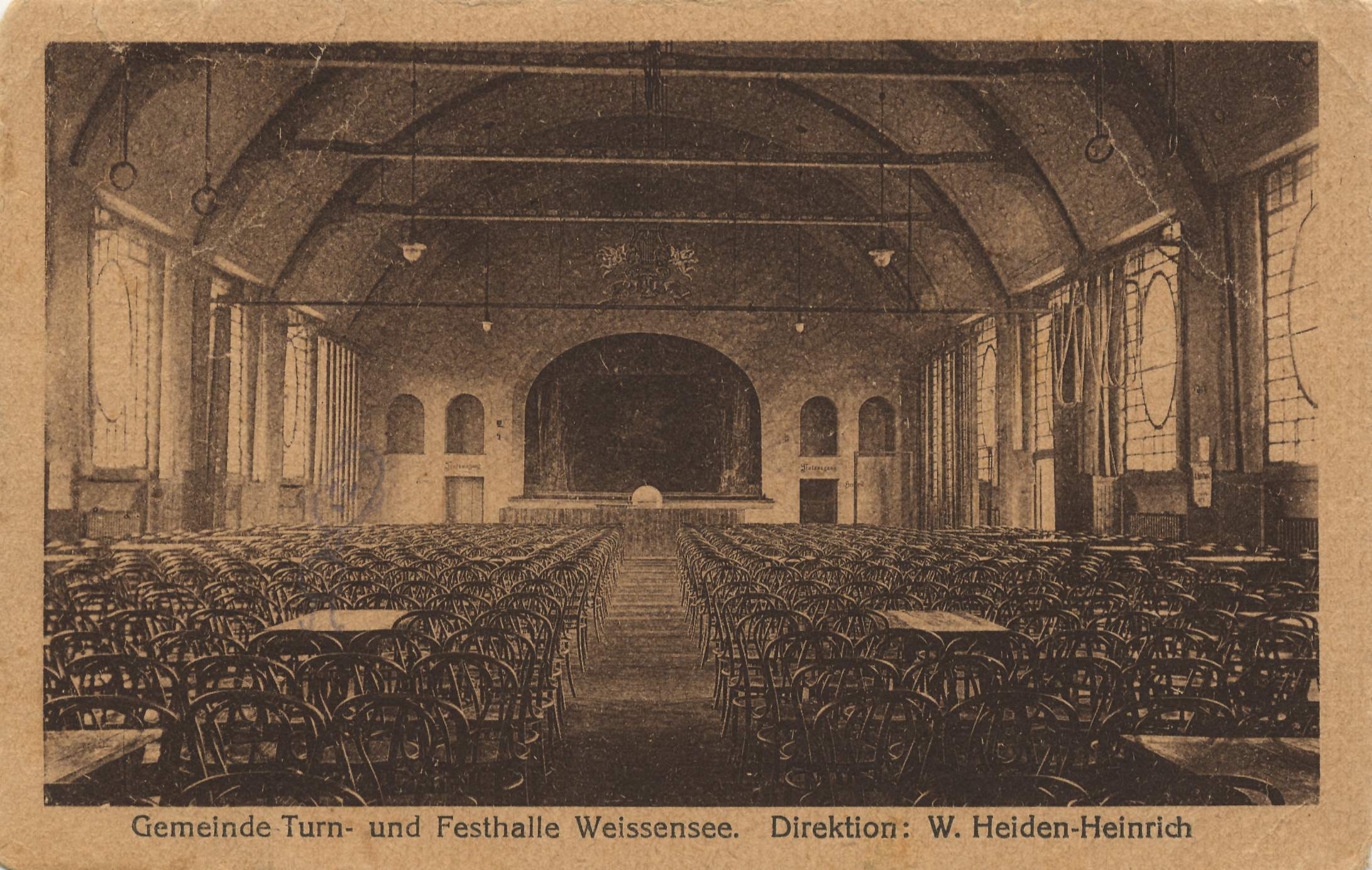
Adlershof | Altglienicke | Alt-Hohenschönhausen | Alt-Treptow | Baumschulenweg | Biesdorf | Blankenburg | Blankenfelde | Bohnsdorf | Borsigwalde | Britz | Book | Buckow | Charlottenburg | Charlottenburg-North | Dahlem | Falkenberg | Falkenhagener Feld | Fennpfuhl | French Buchholz | Friedenau | Friedrichsfelde | Friedrichshagen | Friedrichshain | Frohnau | Gatow | Gesundbrunnen | Gropiusstadt | Grünau | Grunewald | Hook field | Halensee | Hansaviertel | Haselhorst | Heiligensee | Heinersdorf | Hellersdorf | Hermsdorf | Johannisthal | Karlshorst | Karow | Kaulsdorf | Kladow | Konradshöhe | Köpenick | Kreuzberg | Lankwitz | Lichtenberg | Lichtenrade | Lichterfelde | Lübars | Mahlsdorf | Malchow | Mariendorf | Marienfelde | Märkisches Viertel | Marzahn | Middle | Moabit | Müggelheim | Neu-Hohenschönhausen | Neukölln | Niederschöneweide | Niederschönhausen | Nikolassee | Oberschöneweide | Pankow | Plänterwald | Prenzlauer Berg | Rahnsdorf | Reinickendorf | Rosenthal | Rudow | Rummelsburg | Schmargendorf | Schmöckwitz | Schöneberg | Siemensstadt | Spandau | Staaken | Malchow suburban settlement | Steglitz | Tegel | Tempelhof | Zoo | Adventure | Wannsee | Wartenberg | Wedding | Weissensee | Westend | Wilhelmsruh | Wilhelmstadt | Wilmersdorf | Wittenau | Zehlendorf