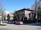
List of streets and squares in Berlin-Friedenau
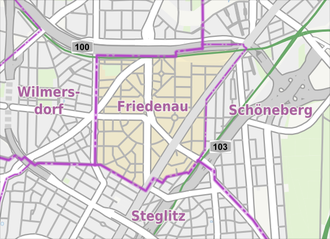
The list of streets and squares in Berlin-Friedenau describes the street system in the Berlin district of Friedenau with the corresponding historical references. At the same time, this compilation is part of the lists of all Berlin streets and places .
overview
Friedenau has 28,263 inhabitants (as of December 30, 2019) and includes the postcode areas 10827, 12159, 12161, 12163, and 14197.
The urban development feature of the Friedenau district is the " Carstenn figure " named after the planner Johann Anton Wilhelm von Carstenn , a regular urban layout of streets and squares. The original settlement structure can still be clearly seen: From the central Friedrich-Wilhelm-Platz , which was designed as an anger , streets radiate apart in all directions, a horseshoe-shaped ring ( Stubenrauchstrasse and Handjerystrasse ) with four other squares ( Perelsplatz , formerly Berliner Square and later Maybachplatz, the Renée-Sintenis Square , formerly Wilmersdorfer place the Schillerplatz until 1905 Schmargendorfer place and the former Hamburg place , now part of the cemetery at the Stubenrauchstraße sets) around the central square and the north by the in West-east axis of Mainauer , Senta and Evastraße closed. The central north-south axis forms the federal avenue and the Rhine and the main road run diagonally in the south-east and the south-west Corso to the north- west .
Some Friedenau streets were renamed after rivers in Alsace-Lorraine , which should give expression to the basic idea behind the naming of Friedenau in memory of the " Peace of Frankfurt " concluded in the year it was founded (1871) .
Most of the buildings in Friedenau date from the beginning of the 20th century. As a result, the district has an almost uniform building stock. 185 objects are under monument protection .
Access to the Friedenau properties is possible via 64 streets and twelve squares, whereby the list includes an unassigned private street . The list thus reflects the official register of these locations, even if other areas - mostly east of Friedenau - are incorrectly included in this. These include the Friedenau S-Bahn station , the Ceciliengärten and the area around Rubensstrasse up to Grazer Damm (the so-called “Malerviertel”) and the Auguste Viktoria Hospital . The residential complexes built there in the first third of the 20th century were called "Neu-Friedenau", although they are located in the Schöneberg district.
Overview of streets and squares
The following table gives an overview of the streets and squares in the district as well as some related information.
- Name / location : current name of the street or square. Via the link Location , the street or the square can be displayed on various map services. The geoposition indicates the approximate center of the street length.
- Traffic routes not listed in the official street directory are marked with * .
- Former or no longer valid street names are in italics . A separate list may be available for important former streets or historical street names.
-
Length / dimensions in meters:
The length information contained in the overview are rounded overview values that were determined in Google Earth using the local scale. They are used for comparison purposes and, if official values are known, are exchanged and marked separately.
For squares, the dimensions are given in the form a × b for rectangular systems and for (approximately) triangular systems as a × b × c with a as the longest side.
If the street continues into neighboring districts, the addition ' in the district ' indicates how long the street section within the district of this article is. - Name origin : origin or reference of the name.
- Notes : further information on adjacent monuments or institutions, the history of the street and historical names.
- Image : Photo of the street or an adjacent object.
| Name / location | Length / dimensions (in meters) |
Origin of name | Date of designation | Remarks | image |
|---|---|---|---|---|---|
|
Adam-Kuckhoff-Platz
( Location ) |
70 × 50 (triangular shape) |
Adam Kuckhoff (1887–1943), resistance fighter |
Aug 30, 1990 | The square was created by calming traffic at the intersection of Wilhelmshöher Strasse with the Südwestkorso and Laubacher Strasse . The central point of the square is the Erikabrunnen by Heinz Spilker from 1982, which was recreated based on the children's fountain that was built in 1911 and partially damaged in the Second World War . |

|
| Albestrasse
( Location ) |
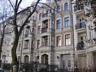
410 | Albe , tributary of the Saar | Oct. 22, 1875 | The previous name was Querstraße II between 1872 and 1875 . In 1875 the 1st community school in Friedenau was founded here, which in 1970 - now the Fläming elementary school - moved to Illstrasse on the Kaisereiche .
The composer and conductor Max Bruch lived at Albestraße 3 . The actor Max Schreck (including Nosferatu - A Symphony of Horror ) moved with his family to Albestrasse at the age of six in 1885 and spent his school days there. |
|
|
Bachestrasse
( Location ) |
200 |
Friedrich Bache (1841–1917), local politician |
1910 | The street forms the connection between Mainauer Straße and Bundesallee . Her previous name was 12 Street . |

|
| Bennigsenstrasse
( Location ) |
380 | Rudolf von Bennigsen (1824–1902), politician and President of the Prussian House of Representatives | Jan. 3, 1903 | Bennigsenstraße leads from the former Friedenauer Straße (today: Hauptstraße ) in a westerly direction to Lauterstraße and at the time it was founded, it mostly belonged to the city of Schöneberg . Her previous name was 43b Street . |

|
| Blankenbergstrasse
( Location ) |
225 | Louis Ludwig Karl Ernst Blankenberg (1821–1889), entrepreneur and local politician | around 1895 | Around 1900 part of the street was renamed Hertelstraße . Today the Blankenberg road provides the connection between the Hertel- and Goßlerstraße in the north and the southern hacking and Fröaufstraße ago. Between 1873 and 1895 it was called Bischofstrasse . |

|
| Bornstrasse
( Location ) |
525 |
David Born (actually: David Buttermilch , 1817–1879), entrepreneur |
5th Sep 1889 | Bornstrasse forms the southwestern border to the Steglitz district . It runs from Kreuznacher Straße to Walther-Schreiber-Platz , into which it flows between the Schloss-Straße-Center and the Forum Steglitz . The first name between 1874 and 1889 was Steglitzer Straße . |

|
|
Breslauer Platz
( Location ) |
70 × 50 (triangular shape) |
Wroclaw , the former capital of Silesia | Oct. 1, 1964 | The square was called Lauterplatz from 1875 to 1964 , before that it was also known as the school square or market square . One of Berlin's oldest weekly markets has been held here three times a week since 1881 . The late historic Friedenau town hall designed by Hans Altmann is located on the square . Directly on the square is the kiosk, which was built in 1929 according to a design by the architect Heinrich Lassen as a public lavatory with an attached bus shelter and is a listed building. |

|
| Brünnhildestrasse
( Location ) |
125 | Brünnhilde , a character from Richard Wagner's opera Die Walküre | 1906 | The previous name was Street D . The street was created in 1906 through the construction of the Wagner quarter on the site of the former Sportpark Friedenau and establishes the north-south connection between Varziner Strasse and Cosimaplatz . |

|
|
Bundesallee
( Location ) |
1480 (in the district) |
after the Federal house , which in Wilmersdorferstrasse part between Schaper and Spichernstraße is | July 18, 1950 | The avenue was laid out between 1872 and 1874 under the name Kaiserstraße and was called Kaiserallee from March 16, 1888 to July 18, 1950 . It is the central north-south axis of the Carstenn figure . The northern part of the street is in Wilmersdorf .
The writer Georg Hermann lived at Bundesallee 68 and 108. The well-known Berlin theater critic Friedrich Luft lived at Bundesallee 74 and the satirist and writer Kurt Tucholsky lived at Bundesallee 79. |

|
| Büsingstrasse
( Location ) |
380 | Friedrich Wilhelm Büsing (1834–1904), architect, university professor and local politician | around 1905 | The road runs in a north-south direction between Odenwaldstrasse and Bornstrasse .
The artist Hannah Höch lived at Büsingstrasse 16 ( Berlin memorial plaque on the house). |

|
|
Cosimaplatz
( Location ) |
50 × 50 |
Cosima Wagner (1837–1930), wife of Richard Wagner |
Feb 12, 1935 | The previous name was Wagnerplatz between 1905 and 1935 .
Up until 1904 there was a 500-meter-long, oval cement racing track on the surrounding grounds of the Wagner quarter , which was located in what was then the Friedenau sports park. The sports park was demolished and rental houses were built on the site from 1906. |

|
|
Deidesheimer Strasse
( Location ) |
175 (in the district) |
Deidesheim , town in the Rhineland-Palatinate district of Bad Dürkheim | Aug 19, 1909 | The western part of the street is in the Rheingauviertel in Wilmersdorf . The Friedenau part runs in an east-west direction between Südwestkorso and Laubacher Straße . The first name was Street 14 . |

|
| Dickhardtstrasse
( Location ) |
350 |
Konrad Dickhardt (1899–1961), local politician |
Nov 1, 1962 | The previous name between 1872 and 1962 was Ringstrasse . This is where the first buildings of what was then the Friedenau country house colony were built after 1871. The street runs in a semicircle as an extension of Roennebergstraße to Breslauer Platz . It begins and ends on Rheinstrasse . |

|
|
Elsastrasse
( Location ) |
110 | Elsa von Brabant , a female character from Richard Wagner's opera Lohengrin | 1906 | The first name was street D until 1906 . The road between the Cosimaplatz the north and the southern Sarrazin Street was created by the investment of the Wagner district on the site of the former sports parks Friedenau.
The draftsman and illustrator Walter Trier lived at Elsastraße 2 from 1912 to 1916. |

|
| Eschenstrasse
( Location ) |
150 | after the first planting with ash trees | May 15, 1905 | Eschenstrasse runs between Stubenrauchstrasse and Görresstrasse . The previous name was 11 Street . After the Second World War , plans were made in 1945 to rename Eschenstrasse to Fritz-Haber-Strasse , which, however , was not confirmed by the then municipal authorities . |

|
| Evastrasse
( Location ) |
100 | Eva, a female figure from Richard Wagner's opera Die Meistersinger von Nürnberg . | 1906 | Between the Cosimaplatz and Handjerystraße running road originated in 1906 by the abutment of Wagner area on the grounds of the former sports parks Friedenau. Today it is a dead end from Cosimaplatz . |

|
|
Fault road
( Location ) |
425 |
Adolf Fehler (1828–1903), Berlin local politician |
around 1900 | The section of Fehlerstrasse north of today's Schöneberg III cemetery was previously called Am Friedhof and was renamed Fehlerstrasse around 1900 . The street connects the Laubacher Straße with the Südwestkorso .
The Hermann Noack foundry had its traditional headquarters in Fehlerstraße 8 until 2009. |

|
| Fregestrasse
( Location ) |
835 (in the district) |
Ferdinand Ludwig Frege (1804–1883), theologian and historian, pastor in Schöneberg between 1846 and 1883.
The great-great-grandson Freges is Campino , the singer and front man of the music group Die Toten Hosen . |
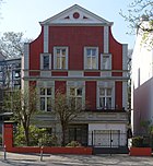
Apr 29, 1884 | Fregestraße is the southern extension of Stierstraße and runs between Hauptstraße and Feuerbachstraße . The previous name was Street 27 . The southern part of the street is in Steglitz . The houses on the eastern side of the street between Hauptstrasse and Holsteinischer Strasse belong to the Schöneberg district .
The poet and writer Hans Magnus Enzensberger lived at Fregestraße 19. The former city councilor and later Federal President Theodor Heuss lived in house number 80 . |
|
|
Friedrich-Wilhelm-Platz
( Location ) |
275 × 85 (oval shape) |
Friedrich Wilhelm III. (1770–1840), Prussian king |
around 1870 | The square with the neo-Gothic church of the Good Shepherd was built according to plans by Johann Anton Wilhelm von Carstenn and Johannes Otzen as a square extension on what was then Kaiserstraße (today: Bundesallee ). It forms the central square of the Carstenn figure - who characterizes the district . In 1945 efforts were made to rename Friedrich-Wilhelm-Platz into Engelsplatz , which, however , was not confirmed by the then municipal authorities .
The underground station of the same name on the U9 line is located under the square . |

|
| Fröaufstrasse
( Location ) |
165 |
Wilhelm Fröauf (1814–1899), local politician and secret accountant at the trade academy |
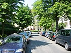
around 1890 | The first name between 1873 and 1890 was Schillingstrasse . By dividing Schillingstraße into Fröaufstraße and Hackerstraße , today's street was created, which flows into Bundesallee on the eastern side . |
|
|
Gorresstrasse
( Location ) |
315 |
Josef Görres (1776–1848), writer and historian |
July 31, 1947 | The previous names were Wilhelmstraße until 1937 , Golzheimer Straße from 1937 to 1945 and Aufbaustraße between 1945 and 1947 . Between 1967 and 1976 the “ Buchhändlerkeller ” was located in Görresstraße 8 as a literary cultural institution and event location in the Friedenau district. |

|
| Goßlerstrasse
( Location ) |
390 |
Gustav von Goßler (1838–1902), politician |
1883 | The street runs from Hertel- and Blankenbergstraße to Friedrich-Wilhelm-Platz . From the Stubenrauchstrasse it is a dead end . The previous name from 1876 to 1883 was Centralstrasse .
The Paul-Natorp-Gymnasium (formerly: Königin-Luise-Mädchenlyzeum ) is located at Goßlerstraße 13–15 . |

|
|
Hackerstrasse
( Location ) |
170 (in the district) |
Johann Carl Hacker (1811–1892), local politician and secret accountant in the Imperial War Ministry |
around 1890 | By dividing Schillingstraße (1873–1890) into Fröaufstraße and Hackerstraße , today's street was created, some of the streets of which are located in Steglitz . |

|
| Hahnelstrasse
( Location ) |
315 | Hermann Hähnel (also: Hänel , 1830–1894), entrepreneur and master builder | Nov 2, 1892 | The street runs from Lauterstraße at Perelsplatz to Hauptstraße . The first name was 43a Street . | |
| Handjerystrasse
( Location ) |
1120 | Nicolaus Prinz Handjery (1836–1900), politician | 1883 | The street was created by merging the former Promenade II with Promenade I and Promenade III . Handjerystraße, together with Stubenrauchstraße, forms the U-shape of the Carstenn figure, which is characteristic of Friedenau's street structure .
In Handjerystraße 2, during the Berlin Airlift , which was set up on the occasion of the Berlin blockade in 1948/1949, a “ cherry bomber ” crashed on July 25, 1948 and severely damaged the building. The roof of the Friedenau high school opposite was also affected. A plaque on the house at Handjerystraße 2 commemorates the two US pilots who were killed at the time. |

|
|
Main road
( Location ) |
825 (in the district) |
the main thoroughfare of Friedenau and part of the former Berlin-Potsdamer Chaussee |
27 Aug 1881 and 1908 (in two sections) |
On June 13, 1893, Friedenauer Strasse was included in Hauptstrasse from Mühlenstrasse to Ringstrasse (today: Dominicusstrasse to Innsbrucker Platz ). The remaining part of Friedenauer Strasse (between Innsbrucker Platz and Rheinstrasse ) was renamed Hauptstrasse on December 12, 1907 and February 13, 1908, respectively. The Friedenau town hall is located on Breslauer Platz . The street was part of Reichsstraße 1 and then Bundesstraße 1 until the 1970s .
The building of the Roxy Palace, designed in 1929 as a steel frame construction , is located in Hauptstrasse 78/79 . Here, on the night of April 4th to 5th, 1986, there was an attack on the discotheque " La Belle ", which was located there at the time , which caused a worldwide sensation. - Part of the street runs in Schöneberg . |

|
| Hedwigstrasse
( Location ) |
130 (in the district) |
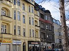
Hedwig Neumann, only daughter of the Schöneberg pastor Ferdinand Ludwig Frege , after whom a street in Friedenau is also named ( → Fregestraße ) | Apr 29, 1884 | The street was built on in the mid-1880s. It runs as an extension of Schmargendorfer Strasse from Rheinstrasse to Sponholzstrasse . The eastern part of the street is in Schöneberg .
The Islamic religious community owns a relatively inconspicuous mosque at Hedwigstrasse 15. |
|
| Hertelstrasse
( Location ) |
250 | Albert August Robert Hertel (1824–1886), secret accountant and Berlin local politician | around 1900 | The street runs from Goßlerstraße to Laubacher Straße . Hertelstraße was built around 1900 as a former part of Blankenbergstraße . The previous name was Bischofstrasse around 1873 to 1895 . |

|
| Holstein Street
( Location ) |
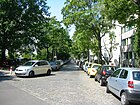
270 | Holstein , southern part of Schleswig-Holstein , formerly a Prussian province | around 1896 | The street runs from Flora to Fregestraße . The previous names were Street 22 and Street 26 . The road area is partly in Steglitz . |
|
| Homuthstrasse
( Location ) |
145 |
Johannes Homuth (1839–1922), local politician |
1906 | The street runs from Wiesbadener Straße to Schwalbacher Straße . Here is an entrance to the Rheingau-Gymnasium (formerly: Reform-Realgymnasium and Oberrealschule ). The street was named after a community elder and honorary citizen of Friedenau. He has a grave of honor in the cemetery on Stubenrauchstrasse . |

|
|
Illstrasse
( Location ) |
85 | Ill , left tributary of the Rhine | Oct. 22, 1875 | The Illstrasse used to connect the Holsteinische Strasse with the Imperial Oak ; today it is a dead end from Saarstrasse . The previous name from 1872 to 1875 was Kastanienstraße .
The Fläming Primary School is located at Illstrasse 4–6 (originally: I. Friedenauer Community School ). |

|
|
Innsbrucker Platz
( Location ) |
90 (diameter) |
Innsbruck , city in Austria | Sep 14 1927 | The square was created in 1910 and has been redesigned several times since then. It is a central traffic junction : The ring line of the S-Bahn and the U4 line of the U-Bahn run here, each of which has a train station here. The square has been crossed by the city motorway since 1979 and has received a motorway junction that dominates the square with its heavy traffic. Part of the square belongs to Schöneberg . |

|
| Isoldestrasse
( Location ) |
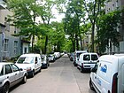
150 | Isolde, Queen of Cornwallis , character from Richard Wagner's opera Tristan und Isolde | 1906 | The street in today's Wagner district runs from Handjerystraße to Varziner Straße . The previous name from 1876 to 1906 was Moltkestrasse . Originally the road was temporarily nameless or was road C called. |
|
|
Imperial oak
( Location ) |
70 (diameter) |
after Emperor I. Wilhelm named | March 22, 1879 | On the occasion of the golden wedding anniversary of Kaiser Wilhelm I and his wife Augusta , the oak tree, which stands on what is now the median of Saarstrasse , was planted to commemorate the emperor's 82nd birthday. The square was previously called the Rondell . |

|
| Kreisauer Strasse
( Location ) |
75 | Kreisau (today: Krzyżowa), city in the former Lower Silesia , (today: Lower Silesian Voivodeship ) | 1910 | Kreisauer Strasse is the shortest street in Friedenau. It runs from Fehlerstraße to Varziner Straße . |

|
| Kreuznacher Strasse
( Location ) |
95 | Bad Kreuznach , city on the Nahe | 1903 | The street runs from Bornstrasse and Odenwaldstrasse to Breitenbachplatz , with parts of the street in Steglitz and Wilmersdorf . The first name was Street 12 . |

|
| Kundrystrasse
( Location ) |
100 | Kundry , a character from Richard Wagner's opera Parsifal | 1906 | The street was created in 1906 when the Wagner district was built on the site of the former Friedenau sports park. It runs from Bundesallee to Sarrazinstraße . |

|
|
Laubacher Strasse
( Location ) |
1120 | Laubach , city in Hesse | March 16, 1888 | The previous names were between 1856 and 1880 Steglitzer Weg , from 1880 Grüner Weg , sometimes also Grenzstraße . The street runs between Maßmannstrasse and Kreuznacher Strasse to Blissestrasse and Varziner Strasse . It forms the border between the districts of Wilmersdorf and Friedenau, whereby the road area belongs to Wilmersdorf. |

|
| Lauterstrasse
( Location ) |
570 | Loud , left tributary of the Rhine | Oct. 22, 1875 | As one of the first streets in Friedenau, Lauterstraße was laid out in 1872 and initially named Grenzstraße . It runs from Bennigsenstrasse to Breslauer Platz , where it borders the Friedenau town hall . |

|
| Lefèvrestrasse
( Location ) |
545 |
Robert Lefèvre (1843–1905), secret chancellery and local politician |
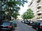
May 25, 1905 | The street runs from Bundesallee to Hertelstraße .
The grave of the namesake is in the cemetery on Stubenrauchstrasse . |
|
| Liane-Berkowitz-Platz
( Location ) |
70 × 50 (triangular shape) |
Liane Berkowitz (1923–1943), resistance fighter |
Jan. 18, 2000 | The characteristic kiosk by the architect Hans Altmann is located on the square on the Südwestkorso , Wilhelmshöher Straße and Rheingaustraße .
The place was nameless until 2000. |

|
|
Mainauer Strasse
( Location ) |
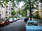
200 | Mainau island in Lake Constance | around 1895 | The spelling at the turn of the 20th century was Meinauer Straße . It runs as an extension of Sentastraße from Bundesallee to Südwestkorso . |
|
| Moselstrasse
( Location ) |
145 | Moselle , left tributary of the Rhine | Oct. 22, 1875 | The street runs from Dickhardt- and Wilhelm-Hauff-Straße to Kaisereiche , where it ends as a dead end. The previous name from 1872 to 1875 was Ahornstrasse . In 1926, the Moselstraße between the then Ringstraße (today: Dickhardtstraße) and the former border with Schöneberg was renamed Wilhelm-Hauff-Straße. |

|
|
Niedstrasse
( Location ) |
415 | Nied , tributary of the Saar | Oct. 22, 1875 | The first name from 1872 to 1875 was Querstraße III . Because in this street u. a. many writers had settled down, the street is also known as the “literary mile”. For example, Nobel Prize winner Günter Grass lived between 1963 and 1996 at Niedstrasse 13, the writer Uwe Johnson and the painter Karl Schmidt-Rottluff lived and worked in house no.14. In house no.5, the brothers Siegmund and David Loewe founded Radiofrequenz GmbH in 1923 , from which Loewe-Opta AG emerged . Erich Kästner later lived with his secretary Elfriede Mechnig, also at 5 Niedstrasse . The writer Max Halbe lived in No. 10 and the writer and dramaturge Günther Weisenborn in No. 25.
→ See also: “Literary” in the Friedenau article . |

|
|
Odenwaldstrasse
( Location ) |
440 | Odenwald , low mountain range in Hesse | around 1890 | The street, newly laid out at the end of the 19th century, runs from Stubenrauchstrasse to Kreuznacher and Rheingaustrasse . |

|
| Offenbacher Strasse
( Location ) |
240 (in the district) |
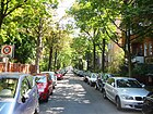
Offenbach am Main , city in Hesse | Aug 19, 1909 | The street connects the Südwestkorso at the level of Stubenrauchstrasse with Hohensteiner Strasse . The first name was Street 13 . The western part of the street is in the Rheingauviertel in Wilmersdorf .
The Ruppin Primary School and the Bobertal Secondary School (formerly: III. Friedenauer Community School ) are located in Offenbacher Strasse . |
|
| Ortrudstrasse
( Location ) |
125 | Ortrud, character from Richard Wagner's romantic opera Lohengrin | 1906 | The street runs from Bundesallee to Elsastraße . It was created in 1906 when the Wagner quarter was laid out on the site of the former Friedenau sports park. |

|
|
Perelsplatz
( Location ) |
170 × 70 | Friedrich Justus Perels (1910–1945), legal advisor of the Confessing Church | Oct. 1, 1961 | The previous name of the square was Berliner Platz from 1873 to 1884 , Maybachplatz between 1884 and 1961 , named after the Prussian Minister of Commerce and Minister for Public Works Albert von Maybach . The park was popularly known as the birch grove for a long time because of its trees . The Friedrich-Bergius-Oberschule (the former Friedenauer Gymnasium ) is located on the square .
Perelsplatz is the northeast of four squares that form the corner points of the Carstenn figure . |

|
| Peschkestrasse
( Location ) |
100 (in the district) |
Karl Hermann Peschke (1838–1912), local politician and from 1892 to 1901 community representative in Steglitz |
around 1902 | The street runs from Rheinstraße to Fregestraße . The previous name was 25 Street . Part of the street is in Steglitz . |

|
|
Renée-Sintenis-Platz
( Location ) |
70 (diameter) |
Renée Sintenis (1888–1965), sculptor |
Apr 1, 1967 | The first name from 1872 to 1967 was Wilmersdorfer Platz . Today's square was designed in 1955 by Karl Tümler. On the square is the imposing building of the former Imperial Post Office I. Class (today: Post Office 410) by Ludwig Meyer, which was opened on October 1, 1918 on the site of the Friedenau town hall originally planned here . The area around the square represents the oldest building area in Friedenau. Renée-Sintenis-Platz is the southeast of four squares that form the corner points of the Carstenn figure .
The square, which was redesigned by Karl Tümler in 1955, is a garden monument ; Renée Sintenis placed the sculpture Grazing Foal on it . |
|
| Retzdorffpromenade
( Location ) |
90 | Willy Retzdorff (1856–1910), local politician |
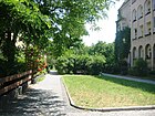
1910 | The Retzdorffpromenade is exclusively dedicated to pedestrians and forms a small park-like connection between Rheingaustraße and Lefèvrestraße . |
|
| Rheingaustrasse
( Location ) |
680 | Rheingau , a region in Hesse | around 1895 | The first name from 1873 to 1895 was Parallelstrasse . The street runs from the Südwestkorso at the level of Liane-Berkowitz-Platz to Bornstrasse .
At the beginning of the 20th century, Rheingaustraße 30 housed the power station of the country house colony at that time, and number 8 was where the poet Rainer Maria Rilke lived . The Stechlinsee primary school is located at Rheingaustraße 7. |

|
|
Rheinstrasse
( Location ) |
985 | after the connection between Berlin and the Rhine | Oct. 22, 1875 | The part of the former Provinzialchaussee Berlin – Potsdam was renamed in 1875 because of the connection between Berlin and the Rhineland . The street was later part of Reichsstraße 1 and then federal highway 1 until the 1970s . As an entry and exit road, it creates the connection between the city center and the southwestern districts of Berlin and is one of the most important shopping streets in Friedenau. |

|
| Roennebergstrasse
( Location ) |
200 | Georg Roenneberg (1834–1895), Friedenau mayor | 21 Sep 1892 | The street runs from Rheinstraße to Handjerystraße . The previous name between 1885 and 1890 was Neue Straße , then Ringstraße until 1892 .
In 2006 (135 years after the original establishment of the former Askania-Werke ), Askania AG was re-established in Roennebergstrasse 3a . |

|
| Rotdornstrasse
( Location ) |
125 | after the first planting of the street with hawthorn trees | 1906 | The street runs with a 90-degree curve between Wiesbadener and Stubenrauchstrasse . |

|
|
Saarstrasse
( Location ) |
290 | Saar , tributary of the Moselle | Oct. 22, 1875 | The street connects Rheinstraße , Schmiljanstraße and Kaisereiche with Knausstraße behind the Friedenauer Bridge . A short part of the street (house no. 11a) belongs to Steglitz . The first name between 1872 and 1875 was Bahnstrasse .
The politician Karl Kautsky lived at Saarstrasse 14. |

|
| Sarrazinstrasse
( Location ) |
340 |
Otto Sarrazin (1842–1921), secret senior building officer and local politician |
July 31, 1947 | The previous names were Carlsruher Strasse between 1872 and 1876 , Bismarckstrasse between 1876 and 1937, and Jänischallee between 1937 and 1947 . The planned change of name to Maybachstrasse after 1945 was not approved by the magistrate .
The architect and writer Max Frisch lived at Sarrazinstrasse 8. |

|
| Schillerplatz ( location ) |
70 (diameter) |
Friedrich Schiller (1759–1805), poet |
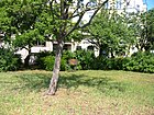
May 8, 1905 | The first name was Schmargendorfer Platz . In order to ensure a better flow of traffic (especially that of the BVG bus line A 17 at the time), Wiesbadener Strasse , which at that time ran around the square, was widened in 1957 and led at right angles over Stubenrauchstrasse . Schillerplatz is the southwest of four squares that form the corner points of the Carstenn figure . |
|
| Schmargendorfer Strasse
( Location ) |
390 | Schmargendorf , district to which the road leads | Oct. 26, 1875 | The street runs from Rheinstraße on Breslauer Platz to Bundesallee on Friedrich-Wilhelm-Platz , where it ends as a dead end.
The Caribbean island state of Jamaica has its embassy at 32 Schmargendorfer Straße . |

|
| Schmiljanstrasse
( Location ) |
345 |
Hans Kurt Willi Schmiljan (1901–1961), economist and politician |
Feb. 1, 1962 | The street runs from Bundesallee on Friedrich-Wilhelm-Platz to Rheinstraße to Saarstraße on the Kaisereiche . The previous names were Chausseestrasse between 1876 and 1883 , Saarstrasse between 1883 and 1890, and Kirchstrasse from 1890 to 1962 . |

|
| Schnackenburgstrasse
( Location ) |
170 |
Bernhard Schnackenburg (1867–1924), local politician |
Sep 9 1931 | The street connects Lauterstraße with Handjerystraße . The previous names were Querstraße I between 1872 and 1885 and Feurigstraße from 1885 to 1931 . |

|
| Schwalbacher Strasse
( Location ) |
300 | probably to Bad Schwalbach , town in the Rheingau-Taunus district | around 1895 | The street runs from Stubenrauchstrasse to Laubacher Strasse . The Rheingau-Gymnasium (formerly: Reform-Realgymnasium and Oberrealschule ) is located in Schwalbacher Straße 3/4 . |

|
| Sentastrasse
( Location ) |
95 | Senta, character from Richard Wagner's opera Der Fliegende Holländer | 1906 | The street was created in 1906 when the Wagner district was built on the site of the former Friedenau sports park. It runs as an extension of Mainauer Straße from Bundesallee to Cosimaplatz . |

|
| Sieglindestrasse
( Location ) |
150 | Sieglinde is Siegfried's mother in Richard Wagner's Der Ring des Nibelungen | 1906 | The street was created in 1906 when the Wagner district was built on the site of the former Friedenau sports park. It connects the Bundesallee with the Varziner Platz . |

|
| Bull street
( Location ) |
315 |
Wilhelm Stier (1799–1856), civil engineer and architect |
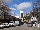
Dec. 30, 1901 | The street runs as an extension of Fregestraße from Hauptstraße to Bennigsenstraße .
The painter Karl Schmidt-Rottluff and the writer Uwe Johnson lived and worked at Stierstrasse 3. |
|
| Street at the freight yard Wilmersdorf (unofficial name)
( Location ) |
90 + 120 | to the Wilmersdorf freight station, which was formerly located here | undedicated | The formerly 600 meter long private road , which ran parallel to Bennigsenstrasse to the north between Handjerystrasse and Hauptstrasse , is unofficially referred to as "Strasse am Güterbahnhof Wilmersdorf". It is not a public road and was closed to through traffic in 2010 (gates prevent access). There are only short sections left from Hauptstraße or Handjerystraße (part of the Edeka car park north of the Friedrich-Bergius-Oberschule ).
Currently (as of May 2020) construction work is in progress to build around 1500 apartments by 2023 on the approximately 6000 m² site of the former freight yard under the name "Friedenauer Höhe". |

|
| Stubenrauchstrasse
( Location ) |
1120 |
Ernst von Stubenrauch (1853–1909), lawyer and local politician |
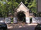
5th Sep 1889 | The previous names were between 1874 and 1876 Nassauer Strasse , in the years 1876-1883 Promenade IV , Promenade V and Promenade VI and between 1883 and 1889 Ringstrasse . Stubenrauchstrasse, together with Handjerystrasse, forms the U-shape of the Carstenn figure that is characteristic of Friedenau's street structure .
The writer Georg Hermann lived at Stubenrauchstrasse 5. At the turn of the year 1927/1928 the vocal ensemble Comedian Harmonists was founded at Stubenrauchstrasse 47. |
|
|
Southwest Corso
( Location ) |
800 (in the district) |
in the direction of the street in which it runs from Berlin | March 27, 1909 | The previous name was Schwarzwaldstraße . The street was laid out as a connection from the then Kaiserallee (today: Bundesallee ) to the then newly built Domain Dahlem . It runs from Bundesallee at the corner of Varziner Strasse to Breitenbachplatz , with the southwestern part starting from Laubacher Strasse in Wilmersdorf . |

|
|
Taunusstrasse
( Location ) |
495 | Taunus , Hessian low mountain range | 1898 | The street runs as an extension of Homburger Strasse from Laubacher Strasse to Görresstrasse . At the corner of the southwest parade is the only theater in Friedenau with the small theater . |

|
|
Varziner Platz
( Location ) |
60 × 40 | Varzin ( East Pomerania ), a place where Chancellor Otto von Bismarck owned a manor | May 11, 1983 | The square was created through traffic calming , in which the streets running here became partially dead ends . Brünnhilde- , Isolde- and Sieglindestraße flow into the square . The Varziner road touches the square. |

|
| Varziner Strasse
( Location ) |
810 | Varzin ( East Pomerania ), a place where Chancellor Otto von Bismarck owned a manor | around 1900 | The street forms the district boundary to Wilmersdorf along the route of the ring railway . It runs from the Südwestkorso to Laubacher Straße .
Until 2009 , the Hermann Noack art foundry had its traditional headquarters in Varziner Straße 18 . |

|
|
Walther-Schreiber-Platz
( Location ) |
100 × 50 | Walther Schreiber (1884–1958), politician | 5th July 1958 | The square forms the district boundary to Steglitz . Before its current name, it was unofficially referred to as Rheineck . The Bundesallee , Rheinstrasse , Schloßstrasse , Schöneberger Strasse and Bornstrasse all flow here . The underground station of the same name on the U9 line is located under the square .
The Forum Steglitz , the Schloss-Straßen-Center and the Titania-Palast are located on the square . |

|
| Wexstrasse
( Location ) |
400 (in the district) |
Eduard Wex (1827–1902), civil engineer, President of the Berlin Railway Directorate |
Dec 22, 1911 | The part of Wexstraße in Friedenau is a motor road - not accessible to pedestrians and cyclists - that merges as a 400-meter-long motorway-like section into junction 17 - Innsbrucker Platz (western section) of the city motorway. The northern part of the street is in Wilmersdorf . |

|
|
Wiesbadener Strasse
( Location ) |
515 (in the district) |
Wiesbaden , Hessian state capital | around 1902 | The original route of this road was the Alte Landweg to Schmargendorf , therefore between 1873 and 1890 it was called Schmargendorfer Straße , later Kasseler Straße . The western part of the street is in Wilmersdorf . |

|
| Wilhelm-Hauff-Strasse
( Location ) |
125 (in the district) |
Wilhelm Hauff (1802–1827), writer |
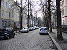
Sep 1 1926 | The street runs in the extension of Moselstraße from Dickhardtstraße to Wielandstraße . The previous names were Haufstrasse (with an "f"), and Hauffstrasse (with two "f"). Part of the street is in Schöneberg . |
|
| Wilhelmshöher Strasse
( Location ) |
460 | Wilhelmshöhe Castle near Kassel | around 1890 | The street runs from Friedrich-Wilhelm-Platz to Liane-Berkowitz-Platz on the Südwestkorso . The buildings with the house numbers 17-20 were designed as single- kitchen houses and planned by several architects, including Albert Gessner . The term “Einküchehaus” describes the concept of a community facility presented by Social Democrat Lily Braun in the socialist debate on housing reform and women's emancipation in 1900 . With the facility - also known as the “central kitchen house” - she created a fundamental idea for reforming the domestic economy .
The resistance fighter Erika von Brockdorff lived in house number 17 and the writer and resistance fighter Adam Kuckhoff in house number 18/19. |

|
Other locations in Friedenau
Georg Hermann Garden

The Georg Hermann Garden was inaugurated in 1962 on the site of the original “Ulmenhof” (park of the “Villa Sarrazin”) as a memorial for the writer and art critic Georg Hermann , who was murdered in Auschwitz in 1943 . As early as 1914, he was one of the few writers in Germany who did not welcome the outbreak of the First World War . Although the garden is not part of the public roads, it can be viewed on request at the “Pestalozzi-Fröbel-Haus” day-care center at Bundesallee 79-81 (closed on weekends). The former entrances in Stubenrauchstrasse and Goßlerstrasse have now been closed. The memorial stone for Georg Hermann is somewhat hidden on the fenced-in daycare playground. Georg Hermann had a loving and distant relationship with Friedenau. In his novel Der kleine Gast from 1925, he described Friedenau as an “idyllic garden district” and as an “Eldorado of clay dwarfs” ( location ).
Wagner quarter
The Wagner quarter, bounded by the area of Bundesallee , Varziner Straße , Handjerystraße and Sarrazinstraße , was named after works by Richard Wagner . The Sportpark Friedenau with a 500-meter-long oval cycle track was located on part of this terrain until 1904 . The original plan was to build the Schöneberg gasometer in this area, which met with great resistance from the population of the newly established country house colony. The gasometer was then set up on the nearby " Red Island " in Schöneberg . After the sports park was demolished, apartment houses were built on from 1906 ( location ).
Former Hamburger Platz

The former Hamburger Platz was located at the confluence of Stubenrauchstrasse and Görresstrasse (formerly: Wilhelmstrasse ) on the Südwestkorso (formerly: Schwarzwaldstrasse ) at the level of Offenbacher and Mainauer Strasse . It was the northeast of four squares that form the corner points of the Carstenn figure . The name of the square is derived from the Hanseatic city of Hamburg , the birthplace of the planner Johann Anton Wilhelm von Carstenn . At the time, the community council of Friedenau intended to create the Hamburger Platz, which was already planned in Carstenn's plan - a mirror image of today's Perelsplatz - as a community cemetery. The inauguration of the cemetery took place on May 20, 1881. The Hamburger Platz thus only comprised the section at the confluence of the former Black Forest , Mainauer and Wilhelmstraße in the Stubenrauchstraße (today about the intersection of Stubenrauchstraße, Südwestkorso and Görresstraße). The flood fountain designed by Paul Aichele , which later found its current location on Maybachplatz (today: Perelsplatz) , stood on the square, which was bypassed by the tram on both sides . The square had to be given up because of the expansion of the Friedenau cemetery to the south, but can still be recognized as such because of the opening of the streets at this point. It was often listed in address books and plans without a name and was kept in 1933 ( Lage ).
Others
- A small green area in a triangular shape on the border to Steglitz (crossing of Rheingau- , Born- , Odenwald- and Kreuznacher Straße ) is so far unnamed ( location ).
- The access from Wexstraße (southern area) to the city motorway (RBS: 99018) with the Innsbrucker Platz junction (western part) is on the Friedenau area, it is a local road connection (StEP level III), OKSTRA class: A with a Length of 250 meters.
See also
literature
- Gudrun Blankenburg: Friedenau - artist's place and idyllic residential area. The history of a Berlin district . Frieling, Berlin 2006, ISBN 3-8280-2350-9 (with register and enclosed monument map).
- Christel and Heinz Blumensath: The other Friedenau - walks through 125 years of art, literature and building history . District Office Schöneberg, Berlin 1996.
- Alfred Bürkner: Friedenau - streets, houses, people . Stapp, Berlin 1996, ISBN 3-87776-065-1 .
- Hermann Ebling: Friedenau - From the life of a rural community, 1871-1924 . Zinsmeister and Grass, Berlin 1986, ISBN 3-9801309-0-8 .
- Hermann Ebling, Evelyn Weissberg: Friedenau tells: Stories from a Berlin suburb - 1871 to 1914 . edition Friedenauer Brücke, Berlin 2007, ISBN 978-3-9811242-1-7 .
- Hermann Ebling, Evelyn Weissberg: Friedenau tells: Stories from a Berlin suburb - 1914 to 1933 . edition Friedenauer Brücke, Berlin 2008, ISBN 978-3-9811242-2-4 .
- Stefan Eickhoff: Max Schreck: Ghost Theater . 2009, ISBN 978-3-936298-54-3 .
- Stefan Eggert: Walks in Schöneberg. Berlin reminiscences . tape 78 . Haude & Spener, Berlin 1997, ISBN 3-7759-0419-0 .
- Peter Lemburg, Gabriele Schulz, Dietrich Worbs: Monuments in Berlin, Schöneberg district, Friedenau district. Monument topography Federal Republic of Germany . Ed .: Landesdenkmalamt Berlin and District Office Schöneberg. Willmuth Arenhövel, Berlin 2000, ISBN 3-922912-52-4 .
- Helmuth Pohren-Hartmann, Hermann Ebling, Evelyn Weissberg: The artist cemetery in Friedenau . edition Friedenauer Brücke, Berlin 2006, ISBN 3-9811242-0-0 .
- Hans-Jürgen Mende (Ed.): Lexicon 'All Berlin Streets and Squares' - From the foundation to the present . tape 1 : A-Fre ; tape 2 : Fre-Len ; tape 3 : Leo – Schö ; tape 4 : Schö-Z . New Life / Edition Luisenstadt, Berlin 1998, ISBN 3-355-01491-5 .
- Franziska Arndt, Ronald Hoppe, Hannah Otto: Streets in Berlin Friedenau - The small lexicon. Epilog 1.002, Berlin 2010, ISSN 2190-9113 .
Web links
- Everything about Berlin-Friedenau. - Comprehensive information on culture, economy and social issues
- The poet's place in Friedenau. - Literary walk to the houses of Günter Grass , Max Frisch , Uwe Johnson and Erich Kästner
- House number details on all streets in Berlin-Friedenau.
- Office for Statistics Berlin-Brandenburg: List of streets and squares in the Tempelhof-Schöneberg district (PDF, as of February 2015)
Individual evidence
- ^ S. Eggert: Walks in Schöneberg. P. 48.
- ↑ Website of the Auguste Viktoria Hospital supposedly located in Friedenau
- ↑ Herta Müller, winner of the Nobel Prize for Literature. Friends with the neighbors in Friedenau. In: Berliner Morgenpost , October 9, 2009 (article about Herta Müller and Menzelstrasse, which is not officially part of Friedenau).
- ↑ Claudia Fuchs: Most insist on being Friedenauer. In: Berliner Zeitung , April 20, 2012 ( online ), on the 125th anniversary of Frieden from 1996
- ↑ Breslauer Platz, kiosk, bus shelter, public lavatory
- ↑ Renée-Sintenis-Platz, town square, around 1872 with the sculpture Grazing foal
- ↑ Friedenauer Höhe . At: howoge.de , accessed on May 14, 2020


