List of streets and squares in Berlin-Lichtenberg
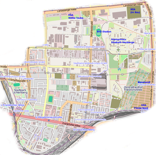
The list of streets and squares in Berlin-Lichtenberg contains all streets and squares as well as some other publicly accessible facilities in the official district of Berlin-Lichtenberg ( Lichtenberg district ). The boundaries were redefined on the occasion of the reorganization of the districts in the district in 2002. At the same time, this compilation is part of the general overview lists of streets and squares in Berlin .
overview
The district and thus its network of paths consist of differently grown areas: the old village center around Loeperplatz , the industrial area around what was then Rittergutstraße (since 1960: Josef-Orlopp-Straße ), which extends between Bornitzstraße and Herzbergstraße . At the same time, around the turn of the 20th century, the areas around the new municipal facilities such as the district court on Roedeliusplatz (popularly referred to as the " Wagner district" after the street names assigned ), the Lichtenberg town hall , the municipal hospital and the Stadtpark Lichtenberg and around the cemeteries such as the central cemetery Friedrichsfelde .
The road network described borders in the northwest on the areas Fennpfuhl and in the north on Alt-Hohenschönhausen , in the east on Marzahn (the border forms the middle of Rhinstrasse), in the south on Friedrichsfelde , in the southwest on Rummelsburg and in the west on Friedrichshain .
The community leaders and later mayor Oskar Ziethen , Gustav Kielblock , Waldemar Atzpodien and the Roeder family, who owned the land, played an important role in the infrastructural development of Lichtenberg . A number of new streets were built in the 1970s with the construction of the residential area Frankfurter Allee Süd on the area of the former Friedrichsberg colony , the area south of Frankfurter Allee up to the railway embankments with connection to Victoria City . Most of these streets were named after resistance fighters of the Schulze-Boysen / Harnack group . In the 2010s, fallow land south of Bornitzstrasse and east of Kriemhildstrasse was rededicated as building land and around 10 new streets were built. Their names adapt to the existing ones in the area as far as possible.
The district of Lichtenberg has 41,758 inhabitants (as of December 30, 2019) and includes the postal code areas 10365, 10367 and 10369.
Overview of streets and squares
The following table gives an overview of the streets and squares in the district as well as some related information.
- Name / location : current name of the street or square. Via the link Location , the street or the square can be displayed on various map services. The geoposition indicates the approximate center of the street length.
- Traffic routes not listed in the official street directory are marked with * .
- Former or no longer valid street names are in italics . A separate list may be available for important former streets or historical street names.
-
Length / dimensions in meters:
The length information contained in the overview are rounded overview values that were determined in Google Earth using the local scale. They are used for comparison purposes and, if official values are known, are exchanged and marked separately.
For squares, the dimensions are given in the form a × b for rectangular systems and for (approximately) triangular systems as a × b × c with a as the longest side.
If the street continues into neighboring districts, the addition ' in the district ' indicates how long the street section within the district of this article is. - Name origin : origin or reference of the name.
- Notes : further information on adjacent monuments or institutions, the history of the street and historical names.
- Image : Photo of the street or an adjacent object.
| Name / location | Length / dimensions (in meters) |
Origin of name | Date of designation | Remarks | image |
|---|---|---|---|---|---|
|
Albert-Hößler-Strasse
( Location ) |
365 | Albert Hößler (1910–1942), resistance fighter | March 1, 1972 | Albert-Hößler-Strasse runs between Harnackstrasse and Coppistrasse. It was created during the construction of the Frankfurter Allee Süd residential area . |

|
| Alfred-Jung-Strasse
( Location ) |
310 (in the district) |
Alfred Jung (1908–1944), resistance fighter | March 1, 1972 | It runs between Scheffelstrasse in the south and Paul-Junius-Strasse in the north. Only the southern section of the road is in the district. The intersection with Storkower Straße forms the border to the neighboring district of Fennpfuhl .
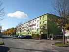
Before the 'Lichtenberg-Nord' area was built on and some streets were changed, Woerdenstraße ran here . A striking building is the senior citizens' home 'Alfred Jung' (house number 17; picture below) supported by the People's Solidarity Organization . At house number 5 there is a memorial plaque for the resistance fighter Max Brunnow . At the southern end of the street, address Scheffelstraße 6, there was the historic 'Biernoth' pub for decades. |
 
|
| Alfredstrasse
( Location ) |
270 | Alfred , male first name | before 1900 | It connects Frankfurter Allee with Fanningerstraße and continues as Schottstraße. This is where the Berlin women's prison, which was built in the 1930s, is located (house numbers 11/12). After 1990, it was merged with other women's prisons from other Berlin districts to form the prison for women in Berlin and is also their main location. |

|
|
Avenue of the Cosmonauts
( Location ) |
800 (in the district) |
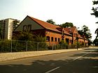
Cosmonaut , Russian term for space explorer | 22 Sep 1978 | At its western end, the avenue is only a very small part of the Lichtenberg area. It initially runs for a short stretch from south to north, then it bends in a west-east direction, crosses the northern Grenzgrabenbrücke and changes at the intersection with Rhinstrasse to the Marzahn district .
The name was given by the East Berlin magistrate in honor of the first German cosmonaut Sigmund Jähn and his Soviet commander Valeri Bykowski during a visit by the two of them. |
|
| Alzeyweg
( Location ) |
100 | Volker von Alzey , figure of the Nibelungenlied | July 26, 2013 | The street runs parallel to the east of Kriemhildstrasse in the “Nibelungenpark” residential area and connects the two arms of the Nibelungenring . |

|
| At the old engine shed
( Location ) |
20 (in the district) |
Roundhouse of the station Lichtenberg | 2011 | The newly dedicated street forms the connection path from Buchberger Straße to the Nöldnerplatz S-Bahn station . It used to be known colloquially as the Black Path because it was not paved, but covered with gravel . Most of the way is in the Rummelsburg district |

|
| At the estate park
( Location ) |
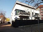
50 | Lichtenberg Manor Park | 3rd June 2014 | The street branches off northwards from Bornitzstraße, has nine house numbers, and at its end a footpath leads further into the corresponding park. The two to three-storey apartment buildings were built by a private investor who also gave the access road its name. |
|
| At the city park
( Location ) |
50 (street) 340 (footpath) |
Lichtenberg City Park | around 1915 | The street begins in the south on the Parkaue street, crosses the Lichtenberg city park as an unpaved footpath and then continues in the north to Scheffelstraße. It was not included in the Parkaue, which was planned for 1946. The four-storey residential buildings on both sides of the street were built between 1912 and 1915 and form a green inner courtyard. Before the development, the traffic route was called Straße 68 . |

|
| At the waterworks
( Location ) |
870 | Lichtenberg intermediate pumping station , colloquially "waterworks" | Feb 5, 1996 | The traffic route was laid out in the 1990s along the former road 19a as a paved connecting road between Landsberger Allee in the north and Herzbergstrasse in the south. There are no residential buildings on it, but there are some storage areas and company driveways. |

|
| Atzpodienstraße
( Location ) |
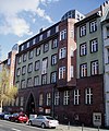
270 | Waldemar Atzpodien (1834–1910), owner of the Lichtenberg official property and local politician. He got involved in the expansion of the community of Lichtenberg into an independent city. | around June 1895 | The south-north connection between Frankfurter Allee and Gotlindestraße is crossed by Fanningerstraße and Rüdigerstraße. The traffic route was laid out as a private route (on Frankfurter Chaussee) in the 1890s . During the GDR era, the Berlin district institute for blood donation and transfusion was located at number 9/11 . At 19 Atzpodienstraße, the elementary school is located on the clear mountain, where the Montessori pedagogy is taught. In the southern area of the street (house numbers 45/46) the former Catholic parish school from 1893/94 has been preserved as a monument (see picture). After 1945, the building was the administrative location (specialist departments of the Lichtenberg district council). After renovation in accordance with listed buildings, it was reopened in 2006 as a restaurant and education and event center "Alte Mensa". |

|
|
Bidenswinkel
( Location ) |
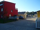
110 | Biden, Old High German or Low German for 'both' or 'two' | Dec 30, 2009 | The access road, going south from Bornitzstraße , was created through further development of the former cemetery area on Gotlindestraße. The street sign was only officially attached on March 3, 2010. |
|
| Bleckmannweg
( Location ) |
220 | Karl Bleckmann (also Carl Bleckmann ) (1864–1920), architect and local politician, Lichtenberg city council from 1908 to 1912, then member of the Berlin magistrate | Nov 9, 1926 | It is a dead end , branching off from Rudolf-Reusch-Straße in an easterly direction . Previously, the path on the southern edge of an old cemetery was nameless. |

|
| Bornitzstrasse
( Location ) |
1280 + 60 (across the Loeperplatz) |
Friedrich Alexander Bornitz (1809–1876), theologian. from 1851 until his death first pastor of the independent Protestant parish in Lichtenberg |
around 1905 | It runs in a west-east direction from Möllendorffstrasse to Siegfriedstrasse. Before the official name, the traffic route from the village green was called Krugstege , presumably after the entrance to the Dorfkrug . It was expanded as a paved road with a cycle lane on both sides in the late 1990s. A tenement house from 1893 has been preserved as a monument at Bornitzstrasse 13. Two modern buildings - a protruding tower and a combination building - are worth mentioning. The house with the curved tower is an office building used by several small companies, the combined building is the Lichtenberg workshop for the disabled . The new development with residential villas undertaken in recent years will be continued - in November 2012 the Lichtenberg district office and the Berlin Senate sold parts of the area on the edge of a tennis club to an investor. The five tennis courts are to be retained. |
 |
| Buchberger Street
( Location ) |
1235 | Buchberg , 469 m high mountain in the Vienna Woods in Austria | Apr 8, 1933 | The street curves from Frankfurter Allee to Schulze-Boysen-Strasse. When it was first built towards the end of the 19th century, it was called Eckertstrasse . The main post office in Lichtenberg (top picture), the Telekom building (bottom picture), several logistics companies and a discount grocery store are located on it. Until the construction of the residential area Frankfurter Allee Süd in the 1970s, the western part of the street was called Oberweg . |
 |
|
Bürgerheimstrasse
( Location ) |
270 (dead end) |
Bürgerheim Aktiengesellschaft, a terrestrial company , founded in 1891 to expand Lichtenberg | around 1900 | The street connects Frankfurter Allee with Fanningerstraße. The Bürgerheim Aktiengesellschaft bought 67 hectares of land from the Lichtenberg community in order to be able to implement a development plan for the area north of Frankfurter Chaussee . The name of a small neighborhood bar on the corner of Fanningerstraße was reminiscent of the Bürgerheim Society for many years (since then a barber shop). House number 6-10 is a listed former community school from 1911 (architect Johannes Uhlig ). After its partial destruction in World War II , this building was supplemented with a new building and until 1990 was a branch of the Dresden School of Transport Engineering . |

|
|
Coppistraße
( Location ) |
870 (ramified) |
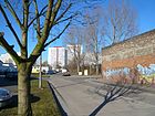
Hans Coppi (1916–1942) and Hilde Coppi (1909–1943), resistance fighters | March 1, 1972 | The street in the Frankfurter Allee Süd district branches off to the west from Buchberger Straße and after a bend leads back to it in a southerly direction. At a rally on June 22, 1972, it was named after the two resistance fighters along with other new streets. In the past, the connecting route in the north-south direction and the road 44 in the west-east direction were in the area of today's Coppistraße . The road bends in two parts. A number of small businesses have set up shop in the south-western area, including a Bahlsen GmbH & Co. KG factory shop . |
|
|
Dankwartstrasse
( Location ) |
205 | Dankwart , figure of the Nibelung saga | July 9, 1965 | It connects the Rüdiger- with the Ortliebstraße. After the construction of residential buildings on the site of a former allotment garden complex (KGA), the new streets were given names that were based on the existing street names in the neighborhood. Almost all of these come from the Nibelungen saga. Before that there were numbered footpaths in the KGA. |

|
| Deutsch- Meisterstrasse ( Location ) |
200 | Deutschmeister , term for a land manager of the Teutonic Knight Order | 1912 | It branches off in a north-westerly direction from Möllendorffstrasse and ends as a dead end . It is known for the AOK building completed in 1928 , which was erected in Expressionist forms as a clinker facing building. During the GDR era, the East Berlin administration of the state social insurance had its headquarters here, and a polyclinic was also housed in the building. The ensemble is a listed building . |

|
| Dietlindestrasse
( Location ) |
310 | Dietlinde , figure of the Nibelungen saga , daughter of Rüdiger von Bechelaren | July 9, 1965 | It connects the Rüdiger- with the Gotlindestraße. After the construction of residential buildings on the site of a former allotment garden complex (KGA), the new streets were given names that were based on the existing street names in the neighborhood. Almost all of these come from the Nibelungen saga. Before that there were numbered footpaths in the KGA. |

|
| Dottistrasse
( Location ) |
190 | Joseph Anton Dotti (1824–1880), Berlin manufacturer, landowner in Lichtenberg | 1899 | The short west-east connecting road is between Rathausstrasse and Ruschestrasse. On the northern side is a listed brick building that was opened as a post office in 1927. The costs for land and construction amounted to 23 million marks . In later years the post office received additional buildings to the east and angled along Ruschestrasse. The building stood empty between 1995 and 2013, since then it has been converted into the Carree Alte Post .
On the south side, extensions to the Deutsche Post of the GDR were built in the 1970s , in which the Fernamt Berlin was located and which Deutsche Telekom continues to use as a training and further education center. |

|
|
Eberhardstrasse
( Location ) |
105 | Eberhard , male first name | before 1907 | It branches off from Scheffelstrasse in a northerly direction and ends as a dead end . |

|
|
Fanningerstrasse
( Location ) |
880 | Carl Wilhelm Fanninger (1792–1856), ministerial official and landowner in the municipality of Lichtenberg | Feb 12, 1935 | The street runs in a west-east direction between Roedeliusplatz and Gudrunstraße. Between 1897 and 1935 it was called Wagnerstrasse after the composer Richard Wagner . The Sana Klinikum Berlin-Lichtenberg is located here under number 32 . There are several listed buildings of the former Oskar Ziethen Hospital on its site . A stumbling block for Frieda Rosenthal was set in front of house number 53 in 2008 . |

|
|
Frankfurter Allee
( Location ) |
1490 (in the district) |
Frankfurt (Oder) , following the earlier direction from Berlin | Sep 20 1872 | The historic trunk road between old Berlin and Frankfurt (Oder) runs between Frankfurter Tor in the Friedrichshain district and Rosenfelder Straße in the Rummelsburg district . The section between the Frankfurter Allee train station and the Lichtenberger Bridge is in Lichtenberg. When it was first built in 1708, it was initially called Frankfurter Chaussee . The picture shows a section of the road at the confluence with Magdalenenstrasse. The residential building no. 151 dates from 1911 and is a listed building. A former factory building west of Buchberger Strasse has been renovated and is now used by Telekom . |
 
|
| Freesienweg
( Location ) |
120 | Freesia | Nov 1, 2014 | The private road, laid out on newly developed building areas between Gotlindestrasse and Bornitzstrasse, runs as a dead end from Gotlindestrasse northwards. |

|
|
Freiaplatz
( Location ) |
80 × 50 (rectangular) |
Freya , Nordic goddess | around 1910 | The square is enclosed by Freia, Siegfried, Rüdiger and Wotanstrasse. First it was written Freya-Platz . The town square has been restructured several times since its inception . It has playgrounds and an old tree population. The district office had the last major renovation, financed from the urban redevelopment program, carried out by August 2013, which takes better account of the wishes of the residents. |

|
| Freiastrasse
( Location ) |
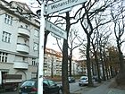
140 | Freya , Nordic goddess | 1907 | The short street connects Siegfriedstraße with Wotanstraße, it forms the northern boundary of Freiaplatz . The residential complex with house numbers 1–4 is a listed building. |
|
|
Gernotstrasse
( Location ) |
220 | Gernot, figure from the Nibelungenlied | 1900 | Gernotstraße is a residential street with loosened up buildings. It connects Gudrunstraße (south) with Rüdigerstraße (north). |

|
| Giselhersteig
( Location ) |
100 | Giselher, figure of the Nibelung saga | July 26, 2013 | The street is in the residential area Nibelungenpark. It branches off to the east from Kriemhildstrasse. |

|
| Glaschkestrasse
( Location ) |
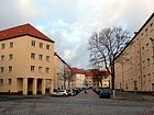
145 | Max Glaschke (1856–1922), local politician in Lichtenberg between 1908 and 1914 | Nov 9, 1926 | The street connects Roedeliusplatz to the north with Rüdigerstraße. At first it was called Straße 88 . |
|
| Gotlindestraße
( Location ) |
1415 | Gotlinde, figure from the Nibelungen saga | Nov 9, 1926 | The street runs in an east-west direction between Kriemhildstrasse and Ruschestrasse. She crosses Siegfriedstrasse. At the connection, which was initially designated as Street 25 , there are numerous apartment buildings and two allotment gardens , a cemetery that was closed in the 1980s and the Lichtenberg Labor Agency , which was created through multiple renovations of an administrative building erected by the Ministry for State Security . In this building there was a now disused paternoster elevator . The Federal Office of Administration is also located in Gotlindestraße . The disused cemetery attracted attention in 2015 when a lone roebuck lived there. |

|
| Gudrunstrasse
( Location ) |
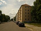
715 | Gudrun , figure from the Nordic Gudrun legend | 1898 | It runs in the south-east of the district directly parallel to lower-lying railway facilities and connects Frankfurter Allee (a remnant that is no longer directly included in the course of the road due to the construction of the new Lichtenberger Bridge from 1975) with the Friedrichsfelde central cemetery . |
|
| Guntherstrasse
( Location ) |
310 | Gunther, figure of the Nibelungenlied | around 1900 | It connects the Gudrun with the Rüdigerstrasse. The first spelling was Güntherstrasse . The street is almost exclusively flanked by rows of houses. House number 43 is a building from 1905, the most noticeable feature of which was an 18 m² Art Nouveau relief depicting a young man, it was on the East Berlin list of monuments. During the modernization in the late 1990s, the picture was plastered over. The adjacent house number 44 is a preserved architectural monument and comes from the same construction time and style. In addition to facade decorations, wall decorations have also been preserved in the hallway. |

|
| Belt Street
( Location ) |
180 (in the district) |
1874 planned expansion of the street as part of a ring road ("belt") around Berlin city center | around 1876 | The street runs between Frankfurter Allee and Weserstraße in the Friedrichshain district . It crosses the district boundary at the bridge under the Ringbahn . | |
| Hadburg path
( Location ) |
100 | Hadburg, figure of the Nibelungen saga | July 26, 2013 | The street is in the residential area Nibelungenpark. It branches off as a dead end to the east of the Nibelungenring. |

|
|
Hagenstrasse
( Location ) |
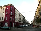
680 | Hagen , figure of the Nibelungen saga, opponent of Siegfried | 1897 | Hagenstraße is a north-south connection between the Frankfurter Allee / Gudrunstraße fork and Gotlindestraße. In its northern section, the Hans-Rodenberg-Oberschule stood in GDR times , which was dismantled in 2012/2013 due to vacancies . This is where the Nibelungen Park was created. |
|
| Harnackstrasse
( Location ) |
535 | Arvid Harnack (1901–1942) and Mildred Harnack (1902–1943), resistance fighters | March 1, 1972 | The curved street was laid out when the Frankfurter Allee Süd residential area was built . It connects Albert-Hößler-Straße with Coppistraße. On the east side are the Hermann Gmeiner primary school and a sports field used by the sports club 'TSV Lichtenberg'. |

|
| Heidenelkenweg
( Location ) |
120 + 120 | Heather carnation | May 11, 2012 | The road, laid out on building areas between Gotlindestraße and Bornitzstraße, runs as a private road fork-shaped from Gotlindestraße northwards. |

|
| Hendrichplatz
( Location ) |
195 × 25 + courtyard 165 × 103 |
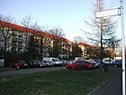
Hermann Hendrich (1854–1931), painter | Oct. 20, 1932 | The square is north of Rutnikstrasse. When the streets were laid out and the apartment blocks were built in the late 1920s, it was initially referred to as K square . The naming is closely related to the preference of the National Socialists for Germanic mythology , which Hendrich depicted in his painting cycles. |
|
| Heringer Strasse
( Location ) |
195 | Heringen , birthplace of the namesake from Hendrichplatz | Oct. 20, 1932 | It connects Bornitzstrasse with Rutnikstrasse. Before the name was given, the traffic route was called Straße 126 . |

|
|
Herzbergstrasse
( Location ) |
2570 (in the district) |
Herzberge hills | 1893 | The street runs in a west-east direction from Roederplatz to the grounds of the Queen Elisabeth Herzberge hospital . The first section of the street to Vulkanstraße belongs to the district of Fennpfuhl . The traffic route was laid out by the Lichtenberg Terraingesellschaft for industrial development in what was then Lichtenberg; numerous architectural monuments have been preserved here. The Queen Elisabeth Herzberge hospital and the former factory 'Siemens & Halske' ( VEB Elektrokohle Lichtenberg in the GDR era ) are particularly well-known . |

|
| Hoenerweg
( Location ) |
220 (dead end) |
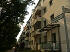
Franz Ferdinand Emil Hoener (1863–1925), theologian and pastor in Lichtenberg between 1893 and 1925 | May 4, 1934 | The short connecting path between Rudolf-Reusch- and Ruschestrasse touches a former cemetery. When it was first built, the path was nameless; on January 30, 1933, it was named Mirusweg . |
|
| Hubertusstrasse
( Location ) |
470 | Hubertus von Liège (around 656–727), Belgian theologian and Bishop of Liège; called Hubertus | 1896 | The street running in a south-north direction between Frankfurter Allee and Rüdigerstraße was divided roughly in the middle by the construction of the Lichtenberg Municipal Hospital . The disused, listed Lichtenberg public swimming pool is also located in the street . |

|
|
In the Lindenhof
( Location ) |
Lindenhof residential area | 21 Sep 2017 | The street runs in a U-shape from Klara-Weyl-Straße around the historic social buildings of the former Lindenhof children's hospital . It was created as plan street B for the residential buildings in the Lindenhof residential area north of Gotlinde- / Kriemhildstraße. |

|
|
|
John Victory Street
( Location ) |
270 | John Sieg (1903–1942), American journalist | March 1, 1972 | The street in the residential area Frankfurter Allee Süd leads from the back of the houses on Frankfurter Allee in bent lines to Schulze-Boysen-Straße. On the occasion of the award of the street name, a rally took place on June 22, 1972 with the participation of workers from Lichtenberg companies (see historical photo). A section of Wartenbergstrasse was included in the western part of the new street. House number 13 is a listed villa from 1928, which is currently used for cultural purposes and has been named 'Studio Fine Arts' (lower picture). |
 
|
| Josef-Orlopp-Strasse
( Location ) |
965 (in the district) |
Josef Orlopp (1888–1960), resistance fighter | Aug 19, 1960 | The west-east connecting road runs parallel to Herzbergstrasse from Möllendorffstrasse to Siegfriedstrasse to the south . Before 1900 the traffic route was laid out as a manor road. At the same time as the street was renamed in 1960, the historic ball bearing factory was given the name VEB Wälzlagerfabrik "Josef Orlopp" . Other large factories and administrations such as the consumer cooperative Berlin and the surrounding area, the VEB Bärensiegel Berlin , an oil mill and many more established themselves on the street . |

|
|
Kielblockstrasse
( Location ) |
85 | Gustav Kielblock (1843–1917), local politician | around 1915 | The short cul-de-sac is between the historic Lichtenberg village green on Möllendorffstrasse and the Lichtenberg city park . |

|
| Kietzer way
( Location ) |
345 | Lichtenberger Kietz | 1877 | The road runs from a curve connecting the Berlin Ringbahn to Wiesenweg. It is the former connection between the old Lichtenberg town center and the Kietzer Lacken parcel, which was laid out on a field mark in 1783 . The northern section was given up in 1972 in favor of residential development in the Frankfurter Allee Süd area . A small piece under the railway embankment to Wilhelm-Guddorf-Straße is still almost in its original condition. |

|
| Klara-Weyl-Strasse
( Location ) |
Klara Weyl (1872–1941), from 1918 city councilor for Lichtenberg | 21 Sep 2017 | It begins at the former entrance to the Lindenhof Children's Hospital and heads north. Klara-Weyl-Straße was created as a plan street A for the residential buildings in the Lindenhof residential area north of Gotlinde- / Kriemhildstraße . The street name honors the commitment of Klara Weyl, who from 1902 worked as a nurse in an orphanage in Berlin. Around 1920 she became the first head of the newly created Berlin State Youth Welfare Office and in this role she was also responsible for the Lindenhof children's and youth facility. |

|
|
| Kriemhildstrasse
( Location ) |
535 (+ 150 meters in the area of the children's clinic) |
Kriemhild , figure of the Nibelung saga | 1900 | The road connects Gudrun with Gotlindestrasse in a south-north direction. The name was given in connection with the construction of the boy's workhouse . Shortly after the road was built, there were already businesses here: In 1908, Paul Heinze advertised his “factory for wire fences in all designs with wooden posts and iron stands”. The lot was numbered 5.
A housing estate has been built on a former factory site east of the road. In 2013 it was given a new network of five access roads. Its northern limit is formed by an eastward arm of Kriemhildstrasse (house numbers 24–76). On the west side, there were also some private homes that were given the house numbers 23–45 (odd). |
 |
| Kubornstrasse
( Location ) |
400 |
Nicolaus Kuborn (1854–1922), theologian and teacher. First archpriest of the St. Mauritius Church and founder of the parish church of the Good Shepherd |
Jan. 22, 1924 | It runs in a south-north direction from Hoenerweg to Rutnikstraße. The first name in the development plan was Straße 86 . In 1932 it was extended to the south beyond Normannenstrasse, including a previously unnamed footpath. |

|
| Kunzeweg
( Location ) |
180 (offset) |
Ernst Kunze (also 'Kuntze'; 1846–1931), theologian, from 1876 pastor in the parish of Lichtenberg | Apr 5, 1934 | The cul-de-sac between Rudolf-Reusch-Straße and Ruschestraße was laid out in 1933 when the apartment blocks were being built. Until 1934 it was called Mückeweg , the origin of which is not known. |

|
|
Landsberger Allee
( Location ) |
2200 (only the southern side of the street in the district) |
Altlandsberg , city east of the Berlin city limits, where the traffic route led | before 1900 | The main traffic route, which connects the city center with the north-eastern surroundings of Berlin, starts at Friedenstraße in the Friedrichshain district and ends at Nikolai-E.-Bersarin-Brücke in the Marzahn district . Between Vulkanstrasse and Rhinstrasse, it forms the northern border of Lichtenberg. It was initially called Landsberger Chaussee , and between 1973 and 1992 Leninallee . On January 31, 1992, it was given its original name back. Worth mentioning here are numerous shopping centers built after the fall of the Wall , the area of the intermediate pumping station (waterworks) Lichtenberg (picture) and the IKEA furniture store, which was inaugurated in 2010 . |

|
|
Loeperplatz
( Location ) |
(see note under "Notes") | Loeper , landowning family from the municipality of Lichtenberg | 1914 | The square is located between the two directional lanes of Möllendorffstrasse north and south of Scheffelstrasse and Bornitzstrasse . The listed old parish church Lichtenberg stands on it .
When the village green was expanded to accommodate traffic, the area was named Wilhelmplatz in honor of the German emperor . After the fall of the empire, the complex was given its current name. The area can be roughly estimated at 7000 m², but since it is a lenticular complex with an interruption through Scheffel and Bornitzstrasse, a × b length specifications are hardly possible. |

|
|
Magdalenenstrasse
( Location ) |
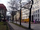
345 | Magdalena or Magdalene, female first name | around 1900 | The street runs in a south-north direction between Frankfurter Allee and Normannenstrasse. Some buildings on this street belong to the former Ministry of State Security . |
|
| Mauritiuskirchstrasse
( Location ) |
115 | Mauritius Church | around 1907 | The street between Wilhelm-Guddorf- and John-Sieg-Straße in the residential area Frankfurter Allee Süd was created during the construction of the Catholic church and the neighboring rectory. From 1969 it was integrated and shortened into the newly developed area. This is where the Mauritius-Kirch-Center (MKC), which is controversial among architecture critics because of its proximity to the listed church buildings, is located. |
 
|
|
Möllendorffstrasse
( Location ) |
1550 (in the district) |
Wichard von Möllendorff (1724–1816), Field Marshal General | between 1909 and 1910 with interruption | The south-north street between Frankfurter Allee and Roederplatz is the original village street of Lichtenberg, on which the Angerdorf developed. Between 1976 and 1990 it was called Jacques-Duclos-Straße . The old parish church Lichtenberg and the town hall Lichtenberg are noteworthy architectural monuments . In the southern area there is the memorial for eleven Spartacus fighters and Red Sailors (called "Blood Wall") who were shot in March 1919 on a former cemetery wall. |
 
|
| Nibelung Ring
( Location ) |
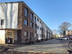
100 | Nibelung legend | July 26, 2013 | The street branches off eastwards from Kriemhildstraße and opens up the Nibelungenpark residential area in a U-shaped line . |
|
|
Normannenstrasse
( Location ) |
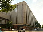
765 | Normans , Nordic tribe | June 6, 1906 | The west-east traffic route runs between Möllendorffstrasse and Roedeliusplatz . When it was first built, it was called Richard-Wagner-Strasse after the composer Richard Wagner . The street name is associated with the main administration of the Ministry for State Security (Stasi) of the GDR, which was initially set up in an earlier tax office in the 1960s . In later years, further adjoining areas, especially the area east of Ruschestrasse, were cleared. The houses belonging to Max Taut were demolished and the New Apostolic Chapel relocated. The Stasi premises expanded considerably. The residents soon spoke of the "Moloch Stasi". The Berlin Senate has included the various Stasi buildings in the list of monuments and finances a memorial. |
|
| Ortliebstraße
( Location ) |
150 | Ortlieb , Kriemhild's son in the Nibelungen saga | July 9, 1965 | It runs between Dietlindestrasse and Dankwartstrasse. After the construction of residential buildings on the site of a former allotment garden complex (KGA), the new streets were given names that were based on the existing street names in the neighborhood. Almost all of these come from the Nibelungen saga. Before that there were numbered footpaths in the KGA. |

|
|
Parking lots
( Location ) |
215 | Park and floodplain | 1912 | The street bends from Deutschmeisterstraße to Möllendorffstraße . Noteworthy are the small square, which has now been re-integrated into the street - between 1980 and 1992 it was called Hans-Rodenberg-Platz after the cultural worker Hans Rodenberg - and the former secondary school attached to it . After 1945 it was a pioneer house , which was named after German Titow's flight into space , and the 'Theater of Friendship' also had its venue in the building (top picture: Theater of Friendship / Pioneer House State 1952). Since 1992 it has been the Theater an der Parkaue with the dual function of a youth theater and other cultural institutions.
The house number range 24–34 is a listed residential building, built in 1915 by the architect Gustav Gebhardt (lower picture). |
 
|
| Paul-Junius-Strasse
( Location ) |
260 (in the district) |
Paul Junius (1901–1944), resistance fighter | Apr 2, 1975 | The road bends several times from Scheffelstraße to Weißenseer Weg . Only the short southern section between Scheffelstrasse and Storkower Strasse belongs to the district of Lichtenberg . When the transport network was set up at the end of the 19th century, it was called Wolfgangstrasse . Directly at the confluence with Scheffelstrasse, the L-shaped residential development is striking, which was built in 1923–1927 for the Berliner Baugenossenschaft (bbg) according to designs by Hans Kraffert and is a listed building. Paul-Junius-Straße 15 is the 1965/1966 built according to plans by Wolf-Rüdiger Eisentraut 'Dr. Georg Benjamin High School for the Physically Disabled ', which now bears the name of Carl von Linné . The first naming of the school was connected with the installation of a memorial plaque for the resistance fighter Georg Benjamin directly on the building. The board was dismantled at the end of 1989, its whereabouts are unknown. |

|
| Philosophers' Way
( Location ) |
220 | philosopher | March 5, 2007 | The former private road in the allotment garden colony 'Heinrichsruh' branches off south of Bornitzstraße. |

|
| Plonzstrasse
( Location ) |
340 | Julius Emil Plonz (1854–1923), local politician and banker | 1913 | The street runs between Roedeliusplatz and Gotlindestraße. The traffic route that existed in the 19th century was first called Straße 103 . It formed a driveway to the municipal cemetery in Gotlindestraße. Plonz lived in a villa in Berlin-Karlshorst (1913). |

|
|
Rathausstrasse
( Location ) |
400 (angled) |
Lichtenberg town hall | around 1900 | The street runs in a southeast-northwest direction between Frankfurter Allee and Normannenstrasse. In 1946 there were plans to rename it Stadthagenstrasse. The buildings that have been preserved are the Lichtenberg Town Hall from 1898, the former Cecilien Lyceum under house numbers 8/9 , built according to plans by Wilhelm Grieme and Johannes Uhrig and opened in 1910, and the former fire station (house number 12; see picture above), which was the headquarters of the until 2014 Police Directorate 6. It is also worth mentioning that there is a large green area between Rathausstrasse and Ruschestrasse, which was designed on the area of an old cemetery. |
 
|
| Reinhardsbrunner Strasse
( Location ) |
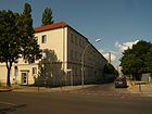
210 | Reinhardsbrunn , district of Friedrichroda in Thuringia | Nov 9, 1926 | The street runs connects the street Am Wasserwerk with Siegfriedstraße. It originally began in the west on the Vulkanstrasse. This part of the street was used to expand industrial facilities in the late 1960s. Until the name was given, it was called Straße 28 . There are several apartment blocks at its eastern end. |
|
| Rhinstrasse
( Location ) |
2345 (in the district) |
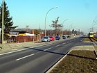
Rhin , a small tributary of the Havel | 1912 | The road runs between Alt-Friedrichsfelde in the district Friedrichsfelde in the south and the Landsberger Allee in the district of Marzahn in the north. The western side of the street between the road bridge at the Friedrichsfelde Ost S-Bahn station and Landsberger Allee forms the eastern border of the Lichtenberg district. The gardens of the KGA 'Alwin Bielefeldt' dominate the street scene. A side entrance to the spacious Friedrichsfelde central cemetery is accessible from the street. |
|
| Rhododendron Trail
( Location ) |
260 | Rhododendron , bush | March 5, 2007 | The U-shaped street is located in the residential estate south of Bornitzstraße. |

|
|
Roedeliusplatz
( Location ) |
90 × 50 | Wilhelm-Albert Roedelius , first head of the Lichtenberg community from 1874 to 1877 | Feb. 1, 1935 | The square lies between Magdalenenstrasse and Alfredstrasse north of Frankfurter Allee . First was the town square after the composer Richard Wagner as Wagnerplatz referred. In 1935 it was given its current name. The entire area of the square - the Coptic Orthodox church with green spaces and paths, the district court and tax office building as well as the surrounding streets (sections) - is listed. - The picture shows the northern part of Roedeliusplatz before its renovation in 2009/2010. |

|
|
Rudigerstrasse
( Location ) |
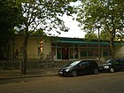
1360 | Rüdiger von Bechelaren , figure of the Nibelungen saga | 1900 | West-Ost-Straße runs from the Hans-Zoschke Stadium to Gudrunstraße at the main entrance to the Friedrichsfelde Central Cemetery . It began with your facility on Ruschestraße and was shortened by the construction of the Hans-Zoschke-Stadium .
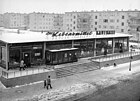
It received its contiguous residential development between 1925 and 1930. At the beginning of the 1960s, a new residential area made of concrete slabs and a school (Rüdigerstrasse 76) were built on a previously cleared allotment area on its northeastern side. The school was named Josef Orlopp Oberschule after the SED functionary Josef Orlopp . The rooms, renovated and modernized after a long period of vacancy, were opened as a creativity high school in 2010 . At the end of the 2017/18 school year, the Selma Lagerlöf language therapy school moved into the building. The “Eigensinn” creativity day-care center is located in the building on Hagenstrasse. In the Rüdigerstrasse, some residential complexes south of Freiaplatz have been preserved as architectural monuments. |
|
| Rudolf-Reusch-Strasse
( Location ) |
340 (N – S) + 140 (NE – SW) |
Rudolf Reusch (1851–1931), local politician in Lichtenberg 1894–1909, then “unpaid city councilor”, rentier | Jan. 22, 1924 | The residential street runs in a south-north direction between Rathausstrasse and Rutnikstrasse. On the west side is the former progress men's clothing factory (later: becon ), which has been converted into lofts since 2010 . |

|
| Rumoldstrasse
( Location ) |
80 (approx.) | Figure of the Nibelungen saga | July 26, 2013 | The street branches off to the east from Kriemhildstrasse and opens up the Nibelungenpark residential area . |

|
| Ruschestrasse
( Location ) |
1180 (N – S) + 200 (O – W) |
Rusche, a farming family in the village of Lichtenberg with large land holdings | 1893 | It runs in a south-north direction between Frankfurter Allee and Josef-Orlopp-Straße and continues as Vulkanstraße. The area between Frankfurter Allee and Normannenstraße was fundamentally redesigned on the eastern side of the street from the 1950s. The GDR Ministry of State Security had buildings demolished and the New Apostolic Church relocated for expansion buildings including a congress center . The entire area was built on, and Müllerstrasse and Helmutstrasse disappeared. After the fall of the Wall , service providers such as a medical center and a bank moved into the administrative buildings, the conference building served as the 'Lichtenberger Kongresszentrum (LCC)', but had to be abandoned at the beginning of the 21st century. The high-rise buildings in the south-east became the property of Deutsche Bahn , which maintained a service facility here until 2011 (DB Station & Service AG, ServiceStore system management). The Stasi Museum with the office and work rooms of the former Minister for State Security Erich Mielke is located in House 1 of the Stasi site . |
 
|
| Rutnikstrasse
( Location ) |
390 | Rutnik, also spelled Rutnick; a knight family from the 13th / 14th centuries Century, which is considered to be the founder of the village of Lichtenberg | Feb 21, 1940 | The street between Möllendorfstrasse and Ruschestrasse was initially called Strasse 125 . It was laid out after the First World War to develop a garden colony and later residential buildings. In the GDR era, the western section on the south side was provided with a complete panel building. There are two parallel 175-meter-long street sections between Möllendorffstraße and Hendrichplatz. |

|
|
Scheffelstrasse
( Location ) |
560 | Joseph Victor von Scheffel (1826–1886), poet and lawyer | 1907 | The Scheffelstrasse runs in an east-west direction from Möllendorffstrasse to the Eldenaer road bridge over the Ringbahn . It continues to the west on Eldenaer Strasse in Berlin-Friedrichshain . On the south side is the May 1st stadium . On the northern side (house numbers 1–16) the corner development with Paul-Junius-Straße is noticeable. The residential buildings were built according to plans by Hans Kraffert up to 1927 and are listed as historical monuments (lower picture). |

|
| Schottstrasse
( Location ) |
440 | Johann Martin Schott (1812 – approx. 1890), local politician and manufacturer | around 1913 | The street, laid out at the end of the 19th century as Straße 89 , begins as a continuation of Alfredstraße on Fanningerstraße and ends on Gotlindestraße. House number 6 is the listed parish hall of the Church of the Faith . | |
| Schulze-Boysen-Strasse
( Location ) |
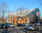
730 | Harro Schulze-Boysen (1909–1942), resistance fighter | March 1, 1972 | The street connects Frankfurter Allee in the north with Buchberger Straße in the south. It was originally the northern section of Pfarrstrasse . After the construction of the residential area Frankfurter Allee Süd , she was named the resistance fighter at a rally on June 22, 1972. In Schulze-Boysen-Strasse there are some architectural monuments such as the Mildred-Harnack-Schule , a teaching institution built as a community dual school in 1905 with an adjacent gym, which was built according to Hans Schuette's designs. There is a memorial plaque for Harro Schulze-Boysen at number 12 . At the beginning of the 21st century a two-storey rotunda was built at its southern end (called: "Kiezspinne"), which is used as a cultural center. |
|
|
Siegfriedstrasse
( Location ) |
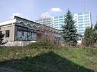
2540 | Siegfried , figure from the Nibelungen saga | 1896 | The street is one of the longest south-north connections in the district, it extends from Frankfurter Allee to Landsberger Allee . Worth mentioning here are the BVG stadium , the Lichtenberg tram station , the residential blocks for former BVG employees, the 'Siegfriedshöfe' (house number 204; see picture below), which were built around 1910 as a factory building and in the GDR era as the 'Werk für Signal' - and security technology '(WSSB) belonged. After vacancy, renovation and later extensions, there is now a hotel, a gallery and 18 loft apartments . as well as small businesses and a restaurant.
It is worth mentioning that the IG Spur 1 interest group has built a model railroad layout in the Siegfriedstrasse 66–70 complex . Open days are held several times a year. |
|
| Silberweidenweg
( Location ) |
90 | White willows , willow plants; Tree of the year 1999 | May 11, 2012 | The Silberweidenweg goes south from Bornitzstraße. It is part of the road network that was laid out on the northern area of the abandoned Gotlindestraße cemetery for a new residential area. |

|
| Stefan-Heym-Platz
( Location ) |
90 × 65 | Stefan Heym (1913–2001), writer | Nov 4, 2014 | The previously unnamed square at the Frankfurter Allee / Möllendorffstrasse intersection , on which the fishing fountain has stood since around 1952 after the rubble had been cleared up, was named by the writer Stefan Heym at the request of the Howoge housing association . In 2013, in preparation for the naming, a memorial event was held in the presence of his wife, Inge Heym. | |
| Storkower Strasse
( Location ) |
420 (in the district) |
Storkow (Mark) , small town in the Oder-Spree district | Apr 2, 1975 | The street begins on Greifswalder Straße in the Prenzlauer Berg district , then runs through Berlin-Fennpfuhl and ends at Möllendorffstraße in Lichtenberg. Only its eastern section from Rudolf-Seiffert-Straße belongs to the district with its southern side. The newly created section from Landsberger Allee to Möllendorffstrasse was only included in Storkower Strasse in 1975 after the construction of a new residential area. |

|
| Street 15
( Location ) |
235 + 190 meters on the premises of the Lichtenberg fire station |
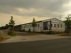
Numbering when dividing the terrain | around 1921 | The spur road in north-south direction runs between the two now disused industrial railway tracks south of Josef-Orlopp-Straße and north of Herzbergstraße , designed as an access road for the factories. In the 1960s it was shortened in the northern part, and in the 1990s the stretch of road north of Josef-Orlopp-Straße was integrated into the area of the Lichtenberg fire station. |
|
|
Tasdorfer Strasse
( Location ) |
230 | Tasdorf, part of Rüdersdorf near Berlin | 1913 | The street begins in the southwest on Wiesenweg, crosses under the embankment of a connecting railway and ends in the residential area Frankfurter Allee Süd behind the houses on Wilhelm-Guddorf-Straße as a dead end . Until the opening of the then new building district, the street in the north extended to Frankfurter Allee . Before the current name was determined, it was called Rummelsburger Strasse . |

|
| Volkerstrasse
( Location ) |
140 | Volker , figure from the Nibelungen saga | before 1902 | The short south-north road connects Gudrun with Rüdigerstrasse. In the 1950s, it received the existing development with residential buildings in large block construction. |

|
| Vulkanstrasse (east side)
( Location ) |
740 | Vulcanization company | 1913 | The street runs in a south-north direction between Josef-Orlopp-Straße and Landsberger Allee . It forms the border between the districts of Lichtenberg and Fennpfuhl. The entire eastern side of the street is made up of production plants built in the 19th and 20th centuries, from the Lichtenberg intermediate pumping station to the former VEB Elektrokohle Lichtenberg to the public industrial estate, formerly a branch of the central cattle yard. |

|
|
Wartenbergstrasse
( Location ) |
320 | Wartenberg , formerly an independent village in the eastern Berlin area | before 1887 | The traffic route between Wilhelm-Guddorf-Straße and Wiesenweg is a street in the south of the residential area Frankfurter Allee Süd . By the time the residential buildings were erected, the street began on Frankfurter Allee . The northern section was abolished in 1972. |

|
| Meadow path
( Location ) |
445 | Meadow | before 1901 | The street running in west-east direction connects the Gürtelstraße (in Friedrichshain ) with the Schulze-Boysen-Straße. It was only possible to cross under the Ringbahntrasse when it was extended to the west in 1925. This is where the listed transformer station from 1904 is located and next to it the historic Lichtenberg gasworks, started in 1890 and expanded by a second container in 1913 (in Hauffstraße, Rummelsburg). It was shut down in 1905, the containers not until 1922. |

|
| Wilhelm-Guddorf-Strasse
( Location ) |
520 | Wilhelm Guddorf (1902–1943), journalist and resistance fighter | March 1, 1972 | The street in the residential area Frankfurter Allee Süd runs between Gürtelstraße and Schulze-Boysen-Straße. The public name was given at a rally in June 1972. |

|
| Wotanstrasse
( Location ) |
450 | Wodan , also written Wotan, Nordic god | 1907 | The Wotanstrasse connects Fanningerstrasse and Gotlindestrasse in a south-north direction. In part, it forms the western boundary of the Freiaplatz . At house number 7 there is a memorial plaque for the resistance fighter Erich Rohde . |

|
No longer existing or renamed streets
| Surname; possibly picture | Origin of name | Name since | Name up | Remarks; Link to the current name |
|---|---|---|---|---|
| Eckertstrasse | Heinrich Ferdinand Eckert (1819–1875) ran the Eckert-Werke, a mechanical engineering company, on this street | around 1900 | 1933 | → Buchberger Strasse |
| Helmutstrasse | Helmut , male first name | around 1910 | May 5, 1961 | The first spelling was Helmuthstraße , after 1961 it was → divested. It ran through the area of the local MfS site north of Frankfurter Allee, between Ruschestrasse and Magdalenenstrasse . The corner building of the former tax office in Normannenstrasse still indicates this traffic route (picture on the right), likewise the east facade of today's Stasi memorial. |
|
Jacques Duclos Street |
Jacques Duclos (1896–1975), French communist politician | 1976 | 1992 | After a resolution by the Senate, the street was given its original name back → Möllendorffstraße . |
Leninallee
|
Lenin (1870–1924), Russian - Soviet politician and ideologist | 1973 | 1991 | → Landsberger Allee |
| Lockenhauser way | Lockenhaus , place in Burgenland | around 1936 | 1970 | In the area of the Friedrichsberg colony, various short access roads are shown on early city maps. This route established a west-east connection between Wartenbergstrasse and Tasdorfer Strasse and on to what was then Pfarrstrasse; it was closed after 1970. Before 1936 the street was called Kleine Straße . |
| Mirusweg | Henriette Mirus , member of the poor commission in Lichtenberg in the 19th century | Jan. 30, 1933 | 1934 | The name was only valid for almost a year. → Hoenerweg |
Müllerstrasse
|
Wilhelm Müller, Kossät | 1876 | 1976 | The 150 m short street, north of Frankfurter Allee between Ruschestraße and Magdalenenstraße, was → withdrawn in 1976. The course of the former Müllerstrasse can still be seen as a starting point at Frankfurter Allee (picture). |
| Oberweg | before 1900 | around 1965 | The traffic route ran in a west-east direction through the area of the Friedrichsberg colony. It was a continuation of the meadow path and found a continuation to the east in Eckertstraße ( Buchberger Straße ). It was removed in the late 1960s when the new building district Frankfurter Allee Süd → was being built. | |
| Rittergutstrasse | Rittergut , an extensive estate previously located here | around 1890 | around 1965 | Between the end of the 19th century and 1965, so called West-Ost-Straße, on which numerous large companies settled at the beginning of the 20th century. These included the "Ludewig and Bütteler Sprit und Preßhefefabrik" (later " Reichsmonopolyverwaltung ", with two locations), " Consumer cooperative Berlin " and the surrounding area, glass factory "H. Heye ”,“ Wollfabrik ”,“ Olex ”,“ Butt und Co. ”,“ Valentin GmbH ”,“ Norddeutsche Ballagerfabrik ”by A. Meyer-Lyken (1939), (later VEB roller bearing factory“ Josef Orlopp ” ). → Josef-Orlopp-Strasse |
| Triftweg | Trift , an agricultural path | around 1900 | around 1961 | The Triftweg existed before the western extension of the Friedrichsfelde central cemetery as a north-east running traffic route in the extension of Gudrunstrasse , with a branching towards the Queen Elisabeth Herzberge hospital. It ran right next to the industrial track system . It has been → de-dedicated. With the removal of the rails of the former industrial railway that lay parallel to this path, a new path for pedestrians and cyclists was created on the route. |
| Connection path | connection | around 1920 | around 1965 | This was an approximately 700 meter long traffic route, initially in a south-east direction and then to the south, running through the former Friedrichsberg colony. Until the opening of the new building district, the street reached in the north to Frankfurter Allee and in the south to Oberweg , which has → no longer existed since then. |
| Wilhelmsberger Feldweg | Wilhelmsberg, formerly located in the north of Lichtenberg and has belonged to Berlin-Alt-Hohenschönhausen since 2000 | around 1900 | around 1965 | With the later development → canceled. |
| Wuhlestrasse | Wuhle , river in the east of Berlin | around 1900 | after 1970 | In the area of the former Friedrichsberg colony, various short access roads are shown on city maps before the construction of the Frankfurter Allee Süd district . Wuhlestrasse was then the eastern continuation of Mauritiuskirchstrasse and was → abolished after 1970. |
Allotments and some private roads
| Name / location | Area / dimensions (in square meters) |
Origin of name | Date of designation | Remarks | image |
|---|---|---|---|---|---|
| KGA, Dr. Alwin Bielefeldt '
( Location ) |
159,462 (830 × 400) (triangular shape) |
Alwin Bielefeldt (1857–1942), Privy Councilor, President of the North German State Insurance Institutions and Chairman of the Central Association of German Workers and Allotment Gardeners . | 1928 | Founded in 1928 on leased land by the von Treskow family as a model colony "Kleingartenheim Bielefeldt". The approximately 300 parcels corresponding to the development of the allotment garden at that time extend over an area of 16 hectares west of Rhinstrasse in its southern area and connect directly to the Friedrichsfelde central cemetery to the east . The name was later changed to allotment gardens Dr. Alwin Bielefeldt changed. There is a club house in the colony, which also serves as a public inn. The garden area is divided by the following access roads:
Alerichstrasse, Beethovenstrasse, Bergstrasse, Carl-Langbecker-Strasse, Dahlienweg, Dresdner Strasse, Fontanestrasse, Freiligrathstrasse, Fritz-Reuter-Strasse, Geschwister-Scholl-Strasse, Giselherstrasse, Goethestrasse, Gotenstrasse, Mittelweg, Paul-Singer-Strasse, Stuttgarter Strasse. Due to the regional reform of 2001, this area now belongs to the district of Lichtenberg, until then the facility was the northern tip of Berlin-Friedrichsfelde.
Commons : Kleingartenanlage Bielefeldt - collection of pictures, videos and audio files
|

|
| ‚Railway allotment garden association connection Röder e. V. '
( Location ) |
10,440 (350 × 30) |
Former location at a siding and Lichtenberg large landowner family Roeder |
1914 | The 31 plots are located southwest of the Herzberge Hospital . A track system of the industrial railway Tegel – Friedrichsfelde that was no longer used parallel to the access route was removed in 2010 and a pedestrian and bicycle path was created on its route. It also serves as access to the Herzberge Landscape Park . |

|
| 'Railway allotment garden association Friedrichsfelde North'
( Location ) |
39,684 ( 350 × 330 × 152) (triangular shape) |
Railway to the south (Ostbahn) and the former affiliation to Berlin-Friedrichsfelde | 1946 | The area belongs to the State of Berlin, which has divided it into 76 plots and assigned it as leasehold. The allotment garden association has existed since 1946. |

|
| KGA 'own home'
( Location ) |
950 (250 × 85) |
Home | 1918 | The colony between Paul-Junius-Straße and Alfred-Jung-Straße consists of 26 parcels, which are accessed by two cross paths between the streets mentioned. When it was established, the KGA comprised additional areas north of this area and was divided by Eberhardstrasse in a north-south direction. |

|
| ‚Kleingartenverein Müllers Ruh e. V. '
( Location ) |
7,150 (230 × 185) |
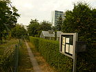
Founder of the plant | 1904 | The businessman Müller leased 30,000 m² of arable land from the Roeder heirs of the manor and around 1900 divided them into more than 110 small parcels. Siegfriedstrasse in the east, Gotlindestrasse in the north, the development on the edge of Rüdigerstrasse in the south and Ruschestrasse in the west formed the original boundary.
After the small gardens were given to colonists (as the tenants were called at the time), Müller appointed a general tenant, who was replaced in 1919 and replaced by self-administration. Over the years, the KGA was continuously downsized, initially through a sports field on Normannenstrasse, and in the GDR era (1967) through the construction of new residential buildings west of Wotanstrasse and south of Gotlindestrasse. From 1973 a further 60 parcels in the western area were closed by the Ministry for State Security for a new administrative building. The last reductions were made for the construction of accommodation for foreign guest workers opposite the tram station in Siegfriedstrasse. The gardens, which now have only 19 parcels, occupy less than a third of the original area. |
|
| ‚Kleingartenverein (Colony) Siegfriedslust e. V. '
( Location ) |
22,777 (115 × 130) |
adjacent Siegfriedstrasse | 1922 | The above-mentioned KGA extends north of Bornitzstraße with 22 parcels. The southern part, which existed until around 2003, was dissolved when the new homes were built. |

|
| KGA 'Weisse Taube e. V. '
( Location ) |
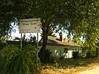
28,218 (in the district; irregular pentagon) |
probably based on the German fairy tale The White Dove | 1918 | 52 parcels, Siegfriedstrasse 13 and Landsberger Allee, including the Nelkenweg and Asternweg. Before the allotment garden was officially set up, a White Dove neighborhood was already entered on this area on a city map from 1899 . On the east side of Siegfriedstrasse (number 90) is the older part of the KGS, the main path of which is called Gartenstrasse. |
|
See also
Web links
- List of streets and squares in Berlin-Lichtenberg bei Kaupert; June 2010 - but contains several mapping errors
- Office for Statistics Berlin-Brandenburg: List of streets and squares in the Lichtenberg district (February 2015) (PDF; 325 kB)
- History of allotment gardens in the landscape framework plan for the Lichtenberg district
- Terrain and property offers . In: Berliner Adreßbuch , 1904. "Street situation in Lichtenberg on the map of the Berlin-Lichtenberger Terain-Actien-Gesellschaft in Liqu.".
Individual evidence
- ↑ a b c Hans-Rainer Sandvoss: Resistance 1933–1945. Resistance in Friedrichshain and Lichtenberg. Published by the German Resistance Memorial Center, Berlin, 1998, ISSN 0175-3592 , pp. 330–332.
- ^ Suburbs: Lichtenberg, Friedrichsberg, Wilhelmsberg . In: Address book for Berlin and its suburbs , 1900, part V, p. 103.
- ↑ Am Gutspark at berlin.kauperts.de, accessed on March 4, 2018.
- ^ Not yet in the address book of the Berlin suburbs in 1896 and included for the first time in 1897: Lichtenberg . In: Address book for Berlin and its suburbs , 1897, Part V, p. 79.
- ↑ Architectural monument school Atzpodienstraße
- ↑ Bidenswinkel on berlin.kauperts.de , accessed on April 19, 2019.
- ↑ Date according to a newsletter of Deutsche Post ( page no longer available , search in web archives ) (PDF; 236 kB)
- ↑ Möllendorffstr. 1 on Frankfurter Chaussee 152a . In: Berliner Adreßbuch , 1915, V, p. 126 (The house at Möllendorffstrasse 1 was owned by the builder C. Bleckmann).
- ↑ Lichtenberg . In: Berliner Adreßbuch , 1906, part V, p. 176. with supplements , including the note old name: Krugstege, new name: Bornitzstraße .
- ↑ Architectural monument residential building Bornitzstrasse 13
- ↑ News. Lichtenberg ; Berliner Zeitung , November 19, 2012, p. 19.
- ^ Lichtenberger Terrain Aktiengesellschaft Berlin on www.wl-historische-wertpapiere.de
- ↑ School building in Bürgerheimstrasse
- ^ The architectural and art monuments of the GDR. Capital Berlin-II. Henschelverlag, Berlin 1984, p. 173.
- ↑ AOK building in Deutschmeisterstraße
- ↑ Monument post office Dottistraße from 1923.
- ^ The draft of the Reich budget for 1923. In: "Zentralblatt der Bauverwaltung" 1923, p. 87.
- ↑ Architectural monument of the tenement building at Frankfurter Allee 151
- ↑ Annual report of the district office of Lichtenberg for 2014 (click: of the district office of Berlin Lichtenberg ), accessed on August 6, 2017.
- ↑ Brief information on the redesign of Freiaplatz on stadtentwicklung.de , accessed on February 24, 2013.
- ^ Press release from the Lichtenberg District Office , August 8, 2013; Retrieved September 10, 2013.
- ↑ Monument Wotanstrasse 1–4
- ↑ Berlin's loneliest deer lives in a cemetery . In: BZ Berlin . 22nd January 2016.
- ^ Lichtenberg> Güntherstrasse . In: Address book for Berlin and its suburbs , 1902, part V, p. 117. Güntherstrasse in Lichtenberg in the Berlin address book from 1902. Suburbs, part V
- ↑ Institute for Monument Preservation (Ed.): The architectural and art monuments of the GDR. Capital Berlin-II. Henschelverlag, Berlin 1984, p. 182.
- ↑ Architectural monument tenement Guntherstrasse 44
- ↑ a b Explanation on Mirusweg on Luise-Berlin; Retrieved June 23, 2010
- ↑ a b Printed matter - DS / 0351 / VIII
- ↑ Monument Villa John-Sieg-Strasse 13
- ↑ Local leisure tips. In: Berliner Woche , January 27, 2016, p. 4.
- ↑ Monument complex formerly North German ball bearing works Josef-Orlopp-Straße 92–96
- ^ Advertisements from companies> Paul Heinze . In: Berliner Adreßbuch , 1908, Part V, p. 74.
- ↑ Institute for Monument Preservation (Ed.): The architectural and art monuments of the GDR. Capital Berlin-II. Henschelverlag, Berlin 1984, p. 169.
- ↑ Monument complex Stasi headquarters Normannenstrasse / Ruschestrasse
- ↑ Monument residential building Parkaue 24–34
- ↑ Architectural monument residential complex on the corner of P.-J.-Straße and Scheffelstraße
- ↑ Hannelore Ohle-Nieschmidt "Under the pavement is the beach" - The Carl von Linné School in Berlin ( Memento from March 11, 2014 in the Internet Archive )
- ↑ ( Page no longer available , search in web archives: Homepage of the school with information on the history ), January 2016. The web archive led to a homepage without content, therefore "dead" (Sept. 2019).
- ↑ Honorary plaque G. Benjamin at Luise-Berlin ; Retrieved June 22, 2010.
- ^ Plonz, E. In: Berliner Adreßbuch , 1916, Part V, p. 74 .: Plonz, E. Strasse 93 (later Wallensteinstrasse)
- ↑ Architectural monument of the Cecilien Lyceum
- ↑ Homepage of the Police Department 6 with the reference to the move. Retrieved January 21, 2016. ( Memento April 13, 2014 in the Internet Archive )
- ↑ a b c d e Berlin city map from 1961. Retrieved on April 19, 2019 . , Course of Reinhardsbrunner Strasse and other streets in Lichtenberg
- ↑ Berlin State Monument List: Roedeliusplatz square ensemble
- ↑ Vacancy has come to an end. The school on Rüdigerstrasse opens as a grammar school. In: Berliner Woche , May 26, 2010, front page
- ↑ Relocation of the Selma Lagerlöf language therapy school. on www.sprachheilschule-selma-lagerloef.de
- ^ Luise-Berlin at Kaupert
- ↑ Architectural monument residential complex on the corner of P.-J.-Straße and Scheffelstraße
- ↑ Architectural monument community center Schottstr. 6th
- ↑ Monument 'Mildred-Harnack-Schule' in Schulze-Boysen-Straße 20
- ↑ Monika Arnold: "Everyone deserves more than one chance" with some details about the Kiezspider / Orangery. On Morgenpost.de/Leserreporter; January 31, 2013 ( Memento from January 23, 2015 in the Internet Archive )
- ↑ Monument complex BVG buildings
- ^ Homepage of Erber-Immobilien with brief information on the Siegfriedhöfe ( memento from June 26, 2015 in the Internet Archive ); Retrieved June 23, 2010.
- ↑ A must for model railroad fans . In: Berliner Woche , edition for Lichtenberg, Fennpfuhl and Rummelsburg, May 8, 2019, p. 2.
- ↑ Monika Arnold: "A place in Lichtenberg is given Stefan Heym's name", November 24, 2013 ( Memento from October 23, 2014 in the Internet Archive )
- ↑ E-Werk monument from 194, house numbers 5–9
- ^ Website of the "Verein der Gaswerkfreunde" about former gas factories in Germany; Retrieved June 22, 2010
- ↑ Old Berlin city map from 1926 with the location of Helmutstrasse. Retrieved September 19, 2019 .
- ↑ Berlin city map from 1961
- ↑ Berlin city map 1907
- ^ Müllerstrasse (historical) in Lichtenberg on Luise-berlin
- ↑ Old Berlin city map from 1926 with the location of Müllerstrasse. Retrieved September 19, 2019 .
- ↑ Berlin city map from 1949
- ^ Lichtenberg> Wilhelmsberger Feldweg . In: Berliner Adreßbuch , 1903, Part V, p. 130.
- ^ Page no longer available , search in web archives: Biography of Alwin Bielefeldt on the homepage of the KGA of the same name ; Retrieved April 26, 2010.
- ↑ Homepage KGA Bielefeldt
- ↑ a b History of the Lichtenberger KGA; here: table of the 2006 existing ones with details; Retrieved June 20, 2010
- ↑ a b c d Homepage Gartenfreunde Lichtenberg, accessed on June 18, 2010
- ↑ Information board in the colony; Photographed on June 18, 2010.
- ↑ Visual inspection and reports from contemporary witnesses
- ↑ City map of Old Berlin from 1899
