
Berlin-Friedrichsfelde
|
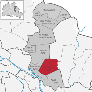
Friedrichsfelde district of Berlin |
|
|---|---|
  |
|
| Coordinates | 52 ° 30 '21 " N , 13 ° 31' 9" E |
| surface | 5.55 km² |
| Residents | 53,813 (Dec. 31, 2019) |
| Population density | 9696 inhabitants / km² |
| Incorporation | Oct. 1, 1920 |
| Postcodes | 10315, 10319 |
| District number | 1101 |
| structure | |
| Administrative district | Lichtenberg |
| Locations | |


Friedrichsfelde is a district in the Berlin district of Lichtenberg . It is characterized by its historical development in the historic center , but above all by large housing estates that arose between the 1960s and 1990s. The district is known in particular for the Berlin Zoo with Friedrichsfelde Palace .
history
The village of Rosenfelde was founded by Low German settlers around 1230. The documentary mention of pastor Ludwig zu Rosenfelde is the first evidence of the village in 1265. The first stone church, which no longer exists today, was built in the second half of the 13th century. The land book of Emperor Karl IV. From 1375 indicated 104 hooves for Rosenfelde , of which 6 were parish hooves ( Wedemhof ). This very unusual size includes about twice the number of hooves, as they were on the Barnim on the average for planned German villages .
Rosenfelde was 1699 after the Elector Friedrich III. renamed Friedrichsfelde .
The area around the former anger forms the historic village center .
The Friedrichsfelde Colony on Frankfurter Chaussee (today: Alt-Friedrichsfelde Street ) became the preferred place of residence for craftsmen.
The Brandenburg General Naval Director Benjamin Raule acquired Rosenfelde at the end of the 17th century and built a pleasure house there on the road to Köpenick , which later became Friedrichsfelde Castle . In 1717 the property was transferred to Margrave Albrecht Friedrich von Brandenburg-Schwedt , an uncle of the " Soldier King ", who had the original castle expanded. After his death in 1731, his son Carl inherited the castle. Eventually the property passed to his cousin Prince Ferdinand of Prussia , the youngest brother of " Old Fritz ". Four of his children, including his son Louis Ferdinand Prince of Prussia , were born there. In 1896 the Karlshorst colony (then: Carlshorst ) was detached from Sigismund von Treskow 's Friedrichsfelde estate and became part of the Friedrichsfelde community. Karlshorst then developed into a country house colony.
In 1920 the community Friedrichsfelde was incorporated from the Brandenburg district of Niederbarnim in Greater Berlin . In 1945 Friedrichsfelde was temporarily the seat of the Berlin headquarters of the Red Army (Alt-Friedrichsfelde / Rosenfelder Straße). At the intersection at Am Tierpark / Alfred-Kowalke-Strasse, a memorial stone commemorates Nikolai Bersarin , the first Berlin city commandant in 1945, who had a fatal accident there in a motorcycle accident. The group Ulbricht had after their return from the Soviet Union from May to July 1945 based in the Einbecker Straße 41. She supported the Soviet authorities in the reorganization of public life and the administration of Berlin and prepared the creation of political parties, trade unions and organizations in the Soviet zone of occupation .
The Friedenskreis, which has been working in the Friedrichsfelde parish since 1984, made political history. He was one of the most active East Berlin resistance groups against SED rule.
During the administrative reform in 2001 , the district was redesigned. The section located north of the Prussian Ostbahn (Berlin – Kostrzyn line ) on Rhinstrasse has since been part of the (Alt-) Lichtenberg district . The Friedrichsfelde Central Cemetery, established in 1881, with the Socialist Memorial , was also assigned to Lichtenberg.
Development

The district is characterized by multi-storey new buildings. The northern boundary is formed by the railway line of the Ostbahn with the S-Bahn station Friedrichsfelde Ost , in the east in the direction of Biesdorf ( Berlin outer ring ) and south in the direction of Karlshorst ( VnK route ), railway embankments also delimit the district. The district of Rummelsburg connects to the west .
Historic buildings
Along the Alt-Friedrichsfelde street , but especially in the historic center of Friedrichsfelde, some historic residential buildings from the 19th century have been preserved, which are now under monument protection . This also includes the Friedrichsfelde village church . In Short Street , the Catholic Church is to Good Shepherd . In the south-eastern part is the Berlin Zoo , which was set up in the former palace park and opened in 1955, with Friedrichsfelde Palace .
Residential high-rise buildings and office buildings
The majority of the residential buildings are six- to twenty-story prefabricated buildings , for which new areas were developed between the 1960s and 1990s, and a completely new road network was created. The then Hans-Loch-Viertel on both sides of Sewanstrasse was the first large new housing estate in East Berlin after the Second World War .
Immediately north of the zoo is the site of the education and administration center, a large administrative complex that houses the Berlin-Brandenburg Statistics Office and the Berlin University of Economics and Law . It emerged from an area that was built on and sealed off in the GDR era in 1984, on which the Berlin District Administration of the Ministry for State Security was based.

Splanemann settlement
The Splanemann settlement is located on the southern border of the district . It was built between 1926 and 1930 as the first prefabricated housing estate in Germany based on a design by the architect Wilhelm Primke and at the instigation of Martin Wagner , the then Berlin city planning officer . 138 apartments were originally built in the two- and three-storey houses, some of which were destroyed in the Second World War .
It was initially called Kriegerheimsiedlung after the main access road, Kriegerheimstrasse. The settlement has had its current name since 1951, after Kriegerheimstrasse was renamed Splanemannstrasse. Namesake is the resistance fighter Herbert Splanemann .
population
|
|
Source: Statistical Report AI 5. Population in the State of Berlin on December 31st. Basic data. Office for Statistics Berlin-Brandenburg (corresponding years)
traffic
Road traffic
One of the busiest intersections in Berlin is in Friedrichsfelde. For one, in west-east direction, the road Alt-Friedrichsfelde (1976-1992 road of liberation ) as part of - on a common route out - federal highways B 1 and B 5 from the city center of Berlin to the eastern region. In a car tunnel opened in 1979, it crosses the north-south route of Rhinstrasse and Am Tierpark .
This north-south street is a section of the tangential connection that connects several eastern Berlin districts from Alt-Hohenschönhausen in the north to Niederschöneweide in the south. The main traffic axis of the Sewanviertel is Sewanstraße (1961–1992: Hans-Loch-Straße ). It is also the connection to the neighboring district of Rummelsburg .
Transportation

The district is connected to the Berlin rapid transit network via two S-Bahn stations ( Friedrichsfelde Ost on the S5, S7 and S75 lines and Rummelsburg depot on the S3) and two underground stations ( Friedrichsfelde and Tierpark on the U5 ). The stations also serve as transfer points to several tram and bus routes that open up the district.
Friedrichsfelde has been connected to the Berlin tram network since December 1900.
From 1930 to 1973 Friedrichsfelde was the terminus of the current U5 subway line (then line E). The Friedrichsfelde workshop maintains the vehicles on the U5, U8 and U9 large-profile lines of the Berlin subway .
The tram route between Neu-Hohenschönhausen and Niederschöneweide runs along Rhinstraße and Am Tierpark . It is used by the lines M17, 27 and 37.
schools
- Adam Ries Primary School, Alt-Friedrichsfelde 66
- Bernhard-Grzimek-School (elementary school), Sewanstr. 184
- Mayor Ziethen School (primary school), Massower Str. 39
- Evangelical School Lichtenberg (elementary school), Rummelsburger Str. 3
- Friedrichsfelder Schule (elementary school), Lincolnstr. 67
- Butterfly Primary School, Dolgenseestr. 60
- Paul-und-Charlotte-Kniese-Schule (special school), Erich-Kurz-Str. 6-10
- Alexander Pushkin School (Integrated Secondary School), Massower Str. 37
- George Orwell School (Integrated Secondary School), Sewanstr. 223
Personalities
Sons and daughters of Friedrichsfelde
- Louis Ferdinand of Prussia (1772–1806), Prussian general
- Prince August of Prussia (1779–1843), Prussian general
- Julius von Treskow (1818-1894), Prussian politician
- Carl von Treskow (1819–1882), Prussian politician, landlord on Friedrichsfelde
- Sigismund von Treskow (1864–1945), Prussian politician, landlord on Friedrichsfelde
- Hermann Müller (1873 – after 1927), politician (SPD)
- Felix Tucholla (1899–1943), resistance fighter against National Socialism
- Günter Riesebrodt (1911–1989), politician (CDU)
- Wendelin Niedlich (* 1927), bookseller and gallery owner
Personalities associated with Friedrichsfelde

- Benjamin Raule (1634–1707), Brandenburg General Naval Director, lived in Schloss Friedrichsfelde
- Albrecht Friedrich von Brandenburg-Schwedt (1672–1731), lieutenant general of Brandenburg , died in Friedrichsfelde Palace
- August Ferdinand von Prussia (1730–1813), Prussian general, lived in Friedrichsfelde Palace
- Carl von Treskow (1787–1846), agricultural reformer, landowner of Friedrichsfelde
- Nikolai Bersarin (1904–1945), Berlin city commander in 1945 based in Friedrichsfelde
- Heinrich Dathe (1910–1991), first director of the Berlin Zoo
- Agnes Kraus (1911–1995), actress, lived at Mellenseestraße 36
- Herbert Ziergiebel (1922–1988), writer, lived at Schwarzmeerstraße 50
- Heiner Müller (1929–1995), writer, lived 1979–1993 at Erich-Kurz-Strasse 9
See also
- List of streets and squares in Berlin-Friedrichsfelde
- List of cultural monuments in Berlin-Friedrichsfelde
- List of stumbling blocks in Berlin-Friedrichsfelde
literature
- Jan Feustel : Walks in Lichtenberg. Haude and Spener, 1996, ISBN 3-7759-0409-3 .
- Institute for Monument Preservation (Ed.): The architectural and art monuments of the GDR. Capital Berlin-II. Henschelverlag, Berlin 1984, pp. 209-218.
- Johannes Schultze (Hrsg.): The land book of the Mark Brandenburg of 1375 (= Brandenburg land books . Volume 2; publications of the historical commission for the province of Brandenburg and the imperial capital Berlin . Volume VIII, 2). Commission publisher von Gsellius, Berlin 1940 ( digitized in Potsdam University Library ).
- Herbert Schwenk: The Splanemann settlement . In: Berlin monthly magazine ( Luisenstädtischer Bildungsverein ) . Issue 4, 1997, ISSN 0944-5560 , p. 67–71 ( luise-berlin.de - the history of its origins).
- Klaus-Dieter Stefan (Ed.): Friedrichsfelde - The place. The lock. The history. Hendrik Bäßler Verlag, 2014.
Web links
- History of Friedrichsfelde on the website of the district office
Individual evidence
- ↑ Where is Rosenfelde? In: Berliner Woche , Friedrichsfelde-Karlshorst edition, September 5, 2018, p. 3.
- ^ Karlshorster Landstrasse . In: Street name lexicon of the Luisenstädtischer Bildungsverein
- ↑ Memorial plaque at Einbecker Straße 41 on www.gedenkenafeln-in-berlin.de
- ↑ Friedenskreis Friedrichsfelde at www.jugendopposition.de
- ↑ Statistical report AI 5 - hj 2 / 19. Residents in the state of Berlin on December 31, 2019. Basic data. P. 26
- ↑ Large Berlin tram on www.berliner-bahnen.de
- ↑ News in brief - U-Bahn . In: Berliner Verkehrsblätter . No. 12 , 2015, p. 237 .
- ↑ Street reminds of actress Agnes Kraus. In: Der Tagesspiegel , February 14, 2011.
- ^ Telephone book for the capital of the German Democratic Republic Berlin. 1986 edition, p. 552
- ↑ memorial plaque on www.gedenkenafeln-in-berlin.de
