List of streets and squares in Berlin-Alt-Treptow

The list of streets and squares in Berlin-Alt-Treptow describes the street system in the Berlin district of Alt-Treptow with the corresponding historical references. At the same time, this compilation is part of the lists of all Berlin streets and places .
overview
At 2.31 square kilometers, Alt-Treptow is the smallest district in the Treptow-Köpenick district . Until the administrative reform in 2001 , it was the eponymous district of the former Treptow district . Alt-Treptow is located in the northwestern part of the district Treptow-Koepenick and bordered on the southwest by Neukölln , in the northwest of Kreuzberg , in the northeast on the south bank of the River Spree in Friedrichshain , and to the southeast by Plänterwald .
There are 30 dedicated streets in the district, plus two squares and (as officially assigned) an island. Of these roads, eight continue in the neighboring districts, and four have (at least) in sections the rank of a federal road . The total length of all city and federal roads in the district is 16 kilometers. The district of Alt-Treptow has 12,878 inhabitants (as of December 30, 2019) and includes the postcode area 12435.
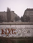
Starting in the north, the district is delimited clockwise as follows: the banks of the Spree including the Insel der Jugend up to Bulgarische Straße , on the park side of Bulgarische Straße and Am Treptower Park (without the street area), Matthesstraße , S-Bahn line of the Ringbahn , via Kiefholzstraße , Treptower Strasse , Heidelberger Strasse , Bouchéstrasse , Harzer Strasse to Lohmühlenbrücke , Landwehrkanal to Treptower Brücke , Am Flutgraben to the banks of the Spree. The wall ran from 1961 to 1990 on the section from Kiefholzstrasse to the banks of the Spree . Today it is part of the Berlin Wall Trail . Due to its location in a corner of the wall, the area around Bouchéstrasse was somewhat isolated from the rest of East Berlin .
Alt-Treptow is a junction of the road, water and rail routes in the city of Berlin. The road system began with the construction of the Treptow suburb and the colonist settlement founded towards the end of the 18th century . The creation of the Berlin – Görlitzer Railway , which was completed in 1867, and its connection to the Stadtbahn in 1891 proved to be significant for the infrastructure . The Berlin trade exhibition of 1896 was also significant .
The B 96a crosses the Spree on the Elsenbrücke . The spacious streets in the Berlin road system ( An den Treptowers , Elsenstraße , Am Treptower Park, Alt-Treptow , Puschkinallee ) belonging to the B 96a were expanded in the 1960s and 1970s, so that the latter three now run as one-way streets around Treptower Park. The street Am Treptower Park and the Puschkinallee continue to Kreuzberg. The superordinate road connection Elsenstraße, Karl-Kunger-Straße, Wildenbruchstraße is an important connection to Neukölln. The planned extension of the city motorway will initially lead to the Am Treptower Park junction and end with entrances and driveways on both sides of Matthesstraße. 450 meters of Kiefholzstrasse are categorized as a supplementary road.
Overview of streets and squares
The following table gives an overview of the streets and squares in the district as well as some related information.
- Name / location : current name of the street or square. Via the link Location , the street or the square can be displayed on various map services. The geoposition indicates the approximate center of the street length.
- Traffic routes not listed in the official street directory are marked with * .
- Former or no longer valid street names are in italics . A separate list may be available for important former streets or historical street names.
-
Length / dimensions in meters:
The length information contained in the overview are rounded overview values that were determined in Google Earth using the local scale. They are used for comparison purposes and, if official values are known, are exchanged and marked separately.
For squares, the dimensions are given in the form a × b for rectangular systems and for (approximately) triangular systems as a × b × c with a as the longest side.
If the street continues into neighboring districts, the addition ' in the district ' indicates how long the street section within the district of this article is. - Name origin : origin or reference of the name.
- Notes : further information on adjacent monuments or institutions, the history of the street and historical names.
- Image : Photo of the street or an adjacent object.
| Name / location | Length / dimensions (in meters) |
Origin of name | Date of designation | Remarks | image |
|---|---|---|---|---|---|
|
Alt-Treptow
( Location ) |
400 | old village center of Treptow | Sep 7 1909 | Alt-Treptow street with lots 1–6, 12, 14–17 (continuous) is located between Bulgarische Straße and the transition to Puschkinallee on the Spreetunnel square. It is part of the B 96a and is a one-way street in a north-westerly direction. A western approach arch opens up the access to the Archenhold observatory .
Part of the street was initially called Treptower Chaussee and formed the old Treptower Dorfstraße. It was located between the square at the Spreetunnel and Parkstrasse , today's Bulgarian Strasse, where the old Treptow plant was located. Between 1908 and 1945 the tram ran on the street. The path to the abbey island starts at plot 6. At the western end there is the restaurant complex of Haus Zenner , the street crosses over the Heidekampgraben . |

|
| At the flood ditch
( Location ) |
100 (in the district) |
Flutgraben , the Obere Flutgraben is a former timber rafting ditch parallel to the upper lock of the Landwehr Canal | Aug 28, 1928 | The street is a dead end from Puschkinallee to the north and runs parallel to the southeast bank of the flood ditch on the border between Treptow and Kreuzberg . Plots 2 and 3 are in the district, but plot number 1 on the Obere Freiarchenbrücke / Puschkinallee belongs to Kreuzberg. In 1943, Breitersche Haus (today No. 1) is mentioned in the address book next to Vor dem Schlesisches Tor. Due to the location between West and East Berlin , the section of the Berlin Wall was located on this site . There are several restaurants right by the Flutgraben. South of Puschkinallee, an officially not so named path leads between Flutgraben and Schlesisches Busch to Jordanstraße . |

|
|
At Treptower Park
( Location ) |
480 (in the district) |
Treptower Park , a park laid out in the 19th century | Sep 7 1909 | The street is located in the district between Puschkinallee and the western railway bridge under the Berlin Ringbahn . In the further course of the road lies in Plänterwald . The north-eastern edge of the road at Treptower Park forms the district boundary.
The house number sequence follows the principle of horseshoe numbering , plots 1–8 and 14 belong to the district. The section between Bouchéstrasse and Elsenstrasse is occupied by the Am Treptower Park barracks area, which is used by the BKA and the anti- terrorism center. Most of the road land and the south-western side of the road are in Plänterwald . Until 1909 it was part of the Köpenicker Landstrasse . The tram line, which was laid out in 1896, was the last in the district to be closed in 1973 with the road expansion. |

|
| At the Treptowers
( Location ) |
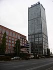
200 | Treptowers , office building complex | Sep 24 1997 | The street is between Elsen- / corner Martin-Hoffmann-Straße and the Elsenbrücke . Before it was renamed, part of Elsenstrasse, which now leads to Martin-Hoffmann-Strasse, could only be recognized from the outside by a lane. The busy and noisy street has only the office high-rises No. 1, 2, 3 as residents. The Spreeweg, a 59 kilometer long hiking trail along the Spree and part of the European hiking trail E11 , runs under the road and the Elsenbrücke . | |
|
Beermannstrasse
( Location ) |
200 | Beermann, name of an entrepreneurial family from Treptow |
Sep 9 1904 (with interruption) |
The street is between Elsenstrasse and Matthesstrasse. It was laid out as street A according to the development plan . From 1938, during the Nazi era (1938–1947), the traffic route was renamed because the Beermann family was of Jewish origin. It was then called Mächtigstrasse until 1947 , with which the horticultural director Hermann Mächtig was honored. On August 1, 1947, the street got its first name back.
The rear of the Treptow Park Center is located on the north side of Lot 3. The southern development, plots 2–22 are old buildings with backyards facing the embankment of the former route of the Görlitzer Bahn. The allotment garden BLW 'Alt-Ruhleben' in this street with 23 plots was cleared, some residential buildings on Beermannstraße (numbers 20 and 22) were demolished in 2015. Both measures create space for the further construction of the A 100 , the route of which runs along the east end of Beermannstrasse and also borders the Plänterwald district . |

|
| Bernhard-Langwaldt-Weg ( location ) |
350 (in the district) |
Captain Langwaldt and his crew saved numerous children in the 1951 shipwreck in Berlin-Treptow | Jul 5, 2016 | The Bernhard-Langwaldt-Weg is a footpath and bike path to the east parallel to the Treptower Park train station . It runs from Puschkinallee to the Parkwegbrücke . The path was laid out as a park path in 1901 and was first listed in the address book the following year. The name of the Parkweg bridge over the Spree (parallel to the railway and Elsen bridges) to the north was ignored when it was renamed in 2016, it belongs to Friedrichshain . Likewise, the continuation of the path to the Alt-Stralau street also kept the name Parkweg, as the Friedrichshain-Kreuzberg district office did not participate in the renaming. |

|
| Bouchéstrasse
( Location ) |
990 (in the district) |
Johann Peter Bouché (1759–1846), Berlin local politician (member of the Forestry and Economics Deputation of the Magistrate) | before 1890 | Bouchéstraße is located between Am Treptower Park and the Kiehlufer. The house number sequence follows the principle of horseshoe numbering . In the district, lots 5 and 11–41 (odd) and 10a – 40 (even) are located between Am Treptower Park and before the Heidelberger Straße intersection. From there to Harzer Straße, the road area was part of the construction of the Berlin Wall from 1961 to 1989 . The south-western section of Bouchéstrasse beyond Harzer Strasse is located in Neukölln . The previous name until 1889 was Bouchéweg and on Neuköllnergebiet Straße 11 . Intensive construction activity began in 1891; the builders were the tax authorities , private individuals and the Görlitz railway company. Between 1911 and 1923 a tram ran on the street. The Berlin Wall ran along the section between Harzer Strasse and Heidelberger Strasse from 1961 , today a section of the Wall Trail is located here, the Treptower Strasse side is still partly undeveloped, as it was cleared after 1961 to create construction space for the border fortifications. In 1983, GDR citizens Holger Bethke and Michael Becker managed one of the most famous GDR escapes, starting from the residential building at Schmollerstraße 5 at the corner of Bouchéstraße 33 . |

|
| Bulgarian street
( Location ) |
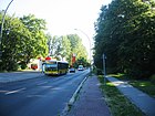
780 | Bulgaria , country in Southeast Europe | Sep 30 1935 | The street runs in a north-easterly direction from Am Treptower Park / Köpenicker Landstraße via Alt-Treptow / Neue Krugallee to the Spree . As part of Bundesstraße 96a , it is a one-way street to Alt-Treptow.
The road land and the south-east side of the road are in Plänterwald . From 1842 to around 1888 it was called Park-Allee and from around 1888 to 1935 the name Parkstrasse . The renaming to Bulgarian Street had political significance. It was a sign of the brotherhood in arms between Germany and Bulgaria in the First World War and a common economic, political and cultural community of interests of both states. The tram line opened in 1896 and last operated to the final stop in Treptow, Rathaus, was shut down in 1959. |
|
|
Oak Street
( Location ) |
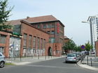
300 | Oak , a type of tree that was here in the so-called "Vorderheide" on the former border with Berlin before the development | around 1895 | Eichenstrasse starts from Puschkinallee, runs over Martin-Hoffmann-Strasse and leads to the banks of the Spree . The site of the former Allgemeine Berliner Omnibus AG at Eichenstrasse 4 is used by the organizer Arena Berlin . Originally, the street was laid out as an entrance to the Beermann factory for agricultural machines, which was founded in 1872, and ended at what was then Hoffmannstraße . It was renewed on April 1, 2004. |
|
|
Elsenstrasse
( Location ) |
1000 (in the district) |
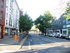
Elsen, another name for alders | Nov 21, 1895 | Elsenstrasse runs from Martin-Hoffmann-Strasse and An den Treptowers to Kiehlufer in Neukölln. The house number sequence follows the principle of horseshoe numbering . At Elsenstrasse 1 is the Treptow Medical Center with art in the building , at No. 3 the Vietnamese Embassy . The southwest section of the street with the house numbers 42–84 is in Neukölln. From 1842 on, the street was called Elsen-Allee and was renamed in 1895 together with street 42 of the development plan to its current name. During the division of Germany , Elsenstrasse was interrupted by the Berlin Wall . From 1913, a tram line ran through Elsenstrasse; it was shut down between 1952 and 1973. |
|
|
Fanny-Zobel-Strasse
( Location ) |
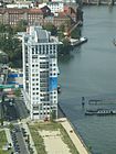
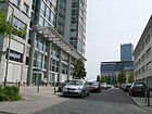
330 | Fanny Zobel (1872–1958), local politician, persecuted by National Socialism | July 1, 1997 | The street laid out on the former site of the VEB Elektro-Apparate-Werke Berlin-Treptow "Friedrich Ebert" connects the Martin-Hoffmann-Strasse with the Eichenstrasse in an arch, at the confluence of which the twin towers built in 2006 are located. A building project with apartments and a hotel is to be implemented here by the Agromex company. | |
|
Grabowstrasse
( Location ) |
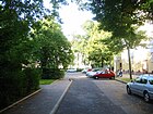
210 | Wilhelm Grabow (1802–1874), lawyer, Prussian politician | Aug 6, 1937 | Grabowstrasse runs from Heidelberger Strasse over Lexisstrasse. Before it was given its current name, it was referred to as Straße 37 . On June 16, 1960, the street was extended by the section between Lexisstrasse and Harzer Strasse. |
|
|
Harzer Strasse
( Location ) |
370 (in the district) |
Harz , low mountain range in Lower Saxony, Saxony-Anhalt and Thuringia | Nov 25, 1895 | Harzer Straße runs from Lohmühlenstraße to Teupitzer Straße in Neukölln . A section of the northeast side of the street with the house numbers 111-119 belongs to Alt-Treptow, while the rest of the street belongs to Neukölln. The house number sequence follows the principle of horseshoe numbering . The previous names were Straße 37 and Straße 33 . The Berlin Wall ran along the section between Lohmühlenstrasse and Bouchéstrasse . |

|
| Heidelberger Strasse
( Location ) |
830 (in the district) |
Heidelberg , city in Baden-Württemberg | June 10, 1904 | Heidelberger Strasse runs from Lohmühlenstrasse to Treptower Strasse. Part of the street is in Neukölln . The house number sequence follows the principle of horseshoe numbering . The street was first referred to as street 106 . First, on January 11, 1904, the section in Rixdorf was named after the city of Heidelberg. In July of the same year the section in Treptow was included. On 24 June 1960, decided Magistrate of East Berlin , the Heidelberg road around the street 23a extend. Heidelberger Strasse was the starting point for two tunnel alignments during the German division , as the Berlin Wall ran along the section between Bouchéstrasse and Treptower Strasse . |

|
|
Isingstrasse
( Location ) |
200 | Julius von Ising (1832–1898), Prussian general (according to other information after Joachim von Ising, private scholar and Treptower resident) | Nov 30, 1911 | According to the development plan, it was first called Straße 36 . The street runs from Lohmühlenstraße to Krüllsstraße. |

|
|
Jordanstrasse
( Location ) |
430 | Max Jordan (1818–1892), founder of the chemical factory in Treptow | around 1895 | The street is located between Bouchéstraße and Lohmühlenstraße in the industrial area, bordered on the south side by the embankment of the former railway line to Görlitz station. Plots 1–4 are on the other side of the street. The buildings of the first Treptow industrial company, the Jordan'schen Chemical Factory, founded in 1850, were located on this site . Later, the Actien-Gesellschaft für Anilin-Fabrikation (Agfa) had its headquarters and in the 1950s the Steremat's buildings in the Treptow electrical equipment factory were used. Since the turn of 1990, several spin-offs have been established and the buildings have been used for commercial enterprises ever since. In 1943, property 1 was connected to Lohmühlenstraße 65, 66 and 67 and the IG Farbenindustrie Akt.Ges. (Aniline factory). |

|
|
Karl-Kunger-Strasse
( Location ) |
780 | Karl Kunger (1901–1943), worker, resistance fighter against National Socialism | Aug 24, 1962 | The street runs from Lohmühlenstraße to Elsenstraße. The house number sequence follows the principle of horseshoe numbering . From 1896 to 1906 the no longer existing first part of the street was called An der Wiener Brücke and formed a continuous street with Wiener Straße until the bridge was blown up in 1945. After expansion, it was named Liststrasse from 1906 to 1907 and Graetzstrasse from 1907 to 1962 . From 1911 to 1973 the Berlin tram ran on the street. |

|
| Kiefholzstrasse
( Location ) |
1250 (in the district) |
Pine , old name for pine trees | Nov 25, 1895 | Parts of the road run through Neukölln , Plänterwald and Baumschulenweg . From 1842 to 1895 the street was called Kiefholzweg . Kiefholzstraße runs from Lohmühlenstraße to Südostallee in Baumschulenweg. It leads with 428 house numbers through four Berlin districts and three postcode areas and follows the principle of horseshoe numbering . The house numbers 1-50 and 394-420 are in Alt-Treptow. The road was the starting point for several tunnel routes during the German division . |

|
| Krüllsstrasse
( Location ) |
250 | Peter Krülls (* 1855), chief engineer, local politician in Treptow | Dec 11, 1909 | The street runs from Onckenstraße to Kiefholzstraße. It was laid out in 1907, built on in 1909 and paved for the first time in 1910. It was initially referred to as Street 8 . From 1933 to 1947 it was named Erwin-Moritz-Strasse , after the SA man Erwin Moritz (1910-1931), who was shot in the Graetzstrasse during violent clashes between National Socialists and Communists . |

|
|
Lexisstrasse
( Location ) |
170 | Wilhelm Lexis (1837–1914), economist | May 17, 1930 | Lexisstraße runs from Lohmühlenstraße to Mengerzeile. Like the neighboring streets Mengerzeile, Onckenstraße and Schmollerplatz, it is named after well-known economists. The section between Grabowstrasse and Lohmühlenstrasse was not included in Lexisstrasse until 1960. |

|
|
Lohmühlenstrasse
( Location ) |
680 | Tire mills that used to be operated here | July 26, 1897 | The street runs from Jordanstraße to Harzer Straße and to the Kiehlufer. It is a quiet residential street with a bus connection and close to Görlitzer and Treptower Park . The houses on the west side in particular have an unobstructed view of the Landwehr Canal , the Silesian Bush and the Kreuzberg bar scene are close by. A piece of the Teltower Dörferweg marked “15” lies on the road . The house number sequence follows the principle of horseshoe numbering . It initially led from Schlesische Strasse on Flutgraben to Harzer Strasse on Lohmühlenbrücke . The section in the Kreuzberg district, separated by the Berlin Wall , was devoloped in 1978. The closure of the Lohmühlenbrücke meant that an important connection within Neukölln was no longer available, so that Harzer Strasse , which belongs to West Berlin, ended as a dead end at Lohmühlenplatz. In 1988, the place north-east of the bridge in the death strip changed to the Neukölln district by exchanging areas , thus creating a new western approach to the area known as “Lohmühlenzwickel”. Between 1896 and 1911 the BESTAG lines ran on the road. | |
|
Martin-Hoffmann-Strasse
( Location ) |
480 | Martin Hoffmann (1848–1912), gardener owner, local politician in Treptow | Dec 1, 2010 | Martin-Hoffmann-Straße runs from Eichenstraße to Elsenstraße. It was laid out in 1872 as part of Eichenstraße and on October 28, 1899, it was renamed as an independent street in Hoffmannstraße . The headquarters of VEB Elektro-Apparate-Werke Berlin-Treptow "Friedrich Ebert" was on the premises at house numbers 15-26 . At the end of 2010 the street got its current name. |

|
| Matthesstrasse
( Location ) |
170 | Wilhelm Matthes (1848–1901), community representative, founder of the volunteer fire department in Treptow | Sep 9 1904 | The street lies between street Am Treptower Park and Beermannstraße. Before it received its present name it was as road B , respectively. The street is in the 1915 address book with “s. Berlin ”for SO 36 and also listed as undeveloped along the Ringbahn in 1943. Today the embankment of the Ringbahn lies on the east side and to the west of the road there is a strip of green up to the “Park Center Treptow”, which is kept free for the planned exit of the A 100 to “Am Treptower Park”. |

|
| Bulk line
( Location ) |
120 | Carl Menger (1840–1921), economist | May 17, 1930 | The Mengerzeile runs from Harzer Straße to Schmollerstraße. Before it was given its current name, it was referred to as Street 39 . Like the neighboring streets Lexisstraße, Onckenstraße and Schmollerplatz, it is named after well-known economists. |

|
| Onckenstrasse
( Location ) |
120 (in the district) |
August Oncken (1844–1911), economist | May 17, 1930 | The street runs from Schmollerplatz to Kiehlufer. The house number sequence follows the principle of orientation numbering. The north-eastern section of the street with house numbers 1-16 is in Alt-Treptow. The southwest section of the road runs in Neukölln . The previous name was Street 8 . During the division of Germany , Onckenstrasse on Harzer Strasse was interrupted by the Berlin Wall . Like the neighboring streets Lexisstraße, Mengerzeile and Schmollerplatz, it is named after well-known economists. |

|
|
Place at the Spree tunnel
( Location ) |
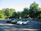
70 × 20 | Tram tunnel under the Spree | Apr 19, 1901 | The square is on Puschkinallee and the Alt-Treptow street at Gasthaus Zenner . The name Spreeplatz was originally intended for the square . However, it was given the name Platz am Spreetunnel, since a Spreeplatz already existed in Charlottenburg . This is where the Spreetunnel Stralau – Treptow ends , through which the so-called Knüppelbahn ran from 1899 to 1932. |
|
| Plesser Street
( Location ) |
170 | Pless , town in Upper Silesia , today Pszczyna , birthplace of Georg Simon, the financier for the construction of the street | July 17, 1912 | Plesser Strasse runs from Kiefholzstrasse to Karl-Kunger-Strasse. In the middle on its north side is the Evangelical Confessional Church . Before the street got its current name, it was referred to as Street 44 . Between 1923 and 1973 the Berlin tram used the street. |

|
| Puschkinallee
( Location ) |
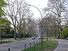
2050 | Alexander Pushkin (1799–1837), Russian poet, named on the occasion of his 150th birthday | June 2, 1949 | The street runs as an extension of the Alt-Treptow street from Platz am Spreetunnel to street Am Flutgraben and continues at the Schlesische Brücke over the Landwehrkanal in the Kreuzberg district as street Vor dem Schlesisches Tor. From the southeastern end to Elsenstrasse, it is part of Bundesstrasse 96a and is a one-way street . The main entrance to the Soviet Memorial in Treptower Park is on Puschkinallee .
The traffic route was called Kastanienallee until 1842 and Treptower Chaussee from 1842 to 1949 . The horse-drawn tram line on Treptower Chaussee, which was laid out in the 1870s, was electrified in 1896 on the occasion of the trade exhibition and extended to the space at the Spreetunnel. In 1945 tram traffic was stopped, in the western section in 1960. At Puschkinallee 49 there is a dormitory for people with severe disabilities, in which 19 people between the ages of 23 and 76 live (as of March 2019). Immediately after the end of the Second World War, the two-storey plastered building served as the headquarters of the Soviet secret service, a forerunner of the KGB in Berlin. After he moved out, the town villa became the embassy of Hungary, Albania and Nicaragua. The consequences of the fall of the Berlin Wall in 1989 initially led to the house being vacant, until the social association Volkssolidarität took over the property in June 1998 and opened it as a dormitory. - Thanks to a donation from an (unspecified) international film project, a barefoot path and a relaxation corner were created on the property in 2018 . |
|
|
Schmollerplatz
( Location ) |
220 × 50 | Gustav Schmoller (1838–1917), economist | May 17, 1930 | The square is on Schmollerstrasse and Lexisstrasse. Before it was given the name Schmollerplatz, it consisted of the complex of streets 8a , 41 and 39 between Schmollerstraße and streets 41 and 46 and squares I, II and III of the development plan. The area between the New Apostolic Church and Schmollerplatz 17 was included in Schmollerplatz in 1960. Like the neighboring streets Mengerzeile, Onckenstraße and Lexisstraße, the square is named after well-known economists. |

|
| Schmollerstrasse
( Location ) |
110 | Gustav Schmoller (1838–1917), economist | July 2, 1914 | The street runs from Bouchéstraße to Schmollerplatz. Before it was given the name Schmollerstraße, it was referred to as Straße 40 according to the development plan . Like the neighboring Lexisstraße, Mengerzeile, Onckenstraße and Schmollerplatz, the street is named after economists. |

|
|
Treptower Strasse
( Location ) |
220 (in the district) |
Treptow , an independent municipality until 1920, today as the Alt-Treptow district of Berlin | before 1882 | The street runs from Böhmische Strasse to Kiefholzstrasse. The house number sequence follows the principle of horseshoe numbering . Part of the northwest side of the street with the house numbers 51-56 is in Alt-Treptow. The Berlin Wall ran along the street in this area . The rest of the street is in Neukölln . On the map from 1877 the route was entered without a designation. Treptower Strasse was already mentioned in the 1882 address book. |

|
|
Waterfront
( Location ) |
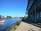
500 | Bank on the Spree | before 1882 | The bank promenade is the unofficial name for the path along the Spree between Eichenstrasse and Treptower Hafen. The riverside promenade is part of the Inner Parkring, one of the 20 main green routes in Berlin, and a section of the E 11 long-distance route . To the east he goes into the Parkweg and to the west to the Flutgraben. |
|
|
Meadow bank
( Location ) |
220 | Wiesenufer was a field name on the Landwehr Canal , which was once called Wiesengraben. | before 1877 | The Wiesenufer runs from the Flutgraben (Treptower Bridge), crossing the Vienna Bridge (which was blown up in 1945) to the Lohmühlen Bridge , along the southeast bank of the Landwehr Canal.
In the first Berlin telephone directory from 1881, the aniline factory of the stock corporation for aniline fabrication with the address An der Treptower Brücke / Wiesenufer is listed with the telephone number 80 , which, according to a corresponding photo, has apparently existed since the 1870s. For 1884 the Wiesenufer is marked with the comment “go. zu Rixdorf ”between Cottbuser Damm and Lohmühlenweg in the address book. The southern bank of the westward section (Neukölln) and the eastern bank of the northern section (Kreuzberg / Treptow) were called Wiesenufer. This name remains across from the Görlitzer Ufer in Kreuzberg. The western bank area has been called Maybachufer since 1883 , the northern, formerly Cottbusser Ufer, Paul-Lincke-Ufer . In 1884 the southern (Rixdorfer) bank was built on and was also called meadow bank. In 1932, only the northern part up to Reichenberger Strasse belonged to Treptow. The street for Treptow is noted in the address book from 1943 (not yet in 1935), the plots 1 and 2 mentioned here are connected to Lohmühlenstraße 36 and 35, plus a room space . The division of the city as a result of the Second World War meant that the Landwehr Canal also separated East and West Berlin from one another until 1990 ; the Wiesenufer remained entirely in (old) Treptow. In the 1920s, only the eastern area of the Wiesenufer belonged to Treptow. Due to this location between the sectors, the Wiesenufer was included in the border systems of the Berlin Wall in 1961 and thus lost its public significance. Only a small unnamed path between the former railway line of the Görlitz train station and the Lohmühlenbrücke lies on the (current) green strip of the wall area. The Inner Parkring , which circles downtown Berlin, runs along this path . It ends in the south at Lohmühlenplatz in front of Neukölln and is thus a section of the Wall Trail . |

|
| Wildenbruchstrasse
( Location ) |
330 (in the district) |
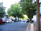
Ernst von Wildenbruch (1845–1909), writer | March 13, 1894 | Wildenbruchstrasse runs from Sonnenallee and Erkstrasse in the Neukölln district to Kiefholzstrasse. The previous name was Street 12a . The part between Harzer and Kiefholzstraße was named between 1921 and 1925. The house numbers 35 to 53 are in Alt-Treptow. The southwest section of the street runs through Neukölln. Between 1961 and 1989 Wildenbruchstrasse at Heidelberger Strasse was interrupted by the Berlin Wall . |
|
Parks and other facilities in Alt-Treptow
| Name / location | Area (in m²) |
Origin of name | designation | Remarks | image |
|---|---|---|---|---|---|
|
Island of youth
( Location ) |
27,500 | Youth club on the Spree island | 1896 | The island lies in the Spree between Treptower Park and the Plänterwald forest opposite the Stralau peninsula . The island was filled up in the course of the Berlin trade fair in 1896 and was initially called "Treptower Bruch". After an excursion restaurant designed as a Scottish monastery ruin ( abbey ) went into operation, it was given the name " Abbey Island". After a fire, the restaurant was torn down, whereupon the city of Rixdorf had the abbey bridge and a bridge house built. This house was used as a youth club during the GDR and gave the island its name. Since 2010 it has been called "Insel Berlin". |

|
|
Silesian bush
( Location ) |
74,800 | Coppice , bush-shaped shrubs and trees on the former Berlin city limits, the Schlesisches Tor | 1994 | One of the five remaining watchtowers of the former Berlin Wall is in the green area . |

|
|
Treptower Park
( Location ) |
882,000 (irregular shape) |
Location in the then rural community of Treptow , from which the Treptow administrative district emerged in 1920 | 1888 | The 88.2 hectare park was laid out from 1876 to 1888 according to plans by the then city gardening director Gustav Meyer . In addition to a large number of meadows, the Treptower Harbor, three residential ship colonies and the Archenhold Observatory are located on the Spree side . A Soviet memorial was built in the western part of the park in 1949 . |

|
See also
Web links
- Map of Berlin 1: 5000 with district boundaries. Senate Department for Urban Development Berlin, 2009, accessed on January 11, 2013 .
- Street directory Alt-Treptow. kaupert media GmbH, accessed on February 25, 2011 .
- Berlin-Brandenburg Statistics Office: Directory of streets and squares in the Treptow-Köpenick district (as of February 2015); pdf
- Hermann Jansen: Development plan Berlin-Treptow
Individual evidence
- ^ Wolfgang Kramer, Siegfried Münzinger: The company for the construction of underground railways GmbH - Berliner Ostbahnen . In: Berliner Verkehrsblätter . Issue 7, 1962, pp. 55-56 .
- ↑ a b c d e f g Sigurd Hilkenbach, Wolfgang Kramer: The tram of the Berliner Verkehrsbetriebe (BVG-Ost / BVB) 1949–1991 . transpress, Stuttgart 1999, ISBN 3-613-71063-3 , pp. 15-21 .
- ↑ a b Address search in the RBS database for the map 1: 5000, produced by the district surveying offices
- ↑ a b c d address book 1943: Streets in the administrative district Treptow - Treptow
- ↑ City Guide Berlin - Hidden Places in Berlin
- ^ A b c Heinz Jung: The Berlin Electric Tramways AG . In: Berliner Verkehrsblätter . Volume 10, 1965, pp. 130-133 .
- ↑ stadtentwicklung.berlin.de: 20 green main routes - Spreeweg / Berliner Urstromtal
- ↑ Mächtigstrasse on berlingeschichte.de
- ↑ Press release of the Treptow-Köpenick District Office , June 30, 2016
- ^ K5 map of Berlin 1: 5000: station area
- ↑ Berlin address book 1903 : Bouchéstraße with an explanation of the name
- ^ Berlin address book 1890 : Bouchéstrasse with three houses
- ^ Berlin address book 1891 : Bouchéstrasse with numerous construction sites and a parade ground
- ↑ a b c Heinz Jung: The Berlin electrical streetcars AG . In: Berliner Verkehrsblätter . Issue 11, 1965, pp. 146-150 .
- ^ A b Reinhard Schulz: Tram in turbulent times. Berlin and its trams between 1920 and 1945 . In: Verkehrsgeschichtliche Blätter . Volume 4, 2005, pp. 94-110 .
- ↑ How a wall escape with a bow and arrow succeeded. In: Die Welt , March 31, 2008
- ^ Bulgarian street near Kauperts
- ^ Wolfgang Kramer, Siegfried Münzinger: Southern Berlin suburban railway . In: Berliner Verkehrsblätter . Issue 7, 1963, pp. 69-72 .
- ↑ Agromex: Agromex building project Fanny-Zobel-Straße - new apartments and a hotel directly on the banks of the Spree , accessed on August 13, 2012
- ↑ "In 13 years as a local councilor, he has done a great job for the development of the Treptow community" Explanation of the name at Krüllsstrasse . In: Berliner Adreßbuch , 1920, III, p. 461.
- ↑ berliner-stadtplan.com: Lohmühlenstraße, Berlin-Alt-Treptow
- ↑ 20 green main paths: Teltower Dörferweg
- ↑ Everything in flux: From industry to high technology . In: Der Tagesspiegel , November 16, 2007, accessed on August 13, 2012
- ^ Martin-Hoffmann-Strasse near Kauperts
- ^ Address book 1915: Suburbs> Berlin = Treptow
- ^ Author collective: Tram archive 5. Berlin and surroundings . transpress, Berlin 1987, ISBN 3-344-00172-8 , pp. 30-51 .
- ↑ Das Magazin 3-2018; Ed. Volkssolidarität Berlin, p. 12: Barefoot path and relaxation corner .
- ^ Website of the home for the disabled , accessed on March 5, 2019.
- ↑ a b 20 main green paths: Innerer Parkring (description)
- ↑ a b List of those involved in the telephone equipment . Berlin, July 14, 1881
- ^ Westermann's plan of Berlin . Publisher: Georg Westermann, Berlin W 40 / Braunschweig 1932. ( Memento of the original from December 10, 2015 in the Internet Archive ) Info: The archive link was inserted automatically and has not yet been checked. Please check the original and archive link according to the instructions and then remove this notice. Retrieved March 26, 2013
- ↑ Picture of the street view Wiesenufer in the foreground: Agfa factory at Wiesenufer, Treptow near Berlin / Germany, in 1877 .
- ^ Map of Berlin. Pierer's Conversations Lexicon, 6th edition for Treptow around 1875 ( page no longer available , search in web archives ) Info: The link was automatically marked as defective. Please check the link according to the instructions and then remove this notice.
- ↑ On the distribution of the road between Neukölln and Treptow
- ^ Address book 1943: Streets in the Treptow administrative district: Treptow. Part IV, p. 2114
- ↑ Pharus City Map Berlin Large Edition: Treptow around 1954 ( Memento of the original from December 13, 2015 in the Internet Archive ) Info: The archive link has been inserted automatically and has not yet been checked. Please check the original and archive link according to the instructions and then remove this notice.
- ^ Pharus Plan Berlin (large edition with suburbs) . Pharus Verlag GmbH / Berlin SW 68 / Linden-Strasse 3, around June 1921 ( page no longer available , search in web archives ) Info: The link was automatically marked as defective. Please check the link according to the instructions and then remove this notice.
- ↑ History of the island of Berlin ; inselberlin.de, accessed on February 1, 2016.

