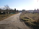
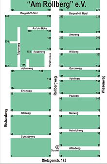
List of streets and squares in Berlin-Rosenthal
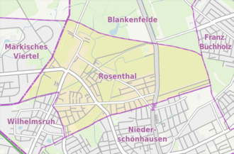
The list of streets and squares in Berlin-Rosenthal describes the street system in the Berlin district of Rosenthal ( Pankow district ) with the corresponding historical references. At the same time, this compilation is part of the lists of all Berlin streets and places .
overview
Statistical
The district of Rosenthal has 9,596 inhabitants (as of December 30, 2019) and includes the postal code area 13158.
The total length of the 147 streets dedicated to Rosenthal in the official street list is 54.8 kilometers. The new naming of 65 private roads at the beginning of the 2010s increased Rosenthal's share of the Pankow district road network. The public road network (2011) in the entire district is 613.0 kilometers long. In addition to the Steglitz-Zehlendorf district (637.6 km) and the Treptow-Köpenick district (668.1 km), the Pankow district has one of the largest road networks in the German capital. According to the area share, the district even has the largest road network with more than 1050 hectares , although the share of 10.2% of the Pankow district area (only) places it in seventh place.
Development of the road system
“ Rosenthal , parish village in the Nieder = Barnim district ¾ miles from Berlin, in front of the Rosenth. Gate with 28 fire places and 253 inhabitants. "
On the map from 1894 there are five other streets and one way from Rosenthal in addition to the Dorfstraße through the town center. In the course of today's Mönchmühler Straße, a path leads north (slightly to the west of the main road ) in the direction of Blankenfelde through Rieselfelder . The street goes south in a straight line in the course of today's Wilhelmsruher Hauptstraße to Reinickendorf past the stop of the Berliner Nordbahn (since 1937: Wilhelmsruh S-Bahn station ). The Wilhelmsruh colony (today's district) is still a corridor, partly swampy terrain. From the center of the village by the church, Schönhauser Straße leads eastwards with a connection to Niederschönhausen. From this, today's main path goes on the eastern edge of the village via the Chaussee (Dietzgenstraße), which was then remote from the village, directly to the center of French Buchholz (today's Rosenthaler Weg). On the southern outskirts, a road runs to the west. This divides into a south-western branch in the course of the (today's) Wilhelmsruher Damm to Dalldorf (since 1905: Wittenau ), past the stop Dalldorf (since 1912: S-Bahn station Wittenau ) of the northern railway. A north-western road (in the course of today's Quickborner Strasse) goes past the Fasanerie as a road to Wittenau .
While the location Nordend came to the Pankow administrative district in 1920 and became a location of Rosenthal in the post-war years, it belonged (politically) to Niederschönhausen in the 1930s, while Wilhelmsruh, as a former part of the Niederbarnimer municipality of Rosenthal, belonged to the Reinickendorf administrative district in the early 1930s with the regional reform of 1938 for the administrative district of Pankow, compare the note in the 1933 address book. Information can be found at the boundary between Blankenfelde, Rosenthal, Niederschönhausen and Wilhelmsruh and thus at the district boundaries on the overview map in the 1925 address book.
Todays situation
Since the 1990s, the main road network has existed in the course of Friedrich-Engels-Strasse and Wilhelmsruher Damm in the connection from Niederschönhausen to the Märkisches Viertel . This is supplemented by the district Wilhelmsruh via the main road to Reinickendorf as the main traffic connection. Rosenthal is connected to the main road system via Kastanienallee to Dietzgenstraße (as part of the B 96a ), alternatively via Mönchmühler Straße via Blankenfelde . Otherwise there is a connection to the B 96 via Wilhelmsruher Damm. The development of Kastanienallee and Friedrich-Engels-Straße in the 2010s is still characterized by the outskirts of the district until the fall of the Berlin Wall in 1989. Once Rosenthal had its own S-Bahn station at the Heidekrautbahn next bus is the connection to the Berlin center by the Metro tram line M1 possible. Friedrich-Engels-Strasse (until 1951 Reichskanzlerdamm) has been largely responsible for developing the Eigen Scholle settlement near Berlin-Rosenthal (VI 450) since the late 1920s. The current state of development as a main street with overriding importance brings with it the expansion work beginning in the 2010s to connect to the Märkisches Viertel.
In connection with the need to create clear street assignments in gardens and the activities of the Pankow district on behalf of the owners, 103 streets in the Am Rollberg, Einigkeit, Schönwald and Nordend facilities were renamed and dedicated in coordination with the settlers, and the plots were redesigned partly arranged differently. These names on the northern edge of the district from 2011 to 2014 are the youngest streets in the district. These street names in the already populated area indicate that the expansion of Berlin districts is still in development, especially since housing estates are also forming through the reallocation of areas and the construction of residential buildings from gardens. These (semi-public) private roads are in the same condition as the garden paths, the plots have been partially reallocated.
Overview of streets and squares
The following table gives an overview of the streets and squares in the district as well as some related information.
- Name / location : current name of the street or square. Via the link Location , the street or the square can be displayed on various map services. The geoposition indicates the approximate center of the street length.
- Traffic routes not listed in the official street directory are marked with * .
- Former or no longer valid street names are in italics . A separate list may be available for important former streets or historical street names.
-
Length / dimensions in meters:
The length information contained in the overview are rounded overview values that were determined in Google Earth using the local scale. They are used for comparison purposes and, if official values are known, are exchanged and marked separately.
For squares, the dimensions are given in the form a × b for rectangular systems and for (approximately) triangular systems as a × b × c with a as the longest side.
If the street continues into neighboring districts, the addition ' in the district ' indicates how long the street section within the district of this article is. - Name origin : origin or reference of the name.
- Notes : further information on adjacent monuments or institutions, the history of the street and historical names.
- Image : Photo of the street or an adjacent object.
| Name / location | Length / dimensions (in meters) |
Origin of name | Date of designation | Remarks | image |
|---|---|---|---|---|---|
|
Abajstrasse
( Location ) |
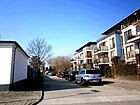
180 | Ibrahim Abaj Kunanbayev (1845–1904), Kazakh poet and composer | Feb 14, 2000 | Until the year 2000 this was called Straße 90 . The Embassy of Kazakhstan is located south of the street in the square Nordendstrasse / Eschenallee / Abajstrasse / Taufsteinweg on the previously undeveloped site. This is related to the choice of name and the ceremonial naming of the Kazakh poet, which took place on February 18, 2000 with the participation of the Ambassador . The street is located between Taufsteinweg and Eschenallee in Nordend. |
|
| Maple Avenue
( Location ) |
280 | Maple , tree species | before 1902 | It is located between Nordendstrasse and the named Kastanienallee in Nordend. Drawn in on a map from 1905 and mentioned in the record for Berlin and the surrounding area in 1908. The Ahornallee is still registered in the 1943 address book for Niederschönhausen. Monument: The country house on the corner of Ahornallee 9 / Nordendstraße is dated between 1875 and 1880. It is included in the 1943 address book (belonging to Niederschönhausen) with four multi-family and three single-family houses on the nine plots between Kastanienallee and Nordendstrasse. The house 1/2 is a double lot and the lot 3 belongs to Schönhauser Straße 3, the former clinic for brain medicine. |

|
| Affensteinweg
( Location ) |
100 | Affensteine , rock group in Saxon Switzerland | Nov 12, 2013 | Affensteinweg is a private road in the Schönwald garden colony and is the second crossing from Schönhauser Straße from Liliensteinweg to the south to Lasensteinweg. Named as path 2 before being named within the facility . The designation of the garden path by the Pankow district as a private road was carried out for better georeferencing of the properties in preparation for the nationwide introduction of the computer-aided property cadastre information system . |

|
| Acacia avenue
( Location ) |
280 | Acacia , species-rich tree | before 1905 | It is located between Nordendstrasse and the named Kastanienallee in Nordend. It is marked on a map from 1905 and in the “Verification for Berlin and Surroundings 1908” for the “Landhauskolonie Nordend”. In the 1943 address book it is included (belonging to Niederschönhausen) with eight single-family houses on the 14 plots between Kastanienallee and Nordendstraße. |

|
| Altarsteinweg
( Location ) |
100 | Altar stone, rock in Saxon Switzerland | Nov 12, 2013 | The Altarsteinweg is a private road in the Schönwald garden colony and is the third cross-path from Schönhauser Straße from Liliensteinweg north to Rotsteinweg. Named as path 14 before being named within the facility . The designation of the garden path by the Pankow district as a private road was carried out for better georeferencing of the properties in preparation for the nationwide introduction of the computer-aided property cadastre information system . |

|
| At the Meisenwinkel
( Location ) |
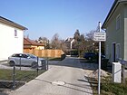
30th | symbolic name for the residents' closeness to nature | March 31, 2011 | The street is an eastern cul-de-sac from Friedrich-Engels-Straße between Zingergraben and the northern parallel Im Igelgrund in the locality of Nordend. The designation was made at the request and at the expense of the community of owners as an access route to the construction site at Friedrich-Engels-Strasse 112. In connection with the redevelopment of the area of the former KGA “Friedrich-Engels-Strasse”, two access routes were created for the development of the newly created properties built. The applicants opted for the names "Im Igelgrund" and "Am Meisenwinkel" to show their closeness to nature. Plots 2 and 3 belong to this private road, the residential complex was built on 6000 m² and borders on the rear of the south-western plots on Weißdornallee . It is noteworthy that the very short access road when the single-family houses were built was not run as a crossroad with Friedrichs-Engels-Straße, but that the adjacent properties already received a georeferenceable address , as operated by the Pankow district in preparation for the ALKS . |
|
| At the temple moat
( Location ) |
180 | nearby Fließ Tempelgraben | Oct 21, 2000 | The street opens up with plots 1–25 (odd, western side), 2–28 (even, eastern side) a new housing estate with type single-family houses, which was built around 2000 on an abandoned allotment area, housing estate on the temple pond. The road lies between Angerweg (no connection for vehicles) and the border to Niederschönhausen , the access road is a cross street of the Schönholzer Weg , which is of the same name and forms the actual Rosenthaler section of the Schönholzer Weg. The settlement is located to the west of the Schönholzer Straße, which belongs to Wilhelmsruh, and is accessed from Am Tempelgraben and Hermann-Günther-Straße , which connect to the (actual) street of this name through the crossway known as Schönholzer Weg . In 2012 and 2013, vacant fallow land belonging to a community of heirs (Carl Nieder Seniorsche Erbengemeinschaft) brought work for the district office, which led to this area being limited from public access with a fence. The Tempelgraben is a small river between the Garibaldi pond to the west in Wilhelmsruh and its outflow into the Zingergraben on the northern edge of Nordendstrasse ; it underlies the street between lots 23/25 and 26/28. The KGA Am Anger connects to the east behind the property, the Tempelgraben runs eastwards through this to the south and then along Nordendstrasse on the Rosenthaler side. The temple moat runs through the aforementioned wasteland, under the responsibility of the Senate Department for Urban Development and the Environment. "A pond in the abandoned facility has to be cleaned of waste by the owner." The street is shown as usable only for residents and has a gate for this at Angerweg, but has an open driveway at the access to Schönholzerweg. |

|
| On the Rollberg
( Location ) |
180 | Rollberg nearby low elevation (59 meters) | July 27, 1927 | The Rollberg is a 59 meter high ice age single elevation north of the street named after it. The road lies between Dietzgen- (suburb of Niederschönhausen) and Schönhauser Strasse in the Nordend area. In the mid-1950s there were street 48 , street 49 and street 50 on the north side of the street as short access roads to the site of today's KGA 'Am Rollberg'. In the north end of 1900 these led to the extended Friedensweg, since the 1950s there have been connections to the adjacent properties. In the 1930 address book Am Rollberg (Post Bln. = Niederschönhausen) with the plots 1–21 (continuous to Schönhauser Straße) and 22–48 (continuous to Blankenfelder Straße) with seven developed properties with houses and garden plots on 1–3, 6– 13, 15, 17, 19-21, 22-28, 30-35 and 37-48. Heinrich Möller's house no. 3 from the years 1920–1925 is a monument. |

|
| On the meadow ground
( Location ) |
200 | here were the "Winkelwiesen" | June 21, 2000 | Previously set up as road 114 of the development plan. The road goes from the main road to the east as an access road to the adjacent residential buildings as a dead end . The street opens up a "residential complex (1–17 north, 2–34 south) Wiesenwinkel" with multi-family houses in the front and single-family houses in the rear, which is located on an area between Hauptstrasse , Nordgraben (Strasse 144) and Bratvogelweg and Rosskastanienhof. This settlement was built on a previously unused green area that was still part of the Winkelwiesen in the corner west of Kastanienallee / Hauptstraße in the early 1990s. The planned train from Straße 144 was built over and existing residential properties on Nordgraben were added to Hauptstraße 83f-83f. |

|
| Andanteweg
( Location ) |
110 | Andante , musical tempo designation | March 15, 1999 | The Andanteweg lies between Debussy and César Franck streets, named after a musician. Before it was named today, the street was called Straße 120 . On the same day, other numbered streets located here were renamed. The street 120 is built in the address book 1935 with four houses (unnumbered) according to the owners and one summer house and is recorded in the course between street 119 and street 121 . Andanteweg 2–6 (straight) and 3–7 (straight) are listed in the directory of the Berlin-Brandenburg Statistical Office for living-world-oriented planning areas. The road is paved, the unpaved edge strips were individually designed by the owners as a parking lane, sidewalk or even planted. |

|
| At the bird pasture
( Location ) |
200 | In the neighboring allotment garden, the paths are named after bird species | Sep 1 1995 | At the bend in the main road at the northern end, it continues straight as a spur road and turns east to Zingergraben and here delimits a settlement of new multi-family buildings whose southern boundary is named Kuckucksweg. The residential complex here is inaccessible to public transport due to barriers, but the street is only the access road to the residential buildings of the state-owned housing association Gewobag that were built here in the 1990s. This residential complex condensed the development in the north of the main street in the area of the Dorfaue, north of the church. The names of Pfauen- and Kuckucksweg in the KGA Alt-Rosenthal gardens to the east and south were used to name the street and settlement. |

|
| At the priest's paddock
( Location ) |
660 | local parcel Priest paddock | Jan. 16, 1925 | The street lies between Nesselweg and Kastanienallee . A western section between Nesselweg and Straße 140 is interrupted by the northern part of the street Own Scholle (cross way) by the north ditch . An der Priesterkoppel (under P) is already included in the 1926 address book as a street between Eiskutenweg (since 1934 Rispenweg ) and Reichskanzlerdamm (since 1951 Friedrich-Engels-Strasse) with the built-up and inhabited properties (single-family houses) 20, 21, 23, 25, 26. The north trench was only drawn through its course after the road had been built. According to the description from 1926, the road between Friedrich-Engels-Strasse and Nesselweg was not realized, but was extended between Rispenweg / Bergrutenpfad and Kastanienallee. The unpaved road in the southeast has the same equipment as the former settlement (own plaice) ; allotments (allotment gardens Tiefland and allotment gardens Rosenthal) border the road. In the north-western area mainly single-family houses were built. The unpaved road in the south-east has the original character of a settlement with the allotment gardens (KGA 'Tiefland' and 'Rosenthal'), otherwise mostly new single-family houses have been built. |

|
| Angerweg
( Location ) |
860 | local parcel "Der Anger" | after 1915 | The concrete street with narrow sidewalks is located between Schönholzer Weg and Friedrich-Engels-Straße / corner of Kastanienallee. KGA Am Anger and KGA Wasserwerk Rosenthal are on the south side of the street. The only large building is the former official house of the Rosenthal waterworks, pumping station. The north side is mostly built on with settlement houses. In the 1922 address book, not the Angerweg, but “Wasserwerk, next Reichskanzlerdamm” with the civil servants' house owned by the city of Berlin for five waterworks officials as residents. This description can be found in the address books up to 1939. In the 1941 address book, the Angerweg can be found for the first time with the odd numbered plots 1–55, 13 of which are built on and inhabited, as well as two with summer houses and one new building, from here street 119, 121 , 123 and 124 . The pumping station (owned by the City of Berlin) is located on plot 47-55. On the south side (unnumbered) the arbor area and the sports field are noted, on the plots 20-58 there is the waterworks and in particular the official house named (as an inhabited building without number assignment) with the leader of the municipal drainage institute, building and operations office Pankow, and four residents ( Schmide, machine operator, driver and toolmaker). On old maps, the area north of today's Nordendstrasse on both sides of the Zingergraben and southwest of the Priesterkoppel is called "Der Anger", an area that is now covered by the KGA 'Am Anger' and the northern settlement of Kastanienallee. Anger refers to a mostly grassy, jointly owned land that belonged to the Rosenthaler Feldflur at this location. |

|
| Anise path
( Location ) |
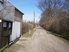
210 | anise | Sep 7 2011 | The road, formerly Primelweg , lies between the mountain and meadow herb path , across the north ditch to the south. The district office of Pankow renamed 35 system paths of the garden complex unity between Mönchmühler, Schönhauser, Dietzgenstraße and Blankenfelder Chaussee as private streets after herbs, medicinal and aromatic plants. |
|
| Anton-Webern-Weg
( Location ) |
150 | Anton Webern (1883–1945), Austrian composer | March 15, 1999 | Before that, as street 118 , it lies between Schönholzer Weg and Debussystraße. On the same day, other numbered streets located here were renamed. In the 1943 address book, street 118 , under Post Bln. = Wilhelmsruh and completely built-up between Schönholzer Weg and Straße 119 , is noted across a private street . In 1935 the street 118 was taken from the Schönholzer Straße to the street 119 , ten houses each inhabited by a family are entered unnumbered, in today's Anton-Weber-Straße 2–12 (even) and 3–11 (odd) are with Settlement houses and town villas built on with front gardens, the roughly two-lane road is paved and has unpaved green verges that are used as a parking lane. |

|
| Aralienweg
( Location ) |
100 | Araliaceae , plant family | Feb. 1, 2000 | The Aralienweg is an arched cul-de-sac that branches off south of the Am Rollberg street. It is the access road to a residential complex with multi-storey houses from the 2000s in the Nordend area. |

|
| Arnsteinweg
( Location ) |
140 | Arnstein, rocks in Saxon Switzerland | Nov 12, 2013 | The Arnsteinweg is a private road in the Schönwald garden colony and is the fifth crossing path from Schönhauser Straße from Liliensteinweg to the south to Lasensteinweg. Named as path 5 before naming within the facility . The designation of the garden path by the Pankow district as a private road was carried out for better georeferencing of the properties in preparation for the nationwide introduction of the computer-based property cadastre information system . |

|
| Auffacher way
( Location ) |
100 | Auffach , place in Tyrol, Austria | Aug 2, 1997 | It is located between Schönhauser Strasse and Niederauer Weg. It was laid out in the 1930s with the new settlement here and built with multi-family houses from the 2000s. This housing estate also includes houses along the Bergrutenpfad and along Schönhauser Straße. |

|
|
Basil path
( Location ) |
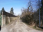
210 | basil | Sep 7 2011 | The road, formerly Rosenweg , lies between the mountain and meadow herb path , across the north ditch to the south. The district office of Pankow renamed 35 system paths of the garden complex unity between Mönchmühler, Schönhauser, Dietzgenstraße and Blankenfelder Chaussee as private streets after herbs, medicinal and aromatic plants. |
|
| Basteiweg
( Location ) |
130 + 90 + 100 + 100 + 110 | Bastei , rock formation in Saxon Switzerland | Nov 12, 2013 | The Basteiweg is a private road in the Schönwald garden colony and opens up from Lorenzweg to the northern tip of the complex, which, bounded by the Wiesenweggraben, 'protrudes' into the Einigkeit complex. Prior to the naming within the facility, the direct access Elsterweg and the parallel paths Fuchs - Wiesel -, Drosselweg following eastwards were named. |

|
| Benediktsteinweg
( Location ) |
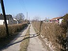
120 | Benediktstein, rock in Saxon Switzerland | Nov 12, 2013 | The Benediktsteinweg is a private road in the Schönwald garden colony and is the third crossing path from Schönhauser Straße from Liliensteinweg to the south to Lasensteinweg. Named as path 3 before being named within the facility . The designation of the garden path by the Pankow district as a private road was carried out for better georeferencing of the properties in preparation for the nationwide introduction of the computer-aided property cadastre information system . |
|
| Mountain trail
( Location ) |
280 | old hallway name | Jan. 23, 1931 | Previously known as Straße 99a, it is located between Schönhauser Straße and Rispenweg. In the site plan from 1780 there is the parcel “the Berg Ruthen”, which was probably the inspiration behind the name. This path is already indicated for 1935 and single-family houses are built on 10, 12 and 14. These residential buildings from the 1930s on the western side of the street were supplemented on the other side of the street and on open spaces by the 2000s when the settlement to the east was built, with a sidewalk with green strips being laid on the eastern side of the street. The new development area consists of single and multi-family houses, in the southern part of the street the lowland allotment garden borders. |

|
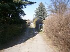
| Bernhardsteinweg
( Location ) |
140 | Bernhardstein, rocks in Saxon Switzerland | Nov 12, 2013 | The Bernhardsteinweg is a private road in the Schönwald garden colony and is the fourth crossing path from Schönhauser Straße from Liliensteinweg to the south to Lasensteinweg. Named as path 4 before naming within the facility . The designation of the garden path by the Pankow district as a private road was carried out for better georeferencing of the properties in preparation for the nationwide introduction of the computer-aided property cadastre information system . |
|
| Birch avenue
( Location ) |
280 | Birch , deciduous tree | before 1905 | It is located between Nordendstrasse and the Kastanienallee, which has a similar name, in the locality of Nordend. It is already listed by name in the directory for Berlin from 1908. In the 1943 address book it is included (belonging to Niederschönhausen) with twelve multi-family and single-family houses on the twelve plots between Kastanienallee and Nordendstrasse. |

|
| Bolero path
( Location ) |
250 | Bolero , dance in 3/4 time | March 14, 1999 | The former street Straße 122 lies between César-Franck- and Maurice-Ravel-Straße. Ravel's Bolero is one of his most famous pieces of music. On the same day, other numbered streets located here were renamed. The 1935 address book names the street 122 located between street 124, street 123 and street 121 and built on with six residential houses and a few summer houses. Since the 1980s at the latest, it has been a narrow asphalt road with unpaved edge strips and without street drainage with partially newly built residential buildings on the properties Boleroweg 1–23 (odd) and Boleroweg 2–22 (even). |

|
| Bratvogelweg
( Location ) |
270 | Bratvogel , local farming family | May 5, 1994 | The street lies between Wurstmacherweg and Kastanienallee, it was created as a paved and closed access road to the adjacent residential buildings of the "Wohnanlage Wiesenwinkel" (3–17, odd west, 2–18 straight east) with apartment buildings. The road is laid out with sidewalks and edge trees. In the southern part of the Kastanienallee, opposite the residential buildings, is the Rudolf-Dörrier-Grundschule. This settlement was built on a previously unused green area, which was part of the Winkelwiesen in the corner west of Kastanienallee / Hauptstraße in the early 1990s . In the middle of the street, a small parking area was preserved with trees on the edge. The Bratvogel family took over a farm in Rosenthal from the Wilcke family, who had managed it in the 19th century. The street name after local people complements the adjoining residential complex on Wurstmachserweg to the east. |

|
| Brausensteinweg
( Location ) |
100 | Brausenstein, rock in Saxon Switzerland | Nov 12, 2013 | The Brausensteinweg is a private road in the Schönwald garden colony and is the first crossroad from the Liliensteinweg north to the Lorenzsteinweg from Schönhauser Straße. Named as route 16 before being named within the facility . The designation of the garden path by the Pankow district as a private road was carried out for better georeferencing of the properties in preparation for the nationwide introduction of the computer-aided property cadastre information system . |

|
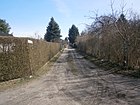
| Watercress trail
( Location ) |
300 | Watercress | Sep 7 2011 | The road lies between the lady's mantle and medicinal herb path and parallel to the herb path. It was previously called Brunnenweg , which is indicated by the choice of name. The district office of Pankow renamed 35 system paths of the garden complex unity between Mönchmühler, Schönhauser, Dietzgenstraße and Blankenfelder Chaussee as private streets after herbs, medicinal and aromatic plants. |
|
| Buntsteinweg
( Location ) |
220 | Buntstein, a type of rock typical for the Berlin area, which is inserted on the "Geological Wall" in the nearby Botanical Volkspark | January 29, 2014 | The path previously referred to as the Apple Path in the complex is east-west between Dietzgenstraße and Zechsteinweg. The ways in which, investment Northrend were from the district office as private roads dedicated as the previous building addresses as Dietzgenstraße 186 not followed by garden path specified Georeferencing were. This became necessary so that the computer-based rescue programs of the police and fire brigade are ensured and in particular due to the requirements of the nationwide conversion of the real estate cadastre . The naming procedure was carried out in accordance with Section 5, Paragraph 1, Clause 2 of the Berlin Roads Act, including inquiries from the other civil engineering and landscape planning offices in Berlin and the Berlin-Brandenburg Statistics Office, as well as coordinating with the District Women's Council. The naming of the private roads was made at the request of the owner of the Nordend facility, Liegenschaftsfonds GmbH & Co. KG, Warschauer Str. 41/42, 10243 Berlin. The plant path was called the apple path . The Buntsteinweg goes from Dietzgenstraße into the settlement to Zechsteinweg. |

|
|
Charlottenstrasse
( Location ) |
40 (in the district) |
Sophie Charlotte (1668–1705), Queen in Prussia | 1899 | Located between the border to Niederschönhausen on the Rosenthaler Grenzweg (crossing excluded) and road 52b, the plots 31J and 31L in the Nordend area belong to the district. Most of the road continues south to Wackenbergstraße in Niederschönhausen . |

|
| César-Franck-Strasse
( Location ) |
430 | César Franck (1822–1890), French composer | March 14, 1999 | Previously set up as Street 121 , it is located between Kastanienallee and Angerweg . On the same day, other numbered streets located here were renamed. As Straße 121 this paved least since the 1980s, two-lane connection between Kastanienallee and Angerweg about is road 120 away built in the address book in 1935 with 17 houses, which are named after the owners and not listed as numbered plots. In the address directory of the Berlin-Brandenburg Statistics Office, the properties César-Franck-Straße 1–29 (odd) and 2–44 (even) are listed, the residential buildings are partly two-story, but have already been replaced by multi-story apartment buildings. |

|
| Cent way
( Location ) |
100 | Cent , replaced the penny since 2000 | May 1, 2006 | The street is between Mönchmühler / Hauptstraße and in the arch to Straße 127 , parallel to Straße 126 and north of KGA 'Rosenthal Nord'. Previously, it was laid out as Straße 125 and was then undedicated in the former "Ziekow Colony". The street was named after a change of ownership at the request of the owners' association of the former allotment garden 'Ziekow' in 2001. The former leased properties were to be given a street name on the common path, as the name Street 125 was no longer printed in the city maps Loss of the KGA 'Ziekow' the path in it is no longer listed as street 125 . The community of owners of the garden colony that has been converted into a residential complex decided on the name Centweg. They wanted a contemporary and uncomplicated street name and therefore chose the smallest unit of our European currency. After the inquiry with the other civil engineering offices revealed the unambiguousness of the designation , the decision to designate the district office was taken. |

|
| Chilli way
( Location ) |
210 | chili | Sep 7 2011 | The road lies between the mountain and meadow herb path, across the north ditch to the south. The district office of Pankow renamed 35 system paths of the garden complex unity between Mönchmühler, Schönhauser, Dietzgenstraße and Blankenfelder Chaussee as private streets after herbs, medicinal and aromatic plants. The previous name was Grabenweg , because the path ran (across) from or to the Nordgraben. |

|
| Cupetiussteinweg
( Location ) v |
320 | Cupetiusstein, rock in Saxon Switzerland | Nov 12, 2013 | The private road is in the KGA Am Rollberg. It lies between the Wiesenweggraben and the southern border of the KGA north of the Am Rollberg property and forms the western end of the allotment garden complex, it crosses the Liliensteinweg, which forms the main path to the west to the Schönwald complex. This private path coincides with Bergeshöh, the name of the previous garden path. The designation of the garden path by the Pankow district as a private road was carried out for better georeferencing of the properties in preparation for the nationwide introduction of the computer-based property cadastre information system . |

|
| Curry herb trail
( Location ) |
130 | Curry herb | Sep 7 2011 | The road lies between the medicinal herbs and herbs path, across the north ditch to the north. The district office of Pankow renamed 35 system paths of the garden complex unity between Mönchmühler, Schönhauser, Dietzgenstraße and Blankenfelder Chaussee as private streets after herbs, medicinal and aromatic plants. Previously, the path in the facility was called Georgienweg. | |
|
Dammsmuehler Street
( Location ) |
800 | Gut and Dammsmühle Castle on Lake Mühlenbeck | July 26, 1927 | The street is between Dietzgenstraße and Straße 132 parallel to Kirchstraße in the locality of Nordend. The son of the head of Amt Pankow built Dammsmühle Castle into a manor. In the 1930 address book, Dammsmühler Straße (Post Bln = Niederschönhausen) between Blankenfelder Straße and Schönhauser Straße is listed, 13 of the 37 consecutively numbered properties are built on with residential buildings, five are designated as garden parcels. After the 1950s, Straße 133 (listed in the address book in 1940) , which was laid out after 1935, was incorporated west of Schönhauser Straße to Straße 132 in Dammsmühler Straße. |

|
| Debussystrasse
( Location ) |
300 | Claude Debussy (1862-1918), French composer | March 14, 1999 | Previously laid out as road 119 , it is located between Angerweg and Strawinskystraße. On the same day, other numbered streets located here were renamed. The street 119 is indicated in the address book 1935 between Angerweg via street 118 and street 120 in the Feldmark. Twelve residential houses are built, which are not numbered according to the plot of land, but are named after the owners of the single-family houses. In 2013, the built-up lots Debussystraße 1–29 (odd) and 2–26 (even) are named in the directory of streets of the Berlin-Brandenburg Statistical Office. The paved road without sewerage has two unpaved green edge strips in front of the property, some of which were designed as sidewalks by the owners. In addition to two-story residential buildings, there are also ground-floor low-rise buildings here. |

|
| Dietzgenstrasse
( Location ) |
1380 (in the district) |
Josef Dietzgen (1828–1888), materialist philosopher, socialist theorist | Apr 12, 1951 | The federal highway 96a runs partly on the Dietzgenstraße. In the east of the district it belongs to the local situation Nordend (plots 102-192, straight) in connection with the road in the south of Niederschönhausen . So it lies in the entire length between the southern border of the district (Schillerstraße) to the northern border to Blankenfelde (Rosenthaler Weg). When the Magistrate of Greater Berlin renamed it in 1951 , Kaiser-Wilhelm-Strasse was given the new name. On November 1, 2006, Blankenfelder Strasse , which ran between Blankenfelder Chaussee (named after 1961) and Dietzgenstrasse, was included in Dietzgenstrasse as part of the removal of duplicate names. The Nordend-Arena and the Bolle-Sportplatz (Blankenfelder Straße 96 and 108) are listed as a complete facility from the years 1920-1925 with changing building and grandstand, rebuilt 1938-1939. Parts of the Nordend cemeteries (see cemetery list ) are also listed. |

|
| Dillweg
( Location ) |
200 | dill | Sep 7 2011 | The road lies between the mountain and meadow herb path, across the north ditch to the south. The district office of Pankow renamed 35 system paths of the garden complex unity between Mönchmühler, Schönhauser, Dietzgenstraße and Blankenfelder Chaussee as private streets after herbs, medicinal and aromatic plants. Previously, the path in the facility was called Levkojenweg. |

|
| Dinkelweg
( Location ) |
170 | Spelt | Sep 7 2011 | The street, previously known as the Petunienweg , lies between the medicinal herb and herb path , from the edge of the district to the north ditch. The district office of Pankow renamed 35 plant routes of the garden and settler community 'Unity' between Mönchmühler, Schönhauser, Dietzgenstrasse and Blankenfelder Chaussee as private roads after herbs, medicinal and aromatic plants. The renaming of the paths designated by the settler community to dedicated partially public private roads took place in the district with nationwide georeferencing in order to improve digitization. |

|
| Thistle path
( Location ) |
130 | Thistles , prickly, herbaceous plants | 28 Sep 1995 | It goes off from the named Nesselweg as a western cul-de-sac. The street is a newly created cul-de-sac in the mid-1990s when a residential complex with condominiums in multi-storey residential buildings was built on an open-air site. The existing residential area here is considered to be very good. |

|
| Döbrabergweg
( Location ) |
160 | Döbraberg is the highest point in the Franconian Forest (Bavaria) | Jan. 31, 1931 | The street previously set up as street 117 is located between Kastanienallee and Kirchstraße, to the west parallel to Erbeskopfweg in Nordend. Two-story residential buildings from the 1930s stand on both sides of the cobblestone street with developed sidewalks and front gardens. For 1935, the street as the Niederschönhausen post office was already fully built up with twelve four-family houses, the owner is the housing welfare organization. Berlin mbH | |
| Own clod
( Location ) |
1270 | own plaice (own land) Name of the settlement of the association “Eigen Siedlung 1930 e. V. " | Jan. 31, 1925 | As a side street, the street encloses the area of the Eigen Scholle settlement between Friedrich-Engels-Straße and Schönhauser Straße, southeast of Nordgraben and northwest of Zingergraben. The northern branch along the Nordgraben goes south of the Nordgrabenbrücke from Schönhauser Straße opposite the Gebirgskräuterweg and 350 meters to the south-east there is a southern branch. The western section of the road connecting these lies parallel between Friedrich-Engels-Strasse and An der Priesterkoppel and crosses Rispenweg. At the Priesterkoppel the course of the road separates: to the east are the allotment gardens and to the west are the settlement houses. The southern section leads as a street-wide path through the allotment gardens northwest of Zingergraben and separates KGA Tiefland (northwest) and KGA Neuland Rosenthal (southeast). The street name applies to the part of the 'Eigen Scholle' settlement east of Friedrich-Engels-Straße (formerly on both sides of Reichskanzlerdamm). The settlement name “Eigen Scholle” also refers to areas west of Friedrich-Engels-Straße. In the address book 1932 the location with the plots 1–4 between An der Priesterkoppel and Eiskutenweg , with 6–11 to An der Priesterkoppel, 11–20 to Eiskutenweg and 21–30 again to An der Priesterkoppel, 21 residential houses, a summer house and four as a garden plot, the rest as a construction site. The northern section of the road runs west of An der Priesterkoppel to the section that bends to the south, the northern trench is behind the property. The continuation north-east of An der Priesterkoppel, a (three-lane wide unpaved) road south of the north ditch is sometimes referred to as “Eigen Scholle” as far as Schönhauser Straße. Since the route of road 140 was here before the construction of the north trench, this route is (additionally) marked as road 140. According to the official map 1: 5000 this path is unnamed and not shown separately, the mountain herb path then continues over Schönhauser Straße. |

|
| Verbena trail
( Location ) |
190 | Verbena | Sep 7 2011 | The road lies between the mountain and meadow herb path, across the north ditch to the south and was previously called the Resedaweg . The district office of Pankow renamed 35 system paths of the garden complex unity between Mönchmühler, Schönhauser, Dietzgenstraße and Blankenfelder Chaussee as private streets after herbs, medicinal and aromatic plants. |

|
|
Erbeskopfweg
( Location ) |
155 | Erbeskopf is the highest point in the Franconian Forest (Bavaria) | Jan. 31, 1931 | The street, which was established as part of street 113 according to the development plan, was laid out and named in 1931. It is located between Kastanienallee and Kirchstraße, east parallel to Döbrabergweg in the locality of Nordend. As for this, in the 1935 address book for the eleven four-family houses built here on 1–11 (odd, west side) is the housing welfare service. Berlin mbH named as builder and owner. Now the east side of the street on plots 4–10 is also built on; there are commercial buildings here. | |
| Eschenallee
( Location ) |
190 | Ash , deciduous tree | before 1925 | It is located between Nordendstrasse and the name-like Kastanienallee in Nordend. In the 1943 address book it is (belonging to Niederschönhausen) built on with four apartment buildings and three single-family houses on lots 1, 3, 4 and is located between Kastanienallee and Nordendstraße, street 90 goes off. In the square of Eschenallee / Abajstraße / Taufsteinweg / Nordendstraße there is the Embassy of Kazakhstan railing, previously an undeveloped area between Rosenthal and Niederschönhausen, with ambassadors' seats in the area during GDR times. |

|
| Tarragon path
( Location ) |
210 | tarragon | Sep 7 2011 | The street, previously Nelkenweg , lies between the medicinal herbs and herbs path , across the north ditch to the north. The district office of Pankow renamed 35 system paths of the garden complex unity between Mönchmühler, Schönhauser, Dietzgenstraße and Blankenfelder Chaussee as private streets after herbs, medicinal and aromatic plants. |

|
|
Field herb path
( Location ) |
960 | Field herbs , collective term for herbs growing in the arable field | Sep 7 2011 | The road lies between the Gebirgskräuterweg and Chiliweg and was previously called Feldweg in the western section at an angle along the Zinger- and Wiesenweggraben , which is what the name refers to. In the western section it is supplemented by the previous middle way . The district office of Pankow renamed 35 system paths of the garden complex unity between Mönchmühler, Schönhauser, Dietzgenstraße and Blankenfelder Chaussee as private streets after herbs, medicinal and aromatic plants. The path through the allotment gardens branches off from the hiking trail at Nordgraben and follows the southern Zingergraben. From the junction you can see the small cascade with which the northern Zingergraben pours into the northern trench. It is part of the Zingergraben hiking trail. |

|
| Frauenmantelweg
( Location ) |
440 | Lady's mantle | Sep 7 2011 | The road lies between Wildkräuter and Wiesenkräuterweg (across the north ditch). Before the renaming, the Blumenweg was north of the Nordgraben , which means that the road bridge over the Nordgraben is called the Blumenwegbrücke, the southern section was previously called the Kornblumenweg . The district office of Pankow renamed 35 system paths of the garden complex unity between Mönchmühler, Schönhauser, Dietzgenstraße and Blankenfelder Chaussee as private streets after herbs, medicinal and aromatic plants. |

|
| Friedrich-Engels-Strasse
( Location ) |
1280 (in the district) |
Friedrich Engels (1820–1895), philosopher | May 24, 1951 | The street is between Nordendstraße (the intersection excluded) and Hauptstraße / Wilhelmsruher Damm in the district, the further street routing to the southeast to Pastor-Niemöller-Platz / Hermann-Hesse-Straße / Grabbeallee continues in Niederschönhausen . Before the renaming campaign in 1951, the street in the district was run as Reichskanzlerdamm . It was laid out as the main road when the development of the area of the Eigener Scholle settlement, which lies on both sides of the road. The street, now an important link between Pankow and the Märkisches Viertel , is being renovated. 1090 meters of the road are used as a higher-level road connection in the Berlin road network . With the fall of the Wall in 1961 , this street in the north of Berlin became more important due to the reusable Wilhelmsruher Damm and serves as a replacement for the missing northern bypass . The tram line M1 runs on the street , the tracks are mainly on the side, as only the western side of the street (often in cobblestone) is developed. The planned western carriageway has been partially developed (preferably north of Kastanienallee) as an access road for the residential buildings on the west side. The residential properties 108 and 103-109 southeast of the Zingergraben belong to the locality of Nordend. |

|
| Friensteinweg
( Location ) |
520 | Frienstein, rock in Saxon Switzerland | Nov 12, 2013 | The private road is in the KGA 'Am Rollberg'. It leads to both sides of Liliensteinweg, the main path of the KGA and lies between the north and south edges of the KGA, whereby the path on the south edge of the facility still leads east to Dietzgenstrasse and marks the end of the KGA to the south. The previous name on the southern edge was Drescherweg , south of the main path was the Nelkenweg , north of the Gustavweg . The Frienweg also borders the central club square with the garden home to the east. The designation of the garden path by the Pankow district as a private road was carried out for better georeferencing of the properties in preparation for the nationwide introduction of the computer-aided property cadastre information system . |

|
|
Mountain Herb Trail
( Location ) |
1150 | Mountain herbs, as a collective term for medicinal herbs that grow in the mountains | Sep 7 2011 | The street is between Schönhauser Strasse and Dietzgenstrasse (along the Nordgraben). The district office of Pankow renamed 35 system paths of the garden complex unity between Mönchmühler, Schönhauser, Dietzgenstraße and Blankenfelder Chaussee as private streets after herbs, medicinal and aromatic plants. The previous name was due to the location Am Nordgraben , the new choice of name for the path is due to the deep cut of the clarification field trap on site. Due to its location on the Nordgraben, the Gebirkskräuterweg is a section of the Humboldt-Spur , number 16 of the 20 green main paths in Berlin between Tegeler Schloss and the Wuhletal. |

|
| Gierschweg
( Location ) |
160 | Giersch | Sep 7 2011 | The road lies between the mountain and field herb path, across the north ditch to the south and was previously called the Mohnweg . The district office of Pankow renamed 35 system paths of the garden complex unity between Mönchmühler, Schönhauser, Dietzgenstraße and Blankenfelder Chaussee as private streets after herbs, medicinal and aromatic plants. | |
| Goldenrod Trail
( Location ) |
300 | Goldenrods | Sep 7 2011 | The road lies between the herb and medicinal herb path , across the north ditch at the herb square to the north, previously Asternweg . The district office of Pankow renamed 35 system paths of the garden complex unity between Mönchmühler, Schönhauser, Dietzgenstraße and Blankenfelder Chaussee as private streets after herbs, medicinal and aromatic plants. |

|
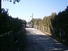
| Granite path
( Location ) |
660 | Granite , a type of rock typical for the Berlin area, which is inserted on the "Geological Wall" in the nearby Botanical Volkspark | January 29, 2014 | Before that, the granite path in the facility was called Fliederweg and the cross path included was called Schneeballweg . It is the south-east-west route in the complex, located between Dietzgenstrasse and Lehmweg with a square on Nordgraben. The paths of the garden small settlement Northrend (previously, investment Northrend) were from the district office as private roads dedicated as the previous building addresses as Dietzgenstraße 186 not followed by garden path specified Georeferencing were. This became necessary so that the computer-based rescue programs of the police and fire brigade are ensured and in particular due to the requirements of the nationwide conversion of the real estate cadastre . The naming procedure was carried out in accordance with Section 5, Paragraph 1, Clause 2 of the Berlin Roads Act, including inquiries from the other civil engineering and landscape planning offices in Berlin and the Berlin-Brandenburg Statistics Office, as well as coordinating with the District Women's Council. The private roads were named at the request of the owner of the 'Anlage Nordend', Liegenschaftsfonds GmbH & Co. KG, Warschauer Str. 41/42, 10243 Berlin. |
|
|
Main road
( Location ) |
1370 | the main street in the district | around 1900 | The street, which has been used as a village street since the village was founded, officially became the main street around 1900 with the surrounding settlement. It is located in a street between Wilhelmsruher Hauptstrasse and Mönchmühler Strasse, which adjoins it in the north. In an east-west direction the street crosses Friedrich-Engels-Straße and Wilhelmsruher Damm to the connection between the Niederschönhausen and the Märkisches Viertel , which was interrupted during the time of the Berlin Wall . The main street is a cobblestone street from the 1960s, it has been paved continuously since 1895, because the damp and sandy subsoil does not allow good paving. Since Rosenthal is an area monument, it will remain a cobblestone street.
Architectural monuments: The central buildings on Hauptstraße between house numbers 90 and 186 (even) and 97–187 (odd) belong to the Dorfanger monument ensemble. All of these residential buildings, some with stables, coach houses or farm buildings from the years 1860–1950, are independent on the List. The ensemble part “Dorfkrug with house and ballroom” in Hauptstrasse 134 from around 1900 is mentioned separately. The former Rosenthal water tower was blown up on December 19, 1958. The country house with the water tower is located at Hauptstrasse 94. This was built as a community school, then as town hall, then again as a school, in GDR times as the “House of Pioneers”. The construction costs of the "Landhaus Rosenthal" as a school were largely paid for from the church treasury. |

|
| Witch Hazel Path
( Location ) |
90 | Witch hazel | Sep 7 2011 | The road lies between the mountain and field herb path, across the north ditch to the south, parallel to the Gierschweg and was previously called Lindenweg . The district office of Pankow renamed 35 system paths of the garden complex unity between Mönchmühler, Schönhauser, Dietzgenstraße and Blankenfelder Chaussee as private streets after herbs, medicinal and aromatic plants. | |
| Medicinal herb trail
( Location ) |
1480 | Medicinal herbs | Sep 7 2011 | The street lies between Mönchmühler Straße and Kräuterweg along the northern edge of the facility, previously the paths were called Auf dem Damm (west), Am Botanical Garden (east) and at the east end the school garden path was included. The district office of Pankow renamed 35 system paths of the garden complex unity between Mönchmühler, Schönhauser, Dietzgenstraße and Blankenfelder Chaussee as private streets after herbs, medicinal and aromatic plants. The path forms the border with Blankenfelde and lies on the embankment of the former Tegel – Friedrichsfelde industrial railway , bordering the floodplain of the Zingergrabenniederung in the west and the botanical complex in the east . |

|
| Hermann-Günther-Strasse
( Location ) |
200 | Hermann Günther († after October 1908), Reinickendorfer master baker | March 17, 2001 | With lots 2–28 (straight, only on the eastern side), the street opens up a new housing estate with single-family houses that was built around 2000 on an abandoned allotment garden. The road lies between Angerweg and Schönholzer Weg , 90 meters above the latter to the border of Niederschönhausen . The settlement is located west of the Schönholzer Straße, which belongs to Wilhelmsruh, and is accessed from Am Tempelgraben and Hermann-Günther-Straße, which connect to the main street through Schönholzer Weg . The Tempelgraben leads under the street between the lots 26/28, opposite are the backs of Schönholzer Straße 22b and 22c. Hermann Günther bought land on the Rosenthaler Feldmark and built country houses in the Wilhelmsruh colony to the south (since 2001: Pankow district ) with the approval of the Rosenthaler community board . As a sponsor, he gave money for the school and a cemetery . The road is shown as only usable for residents and has a gate on Angerweg, but has an open driveway at the branch access to Schönholzerweg. |

|
| Hohler-Stein-Weg
( Location ) |
150 | Hohler Stein, rock formations in Saxon Switzerland | Nov 12, 2013 | The private road is located in the KGA 'Am Rollberg' south of Liliensteinweg to Friensteinweg on the southern edge of the facility. The name of the garden path was Erichweg . The designation of the garden path by the Pankow district as a private road was carried out for better georeferencing of the properties in preparation for the nationwide introduction of the computer-aided property cadastre information system . |

|
| Coltsfoot Trail
( Location ) |
340 | Coltsfoot | Sep 7 2011 | The road lies between the herb and medicinal herb trail north of the north ditch, previously Veilchenweg . The district office of Pankow renamed 35 system paths of the garden complex unity between Mönchmühler, Schönhauser, Dietzgenstraße and Blankenfelder Chaussee as private streets after herbs, medicinal and aromatic plants. |

|
|
Ginger path
( Location ) |
370 | ginger | Sep 7 2011 | The street lies between the herb and medicinal herb path (corner of the chives path) and was previously called Seeweg , as it leads in the direction of the Great and Small Zingerteich on Blankenfelder Flur . The district office of Pankow renamed 35 system paths of the garden complex unity between Mönchmühler, Schönhauser, Dietzgenstraße and Blankenfelder Chaussee as private streets after herbs, medicinal and aromatic plants. |

|
| In the Igelgrund
( Location ) |
80 | symbolic name for closeness to nature | March 31, 2011 | The street is an eastern cul-de-sac from Friedrich-Engels-Straße between Zingergraben and the southern parallel Am Meisenwinkel and still belongs to the locality of Nordend . The designation was made at the request and at the expense of the community of owners as an access route to the construction site at Friedrich-Engels-Strasse 112. In connection with the redevelopment of the area of the former KGA “Friedrich-Engels-Strasse”, two access routes were created for the development of the newly created properties built. The applicants decided on the names to represent their closeness to nature. Plots 1–9 (odd on the west side) and 2–6 (even on the east side) belong to the private road. It is noteworthy that the very short access road when the single-family houses were built was not run as a crossroad with Friedrichs-Engels-Straße, but that the adjacent properties already received a georeferenceable address , as operated by the Pankow district in preparation for the ALKS . |

|
|
Johannes-Kupke-Strasse
( Location ) |
180 | Johannes Kupke (1894–1988), doctor, resistance fighter against the Nazi regime | Oct 1, 2002 | The street is a cul-de-sac to the west of Friedrich-Engels-Straße . The entrance to the street is a little further north on Friedrich-Engels-Straße 149, as the direct length of the street to Friedrich-Engels-Straße is interrupted by the tram tracks. The adjacent plots 1–23 (odd) and 6–12 (even) of the settlement between the side street of the same name from Friedrichs-Engels-Straße to Kastanienallee and the KGA 'Humboldt' (department 'Gray School') were created when the street was laid out 2002 built with uniform double houses. Before that there were allotments on the area. Kupke belonged to the resistance group around Husemann , prevented the shelling of Niederschönhausen by the advancing Red Army and was the first mayor of Niederschönhausen after 1945. |

|
| St. John's wort path
( Location ) |
190 | Johannis herbs | Sep 7 2011 | The road lies between the Wildkräuter- and Herbweg, previous name Goldackerweg . The district office of Pankow renamed 35 system paths of the garden complex unity between Mönchmühler, Schönhauser, Dietzgenstraße and Blankenfelder Chaussee as private streets after herbs, medicinal and aromatic plants. |

|
|
Kabelitzweg
( Location ) |
300 | Kabelitz, old Rosenthal farming family | Nov 21, 1996 | The Kabelitzweg runs between Schönholzer Weg and César-Franck-Straße. The Kabelitz siblings owned the “Dreimäderlhaus”, the location of the former windmill and the “Gasthaus zur Mühle” in Hauptstrasse 84. |

|
| Kampferweg
( Location ) |
420 | Fighter | Sep 7 2011 | The road lies between the chives and herbs path and has a right-angled hook in the path that already existed in the previously called Dahlia path. The district office of Pankow renamed 35 system paths of the garden complex unity between Mönchmühler, Schönhauser, Dietzgenstraße and Blankenfelder Chaussee as private streets after herbs, medicinal and aromatic plants. |

|
| Kastanienallee
( Location ) |
2170 | Chestnut , beech family, often avenue tree | before 1905 | It is located between Dietzgenstrasse and Hauptstrasse , the lots Kastanienallee 1–29a and 102–123 are in the Nordend area. Chestnuts are still standing on both sides and partly in the middle of the partly divided carriageway of this east-west running street . Around 1898, farms were built on Kastanienallee in front with front gardens on the road and fields, barn and coach house to the rear. The street (from Nordend) ended in 1915 at the Rosenthal district in front of the Zingergraben. The extended Kastanienallee with a connection to the main street is included on the address book card . Until the 1990s, the western section of Kastanienallee was a street with two asphalt strips between which there was a green strip planted with chestnuts and the street led through older housing developments. Around 2010 this was expanded to a wide asphalt road with parking pockets on the edge between Wilhelmsruher Hauptstrasse and Friedrich-Engels-Strasse in connection with the newly built residential complexes and in anticipation of its use as a north bypass . The eastern part of the road was created in the Nordend colony, while the western section was initially more of a local connecting road from Rosenthal-Wilhelmsruh, so that the well-off expansion (north route, good residential area) has only recently emerged. |

|
| Katzsteinweg
( Location ) |
150 | Katzstein , rocks in Saxon Switzerland | Nov 12, 2013 | The Katzsteinweg is a private road in the Schönwald garden colony and is the sixth crossing path from Schönhauser Straße from Liliensteinweg to the north to Lorenzsteinweg. Named as route 11 before naming within the facility . It closes off Müllersteinweg and Rotsteinweg to the east. The designation of the garden path by the Pankow district as a private road was carried out for better georeferencing of the properties in preparation for the nationwide introduction of the computer-aided property cadastre information system . |

|
| Pebble path
( Location ) |
110 | Pebbles , a type of rock typical for the Berlin area, which is inserted on the "Geological Wall" in the nearby Botanical Volkspark | January 29, 2014 | Before, the Kieselweg in the complex was called Kornblumenweg . The Kieselweg is an east-north-south route between the Lehmweg am Nordgraben and the Marmorweg. The ways in which, investment Northrend were from the district office as private roads dedicated as the previous building addresses as Dietzgenstraße 186 not followed by garden path specified Georeferencing were. This became necessary so that the computer-based rescue programs of the police and fire brigade are ensured and in particular due to the requirements of the nationwide conversion of the real estate cadastre . The naming procedure was carried out in accordance with Section 5, Paragraph 1, Clause 2 of the Berlin Roads Act, including inquiries from the other civil engineering and landscape planning offices in Berlin and the Berlin-Brandenburg Statistics Office, as well as coordinating with the District Women's Council. The naming of the private roads was made at the request of the owner of the Nordend facility, Liegenschaftsfonds GmbH & Co. KG, Warschauer Str. 41/42, 10243 Berlin. |

|
| Kirchstrasse
( Location ) |
780 | Adjacent parish hall of the Protestant parish Nordend | before 1915 | It is located between Dietzgenstrasse and Strasse 132, north parallel to Kastanienallee and south of the parallel Dammsmühler Strasse, in the locality of Nordend.
The Evangelical Church in Nordend Kirchstrasse 31 at the corner of Schönhauser Strasse 32 based on a design by Fritz Gottlob from the years 1909–1910 is a monument. The move from growing Berlin prompted the construction of a parish hall with a church hall and kindergarten as well as a parish service apartment. In 1909 the colony's settlers inaugurated their parish hall. An air raid in World War II destroyed the ridge turret with the bells, but a bell tower made of field stones was built in the 1950s. The construction of a large church was planned on the current Kirchwiese, the First World War and inflation prevented these plans. The road was laid out before 1902 and named as a Grenzweg and before 1905 as a Grenzstraße . At that time it was the northernmost path in the settlement of Nordend and was therefore given this name. After 1910 the street was renamed because of the construction of the community center . However, this Kirchstrasse is still undeveloped in 1920. After the 1950s, Straße 134 (listed in the address book in 1940) , which was laid out after 1935, was included west of Schönhauser Straße to Straße 132 in Kirchstraße. To the west of Straße 132 to Zingergraben, a non-dedicated driveway remained along the allotment gardens of the KGA 'Windige Ecke'. In 1989, Kirchstrasse was still drawn across Strasse 132 on the plan. This section between Zingergraben and Straße 132 is unpaved and is three lanes wide (10 meters with a green border). At the end near Zingergraben there is a street name sign and the traffic sign "30er zone" . This location on the private road is neither recorded in the Berlin road register nor on the official map of the national map system. |

|
| Kleinsteinweg
( Location ) |
80 | Kleinstein , rock formation in Saxon Switzerland | Nov 12, 2013 | The Kleinsteinweg is a private road in the Schönwald garden colony and is the fourth crossing path from Schönhauser Straße from Liliensteinweg north to Rotsteinweg. Before being named within the facility, named as path 13 . The designation of the garden path by the Pankow district as a private road was carried out for better georeferencing of the properties in preparation for the nationwide introduction of the computer-aided property cadastre information system . |

|
| Kohlbornsteinweg
( Location ) |
150 | Kohlbornstein , rock in Saxon Switzerland | Nov 12, 2013 | The Kohlbornsteinweg is a private road in the Schönwald garden colony and is the seventh crossing path from Schönhauser Straße from Liliensteinweg to the north to Lorenzsteinweg. Systematically named as path 10 before naming within the facility . The designation of the garden path by the Pankow district as a private road was carried out for better georeferencing of the properties in preparation for the nationwide introduction of the computer-aided property cadastre information system . |

|
| Herb place
( Location ) |
80 × 60 | Herbs | Sep 7 2011 | The square with the club house and a locked parking lot is centrally located on the Kräuterweg and lies between Goldenrutenweg and Frauenmantelweg , it is located in the course of the previous main path, which runs centrally through the complex . The district office of Pankow renamed 35 system paths of the garden complex unity between Mönchmühler, Schönhauser, Dietzgenstraße and Blankenfelder Chaussee as private streets after herbs, medicinal and aromatic plants. |

|
| Herbal Trail
( Location ) |
1430 | Herbs | Sep 7 2011 | The street is between Schönhauser Strasse and Dietzgenstrasse. This wide plant road on the northern edge of the north trench was previously called Hauptweg , according to its importance . The district office of Pankow renamed 35 system paths of the garden complex unity between Mönchmühler, Schönhauser, Dietzgenstraße and Blankenfelder Chaussee as private streets after herbs, medicinal and aromatic plants. |

|
| Kümmelweg
( Location ) |
100 + 100 | Caraway seed | Sep 7 2011 | The road is T-shaped between the herb and laurel path to the north ditch and was formed from the previous Lilienweg (N – S) and the Kurzer Weg (E – W). The district office of Pankow renamed 35 system paths of the garden complex unity between Mönchmühler, Schönhauser, Dietzgenstraße and Blankenfelder Chaussee as private streets after herbs, medicinal and aromatic plants. |

|
| Lampertsteinweg
( Location ) |
190 | Lampertstein, Table Mountain in Saxon Switzerland | Nov 12, 2013 | The street is in the KGA 'Am Rollberg' between Liliensteinweg to the north and the Wiesenweggraben. The name of the previous garden path is Alfredweg , it is the eastern private path parallel to Dietzgenstraße. The designation of the garden path by the Pankow district as a private road was carried out in preparation for the nationwide introduction of the computer-aided real estate cadastre information system to better georeference the properties . |

|
| Lasensteinweg
( Location ) |
470 | Laasenstein , mountain in Saxon Switzerland | Nov 12, 2013 | The Lasensteinweg is a private road in the Schönwald garden colony and is located from Schönhauser Straße as the first and seventh crossroad from Liliensteinweg to the south and encompasses the complex south with an east-west section. Correspondingly, the sections within the facility were called Weg 1 and Weg 7 before they were named , while the southern section was called Weg zur Höhe . The latter name referred to the Rollberg to the east . The designation of the garden path by the Pankow district as a private road was carried out for better georeferencing of the properties in preparation for the nationwide introduction of the computer-aided property cadastre information system . |

|
| Clay path
( Location ) |
780 | Clay , a type of rock typical for the Berlin area | January 29, 2014 | The Lehmweg was called 'Nordend' Grenzweg , and a previously unnamed path along Dietzgenstrasse was included in the renaming . The Lehmweg encloses the facility in the west (parallel to Dietzgenstrasse) and in the north along the north ditch . The paths in the garden small settlement Northrend were from the district office as private roads dedicated as the previous building addresses as "Dietzgenstraße 186" is not followed by a garden path specified Georeferencing were. This became necessary so that the computer-based rescue programs of the police and fire brigade are ensured and in particular due to the requirements of the nationwide conversion of the real estate cadastre . The naming procedure was carried out in accordance with Section 5, Paragraph 1, Clause 2 of the Berlin Roads Act, including inquiries from the other civil engineering and landscape planning offices in Berlin and the Berlin-Brandenburg Statistics Office, as well as coordinating with the District Women's Council. The naming of the private roads was made at the request of the owner of the Nordend facility, Liegenschaftsfonds GmbH & Co. KG, Warschauer Str. 41/42, 10243 Berlin. The Lehmweg with the plots 2–16, 22–28, 42, 44 (straight) delimits the further settlement routes in the north and leads eastwards on the former industrial railway line . |

|
| Liliensteinweg
( Location ) |
880 + 60 + 100 | Lilienstein , Table Mountain in Saxon Switzerland | Nov 12, 2013 | This private road connects the 'Schönwald complex' (in the west) with the eastern KGA 'Am Rollberg' as a central facility route and is thus between Schönhauser and Dietzgenstrasse . A cross-path from the KGA Rollberg (previously: Auf der Höh ) going south is included. Before the dedication, the names were in the KGA Rollberg up to the southwest bend in the Schönwald Rollbergweg facility, the western continuation in Schönwald was called Hauptweg . In the Schönwald facility, a (short) north cross path (previously: path 12 ) to Rotsteinweg was included. The designation of the garden path by the Pankow district as a private road was carried out for better georeferencing of the properties in preparation for the nationwide introduction of the computer-aided property cadastre information system . |

|
|
Laurel Path
( Location ) |
510 | laurel | Sep 7 2011 | The road, previously known as the Tulpenweg , lies between the chives path and the north ditch, over the thyme, wild herbs and herbs path . The district office of Pankow renamed 35 system paths of the garden complex unity between Mönchmühler, Schönhauser, Dietzgenstraße and Blankenfelder Chaussee as private streets after herbs, medicinal and aromatic plants. |

|
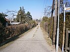
| Lorenzsteinweg
( Location ) |
730 | Lorenzsteine , rock formation in Saxon Switzerland | Nov 12, 2013 | The Lorenzsteinweg is a private road in the Schönwald garden colony. It encloses a northern part of the facility and is located from Schönhauser Strasse on Zingergraben and further on the (west-east) route of the previous Grabenweg to the eastern edge of the facility and leads across the Liliensteinweg as the ninth north crossway (previously: Path 8 ) of the Liliensteinweg to the south. The designation of the garden path by the Pankow district as a private road was carried out for better georeferencing of the properties in preparation for the nationwide introduction of the computer-aided property cadastre information system . |
|
| Luchssteinweg
( Location ) |
120 | Luchsstein , a rock in Saxon Switzerland | Nov 12, 2013 | The Luchssteinweg is a private road in the Schönwald garden colony. From Schönhauser Strasse, take the second crossing from Liliensteinweg north to Rotsteinweg. Systematically named path 15 within the facility (before the official designation) . The designation of the garden path by the Pankow district as a private road was carried out for better georeferencing of the properties in preparation for the nationwide introduction of the computer-aided property cadastre information system . |

|
|
Marjoram path
( Location ) |
330 | marjoram | Sep 7 2011 | The road lies between Wildkräuterweg and Wasserkräuterweg (near Nordgraben), previous name was Fliederweg . The district office of Pankow renamed 35 system paths of the garden complex unity between Mönchmühler, Schönhauser, Dietzgenstraße and Blankenfelder Chaussee as private streets after herbs, medicinal and aromatic plants. |

|
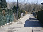
| Marble path
( Location ) |
470 | Marble , a type of rock that is inserted into the “Geological Wall” in the nearby Botanical Volkspark | January 29, 2014 |
Männertreuweg was the name in the annex before it was named. The marble path is located in the middle east-west between Dietzgenstraße and Lehmweg, with only narrow passages at both ends.
The ways in which, investment Northrend were from the district office as private roads dedicated as the previous building addresses as Dietzgenstraße 186 not followed by garden path specified Georeferencing were. This became necessary so that the computer-based rescue programs of the police and fire brigade are ensured and in particular due to the requirements of the nationwide conversion of the real estate cadastre . The naming procedure was carried out in accordance with Section 5, Paragraph 1, Clause 2 of the Berlin Roads Act, which also included inquiries from the other civil engineering and landscape planning offices in Berlin and the Berlin-Brandenburg Statistics Office, as well as coordination with the District Women's Council. The naming of the private roads was made at the request of the owner of the Nordend facility, Liegenschaftsfonds GmbH & Co. KG, Warschauer Str. 41/42, 10243 Berlin. |
|
| Maurice Ravel Street
( Location ) |
230 | Maurice Ravel (1875–1937), composer | Nov 9, 1994 | The street is already longer and it lies between Angerweg and Kastanienallee. Before it was named, it was listed as Straße 124 according to the development plan, and it is included in the 1943 address book with the comment “Post Bln = Wilhelmsruh”. The left side (odd) from Angerweg on road 122 to Kastanienallee with plots 1–19 is built on with single-family houses (1, 3 construction site, 17 three residents) and on the right with the even numbered plots 2 (belongs to Angerweg), 4 (summer house). 6 and 8 (single-family houses). Road 130 goes off between 10 and 12 : 10 and 16 construction site, 12, 14 do not exist, 18 is built on with a private home and 20 belongs to Kastanienallee 88. With the upgrading of the existing residential area (by eliminating commercial space), the street became as well as the neighboring numbered streets named after composers. |

|
| Mittelstrasse
( Location ) |
240 | In the middle of the route from Kastanienallee and Nordendstraße / Straße 52a | 1915 | The street has been in the middle of the triangle of Kastanienallee, Blankenfelder Strasse (since 2006: Dietzgenstrasse) and Schönhauser Strasse since the Nordend settlement was built . The Nordend hospital and convalescent house was located at Mittelstrasse 6-8. This is where Carl von Ossietzky was when he won the Nobel Peace Prize in 1936. In the lung hospital of Dr. Dosquet received treatment for the consequences of his torture in the Sonnenburg and Papenburg concentration camps. |

|
| Mönchmühler Strasse
( Location ) |
240 (in the district) |
Mönchmühle , the direct destination of the road | Aug 4, 1930 | The road extends the main road to the district boundary, the course through the former Rieselfelder has as its destination west of Blankenfelde to Mönchmühle, even if it was only given this official name in 1930, it is already marked in the original measuring table from 1871. The street begins at the intersection of Hauptstraße / Centweg / Straße 126 / Mönchmühler Straße and leads as a cobblestone street through fields of the Zingergrabenniederung (formerly: Rieselfelder) from the Rosenthal churchyard to the Pankow district of Blankenburg. The cemetery of the Protestant parish Rosenthal in Mönchmühler Straße 11 from 1899 is a listed building with a cemetery chapel and enclosure. The cemetery, the church and the houses at Mönchmühler Straße 2 and 9 are part of the "entire village green ensemble" |

|
| Müllersteinweg
( Location ) |
210 | Müllerstein , rocks in Saxon Switzerland | Nov 12, 2013 | The Müllersteinweg is a private road in the Schönwald garden colony and is the third (west / east) parallel path north of the Liliensteinweg between Lorenzstein and Katzsteinweg. Before it was named, it was named as a parallel path within the complex because of its location . The designation of the garden path by the Pankow district as a private road was carried out for better georeferencing of the properties in preparation for the nationwide introduction of the computer-aided property cadastre information system . |

|
|
Evening primrose path
( Location ) |
160 | Evening primrose | Sep 7 2011 | The path is the most westerly between the wild herb and herb path. The previous name was Margeritenweg . The district office of Pankow renamed 35 system paths of the garden complex unity between Mönchmühler, Schönhauser, Dietzgenstraße and Blankenfelder Chaussee as private streets after herbs, medicinal and aromatic plants. |

|
| Nesselweg
( Location ) |
380 | Nettle , a common type of plant | Aug 4, 1930 | It is located between Friedrich-Engels- and Schönhauser Strasse. In 1943 the street in Post Bln. = Wilhelmsruh between Reichskanzlerdamm and An der Priesterkoppel to Schönhauser Straße is recorded in consecutive numbering in the address book. Lot 1 is indicated as a garden, 2–4 are built on with residential buildings, north of An der Priesterkoppel the construction sites follow on 5–11 and on the opposite western side of the street are construction sites 12–23. |

|
| Niederauer way
( Location ) |
140 | Niederau , place in Tyrol, Austria | Aug 2, 1997 | It lies between the Bergrutenpfad and (the name-like) Auffacher Weg . Both streets open up the residential area that was created in the 1990s in the garden to the south-east of the Bergrutenpfad, with homes built by a property developer. |

|
| Nordendstrasse
( Location ) |
430 (in the district) only north side |
Nordend , location of Rosenthal and the neighboring Niederschönhausen | before 1910 | It is located between Schönhauser and Wodanstrasse. A route was already marked on this route before 1900. It was called Rosenthaler Grenzweg as a demarcation from the rural community of Niederschönhausen. Later with the development of the (Rosenthaler) 'Kolonie Nordend' it was renamed to Flurmark Rosenthal, east of Blankenfelder Straße the route continued with a path of the same name. The road area and the south side of the road belong to the neighboring district of Niederschönhausen . The location Nordend actually only includes plots 6–31 (continuous). Nordendstrasse was laid out as an unpaved border route to Rosenthal immediately after the turn of the century. The area around Nordendstrasse is criss-crossed by small moats and used to be very humid. Pankow was supplied with groundwater from here by two waterworks. When these ceased their activities in 1911 and the central water supply came from Stolpe, this led to flood problems all around. One of the first rain sewers was laid under Nordendstrasse to drain the water. The KGA Wasserwerk, with Department III between Nordendstrasse and Zingergraben, refers to this location. |

|
| Nordgrabenweg
( Location ) |
650 | Named after the north ditch that runs here | Feb 21, 2018 | The previously unnamed road south on Nordgraben between Uhlandstrasse and the allotment garden “Humboldt Abt. Neues Heim” (stub road from “Wurstmacherweg”) was named “Nordgrabenweg”. Previously, the adjacent properties were numbered across the surrounding streets, which led to irritation at the post office and the fire department. The initially intended street name in "Weg vor Wilhelmsruh" was rejected by residents. The statistical key number is: 11122. The women's council has been approved. | |
|
Oregano path
( Location ) |
140 + 100 | oregano | Sep 7 2011 | The road is in the west of the facility in a T-shape between Mönchmühler Straße and with a transverse section from the east end to the peppermint and water herb path. This route is based on the two previous garden paths: Grenzweg (transverse N – S) and Weidenweg (from Mönchmühler Straße E – W). The district office of Pankow renamed 35 system paths of the garden complex unity between Mönchmühler, Schönhauser, Dietzgenstraße and Blankenfelder Chaussee as private streets after herbs, medicinal and aromatic plants. The Oreganoweg belongs to section 5 of the settlement. |

|
| Papststeinweg
( Location ) |
150 | Papststein , Table Mountain in Saxon Switzerland | Nov 12, 2013 | The Papststeinweg is located south between Liliensteinweg and Friensteinweg (on the southern edge of the facility) in the KGA Am Rollberg. Before it was named, it was called Schrapeweg in the garden colony. It is the easternmost of the (southern) cross paths parallel to Dietzgenstrasse. The designation of the garden path by the Pankow district as a private road was carried out for better georeferencing of the properties in preparation for the nationwide introduction of the computer-aided property cadastre information system . |

|
| Pfaffensteinweg
( Location ) |
180 | Pfaffenstein , Table Mountain in Saxon Switzerland | Nov 12, 2013 | The street is located in the KGA Am Rollberg as a cross path north of Liliensteinweg to the northern edge of the facility on Wiesenweggraben. Parallel between the continuous eastern Rauenstein and the Zirkelsteinweg. The unused name in the garden was Paulweg , the fourth west of Dietzgenstraße. The designation of the garden path by the Pankow district as a private road was carried out for better georeferencing of the properties in preparation for the nationwide introduction of the computer-aided property cadastre information system . |

|
|
Peppermint Trail
( Location ) |
350 | peppermint | Sep 7 2011 | The road lies between Mönchmühler Straße and Zingergraben and goes straight over the Zingergrabensteg into Queckenweg , the path is on the western section of An der Industriebahn (disused section of the Tegel – Friedrichsfelde industrial line ). The district office of Pankow renamed 35 system paths of the garden complex unity between Mönchmühler, Schönhauser, Dietzgenstraße and Blankenfelder Chaussee as private streets after herbs, medicinal and aromatic plants. |

|
| Pöhligsteinweg
( Location ) |
140 | Pöhligstein, rocks in Saxon Switzerland | Nov 12, 2013 | The Pöhligsteinweg is a private road in the Schönwald garden colony and is located from Lorenzsteinweg to the north in the corner of the complex that is delimited by the Wiesenweggraben, the area to the east is accessed from the Basteiweg . as the fifth crossing from Liliensteinweg to the south to Lasensteinweg. Before it was officially named, it was named Igelweg within the facility . The designation of the garden path by the Pankow district as a private road was carried out for better georeferencing of the properties in preparation for the nationwide introduction of the computer-aided property cadastre information system . |

|
|
Quickborner Strasse
( Location ) |
320 (in the district) |
Quickborn , town in Schleswig-Holstein | Dec 11, 1936 | It lies between Wilhelmsruher Damm and the district boundary to the Märkisches Viertel and continues to Lübars . Before it was renamed, the street was called Lübarser Straße , and in 1936 it was given the same name together with its counterpart Rosenthaler Weg (running to Lübars). Use of the street was interrupted during the time of the Berlin Wall . The Berlin-Rosenthal II station on the Reinickendorf-Mittenwalder Railway, the former station of the Heidekrautbahn , stood on the Rosenthaler Flur on Quickborner Strasse . It was removed at the beginning of the wall era . Immediately in the wall area in front of Uhlandstraße, where the wall stood, was the turning loop of tram line 22. When the road was passed after the turning point, only the direction of travel into the Märkisches Viertel remained free for car traffic at the turning loop (Metrotram line M1). |

|
| Whirl path
( Location ) |
190 | Quirl , Table Mountain in Saxon Switzerland | Nov 12, 2013 | This dedicated private path is located in the KGA Am Rollberg as the northern cross path from Liliensteinweg, the second east of Dietzgenstraße. The previous name was Heinrichweg in the garden. The designation of the garden path by the Pankow district as a private road was carried out for better georeferencing of the properties in preparation for the nationwide introduction of the computer-aided property cadastre information system . |
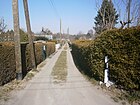
|
| Queckenweg
( Location ) |
310 | Couch grass | Sep 7 2011 | The road lies between the Wasserkräuterweg and the chives path and goes straight over the Zingergrabensteg into the Pfefferminzweg . Queckenweg is located on the eastern section of An der Industriebahn (disused section of the Tegel – Friedrichsfelde industrial line ), and Am Zingergraben was included in the renaming of the Graben to the south in order to assign the historically grown parcels to the new property numbering. The district office of Pankow renamed 35 system paths of the garden complex unity between Mönchmühler, Schönhauser, Dietzgenstraße and Blankenfelder Chaussee as private streets after herbs, medicinal and aromatic plants. |
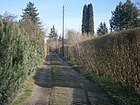
|
|
Rhapsodieweg
( Location ) |
170 | Rhapsody , piece of music | January 15, 1999 | Previously laid out as road 123 . It lies between Angerweg and Boleroweg . Both Debussy and Ravel composed rhapsodies, after which neighboring streets are named. On the same day, other "numbered streets" located here were renamed. In 1935 the address book already lists the street 123 between Angerweg and Feldmark across the street 122 with two houses and a summer house. In the current street directory of the Statistics Office, Rhapsodieweg 1–13 (odd) and 4–12 (even) with residential houses partly in the rear of the plots on a three-lane asphalt road, whose unpaved edge strips are partly used as sidewalks and partly as parking lanes . |

|
| Rauensteinweg
( Location ) |
350 | Rauenstein , Table Mountain in Saxon Switzerland | Nov 12, 2013 | The street is located in the KGA Am Rollberg as a cross path from Liliensteinweg, to the north (previously: Maxweg ) to Wiesenweggraben and to the south (previously: Ottoweg ) to Friensteinweg, each at the edge of the facility. The designation of the garden path by the Pankow district as a private road was carried out for better georeferencing of the properties in preparation for the nationwide introduction of the computer-aided property cadastre information system . |

|
| Rauschensteinweg
( Location ) |
170 | Rauschenstein , sandstone rock in Saxon Switzerland | Nov 12, 2013 | The street is in the KGA Am Rollberg. The path is between Liliensteinweg to the north (eighth from Dietzgenstraße) and the Wiesenweggraben on the northern edge of the facility. Before the plant paths were dedicated, it was called Weidenweg . The designation of the garden path by the Pankow district as a private road was carried out for better georeferencing of the properties in preparation for the nationwide introduction of the computer-based property cadastre information system . |

|
| Rispenweg
( Location ) |
210 | Panicle , genus of sweet grasses | July 13, 1934 | Called the Eiskutenweg between 1925 and 1934 , the path lies between Friedrich-Engels-Straße and An der Priesterkoppel and crosses Eigen Scholle in their western section. Between the creation and the renaming of the path, the north ditch was built and placed deep in the area to secure the drainage. The previous name referred to the common use of natural ice across Berlin at the beginning of the 20th century, which was obtained here commercially from the neighboring pond. The pond fell dry because of the north trench. With the location west of An der Priesterkoppel, the street is built on with settlement houses, while garden colonies follow to the east (here the mountain trail ). |

|
| Rittersteinweg
( Location ) |
250 | Ritterstein, a rock in Saxon Switzerland | Nov 12, 2013 | The street is in the KGA Am Rollberg. It is located as a cross path north of Liliensteinweg to the edge of the facility on Wiesenweggraben (previously: Willyweg ) and to the south on the western edge of the central club square as a blind path on the route of the previous Rosenweg . The designation of the garden path by the Pankow district as a private road was carried out for better georeferencing of the properties in preparation for the nationwide introduction of the computer-aided property cadastre information system . |
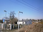
|
| Rosenthaler Grenzweg
( Location ) |
914 | Border between Rosenthal and Niederschönhausen | 1925 | The street is located between Waldemarstraße and the colony 'Gartenbau Nordend' (beach promenade) in the district in the locality of Nordend. Only the properties Rosenthaler Grenzweg 1–21b, 23–53 and 69 (continuous) on the north side belong to the district, Straßenland and the southern side of the road are in the neighboring district of Niederschönhausen . Interrupted by the Nordend tram station, built around 1900, the road that once continued to the west was named Nordendstrasse , as it no longer adjoined the Rosenthaler Feldmark, but rather the Nordend country house colony. |

|
| Horse chestnut farm
( Location ) |
190 | Horse chestnut , symbolic name because of the trees here | June 17, 2003 | This publicly usable private road is located between the main road and does not go on to Kastanienallee through transversely laid housing estates . It was named when the settlement houses were built at the request of the owners. The name was chosen according to the stock of horse chestnuts on Kastanienallee, which previously stood on the median (as it was east of Friedrich-Engels-Straße). With the "Wurstmacher- / Bratvogelweg residential district", this traditional horse chestnut avenue structure was replaced by an equally wide road in favor of the unconverted northern bypass. |

|
| Rotkleeweg
( Location ) |
130 | Red clover | Sep 7 2011 | The road lies between the water herb path and chives path. The district office of Pankow renamed 35 system paths of the garden complex unity between Mönchmühler, Schönhauser, Dietzgenstraße and Blankenfelder Chaussee as private streets after herbs, medicinal and aromatic plants. This newly named short path was previously called the Rosentaler Weg despite its shortness . |

|
| Rotsteinweg
( Location ) |
220 | Rotstein , a rock in Saxon Switzerland | Nov 12, 2013 | The Rotsteinweg is a private road in the Schönwald garden colony. It lies between the western section of the Lorenzsteinweg and the Katzsteinweg. The location parallel to the southern Liliensteinweg (the central plant path) and the more northerly Müllersteinweg gave it the name Mittelweg before it was officially named. The western cross paths from Liliensteinweg end here. The designation of the garden path by the Pankow district as a private road was carried out for better georeferencing of the properties in preparation for the nationwide introduction of the computer-aided property cadastre information system . |

|
| Slate way
( Location ) |
230 | Slate is a type of rock that is inserted into the “geological wall” in the nearby Botanical Volkspark . | January 29, 2014 | The slate path named Maiblumenweg in the enclosure is located as a north-south path between the Lehmweg and Granitweg, with the wider driveway only being between the Apple and Marble Path. The ways in which, investment Northrend were from the district office as private roads dedicated as the previous building addresses as Dietzgenstraße 186 not followed by garden path specified Georeferencing were. This became necessary so that the computer-based rescue programs of the police and fire brigade are ensured and in particular due to the requirements of the nationwide conversion of the real estate cadastre . The naming procedure was carried out in accordance with Section 5, Paragraph 1, Clause 2 of the Berlin Roads Act, which also included inquiries from the other civil engineering and landscape planning offices in Berlin and the Berlin-Brandenburg Statistics Office, as well as coordination with the District Women's Council. The naming of the private roads was made at the request of the owner of the Nordend facility, Liegenschaftsfonds GmbH & Co. KG, Warschauer Str. 41/42, 10243 Berlin. |

|
| Schönhauser Strasse
( Location ) |
1970 (in the district) |
Schönhausen , southeastern neighbor | before 1908 | This old connecting route to the neighboring town in the southwest was paved before 1908 and renamed street. It is located between Dietzgenstraße at the level of Schillerstraße in the neighboring district and the main street . The properties at Schönhauser Strasse 12–36b and 40–55 (continuous) are located in the Nordend area. In 1921 the Rosenthaler Straße , which originally ran from Niederschönhausen to Rosenthal, was included with the combination of the neighboring districts in the Pankow administrative district of Greater Berlin . The monument on this street in the Nordend settlement is the former clinic for the mentally illSchönhauser Strasse 41 , including the residential building for patients (1890–1895) and the building for the female and male mentally ill (1900–1905). The residential buildings No. 2–5 and 87, some with a stable, from the years 1870–1900 are part of the “Dorfanger Rosenthal” monument ensemble | |
| Schönholzer Weg
( Location ) |
140 (in the district) |
The way between Schönholz , in the neighboring town of Niederschönhausen, and Rosenthal | around 2000 | The Schönholzer Weg existed before 1920 and is located with the road in Wilhelmsruh and leads up to the Kastanienallee in the north with a newly created exit. The plots on the east side belong from their western edge to the district with the new construction of the settlement houses on these plots in the 2000s, the name was adopted for the supply road. The road lies between the Wilhelmsruher border and the adjacent KGA 'Am Anger' in the east, the KGA main path leads to the Tempelgraben. The street crosses the Am Tempelgraben and Hermann-Günther-Straße belonging to this settlement ( 30 zone ) and is designed as a dead end , as the cross streets in the north have no public exit to Angerweg. In the south, those end at the district boundary to Niederschönhausen (behind the Heegermühler Weg property). The row houses 20 and 20a, as well as 19-19d on plots 19 and 20 are assigned to Schönholzer Weg, these houses are located at the east end of Schönholzer Weg. Plots 19e and 19f are on KGA grounds. The name of the Schönholzer Weg goes back to the traditional name from Tosenthal to Schönholz in the south, in 1915 this street is not yet listed and for the first time in the address book 1920 for Rosenthal (at that time it belonged to Reinickendorf ) from Hauptstraße but not built on. The Schönholzer Weg for Wilhelmsruh is included in the 1943 address book. |

|
| Schrammsteinweg
( Location ) |
140 | Schrammsteine , rocky area north of the Elbe in Saxon Switzerland | Nov 12, 2013 | The Schrammsteinweg is a private road in the Schönwald garden colony. It is the sixth crossroad from Schönhauser Strasse from Liliensteinweg to the south to Lasensteinweg. Its previous name was within the Schönwald Weg 6 complex . The designation of the garden path by the Pankow district as a private road was carried out for better georeferencing of the properties in preparation for the nationwide introduction of the computer-aided property cadastre information system . |
|
|
Chives way
( Location ) |
280 | chives | Sep 7 2011 | The road lies between the water herb path and the medicinal herb path at "Graben 1 Blankenfelde" along which the water from the Zingergraben once led to the sewage water. The district office of Pankow renamed 35 system paths of the garden complex unity between Mönchmühler, Schönhauser, Dietzgenstraße and Blankenfelder Chaussee as private streets after herbs, medicinal and aromatic plants. The previous name of this trail was Long Road . |
|
| Sonata Path
( Location ) |
100 | Sonata , instrumental piece. | March 15, 1999 | It was initially referred to as Straße 136 when it was laid out . A western cul-de-sac from Maurice-Ravel-Straße not through to Angerweg. On the same day, other numbered streets located here were renamed. Street 136 is not yet included in the 1935 address book ; for 1943 it is (Post Bln. = Wilhelmsruh) between Angerweg and Straße 124 with a built-up property and five properties as a construction site. In the 2013 address directory, Sonatenweg 2–12 (even) and 3–7 (odd) are designated. The Sonatenweg is a cul-de-sac that no longer leads through to Angerweg. At the east end, some new residential buildings have been built, but there are commercial buildings in front of Angerweg. |

|
|
Street 52a
( Location ) |
1550 | numbered according to the development plan | before 1910 | It is located east of Dietzgenstrasse and the eastern border of the district ( beach promenade ) south of the Nordendfriedhöfe in the Nordend area. The street leads to the territory of French Buchholz, as the property of the former KGA 'Ostsee' with the number 45 is assigned to this street. The access from Dietzgenstrasse is north of the tram depot. In the early 1950s it had a connection to Waldemarstrasse. |

|
|
Street 52b
( Location ) |
990 | numbered according to the development plan | before 1910 | It is located in Nordend between Charlottenstrasse and the eastern border of the district in French Buchholz ( beach promenade ), south of the Nordendfriedhöfe. Plots 8 and 20–51 (continuous) and 56 (located on the north side) belong to the street. The connection to Dietzgenstrasse, as it was in the early 1950s, is no longer designed as a street, but as a component on the northern edge of the Lidl store and the adjoining daycare center. It is included in the 1943 address book (belonging to Niederschönhausen) between Blankenfelder Straße and the Buchholz district and on the south side with arbor area (1–14) / garden parcels (20–22, 27/28, 47, 49/50) and with 20 apartment buildings and single-family houses built on the 50 plots (consecutively numbered) and the arbor area is indicated continuously on the north side. On the north side are the parcels of the garden club Gartenfreunde Nordend towards the street 52a. |
|
|
Street 60
( Location ) |
150 | numbered according to the development plan | before 1930 | The spur road going to the northeast is located on Friedrich-Engels-Strasse a little east of the main road . The street between Reichskanzlerdamm and Feldmark is listed in the 1935 and 1943 address book and a two-family house is built on plot 2. In the meantime, lots 1, 3–5 (continuously) on the east side have been built on with residential houses, which have street 60 as the access road. On the west side of the street, a new housing estate with row type houses was built in the 2010s, which are located along Friedrichs-Engels-Straße and can be reached from an access road further west. To the north are the houses on Distelweg, which can be reached via Nesselweg. |
|
|
Street 87
( Location ) |
60 | numbered according to the development plan | after 1960 | The western cul-de-sac from Friedrich-Engels-Strasse is south of Zingergraben in the locality of Nordend . The street is not yet indicated on the map from 1954, but it is on city maps after 1970. It is the narrow access road to the adjoining houses and their gardens. It ends to the west at the "KGA waterworks department III" area. The street 87 was developed via the property Friedrich-Engels-Strasse 107 (which is no longer existent) and there are the residential properties 1–9 (odd) to the south and 6 and 8 (bordering the Zigergraben) to the north. |

|
| Road 113
( Location ) |
220 | numbered according to the development plan | after 1933 | The road 113 is laid out according to the development plan, however the southern part was taken over for the settlement on Erbeskopf- and Döbrabergweg and the road 113 lies between Am Rollberg and Kirchstraße in the locality of Nordend. In 1940 the street 113 belongs to Rosenthal, but the address book 1943 refers to this street in Nordend on Niederschönhausen. |

|
| Street 126
( Location ) |
150 | numbered according to the development plan | after 1930 | The unpaved road with road damage and the 30 zone is an extension of the main road between this and road 127 on the former wall strip . It was located in the area of the former Ziekow colony south of the Rosenthal cemetery. The street 126 is indicated in the address book 1935 between Hauptstraße and the Reinickendorf-Liebenwalder railway , further to Feldmark and crosses street 127. It is built up in 1935 with seven houses and undeveloped lots as construction sites. For 2013 the address list contains the developed lots 1–15 ( odd) and 4–16 (even) noted. The southern uneven plots border with the southern edge directly on Centweg , the street 127 flows between plot 14 and 16. Here at the western end of the street new housing developments are being built after the area was dedicated to the colony as building land. Lot 16 in the area of the former Berlin Wall is between Straße 127 and Mauerweg and remained undeveloped in the 2010s. |

|
| Street 127
( Location ) |
430 | numbered according to the development plan | after 1930 | Road 127 is a paved path between road 126 and its property 14 at the level of the southern border of the Rosenthal cemetery. The southern continuation between the border strip and the former colony 'Ziekow' ( Centweg ) and the northern continuation to the path on the northern edge of the cemetery are field paths not included in the street according to the official map of the district surveying offices, an asphalt surface probably proves belonging to the post path as here the Berlin Wall was in place. As a result, after the fall of the Wall , only lots 11-14 (continuous) and the corner lot “Straße 126 No. 14” east of the street are built on. The street 127 is listed between Feldmark and Straße 126 in the address book 1935 on the plots 12, 13, 14 with single-family houses built on. The current street directory lists the plots number 1–20 (consecutively) for street 127. The street 127 is added to the address book in 1943 with the comment "Post Bln.-Wilhelmsruh" between street 126 and Feldmark. On the east side, plot 11 is listed as a construction site, 12, 13, 14 are built on with residential houses, on the west side 15–20 (continuous) are built on with residential buildings. Since the road lies east of the former route of the Reinickendorf-Liebenwalder Railway along Lübarser Weg, it came along the sector border after 1945 and became a border road from East to West Berlin . The consequences of the Berlin Wall , which stood here between 1961 and 1990, were still present on the west side of the street as a broad strip of wasteland in the 2010s. 11-14 are built up and marked as belonging to the street. Numbers 1–10 on the east side and south of road 126 are in the current plan south of road 126 No. 15 and Centweg No. 15 from garden plots that were probably used as allotment gardens in the post-war period (Ziekow colony, which was rededicated as Centweg in 2000) . Plots 1–10 do not exist. Street 127 No. 10 probably merged with Street 126 No. 14. The northern continuation on the western edge of the cemetery is currently shown as an agricultural area, with a road leading through here that goes to Mönchmühler Straße on the northern edge of the cemetery . To the south on the edge of the boundary fence of the settlement at Centweg is a narrow concrete road, signposted as "use at your own risk", west of Road 127 to the heritage railway line is a wooded fallow area (in the current plan as a forest) to the Wall Trail and the Lübarser way called . |
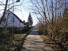
|
| Street 129
( Location ) |
230 | numbered according to the development plan | after 1930 | Eastern spur road from Uhlandstrasse and a few meters south of Wilhelmsruher Damm, surrounded by the "KGA Rosenthal Süd". The street 129 is listed in the address book 1935, between Uhlandstraße and Feldmark only the plot 1a was built with a three-family house at this time. In 1943, six lots were built with houses. In the LOR address directory 2013, the plots 2–20 (straight) on street 129 are named, the bad concrete street (road damage signposted) is a dead end, the one on the south side with a paved sidewalk, the one on the south side, preferably on the east end, with newly built settlement - and single-family houses that have been or are being built. On the north side there are garden plots with residential gazebos that are not designated as plots on Street 129 and belong to the allotment garden. To the south, parallel to street 129, there was a train from street 128 ; it was indicated on the maps before 1990. However, 128 - unlike Street 129 - is not listed in the 1943 address book. It was in the area of the Rosenthal Süd colony. This garden was laid out in 1979 and road 128 was apparently closed. |

|
| Street 132
( Location ) |
150 | numbered according to the development plan | after 1936 | It is located in Nordend, between Dammsmühler and Kirchstraße at the western end. The street is not yet listed in the 1935 address book. In the 1940 address book continuously between Kastanienallee and Schönhauser Strasse , where Strasse 133 (since then Dammsmühler Strasse ) and Strasse 134 ( Kirchstrasse ) are crossed. The street with the Melzow'schen house is built up, the owner is a commercial. Employee, manager of the carpenter Sitteck, inhabited by the official Elbrecht. These three 130 streets are marked with "Post Bln. = Niederschönhausen": Street 133 (60 numbered lots) is built on with residential buildings on plot 59 and 60, Street 134 on seven lots with houses (there are numbered 1–70, but 1– 8 and 2–40 to Schönhauser Straße “do not exist”), on 68 and 70 summer houses are noted. The address book from 1943 refers to the district of Niederschönhausen for these three streets, the state of development is the same as (for Rosenthal) mentioned above. On the 1954 map, road 132 still leads to Kastanienallee, to the north are the allotment gardens. In the current street directory, there are built-up lots at Street 132 # 16, 18, 20, 21, 26, 30 (consecutive). The west side of the street is on the allotment gardens of the KGA 'Windige Ecke'. |

|
| Street 134
( Location ) |
220 | not dedicated , remaining part of Kirchstrasse | after 1935 | This private road of the KGA 'Windige Ecke' is located in Nordend between Zingergraben and Straße 132. The route to the east of Schönhauser Straße was laid out before 1902 and was named the northernmost route in the Nordend settlement Grenzweg and around 1905 Grenzstraße . In 1920 the route has not yet been laid out and has not been built on. A street 134 was laid out west of Schönhauser Strasse after 1935 and is listed in the 1940 address book (also vacant). After the 1950s, it was incorporated into Kirchstrasse between Schönhauser Strasse and Strasse 132 . What remained was the non-dedicated western section on the other side of road 132, which was on the site of the allotment garden association Windige Ecke e. V. lies. The private road is 10 meters wide with two lanes and has a southern verge and continues into Kirchstrasse, however, unpaved to the west. The private road is marked with an (officially correct) road sign and a 30 limit . On the official map of the district surveying offices, it is unnamed and only marked as a route within the garden colony. Some maps (e.g. Google earth) show it as Modersohnstrasse. |

|
| Street 140
( Location ) |
300 | numbered according to the development plan | after 1930 | It is located north of the north ditch between An der Priesterkoppel and Schönhauser Strasse near the streets 141 and 142 (south of Schönhauser Strasse) but, unlike these, is not listed in the 1943 address book. However, since the "north canal" with its interruption is marked from An der Priesterkoppel, the route from the angle Nordgraben / An der Priesterkoppel to Schönhauser Straße could have existed, the area concerned was registered in 1954 as built-up. It was also not included on the city maps before 1960. On the street - a driveway - there are garden plots built with residential buildings. Sometimes a route that was used during the construction of the north trench is also referred to as road 140 for the road south of the north trench (between An der Priesterkoppel and Schönhauser Straße), and on the other hand also as own plaice. According to the official map 1: 5000, this path is unnamed. |

|
| Road 141
( Location ) |
130 | numbered according to the development plan | after 1925 | It is located north of the northern trench, the northern cul-de-sac of Schönhauser Strasse opposite Strasse 140 . In the 1943 address book, the street is recorded with the note “Post Bln = Wilhelmsruh”. On the left side north of Schönhauser Straße to the northwest the arbor area is listed, on the opposite side of the street to Zingergraben there are construction sites and the Lindner'sche as well as the house of the blacksmith A. Knaack. |

|
| Street 142
( Location ) |
90 | numbered according to the development plan | after 1930 | It lies across road 141 north of the north trench and the northern part of the Zinger trench that ends here. In the 1943 address book, the street is recorded with the note “Post Bln = Wilhelmsruh”. On the left-hand side from 141 there are construction sites and on the right-hand side towards the Feldmark the houses of warehouse clerk P. Siederer, city inspector W. Druse and the house of carpenter W. Eberhardt. |

|
| Street 151
( Location ) |
250 | numbered according to the development plan | after 1940 | It is located south of the north ditch between An der Priesterkoppel and Schönhauser Straße. The street belongs to the area of “Siedlung Eigen Scholle” and, with street 152, opens up residential properties between An der Priesterkoppel, Nordgraben, Schönhauser Straße and Bergrutenpfad, but it is not yet in the 1943 address book, but is recorded on the 1954 city map. |

|
| Street 152
( Location ) |
120 | numbered according to the development plan | after 1930 | It is located south of the north ditch between road 151 and the section of Eigen Scholle, which leads along the north ditch. The street belongs to the area of “Siedlung Eigen Scholle” and with street 151 opens up residential properties between An der Priesterkoppel, Nordgraben, Schönhauser Straße and Bergrutenpfad, but it is not yet recorded in the 1943 address book but on the 1954 city map. |

|
| Stravinskystrasse
( Location ) |
280 | Stravinsky (1882–1971), Russian composer | Jan 15, 1999 | Previously set up as Straße 143 , it is located between Schönholzer Weg and César-Franck-Straße. On the same day, other numbered streets located here were renamed music-related. The street 143 is mentioned in the 1943 address book going from Schönholzer Straße, but it is undeveloped. The 2013 address directory of the Statistical Office names the properties Stravinskystrasse 1a – 25 (odd) and 2–26 (even). The asphalt road without road drainage has unpaved edge strips on both sides, it is built on with partly newly built residential buildings. |

|
|
Taufsteinweg
( Location ) |
230 | Baptismal font , highest point of the Vogelsberg, Hesse | Jan. 23, 1931 | The road previously laid out as road 116 according to the development plan lies between Nordendstrasse and Kastanienallee in the locality of Nordend. Accordingly, it is also assigned to Niederschönhausen in the 1943 address book . On the left (plots 1–7 from Nordendstrasse to Kastanienallee) a four-family settlement house (No. 3, corner of Strasse 90) and a single-family house are listed on 5 1 and 2 are construction sites (assigned but undeveloped) 6 and 7 are plots (undeveloped and without owner). The opposite side of the street is marked on 8-17 with "construction site". The street name differs from the parallel "avenues" named after tree species, as it was only named later on the edge of the original north end. |

|
| Thyme way
( Location ) |
350 | thyme | Sep 7 2011 | The street lies between the Zingergraben on the water herb and ginger path , parallel to the south of the chives path , previously it was called the green path . The district office of Pankow renamed 35 system paths of the garden complex unity between Mönchmühler, Schönhauser, Dietzgenstraße and Blankenfelder Chaussee as private streets after herbs, medicinal and aromatic plants. |

|
| Tonweg
( Location ) |
110 | Clay is a type of mineral that is inserted on the "Geological Wall" in the nearby Botanical Volkspark . | January 29, 2014 | The previously mentioned tomato path in the system is the western north-south path in the northern part of the system between the Lehm- and Buntsteinweg. The ways in which, investment Northrend were from the district office as private roads dedicated as the previous building addresses as Dietzgenstraße 186 not followed by garden path specified Georeferencing were. This became necessary so that the computer-based rescue programs of the police and fire brigade are ensured and in particular due to the requirements of the nationwide conversion of the real estate cadastre . The naming procedure was carried out in accordance with Section 5, Paragraph 1, Clause 2 of the Berlin Roads Act, which also included inquiries from the other civil engineering and landscape planning offices in Berlin and the Berlin-Brandenburg Statistics Office, as well as coordination with the District Women's Council. The naming of the private roads was made at the request of the owner of the Nordend facility, Liegenschaftsfonds GmbH & Co. KG, Warschauer Str. 41/42, 10243 Berlin. |
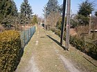
|
|
Uhlandstrasse
( Location ) |
390 (in the district) |
Ludwig Uhland (1787–1862), poet and lawyer | 1902 | The street lies between Wilhelmsruher Garibaldistraße and Quickborner Straße . In the Ortstei it lies from the Nordgraben, including the Uhlandstrasse Bridge on the Nordgraben, to the north to Quickborner Strasse. At the time of the Wall (1961–1990), however, the section from Wilhelmsruher Damm (including) to the north was the location of the Wall. Further north it led across grassland and connected to road 127. The address book shows the street in the district from the Wilhelmsruh district (Lessingstraße) via Buchhorster Straße, Nordkanal, Straße 129 to Wilhelmsruher Damm. Plots 1–31 (odd) and 2–32 (even) are in Wilhelmsruh. The Rosenthaler plots 37 (apartment building), 41, 81–89 (to street 129) and on the eastern side of the street 44, 46 and 84–90 are built up with single family houses. Between the north canal and the parallel path (on the northern edge of the cemetery) there are construction sites, a garden and the cemetery to which arable land up to plot 84 adjoins Wilhelmsruh (32-42) and undeveloped plots where the 'KGA Gauert' ( towards Wilhelmsruh). In contrast to the district boundary since 2001, the district boundary between Wilhelmsruh and Rosenthal was further south. On the other hand, until the Wilhelmsruh-Rosenthal S-Bahn line was demolished, the street was extended along the unused railway line along the Berlin Wall to the Rosenthal part of Quickborner Straße. In 1961 the street ended at Wilhelmsruher Damm, on a street map from 1966 it is drawn as far as Quickborner Straße. The back wall stood from plot 83 and up to the Quickborner Straße tram loop (tram line 22), so the street ran between the front and back wall. The front wall ran directly on the track of the Heidekrautbahn . Plots 42–86 even, 81–113 odd are in the district. The state-owned Pankow VII cemetery is located on Uhlandstrasse facing the Märkisches Viertel , and the burial sites of Caesar Horn (burial sites 142–145) and Karl Müller (site 241) are historical monuments. |

|
|
Water herb path
( Location ) |
1050 | Water herbs , collective term for all growing at the water herbs | Sep 7 2011 | The street lies between Mönchmühler Straße (opposite the Rosental cemetery) and Nordgraben, because of the course along the Zingergraben it has the shape of an elongated Z and the previous name of the path was Am Zingergraben . The district office of Pankow renamed 35 system paths of the garden complex unity between Mönchmühler, Schönhauser, Dietzgenstraße and Blankenfelder Chaussee as private streets after herbs, medicinal and aromatic plants. The choice of name takes up the watercourse of the parallel Zingergraben, which still carries water here in the northern section, which it releases into the Nordgraben - through which it was cut - the watercourse of the Zingergraben south of the Nordgraben is predominantly dry during the year. |

|
| Hawthorn avenue
( Location ) |
240 | Hawthorn , shrubs and small trees. | Nov 26, 1925 | It is located between Kastanienallee and Nordendstraße in Nordend. When choosing a name, the specification from "Landhauskolonie Nordend" was adopted, in which the parallel streets to the east were named as avenues after tree species. called. In the 1943 address book it is included (belonging to Niederschönhausen) with eight single-family houses on the 14 plots between Kastanienallee and Nordendstraße. Between Nordendstrasse and Kastanienallee there are 2–4, 7 and 9 on the left and 12–14 and 16–21 on the right with residential houses for one to three families, the remaining plots are still undeveloped and used as construction sites by the owners marked. The area of the Weißdornallee on the boundary of Rosenthal was developed around 1920. In 1915 the Kastanienallee was only laid out as an extended Kastanienallee , whereas it was laid out as a street to Hauptstraße as early as 1922 . |

|
| Meadow Herb Path
( Location ) |
840 | Wild herbs , a collective term for all of meadows growing herbs | Sep 7 2011 | The road lies between Gebirgskräuterweg and Dietzgenstraße and forms the edge of the complex in the south to the east. The district office of Pankow renamed 35 system paths of the garden complex unity between Mönchmühler, Schönhauser, Dietzgenstraße and Blankenfelder Chaussee as private streets after herbs, medicinal and aromatic plants. The path in the complex was previously called Wiesenweg , which the street name refers to. |

|
| Wiesenwinkel
( Location ) |
400 | former Winkelwiesen wetland | July 22, 1981 | The street begins on Friedrich-Engels-Straße, touches Wurstmacherweg in a change of direction from north-south to west-east and ends at the daycare center in a turning hammer. From here, sidewalks lead west to Wilckeweg and east to an access road that is also named Friedrich-Engels-Straße. To the south of it is a green fallow area that takes up the central park “Der Wiesenwinkel” for the “Wohnanlage Wiesenwinkel” between Kastanienallee, Hauptstraße and “KGA Humboldt”. This settlement was built on a previously unused green area that was still part of the Winkelwiesen in the corner west of Kastanienallee / Hauptstraße in the early 1990s. Plots 1–14 (continuous, east side) and on the west side 22, 20 and 17 (day care center) belong to the street. The northern section of this street with the single-family houses 1–11 located here is divided by the KGA 'Humboldt Dept. Gray School' from 'Dept. Neues Heim ', which lies on the north ditch, behind which the Wördenweg department of the KGA is located. The Wiesenwinkel 22 property is a housing estate on the KGA site. At the corner of Wurstmacherweg there is house 20 with a therapeutic youth living group according to SGB VIII of the association “Der Steg gGmbH”. |

|
| Wilckeweg
( Location ) |
380 | Wilcke, Rosenthaler resident family | May 5, 1994 | The street is a cul-de-sac between Kastanienallee and Wiesenwinkel , to which, however, only a sidewalk leads to the turning area and the daycare center. The street with the multi-family houses on plots 1–11 (odd) is only built on on the west side and belongs to a new development area to the west with multi-family houses north of Kastanienallee. This Wiesenwinkel settlement was built on a previously unused green area, which was still part of the Winkelwiesen in the corner west of Kastanienallee / Hauptstraße in the early 1990s . The Wilcke family owned a farm in Rosenthal in the 19th century, which the Bratvogel family then continued to manage. The street name with reference to a local family is also taken up in the settlement from the Bratvogel- und Wurstmacherweg . |

|
| Wild herb trail
( Location ) |
690 | Wild herbs , non-cultivated herbs suitable for consumption | Sep 7 2011 | The road lies between the water and medicinal herb path in a west-east direction, parallel to the herb path to the northern edge of the facility, which is also the district boundary. The district office of Pankow renamed 35 system paths of the garden complex unity between Mönchmühler, Schönhauser, Dietzgenstraße and Blankenfelder Chaussee as private streets after herbs, medicinal and aromatic plants. The tracks of the Tegel – Friedrichsfelde industrial railway that used to run here give rise to the route's previous name: railroad . |

|
| Wilhelmsruher Damm
( Location ) |
510 (in the district) |
Wilhelmsruh , southern neighboring town | May 20, 1937 | To the west of the main street , Friedrich-Engels-Straße (formerly: Reichskanzlerdamm ) merges into Wilhelmsruher Damm to the Märkische Viertel and belongs to the district boundary of Rosenthal. Before the current name it was called Wittenauer Weg and Wittenauer Straße . With the fall of the Berlin Wall in 1961 , this street in northern Berlin became usable again and serves as a replacement for the missing northern bypass . |

|
| Wördenweg
( Location ) |
470 | Field name "Die Worthen" (fields) | 1927 | The Wördenweg lies along the Nordgraben (northwest) between Hauptstrasse and Friedrich-Engels-Strasse, here as a continuation of the Nesselweg. The basis of the name was probably the field name "Die Worthen" used on a map in 1780, which stands for fields behind the farms. The Wördenweg is signposted as a street, but not included in the current street directory of the Office for Statistics. As a path on the north bank of the Nordgraben, it cuts through the Humboldt Colony (KGA Humboldt). The course of this path is part of the Humboldt lane with number 16 of the 20 green main paths in Berlin. In the 1927 address book, the route is listed for the first time as An der Wörde between Reichskanzlerdamm and Schönhauser Straße via An der Priesterkoppel with 23 properties, two of which to the west of Reichskanzlerdamm are inhabited. In 1929 the same course of the road is called Wördenweg and this is still registered in 1931. From 1932 the address book names the Nesselweg with this course and with another built-up plot of land as the street name and under Wördenweg the note “s. Nesselweg ". The use and signposting of the path while retaining the name should probably be associated with the construction of the north trench. |

|
| Wurstmacherweg
( Location ) |
380 |
Otto Wurstmacher (1879–1940) chronicler for Rosenthal |
May 5, 1994 | The street lies between Wiesenwinkel and the properties of the main street on Nordgraben. It was built as an access road to the adjacent multi-family houses in the "Wiesenwinkel residential complex" (21–33, odd north, 22–40 straight south). The narrow, paved street is laid out with sidewalks and side trees, there are parking spaces on both sides for horizontal parking and in front of the houses on both sides of the street there are broad bushes. With two cross streets, the eastern one continues the Wiesenwinkel , the residential buildings are accessed to the east of the Bratvogelweg . These cross streets end to the south at a small park area that was named "Die Winkelwiesen". The following parts of the street to the south with the similarly designed residential buildings of the new settlement are assigned to Kastanienallee. This settlement was built on a previously unused green area, which was part of the Winkelwiesen in the corner west of Kastanienallee / Hauptstraße in the early 1990s. Wurstmacher was the first chronicler of Rosenthal. His grave is in the cemetery near the Rosenthal village church, the name given here is related to the Bratvogelweg. |

|
|
Zechsteinweg
( Location ) |
180 | Zechstein is a type of mineral that is inserted on the "Geological Wall" in the nearby Botanical Volkspark . | January 29, 2014 | The one previously mentioned in the attachment Birnenweg is the north-south path east of the slate clay path. It lies between Granitweg and goes over Buntsteinweg. The lack of a connection to the Lehmweg is due to the interruption of the (former) Grenzweg on the area (previously) belonging to the Dietzgenstraße 190 commercial property . The ways in which, investment Northrend were from the district office as private roads dedicated as the previous building addresses as Dietzgenstraße 186 not followed by garden path specified Georeferencing were. This became necessary so that the computer-based rescue programs of the police and fire brigade are ensured and in particular due to the requirements of the nationwide conversion of the real estate cadastre . The naming procedure was carried out in accordance with Section 5, Paragraph 1, Clause 2 of the Berlin Roads Act, which also included inquiries from the other civil engineering and landscape planning offices in Berlin and the Berlin-Brandenburg Statistics Office, as well as coordination with the District Women's Council. The naming of the private roads was made at the request of the owner of the Nordend facility, Liegenschaftsfonds GmbH & Co. KG, Warschauer Str. 41/42, 10243 Berlin. |
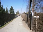
|
| Zirkelsteinweg
( Location ) |
170 | Zirkelstein , the smallest table mountain in Saxon Switzerland | Nov 12, 2013 | The street is in the KGA Am Rollberg. It is a northern crossing path from Liliensteinweg to the edge of the facility at Wiesenweggraben, before it was officially named by the Pankow district office, it was called Adolfweg . From Dietzgenstraße the fifth cross way on Liliensteinweg. The designation of the garden path by the Pankow district as a private road was carried out for better georeferencing of the properties in preparation for the nationwide introduction of the computer-aided property cadastre information system . | |
| Zschirnsteinweg
( Location ) |
150 | Zschirnstein , two table mountains in Saxon Switzerland | Nov 12, 2013 | The Zschirnsteinweg is a private road in the Schönwald garden colony. From Schönhauser Straße as the eighth northern crossway from Liliensteinweg, it ends at the northern plant property of Lorenzweg. Before it was named, it was named path 9 within the facility . The designation of the garden path by the Pankow district as a private road was carried out for better georeferencing of the properties in preparation for the nationwide introduction of the computer-aided property cadastre information system . |

|
Planned and former streets
In the Berlin address book, the district is recorded as a suburb of Berlin from 1909: "Rosenthal, Wilhelmsruh and Nordend (Niederbarnim district)". The streets described below are included. In the 1915 address book the information is then “Berlin = Rosenthal with Wilhelmsruh and Nordend”.
- Main street that lies between the Wilhelmsruh district across Schönhauser Strasse and the Tegel – Friedrichsfelde industrial railway . Properties 97–181 (odd on the right side) and 84–174 (even, left side) belong to Rosenthal. To the north, there are “construction sites” as far as the Blankenfelde district and, on the left, the Rosenthal churchyard in particular. The properties with the smaller numbers are located on the street of the same name, however, to the south in the “Wilhelmsruh district”.
- Lübarser Straße , Querstraße to Wittenauer Straße , plots 2 and 4 are built on and inhabited.
- Lübarser Weg , which continues Lübarser Straße with the Schudmaschen and Güssowschen houses. Since the marking of the 20 green main routes in Berlin , Lübarser Weg has stood for the green main route 04.
- Parallel path , with two nurseries and a connection to Wittenauer Straße .
- Schönhauser Strasse, it lies between Hauptstrasse and the Nordend district and is built on and inhabited on 3–9 (odd), as well as 8 and 14. In addition to construction sites, there are 10 and 12 with barns in particular.
- Wittenauer Straße , it lies between Hauptstraße and continues over Lübarser Straße as Wittenauer Weg . It is noted with the built and inhabited lots 3–9 (odd) and on the right-hand side with 4, 6 and 12.
- Wittenauer Weg : It belongs to the “Postbez. Wittenau ”, the Wittenauer Straße continues over the railway to the Wittenau district, the parallel path branches off on the left . On the path there are (unnumbered) four houses on the left and three on the right.
For the district of Nordend , which has been part of the Rosenthal district since the post-war period, further streets are also included in the 1909 address book, some of which still exist under the same name.
- Ahornallee : between Charlottenburger (corner of Schönhauser) Strasse and Kastanienallee with seven residential buildings.
- Akazienallee : exit from Charlottenburger Strasse, undeveloped.
- Birkenallee : between Charlottenburger Strasse and Kastanienallee with six residential buildings and one new building, plus gardens and construction sites.
- Blankenfelder Straße between the Niederschönhausener Feldmark and the Blankenfelde district are on the left (eastern side and consecutively numbered) two apartment buildings (1, 2), a nursery (3) and the Steinplatz (4), as well as the cemetery of the Gethsemanegemeinde on 5a and 5b the stonemason place and the cemetery of the Peace and Assumption Congregation, at number 6 the administrative building of the city synod for the cemetery of the Peace and Assumption Congregation and at 7 the “cemetery of the Zion community” is. On the western side (in the direction of Blankenfelde to Niederschönhausen) there are six residential buildings, plot 13 is the former Chausseehaus, there are also construction sites, a stonemasonry (9/10), the nursery (18) and construction sites; Kastanienallee and Mittelstrasse are on this side of the street.
- Charlottenburger Strasse is located between Schönhauser Strasse over Ahornallee and Birkenallee, with a new building on Birkenallee.
- Eichenallee , off the Charlottenburger Straße it is vacant.
- Leaving Eschenallee from Charlottenburger Strasse, it is vacant.
- Kastanienallee lies between Blankenfelder Strasse and the Rosenthal district across Schönhauser Strasse. On the left, western side the plots 1-20 with five multi-family and five single-family houses, the school building of the Rosenthal community at 15. The opposite side of the street is with an ice works (21) and four residential buildings and the streets on this side Akazienallee, Kronprinzenplatz , Birch and maple avenue.
- Kronprinzenplatz is on Kastanienallee and is vacant. It was the center of the Nordend colony and is an unnamed (semi-) round square on Kastanienallee, corner of Birkenallee. The small school is still there, but is now a residential building. In the west are the Rosenthal allotment gardens and in the south the urban area of Niederschönhausen.
- Mittelstrasse between Blankenfelder and Schönhauser Strasse with two residential buildings 3–5 and 6–8, in the latter two doctors live who run a “Sanatorium Nordend” on this property.
- Schönhauser Straße is located between the Niederschönhausener Feldmark and the Rosenthal district, the Mittelstraße branches off and the Kastanienallee crosses. There are two apartment buildings and six single-family houses on the street, with three neurologists operating a mental hospital in 25, 27/28.
In the 1915 address book the suburb name is "Berlin = Rosenthal with Wilhelmsruh and Nordend". For Rosenthal, the extended Kaiserweg has been added to the streets, leaving the main street and undeveloped. For Nordend there is also the still undeveloped Kirchstrasse from Blankenfelder Strasse and Nordendstrasse (Post Niederschönhausen) on Schönhauser Strasse and crossing over maple, birch and acacia avenues, on Schönhauser Strasse and Akazienallee with gardens, the property is built on with a single-family house 1 between maple and birch avenues.
The 1943 address book lists the following streets (also shown in the 1935 address book):
- the streets of Rosenthal in the narrower sense are marked with “Post Bln. = Wilhelmsruh "provided: Angerweg, Buchhorster Straße, Hauptstraße, Kastanienallee, Möllersfelder Straße, Mönchmühler Straße, Nesselweg, Parallelweg, An der Priesterkoppel, Prinz-Heinrich-Straße (also Wilhelmsruh), Quickborner Straße, Reichskanzlerbrücke (across the north ditch for the Reich Chancellor Damm ), Reichskanzlerdamm (including 1–34 and 44–74 (Post Bln = Wilhelmsruh), 35–43 politically and under Post Bln. = Niederschönhausen), Reichskanzlerplatz, Rispenweg, Schönhauser Strasse (but 24–56 to Niederschönhausen), Strasse 60, Street 118, Street 119, Street 120, Street 121, Street 122, Street 123, Street 124, Street 126, Street 127, Street 129, Street 136, Street 141, Street 142, Street 143, Wilhelmsruher Damm
- the streets of Nordend, because of its assignment with the note "s. u. Niederschönhausen ": Ahornallee, Akazienallee, Birkenallee, Blankenfelder Strasse, Erbeskopfweg, Eschenallee, Heegermühler Weg (also suWilhelmsruh), Kirchstrasse, Mittelstrasse, Nordendstrasse, Am Rollberg, Strasse 52a, Strasse 52b, Strasse 90, Strasse 113, Strasse 132, Strasse 133, Straße 134, Taufsteinweg, Weißdornallee
- as well as the (here neglected streets) in Wilhelmsruh with the note “s. u. Wilhelmsruh "
- be noted with the note “s. u. Wittenau “: Fasanerie, private road.
- Reichskanzlerdamm : not yet listed in 1915, in 1916 it is listed as undeveloped from Hauptstraße. which was named in 1951 in Friedrich-Engels-Straße . The first Reich Chancellor Otto Eduard Leopold Graf von Bismarck-Schönhausen gave this connection road its name.
- Eiskutenweg : between Reichskanzlerdamm and An der Priesterkoppel, according to the 1926 address book, four single-family houses (2, 9, 10, 63) are built on the 64 numbered lots. Named on January 16, 1925, it was renamed Rispenweg on July 12, 1934. The Eiskute was a pool of water that disappeared in 1927 when the allotment garden colony was established. The pool was probably used by the ice works on Kastanienallee, which is the reason for the name.
- Kronprinzenplatz : The square on Kastanien- und Birkenallee, which was planned as the central square for Nordend before 1900, ceased to exist before 1920. However, at the northern end of the Birkenallee, the surrounding ring that forms the square can still be seen, a southern part of the street with a roundabout along the Kastanienallee and the circular path of the unpaved northern half-ring that surrounds the brick building 15a (former community school). It was originally named after the German Crown Prince Friedrich Wilhelm Viktor August Ernst (1882–1951).
Further locations of Rosenthal
Allotment gardens (KGA)
The allotment gardens in Rosenthal are mainly in the Nordend area and in the outskirts of Blankenfelde. The state-owned leased areas are owned by the Pankow district and are managed by the Pankow district office (youth and facility management department, recreation facilities). Allotment garden facilities that are listed in the allotment garden development plan 2010 are named below. Some allotment gardens have changed their status as garden settlements with building rights and are therefore listed under housing estates .
- KGA 'Alt-Rosenthal' (KGEP 08884 - Hauptstrasse 173, Lage ), the permanent allotment garden was founded in 1927 and has 30 plots on 10,271 m² of state-owned land, as well as eight plots on 3,682 m² of private land, the preservation of which is secured by land use plan. (RBS: 00211) On March 11, 2002 the KGA 'Hauptstrasse 171a' (44240) was renamed KGA 'Alt Rosenthal'. The allotment garden 'Alt Rosenthal e. V. ' 1927. Pfaun- and Kuckucksweg, which are not dedicated as layout paths, lead through the complex.
- KGA 'Am Anger' (KGEP 03039 - Angerweg 32 / Nordendstraße, Lage , RBS: 8253) was founded in 1918 and has 252 parcels (five permanent residents) on 119,062 m² of private land, which are designated as allotments - grassland by the zoning plan. (RBS street key: 08253) On December 13, 1994 the KGA 'Nordendstraße 31' (44314), KGA 'Nordendstraße 33' (44315), KGA 'Nordendstraße 38' (44316), KGA 'Angerweg 18' (44132) and KGA 'Zingergraben 31' (44450) summarized as KGA 'Am Anger'. The allotment garden association 'Am Anger e. V. ' was founded in 1918. The area of the garden borders in the south on the district boundary to Niederschönhausen and in the north on the Angerweg. The KGA 'Wasserwerk' joins to the east. The non-dedicated club paths Chrysanthemum, sports field and border path lead through the KGA between Tempelgraben (district boundary) and Angerweg.
- KGA 'Am Rollberg' (RBS: 08258, KGEP: 03043 - Dietzgenstrasse 175): There are 272 parcels on 145,496 m² of private leased land, 59 of which are used by permanent residents. According to the allotment garden development plan 2004, it is a highly secured facility. These leased areas of the facility belong to the Evangelical Church of Rosenthal and are managed by Hilfswerk GmbH. The allotment garden 44164 KGA 'Blankenfelder Straße 80' was named on December 14, 1994 in the official list as 8258 KGA 'Am Rollberg'. The allotment garden association 'Am Rollberg e. V. ' was founded in 1917. The foundation of the "Gemeinnützige Siedlungsverein Daheim" (non-profit settlement association) was followed in 1921 by the decision of the parish council to sell the leased land to "Daheim". Police officers had already settled and built buildings since 1913, and they later joined the facility. The status of an allotment garden is retained, however, in contrast to the Federal Allotment Garden Act, the confirmed permanent users have an opening for settlement according to building law. With the introduction of georeferenceable addresses for the ALKIS program system required by federal law , plant routes with 30 new street names to mountain peaks and climbing rocks in Saxon Switzerland were approved as dedicated private roads . The area of the KGA was named jointly with that of the Schönwald plant.
- KGA 'Daheim II' (Dietzgenstrasse 166–174, Lage ). The permanent facility was founded in 1918 and is located with 264 parcels (of which 18 permanent residents) on 152,442 m² of private land and 76 parcels on 41,898 m² of state-owned leased land, part of the latter being intended for the "tangential connection north", which is a transport project in the north of Berlin is planned without priority. The RBS road code 44182 for KGA Daheim 2 was officially changed on November 12, 2007 for KGA 'Blankenfelder Straße 63' (44162) when it was renamed. The allotment garden is located between Friedensweg (on the cemetery grounds) and Grenzweg in the north, with Mittelweg parallel between them. As private system routes, these three are not dedicated and not mentioned in the road register. In June 1980, the 'Daheim' facility was recognized as a “state-approved local recreation area”.
- KGA 'Humboldt' (KGEP 030074) consists of the sub-areas 'Graue Schule' (RBS: 08829), 'Neues Heim' and 'Wördenweg' (RBS: 08830) at the postal address Friedrich-Engels-Straße 157–177 and comprises 88 Parcels. ( Location ). The 'Wördenweg' department is registered with 13 plots (six permanent users) on 11,591 m² as permanently secured in the allotment garden development plan (KGEP). The 'New Home' department has 54 parcels on 32,218 m² of leased land and the 'Gray School' department has 21 parcels (two permanent residents) on 11,772 m² of private land. The KGA 'Friedrich-Engels-Straße 169' was officially assigned the designation KGA 'Humboldt' Dept. 'New Home' (8314) on August 14, 1997.
The allotment garden 'Humboldt e. V. ' was founded in 1937. According to the 'Urban Development Plan Living 2015', the KGA Humboldt is only secured until after 2025, after which it is to be built on with residential buildings, which means it is considered 'at risk'.
- KGA 'Kissingen II' (KGEP 03078, RBS 08830) at the address Schönhauser Straße 8 ( Lage ) was founded in 1927 and has 108 plots on 45,320 m² of leased land that are permanently secured by land use plans. Until March 11, 2002, the allotment garden was run as KGA 'Schönhauser Strasse 8' (44374). In the summer of 1926 the 'Kissingen II' association colony in Berlin Pankow, located on Kissingenstrasse near the Berlin-Pankow S-Bahn station, had to give way to the new residential building. In Rosenthal, fallow land was made available to compensate for the construction of a new allotment garden with 138 plots. The allotment garden 'Kissingen II e. V. ' was founded in 1927. The facility is located west of the Zingergraben, over which it connects to the “garden and settler community unity”. The Kissingenweg runs lengthways through the colony and the gardens are accessed from the Kräuterweg from the Zeisig- and Wachtelweg, right (south to north) follow the Amsel-, Wachstelzen-, Drossel-, Elster-, Finken-, Grünspechtweg to Kuckucksweg , on the left are the Koloniewege Uhu-, Tauben-, Sparrow-, Raben-, Habichtsweg and to the latter the Rotkehlchenweg which leads across from An der Vogelweide to the side section of the main road.
- KGA 'Nesselweg' (KGEP 03085) has the postal address Nesselweg 7 and 17 ( location ). Of this complex on private leased land, 19 plots on 12,805 m² with five permanent users are secured by the zoning plan and are to be retained. A further 20 parcels (including ten permanent users), which are located on 12,925 m² in the midst of private homes, are only secured until 2015 and will then be built with residential houses.
The KGA 'Nesselweg 7' was named KGA 'Am Nesselweg' in the official list on June 18, 2003. In the location between Schönhauser Strasse and Nesselweg, gardens have already been de-designed and residential quarters built on.
- KGA 'Neuland Rosenthal' (KGEP 03087 - An der Priesterkoppel 26, Lage , RBS: 8259). The permanent allotment garden was founded in 1945 and has 112 parcels on 68,700 m² of state-owned leased land. The plant was officially listed as "KGA An der Priesterkoppel 26" until December 14, 1994. The allotment garden 'Neuland Rosenthal e. V. ' was founded in 1945. The facility is located between Eigen Scholle and Zingergraben and from south to north the association paths: Weg 1, Weg 3, Weg 5, Weg 7. The KGA 'Tiefland' is located across the Eigen Scholle. The Neuland colony is centrally located on the “Priesterkoppel” parcel.
- KGA 'Nordlicht' (Street 52a No. 45b, Lage ) is an allotment garden with 154 parcels on 91,389 m² of private land, which is to be preserved according to the zoning plan. (RBS: 44317) The facility is located to the east of the Nordend cemeteries on the outskirts of the French-Buchholz district, with part of it on unused and de-dedicated former cemetery grounds. This area was only used for allotment gardens after 1989. In addition to the northbound path, there are the Koloniewege Zinnowitzer Weg (adjoining the beach promenade in the east), as well as Barther Weg and Greifswalder Bucht.
- The 'allotment garden park Rosenthal-Nord' (Quickborner Strasse 12 and 14, location ) is located on 39,746 m² of state-owned leased land (75 parcels) and with 146 parcels on 80,187 m² of private land and is permanently secured in the zoning plan through the entry as "allotment gardens - grassland". The allotment garden 'Rosenthal-Nord' was founded on November 3rd, 1977. The complex has a 500-meter-long nature trail, an insect hotel and a children's playground.
- KGA 'Rosenthal-Süd' (Street 129 No. 20, Lage ) is noted in the allotment garden development plan (KGEP) under the number 03101. The permanent allotment garden on 119,448 m² of state-owned leased land has 229 parcels. (Noted in the street register under 00211) On April 8, 2003 KGA 'Rosenthal Süd I' (44352) and KGA 'Rosenthal Süd II' (44353) were officially named together as KGA 'Rosenthal-Süd'. The allotment garden association 'Rosenthal-Süd e. V. ' was founded on a grain field between Nordgraben, Märkisches Viertel, Wilhelmsruher Damm and Hauptstraße in Rosenthal in 1979 and laid out in 1980 by the company "VEB Landbau" with the preparatory work. At the end of the 1990s, the project of the north bypass threatened the facility but has since been lifted.
- KGA 'Tiefland' (KGEP 03110, RBS 08260) was founded in 1946. (An der Priesterkoppel 27, Lage ) This (fictitious) permanent allotment garden has 64 parcels on 37,879 m² of land owned by the state. The KGA 'An der Priesterkoppel 27' (44129) was officially named on December 14, 1994 as the KGA 'Tiefland'. The new buildings on the Bergrutenpfad are on part of the former garden area. The colony is located in the northwest of the "Priesterkoppel" parcel.
- KGA 'Wasserwerk Rosenthal' (KGEP 03111, RBS 08991, 8992, 8993) was founded in 1929 and is located on Angerweg 58 / Nordendstraße 30 ( Lage ). The 103 plots with nine permanent residents are located on 49,403 m² of state-owned leased land and are permanently secured by FNP registration. On February 12, 2003, KGA 'Angerweg 58', KGA 'Angerweg 64' and KGA 'Nordendstraße 30' were officially named as the three departments of KGA 'Wasserwerk Rosenthal' (Dept. I, Dept. II, Dept. III). The allotment garden 'Wasserwerk Rosenthal e. V. ' was founded in 1929, named after the waterworks with the civil servants' house that was previously located here. 'Department III' borders the north side of Nordendstrasse. It is separated by the Zingergraben from 'Division I' (west) and 'Division II' (east), which are adjacent to Angerweg to the south.
- KGA 'Windige Ecke' (Street 132 No. 21, Lage ) was founded in 1948 and owns 62 parcels. The 40,895 m² of state-owned leased land are considered to be permanently secured through the entry in the FNP as allotment gardens / grassland according to the allotment garden development plan (KGEP Berlin). The allotment garden association 'Windige Ecke e. V. ' was founded in 1948 and built on a former wetland. It is in the middle of the square of Kastanienallee, Schönhauser Straße and Zingergraben. The extension of Kirchstraße and Straße 132 as well as a small path from Schönhauser Straße along the Schönwald complex leads to the allotment garden complex, which is adjacent to the allotment garden complexes Neuland Rosenthal and Schönwald. The Zingergraben is the system boundary to 'Neuland Rosenthal'. An extension of Kirchstrasse runs through the colony, but it has remained undedicated but is signposted as Strasse 134 . The colony paths under the supervision of the association are to the south of the Rosenweg and Narden to Schönhauserstraße aster, dahlia, carnation and tulip path. In June 1980, the facility was recognized as a "state-approved local recreation area". The colony is to the east of the "Priesterkoppel" parcel.
Housing estates
In addition to these allotment gardens according to the Federal Allotment Garden Act , some colonies have been rededicated as permanent housing estates at the request of the settlers or as settlements on public building land and are no longer listed in the allotment garden development plan. Some of these facilities were converted into building land or housing estates, while maintaining their club character.
Up until now, the addresses in large gardens were defined using the uniform property address of an adjacent public street with the addition of the internal route designation and parcel number: "X-street YY Z-way parcel NN". This form of address cannot be georeferenced ; according to federal law, Berlin must introduce the ALKIS program system into the real estate cadastre . A “unique address with house number” must be available for the “geo-referenced building address”. For this reason, the paths and connections at facilities in the Pankow districts were dedicated in coordination with the residents and owners and new street names were given. During the planning process, it was checked whether these new street names in the urban area (of the state) of Berlin are unique .
- KGA 'Gartenfreunde Nordend' 03066 (Street 52a No. 2, location ). It was founded in 1919 and owns 55 parcels on 30,299 m² of state-owned leased land and 65 parcels on 40,662 m² of private land, which are not secured in the portfolio.
- Schönwald settlement - Reiche department, RBS: 8587 ( location ). The "KGA Schönhauser Str. 22" was renamed KGA Schönwald Abt. Reiche on September 8, 1999 and is no longer listed in the allotment garden development plan.
- "Bauland Ostsee" (RBS: 08258), this area is partly already in French Buchholz along the beach promenade, which is signposted as a street but has not (yet) been officially dedicated. Single-family houses are being built here by the owners. The allotment gardens, which were initially run as "KGA Straße 52a No. 45 (44405)", were officially named "KGA Ostsee" (8823) on September 5, 2003 and were later de-dedicated and no longer included in the allotment garden development plan.
- 'System unity' (RBS: 08313 Lage ) The 'KGA Blankenfelder Straße 94' was officially re-named on August 14, 1997 as an investment agreement. The facility was founded in 1916. It is a garden without the obligation to use it for allotment purposes. The gardens are rented, the ownership of the buildings, the growth and the outdoor facilities as well as the possibility of resale are contractually guaranteed. However, the complex is not listed in the allotment garden development plan , but the existing garden complex is secured by the land use plan , the leased land is owned by the state and is managed by the Pankow district office. In September 2011, by a decision of the district, 35 paths were named in the facility and are officially designated as private roads. The designations were made at the request of the manager of the private routes in the Unity Annex (District Office Pankow, Dept. Youth and Real Estate, SE Real Estate) and are coordinated with the organizing association. All the paths in this complex were named after herbs, medicinal and aromatic plants. These newly named streets are located on the northern edge of the district between Mönchmühler Straße , Blankenfelde, Dietzgenstraße and the southern rest of the Blankenfeldergraben to Zingergraben (on both sides of the Nordgraben). The side streets of the facility are now (clockwise) Heilkräuterweg , Dietzgenstraße , Wiesen- Feld- , Wasserkräuterweg , Mönchmühler Straße . The connection over the north ditch forms the Frauenmantelweg with the Blumenwegbrücke. The private lines of the facility north of Nordgraben are the central Kräuterweg and herbs Place , from west to east Nachtkerzenweg , Majoranweg , Lorbeerweg , Kampferweg and Kümmelweg , Johanniskrautweg , Ingwerweg , Huflattichweg , Goldrutenweg , Estragonweg , Dinkelweg , Currykrautweg and from north to south transversely Queckenweg , Rotkleeweg , Schnittlauchweg , Thymianweg , Wildkräuterweg , Brunnenkresseweg (in the east). To the south of the north ditch lies the mountain herb path along the ditch , and to the south the field herb and meadow herb path . From the north ditch to the south, the Hamamelisweg , Gierschweg , part of the Wiesenkräuterweg and the (only) continuous Frauenmantelweg , Eisenkrautweg , Dillweg , Chiliweg , Basilikumweg , Anisweg are from west to east . From Mönchmühler Straße on the north-west part of the Pfefferminzweg and Oreganoweg , as well as the medicinal herbs path (north edge) and water herbs path (south edge). Suggested names: Rosmarinweg and Waldmeisterweg were not used.
- For the 'KGA Am Rollberg' and the neighboring 'Anlage Schönwald', the private paths between the garden plots were renamed and dedicated in the planning process, so they can be geo-referenced with the street name and property number. "Mountain peaks and stones in the area of Saxon Switzerland (Elbe Sandstone Mountains) were used as a template for the name ." The naming of the private roads was carried out on behalf of the Evangelical Church Community Berlin-Rosenthal, which owns both facilities and was applied for by the authorized "aid agency settlement". On August 28, 2013, BVV became aware of the intention to nominate. In detail, the following already existing private roads have been renamed. The Liliensteinweg belongs to both systems . In the complex, Schoenwald '- in the west of the designation area - there are monkeys Steinweg , altar Steinweg , Arnsteinweg , Basteiweg , Benedict Steinweg , Bernhard Steinweg , shower Steinweg , Katz Steinweg , small stone path , carbon Born Steinweg , Laz Steinweg , Lorenz Steinweg , Luchsteinweg , Müller Steinweg , Pöhligsteinweg , Rotsteinweg , Schramm Steinweg , Zschirnsteinweg . The following private paths are located in the allotment garden 'Am Rollberg': Cupetiussteinweg , Friensteinweg , Hohler-Stein-Weg , Lampertssteinweg , Papststeinweg , Pfaffensteinweg , Quirlweg , Rauensteinweg , Rauschensteinweg , Rittersteinweg , Zirkelsteinweg .
- 'Gartenkleinsiedlung Nordend': The facility (RBS: 08312, Dietzgenstrasse 186, Lage ) connects to the KGA “Daheim II” to the north. In the north it connects to the district boundary, which is marked by the north ditch , in front of which the elevated route of the former freight railway is located in the district. In the allotment garden development plan 2010, the system with its 126,263 square meters is no longer included. As part of the nationwide introduction of the ALKIS program system into the real estate cadastre, the properties should have a georeferenced building address. For this reason, the garden paths that were previously grouped under the facility address were renamed and dedicated as private roads. “A few ways have been combined so that you don't have to name every short branch independently. For a sufficient orientation within the facility, 8 names are essential. ”The theme of the path names was based on layers of soil and types of rock that are contained in the“ Geological Wall ”of the nearby Botanischer Volkspark Blankenfelde . About 150 types of rock and layers of earth from the uppermost crust in the Berlin area are represented on this wall. In this way, a local reference of the street names is achieved. The choice of names for the dedicated private routes was restricted in order to avoid duplication within Berlin . The neuvergebenen names are Lehmweg , audio path , stained Steinweg , Marmorweg , Granitweg , Schiefertonweg , Zechsteinweg , gravel road .
Parks and other open spaces
- Cemeteries Nordend (Evangelischer Friedhof Nordend): The three cemeteries of Berlin parishes, which were laid out around 1900 outside the Berlin urban area, have an area of around 40 hectares , but only the front parts of them are occupied with piety. Due to the previously separate facility, each of the three areas has a main axis with an entrance on Dietzgenstrasse. Since the Ascension and Peace Community had their headquarters in the western part of Berlin , access by GDR authorities to the areas was prevented by amalgamating the cemetery areas for the Protestant parishes of the Nordendfriedhöfe. The three sub-areas are included in the list of monuments as a whole
- Gethsemane area (Dietzgenstrasse 120, Lage ). The entire system of the cemetery of the Gethsemane parish (formerly Blankenfelder Straße 23, now Dietzgenstraße 120), consisting of a chapel, waiting hall, enclosure and administrative building from 1897 to 1910 are on the list of monuments. The avenue district cemetery covers an area of 86,847 m². There are 391 individual graves of victims of war and tyranny.
- Area Zions (Dietzgenstrasse 158, Lage ) is 93,284 m² and is an avenue district cemetery with 398 permanently protected individual graves for war victims.
- The Ascension of Peace (Dietzgenstrasse 130 Lage ). The entire complex, consisting of a chapel (1898–1899) and tombs for those who died in the First World War in the cemetery of the Ascension and Peace Parish are on the list of monuments. This avenue district cemetery is 140,662 m², there are 71 individual graves and two collective graves on 30 m² for victims of war and tyranny.
- Dorffriedhof Rosenthal: The old Rosenthaler Friedhof with 2914 m² is located at Hauptstraße 149 directly at the church. It is designated as a garden and architectural monument ensemble.
- Evangelischer Neuer Friedhof Rosenthal ( Lage ) is located at Mönchmühler Straße 12/14 near the northern boundary of the district. The community cemetery, laid out in 1901, was located between the outskirts and the adjacent fields. It is bordered on three sides by a brick wall and to the street with a wrought iron fence. The chapel is in the center and wall graves from the time it was built exist in the northern area. It is an avenue equarment cemetery on 10,210 m², the area of which has a single row of trees and a central avenue along the circular path. Eight individual graves of the victims of war and tyranny are located in a protected honorary grave.
- State-owned cemetery Pankow VII (Wilhelmsruh) is located in the district west of Uhlandstrasse 54-56 ( location ) to the Märkisches Viertel , formerly in the border zone of the Berlin Wall . Therefore the western parts of the cemetery (unoccupied between 1961 and 1990) could only be used after the fall of the Wall . In this area, the urn community facility was created, in front of the war cemetery with 70 individual graves.
- Sports fields "Nordend-Arena" ( location ), located south of the north ditch and bordered in the west by the garden and settler community Einigkeit. This sports facility and the sports field of the FC Concordia Wilhelmsruh are located between the herb and meadow herb path west of Dietzgenstraße.
See also
literature
- Ines Rautenberg: Street names in Berlin-Pankow. Origin and history. Kulturamt Pankow and Friends of the Chronicle Pankow, Berlin 1999.
- Karl-Heinz Gärtner, Günter Nitschke, Ines Rautenberg u. a .: Berlin street names. A reference work for the eastern districts. Ch. Links Verlag, Berlin 1995, 2nd updated edition, ISBN 3-86153-103-8 .
Web links
- Map of Berlin 1: 5000 with district boundaries. Senate Department for Urban Development Berlin, 2009, accessed on January 11, 2011 .
- Street directory Rosenthal. kaupert media GmbH, accessed on December 5, 2011 .
- Berlin city map archive
- Office for Statistics Berlin-Brandenburg: List of streets and places in the Pankow district (as of February 2015); pdf
- List of monuments Pankow (pdf; 2.2 MB) . Retrieved January 9, 2012.
- In Pankow: Rosenthal
- Pharus city map Berlin large edition - Rosenthal around 1954
Individual evidence
- ^ Pankow civil engineering department
- ↑ Yearbook 2011, p. 380: Length of public roads on January 1, 2011 by district (PDF; 3.9 MB)
- ↑ JGA Ludwig Helling (ed.): Historical-statistical-topographical pocket book of Berlin and its immediate surroundings. HAW Logier, Berlin 1830. Online at google-ebooks . Retrieved December 20, 2011.
- ↑ a b c d e f g h i j k border location Nordend in the city map of Berlin 1907
- ↑ Rosenthal . In: Berliner Adreßbuch , 1933, part IV., P. 2254. "Rosenthal (saBezirk XX)" (compare the additions: Post Bln.-Niederschönhausen for some streets).
- ↑ a b outline map of administrative districts: . In: Berliner Adreßbuch , 1925, Part IV, p. 2033. “Reinickendorf district border to Pankow in the Rosenthal area” (locations before the district reform of 1938).
- ↑ Lieselott Enders , Kleus Neitmann, Peter P. Rohrlach: Historical local lexicon for Brandenburg. Part XI Place and person registers . Heinrich Böhlau, Weimar 1995, ISBN 3-491-91988-6 .
- ↑ Printed matter on the naming of streets in the Pankow district
- ↑ Intent to name 30 private paths in the Schönwald complex and the allotment garden complex (KGA) Am Rollberg in the Rosenthal district
- ↑ Naming of 8 private roads in the Nordend facility in the Rosenthal district, January 29, 2014
- ↑ a b c d e f g h i j k l m n o p q r s t u v w x y z aa ab The location of Nordend is characterized not only by belonging to the district but also by the assignment to LOR planning areas 9 and 10.
- ↑ a b Rosental . In: Berliner Adreßbuch , 1943, Part IV., P. 2473 ff. (For the streets of Rosenthal, only see below under Niederschönhausen is noted in the relevant case).
- ↑ Landhaus Ahornallee
- ↑ a b c d e f g h i j k l m Berlin address book 1943, Rosenthal, part IV., P. 2473.
- ↑ a b c d e f g h i j k l m n o p q r s t u v w x y z aa ab ac printed matter - VII-0613 - naming of 30 private paths in the Schönwald complex and the allotment garden complex (KGA) On the Rollberg in the Rosenthal district
- ↑ a b c d e f g h i j k l m n o p q r s t u v w x y z aa ab ac Decision of the Pankow District Office on naming ( memo from February 2, 2014 in the Internet Archive )
- ↑ Pictures of the building at the temple moat
- ↑ Printed matter - VII-0023: Preservation of the green area at Tempelgraben / Am Anger Berlin-Wilhelmsruh / Rosenthal
- ↑ KA-0333 / VII: State of affairs in the matter of green space Am Tempelgraben / Am Anger Berlin-Wilhelmsruh / Rosenthal ( Memento from April 2, 2015 in the Internet Archive )
- ↑ a b c d e f g h i j Map of the country initially Berlin from 1867, with additions from 1899 ( Memento from December 28, 2015 in the Internet Archive )
- ↑ City map Berlin 1955
- ↑ Rosenthal . In: Berliner Adreßbuch , 1930, Part VI, p. 2196 (Details are noted for the streets in the Rosenthal Post Bln.-Niederschönhausen section, but the properties are noted here).
- ↑ House No. 3
- ↑ a b c d e f g h In 1999, numbered streets were named in the settlement east of Schönholzer Weg, adapted to Beethoven and Mozartstrasse on Wilhelmsruher: January 15, 1999 Street 123 in Rhapsodieweg and Street 143 in Stravinskystrasse , on January 14th. This was followed by Straße 118 in Anton-Webern-Weg , Straße 119 in Debussystraße , Straße 120 in Andanteweg , Straße 121 in César-Franck-Straße , Straße 122 in Boleroweg and Straße 136 in Sonatenweg . These streets are already listed in the address books from 1929/1931 with the note "Post Bln. = Wilhelmsruh".
- ↑ a b c d e f g h i j k l Berlin address book for 1935, part IV, 2268, Pankow, Rosenthal
- ↑ At the priest's paddock and others . In: Berliner Adreßbuch , 1926, Part VI, p. 101 ff.
- ↑ Pharus-Plan Berlin, dimensions: 125 × 95 cm, excerpt from the large two-part edition 1943 ( Memento from January 4, 2016 in the Internet Archive )
- ↑ www.berliner-stadtplan.com: Settlement area Eigen-Scholle
- ↑ Sanwald Plan Berlin: Niederschönhausen around 1926 ( Memento from November 26, 2015 in the Internet Archive )
- ↑ a b c d e f g h i j k l m n o p q r s t u v w x y z aa ab ac ad ae af ag ah ai Printed paper - VI-1379 (September 7, 2011): Intention to designate 35 private roads in the Unity facility in the Rosenthal district
- ↑ a b c d e f g h i j k l m n o p q r s t u v w x y z aa ab ac ad ae af ag ah ai aj In the garden unity, private roads were made at the request of the owner and in consultation named with the association. On the one hand, a new name was necessary because there was previously no official address for the properties and parcels. Rather, these were accessed via the adjacent public roads, which led to orientation problems in the large complex. Missing building addresses were problematic for the navigation systems of the police, fire brigade and management companies. Due to the nationwide introduction of the ALKIS program system in the real estate cadastre for the connection of the automated real estate book (ALB) with the automated real estate map (ALK), properties must have a " georeferenced building address". The Berlin-Brandenburg Statistics Office also clarified that these Berlin addresses are unique in the city.
- ↑ a b c d e f g h i j k l m n o p q r s printed matter - VII-0640 - naming of eight private roads in the Nordend facility in the Rosenthal district
- ↑ a b c d e f g h i Map of Berlin 1: 5000 (K5 - color edition): new street names in the north of Rosenthal
- ↑ Printed matter - V-1224: Name of the street 125 in the district Rosenthal
- ↑ Dammsmühler Strasse . In: Berliner Adreßbuch , 1930, Part IV., P. 2196.
- ^ Renaming of "Blankenfelder Strasse" in the Rosenthal district to "Dietzgenstrasse", decision of BVV Pankow of December 7, 2004, printed matter no .: V - 0909/05
- ↑ The entire Nordendarena facility
- ↑ a b Gethsemane Congregation Cemetery
- ↑ a b Dietzgenstrasse 130 (formerly Blankenfelder Strasse 29 and 31)
- ↑ a b c d e f FIS broker map display map of Berlin 1: 5000 (K5 color edition), produced by the district surveying offices
- ↑ a b c d e f g h i j under construction sites are assigned in the address book, abr as yet undeveloped land; in particular, a property number is usually missing.
- ↑ www.berliner-stadtplan.com: Zingergraben hiking trail (southern Zingergraben)
- ↑ a b Route 16 of the 20 main green routes in Berlin between Humboldt Castle in Tegel and the Wuhletal , also along the Nordgraben
- ↑ Road map 1894 ( Memento from December 13, 2015 in the Internet Archive )
- ↑ Walk through Rosenthal ( Memento from November 13, 2013 in the Internet Archive )
- ↑ a b c Rosenthal village green
- ↑ Rosenthal village mug
- ↑ a b c Old postcards from Rosenthal
- ↑ Strolling in Berlin: Pankow-Rosenthal
- ↑ Pictures of the building at the temple moat
- ↑ compare Google Earth: aerial photos from June 1, 2000 and September 6, 2005
- ↑ a b c d Berliner Zeitung (February 3, 2001): Evangelical cemeteries in Nordend
- ^ Berlin address book 1910> V. Suburbs of Berlin> Rosenthal, Wilhelmsruh and Nordend
- ^ Berlin address book 1915> V. Suburbs of Berlin> Berlin = Rosenthal with Wilhelmsruh and Nordend
- ↑ Road map 1926 ( Memento from November 26, 2015 in the Internet Archive )
- ↑ Parish hall and church
- ↑ a b c d postcards from Pankow: Nordend
- ↑ Evangelical cemetery in Rosenthal
- ↑ The history of the Nordendstrasse sports facility ( Memento from November 13, 2013 in the Internet Archive )
- ↑ a public street in the sense of § 2 BerlStrG
- ↑ Location of the Nordgrabenweg
- ↑ sammlung / online / vo020.asp? VOLFDNR = 4730 , printed matter - VIII-0382, February 21, 2018
- ↑ The naming of the street fulfills the prerequisites for the implementation of the implementing regulations for Section 5 of the Berlin Roads Act (AV naming).
- ↑ The naming procedure was carried out in accordance with Section 5, Paragraph 1, Clause 1 of the Berlin Roads Act.
- ^ The wall of the "third generation" on Quickborner Strasse, in the background Friedrich-Engels-Strasse in the East Berlin district of Rosenthal May 1, 1976 ( Memento from January 6, 2014 in the Internet Archive )
- ^ BVV Pankow: Printed matter - V-0396: Designation of a private road in the Rosenthal district in Rosskastanienhof
- ↑ Berlin address book 1915: Vororte (Part V), p. 284 Berlin = Rosenthal
- ↑ Berliner Adressbuch1920: Suburbs (Part V.) - Berlin = Rosenthal (p. 277)
- ↑ Street 127 . In: Berliner Adreßbuch , 1943, Part IV, p. 2475. "The houses 15-20 are from Feldmark to the street 126".
- ↑ compare Google Earth (52 ° 36'7 "N, 13 ° 22'46" E) on the historical pictures from 1943 and 1953. The location is in the east of the railway arch and south of the industrial railway. (Because of the peripheral location, the aerial photo from 1943 has been postponed)
- ↑ compare Google Earth (52 ° 36'7 "N, 13 ° 22'46" E) on the aerial photo from June 2000 the location of the walls (ten years ago) can still be seen: on the left in the picture the heather railway line with a forest , next to it the fallow land with the Postenweg in the middle, at the edge is the street 127 with the four settlement houses and to the north the cemetery.
- ↑ Street 132 . In: Berliner Adreßbuch , 1940, part IV, p. 2462 ff. (The representation of the streets in the area of the 130s).
- ↑ Road map 1926 ( Memento from November 26, 2015 in the Internet Archive )
- ↑ Berlin address book 1943> Heads of household, companies and businesses registered by the commercial court, sorted by street> Pankow administrative district> Niederschönhausen with Schönholz
- ↑ The Wall in an aerial photo 1989 ( Memento from November 19, 2013 in the Internet Archive )
- ↑ Gravestones at the Pankow VII cemetery
- ↑ Der Steg: Company History ( Memento from October 25, 2013 in the Internet Archive )
- ^ Address book 1929 - Pankow administrative district - Rosenthal
- ^ Address book 1932: Pankow administrative district: Rosenthal
- ↑ Printed matter - VII-0613: Naming of 30 private paths in the Schönwald complex and the allotment garden complex (KGA) Am Rollberg in the Rosenthal district : "The private paths are named on behalf of the owner [... (] Evangelical Church Community Berlin-Rosenthal [) ...] The designations were urgently necessary to ensure sufficient orientation possibilities within the meaning of Section 5 (1) sentence 2 of the Berlin Roads Act (BerlStrG). A property number can only be determined for a property or a parcel on the basis of the official naming of the property. "
- ↑ Rosenthal . In: Berliner Adreßbuch , 1909, Part V., p. 433. "Main street from Wilhelmsruh district, Lübarser Straße, Lübarser Weg, Parallelweg, Schönhauser Straße, Wittenauer Straße, Wittenauer Weg (Wittenau postal district) to Wittenau district”.
- ↑ In the street information, those in the Wilhelmsruh district (since 2001) are ignored. The streets are mainly on the former Rosenthaler Feldflur, which were sold by the farmers of the community Rosenthal (Niederbarnim district) at the beginning of the 1870s to the "Colonie Wilhelmsruh". With the formation of Greater Berlin, this area (from Wilhelmsruh) and its streets were temporarily part of the Reinickendorf administrative district.
- ^ Berlin address book from 1909, part V., p. 435, Nordend
- ↑ Nordend is like an urban enclave in a green environment Living in Berlin - Part 96: A little colony has remained
- ^ Address book 1915: Part V. Suburbs - Berlin = Rosenthal with Wilhelmsruh and Nordend
- ^ Berlin address book 1915: Berlin = Rosenthal with Wilhelmsruh and Nordend
- ^ Berlin address book 1916: Berlin = Rosenthal
- ^ Berlingeschichte.de: Pankow administrative district - Rosenthal
- ↑ Berlin address book 1920: Suburbs Berlin = Rosenthal
- ↑ www.gartenfreunde-pankow.de ( Memento from March 25, 2012 in the Internet Archive )
- ^ Controversy over allotments on church land. In: Berliner Zeitung , August 14, 1999.
- ↑ Management of the recreational facilities ( Memento from November 5, 2013 in the Internet Archive )
- ↑ Senate resolution of January 12, 2010.
- ↑ a b c d e f g h i j Level V b: Fictitious permanent allotment gardens according to Sections 16 and 20a of the Federal Allotment Garden Act. The fictitious permanent allotment gardens are additionally protected by being shown in the zoning plan as green areas - allotments.
- ↑ a b c d e f Level IV: Allotment garden areas which, according to the presentation of the zoning plan, should be preserved.
- ↑ Site plan of the KGA 'Am Rollberg' ( Memento from September 28, 2013 in the Internet Archive )
- ↑ Site plan of the KGA ( Memento from September 28, 2013 in the Internet Archive )
- ↑ History of the allotment gardens on the Rollberg ( Memento from February 18, 2015 in the Internet Archive )
- ↑ a b Neues Deutschland : The short message: Allotments , June 13, 1980
- ↑ a b Stage III: Fictitious permanent allotment gardens which, according to the representations of the land use plan, are to be used for other purposes.
- ↑ a b Das Grundstück , Journal des VDGN, 11 / 12-2016, p. 07: Allotment gardens in Berlin at risk .
- ↑ a b Level Ia: Allotment gardens on private areas that are intended for another use according to the representations of the land use plan. A termination is possible at any time in compliance with the allotment garden regulations
- ↑ Chronicle of the small plant Rosenthal-Nord
- ^ Chronicle of the allotment garden association Rosenthal-Süd
- ↑ Presentation on onlinestreet.de
- ↑ compare printed matter - V-0687 (administration of the facilities "Frohsinn" in the district of Blankenfelde and "Nordend" in the district of Rosenthal)
- ↑ Garden community unity (pdf) ( Memento from November 13, 2013 in the Internet Archive )
- ↑ Printed matter - VI-1379 (September 7, 2011): Intention to designate 35 private roads in the Einigkeit complex in the Rosenthal district
- ↑ Intent to name 30 private paths in the Schönwald complex and the Am Rollberg allotment garden in the Rosenthal district
- ↑ “The 30 private paths are to be named according to the terminology used in the Elbe Sandstone Mountains, Saxon Switzerland. The main path connecting the two plants will be called Liliensteinweg. The query at the other civil engineering and landscape planning offices in Berlin and at the Berlin-Brandenburg Statistics Office showed that there are no identical designations and that the same or identical street names are not available in Berlin. "According to printed matter - VII-0503: Designation for 30 private roads
- ↑ "The query at the other civil engineering and landscape planning offices in Berlin and the Office for Statistics Berlin-Brandenburg has shown that there are no identical naming intentions and that the same or identical street names are not available in Berlin.", District Office Pankow: Drucksache - VII-0640
- ↑ Nordend cemetery area Peace-Ascension (Ev.) ( Memento from April 26, 2013 in the Internet Archive )
- ↑ Cemetery of the Evangelical Church Community Rosenthal

