List of streets and squares in Berlin-Oberschöneweide

The list of streets and squares in Berlin-Oberschöneweide describes the street system in the Berlin district of Oberschöneweide with the corresponding historical references. At the same time, this compilation is part of the lists of all Berlin streets and places .
overview
The boundaries of the district are formed (starting from the northwest in a clockwise direction) by the Hohen Wallgraben , the Rummelsburger Landstraße, the street Am Walde in Karlshorst , the borderline through the Wuhlheide , the Rudolf-Rühl-Allee (except for the plots 263 and 265 of the old ones Försterei ), the western bank of the Wuhle and the southern and western banks of the Spree. Oberschöneweide is surrounded by the districts of Rummelsburg , Karlshorst , Köpenick , Niederschöneweide , Baumschulenweg and Plänterwald .
Oberschöneweide has 23,500 inhabitants (as of December 30, 2019) and includes the zip code area 12459. There are 64 dedicated streets and two named squares in the district (some areas with the character of a town square are not named). Across the Spree, Oberschöneweide is connected to Niederschöneweide and Köpenick by four road bridges and a pedestrian bridge . The railway bridge of the Berlin outer ring also crosses the Spree in the Oberschöneweider area.
There are also five streets in the neighboring districts. The total length of the city streets in the district is 32.4 kilometers. The main road system lies in an east-west direction between Rummelsburg and Köpenick in the Rummelsburger Landstrasse - Rummelsburger Strasse - An der Wuhlheide, supplemented by Wilhelminenhofstrasse, Ostendstrasse and Weiskopffstrasse. The north-south route is on the Treskowallee and Edisonstrasse or Siemensstrasse. The "south-east connection" ( SOV for short ) to the west over the Minna-Todenhagen bridge connects Rummelsburger Strasse with Köpenicker Landstrasse in Niederschöneweide.
Several new streets were built in 2009/2010 on abandoned and rededicated commercial areas in the east of Wilhelminenhofstrasse.
Overview of streets and squares
The following table gives an overview of the streets and squares in the district as well as some related information.
- Name / location : current name of the street or square. Via the link Location , the street or the square can be displayed on various map services. The geoposition indicates the approximate center of the street length.
- Traffic routes not listed in the official street directory are marked with * .
- Former or no longer valid street names are in italics . A separate list may be available for important former streets or historical street names.
-
Length / dimensions in meters:
The length information contained in the overview are rounded overview values that were determined in Google Earth using the local scale. They are used for comparison purposes and, if official values are known, are exchanged and marked separately.
For squares, the dimensions are given in the form a × b for rectangular systems and for (approximately) triangular systems as a × b × c with a as the longest side.
If the street continues into neighboring districts, the addition ' in the district ' indicates how long the street section within the district of this article is. - Name origin : origin or reference of the name.
- Notes : further information on adjacent monuments or institutions, the history of the street and historical names.
- Image : Photo of the street or an adjacent object.
| Name / location | Length / dimensions (in meters) |
Origin of name | Date of designation | Remarks | image |
|---|---|---|---|---|---|
|
At the Wuhlheide train station
( Location ) |
140 (in the district) |
Wuhlheide S-Bahn station , at the crossing | 23 Dec 1983 | The street runs with plots 1–4 (continuously) along the route to the Wuhlheide Park Railway between the west-south junction and the east edge of the road bridge. The section connecting to Rudolf-Rühl-Allee is in Köpenick. A previous street name is not known. |

|
| At the Wuhlheide
( Location ) |
4000 (in the district) |
Wuhlheide forest area , touched by the road to the south | Jan. 7, 1928 | The street runs from Edisonstraße / Treskowallee eastwards to 20 meters before the pyramid bridge over the Wuhle.
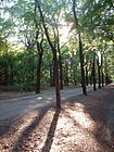
With the development of the rural community of Ober-Schöneweide, individual sections of this road initially received different names. Around 1900 the eastern area between Rathenaustraße and the district of Cöpenick was named Berliner Chaussee , from 1904 Berlin-Köpenicker Chaussee . In 1905 the westernmost section was spun off and called Köpenickerstraße (also spelled Cöpenicker Straße ). The middle area between Rummelsburger Straße and Weiskopffstraße was called Waldstraße from 1905 , on which the recently opened community cemetery was located. The street An der Wuhlheide received its continuous name in 1928. The northern lane between the driveway east of Rudolf-Rühl-Allee (old street layout) along property 263 (the Alte Försterei stadium ) and property 265 (without the street in front of it) belong to it Koepenick . The Oberschöneweide forest cemetery , which can be reached via the extended Rathenaustraße, currently has the address An der Wuhlheide 131 a. The Mellowpark was laid out on the Spree side in 2012 (middle picture). |

|
| Antoniuskirchstrasse
( Location ) |
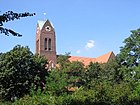
140 | St. Anthony of Padua Church | 1909 | The street encloses the church in a U-shape. With the construction of the church in 1906/1907, the road was laid out as a condition for the granted building permit by the parish. |
|
|
Deulstrasse
( Location ) |
320 | Carl Deul (1855–1904), architect , first mayor since 1898; Administrator of the Oberspree development area | around 1900 | Deulstrasse connects Siemensstrasse (south) with Helmholtzstrasse (north). In 1901 it is still shown as "undeveloped". In the 1901 address book (suburb of Ober-Schöneweide) Deul is listed as a master builder with the address Edisonstraße 7. The Evangelical Methodist Church of Peace is located on the corner of Helmholtzstrasse . |

|
|
Edison Street
( Location ) |
950 (in the district) |
Thomas Alva Edison (1847–1931), American inventor, best known worldwide for the phonograph and the incandescent lamp | around 1896 | The street runs in two easy arcs from the Treskowbrücke to Rummelsburger Straße / An der Wuhlheide. It connects the Brückenstraße in the district of Niederschöneweide with the Treskowallee and is traversed by several tram lines along its entire length.
When the road network was first constructed, only today's northern section between Wilhelminenhofstrasse and An der Wuhlheide was given the name Edisons. The rest of the traffic route was named Halskestrasse after the engineer and entrepreneur Johann Georg Halske . Presumably when the Treskow Bridge was completed in 1904, the entire street was given the name Edisonstraße. When the development began, a deaconess station with the Frauenhilfe clubhouse had been established at Edisonstraße 62 . The intersection with Wilhelminenhofstrasse, initially not surrounded by large factory buildings, was called Königs-Platz around 1900 after the reindeer F. König who lived there, and from 1907 it was shown separately as Königsplatz . In 1930 it received the joint -s, in 1936 it was deleted from the street directory. |

|
| Oak frame
( Location ) |
Frame , historical name for a road through a forest area, here probably predominantly lined with oaks | around 1730 | The straight forest path north parallel to An der Wuhlheide runs between Treskowallee (west) and the road at the FEZ . The unpaved path is said to have been created as a connection between the Berlin Palace and the Köpenick Palace . | ||
| Elmotion
( Location ) |
Elbe , river in Germany | around 1995 | The Elbeweg is a cul-de-sac between Spreeschloßstraße (north) and Minna-Todenhagen-Straße (south) through the allotment garden 'Am Freibad'. Residential houses are not shown there, but two commercial operations are. |

|
|
| Ernst-Ziesel-Strasse
( Location ) |
270 | Ernst Ziesel (1880–1946), industrial architect | around 2009 | The street was laid out to develop the Wilhelminenhof campus. This courtyard was created after former large factories were liquidated and is largely used as a location for the Berlin University of Technology and Economics . Ernst-Ziesel-Straße is a cross connection between Johannes-Kraaz-Straße and Peter-Behrens-Straße. |

|
|
Firlstrasse
( Location ) |
520 | Wilhelm Firl (1894–1937), resistance fighter against National Socialism | Apr 20, 1948 | Firlstrasse connects An der Wuhlheide southwards with Wilhelminenhofstrasse. When the road network was set up around 1896, the traffic route was named Frischenstrasse after the technician Carl Ludwig Frischen (1830–1890), who worked successfully in the telegraph technology sector at Siemens & Halske . Immediately after the end of the Second World War , the street was renamed; this was not officially registered until 1948. Here, among other things, the Christ Church can be seen in the picture . | |
| Fontanestrasse
( Location ) |
360 | Theodor Fontane (1819–1898), writer | 1909 | The street runs from the Greek avenue to the street An der Wuhlheide. According to the development plan from 1906, the traffic route was named Straße 14 . In 1911 the Albrecht-Dürer-Realgymnasium (today Isaac-Newton-Oberschule) was built as the first building in the street. |

|
| Fritz Kirsch line
( Location ) |
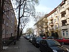
320 | Fritz Kirsch (1903–1940), politician, resistance fighter | Apr 20, 1948 | It connects Wattstrasse with Helmholtzstrasse. According to the development plan of 1906, the traffic route was called Westendstraße , which denotes the western end of the new development area. The name change, which was made after the end of the war in 1945, was not officially confirmed until 1948. |
|
| Fritz-Koenig-Weg
( Location ) |
630 | Fritz König (1849–1928), community representative and original in Oberschöneweide | Feb. 1, 2010 | It leads from Nalepastraße (west) to Rummelsburger Landstraße (east). The traffic route was called Route 7 until 2010 . |

|
| Fuststrasse
( Location ) |
340 | Johannes Fust (~ 1400–1466), merchant, became known as a lender for the printing of the Gutenberg Bible | around 1915 | Fuststrasse runs parallel to Rummelsburger Strasse and connects Mentelinstrasse with Edisonstrasse. According to the development plan from 1906, the traffic route was called Straße 6 . |

|
|
Gaussstrasse
( Location ) |
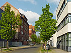
130 | Carl Friedrich Gauß (1777–1855), mathematician and astronomer | around 1900 | The Gaußstraße runs from Waldowplatz in a south-west direction to Slabystraße. When the road system was laid out, the traffic route got its current name around 1900. In 1906 no development was identified. In 1907 the community built its first community school here. |
|
| Goethestrasse
( Location ) |
610 | Johann Wolfgang von Goethe (1749–1832), poet | 1909 | The Goethestrasse connects the Greek Allee with the Großstrasse in a curved street layout. When the road system was laid out, the traffic route got its current name around 1900. |

|
| Greek avenue
( Location ) |
690 | Greece , south-east European state | Apr 20, 1937 | The Greek Allee runs between Edisonstrasse and Firlstrasse. In the middle between the two lanes there is a green area, the Greek Park.
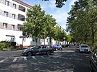
The street was laid out by the rural community of Oberschöneweide, which was founded in 1898, as Rathausstraße in the form of Anger . The eponymous town hall, however, was not built. When the name was changed, the market square stretching east to Edisonstrasse was included. Fascist Germany paid homage to one of its allies by renaming it. The sculpture “Venus and Amor” by Peter Christian Breuer from 1925 is in the Greek Park (see second picture, last column). As part of the renovation work, the Greek Allee was reconstructed in 2011/2012, primarily with its historical paving, based on the work of the garden and landscape architects Müller / Wehberg and the research and planning group Stadt und Verkehr Büro Lützow 7 . The listed St. Antonius Church is on the Greek avenue . |

|
| Major road
( Location ) |
230 | Hans Groß (1860–1924), airship designer | Oct 26, 1910 | The major road runs in a south-east direction from Greek Allee to Firlstrasse. When the road system was laid out around 1902, the traffic route was given the name Straße 12 . |

|
|
Helmholtzstrasse
( Location ) |
570 | Hermann Helmholtz (1821–1894), natural scientist | around 1896 | The street connects Edisonstrasse (in the east) with Tabbertstrasse (in the west). It was given its current name when the road system was laid out in 1896. In 1901 it is still shown as "undeveloped". In 1960 the former Straße 5 was incorporated into Helmholtzstraße. |

|
|
Johannes Kraaz Street
( Location ) |
270 | Johannes Kraaz , architect , working on the development of the Oberschöneweide industrial area | Jan. 4, 2010 | The street was laid out on the Wilhelminenhof campus and connects Wilhelminenhofstrasse with Ernst-Ziesel-Strasse. The name of the street was corrected due to a misspelling (Johannes Kraatz). |

|
|
Keplerstrasse
( Location ) |
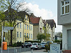
190 | Johannes Kepler (1571–1630), astronomer | around 1900 | Keplerstraße runs from Rathenaustraße (northwest) to Waldowplatz (southeast). |
|
| Kilianistrasse
( Location ) |
330 | Heinrich Kiliani (1855–1945), chemist | May 24, 1951 | Kilianistrasse runs from Parsevalstrasse (west) over Schillerpromenade to Großstrasse (east). When the road system was laid out, the traffic route was initially called Straße 13 , in 1909 it was named Bismarckstraße after Chancellor Otto von Bismarck . |

|
| Klarastrasse
( Location ) |
150 | Klara , female name | around 1900 | The street connects Wilhelminenhofstraße (southwest) with Plönzeile (northeast). It got its current name with the layout of the road system around 1900, until 1903 it was written Clarastraße . | |
| Kottmeierstrasse
( Location ) |
510 | Hermann Kottmeier (1855–1927), first head of office of Ober-Schöneweide , head forester in Köpenick | 1909 | It connects Firlstrasse with Rathenaustrasse . It also has an access arm north of the main route. According to the development plan, it was initially called Straße 11 . |

|
| Kunheimstrasse
( Location ) |
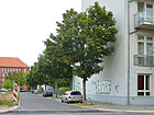
100 | Kunheim & Co. Chemical factory in Niederschöneweide | Sep 1 2003 | Kunheimstrasse lies between Tabbertstrasse and Nalepastrasse and was initially laid out as a private road for development after 1990. A dead end street named after the entrepreneur and chemist Hugo Kunheim (1838–1897) existed from 1906 to the 1940s south of Wilhelminenhofstrasse. The AEG had one of its administrative offices there. This cul-de-sac was later rededicated . |
|
|
Lauffener Strasse
( Location ) |
130 |
Lauffen , a town in Baden-Württemberg, was the demonstration site of the first functional 25 kilovolt overhead line in 1891 |
around 1896 | It connects Wilhelminenhofstrasse with the square on Kaisersteg . When it was first named, it was spelled Laufenerstraße or Laufener Straße (without double-f). |

|
|
Marienstrasse
( Location ) |
240 | Maria , female first name | around 1900 | Three parallel streets (Klarastraße, Marienstraße, Mathildenstraße) between Wilhelminenhofstraße and Plönzeile were named at the same time after female first names. The Marienstraße ends as a dead end about 100 meters after the Plönzeile . In 1901 it is still shown as 'undeveloped'. | |
| Mathildenstrasse
( Location ) |
150 | Mathilde , first name of the wife of the entrepreneur Emil Rathenau, was mainly socially committed in Oberschöneweide | around 1900 | Three parallel streets (Klarastraße, Marienstraße, Mathildenstraße) between Wilhelminenhofstraße and Plönzeile were named at the same time after female first names. In 1901 it is still shown as "undeveloped" and until 1907 it was written without joints . | |
| Mentelinstrasse
( Location ) |
560 | Johannes Mentelin (~ 1410–1478), printer | Apr 10, 1931 | Mentelinstrasse was laid out as Strasse 4 around 1900 . It runs from Rummelsburger Strasse southwest to Tabbertstrasse. |

|
| Minna-Todenhagen-Strasse
( Location ) |
850 (in the district) |
Minna Todenhagen (1880–1950), co-founder of the Arbeiterwohlfahrt | 2016 | The street was called Grenzweg until 2016 . It connects the Rummelsburger Landstrasse / Rummelsburger Strasse over the Minna-Todenhagen-Brücke with the Köpenicker Landstrasse in the district of Niederschöneweide . |

|
|
Nalepastrasse
( Location ) |
2140 | Paul Nalepa (1846–1900), dye works owner, community representative (aldermen) in Oberschöneweide | 1904 | Nalepastraße leads south from Rummelsburger Landstraße to Siemensstraße. It is interrupted by the site of the former Nalepastraße radio station , in which the radio of the GDR was based from 1956 to 1991. In its course the street crosses the allotment gardens Wilhelmstrand, Oberspree and Am Freibad.
The southern end of Nalepastraße has existed as Alteneckstraße since 1896 , the tram depot there since 1901. The street received its current name in 1904 and was extended to the north in 1930. At the northern end there was Nobelshof Street from 1914 . Since 1938 both streets have been connected as Nalepastraße and have been renumbered. |
 |
| Nixenstrasse
( Location ) |
90 | Mermaid , water spirit | before 1919 | The Nixenstraße goes southwest from An der Wuhlheide and leads as a dead end directly to the Spree. The rowing society of 1884 had secured a terrain here in good time . |

|
| Osmar-Klemm-Strasse
( Location ) |
290 | Osmar Klemm , architect; Participated in the construction in Oberschöneweide together with Paul Tropp and Ernst Ziesel . | Jan. 4, 2010 | The traffic route was created on the Wilhelminenhof campus and is a cross-connection between Johannes-Kraaz-Straße, Peter-Behrens-Straße and Paul-Tropp-Straße.
The street was initially named Gottfried-Klemm-Straße. Some time after the official name assignment, two scientists discovered that the first name of the architect honored here was not Gottfried, but Wilhelm Osmar. The Berlin authorities they informed checked the process again. The name of the street was corrected as a result. |

|
|
Ostendstrasse
( Location ) |
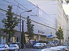
680 | The street is on the eastern outskirts of the former rural community Oberschöneweide. | before 1896 | The street runs between Wilhelminenhofstrasse and Parkstrasse and continues as Weiskopffstrasse. Several tram lines run on it.
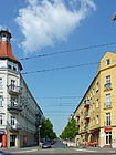
The name refers to a former villa colony called Ostend , which was built in the founding years . In the time of industrialization, numerous entrepreneurs had their factory buildings built along the street; the best known is the Behrensbau (picture below). It was built in 1915–1917 based on plans by the architect Peter Behrens for the National Automobile Society and later housed the Oberspree tube factory (RFO) of the AEG . After the Second World War, the RFO became the Oberspreewerk (OSW), from 1951 the telecommunications plant and finally in 1960 the television electronics plant . |
|
| Otto Kruger line
( Location ) |
240 | Otto Krüger (1886–1936), communist and resistance fighter | June 24, 1960 | It connects Helmholtzstrasse northwards with Mentelinstrasse. According to the initial development plan, the traffic route was named Straße 8 . The namesake lived in Oberschöneweide on Wattstrasse. |

|
|
Parkstrasse
( Location ) |
120 | Volkspark Wuhlheide | before 1901 | It begins at the An der Wuhlheide traffic route and ends at the Ostendstrasse – Weiskopffstrasse road. |

|
| Parsevalstrasse
( Location ) |
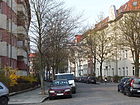
180 | August von Parseval (1861–1942), airship designer | Oct 26, 1910 | The street connects the southern carriageway of the Greek Allee with the Goethestrasse towards the south and extends a short distance beyond it. Construction began in the year it was named. |
|
| Paul-Tropp-Strasse
( Location ) |
190 | Paul Tropp , architect who, together with other architects of his time, was involved in the development of the Schöneweide industrial area | Jan. 4, 2010 | Paul-Tropp-Straße was laid out on the Wilhelminenhof campus. It connects Wilhelminenhofstrasse with Osmar-Klemm-Strasse. |

|
| Peter-Behrens-Strasse
( Location ) |
280 | Peter Behrens (1868–1940), architect and urban planner | Jan. 4, 2010 | Peter-Behrens-Straße was laid out on the Wilhelminenhof campus. It connects Wilhelminenhofstrasse with Ernst-Ziesel-Strasse. In Oberschöneweide, the architect Behrens was in charge of the construction of the AEG industrial buildings, such as the Behrensbau in Ostendstrasse 1-4. |

|
| Place on Kaisersteg
( Location ) |
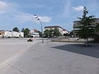
100 × 90 | Kaisersteg , a bridge over the Spree | March 11, 2008 | The square was first created with the reconstruction of the Kaisersteg, which was destroyed in World War II. It is connected to Wilhelminenhofstrasse by the Lauffener Strasse leading northwards. |
|
| Plön line
( Location ) |
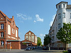
480 | Fritz Plön (1906–1944), worker from the AEG plant in Schöneweide and resistance fighter | Apr 20, 1948 | The Plönzeile connects Firlstraße with Rathenaustraße. When the road system was laid out around 1906, it was named Luisenstrasse in honor of Luise, Queen of Prussia . For a long time the town hall of Oberschöneweide was located in the building at Luisenstraße 33.
The street name change took place in 1945 immediately after the end of the Second World War , but did not become official until 1948. |
|
| Poggendorffweg
( Location ) |
120 |
Johann Christian Poggendorff (1796–1877), physicist |
Dec 15, 1930 | The Poggendorffweg connects the Nalepastraße with the Rummelsburger Landstraße. The way was laid out as Straße 2, then it was named Nobelshof, where the central station of the Berlin electricity works was located. |

|
|
Rathenaustraße
( Location ) |
520 | Emil Rathenau (1838–1915), mechanical engineer and entrepreneur, father of Walther Rathenau |
1900 (with interruption) |
Rathenaustraße runs between Wilhelminenhofstraße (south-west) and An der Wuhlheide (north-west). To the north, the continuation to the cemetery is shown on some maps as Extended Rathenaustraße.
When the road system was laid out, the traffic route was named in honor of the entrepreneur Emil Rathenau, who made a significant contribution to the economic growth of Schöneweide. Because it came from a Jewish family, the name was changed to Irmhildstrasse on April 5, 1934 . When the name changed after the war, the street was given its original name back on April 20, 1948. |
|
| Reinbeckstrasse
( Location ) |
80 | Johann Philipp Otto Reinbeck (19th century), owner of the first documented Oberschöneweider homestead; Oberfinanzrat | May 11, 1938 | Reinbeckstraße goes off Wilhelminenhofstraße to the south as a spur road. When it was built around 1907, it was called Schloßparkstrasse . The Reinbeckhallen, a center for contemporary art, are located next to it. |

|
| Roedernstrasse
( Location ) |
380 | Siegfried von Roedern (1870–1954), district administrator of the Niederbarnim district | 1909 | The Roedernstraße runs from the Greek avenue northwards to the Edisonstraße. The rectory of the St. Antonius parish at number 1 is a listed building . |

|
| Rudolf-Rühl-Allee
( Location ) |
2260 | Rudolf Rühl (1842–1909), farmer, local politician and city elder of Köpenick | March 29, 2011 | The Köpenicker Allee , which was rebuilt and modernized in 1995, was given this name in 2011. It is located between the street An der Wuhlheide and the district boundary to Karlshorst on Waldowallee. The northern 65 meters with the connection to Waldowallee belong to Köpenick. The following street section (to the north and south) between the KGA 'Gartenfreunde Wuhlheide' and plots 1 and 2 belong to the district. The district boundary to Köpenick runs along the Alte Köpenicker Allee to the new street layout, from this intersection (including the Wuhlheide train station ) the street and the eastern edge of the road belong to Köpenick, the Wuhlheide to the west along the street to Oberschöneweide. The southern 190 meters of the road are again in Oberschöneweide, while the district boundary remains on the old route. |

|
| Rummelsburger Landstrasse
( Location ) |
950 (in the district) |
Rummelsburg , direction | around 1950 | The street lies between the bridge at Hohen Wallgraben (south of Blockdammweg) and Minna-Todenhagen-Straße. Its northeast side forms the district boundary to Karlshorst north of the Fritz-König-Weg . The properties on the northeast side 1–15 (odd) therefore belong to Karlshorst.
When the road connection was first constructed around 1920 from Köpenick to Berlin, it was initially called Rummelsburger Chaussee . |

|
| Rummelsburger Strasse
( Location ) |
560 | Rummelsburg , direction | before 1906 | The street runs between Minna-Todenhagen-Straße and Edisonstraße. The driveway to the bridge over the Treskowallee / Edisonstrasse intersection begins at its southeastern end .
Today's Rummelsburger Strasse was shortened in the 1920s by the section between Am Walde and Minna-Todenhagen-Strasse. This area fell on the Rummelsburger Landstrasse. The route between Waldstrasse and Edisonstrasse is given in the 1919 address book . |

|
|
Scharnweberstrasse
( Location ) |
360 | Georg Scharnweber (1816–1894), District Administrator of the Niederbarnim district | before 1906 | It connects Ostendstrasse to the northwest with Waldowplatz. |

|
| Schiller promenade
( Location ) |
250 | Friedrich Schiller (1759–1805), poet | 1910 | The broad street was initially called Street 15 . It connects Wilhelminenhofstrasse with the southern carriageway of Greek Allee . On the corner with what was then Rathausstrasse (now: Greek Allee) is the listed former Imperial Post Office (see picture). |

|
| Black way
( Location ) |
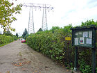
930 | Presumably, after attachment of the way with slag named | around 1925 | Not officially named road through several allotment gardens, which runs between Rummelsburger Landstrasse and Nalepastrasse, interrupted by Minna-Todenhagen-Strasse. |
|
| Siemensstrasse
( Location ) |
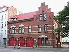
510 | Werner von Siemens (1816–1892), entrepreneur, founder of electrical engineering | around 1896 | The street runs from the Stubenrauchbrücke eastwards to Edisonstrasse. It was given its name during the expansion of the Oberschöneweide community, which honored Siemens' commitment to the settlement of factories here. House number 22 houses the Oberschöneweide volunteer fire brigade (see photo). The building was erected around 1897 and is a listed building. |
|
| Slabystrasse
( Location ) |
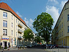
370 | Rudolf Slaby (1887–1953), Adolf Slaby's son, was an engineer and co-founder of the Slaby-Beringer -Automobil-Gesellschaft. | around 1896 | Slabystrasse runs southeast between Rathenaustrasse and Ostendstrasse. In 1901 it is still shown as "undeveloped". |
|
| Spindlersfelder Strasse
( Location ) |
280 (in the district) |
Spindlersfeld , district of Berlin-Köpenick, direction | July 16, 2002 | The Spindlersfelder Straße leads from An der Wuhlheide over the Wilhelm-Spindler-Brücke over Köpenick to Glienicker Straße. Only the section from the south bank of the Spree to An der Wuhlheide belongs to Oberschöneweide, it is not built on. The name was given in connection with the construction of the bridge over the Spree. It is part of the Tangential Link Ost (TVO). |

|
| Spreeschlossstrasse
( Location ) |
230 | probably looking for a restaurant here | after 1901 | It is a street dedicated to the allotment garden 'Wilhelmstrand' and leads from Nalepastraße as a dead end street to the east bank of the Spree. From there the ferry line F11 , the oldest ferry connection in Berlin, goes to Baumschulenstrasse . |

|
| Steffelbauerstrasse
( Location ) |
300 | Kurt Steffelbauer (1890–1942), teacher, resistance fighter against National Socialism | May 24, 1951 | The Steffelbauerstraße was called Kaiserstraße around 1907 in honor of the German emperor . It connects An der Wuhlheide to the southwest with Ostendstrasse. The previous southern tip up to the Spree merged into the industrial site. |

|
| Road to the FEZ
( Location ) |
620 | Leisure and recreation center (FEZ) in the Wuhlheide | May 3, 2005 | The road goes north as a dead end from An der Wuhlheide. With the establishment of the then pioneer palace "Ernst Thälmann" (later called FEZ) it was built, but remained nameless for many years. |

|
|
Tabbertstrasse
( Location ) |
540 | Louis Tabbert (19th / 20th century), community representative in Oberschöneweide, brewery owner | around 1906 | The street runs from Siemensstraße northwest approximately parallel to the Spree . After a right-angled bend, it joins Nalepastraße.
The northern section of the street was first called Hefnerstraße after Friedrich von Hefner-Alteneck , an airship designer. Tabbert owned a wheat beer brewery and ran the Tabberts Waldschlößchen excursion restaurant in the community . According to the address book from 1901, he lived at Wilhelminenhofstrasse 19. |

|
|
Treskowallee
( Location ) |
850 (in the district) |
Carl von Treskow (1787–1846), owner of the Friedrichsfelde estate |
1900 (with interruptions) |
The road begins in the district of Karlshorst , crosses the district boundary south of the Trabrennbahn and ends at Rummelsburger Straße / An der Wuhlheide. Several tram lines run on it. Edisonstrasse is its southern continuation.
When the rural community of Ober-Schöneweide was formed, this traffic route formed the connection to the lands of the lords of Treskow and was given the name Treskowallee. The southern section was spun off in 1910 and was called Karlshorster Chaussee until 1955 , when it became Karlshorster Landstrasse . Between 1961 and 1992 the entire street was named Hermann-Duncker-Straße after the unionist Hermann Duncker . The avenue was given its original name back on January 9, 1992. |

|
| Treskowstrasse
( Location ) |
110 | Sigismund von Treskow (1864–1945), District Administrator of the Niederbarnim district, promoted the development of the northern and eastern suburbs of Berlin | before 1906 | This short road connects An der Wuhlheide to the south with Waldowplatz. |

|
| Triniusstrasse
( Location ) |
330 | August Trinius (1851-1919), writer | 1909 | The Triniusstraße connects the Greek avenue with the street An der Wuhlheide. At first the traffic route was called Straße 16 . |

|
|
Under the crane runway
( Location ) |
220 | Crane runway , name for a crane running on rails | March 11, 2008 | The street is only a bike and footpath and forms an entrance from Wilhelminenhofstraße to the square on Kaisersteg . The eponymous crane runway has been preserved as a technical monument on the industrial site. |

|
|
Waldowplatz
( Location ) |
80 (circular) |
Wilhelm von Waldow (1856–1937), lawyer and civil servant, district administrator of the Niederbarnim district | around 1900 | From this green space the Keplerstrasse, Treskowstrasse, Scharnweberstrasse, Waldowstrasse and Gaußstrasse go in a star shape. |

|
| Waldowstrasse
( Location ) |
220 | Wilhelm von Waldow (1856–1937), lawyer and civil servant, district administrator of the Niederbarnim district | around 1900 | The Waldowstraße runs from Ostendstraße northwest to Waldowplatz. It then continues as a footpath and ends as a dead end . Until the 1950s it led to the street An der Wuhlheide. |

|
| Waltraud-Krause-Weg
( Location ) |
140 | Waltraud Krause (1925–2010), local chronicler from Oberschöneweide | Aug 30, 2015 | Newly laid out path between Siemens- (No. 22) and Wilhelminenhofstraße (No. 7). Course slightly offset in the course of Deulstrasse. | |
| Waterway
( Location ) |
90 | Watercourse of the Spree | before 1905 | The waterway extends from the Ostendstraße / Weiskopffstraße to the north bank of the Spree. When it was added to the Berlin address book in 1905, it was still shown as "undeveloped". |

|
| Wattstrasse
( Location ) |
650 | James Watt (1736-1819), English inventor | around 1900 | Wattstrasse runs between Siemensstrasse (south) and Mentelinstrasse (north). It continues as a cul-de-sac in the allotment gardens Grüne Aue . |

|
| Weiskopffstrasse
( Location ) |
250 | Wilhelm Weiskopff (19th / 20th century), bleacher owner , local politician | around 1900 | Weiskopffstraße is the eastern continuation of Ostendstraße to An der Wuhlheide. |

|
| Wilhelminenhofstrasse
( Location ) |
1900 | Excursion restaurant "Wilhelminenhof", which was opened at the beginning of the 19th century by the secret finance councilor Johann Philipp Otto Reinbeck on the northern bank of the Spree | around 1896 | The busy street runs from Siemensstraße to Ostendstraße. The last section after Ostendstrasse is a residential street that leads directly to the Spree. Several tram lines pass through it between Edisonstrasse and Ostendstrasse.
Wilhelminenhofstrasse became known nationwide in the 20th century because numerous important factories such as the AEG cable works Oberspree ( Atelierhaus79 ), the accumulator works (later Afa / Varta AG ) and the Deutsche Niles works had established themselves on it. The Wilhelminenhof campus of the University of Technology and Economics is located on it . Many artists have set up their studios in the former factory halls. Numerous buildings are under monument protection. |

|
|
Zeppelinstrasse
( Location ) |
840 | Ferdinand Graf von Zeppelin (1838–1917), designer of airships | 1909 | Zeppelinstraße runs in a west-east direction between Edisonstraße and Firlstraße. When the road system was laid out around 1896, the traffic route was given the name Straße 10 . |

|
Other locations in Oberschöneweide
Allotment gardens
The allotment gardens (KGA) are also known colloquially as colonies. The district includes:
Parks, open spaces
|
|
Commercial space
|
Existing or only planned streets
- Anyway : First mentioned in the address book in 1925, it is no longer included in 1928.
- Alteneckstraße (1896) after the technician and designer Friedrich von Hefner-Alteneck , renamed Nalepastraße in 1904
- Bismarckstraße , laid out in 1909, since 1951 Kilianistraße.
- Buntzelstraße : from 1909, after the heirs of Max Buntzel (horticultural director in the community), whose house was on the corner of Wilhelminenhofstraße and Ostendstraße. It disappeared from the address directory after 1930.
- Elisabethplatz : In 1928 such a place between Luisenstraße and Marienstraße was entered in the address book. The place was only deleted from the address directory after 1945.
- Peace Square : This square was first designated in 1901 on the north bank of the Spree, on which the western section of Wilhelminenhofstrasse ends. It kept its name (now Friedensplatz ) even after the Stubenrauchbrücke was built . It was named after the Peace of Frankfurt . In 1930 it received the joint -s and was thus called Friedensplatz . Around 1936 the place was closed.
- Hallenslebenstrasse : since 1909 a traffic route between Frischenstrasse and Irmhildstrasse shown in the address book, named after Emil Hallensleben , lawyer and politician, but it was never built on. Therefore, the district administration moved it in after 1943.
- Hanffstrasse , only registered in 1902 and marked as 'undeveloped'. Probably after Johann Nicolaus Hanff , organist and composer of the 17th / 18th centuries. Century named.
- Karlshorster Chaussee , the southern and only Oberschöneweider part of Treskowallee , which otherwise belongs to Karlshorst , relocated in 1910. The road previously ran through a wooded area, and the Queen Elisabeth Hospital was built in 1910 . In 1955 it was renamed Karlshorster Landstraße , in 1961 it was combined with the Karlshorster part by assigning new house numbers under the name Hermann-Duncker-Straße , and since 1992 Treskowallee again .
- Market square , laid out in 1909, Greek avenue since 1937.
- Nobelshof , name of a large petroleum store built in 1899. From 1914 to 1937 Nobelshof was listed as a street in the address book. From 1938 the street came to Nalepastraße . Nobelshof is still entered as a location in the city map from 1961. Nowadays the name is no longer used.
- Ohmstrasse , named after the technician Georg Simon Ohm , from Helmholtzstrasse northwards to what will later become Mentelinstrasse , then eastwards to Wattstrasse , from 1903 For exact location, see the 1907 map.
- Plattnerstraße , from Nalepastraße to Spree, first recorded in the address book in 1932. It was still included in the 1955 city map, but no longer in 1961.
- Rathausstrasse , laid out in 1909, has been Greek Allee since 1937.
- Reuleauxstraße - named after the mechanical engineer Franz Reuleaux , from Helmholtzstraße to Ohmstraße , built from 1901 (or earlier) to 1908 as the southern part of what would later become Tabbertstraße. For the exact location, see the 1907 city map. Under Reuleauxstraße in the 1902 address book, an innkeeper Rummel and the amusement facility, Rummels Heidepark are named.
- Spreestrasse : The street in the address books between 1901 and 1940 that goes off Ostendstrasse with only five house numbers. Two plots were designated as permanent construction sites, one house (number 3) was actually built. For a long time there was a riding stable under number 4, which then appears as a storage area. In 1930, the Rowing Club 1913 , owned by the City of Berlin, was designated on plot 7 . The street is still marked in the 1961 city map. It was later de-dedicated and the individual buildings included in Ostendstrasse .
See also
Web links
- Map of Berlin 1: 5000 with district boundaries. Senate Department for Urban Development Berlin, 2012, accessed on 23 August 2012 .
- Berlin-Brandenburg Statistics Office: Directory of streets and squares in the Treptow-Köpenick district (as of February 2015); pdf
- Streets in Oberschöneweide by Kaupert Media
Individual evidence
- ↑ a b c FIS Broker map display Map of Berlin 1: 5000 (K5 color edition) accessed on August 22, 2012, daily updated district boundaries
- ↑ Berliner Chaussee, see indicated cross streets . In: Address book for Berlin and its suburbs , 1901, Part V, p. 139.
- ^ Berlin-Köpenicker Chaussee . In: Berliner Adreßbuch , 1904, Part V, p. 174.
- ↑ Köpenickerstraße with details of its course . In: Berliner Adreßbuch , 1905, Part V, p. 206.
- ↑ Waldstrasse, with progress report . In: Berliner Adreßbuch , 1906, Part V, p. 233.
- ^ Deaconess station (third column) . In: Berliner Adreßbuch , 1919, Part V, p. 202.
- ↑ a b Parkstrasse, Wilhelminenhofstrasse> Königs-Platz behind Edisonstrasse . In: Address book for Berlin and its suburbs , 1901, Part V, p. 140.
- ↑ Königsplatz . In: Berliner Adreßbuch , 1907, Part V, p. 259.
- ↑ Berlin. Motorist Atlas 2007/2008 , StadtInfo Verlag, ISBN 3-8279-3008-1 .
- ↑ Press release from the Treptow-Köpenick district office on the renaming of Weg 7 to Fritz-König-Weg , accessed on November 8, 2012.
- ↑ Thomas Loy: Greek conditions in the Greek avenue. On-site meeting for the crisis in Berlin. Der Tagesspiegel, July 17, 2015, accessed on July 18, 2015 .
- ^ Sculpture in Berlin with information on Venus and Cupid ( Memento from May 19, 2014 in the Internet Archive )
- ^ Information from construction signs on the square, 2010.
- ↑ Official Journal for Berlin, publisher: Landesverwaltungsamt Berlin, 66th year No. 22, ISSN 0943-9064 , page 1192
- ↑ Kunheimstrasse . In: Berliner Adreßbuch , 1937, Part IV, p. 1983.
- ↑ Example of writing Laufener Strasse . In: Berliner Adreßbuch , 1919, Part V, p. 203.
- ↑ Resolution 15/16 of the Treptow-Köpenick district office of December 20, 2016
- ↑ a b Nixenstrasse, Nobelshof . In: Berliner Adreßbuch , 1919, Part V, p. 205.
- ↑ Gottfried or Osmar? Confusion about a Treptower street name. In: Der Tagesspiegel , March 20, 2016.
- ↑ Official Journal for Berlin, publisher: Landesverwaltungsamt Berlin, 66th year No. 22, ISSN 0943-9064 , page 1192
- ↑ Schloßparkstrasse . In: Berliner Adreßbuch , 1907, Part V, p. 261.
- ↑ Press release from the Treptow-Köpenick district office and invitation to rename the street from March 23, 2011 , accessed on August 23, 2012.
- ^ Rummelsburger Strasse (second column) . In: Berliner Adreßbuch , 1919, Part V, p. 206.
- ↑ Schiller Promenade . In: Berliner Adreßbuch , 1910, III.
- ↑ According to Kauperts' account, Waldowplatz should not have been officially named. However, it is included in the list of the Statistical Office.
- ↑ waterway . In: Berliner Adreßbuch , 1905, Part V, p. 207.
- ^ Architectural monuments Wilhelminenhofstrasse
- ↑ Allotment gardens in the Treptow-Köpenick district ( Memento from September 29, 2013 in the Internet Archive ) (PDF; 38 kB)
- ↑ All way . In: Berliner Adreßbuch , 1925, Part IV, p. 1814.
- ↑ Oberschöneweide> Buntzelstrasse . In: Berliner Adreßbuch , 1909, Part V, p. 295.
- ↑ Elisabethplatz . In: Berliner Adreßbuch , 1928, Part IV, p. 1918.
- ^ Wilhelminenhofstrasse with a representation of the cross streets: Siemensstrasse. follows the peace place . In: Berliner Adreßbuch , 1903, Part V, p. 168.
- ↑ Oberschöneweide> Hallenslebenstrasse . In: Berliner Adreßbuch , 1909, Part V, p. 296.
- ↑ Ober-Schöneweide> Hanffstraße starting from Slabystraße . In: Address book for Berlin and its suburbs , 1902, Part V, p. 149.
- ↑ a b c d e city maps for 1907 , 1955 and 1961 at www.blocksignal.de
- ^ Karlshorster Chaussee . In: Berliner Adreßbuch , 1903, V.
- ↑ Nobelshof . In: Berliner Adreßbuch , 1914, V. to 1937 Nobelshoif . In: Berliner Adreßbuch , 1937, IV., 1938 no longer (no Nobelshof) . In: Berlin address book , 1938, IV.
- ↑ Location Nobelshof in the city map from 1961 on www.blocksignal.de
- ^ Ohmstrasse . In: Berliner Adreßbuch , 1903, V. (or earlier) to 1908 Ohmstrasse . In: Berliner Adreßbuch , 1908, V., no longer 1909 (no Ohmstr.) . In: Berliner Adreßbuch , 1909, V.
- ↑ Plattnerstrasse . In: Berliner Adreßbuch , 1932, IV.
- ^ Reuleauxstrasse . In: Berliner Adreßbuch , 1903, V. Reuleuxstr. In: Berliner Adreßbuch , 1908, V., no longer 1909 (no Reuleauxstrasse) . In: Berliner Adreßbuch , 1909, V.
- ↑ Ober-Schöneweide> Reuleauxstrasse . In: Address book for Berlin and its suburbs , 1902, Part V, p. 149.
- ↑ Spreestrasse . In: Address book for Berlin and its suburbs , 1902, V, p. 150.
- ↑ Spreestrasse 7 . In: Berliner Adreßbuch , 1930, IV, p. 1948.


