
Baumschulenstrasse (Berlin-Baumschulenweg)
| Baumschulenstrasse | |
|---|---|
|
|
|
 |
|
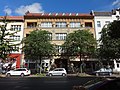
| Plastic Mother Earth by the metal sculptor Rüdiger Roehl |
|
| Basic data | |
| place | Berlin |
| District | Baumschulenweg |
| Created | January 29, 1842 |
| Hist. Names | Filing path |
| Connecting roads | Späthstrasse (southwest) |
| Cross streets |
(Selection) Königsheideweg , Südostallee , Kiefholzstraße , Köpenicker Landstraße , Neue Krugallee |
| Buildings | see: Buildings |
| use | |
| User groups | Pedestrian traffic , bicycle traffic , car traffic , public transport |
| Technical specifications | |
| Street length | 1920 meters |
The Baumschulenstraße is located in the district of Treptow-Koepenick of Berlin . It mainly runs in the Baumschulenweg district , some properties belong to the Johannisthal and Plänterwald districts . The street is named after the Späth'schen tree nursery , which was settled there by Franz Späth in the 19th century .
course
The road begins in the southwest as an extension of Späthstrasse from the confluence with Königsheideweg and runs in a straight line in a north-east direction to the banks of the Spree . In its course, it crosses the Britzer Zweigkanal with the tree nursery bridge , crosses Sonnenallee / Südostallee and then Kiefholzstrasse . Behind the Baumschulenweg S-Bahn station, it crosses Köpenicker Landstrasse and ends on the south bank of the Spree at the pier of the F11 ferry line to Oberschöneweide , the oldest ferry connection in Berlin. According to the official street directory of the Treptow-Köpenick district, the plots 56–60 east of the street belong to Johannisthal, while the parcels west of the street between Neuer Krugallee and the banks of the Spree belong to Plänterwald.
history
At the end of the 19th century, the area in what is now the Baumschulenweg district was still largely covered by the Königsheide mixed forest. There were only a few, comparatively poorly developed roads that led through the remaining areas of the former Cöllnische Heide to Berlin. Nonetheless, in a development plan from 1830, a "street that could be developed" was already identified. This was first mentioned as a filing route on January 29, 1842. This meant a sandy and sometimes very narrow forest path, with which a remote part of the Köllnische Heide, the Hinterheide, was connected to the southern Spree deposit . The gardener owner Wilhelm Mosisch built the Mosisch House, named after him, as the first house in 1869. New residents followed, such as the dyer Ferdinand Kiekebusch, who built house number 75, or the innkeeper Eichbaum with house number 26. They all built essentially simple one to two-storey country houses, some of which are still preserved today as side wings. The street was thus characterized by workers and craftsmen, such as the master cooper Gustav Haubold , who moved to house number 86 in 1885 and produced barrels there until 1916, including for the Kunheim chemical factory . To connect the Späth'sche tree nursery, the Baumschulenweg station on the Görlitzer Bahn opened on May 20, 1890 . With the construction of the suburban tracks of the Görlitzer Bahn , the station was placed on a dam and on May 1, 1906 a second platform was opened on the suburban line. On the Neukölln - Baumschulenweg connecting line, which opened in 1896, there was passenger traffic since 1910. In the years 1894/1895 the house Baumschulenstrasse 14 / Ernststrasse 2 was built, in which first a restaurant, later a tobacco shop and around 1910 a family restaurant Radfahrstation was set up. After the end of World War II , the first local youth club met there in 1945; afterwards it was used by a children's library.

On the initiative of Franz Späth, the rural community of Treptow paved the way in 1896 . It is thanks to his influence that after the establishment of today's Berlin S-Bahn station , the street was also named Baumschulenweg . Sidewalks were made of gravel and clay; This delimitation led the houses to a front garden. The population increased steadily in the following years and led from 1910 to 1912 to the construction of the church Zum Vaterhaus , a building ensemble that is comparatively unique in Berlin for church and communal use, which can still be called the center of the town today. At this time, the lanes were also widened and one of the two rows of trees was cut down that Späth had created a few years earlier. Other buildings, some of which are still preserved today, were built, including the closed perimeter block development in Baumschulenstrasse 39 to 55, which is now a listed building. Nevertheless, some areas remained free of development, such as the corner of Baumschulenstrasse / Sonnenallee, which was popularly known at the time as Waldecke : Several smaller pine forests lined the street at this point. In 1929/1930 Rudolf Henning built several three and four-story houses with flat roofs with another closed perimeter block development at Baumschulenstrasse 2-4, Neue Krugallee 210-230 and Köpenicker Landstrasse 245-259. Towards the north they were rounded off with a semi-oval, white plastered finish and were popularly known as circus tents . On the opposite side was the fool's block , named after the picturesque house entrances.
In the early 1930s, Hermann Bry's haberdashery opened in house number 11 . It was destroyed in the November pogroms on November 9, 1938; Bry had to flee from the National Socialists . At number 15, a first emerged around 1902 drugstore of Kurt Harder . Around 1950 Walter Giese (1900–1981) took over the premises and set up a radio shop with a workshop. Giese, who had previously set up his workshop at Kiefholzstrasse 32, enabled members of the KPD , SPD and SAJ to meet on his premises during the National Socialist era . He was also politically active after the end of the war and on May 12, 1945 he became the district head of the Baumschulenweg local office. He held this position until the office was dissolved on February 28, 1946. He then got involved in the revival of the sports movement in Treptow. In the 1980s, the Handwerksgenossenschaft des Handwerks (PGH) television radio used the building; currently (2014) it is used by a health food store.
During the Second World War, many of these buildings were partially badly damaged, for example Henning's buildings. The house with number 28 from 1895 was also badly hit by a bomb and had to be replaced by a new building. The adjacent building 29 is also no longer available today. In its place there is a passage to the parking lot of a hypermarket.
Buildings
Baumschulenstrasse 39 to 55

Between 1927 and 1934, a settlement for members of the Reichsbahn was built for the Ojoreila housing association according to plans by Walter Kaas . It was expanded by Arthur Poeschla between 1938 and 1940 and is now a listed building.
Baumschulenstrasse 92
The four-storey building was built in 1927/1928 as a residential and commercial building based on plans by Friedrich Brinkmann . In addition to the expressionist facade, a sculpture by Walter Kreussel from 1927 is striking. It shows a cornucopia from which coins flow and are thus a symbol for the Roman god Mercurius : the Cöpenicker Bank once resided in the building .
Ensemble church to the father's house
The entire ensemble of the church Zum Vaterhaus from the years 1910–1912 is a listed building.
Mosisch House
The building with the number 34 was built in 1869 and is therefore probably the oldest building in what is now the Baumschulenweg district. It was initially built with just one storey and a stable, but one storey was added in 1884. As a multi-family house, it remained in the family until around 1942. From 1962, PGH Elektro Treptow used the mezzanine floor. However, the condition of the house must have been problematic at the time, as it was threatened with demolition only three years later. The remaining tenants moved out while the PGH partially renovated the building. In 1971 another demolition could be prevented. After the fall of the Wall , the successor company, Treptower Elektro-Anlagen GmbH (TEA), used the building until they too left it in 2003.

Mosisch House from 1869

Walter Kaas settlement complex

Ferdinand Kiekebusch's house
Former building of the Cöpenicker Bank

Plastic Mercurius by Walter Kreussel


See also
- List of cultural monuments in Berlin-Baumschulenweg
- List of streets and squares in Berlin-Baumschulenweg
literature
- Georg Turk: Baumschulenweg and Plänterwald in Berlin. From crab manure to the plowed forest. From the story of two districts in the southeast of the city . Mercedes print, Berlin 2005
Web links
- Baumschulenstrasse. In: Street name lexicon of the Luisenstädtischer Bildungsverein (near Kaupert )
- Filing path . In: Street name lexicon of the Luisenstädtischer Bildungsverein
Individual evidence
- ^ Mike Straschewski: Baumschulenweg. In: stadtschnellbahn-berlin.de. October 26, 2008, accessed June 7, 2020 .
- ^ Michael Braun: Between Kreuzberg and KW. Suburban traffic on the Görlitzer Bahn (part 2) . In: Verkehrsgeschichtliche Blätter . No. 4 , 1991, pp. 80-90 .
- ↑ Mike Straschewski: Connection Railway Neukölln - Baumschulenweg. In: stadtschnellbahn-berlin.de. October 19, 2013, accessed June 7, 2020 .
- ↑ Complete layout of the Rodelbergweg / Baumschulenstrasse 245–259 (odd) settlement from 1929/1930
- ↑ Church to the father's house : school, church, teacher's house, parish and rectory
Coordinates: 52 ° 27 '48.5 " N , 13 ° 29' 4.8" E