Britzer connection channel
| Britzer connection channel | |||||||||||||||||||||||||||||||||||||||||||||||||
|---|---|---|---|---|---|---|---|---|---|---|---|---|---|---|---|---|---|---|---|---|---|---|---|---|---|---|---|---|---|---|---|---|---|---|---|---|---|---|---|---|---|---|---|---|---|---|---|---|---|
| abbreviation | BVK | ||||||||||||||||||||||||||||||||||||||||||||||||
| length | 3.39 km | ||||||||||||||||||||||||||||||||||||||||||||||||
| Built | 1900-1906 | ||||||||||||||||||||||||||||||||||||||||||||||||
| Beginning | Neukölln waterway intersection | ||||||||||||||||||||||||||||||||||||||||||||||||
| The End | Spree near Baumschulenweg | ||||||||||||||||||||||||||||||||||||||||||||||||
|
course
|
|||||||||||||||||||||||||||||||||||||||||||||||||
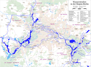
The Britzer Connection Canal (BVK) is a federal waterway of waterway class IV with restrictions in Berlin and belongs legally to the Teltow Canal . Until March 30, 1992 it was called Britzer Zweigkanal . The waterway is an abbreviation for shipping from the Teltow Canal directly to the Spree-Oder waterway (Treptower Spree) and the ports in the city center . The canal is 3.39 kilometers long and was built between 1900 and 1906. The Berlin Waterways and Shipping Office is responsible for administration .
Like the Teltow Canal, there was also an electric towing railway on the Britz connecting canal until the end of the Second World War . The total water area of the canal is 11.7 hectares .
On the bank of the canal, a stele commemorates Chris Gueffroy , the last refugee to be shot by East German border guards at the wall . He died on February 5, 1989, just a few months before the Berlin Wall opened, while attempting to escape from East to West Berlin on the Canal.
List of bridges over the Britzer connecting canal
The list of bridges over the Britzer connecting canal shows all existing bridges . The list summarizes the existing bridges in a table. Only the bridges documented in the sources (literature and web links) are included. The numbering (column 1) and kilometering (column 2) are from the branch from the Teltow Canal to the Spree in Berlin-Treptow. The numbering follows the information on the shipping cards, with newly added bridges being given the addition of the lowercase letter a and the first bridges being given the numbers 00 and 0 . The kilometers of the Teltow Canal are continued and the information is also provided with the addition of the lowercase letter a . The canal begins at kilometer 28.320a at the junction from the Teltow Canal and ends at the Treptower Spree (SOW-km 26.43) at kilometer 31.705a. In column 3, most of the bridges are documented in the picture. The fourth column contains the bridge names, with nameless bridges in brackets. The Berlin districts in which they are located are indicated below. The text column “Comments” gives the most important data of the bridges and, if applicable, their former names and also provides information about the naming. The sixth and last column links the coordinates of the structures.
| number | km | photos | Name of the bridge / place | Remarks | Coordinates |
|---|---|---|---|---|---|
|
|
|||||
| 00 | 28,400a |
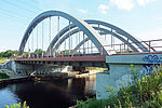
 Motorway bridge A 113 , May 2009 |
(Motorway bridge A 113) Neukölln |
The nameless arch bridge with a suspended bridge panel was built in 2001/2002 from steel (arch) and reinforced concrete (deck slab) as part of the A 113 . The arch span is 112.10 m, the bridge area 3900 m² and the superstructure width 34.74 m. The official draft was carried out by Leonhardt, Andrä und Partner (LAP), the architecture by the planning group Professor Laage and the structural engineering by Meyer + Schubart. The structure spans the Britzer connecting canal at its confluence with the Teltow Canal . Opposite is the port of Britz-Ost. The Neukölln shipping canal branches off to the north . | 52 ° 27 ′ 34 "N, 13 ° 27 ′ 27" E |
| 0 | 29,352a |

|
Britzer Allee Bridge Neukölln |
The Britzer-Allee-Brücke leads the Chris-Gueffroy-Allee (formerly: Britzer Allee) over the Britzer connecting canal. | 52 ° 27 ′ 32 "N, 13 ° 28 ′ 19" E |
| 1 | 29,820a |
 The Nursery Bridge January 1950 |
Tree nursery bridge Baumschulenweg |
The Baumschulenbrücke leads Baumschulenstrasse over the canal. The bridge was built in 1904 as a steel truss bridge in connection with the construction of the canal. | 52 ° 27 '32 "N, 13 ° 28' 44" E |
| 1a | 30,300a |
 The Südostalleebrücke July 2009 |
Südostalleebrücke Baumschulenweg |
The Südostallee bridge leads the Südostallee over the Britzer connecting canal. It was built in 1999 as a steel tied arch bridge with just one overhead arch. | 52 ° 27 '35 "N, 13 ° 29" 10 "E |
| 2 | 30,800a |
 The Kiefholzbrücke July 2009 |
Kiefholzbrücke Baumschulenweg |
The Kiefholzbrücke leads Kiefholzstraße over the Britzer connecting canal. It was built in this form in 1972/73 as a steel girder bridge. In 1997/98 a fundamental renovation took place. | 52 ° 27 ′ 45 "N, 13 ° 29 ′ 29" E |
| 3 | 31,090a |
 The new railway bridge on June 12, 2011 |
(Railway bridge) Baumschulenweg |
52 ° 27 '53 "N, 13 ° 29' 37" E | |
| 4th | 31,310a |
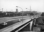
 The Marggraff Bridge on January 6, 1965 |
Marggraff Bridge Baumschulenweg / Niederschöneweide |
The Marggraffbrücke leads the Köpenicker Landstrasse / Schnellerstrasse over the Britzer connecting canal. They belong to the B 96a . It was erected as a girder bridge in prestressed concrete between 1963 and 1965. | 52 ° 27 '59 "N, 13 ° 29' 43" E |
See also
literature
- Hans-J. Uhlemann: Berlin and the Märkische waterways . transpress Verlag, Berlin, various years, ISBN 3-344-00115-9
- Writings of the Association for European Inland Shipping and Waterways e. V. various years. WESKA (Western European Shipping and Harbor Calendar), Binnenschifffahrts-Verlag, Duisburg-Ruhrort
- Folke Stender: Editing of Sportschifffahrtskarten inland 1 . Nautical Publication Verlagsgesellschaft, ISBN 3-926376-10-4 .
- W. Ciesla, H. Czesienski, W. Schlomm, K. Senzel, D. Weidner (collective of authors): Shipping maps of the inland waterways of the German Democratic Republic 1: 10,000 , Volume 4. Ed .: Wasserstraßenaufsichtsamt der DDR, Berlin 1988
- E. Thiemann, D. Desczyk, H. Metzing: Berlin and its bridges . 1st edition. Jaron-Verlag, Berlin 2003, ISBN 3-89773-073-1
Web links
- Overview of Berlin bridges. Senate of Berlin
- Bridges in Berlin at brueckenweb.de
- List of Berlin bridges in 1945
- private homepage with bridges in Berlin
- Berlin bridges from A to Z on a Berlin city map
Individual evidence
- ↑ Directory E, Ser. No. 57 of the Chronicle. ( Memento of the original from July 22, 2016 in the Internet Archive ) Info: The archive link was automatically inserted and not yet checked. Please check the original and archive link according to the instructions and then remove this notice. Federal Waterways and Shipping Administration
- ↑ Lengths (in kilometers) of the main shipping routes (main routes and certain secondary routes) of the federal inland waterways. ( Memento of the original from January 21, 2016 in the Internet Archive ) Info: The archive link was inserted automatically and has not yet been checked. Please check the original and archive link according to the instructions and then remove this notice. Federal Waterways and Shipping Administration
- ↑ Arch bridge over the Britzer connecting canal at structurae
- ↑ Tree nursery bridge with pictures at Brückenweb
- ↑ Südostalleebrücke with pictures at Brückenweb
- ↑ Kiefholzbrücke with pictures at Brückenweb
- ^ Marggrafbrücke with pictures in the bridge web


