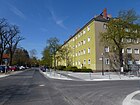
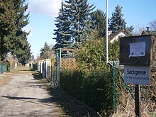
List of streets and squares in Berlin-Tegel


This list of streets in Berlin-Tegel shows the streets in the Berlin district of Tegel with their historical references. At the same time, this compilation is part of the Lists of all Berlin streets and squares project .
overview
Statistical
Tegel has 36,986 inhabitants (as of December 30, 2019) and includes the postal code areas 13505, 13507, 13509, 13629 and parts of 13599. In Tegel there are five named squares and 200 dedicated streets and paths, 18 of which have the same name (within the Berliner Road system) also belong to the neighboring districts. The total length of all officially recorded roads in the Tegel district is 78.7 kilometers.
Description of the current road network
The main road system of Tegel (as of January 2016) is determined in north-south direction by Seidel- / Berliner Straße , which belong to the regional road system . Continuing to the north and parallel to it is the 111 federal motorway with the junctions Holzhauser Straße and Waidmannsluster Damm in the Tegel area. From the A 111, according to the regional reference system, 12.8 kilometers of main lane belong to the spacious and 870 meters for exits and entrances to the higher-level road system, as well as a section of the south-west towards the city center of the Kurt-Schumacher-Damm with connection to the motorway city ring . The main road connections (Category II) leading to the neighboring districts include: to the northeast the Hermsdorfer Damm , to the northwest with 1620 meters the Heiligenseestraße and 610 meters the Karolinenstraße with the continuation to Heiligensee and Hennigsdorf . To the west, Bernauer Strasse leads to the Spandau district. In the same category II are the roads to the motorway Holzhauserstraße and Waidmannsluster dam , and Kurt-Schumacher-Damm arranged and also Veit and Wittestraße . This also includes 380 meters of access to Tegel Airport. The following Bernstorffstraße , Borsigdamm , 150 meters of Buddestraße , as well as Gorki , Konradshöher and Neheimer Straße , as well as the remaining sections of Heiligensee and Karolinenstraße are classified as regional connections . The Friederike- , Otisstraße and Ziekowstraße are complementary road links , as well as the further 390 meters of Buddestraße. In total, 15040 meters of the autobahns in the Berlin street system are recorded as large, 15160 meters as superordinate, 9560 meters as regional and 3020 meters as supplementary according to the road development plan. All other city and residential streets, private streets and footpaths included in the list with a total length of 63,300 meters remain uncategorized in the StEP . According to the OKSTRA class , 52,870 meters are “G” (municipal road), 4690 meters as “P” (private road), 2570 meters as “F” (footpath, so the Semmelweg as a forest road ((STFO) according to RBS), 1190 meters as "N". From the RBS "STRA" class, the Schwarze Weg is included with 1890 meters as "W" and 110 meters as "X" ( see Dattelner Weg , Gabrielenstrasse , Illerzeile ).
New streets since the end of the 19th century
The road system of Tegel was influenced by the rail connection made in 1893 and from 1898 by the construction of the Borsigwerke . Industrialization brought the immigration of workers and the associated establishment of the suburb Borsigwalde (from 1898) and the Waldidyll settlement on the area of the Tegel city forest. In Tegel, development plans for several settlements (Waldidyll, Martin-Luther-Siedlung, St.-Joseph-Siedlung, Borsig'scher employee settlement, Kleinhaussiedlung, Freie Scholle) were drawn up in the late 1920s and early 1930s. The construction of the settlement houses began with the laying of the streets, from 1930 to 1938 the numbered streets of the settlements were then named according to a uniform pattern. In 1934 the suburban settlement on the Hohenzollern Canal (Siemenssiedlung) was added.
A major change in the course of the road in the north of Tegel resulted from the construction of the city motorway in a north-westerly direction . In connection with the subsequent use of Tegel Airport in the south of the district, some colonies were rededicated to housing estates with building rights (garden and settler community) and four new streets in the area between the (dry) Mäckeritzgraben and the access road to the General-Ganeval-Brücke were dedicated and Named 2011: Alter Wiesenweg , Am Hohenzollern Canal , Mecklenburgweg , Before the Gates .
Street system with French names
After the Second World War , a new residential area, the “Cité Pasteur”, was created in what is now the Tegel district, when members of the French garrison stationed in Berlin settled. The streets were given French names throughout, including the prefix “Rue”, which were retained after the forces withdrew in 1994.
Overview of streets and squares
The following table gives an overview of the streets and squares in the district as well as some related information.
- Name / location : current name of the street or square. Via the link Location , the street or the square can be displayed on various map services. The geoposition indicates the approximate center of the street length.
- Traffic routes not listed in the official street directory are marked with * .
- Former or no longer valid street names are in italics . A separate list may be available for important former streets or historical street names.
-
Length / dimensions in meters:
The length information contained in the overview are rounded overview values that were determined in Google Earth using the local scale. They are used for comparison purposes and, if official values are known, are exchanged and marked separately.
For squares, the dimensions are given in the form a × b for rectangular systems and for (approximately) triangular systems as a × b × c with a as the longest side.
If the street continues into neighboring districts, the addition ' in the district ' indicates how long the street section within the district of this article is. - Name origin : origin or reference of the name.
- Notes : further information on adjacent monuments or institutions, the history of the street and historical names.
- Image : Photo of the street or an adjacent object.
| Name / location | Length / dimensions (in meters) |
Origin of name | Date of designation | Remarks | image |
|---|---|---|---|---|---|
|
Ackerplanweg
( Location ) |
60 | Field plan, field name | Oct 16, 1956 | The street is located in the "Freie Scholle settlement" and goes south from the recreation path to the KGA 'An der Industriebahn'. It was routed as street C to the area south of the recreation path, which remained undeveloped until the 1950s. |

|
| Adelheidallee
( Location ) |
390 | Aurora Raffaele Adelheid von Hedemann (1800–1856), first daughter of Wilhelm von Humboldt | around 1912 | The short residential street also ends as a dead end for pedestrians at Schlosspark Tegel and is located northwards from Gabrielenstraße . The street is shown in the Berlin address book from 1912 and was planned as street C according to the development plan . The grave of the namesake lies on the grave of the Humboldt family in the palace gardens. Adelheidallee belonged to the Tegel Castle District. There is a mini golf course with a restaurant and a senior leisure center run by the Reinickendorf district office. The eastern side of the street is bounded by the allotment gardens 'von Humboldt - Gabrielenstraße'. |

|
| Agathenweg
( Location ) |
110 | Agatha of Catania (3rd century), martyr and saint | Aug 4, 1930 | The street is located north of the Catholic St.Joseph Church between Bonifaziusstraße and Liebfrauenweg and was planned as street 27 of the development plan. In the 1930 address book, streets 21–30 between Hermsdorfer Strasse, Fliess and Feldmark are summarized as the “St. Joseph settlement”. |

|
| Allée St. Exupéry
( Location ) |
400 | Antoine de Saint-Exupéry (1900–1944), French writer and aviator | July 30, 1956 | The street lies between Seidelstraße and Rue H. Guilleaumet and leads to the former “Cité Guynemer”, a housing estate of the French protection power stationed in Berlin until 1994. |

|
| Commons path
( Location ) |
480 | Common , communally used part of the community corridor | Jan. 30, 1933 | The street in the "Freie Scholle settlement" lies between Moorweg and Schollenhof on Waidmannsluster Damm. When it was created, it was named Straße 36 of the development plan before it was named . |

|
| Altenhofer way
( Location ) |
690 (in the district) |
Altenhof , an independent municipality at the time it was named | Apr 10, 1961 | The length of the street lies between Conradstraße and Nassenheider Weg and for the most part belongs to Borsigwalde . The northwestern plots 7 and 23 (odd) belong to Tegel, from Eichstädter Weg to the northeast, the district boundary changes across the street, so that the street is in Tegel. According to the development plan, it was planned as road 169 . |

|
| Old meadow path
( Location ) |
350 | Mäckeritzwiese, a meadow path at the time it was named | Oct 15, 2011 | The road is east of the Mäckeritzgraben. With the rededication of colonies on the Mäckeritzwiesen as settlements, the former meadow path was renamed a dedicated street. The assignment of the parcels to "Access to Tegel Airport" via facility names was canceled. This corresponds to the requirement for address-codable information through the introduction of a computer-aided system . The road consists of the route between the Berlin-Spandauer Schifffahrtskanal in the south and the Tegel airport border in the north, as well as four sections to the west. The properties on the street are numbered from 11 to 127 (unordered), the properties to the east belong to the KGA 'Vor den Toren II' and are not assigned to this street. The KGA Neuland II (127) is connected to the airport premises, to the south follow the road 103–125 (Eigenland settlement), 71–101 (Köppen'sche Erben), 17–69 (Albrecht'sche Erben) and 11 for the KGA 'At the water bunker'. The width of the street was already there and the Alte Wiesenweg is already signposted . The Mecklenburgweg, Vor den Toren and Am Hohenzollern Canal mentioned in the same administrative act are not signposted as of 2015. The Alte Wiesenweg is named as a private road (OKSTRA class P) and after the RBS class as STRA, so the responsibility lies with the residents, but the equipment in terms of width and design is that of a city street. The riverside path on the Hohenzollern Canal does not belong to the (dedicated) street, which is a zone of 5 , an access to the Alten Wiesenweg from street A and the Mäckeritzbrücke. |

|
| Alt-Tegel
( Location ) |
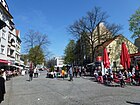
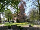
820 | old center of the district | Aug 6, 1937 | The partially traffic-calmed tree-lined street with many cafes and restaurants is located between Eisenhammerweg and Berliner Straße . To the west of the interstate Berliner Straße , it initially has an extension as a pedestrian zone and turns into the one-way street that leads visitors to Lake Tegel. The green area at the western end in front of the entrance to the church bears the unofficial name Otto-Dibelius-Platz within the surrounding road . This one-way street ring leads to the southwest on Eisenhammerweg, at the northwest corner only the access to properties and the footpath to the Greenwich promenade is possible. The plots are numbered odd (1–43) on the south side and even (2a – 42/44) on the opposite side. At the western end opposite the church there is the Alt-Tegel 51 building, in front of Eisenhammerweg settlement houses were built in the 1960s (45-49c). The cul-de-sac village, founded after 1237, and its settlement core have been handed down as a village street . With the expansion of the road network and the expansion of the suburb of Tegel, this was replaced by Hauptstraße at the end of the 19th century . In 1937, the main street and the Seegasse to the west were renamed Alt-Tegel, as was the case for other main and village streets in the towns that were incorporated into Greater Berlin in 1920 . 1945–1946 the name Johanna-Weiher-Strasse was intended for a short time , but it was not officially recognized. At the subway exit there is a tourist information office in a small pavilion with information about Reinickendorf. On the Tegel portal there is a collection of old views of the main street and Alt-Tegel and the square at the church. Notable buildings are the leisure home and daycare center (formerly the municipal children's home) on Alt-Tegel 40 and in the south on Kirchgasse (number 31 –43) the parish hall, rectory and a senior leisure center. At the eastern end of the street are listed residential and commercial buildingsTegel town center Many restaurants are in the buildings from the Wilhelminian era or in former Büdner houses , such as the second oldest half-timbered house in Kiez number 18 where a café is set up. |
|
| At the Borsig tower
( Location ) |
600 (Ringstrasse) |
Borsigturm , Berlin's first high-rise | 23 Dec 1998 | The street is located in the industrial park on the former Borsig site as an arch between Berliner Straße at level 24 and Berliner Straße opposite Ernststraße and is continued in the west by Medebacher Weg. With the “Hallen am Borsigturm” there is a shopping and entertainment center. Offices and a hotel were built in the southern area of the street. Some halls are still waiting for restoration or demolition. | |
| At the fountain
( Location ) |
170 | Location of the emergency well in the center of the settlement | 1920 | The dead end is between Myrthenweg and Höhe Havelmüllerweg, which is interrupted here. A connection to Am Nordgraben at the north end of the street is only available via an unpaved footpath; a bridge over the Nordgraben leads to the Havelmüller colony. |

|
| At Buddeplatz
( Location ) |
100 | Hermann von Budde (1851–1906), military and politician | Apr 4, 1961 | The street lies between Brunowstrasse and Grußdorfstrasse and in this direction is a one-way street. The street is shown in the Berlin address book from 1907 as Am Bahnhofsplatz , as the Tegel S-Bahn station is located across the square . |

|
| At the Hohenzollern Canal
( Location ) |
370 + 340 |
parallel to the Berlin-Spandau shipping canal | Oct 15, 2011 | The street connects the entrance to Tegel Airport with the street Vor den Toren at the corner of Kolonieweg (Hohlweg). With the rededication of colonies on the Mäckeritzwiesen as settlements, the former access route was also named a dedicated street in connection with the plans for the re-use of Tegel Airport. The assignment of the parcels to "Access to Tegel Airport" via facility names was canceled. This corresponds to the requirement for address-codable information through the introduction of a computer-aided system . This street is named in the Berlin register without assigned land as a private street (OKSTRA class P) and according to the RBS class as STRA, so the responsibility lies with the residents, but the equipment in terms of width and design is that of a city street. In the subsequent use of Tegel Airport, the street area is considered to be outside in accordance with Section 35 of the Building Code . The eastern continuation (currently as a route) is also named in the national maps up to the motorway . |

|
| At the Rosensteg
( Location ) |
100 | Rose plantations in the area | before 1922 | The road goes from Myrtenweg to the south as a dead end and access road to the adjoining houses 1-8 on the west side. Return to the east leads to an amount of 2 to 3 . On the opposite side are the gardens of the single-family properties An der Heide 7-12. In the 1925 address book this location is listed between Steinbergstrasse and Wiederkehrstrasse , on the east side: "Gardens go to An der Heide". |

|
| At the Tegeler Hafen
( Location ) |
590 | Port inaugurated in 2008 on the Tegeler Fließ in the Tegeler See | March 15, 1989 | The road 7 of the development plan was named in 1989 and is located between Berlin / Karolinenstraße and Wilke Road. To the west of Medebacher Weg, it is a two-lane street with a green median. The quiet residential street was built in its current form for the International Building Exhibition 1984–1987. There are many passages through courtyards and houses to the promenade at Tegeler Hafen and to the Sechserbrücke . |

|
| At the Tegelgrund
( Location ) |
210 (in the district) |
southeast boundary of the settlement of the same name | May 1, 1978 | The road land with the northwestern properties belongs to Heiligensee . The properties on the corner of Schulzendorfer Strasse and the forest belong to Tegel. |
 
|
| On the heath
( Location ) |
110 | Heide , here as a fictional name | around 1921 | The road is located between Tile-Bruges-Weg and Kehrwieder as an access road to the small housing estate. This location already existed in 1925 with houses 1–6 (east side) and 7–12 (west side) owned by the municipality of Greater Berlin. The bounding streets were called Steinbergstrasse and Wiederkehrstrasse in 1925 . |

|
| At the Mäckeritzbrücke
( Location ) |
180 | Mäckeritz, field name of the damp Mäckeritz meadows | Feb. 1, 1980 | The road 490 1980 of the development plan was given this name and is an extension of the Virgin Heidewegs intersection Saatwinkler dam on the Mäckeritzbrücke north to the past here "colonies Mäckeritzwiesen". The bridge and the canal eastward belongs to Charlottenburg-Nord , to the west of it lies the canal in Siemensstadt , the street with lots 1–7 (odd), 2, 4 (daycare) belongs entirely to Tegel. The Mäckeritzbrücke was created with the Hohenzollern Canal, which divided the Jungfernheide here . The road leads from the bridge to the north to the barrier of the KGA 'Vor den Toren' and between its field IV (west side: An der Mäckeritzbrücke 9) and field III (east side: An der Mäckeritzbrücke 8) through as the same named but not dedicated and less developed section to the airport area. The KGA, for its part, is located south of the Tegel Airport area, where the shooting ranges of the Guard Fusilier Regiment and the artillery firing range in Jungfernheide were previously located. The road that continues through the KGA follows the route of a historic forest path from the canal to Tegeler See, past the shooting ranges. |

|
| At the Malche
( Location ) |
680 | partially at large Malchesee along | Feb. 1, 1980 | The footpath (recorded in the regional reference system of the roads and classified as "FUWE", Okstra : F ) was named on part of Gabrielenstrasse and leads to the Schwarzer Weg in the Tegeler Forest. A section of the “ Humboldtspur ” is located on the road and the path that continues , which is marked with number 16 as one of the 20 main green paths and which continues around Lake Tegel . | |
| At the mill
( Location ) |
150 | Watermill on today's Karolinenstrasse | before 1915 | The Tegeler Mühle is mentioned next to the Tegeler Dorfkrug as early as 1590. On February 1, 1980, the extension to Karolinenstrasse was included. The street is around the parking lot on Karolinenstraße and south of the bus parking lot, the south side is built on. The street turns into Gabrielenstraße and as a path in the castle park continues to the northwest. The street belonged to the Tegel Castle District. Short, quiet street on the Humboldtmühle , which is the only residents, now a rehabilitation center. A footpath leads from the parking lot at the bus stop (corner of Gabrielenstrasse) to Tegel Castle . In the 1915 address book, “An der Mühle” with the Humboldtmühle between the castle district / Gabrielenstrasse and the castle district / Mühlengraben with construction sites facing the Schloßstrasse is recorded. There is still no suitable entry in the 1913 address book, in 1914 the mill passage is shown in this location. |

|
| At the high school
( Location ) |
100 | Established in 1906 as the Tegel boys' school, named Humboldt secondary school in 1908 | around 1915 | The street lies between Tile-Bruges-Weg and Hatzfeldtallee . In 1911 the upper secondary school got a new building. The school is on the west side of the street, to which only lots 1 and 2 belong. The boys' school in Tegel was confirmed as a secondary school in 1906 and in 1908 was named "Humboldt-Oberrealschule". |

|
| Ascheberger way
( Location ) |
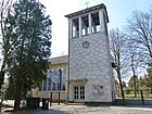
840 | Ascheberg , municipality near Coesfeld, North Rhine-Westphalia | March 11, 1937 | The road 124 of the development plan ran when it was named between Borkener and Westiger path and between 1939 and 1951 the entire route was renamed to Ascheberger Weg. The narrow street is mostly built with single-family houses. The street ends as a dead end at the Evangelical Philippus Church . A bank in front of the church commemorates the former forced labor camp Krumpuhler Weg. From 1940 to 1942, forced laborers from the East who worked for an armaments company founded by Borsig in 1936 were housed in the "Krumpuhler Weg Community Camp". Up to 1500 people, from 1943 also French and Italians, were housed in the camp's 38 wooden buildings. |
|
| Attendorner way
( Location ) |
890 | Attendorn , town in the southern Sauerland, North Rhine-Westphalia | March 11, 1937 | According to the development plan of the Waldidyll settlement (Tegel-Süd), it was laid out as road 114 and named as numbered until the address book in 1937. It lies between Billerbecker and Werdohler Weg and continues as a dead end to the forest. The street is recorded in the address book 1943 with all the land built on. |

|
| Avenue Jean Mermoz
( Location ) |
370 | Charles Leon Jean Mermoz (1901–1936), French aviation pioneer | July 30, 1956 | The street between Seidelstrasse and Rue Joseph le Brix is located in the "Cité Guynemer district" used by the French protecting power between 1945 and 1994 as a quarter. |

|
|
Barnabas Street
( Location ) |
460 | St. Barnabas , Apostle | Aug 4, 1930 | The road lies between Liebfrauenweg and Schollenhof . Before it was named in 1930 , it was laid out as Straße 29 and laid out under this name. In the 1930 address book, streets 21–30 between Hermsdorfer Strasse, Fliess and Feldmark are summarized as the “St. Joseph settlement”. |

|
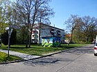
| Basdorf line
( Location ) |
100 | Basdorf , place in Barnim, Brandenburg | Apr 1, 1961 | The street was planned as street 181 according to the development plan and laid out under this name. It lies between Tile-Bruges-Weg and Gorkistraße and was named when the area was expanded in the early 1960s. |
|
| Basiliusweg
( Location ) |
230 | Basil of Caesarea (around 330–379), bishop and doctor of the church | Aug 4, 1930 | The Basiliusweg is laid out as Straße 24, laid out by St. Joseph Spar and Bauverein, between Bonifaziusstraße and Titusweg. In the 1930 address book, streets 21–30 between Hermsdorfer Strasse, Fliess and Feldmark are summarized as the “St. Joseph settlement”. |

|
| Beckumer Strasse
( Location ) |
340 | Beckum , town in the Warendorf district, North Rhine-Westphalia | 4th Sep 1936 | The road to Charlottenburg in today's route was interrupted in 1898 during the construction of the Borsigwerke and from 1904 it was run in the southern part as Charlottenburger Strasse . In 1936 the name was changed. The street lies between Namslaustrasse and Egellsstrasse, although it continues on the latter as a dead end . |

|
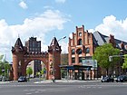
| Berlin street
( Location ) |
1820 | Berlin , destination of the street | before 1897 | Berliner Straße is the main street running lengthways through Tegel, it has two lanes with median strips and three lanes each, Seidelstraße continues to the south and Karolinenstraße to the north. It lies in horseshoe numbering between Waidmannsluster Damm and Holzhauser Straße. In the Berlin address book of 1897 the street was named for Tegel. On April 1, 1980, part of Schloßstraße was incorporated into Berliner Straße. |
|
| Bernauer Street
( Location ) |
5100 | Bernau , street direction from Spandau | before 1899 | The road lies between Bernhard-Lichtenberg-Platz and the district border with Spandau on the Tegeler Bridge over the Hohenzollern Canal. The connecting road between Tegel and Spandau leads westwards from the square through residential areas ( Waldidyll settlement ). The Tegel-Süd municipal hospital, a branch of the Humboldt Hospital, was located on lots 96-134 until the 2000s. Today there is a new building complex here. The road continues to bend to the southwest at the Tegel waterworks on Lake Tegel and here runs through the Jungfernheide. The course of the street aimed with the west-east course on the Spandauer Straße coming from Wittenau (east of the railway line).
The Spandauer Strasse from Tegels Hauptstrasse (today: Alt-Tegel) flows from the north into the southwestern section of the Bernauer Strasse, which is now called Eisenhammerweg and Borsigdamm . In the northern section, Bernauer Straße borders the Borsig settlement facing Jungfernheide. |

|
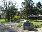
| Bernhard-Lichtenberg-Platz
( Location ) |
160 × 160 × 120 (triangular) |
Bernhard Lichtenberg (1875–1943), theologian, resistance fighter against the Nazi regime | Nov 5, 1985 | The square is on Seidel-, Holzhauser and Bernauer Strasse and is the forecourt to the Holzhauser Strasse underground station . The subway runs in this area at high altitude . When the square was named in autumn 1985 on the occasion of the 110th birthday, a memorial stone (boulder with a plaque attached) was unveiled. |
|
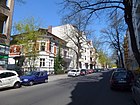
| Bernstorffstrasse
( Location ) |
250 | Johann Heinrich von Bernstorff (1862–1939), diplomat, victim of the Nazi regime | Oct 1, 1977 | The street is between Berliner and Buddestrasse. It was named in 1977 in connection with the construction of the autobahn . Before that, Waidmannsluster Damm ran between Schloßstraße and Berliner Straße in Alt-Tegel. When it was moved to the north, the course west of the S-Bahn line was renamed. |
|
| Betzdorf path
( Location ) |
80 | Betzdorf , town in the Westerwald, Rhineland-Palatinate | March 11, 1937 | The narrow street is mostly built with single-family houses. It is located between Sterkrader Straße and Finnentroper Weg. As road 110 of the development plan, it was initially laid out in the settlement as a numbered road. In the 1937 address book, the Betzdorfer path is still listed as a numbered street. |

|
| Biedenkopfer Street
( Location ) |
560 | Biedenkopf , town on the Lahn, Hesse | 4th Sep 1936 | The wide street with a green median is between Berliner and Sterkrader Straße. Around 1913 the Kruppallee was laid out in this course , this is still undeveloped in 1913 and was renamed in 1936 as the development increased. |

|
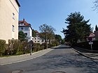
| Billerbecker way
( Location ) |
1390 | Billerbeck , town near Coesfeld, North Rhine-Westphalia | March 11, 1937 | The street in the Waldidyll settlement south of the Borsigwerke lies between Bernauer Strasse and Mescheder Weg. It was laid out as road 104 in the development plan . The street was laid out under this number and the 1937 Address Book is still numbered. Between 1941 and 1945 there was a forced labor camp on the corner of Krumpuhler Weg. |
|
| Blesener line
( Location ) |
170 | Blesen , German name of a village in Poland, northwest of Międzyrzecz in the Lubusz Voivodeship | Apr 1, 1961 | The street is located between Tile-Bruges-Weg (which it is currently continuing) and Staffelder Weg and was laid out and laid out according to the development plan of the small house settlement before it was named as Straße 182 . |

|
| Bocholt way
( Location ) |
460 | Bocholt , city in western Munsterland, North Rhine-Westphalia | March 11, 1937 | Road 133, named in 1937 in the development plan, is located between Billerbecker and Sendener Weg. The street was laid out under the number in the development plan and the 1937 Address Book is still numbered. |

|
| Bollestrasse
( Location ) |
450 | Carl August Bolle (1821–1909), German naturalist | Aug 4, 1930 | The street is between Oeserstraße and Havelmüllerweg. The road 38 was named in 1930, on July 13, 1934 Road 4 and June 1, 1962 renewal, road 15 , also included. As a result, the course of the road between Gorkistraße and Tile-Brugge-Weg is shifted sideways. From 1867–1909, Bolle was the leaseholder of the Tegel archipelago Scharfenberg, Baumwerder and Lindwerder and grew exotic plants there. |

|
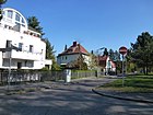
| Bonifaziusstrasse
( Location ) |
430 | Bonifatius (672 / 673–754 / 755), missionary and church reformer in the Franconian Empire | Aug 4, 1930 | The street 21 was named in 1930 with the surrounding streets. It lies between Waidmannsluster Damm and Moorweg over which it continues as a dead end . A quiet residential street of single and multi-family houses with a wide green median as a protected green area. Between Agathenweg and Desideriusweg there is the Catholic Sankt-Joseph-Kirche, there is a direct pedestrian passage to Barnim Dörferweg . In the 1930 address book, streets 21–30 in the area between Hermsdorfer Strasse, Fliess and Feldmark are summarized as the “St. Joseph settlement”. |
|
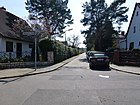
| Borkener way
( Location ) |
440 | Borken , town in western Münsterland on the Dutch border, North Rhine-Westphalia | March 11, 1937 | The narrow street is mostly built with single-family houses and lies between Billerbecker and Werdohler Weg and ends as a dead end for cars at the dog run area in Jungfernheide. Before the name it was 123 . |
|
| Borsigdamm
( Location ) |
860 | August Borsig (1804–1854), entrepreneur, founder of the Borsigwerke | May 1, 1956 | This main street is between Veitstraße and Neheimer Straße, accompanied by the Greenwich promenade on the havel side. In 1956, an unnamed street at the Tegeler Borsighafen between Eisenhammerweg and Uferstraße was named after the founder of the adjacent Borsigwerke, which had been relocated to Tegel in 1898. In 1956, Eisenhammerweg was between Alt-Tegel and Bernauer Straße. |

|
| Bottrop way
( Location ) |
320 | Bottrop , independent city in the Ruhr area, North Rhine-Westphalia | Oct. 1, 1963 | The street that was laid out as street 422 in the development plan was created when the gasworks area was redesigned as a residential area. In this area around Emstaler Platz between Bernauer , Sterkrader , Namslau- , Neheimer Straße, the Bottroper Weg fulfills the function of an access road and leads as a dead end to the west from Sterkrader Straße . There is a connection path through the quarter to Neheimer Straße. The assigned buildings 2, 2a, 2b of the retirement home west of the Martinus Church are set apart from the street. Residential buildings 4, 6, 8 with row garages in between are closer to the street line but across the street. The block of flats 13–29 (odd) is in the southern street line on a lockable access path ( 10 zone ), whereby the street ends at a turning area. Attached transepts behind this southern row of houses belong to Bernauer Strasse . The 14-storey residential building on the north side 8–18 (straight) is facing Emstaler Platz, while the line of residential buildings on its north side is numbered for Namslaustraße. |

|
| Breckerfeld path
( Location ) |
230 | Breckerfeld , town in the Ennepe-Ruhr district, state of North Rhine-Westphalia | March 11, 1937 | The street 122 got its name in 1937 and is located between Ascheberger and Werdohler Weg in the Waldidyll settlement . |

|
| Breitachzeile
( Location ) |
250 | Breitach , mountain river and source river of the Iller in the Allgäu Alps | July 26, 1955 | The Breitachzeile traversed as Street B is located as an eastern spur road from Ziekowstraße near Illerstraße , with which it has no connection. |

|
| Brunowplatz
( Location ) |
50 (circle square) |
Ludwig Brunow (1848–1929), head of office and community in Tegel | after 1898 | The round square with a green central island is located at the intersection of Brunowstrasse and Medebacher Weg. There is a memorial stone for Ludwig Brunow on the small square at the Herz-Jesu-Kirche . | |
| Brunowstrasse
( Location ) |
800 | Ludwig Brunow (1848–1929), head of office and community in Tegel | before 1898 | The street belongs to the settlement south of the old town center of Tegel, which was settled before 1900. It lies in horseshoe numbering between Buddestraße to Eisenhammerweg and initially ended at Kirchgasse. |

|
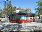
| Buddeplatz
( Location ) |
80 × 40 | Hermann von Budde (1851–1906), military and politician | 1908 | The square is the green area between Grußdorf-, Brunow-, Buddestraße and Am Buddeplatz and is the forecourt of Tegel train station . |
|
| Buddestrasse
( Location ) |
1020 | Hermann von Budde (1851–1906), military and politician | 1907 | In the address book from 1908 it is listed as undeveloped from Hermsdorfer Straße (today Bernstorffstraße). On February 1, 1980, the extension to the north to Waidmannsluster Damm, Straße 488 , was included in the development plan. It is located between Waidmannsluster Damm and Veitstraße, via the latter as a dead-end street to a locked driveway to Borsigpark. |

|
|
Campestrasse
( Location ) |
180 | Joachim Heinrich Campe (1746–1818), writer, linguist, educator and publisher | July 26, 1955 | Previously named as Straße 144 and 1955, it is located in the area south of the castle park to the Tegeler Hafen between Garbielen- and Holwedestraße, over which it continues as a dead end and opens into a path through the amusement park. |

|
| Coesfeld Way
( Location ) |
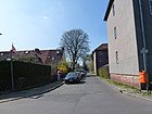
310 | Coesfeld , district town in western Munsterland, North Rhine-Westphalia | March 11, 1937 | The road 175 of the development plan Tegel in 1937 named in its location between Oelder and Kamen way. |
|
|
Dacheroedenstrasse
( Location ) |
180 | Caroline von Humboldt-Dachröden (1766–1829), wife of Wilhelm von Humboldt | July 16, 1955 | Before Straße 148 between Gabrielenstraße and Feldmark it belonged to the castle district was named in 1955 and on May 12, 1956 the changed spelling “Dacheröden” was published in Dacheroedenstraße. The street lies between Gabrielen- and Holwedestraße and goes over this as a dead end street to the castle park. |

|
| Dattelner way
( Location ) |
260 | Datteln , industrial city near Recklinghausen, North Rhine-Westphalia | March 11, 1937 | The settlement road lies between Bocholter and Sendener Weg. With the new Lichtweg housing estate, a passage has been created that is connected to Werdohler Weg. Before it was named, it was Straße 128 at the southwest corner of the Waldidyll settlement . The narrow street mainly consists of single-family houses and is closed to car traffic between Lichtweg and Sendener Weg. |

|
| Desideriusweg
( Location ) |
100 | Desiderius (died after 786), last Longobard king | Aug 4, 1930 | The connection, laid out as road 28 according to the development plan, was named in 1930 and lies between Bonifaziusstraße and Liebfrauenweg south of St. Joseph's Church. The name was chosen as in the surrounding streets of the St. Joseph settlement. In the 1930 address book, streets 21–30 in the area between Hermsdorfer Strasse, Fliess and Feldmark are summarized as the “St. Joseph settlement”. |

|
| Dessinstrasse
( Location ) |
70 | Johann Carl Friedrich Michael Dessin (1809–1869), farmer and church mayor of Dalldorf | 1901 | The short spur road between commercial areas goes eastward from Seidelstrasse opposite the Tegel prison and ends at the underground line above ground . |

|
| Dreifelderweg
( Location ) |
60 | Dreifelderwirtschaft , management of a corridor on the three-year change | Oct 16, 1956 | The street planned as street E and redesigned in 1956 in the southern part of the "Freie Scholle settlement" goes from the recreational path to the south to the KGA "An der Industriebahn". The name was chosen freely with reference to the surrounding streets. It is a short access road built with row houses . |

|
| Dülmen path
( Location ) |
180 | Dülmen , town near Coesfeld, North Rhine-Westphalia | March 11, 1937 | Routed as road 132 of the development plan, it lies between Billerbecker Weg and Selmerpfad in the west of the Waldidyll settlement and belongs to the Tegel-Süd area. The street was also laid out and settled under the development plan number and is still numbered in the 1937 address book. |

|
| Dune path
( Location ) |
70 | Dunes , wind-blown and deposited elevations of sand | March 11, 1937 | The dune path in the "Freie Scholle settlement" is the previous road 137, which goes south from Waidmannsluster Damm, according to the development plan. There is a gas station on the northwest lot on the street with residential houses on lots 1–7. The streets south of Waidmannsluster Damm in the settlement are all named after sand landscapes. The street has a large turning area at the southern end, it does not go through to the recreation path like the parallel streets to the east. |

|
|
Egellsstrasse
( Location ) |
340 | Egells (1788–1854), pioneer of mechanical engineering in Berlin | before 1898 | The street lies between Berliner and Beckumer Straße and leads into the industrial area as a dead end. In 1954, however, the street continued to Eisenhammerweg and, accordingly, in 1910 to Spandauer Straße . In the iron foundry of Egells, Borsig founded his own foundry and mechanical engineering institute in 1837 (in addition, foundation and first locomotive construction ) |

|
| Egidystrasse
( Location ) |
990 | Moritz von Egidy (1847–1898), lieutenant colonel, pacifist social ethicist, writer | before 1904 | The street is already listed in the address book from 1904 with 24 properties belonging to the "Free Scholle Cooperative" and belonging to the Waidmannslust postal district in horseshoe numbering from and to Hermsdorf-Lübarser Weg . The street on the eastern border of the district lies between Moorweg and Waidmannsluster Damm, but continues across it to the south, at least since 1954. The street name also belongs to Waidmannslust with property 42b north of Tegeler Fließ . At the northern end of the street is Marie-Schlei-Platz, over which the footpath to the Egidysteg with the same name continues for 40 meters. The subsequent official Egidysteg, named after 1971, with its 70 meters length continues beyond the Tegeler Fließ to Mühlenfeldstraße in Hermsdorf. It is a quiet residential street with single family houses and gardens. The northern end of the street forms a circular square, formerly Egidyplatz . From the square, two hiking trails lead into the river valley and over a wooden footbridge (Egidysteg) over the marshy river to Mühlenfeldstraße to Hermsdorf. ( Barnimer Dörferweg ). In the 1930 address book, Egidystraße is indicated between the Borsigwalde district (numbers 1 and 2) and the Hermsdorf district (numbers 64 and 65). To the west (left side), road 101 ( Neulandweg ) goes between No. 29 and 31 and road 102 ( Moorweg ) between No. 61 and 63 . In 1928 the entry in the address book on Egidystraße reads: “now Freie Scholle”. |

|
| Eisenhammerweg
( Location ) |
580 | Eisenhammer , after the former local Egell ironworks "Hammer" | May 20, 1937 | The street lies between Alt-Tegel and Veitstraße, over which it goes into the business park to the south. Before the renaming, the Spandauer Straße was already before 1898 along the east bank of the Tegeler See as a connection from Tegels Seegasse over the Bernauer Straße to Spandau. The renaming took place in 1937 in order to remove the ambiguity of street names in various incorporated districts in the formation of Greater Berlin . With the expansion of the Borsigwerke there was overbuilding and the street was divided into two parts. The Borsigdamm was created as a bypass . The southern part of Eisenhammerweg was renamed Neheimer Straße on April 4, 1961 . |

|
| Emstaler Platz
( Location ) |
190 × 60 | Bad Emstal , municipality near Kassel in the southern part of the Habichtswald nature park in the Ems valley | May 31, 1985 | The previously unnamed place between Neheimer / Namslaustraße and Bottroper Weg was named after the twin town of the Reinickendorf district. The square forms the center of the residential buildings and high-rises built here in the 1960s and 1970s on the site of the former Tegel gasworks. The surrounding houses are not assigned to the square, but to the adjacent streets, so Bottroper Straße ends at the square, but houses 13–29 (odd) and 8a – 18 (even) are assigned to this street. The access road is cordoned off as a 10 zone with a barrier. |

|
| Recreational path
( Location ) |
810 | Recreation , symbolic objective in the settlement | Aug 4, 1930 | The street 33 here was built on by the “Genossenschaft Freie Scholle”, so that in the 1929 address book, plots 1–48 (even) are inhabited and 1–23 (odd) are designated as construction sites. In 1930 road 33 between the forest and the steep path was named. In the 1940 address book, the recreational path between Steinberg and Waidmannsluster Damm is shown, but only the northern plots 2-58 (straight) of the Freie Scholle are built on and the left side is still named as construction sites (steep path, moraine and valley sand path cross). On July 26, 1955, the extension to the west was included. The recreational path is located south of Waidmannsluster Damm in the "Freie Scholle settlement" between the sandgrass and field marrow path and continues as a dead end at both ends. |

|
| Erndtebrücker Weg
( Location ) |
140 | Erndtebrück , municipality in the Rothaargebirge at the confluence of the Benfe in the Eder | March 11, 1937 | The street, which is routed as street 105 in the development plan , was laid out under this name and built on in the Waldidyll settlement and is listed in the 1937 address book still numbered. It lies between Billerbecker and Hilchenbacher Weg in the east of the settlement. |

|
| Ernststrasse
( Location ) |
170 (in the district) |
Ernst Borsig (1869–1933), industrialist, grandson of the founder of the Borsig factory | before 1903 | The street is in the district as a dead end between Berliner Straße and the railway line in an industrial area. However, it is connected to the larger part in Borsigwalde by the Ernststrasse footbridge via the railway line and federal motorway 111 . Ernststraße was laid out in the Wittenau area (today: Borsigwalde ) before 1903 . The Gaswerkstrasse , which led to the Tegeler Gaswerke, was laid out in the Tegel area around 1900 , and on March 29, 1939, it was incorporated into Ernststrasse along with the Wittenau Neue Ernststrasse . |

|
| Eschachstrasse
( Location ) |
270 | Eschach , right source river of the Aitrach a tributary of the Iller , Baden-Wuerttemberg | June 1, 1962 | Eschachstraße is located between Wilhelm-Blume- / Hatzfeldtallee and across Gorkistraße (up to Oeserstraße). The road is a driveway above the eastern edge of the Tegel-Ortenkern tunnel of the federal highway 111 , which is covered with a park-like green area and trees along the Eschachstrasse. The path used as an access road is marked as a foot / cycle path (sign 24) and is also secured with bollards south of Gorkistraße. On the east side of the street, the houses are assigned to properties 58–62 (south of Gorkistraße) and 66–72 (north). Before the naming, the street 1 lay along the east side of the railway line . Before 1912, Straße 8 with construction sites and the secondary school was laid south of Hermsdorfer Straße on the east side of the railway.
Before 1914, this was supplemented via Wittenauer Straße (today Gorkistraße) by Straße 1 along the side of the railway facing away from the town center to the boundary of Wittenau, where the Tegeler waterworks was located. In the address book between Graf-Roedern-Corso (Hatzfeldtallee) and Straße 17 (on which the boundary is located) construction sites and the property of the waterworks are indicated, streets 11 , 16 and 18 cross. The road 8 in street 1 included. In 1943 the left side of street 1 is indicated with the railway area, on the right side between street 165 and Waidmannsluster Damm the plots 58-72 (straight) are built on with multi-family houses. In 1954, Friedrich-Harder-Strasse is recorded on the route from Strasse 1 to the south of Tegel station in the Borsigaue settlement. |

|
|
Feldmarkweg
( Location ) |
160 | Feldmark , name fit the parallel streets | Oct 16, 1956 | The road A of the "settlement-free soil" was in the 1950s on the undeveloped south side of the recovery path to the range of industrial railway configured. In a slightly different location, this projected road was named in 1956 and lies south of the recreation path in the arch to and from it. |

|
| Finnentropic way
( Location ) |
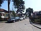
390 | Finnentrop , municipality between the mountain ranges of the Ebbegebirge and Homert an der Lenne, North Rhine-Westphalia | March 11, 1937 | The road, which was laid out and laid out as road 111 in the development plan, was named in 1937. It is located between Billerbecker Weg and Betzdorferpfad in the Waldidyll settlement in the Tegel-Süd area. |
|
| Flohrstrasse
( Location ) |
400 | Machine factory Flohr-Otis-Schmitz | Aug 4, 1930 | The street 118 was named after the company located here and leads through the industrial area northwest of the Seidelstraße under the A 111 to street 22. The street is on the northwest side of the company premises and parallel to Otisstraße on the opposite company border. |

|
| Freilandweg
( Location ) |
80 | Free land , economic policy and land law concept | Jan. 30, 1933 | The path, previously street 103 , is located in the "Freie Scholle settlement" between Schollen- and Allmendeweg and, like the adjacent streets, takes its name from a management framework of land. |

|
| Friederikestrasse
( Location ) |
650 (in the district) |
Friederike , female first name | Apr 10, 1961 | The road continues the Eicheljähstraße in Konradshöhe with the section through the Tegeler Forest between Wildtauben- and Gerlindeweg, whose road area is in the neighboring district to the south again to Konradshöhe, alternating with the Havel. In Tegel, the forest section is without assigned land. This forest section was already called Eichenallee in 1908 and was renamed in 1961 together with the Bismarckstraße in Konradshöhe, which adjoins it to the south, as Friederikestraße. |

|
|
Gabrielenstrasse
( Location ) |
870 | Gabriele Freifrau von Bülow, b. Freiin von Humboldt (1802–1887), daughter of Wilhelm von Humboldt | around 1912 | Gabrielenstraße is located between An der Mühle and across Campestraße as a dead end. It belonged to the Tegel Castle District. Before it was named, it was laid out as street B in the development plan. On February 1, 1980, the western part of Gabrielenstrasse was renamed An der Malche. The quiet residential street with single and multi-family houses is bordered at the western end by the Humboldt allotment garden and the Tegel Castle Park. At the eastern end of the street, at a restored post milestone, there is access to Tegel Castle and Tegel Castle Park. |

|
| Gerlindeweg
( Location ) |
230 + 230 (in the district) |
Gerlinde , female first name (matching the surrounding streets) | June 1, 1961 | The street lies between Nußhähstraße and the continuation in the Beatestraße, while the district boundary on the crossing Friederickestraße gives way to the north around the primary school Am Tegelschen Ort. The road land and the southern plots are in Konradshöhe , the plots 11–23 (odd) in the Tegel Forest belong to Tegel. On November 28, 1892 in Konradshöhe the Dornstückweg , named after the plot of land located here, was laid out on the edge of the Tegel Forest according to the development plan, which was named Walderseestrasse ( Alfred Graf von Waldersee (1832–1904), Prussian Field Marshal) before 1908 . |
 
|
| Gorkistraße
( Location ) |
1530 (in the district) |
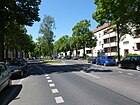
Maxim Gorki (1868–1936), Russian writer. | July 31, 1947 | The street lies between Berliner Straße and Rosentreterpromenade / Alt-Wittenau, but it continues on Am Nordgraben (district boundary ) to Wittenau with lots 172–216 (even) and 183–225 (odd). Already before 1898 the Dalldorfer Weg ran between Tegel (in Dalldorf, today Wittenau as Tegeler Weg). The renaming to August-Müller-Strasse around 1906 led to ongoing development. In 1934 it was renamed Dietrich-Eckart-Straße before it was renamed Gorkistraße in 1947 as part of the denazification process . On June 1, 1962, Strasse 14 , a side street, was also included. It is a pedestrian zone between Berliner and Buddestrasse, and traffic is routed along Bernstorffstrasse. There is a passage to Grußdorfstrasse. A railway barrier leads over the S-Bahn, there Gorkistraße is a moderately traveled residential street with apartment buildings. |
|
| Greenwich Promenade
( Location ) |
630 | Greenwich , borough of London, Great Britain, partner district of Reinickendorf since 1966 | after 1966 | The footpath runs along the banks of the Tegeler See between Borsigdamm and Gabrielenstraße, it leads over the Tegeler Hafenbrücke, also known as the Sechserbrücke. The previous name of this connection was Uferstraße from around 1899 according to its location . On the Greenwich Promenade there is a section of the Heiligenseer Weg , one of the recently created 20 green main routes . On the promenade there are excursion restaurants, parks, mini golf, boat rentals, and boat docks. |

|
| Greetingsdorfstrasse
( Location ) |
250 | Hans Grußdorf, master steward in the Tegelsee district forester | Apr 28, 1961 | The street is between Budde and Berliner Strasse. Before it was renamed, the street was already known as Bahnhofstraße before 1898 , as it created the connection between the center of Tegel and the train station. In 1877 a stop was built on the railway line, which was expanded into a train station in 1899. |

|
|
Halligweg
( Location ) |
860 | Hallig , small unprotected or poorly protected marsh islands off the coast | May 13, 1929 | The service road with lots 1, 3, 8, 14, 20 and 24 lies between Im Saatwinkel and the western tip of the peninsula on the Kleine Malche, and continues to Werder as a (same-named) roadway with road plates. The path leads to the KGA "Auf der Hallig" on the banks of the Havel. The local border with Haselhorst runs along the edge of the path and does not run on the bank of the canal. In the 1943 address book it is shown as undeveloped between the Saatwinkler Chaussee coming from Haselhorst and the Hohenzollern Canal, and in 1954 as the street from Saatwinkler Chaussee to the “Wirtshaus Försterei”. | |
| Hattinger way
( Location ) |
270 (ring-shaped) |
Hattingen , medium-sized town in the southern Ruhr area, North Rhine-Westphalia. | March 11, 1937 | The road in the Waldidyll settlement was planned as road 125 and laid out under this number. It lies in the arc of and to Ascheberger Weg and has a connection to the north to Billerbecker Weg. |

|
| Hatzfeldtallee
( Location ) |
430 | Paul von Hatzfeldt (1831–1901), civil servant in the Foreign Service | March 11, 1937 | The street, laid out as Graf-Roedern-Korso around 1912 , lies between Wilhelm-Blume-Allee and Marzahnstraße. In 1945/1946 the avenue carried the name Hans-und-Hilde-Coppi-Allee for a short time , but was not officially confirmed. In 1954 it was drawn as far as Bolleweg, today the path between the Von Bülow School and the Tegel sports field. The road has two lanes with a tree-lined median with three lanes each, the left and right being marked as a parking lane. The Humboldt Gymnasium with the tower that can be seen from afar is located on property 2–4. |

|
| Havelmüllerweg
( Location ) |
250 + 60 | Dr. Havelmüller , arbor colonist as a figure from the novel Leberecht Hühnchen by Heinrich Seidel | Aug 4, 1930 | The street lies between Bollestraße (No. 2 and 3) and Tile-Bruges-Weg (9-21), but is a dead end on both sides, as the course of the street is interrupted by the residential buildings Am Brunnen. The street was planned as street 41 according to the development plan. In the 1943 address book it is already stated that plots no. 4-8 do not exist. The fictional character Havelmüller , shaped after Seidel's friend Jacobson, lived in Tegel. |

|
| Hermsdorfer Damm
( Location ) |
1190 | Hermsdorf , neighboring town to the east | March 11, 1937 | The street lies between Waidmannsluster Damm and the district boundary to Hermsdorf, which is at the height of the extension of the Titusweg. The road begins and ends at Waidmannsluster Damm in two directional lanes on both sides of the federal motorway 111 , which in turn are connected to the entrance and exit of the Waidmannsluster / Hermsdorfer Damm junction, then you go through the forest to the northeast, with the direction towards Heiligenseestrasse. The Hermsdorf road , the "historic" road to Hermsdorf , begins south, today in the wake Bernstorffstraße - William Flower Avenue - Waidmannsluster dam. The Hermsdorfer Damm from Tegel is assigned to see Hermsdorf according to the address book in 1925 and is called Bismarckstraße in 1937, like the Hermsdorf section before. |

|
| Herscheider way
( Location ) |
420 | Herscheid , municipality in the Sauerland on the edge of the Rhenish Slate Mountains, North Rhine-Westphalia | March 11, 1937 | The road lies between Billerbecker and Werdohler Weg in the Waldidyll settlement. According to the development plan of the settlement as road 117 , it was laid out under this name and the construction of the settlement houses began. In 1937, all numbered streets of the settlement were given a street name based on a uniform pattern as the expansion progressed. |

|
| Jerome Way
( Location ) |
150 | Hieronymus (347–420), church father, saint, scholar and theologian of the old church | Aug 4, 1930 | The previous street 25 in the “St. Joseph Quarter ”is located between Titusweg and Kettelerpfad. In the 1930 address book, streets 21–30 between Hermsdorfer Straße, Fließ and Feldmark are summarized as the “St. Joseph Settlement” before they were named in August 1930 in the Tegel district along with other settlement streets |

|
| Hilchenbacher way
( Location ) |
200 | Hilchenbach , municipality in the southwest part of the Rothaargebirge, North Rhine-Westphalia | March 11, 1937 | The road in the Waldidyll settlement, previously known as road 109 , lies between Billerbecker and Mescheder Weg, but a drivable road only runs between Kreuztaler and Weidenauer Weg. The footpaths to the north and south as far as the Tegel prison are, however, equipped with road signs that show the entire route as Hilchenbacher Weg. |

|
| Holwedestrasse
( Location ) |
280 | Viktor Ludwig Heinrich Freiherr von Holwede (1737–1793), landowner, 1762–1764 owner of Tegel Castle | July 26, 1955 | Before street 143 it is between Campe and Dacherödenstraße. The street belonged to the Tegel Castle District. |

|
| Holzhauser Strasse
( Location ) |
410 (in the district) |
Holzhausen , independent municipality in 1937, now a district of Kyritz , Brandenburg | May 20, 1937 | Tegel only includes the street section with lots 1–49 (odd) and 2–50 (even) between Bernhard-Lichtenberg-Platz (at the underground station) and the S-Bahn overpass. The road continues to Borsigwalde to Am Nordgraben. The Holzhauser Straße junction of the A 111 is in the district. Before 1937, the undeveloped section in Tegel to the east of Seidel- in continuation of Bernauer Straße belonged to the Spandauer Straße (second in Tegel), which bore this name as a connection from Wittenau. |

|
|
Illerzeile
( Location ) |
400 | Iller , right tributary of the Danube | July 26, 1955 | Previously laid out as street A , it was named and built on in 1955. On both sides of this access road, there are driveways to the apartment blocks (1–55 odd and 2–28 even), each with four three-story apartment buildings. The buildings are located on the then still free area of the Borsigaue settlement in Tegel. The western houses are up to the “Tegel Ortskern Tunnel” on the A 111 . The road lies between Stillach- and Trettachzeile (suburb of Borsigwalde ), with a dead end street going over the Stillachzeile to Gorkistraße. The section that goes from Gorkistraße in the route of the Illerzeile, however, is called Gorkistraße and is separated from the dead end by a narrow bush zone. Neighboring streets are named after tributaries of the Iller. |

|
| In the fallow field
( Location ) |
150 | Brachfeldwinkel, the last fallow land in this area | Aug 6, 1937 | The street in the Martin-Luther-Siedlung (also called St. Joseph-Siedlung) lies between Waidmannsluster Damm and Barnabasstraße, to the north the main path of the Martin-Luther-Kirchhof continues. The road was established in the area of Road 134 and Road 135 and Road 136 intersecting . The two side streets of the same name with their turning point at the end of the course can be found in the current development. |

|
| In the seed corner
( Location ) |
300 | Saatwinkel, since 1858 settlement in the Tegel forest, today locality | Jan. 1, 1982 | The road lies in two branches between Maienwerder- and Halligweg and, with the eastern branch, delimits the Saatwinkel allotment garden and encloses the KGA Saatwinkel-Wiese Nord and Saatwinkel-Wiese-Süd. Until the renaming in 1982, the eastern section belonged to Saatwinkler Chaussee and the western to Halligweg . The street with lots 1–65 (odd) and 10 (even) leads from Maienwerderweg as a closed driveway northwards past the “Saatwinkel settlement” to the “Blumes Hof” excursion restaurant on the south bank of Lake Tegel . | |
|
Kamener way
( Location ) |
580 | Kamen , town near Unna, North Rhine-Westphalia | March 11, 1937 | The road lies between Bernauer Strasse and Werdohler Weg, beyond the latter as a dead end in the "Waldidyll settlement". The road continues as a forest path in the south adjoining Der Breite Weg to Maienwerderweg. According to the development plan, street 118 of the settlement was set up on the route of the Breiter Weg and in 1937 it was largely built on. The narrow street consists mainly of single-family houses and ends as a dead end for cars at the dog run area in the Jungfernheide. |

|
| Kampweg
( Location ) |
120 | Kamp, type of block corridor where the plots were surrounded by hedges | Jan. 30, 1933 | The street in the "Freie Scholle" settlement lies between Allmendestrasse and Osianderweg on the route from Strasse 51 of the development plan. The choice of name is based on the neighboring streets, which are named after corridor types. |

|
| Karolinenstrasse
( Location ) |
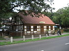
1060 | Caroline Friederike von Humboldt-Dachröden (1766–1829), wife of Wilhelm von Humboldt | before 1914 | Today the street lies between Am Tegeler Hafen / Schloßstraße and Heiligenseestraße / Ruppiner Chaussee. In the main road through Tegel it goes south into Berliner Straße and to the north into Heiligenseestraße (to Hennigsdorf ) and the Waidmannsluster Damm from Hermsdorf flows from the east. In connection with the changes in the course of the road through the construction of the A 111 in the north of Tegel, the northern part of Schloßstraße was included on April 1, 1980. On April 1, 1988, the remaining 100-meter-long section of the Hermsdorfer Damm from Karolinenstrasse to the previously created bend was also included. Carolinenstrasse is listed in the 1914 address book and is still missing in 1913. In the 1915 address book, Carolinenstraße between Mühlengraben / Schloßstraße and Neu = Ruppiner Chaussee / Weg to Tegelort and Heiligensee is shown, partly built on and properties marked as “construction site”, and the route leads to Hermsdorf . The busy road from the busy Alt-Tegel underground station via the Humboldt Library and the Humboldtmühle to two historic restaurants ends in the Tegel Forest. |
|
| Return
( Location ) |
80 | "Return again", wish to return, for example for sailors | 1920 | The street is between Am Brunnen and Rohrbrunner Straße. It has been listed since the address book in 1921, initially with two houses in the Tegel community between Borsigwalde and Am Brunnen, An der Heide. |

|
| Kettelerpfad
( Location ) |
480 | Ketteler (1811–1877), Catholic bishop of Mainz and center party politician | Aug 4, 1930 | The road between Waidmannsluster Damm and Moorweg is in the St. Joseph settlement, according to the development plan as road 20 . |

|
| Kirchgasse
( Location ) |
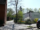
120 | Evangelical Church Tegel | around 1899 | The street is south of the Tegel church between Alt-Tegel (southern branch) and Brunowstraße. According to the 1925 address book, it is undeveloped. The Advent community has its chapel at Kirchgasse 3 and the Protestant church has a day-care center. The passage gives a view of the gardens on Brunowstrasse. |
|
|
Royal road
( Location ) |
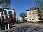
190 | Route used by Frederick the Great (1712–1786), King of Prussia | around 1908 | The street lies between Bernstorffstrasse and Buddestrasse. According to the address book from 1925 and before, it is undeveloped. A path north of Waidmannsluster Damm along the railway line in the property there is also not officially run and also gave its name to the allotment garden between the railway and Tegeler Fließ. |
|
| Konradshöher Strasse
( Location ) |
1870 | leads to the Konradshöhe colony | July 26, 1955 | With the expansion of the Konradshöhe colony, where there was a homestead in 1868, the Gestellweg was expanded through the Tegeler Forest to a connecting route with a connection to the Habichtstraße there and, after 1932, as Konradhöher Chaussee . In 1955 the name was properly classified as a street. |

|
| Kreuztaler Weg
( Location ) |
200 | Kreuztal , town in the northern Siegerland at the Rothaargebirge, North Rhine-Westphalia. | March 11, 1937 | As Straße 106 traced out, it is between Hilchenbach way and Sterkrader street in the settlement Waldidyll. |

|
| Krumpuhler way
( Location ) |
100 | the "Krumme Pfuhl" was in the Jungfernheide, derived from the field name Krummpfuhl | before 1912 | Like the Semmelweg and the Breite Weg, the path is a connection to the Jungfernheide and was partly developed as a road when the residents settled in Waldidyll (Tegel-Süd). Today the street lies between Bernauer Straße and Billerbecker Weg. The free building land in the further course was initially not built on and later developed with the Philippus Church and the municipal gardening school, in the 2010s the new Lichtweg development was created there. |

|
| Kurt-Schumacher-Damm
( Location ) |
2690 (in the district) |
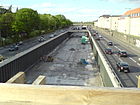
Kurt Schumacher (1895–1952), politician (Member of the Bundestag), resistance fighter against the Nazi regime | Nov 7, 1953 | The Kurt-Schumacher-Damm accompanies the A 111 from the Tegel Airport tunnel and merges into it. Plots 44–246 (straight) and the road area between the former federal motorway 105 (exclusively) and the connection between the Tegel airport tunnel and the A 111 (connection point Kurt-Schumacher-Damm) belong to Tegel . The properties adjoining to the east and south are in Wedding , the northern section continues to Reinickendorf . The part of the Tegeler Weg on Tegeler Flur, located southeast of the Tegel airfield and separated from the northern part on Scharnweberstrasse (today Uranusweg), was renamed Kurt-Schumacher-Damm together with part of the Spandauer Weg in Reinickendorf . In addition to the expansion, the later motorway construction brought about a slight change in the allocation of the district. |
|
|
Letmather way
( Location ) |
190 | Letmathe , formerly an independent municipality in the northwest of the Sauerland, today a district of Iserlohn, North Rhine-Westphalia | March 11, 1937 | Previously laid out and laid out as road 121 , it lies between Ascheberger and Werdohler Weg in the Waldidyll settlement. |

|
| Light path
( Location ) |
260 | Sunlight , here as a symbolic (optimistic) term | June 23, 2007 | The road on the route of the Krumpuhler Weg previously located here was rebuilt for a new housing estate south of the Philippus Church and goes north from Werdohler Weg to Dattelner Weg. The new buildings occupy lots 3–21 (odd) and 16–16f, 26–34 (even) of Lichtweg. To the north, next to the church, there is also the municipal horticultural school. The name was chosen in contrast to the streets of the settlement named after Westphalian places. |

|
| Liebfrauenweg
( Location ) |
490 | Our Lady , for Mary, the mother of Jesus | Aug 4, 1930 | The road 22 of the development plan is between Waidmannsluster dam and Moorweg. It belongs to the settlement of the savings and settlement cooperative St. Joseph (St. Joseph-Siedlung) which resulted in the choice of name. The narrow street is built on with single and multi-family houses and has a passage for pedestrians to Barnim Dörferweg via Virgiliusstraße. In the 1930 address book, streets 21–30 in the area between Hermsdorfer Strasse, Fliess and Feldmark are summarized as the “St. Joseph settlement”. |

|
| Liesborn way
( Location ) |
240 (ring-shaped) |
Liesborn , at the time it was named, a municipality northwest of Lippstadt, today part of the municipality of Wadersloh, North Rhine-Westphalia. | Aug 6, 1937 | The street, which is lined with residential houses, goes from and to Neheimer Straße in the arch (near Namslauer Straße) on the lake side to the west. Before 1922, the street was initially laid out and named as Biskupitzer Weg and renamed with the development. (compare address book 1937 and 1938) |

|
|
Maienwerderweg
( Location ) |
920 | Maienwerder , southernmost island in Lake Tegler See | Feb. 1, 1980 | The road lies between Im Saatwinkel and Bernauer Straße, as a footpath it continues through the Jungfernheide to the Betzdorfer path. Continuous on the map from 1954 as a road from Breiter Weg to Saatwinkel, today an asphalt road runs from Bernauer Straße to Saatwinkel. |

|
| Marie-Schlei-Platz (Egidyplatz)
( Location ) |
50 (circle square) |
Marie Schlei (1919–1983), SPD politician, 1976–1978 Federal Minister for Economic Cooperation | June 21th 2013 | The Rondellplatz with the roundabout was called Egidyplatz until 2013 , as it connects Egidystraße and Moorweg at the northeast corner of Tegel. The square was built around with the single-family houses of the cooperative and thus forms the northern end of the cooperative houses on Egidystraße. The Egidysteg leads to the Tegeler Fließ with a connection to Mühlenfeldstraße in Hermsdorf . On the square there is a memorial stone “In memory of the victims of the two world wars” and a memorial stone for the “Freie Scholle” cooperative. The place was named on May 21, 2013, the 30th anniversary of Marie Schlei's death. |

|
| Marzahnstrasse
( Location ) |
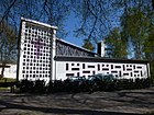
300 | Karl Friedrich Albert Marzahn (1829–1911), the last innkeeper in Tegel | around 1916 | The street was established as street 3 . It is between Gorkistraße and Hatzfeldtallee. It continues on Gorkistraße as a dead end with the adjacent properties and is separated from Oeserstraße by a green area with footpaths. |
|
| Mecklenburgweg
( Location ) |
440 | Mecklenburg , region in northern Germany | Oct 15, 2011 | The road is east of the Mäckeritzgraben. With the rededication of colonies on the Mäckeritzwiesen as settlements, the former (eponymous) Kolonieweg was elevated to a dedicated street . One reason was the plans for re-use for the airport. In addition, the assignment of the parcels located here to “Access to Tegel Airport” via facility names has been canceled. This corresponds to the requirement for address-codable information through the introduction of a computer-aided system . The road connects to the west of the Alten Wiesenweg (at the level of the Köppen'sche Erben settlement) and leads 160 meters to the east to the inflection point to the south around the KGA 'Vor den Toren III'. This section leads 270 meters to the northern edge of the water strip of the KGA 'Vor den Toren I' (Kolonieweg 'Im Winkel'). The only assigned property is 15, the KGA to the west. The KGA 'Neuland I' to the east of the path is assigned to the street Vor den Toren as 50. The Mecklenburgweg is named as a private road (OKSTRA class IP) and after RBS class as STRA, so the responsibility lies with the residents, but the equipment in terms of width and design is that of a city street. The appropriate width of the street is already available. The street name correlates with the other KGA routes: Pommern-, Ostpreußen-, Westpreußen- and Brndenburgweg. |

|
| Medebacher way
( Location ) |
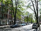
980 | Medebach , small town in eastern North Rhine-Westphalia | June 13, 1936 | Schöneberger Strasse , which was established around 1900, was renamed to include Strasse 4 . It is located between Am Tegeler Hafen and a cul-de-sac on Veitstrasse. |
|
| Mescheder Weg
( Location ) |
540 | Meschede , middle town in the northern Sauerland and district town of the Hochsauerlandkreis, North Rhine-Westphalia | March 11, 1937 | The street lies between Bernauer and Sterkrader Strasse in the Waldidyll settlement. It was named Road 108 in the development plan . |

|
| Miraustraße
( Location ) |
100 (in the district) |
Clemen Mirau (died after 1906), government master builder, district building officer. | before 1910 | The plots 138–148 and 139–149 are in Tegel, from Altenhofer Weg to the south the road continues in Borsigwalde . In Tegel, the section between Gorkistraße and Altenhofer Weg is located. |

|
| Moor path
( Location ) |
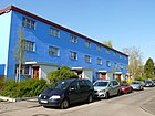
600 | Bog , damp terrain, here the area on the Tegeler Fließ | Aug 4, 1930 | The road was laid north of the “Freie Scholle” and St. Joseph's on the route from Straße 23 , Straße 26 and Straße 102 . It runs between Marie-Schlei-Platz (Egidystraße) and Titusweg south of the LSG Tegeler Fließal along the Tegeler Fließ. From the quiet residential street with single and multi-family houses there are several passages for pedestrians to Barnim Dörferweg. |
|
| Moraine path
( Location ) |
240 | Moraine , the entirety of the material transported by the glacier | Jan. 30, 1933 | The street is a one-way street from the Erholungsweg to Waidmannsluster Damm in the south of the "Freie Scholle settlement". It was planned as street 50 in the development plan. The choice of the street name based on a type of terrain was made to match the parallel streets. |

|
|
Mühlenweg
( Location ) |
3200 | Connection of the village Heiligensee and the watermill on today's Karolinenstrasse | handed down | The Mühlenweg is a footpath and hiking trail through the Tegeler Forest between the Großer Malchesee (An der Malche) and the Rallenweg in Heiligensee , in the western part the district boundary to Heiligensee is on the way, south of the Heiligenseer Baumberge. The tallest tree in Berlin lies on this path. Like other paths in the Tegel Forest, the path does not belong to the dedicated roads. |
 
|
| Myrtle Trail
( Location ) |
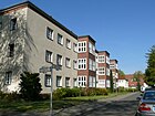
100 | Myrtle , evergreen shrub | Aug 4, 1930 | The street lies between Bollestrasse and Am Brunnen in the settlement south of Havelmüllerweg. In the development plan it was routed as road 39 and was named on urban land for new housing developments. |
|
|
Namslaustraße
( Location ) |
980 | Julius Carl Friedrich Namslau (1842–1912), Berlin City Councilor, Privy Councilor | around 1913 | Namslaustraße is located between Berliner and Neheimer Straße. In the card accompanying the 1912 address book, there is still forest to the south of the Schwarzen Weg and the industrial railway. 1914 entered on the map south of Kruppstrasse. Between 1913 and 1936, Namslaustraße leaving Berliner Straße, later between Berliner and Spandauer Straße, was recorded as vacant. The development in Tegel-Süd took place from 1936, so in the address book 1937 is mentioned for the first time with the gas station on the left and the (already inhabited) apartment buildings 36–58 on the right. Arbor colonies follow between Sterkrader and Spandauer Strasse. |

|
| Neheimer Strasse
( Location ) |
750 | Neheim , (1961) independent town in the Ruhr Valley, since 1975 district of Arnsberg, Hochsauerlandkreis, North Rhine-Westphalia | Apr 4, 1961 | Due to the development change of the Borsigwerke, Eisenhammerweg was divided and the southern part was renamed in 1961. The road lies between Bernauer Strasse, past the former gas works harbor and via Liesborner Weg to the north to the industrial and commercial area. To the south of the confluence between Borsigdamm and Bernauer Straße, 400 meters are the main road in the regional road system. From the bridge over the entrance to the former gasworks port, the 470-meter-long footpath called " Uferweg Neheimer Straße " leads. |

|
| Neulandweg
( Location ) |
90 | New land in the (colony) Freie Scholle | Aug 4, 1930 | The path, routed as road 101 , lies in the "Free Scholle Colony" between Schollenweg and Egidystraße. The naming took place with further settlement roads that were created or named. |

|
| Nordhellesteig
( Location ) |
400 | Nordhelle , highest point in the Ebbegebirge (Sauerland), North Rhine-Westphalia | March 11, 1937 | The street lies between Billerbecker and Werdohler Weg. The street name refers to adjacent streets named after towns on the Ebbe Mountains. According to the development plan, it was initially called Straße 116 . |

|
|
Oelder Weg
( Location ) |
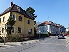
110 | Oelde , city in Muensterland, North Rhine-Westphalia | March 11, 1937 | In the Waldidyll settlement, route 113 is the route between Bernauer Strasse and Billerbecker Weg as an entrance to the settlement. On February 27, 1965, the spelling was corrected as Ölder Weg . |
|
| Oeserstrasse
( Location ) |
850 | Fritz Oeser, director of GAGFAH | July 26, 1955 | The street 179 with its residential buildings lay between street 175 and Miraustraße and was extended and renamed in 1955 to the west into the area of the "settlement Borsigsaue" which was still free at the time. Four-story apartment blocks were then built in this area. Since then, the street has existed parallel to Gorkistraße between Ziekowstraße and as a cul-de-sac beyond Miraustraße. However, it does not reach the Borsigwalder Weg, but ends in a turning area in the district, the border to Borsigwalde runs on the south and east side of the settlement properties that belong to Oeserstraße. |

|
| Osianderweg
( Location ) |
630 | Andreas Osiander (1498–1552), theologian and reformer | June 25, 1936 | Previously laid out as street 37 , the street is located in the St. Joseph settlement between Waidmannsluster Damm and Moorweg. All streets of the settlement are named after people from Christian history. |

|
| Otisstrasse
( Location ) |
950 (in the district) |
Elisha Graves Otis (1811–1861), American master mechanic and entrepreneur | July 19, 1956 | In Tegel, to the south of the underground line (here as an elevated train), the KGA "Waldessaum" is located on the street and to the north there are commercial properties. Otisstrasse forms with lots 33–67 (odd) on the western side of the street the border to the Reinickendorf district with lots 12–78 (even). The road area belongs to the district, the road lies between Seidelstrasse and Wittestrasse, it runs through the underground line and the A 111 ends at Wittestrasse in front of the S-Bahn line . The name was given due to the Otis GmbH administration located at Otisstrasse 33. Before that, the Innungsstrasse , laid out between 1905 and 1908, ran from Seidelstrasse in Tegel to Miraustrasse in Wittenau ; in 1956 it was renamed Otisstrasse in Tegel. |

|
| Otto-Dibelius-Platz
( Location ) |
50 × 50 | Otto Dibelius (1880–1967), Protestant theologian | after 1988 | The (private) square is a green area in front of the Alt-Tegel church . It is located between the roadway of Alt-Tegel , as one-way street in the clockwise direction to the origin of the square-like dead-end village surrounds Tegel. Eisenhammerweg leads out of this one-way street ring from the southwest corner . The place is not included in the official street directory, there is no official sign or other information on site. In contrast, the place name is shown on the official map 1: 5000 of Tegel for the area in front of the church building, as well as on sheet 4347 of the official map series "Map of Berlin". The total area around the church is 5200 m². Most of the current maps show the place name for the western forecourt. From the history it follows that the area between the road land is the property of the Protestant parish of Tegel, the right to name the place belongs to this (or at their request). The church building itself has no addressed assignment to Alt-Tegel or Otto-Dibelius-Platz. The properties addressed to Alt-Tegel are all around on the outside. On January 19, 1912, the first service was held in the (newly built) church, "the entire building reminiscent of the old Saxon church fort was built in 1911." The size of the parish, which grew with the population in the district, led to the decision to build the old church in 1909 Demolished in 1872 with 200 seats and the foundation stone was laid on May 25, 1911 (Ascension Day). The namesake of the place, Bishop Otto Dibelius consecrated the church in Tegel-Süd on Sterkrader Straße in 1961 and he gave the sermon for the 50th anniversary of the parish festival in Alt-Tegel. Dibelius was ousted during the Nazi era , was active in the Confessing Church and during the division of Germany for the unity of the Evangelical Church in Germany . On the west side there is a memorial for the victims of war and violence 1939–1945 and on the east side a memorial stone (boulder) for the local chronicle of Tegel August Wietholz. A Kaiser Wilhelm monument has stood on this side since 1900. |

|
|
Plettenberg path
( Location ) |
410 | Plettenberg , town in the west of the Sauerland between the Lennegebirge and the Ebbegebirge, North Rhine-Westphalia | March 11, 1937 | The road in the Waldidyll settlement lies between Billerbecker and Werdohler Weg on the route of road 115 . |

|
| Polsum path
( Location ) |
160 | Polsum , municipality in the northern Ruhr area, since 1975 district of Marl , North Rhine-Westphalia. | March 11, 1937 | Between Selmer path and Dattelner path in the Waldidyll settlement lies the road 130 projected according to the development plan . |

|
| Prendener line
( Location ) |
100 | Prenden , part of the municipality of Wandlitz im Barnim, Brandenburg | Apr 10, 1961 | The street lies between Gorkistraße and Oeserstraße in the housing estate area. The previous name was Street 180 . |
|
|
Rauxeler way
( Location ) |
90 | Rauxel , industrial city in the Ruhr area, North Rhine-Westphalia | March 11, 1937 | It is located in the Waldidyll settlement on the route of road 126 of the development plan, the Rauxeler Weg is between Hattinger and Billerbecker Weg, over the latter still as a dead end |

|
| Riemerstrasse
( Location ) |
160 | Friedrich Wilhelm Riemer (1774–1845), philologist, tutor of Wilhelm von Humboldt | July 26, 1955 | In 1955, the street 146 in the former Tegel estate, which goes north from Holwedestrasse, was named. |

|
| Rohrbrunner Strasse
( Location ) |
130 | Rohrbrunn , cadastral community Deutsch Kaltenbrunn in Burgenland, Austria | Aug 4, 1930 | The street in the small house settlement southwest of Havelmüllerweg is between this and Kehrwieder , according to the development plan for street 40 . |

|
| Rue Ambroise Paré
( Location ) |
290 | Ambroise Paré (1510–1590), French surgeon | July 30, 1956 | The street lies in the “Cité Pasteur” housing estate, which was laid out until 1994 for the French garrison stationed in Berlin. The street is in the south of the settlement between Kurt-Schumacher-Damm and Rue Hyacinthe Vincent. |

|
| Rue Charles Calmette
( Location ) |
200 | Albert Calmette (1863–1933), French physician, bacteriologist and immunologist | July 30, 1956 | The street is in the north of the settlement between Kurt-Schumacher-Damm and Rue René Laennec. It belongs to the “Cité Pasteur” housing estate, which was created until 1994 for the French garrison stationed in Berlin. The naming after Pasteur refers to the choice of the names of the streets here. |

|
| Rue Dominique Larrey
( Location ) |
230 | Dominique Jean Larrey (1766–1842), French military doctor and surgeon | July 30, 1956 | The street is parallel to the Kurt-Schumacher-Damm between Rue Charles Calmette and Rue Ambroise Paré to the west. It belongs to the “Cité Pasteur” housing estate, which was created until 1994 for the French garrison stationed in Berlin. |

|
| Rue Doret
( Location ) |
100 | Marcel Doret (1896–1955), French aviation pioneer | July 30, 1956 | The street is a dead end to the west from Avenue Jean Mermoz. It belongs to the “Cité Guynemer” housing estate, which was created until 1994 for the French garrison stationed in Berlin. |

|
| Rue du Capitaine Jean Maridor
( Location ) |
300 | Jean-Marie Maridor (1920–1944), French aviator | July 30, 1956 | The street is east as a dead end from Avenue Jean Mermoz and ends at the motorway . It belongs to the "Cité Guyneme" housing estate, which was created until 1994 for the French garrison stationed in Berlin. |

|
| Rue du Commandant Jean Tulas
( Location ) |
220 | Jean Toulasne (1912–1943), French aviator | July 30, 1956 | The street goes south as a cul-de-sac from Rue du Capitaine Jean Maridor and ends at the airport. It belongs to the "Cité Guyneme" housing estate, which was created until 1994 for the French garrison stationed in Berlin. |

|
| Rue du Docteur Roux
( Location ) |
270 | Émile Roux (1853–1933), French biologist | after 1968 | Rue du Docteur Roux is located between Kurt-Schumacher-Damm and Rue Ambroise Paré in the “Cité Pasteur” housing estate, which was built until 1994 for the French garrison stationed in Berlin. The choice of name for the streets in the quarter was based on the eponymous Louis Pasteur . |

|
| Rue Henri Guillaumet
( Location ) |
170 | Henri Guillaumet (1902–1940), French pilot and aviation pioneer | July 30, 1956 | The street lies between Allee St. Exupery and Rue Nungesser et Coli. It belongs to the "Cité Guyneme" housing estate, which was created until 1994 for the French garrison stationed in Berlin. |

|
| Rue Hyacinthe Vincent
( Location ) |
290 | Hyacinthe Vincent (1862–1950), French bacteriologist | July 30, 1956 | The Rue Hyacinthe is on the western edge of the “Cité Pasteur” and goes from the Rue Ambroise Paré to the west to the airport area and north in the housing estate. The settlement was laid out for the members of the French garrison stationed in Berlin until 1994. The choice of name for the streets in the quarter was based on the eponymous Louis Pasteur . The street has some arches to the side that are of the same name. |

|
| Rue Joseph le Brix
( Location ) |
640 | Joseph Le Brix (1899–1931), French aviation pioneer | July 30, 1956 | The street is in the Cité Guynemer, a housing estate of the French garrison, which was stationed in Berlin until 1994, at the east end of Tegel Airport (government airport). It is located between Avenue Jean Mermoz and Rue Nungesser et Coli. |

|
| Rue Marin la Meslée
( Location ) |
100 | Edmond Marin La Meslée (1912–1945), French fighter pilot in World War II | July 30, 1956 | The street is in the Cité Guynemer, a residential area of the French garrison stationed in Berlin until 1994. It goes from Avenue Jean Mermoz to the northwest into the settlement. |

|
| Rue Nungesser et Coli
( Location ) |
730 | Charles Nungesser (1892–1927), French fighter pilot | July 30, 1956 | The street curves west around the Rue Joseph le Brix and curves further south to the east. The street is in the Cité Guynemer, a residential area of the French garrison stationed in Berlin until 1994. |

|
| Rue René Laennec
( Location ) |
80 | René Laënnec (1781–1826), French physician, inventor of the stethoscope | July 30, 1956 | The street in Cité Pasteur, a housing estate owned by the French garrison stationed in Berlin until 1994, goes westward from Rue Charles Calmette. |

|
| Ruppiner Chaussee
( Location ) |
1530 (in the district) |
Ruppiner Land , historical landscape in Brandenburg | after 1914 | Overall, the street is an extension of Karolinenstraße between Heiligenseestraße and the city limits. With the construction of the A 111 , the Ruppiner Chaussee, which runs parallel to the west, has been relieved of traffic and is only permitted for public bus services of the BVG in the Tegel area (apart from 250 meters south access) . The road for public transport is only gone north in Heiligensee . The main road to Hennigsdorf today leads over Heiligenseestraße. Plots 2–10 and 80 (even) and 69–137a (odd) are in Tegel, but mostly in the Tegel Forest. Lot 78 is the Tegel Forestry Office on the other side of the motorway over the "Tegel Forestry Office Tunnel". In the southern part, east of the road, is the Kosakenwiese and there is a children's place. |

|
|
Sandgrass path
( Location ) |
140 | Sand grass , dune grass | July 26, 1955 | First of all, the section established after 1938 south of Waidmannsluster Damm across the Erholungsweg was named as Extended Bonifaziusstrasse and, like this one, has two directional lanes with median strips to the Erholungsweg, and a narrow residential street south of the Erholungsweg. The changed name of the section on both sides of the recreation path has been adapted to the parallel streets. |
|
| Scharfenberger Strasse
( Location ) |
200 (in the district) |
Scharfenberg , island in the Tegeler See | 25 Aug 1894 | The Scharfenberger Straße is the entire street in Konradshöhe , in Tegel the street continues as a pedestrian and roadway. In the district, the property of the Berlin Canoe Club , located 200 meters in the Tegeler Forest on Lake Tegel opposite the Scharfenberg Island , has the official and postal name Scharfenberger Straße 50. However, access is from the officially named Black Path, which is to be continued . |

|
| Schickstrasse
( Location ) |
180 | Gottlieb Schick (1776–1812), painter | July 26, 1955 | The street belonged as street 145 to the former estate district Tegel and lies from Holwedestrasse to the north to the castle park Tegel. |

|
| Schlieperstrasse
( Location ) |
630 | Eugen Schlieper (1842–1907), banker, acquired property in Tegel in 1874 | around 1898 | As the owner of the “Disconto-Gesellschaft” bank, Schlieper acquired terrain in Tegel and had a street built. The street is between Buddestraße and Eisenhammerweg, south of the former village of Tegel. In the post-war period, many of the residential buildings on this street were rebuilt, as the plaques on these houses testify to the “Development program 1954”. |

|
| Schlossstrasse
( Location ) |
200 | Road to the Tegel hunting lodge | around 1898 | The street was initially the entrance to the castle and was given a name in the Tegel castle district with the expansion of Tegler Strasse. The Schloßstraße continued the Berliner Straße from Hermsdorfer / Hauptstraße to the north. On April 1, 1980, the direct section of Schloßstraße was incorporated into Berliner Straße and another into Karolinenstraße. Today, Schloßstraße is a dead end street from Berliner Straße on the side facing away from the palace . |

|
| Schollenhof
( Location ) |
120 | Block of flats belonging to the Freie Scholle settlement community | July 10, 1933 | Schollenhof is the ring road within the residential development and is on the routes of roads 29, 36 and 100 of the development plan. The eponymous “Schollenhof” is a four-sided closed parking area with two-story flat-roof houses and through-passages in the corner buildings. The southern section of the Schollenweg and the Schollenhof street are therefore within the renovation. In the south, outside this inner park, the road closes on Waidmannsluster Damm. The houses on Waidmannsluster Damm are assigned to the Schollenhof with houses 1–31 (consecutive). The passages are between 1 and 2, 5 and 6, as well as 15/16, 17/18 and 23/24, the street is marked as a one-way street in a counterclockwise direction. |

|
| Schollenweg
( Location ) |
650 | Relation to the settlement name "Freie Scholle" | Aug 4, 1930 | The street is parallel to Egidystraße between Schollenhof and Moorweg on the route from Straße 100 in the "Freie Scholle" settlement. As one of the first built-up and populated streets in the owner-occupied colony, the street name takes on the meaning of “down to earth” with its own clod . |
|
| Schulstrasse
( Location ) |
150 | Tegeler community school | around 1905 | The school was initially built opposite the church due to the increasing number of pupils, but in 1889 it was moved to the new location on Charlottenburger Strasse , today Treskowstrasse. Schulstrasse is a one-way street to this from its western parallel street Medebacher Weg. |

|
| Black way
( Location ) |
2050 + 1990 | Schwarzer Weg , a common name for paths without special equipment | before 1922 | The Schwarze Weg branches off from Heiligenseestrasse near Karolinenstrasse to the south. At first it is an asphalt forest road without sidewalks and without sewers with a 30-meter zone and then turns into a residential street , here is the Tegel district forester, a game reserve and the Gerlachwiese. Behind the Tegelsee open-air swimming pool, which is better accessible from Konradshöhe via the extended Dorndreherstrasse, the Schwarze Weg turns into one of Berlin's 20 main hiking trails. In the further course, in the Tegel Forest, you can find the Dicke Marie , a pedunculate oak and one of the oldest trees in Berlin. From here the car ferry also leads to the school island Scharfenberg in Tegeler See . In the south, the Schwarze Weg - under this name - connects to Scharfenberger Straße. Not yet in the Berlin address book from 1918, but his name is shown in the “Proof for the Streets of Berlin” from 1922. Originally the Schwarze Weg ran to Karolinenstrasse. In 1955 the section between Karolinenstrasse and Kirschallee was included and the Kirschallee was renamed Heiligenseestrasse. Lot No. 80 is listed in the LOR directory. The Borsig Villa Reiherwerder is located on plot 45 and is used by the Foreign Service Academy . From Heiligenseestraße to the “Toulouse du lac” restaurant, the path is also used as a car access to Villa Borsig, to some sailing clubs and to the restaurant. The Tegelsee open-air swimming pool and the ferry to the Scharfenberg island are located on the Schwarzen Weg. |

|
| Seidelstrasse
( Location ) |
1210 (in the district) |
Gustav Adolph Ferdinand Seidel (1803–1884), landowner, city councilor and leaseholder of the Berlin corpse transport system | around 1901 | Seidelstrasse is part of the main connection between Tegel and the city center . Between Bernhard-Lichtenberg-Platz and Otisstraße it belongs to the district, up to the A 111 only the southern properties belong to Tegel. The KGA Kleingartenfreunde and the plots 76/77 (continuous) are located together with the western part of the street in Reinickendorf . Initially only the continuation of Berliner Strasse south of Bernauer Strasse up to the level of the JVA, Tegeler Landstrasse was included around 1906 . |

|
| Selmer path
( Location ) |
180 | Selm , town near Unna, North Rhine-Westphalia | March 11, 1937 | The narrow street in the Waldidyll settlement was laid out as street 131 . It lies between Sendener and Bocholter Weg. |

|
| Semmelweg
( Location ) |
400 | Path used by Spandau baker boys through the Jungfernheide | before 1905 | It runs as a forest road through the Jungfernheide from Bocholter Weg near Bernauer Strasse at the Tegel waterworks as the western boundary of the Waldidyll settlement to the southwest to Bernauer Strasse near the island of Reiswerder . The Semmelweg is a connecting path through the forest on the east bank of Lake Tegel that already existed before the “Siedlung Waldidyll” was created . (compare the plan above ) |

|
| Send way
( Location ) |
720 | Senden , municipality in the Münsterland, district of Coesfeld, North Rhine-Westphalia | March 11, 1937 | The narrow street mostly with single-family houses lies between Billerbecker and Bocholter Weg and belongs to the Waldidyll settlement. |

|
| Seppenrader Weg
( Location ) |
160 | Seppenrade , town in the Münsterland, since 1975 district of Lüdinghausen, North Rhine-Westphalia | March 11, 1937 | The road, which is routed as road 129 according to the development plan, lies between Selmer path and Dattelner path in the Waldidyll settlement in Tegel-Süd. |

|
| Singdrosselsteig
( Location ) |
330 | Song thrush , species of songbird | Oct 15, 2011 | The street lies in the bend between An der Mäckeritzbrücke opposite street C and the district boundary to Siemensstadt on the north bank of the Berlin-Spandau shipping canal . From the corner at the Beusselsche Erben settlement, there are two sections of roughly equal length to the west and south. Four properties are assigned to the street: 1, 3, 4 (Kita) and 20 (KGA 'Fabiansche Erben'). The assignment of 3 (Eigenland settlement) and 4 (Beusselsche, Albrecht'sche and Köppen'sche Erben settlements) was influenced by the dedication of the old meadow path and the redistribution of parcels. The street encloses the properties of the street A of the HOKA settlement. |

|
| Relay way
( Location ) |
130 | Staffelde , place in Havelland, since 2001 district of Kremmen, Brandenburg | Apr 10, 1961 | The road 183 of the development plan in the settlement area on Havelmüllerweg between tile Bruges pathway and Blesener line (before 1961: Road 182 ). During the development of this area in the east of Tegel around 1961, road 184 was probably not used. |

|
| Steep path
( Location ) |
260 | Steep path , landscape shape matching the choice of name of the neighboring streets | Aug 4, 1930 | The one-way street built with multi-family houses was planned as street 32 in the “Freie Scholle” estate, it is located between Waidmannsluster Damm and Erholungsweg. |

|
| Sterkrader Strasse
( Location ) |
900 | Sterkrade , since 1929 part of Oberhausen, North Rhine-Westphalia | June 13, 1936 | The Schöneberger Straße, which was here in the forest to the north of today's airport lake, was separated by overbuilding. The southern section that led to the Waldidyll settlement was named after a place with an ironworks and machine factory in 1936 in adaptation to the Westphalian towns used here. It lies between Betzdorfer path and Biedenkopfer Straße, over which it leads as a dead end to the forest area. |

|
| Style headline
( Location ) |
160 | Stillach , source river of the Iller in the Allgäu high alps | July 26, 1955 | The street C in the area of the remaining free Tegeler area of the Borsigaue was laid out in 1955 and named and developed to match the neighboring Illerzeile. The street with lots 1–7 (odd, south) and 2–8 (even, north) lies between Ziekowstraße and Illerzeile. |

|
| Stockumer Strasse
( Location ) |
650 | Stockum , since 1929 a district of Witten in the Ennepe-Ruhr district, North Rhine-Westphalia | July 18, 1958 | The street 379 was built on in 1958 and lies in the arch between Sterkrader- (in the west) and Namslaustraße (in the north). |

|
|
Street 22
( Location ) |
340 | remaining numbering according to the development plan | before 1930 | The road 22 is north of the federal freeway 111 between Otisstrasse and Flohrstrasse and continues over the latter as a dead end. It is located in the industrial park. In 1954 it is indicated between Innungsstrasse (today: Otisstrasse) and through to Holzhauser Strasse |

|
|
Street 52
( Location ) |
70 | remaining numbering according to the development plan | around 1930 | Road 52 is located in the Freie Scholle housing estate as a two meter wide passage between Egidystraße 43/45 and Schollenweg 34/36 . In the street directory of Berlin, street 52 is listed as "F" ( OKSTRA ) and in the RBS class as "STRA" and in the street register dedicated street as 5144. This property passage shortens the cross-connection in the settlement: Straße 52, over the Schollen- to Freilandweg and over the Allmende- in the Kampweg to the Osianderweg, each 200 meters to the north and south. |

|
|
Street 53
( Location ) |
40 | remaining numbering according to the development plan | around 1930 | Road 53 is on the edge of the Freie Scholle settlement from Egidystraße 42/44 to the district boundary . It is a nine-meter-wide passageway to the “Gartenverein Fließal”. This allotment garden can thus be accessed from Tegel, but is located (across the district boundary) with the area in the district Waidmannslust . In the street directory of Berlin the street 53 is listed as "F" ( OKSTRA ) and in the RBS class as "STRA" under the number 5148. Street 53 is an unpaved access road to the KGA that can be closed with a barrier, with no assigned land; from Egidystrasse, a paved access road is laid across the sidewalk. |

|
|
Street 54
( Location ) |
50 | remaining numbering according to the development plan | around 1930 | The street 54 is in the housing estate Freie Scholle at the southern end of the Egidystraße . A staircase leads to the rear of the final residential building on Erholungsweg 8/10/12 , from the upper platform on the property Egidystraße 2 / 2a to the east a path leads to Waidmannsluster Steinbergpark , from which a small area (3350 m²) adjoining this street 54 leads to Tegel heard. In the street directory of Berlin the street 54 is recorded as “F” ( OKSTRA ) and in the RBS class as “STRA” as a dedicated street (5151). This five-meter-wide passage to the park part north of the day-care center on the front lot Erholungsweg 1 has no assigned properties. Because it was used for a small / residential garden, this path was not developed as a built-up road. |

|
| Street 184
( Location ) |
320 | remaining numbering according to the development plan | around 1937 | The road 184 is a nearly five meter wide, paved footpath (OKSTRA class: F), which is listed in the Berlin street directory under 5242 with the RBS class "STRA". In the LOR directory with the plots 2–14 (even) it is assigned to the planning area “Ziekowstraße / Freie Scholle”. It is marked as a combined foot / cycle path. The selection by FIS Broker indicates the footpath along the north bank of the southern trench behind the properties Staffelder Weg 2–14 (straight). Road 184 is the path between the allotment gardens behind the built-up property Staffelder Weg and the shoreline of the Nordgraben, it sets the Havelmüllerweg from Tile-Brugge-Straße to Gorkistraße with a connection across the district boundary to the developed Wittenauer Straße Am Nordgraben . A section of the Humboldt Track is also located here . In 1954, the road 184 is also drawn in the southern extension of the Havelmüllerweg from Tile-Brugge-Weg to Gorkistraße on the bank of the north ditch, the Wittenau road is missing here are allotment gardens. In the 1943 address book, the street 184 between Havelmüllerweg and Dietrich-Eckard-Straße is recorded as undeveloped. |

|
| Street A (HOKA III)
( Location ) |
190 | systematic naming in the Siemens settlement | 1937 | Street A is located in HOKA settlement III (after Hohenzollern Canal) on the Hohenzollern Canal east of An der Mäckeritzbrücke (formerly: Brückenweg ). The driveway is at the bus turning point south of the Kita area and road A leads 60 meters to the east and then turns south, it is on the area within the adjacent western properties of the Singdrosselsteig . Street B was not laid out, street A is listed in the 1943 address book between Brückenweg and Kanaldamm. In the Berlin road register it is listed as a private road ( OKSTRA : P) in the RBS class: STKG . |

|
| Street C (HOKA III)
( Location ) |
380 | systematic naming in the Siemens settlement | 1937 | The asphalt road C, as an access road between An der Mäckeritzbrücke and road L, opens up the short south-going spur roads of the HOKA III settlement. Plots 30 and 32 belong to street C. For 1943, the location between Rohrdamm and Brückenweg is indicated, the left side being designated as arbor area and plots 2–28 do not exist. In the Berlin street register it is listed as a municipal street ( OKSTRA : G) in the RBS class: STKG . |

|
| Street D (HOKA III)
( Location ) |
100 | systematic naming in the Siemens settlement | 1937 | Street D with lots 1–12 (continuous) is the easternmost cul-de-sac from Street C going south to the KGA 'Hohenzollern Canal' in the HOKA III housing estate. The KGA is not yet included in the 1943 address book, the street runs between Street C and Canal Dam. In the Berlin road register it is listed as a private road ( OKSTRA : P) in the RBS class: STKG . |
|
| Street E (HOKA III)
( Location ) |
100 | systematic naming in the Siemens settlement | 1937 | Street E with lots 1–12 (continuous) is a cul-de-sac from street C going south to the KGA 'Hohenzollern Canal' in the HOKA III housing estate. The KGA is not yet included in the 1943 address book, the street runs between Street C and Canal Dam. In the Berlin road register it is listed as a private road ( OKSTRA : P) in the RBS class: STKG . | |
| Street F (HOKA III)
( Location ) |
100 | systematic naming in the colony | 1937 | Street F with lots 1–12 (continuous) is a cul-de-sac from street C going south to the KGA 'Hohenzollern Canal' in the HOKA III housing estate. The KGA is not yet included in the 1943 address book, the street runs between Street C and Canal Dam. In the Berlin road register it is listed as a private road ( OKSTRA : P) in the RBS class: STKG . |

|
| Street G (HOKA III)
( Location ) |
100 | systematic naming in the Siemens settlement | 1937 | Street G with lots 1–12 (continuous) is a cul-de-sac from street C going south to the KGA 'Hohenzollern Canal' in the HOKA III housing estate. The KGA is not yet included in the 1943 address book, the street runs between Street C and Canal Dam. In the Berlin road register it is listed as a private road ( OKSTRA : P) in the RBS class: STKG . |

|
| Street H (HOKA III)
( Location ) |
100 | systematic naming in the Siemens settlement | 1937 | Street H with lots 1–12 (continuous) is a cul-de-sac from street C going south to the KGA 'Hohenzollern Canal' in the HOKA III housing estate. The KGA is not yet included in the 1943 address book, the street runs between Street C and Canal Dam. In the Berlin road register it is listed as a private road ( OKSTRA : P) in the RBS class: STKG . |
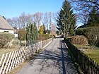
|
| Street J (HOKA III)
( Location ) |
100 | systematic naming in the Siemens settlement | 1937 | Street J with lots 1–12 (continuous) is a cul-de-sac from street C going south to the KGA 'Hohenzollernkanal' in the HOKA III housing estate. The KGA is not yet included in the 1943 address book, the street runs between Street C and Canal Dam. In the Berlin road register it is listed as a private road ( OKSTRA : P) in the RBS class: STKG . |

|
| Street K (HOKA III)
( Location ) |
100 | systematic naming in the colony | 1937 | Street K with lots 1–12 (continuous) is a cul-de-sac from street C going south to the KGA 'Hohenzollern Canal' in the HOKA III housing estate. The KGA is not yet included in the 1943 address book, the street runs between Street C and Kanaldamm and Rohrdamm. In the Berlin road register it is listed as a private road ( OKSTRA : P) in the RBS class: STKG . |

|
| Street L (HOKA III)
( Location ) |
810 | systematic naming in the Siemens settlement | 1937 | The paved road L with lots 2–13 (continuous) and 28a is located in the HOKA III settlement as an access road to the spur roads to the south between Bernauer Strasse and C. At the Ostend, an unnamed and undeveloped area leads south to the Hohenzollern Canal along arranged allotments. The KGA is not yet included in the 1943 address book, the street is between Kanaldamm and Brückenweg, on the right across streets C and D. In the Berlin street register it is listed as a municipal street ( OKSTRA : G) in the RBS class: STKG . | |
| Street M (HOKA III)
( Location ) |
120 | systematic naming in the Siemens settlement | 1937 | Street M with lots 1–16 (continuous) is a cul-de-sac from street L going south to the KGA 'Hohenzollern Canal' in the HOKA III settlement. In the 1943 address book, the course of the street between street L and canal embankment is entered. In the Berlin road register it is listed as a private road ( OKSTRA : P) in the RBS class: STKG . |

|
| Street N (HOKA III)
( Location ) |
120 | systematic naming in the Siemens settlement | 1937 | Street N with lots 1–16 (continuous) is a cul-de-sac from street L going south to the KGA 'Hohenzollern Canal' in the HOKA III settlement. In the 1943 address book, the course of the street between street L and canal embankment is entered. In the Berlin road register it is listed as a private road ( OKSTRA : P) in the RBS class: STKG . |

|
| Street O (HOKA III)
( Location ) |
120 | systematic naming in the colony | 1937 | Street O with lots 1–16 (continuous) is a cul-de-sac from street L going south to the KGA 'Hohenzollern Canal' in the HOKA III housing estate. In the 1943 address book, the course of the street between street L and canal embankment is entered. In the Berlin road register it is listed as a private road ( OKSTRA : P) in the RBS class: STKG . |

|
| Street P (HOKA III)
( Location ) |
120 | systematic naming in the Siemens settlement | 1937 | Street K with lots 1–16 (continuous) is a cul-de-sac from street L going south to the KGA 'Hohenzollern Canal' in the HOKA III housing estate. In the 1943 address book, the course of the street between street L and canal embankment is entered. In the Berlin road register it is listed as a private road ( OKSTRA : P) in the RBS class: STKG . |

|
| Street Q (HOKA III)
( Location ) |
80 | systematic naming in the Siemens settlement | 1937 | Street Q with lots 1–11 (odd) is the western cul-de-sac (near Bernauer Strasse) going north from street L to the Bundeswehr shooting range in HOKA III. In the 1943 address book, the street Qu is entered in the course of the road between Forst and Kanaldamm, on the right-hand side (2–12) are gardens. In the Berlin road register it is listed as a private road ( OKSTRA : P) in the RBS class: STKG . |

|
| Street R (HOKA IV)
( Location ) |
540 | systematic naming in the Siemens settlement | 1937 | Street R with lots 1–51 (odd) on the north side of the street and 2, 4, 4a and 52 on the south side at both ends of the street is also the access street to the HOKA IV estate west of Bernauer Strasse and has no passageway to Im Seed angle. The properties border on the Jungfernheide forest south of Maienwerderweg and the seepage area. In the 1943 address book the course of the street between the Saatwinkel district and Bernauer Straße is noted, on the left side the developed plots 1–51 (odd) and on the right 2 and 4 followed by gardens. In the Berlin road register it is listed as a private road ( OKSTRA : P) in the RBS class: STKG . |
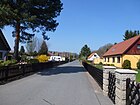
|
| Street S (HOKA IV)
( Location ) |
60 | systematic naming in the colony | 1937 | Street S with lots 1 and 3 in the HOKA IV housing estate is between Street R and Street T. In the 1943 address book, the same street course between Street R and Street T is entered with two lots, with gardens on the right. In the Berlin road register it is listed as a private road ( OKSTRA : P) in the RBS class: STKG . |

|
| Street T (HOKA IV)
( Location ) |
100 | systematic naming in the Siemens settlement | 1937 | The street T with the plots 2-8 (straight) in the HOKA IV settlement lies between street U and across the street S, but has no connection to the Bernauer Strasse, but the plots are up to the Hohenzollern Canal, although the District boundary to Siemensstadt is 15 meters away from the bank. In the 1943 address book, the course of the street between street U and street S further to Bernauer Strasse is entered, gardens on the left and on the right (direction Bernauer Strasse) with the houses 2–8 (odd). In the Berlin road register it is listed as a private road ( OKSTRA : P) in the RBS class: STKG . |

|
| Street U (HOKA IV)
( Location ) |
80 | systematic naming in the Siemens settlement | 1937 | Street U with lots 2–8 (even) and 1–7 (odd) in the HOKA IV housing estate lies between street R and street T. In the 1943 address book, the street on street R with residential houses is 1-7 (odd , left) and 2–8 (straight, right side). In the Berlin road register it is listed as a private road ( OKSTRA : P) in the RBS class: STKG . |
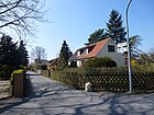
|
| Street V (HOKA IV)
( Location ) |
80 | systematic naming in the Siemens settlement | 1937 | Street V with lots 2–8 (even) and 1–7 (odd) in the HOKA IV housing estate is the southern cul-de-sac from street R to the KGA Hohenzollern Canal. In the address book 1943 the street course on the street R with houses on 1–7 (odd, left) and 2–8 (even, right side) is entered. In the Berlin road register it is listed as a private road ( OKSTRA : P) in the RBS class: STKG . |

|
| Street W (HOKA IV)
( Location ) |
80 | systematic naming in the Siemens settlement | 1937 | Street W with lots 2–8 (even) and 1–7 (odd) in the HOKA IV housing estate is the southern cul-de-sac from street R to the KGA Hohenzollern Canal. In the address book 1943 the street course on the street R with houses on 1–7 (odd, left) and 2–8 (even, right side) is entered. In the Berlin road register it is listed as a private road ( OKSTRA : P) in the RBS class: STKG . |

|
| Street X (HOKA IV)
( Location ) |
70 | systematic naming in the Siemens settlement | 1937 | Street X with lots 2–8 (even) and 1–7 (odd) in the HOKA IV housing estate is the southern cul-de-sac from street R to the KGA Hohenzollern Canal. In the address book 1943 the street course on the street R with houses on 1–7 (odd, left) and 2–8 (even, right side) is entered. In the Berlin road register it is listed as a private road ( OKSTRA : P) in the RBS class: STKG . |

|
| Street Y (HOKA IV)
( Location ) |
70 | systematic naming in the Siemens settlement | 1937 | Street Y with lots 2–8 (even) and 1–7 (odd) in the HOKA IV housing estate is between Street R and Street Z. In the 1943 address book, the street course is also between Street R and Street Z with residential houses on 1– 7 (odd, left) and 2–8 (even, right side) are entered. In the Berlin road register it is listed as a private road ( OKSTRA : P) in the RBS class: STKG . |

|
| Street Z (HOKA IV)
( Location ) |
90 | systematic naming in the Siemens settlement | 1937 | Street Z with lots 2–12 (straight) on the south side in the HOKA IV housing estate is accessed from Street Y. Here the plots reach up to the district boundary which is 15 meters from the bank of the Hohenzollern Canal . In the address book of 1943, the course of the street on Street Y is entered with houses on 2–12 (straight, right side), gardens on the left. In the Berlin road register it is listed as a private road ( OKSTRA : P) in the RBS class: STKG . |

|
| Stubbichtweg
( Location ) |
80 | Stubbichtland, old field name | Oct 16, 1956 | The impasse was previously called road D . She goes from the recovery path. |

|
|
Valley sand path
( Location ) |
270 | Valley sand, geological name for compacted soil residues from the Ice Age. | Aug 6, 1937 | The street leads from Waidmannsluster Damm over the recreation path and ends as a 60 meter long dead end with a turning hammer. At the beginning of the 1950s, this continuing section on the south side of the still undeveloped recreational path was laid out as Road B in the direction of the railway line . Since this was not expanded, the section was included in the Talsandweg on October 16, 1956. |
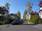
|
| Tile Bruges Way
( Location ) |
850 | Tile (Tyle) Bruges (14th / 15th century), city mayor of Berlin enfeoffed with Gut Reinickendorf | 4th July 1934 | The street was laid out and built on as Steinbergstraße around 1915 . It lies between Havelmüllerweg and Eschachstraße, from An der Oberrealschule as a dead end . In 1945/1946 the proposal was made on Otto-Haase-Straße , but it was not officially adopted. |

|
| Titusweg
( Location ) |
480 | Titus , disciple of the Apostle Paul, first bishop of Crete and saint of the Catholic Church | Aug 4, 1930 | The street was replaced by the “St. Joseph Spar- und Siedlungsgesellschaft ”laid out and built on. It lies between Waidmannsluster Damm and Moorweg. In the 1930 address book, streets 21-30 in the area between Hermsdorfer Straße, Fliess and Feldmark are summarized as the “St. Joseph settlement”. When the Waidmannsluster Dam was laid in connection with the construction of the motorway, the section between the old and new management was incorporated into Ziekowstraße on July 1, 1976. |

|
| Treskowstrasse
( Location ) |
420 | Otto von Treskow (1756-1825), Prussian manufacturer, wholesale merchant and landowner | around 1907 | The Charlottenburger Strasse , which was laid out before 1898, was divided by the expansion of the Borsig works. The northern part was then given the new name around 1907. It lies between Alt-Tegel and Veitstrasse. | |
| Uferweg Neheimer Strasse
( Location ) |
470 | on the banks of the Tegeler See along the Neheimer Straße | after 1970 | From Neheimer Straße by the bridge over the access to the former gasworks port, a footpath leads to Gänsewerder and along the banks of Lake Tegel to properties owned by the water sports and fishing clubs located there. To the north and west around the waterworks, it reaches Bernauer Strasse south of the water ski area. |

|
|
Veitstrasse
( Location ) |
880 | Johann Friedrich Veit (deceased after 1880), wagon entrepreneur | around 1880 | The street lies between Buddestraße and Eisenhammerweg across Tegel, it was built with houses as early as 1900. The Veit'sche Omnibuslinie, actually only set up for excursion traffic, was the first transport connection to Berlin. The fire brigade museum is located on the corner of Veitstrasse and Berliner Strasse. The helicopter standing here is the first “rescue helicopter” in West Berlin that still flew under the US flag because of its four-power status. |

|
| Virgiliusstrasse
( Location ) |
40 | Virgilius von Salzburg (around 700–784), Irish clergyman, bishop of the diocese of Salzburg | Aug 4, 1930 | The short street, designated as street 30 according to the development plan , goes northwards from the moor path to the Tegeler Fliessal landscape protection area in the St. Joseph settlement. In the 1930 address book, streets 21–30 between Hermsdorfer Strasse, Fliess and Feldmark are summarized as the “St. Joseph settlement”. No properties are assigned to Virgiliusstraße. There is only one house on the moor path on the short street . It is closed to public traffic and is only accessible from the Moorweg to the Barnim Dörferweg , which runs south here on the Tegeler Fließ. In Berlin street directory is in the RBS class "STRA" but in OKSTRA as F . |

|
| At the gates
( Location ) |
690 | Guided tour through the KGA 'Vor den Toren' | Oct 15, 2011 | The road is east of the Mäckeritzgraben. With the rededication of colonies on the Mäckeritzwiesen as settlements, the former main route was elevated to a dedicated road . One reason was the plans for re-use for the airport. In addition, the assignment of the parcels located here to “Access to Tegel Airport” via facility names has been canceled. This corresponds to the requirement for address-codable information through the introduction of a computer-aided system . The street connects the (also renamed) streets Am Hohenzollern Canal and Mecklenburgweg in an east-west position . The eastern 460 meters of the street leads through the KGA 'Vor den Toren I' (Vor den Toren 10) and continues between the southern edge of the KGA 'Neuland I' (Vor den Toren 50) and the approximately three hectare LSG (Mäckeritzwiesen) through. In front of the gates is named as a private road (OKSTRA class P) and after RBS class as STRA, so the responsibility lies with the residents, but the equipment in terms of width and design is that of a city street. The appropriate width of the street is already available. |
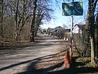
|
|
Guard street
( Location ) |
140 | Karl Wilhelm Wach (1787–1845), royal court painter | July 26, 1955 | The cul-de-sac north of Holwedestraße on the route from Straße 147 belongs to the site of the former Tegel Castle district. |

|
| Waidmannsluster dam
( Location ) |
1740 (in the district) |
Waidmannslust , adjoining district to the west in the Reinickendorf district | Aug 6, 1937 | The Waidmannsluster Damm belongs with the plots 1–79 (odd) and 10–80 (even) between Karolinenstraße and Steinbergpark and Egidystraße in the district and continues to the east in Waidmannslust to Oraniendamm. The Waidmannsluster Damm junction of the A111 is located in the district , north of the Tegel tunnel. The old route to Hermsdorf in this route has been renamed Hermsdorfer Strasse since 1902 , probably after the expansion, and in 1937 together with Waidmannstrasse following the Tegel district boundary. The street ran at the western end until the A 111 was built in the 1970s to Berliner Straße / mouth of Alt-Tegel and crossed the industrial line to the port and the Kremmener Bahn . When the autobahn was built, the dam was in the area of the Ortskern autobahn tunnel and was led further north to Karolinenstraße. On October 1, 1977, the western section separated by the motorway was named Bernstorffstrasse , the eastern section was named Wilhelm-Blume-Allee . |
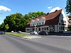
|
| Weidenauer way
( Location ) |
190 | Weidenau , 1937 municipality in the valley of Sieg and Ferndorf, today a district of Siegen, North Rhine-Westphalia | March 11, 1937 | The road in the Waldidyll settlement lies between Sterckrader and Kreuztaler Weg. |
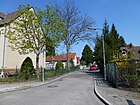
|
| Werdohler way
( Location ) |
670 | Werdohl , town on the Lenne in the Sauerland, North Rhine-Westphalia | March 11, 1937 | The street in the Waldidyll estate lies between the Lichtweg and Attendorner Weg housing estate, and ends in front of the KGA Aschenberg. |

|
| Western path
( Location ) |
200 | Westig , 1937 independent municipality in the Sauerland, today part of Iserlohn , North Rhine-Westphalia. | March 11, 1937 | Route 120 as road it lies between Ascheberger and Werdohler Weg in the Waldidyll settlement. |

|
| Wickeder Strasse
( Location ) |
140 | Wickede , municipality in the Ruhr valley on the edge of the Sauerland, North Rhine-Westphalia | July 18, 1958 | Route 380 as road in the development plan is located in Tegel-Süd and goes east of Stockumer Strasse in the direction of Berliner Strasse, but does not go through to it. |

|
| Wilhelm-Blume-Allee
( Location ) |
560 | Wilhelm Blume (1884–1970), teacher, taught at the Humboldt-Gymnasium Tegel | Oct 1, 1977 | The street with lots 3, 4, 6, 10 and 11 lies between Waidmannsluster Damm, Ziekowstraße and Hatzfeldtallee, but from Ziekowstraße it is a dead end and after the bridge over the Nordgraben through the two parts of the Tegel cemetery to the green space above the town center tunnel Tegel . It is located on the old route from Waidmannsluster Damm to Alt-Tegel. Since its route was led further north to Karolinenstraße when the city motorway was built, the section was named Wilhelm-Blume-Allee in 1977. |

|
| Wilkestrasse
( Location ) |
100 | Johann August Friedrich Wilke (1811–1874), farmer, local politician | before 1898 | The paved street leads from the west end of the street Am Tegeler Hafen on both sides as a dead end . In the development plan it is routed as street 6 . On the one hand, it ends in the underground car park on block of flats 17-23 in front of the Tegeler Hafen and in the south on a sidewalk with fire service access and free access to properties on the extension of Alt-Tegel west of the church. Small street with a high-rise building from the early 1970s. |

|
| Wittestrasse
( Location ) |
1230 (in the district) |
Peter Witte (1822–1902), farmer and politician | before 1897 | The street belongs to Tegel with lots 16–50 with horseshoe numbering between Berliner and Otisstraße and continues to Reinickendorf . It leads through a large industrial area. Wittestrasse was named between 1889 and 1897 while Peter Witte was still alive. On April 1, 1969, the road 444 and part of the forest road in Reinickendorf was included. The Russian Orthodox cemetery is on Wittestrasse. | |
|
Ziekowstrasse
( Location ) |
1010 (in the district) |
Carl Friedrich August Ziekow (1832–1887), feudal and court mayor in Tegel | around 1913 | The street with lots 16–50 running between Waidmannsluster Damm and Altenhofer Weg is located in Tegel and continues south of the Trettachzeile for a short distance in Borsigwalde , which includes the road area and the west side of the street between Trettachzeile and Altenhofer Weg. According to the development plan for Straße 2, the part of the Titusweg between the old and new course of the Waidmannsluster Damm was included on July 1, 1976. In 1945/1946 the street was briefly named Paul-Gehrt-Straße , which was not officially confirmed. Between Hatzfeldtallee and Stillachzeile the street has two lanes separated by a parked green strip, each lined with trees on both sides, from Gorkistraße north to Waidmannsluster Damm it is part of the main street system. |

|
| Access to Tegel Airport
( Location ) |
960, of which 380 to the BAB 111 |
Tegel Airport | after 1955 | The road is located between the Saatwinkler Damm junction of the federal motorway 111 from Saatwinkler Damm and the junction on the airport site, it is part of the main road system (RBS 5608). Properties were not part of this road connection. In order to improve the allocation of the eastern area of the Mäckeritzwiesen, especially after the gardens have been converted into settlements (GSG: Garden and Settlers Association), Beusselsche, Köppensche and Albrechtsche heirs and Eigenland, new roads were dedicated on the area east of the (dry) Mäckeritzgraben. The expanded and paved roads were created in 2011 according to Berlin road law. The “Alte Wiesenweg” has so far been signposted as a road. |
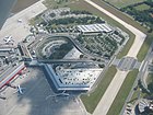
|
Former and unexplored roads
Johanna-Weiher-Strasse for Alt-Tegel, Paul-Gehre-Strasse for Ziekowstrasse, Otto-Haase-Strasse for Tile-Bruges-Weg were intended to be renamed in the immediate post-war period 1945/1946, but not officially confirmed.
| Formerly | from | to | renamed to | Origin of name | Remarks |
|---|---|---|---|---|---|
| At the station square | around 1907 | Apr 1, 1961 | → At Buddeplatz | Place in front of the Tegel train station | In 1891 the railway line between Schönholz and Kremmen was inaugurated. The street is shown by name in the Berlin address book from 1907. |
| August-Müller-Strasse | around 1906 | Sep 18 1934 | → Dietrich-Eckart-Strasse | August Müller (died after 1905), innkeeper, landowner, Schulze in Lübars | The Dalldorfer way was in the range between Berliner Strasse and Kremmener track named initially by a local personality, the remaining piece of the other side of the railway line to Gemarkungsgrenze called Witten Weg partly Wittenauer road and going beyond the city limits continued as Tegeler Weg. In 1934 it was renamed as Dietrich-Eckart-Straße after a supporter of the Nazi regime before the name was given as → Gorkistraße in 1947 . |
| Bahnhofstrasse | before 1898 | Apr 4, 1961 | → Grußdorfstrasse | Named after the stop on the Kremmener Bahn established in 1877 , which was expanded as a train station in 1899 | The street connected Berliner Straße with the station entrance. However, it was renamed in 1961, as the ambiguous street names were gradually eliminated, which had arisen from the fact that in 1920 some street names were the same in the formation of Greater Berlin in different incorporated districts. |
| Biskupitzer way | before 1922 | Aug 6, 1937 | → Liesborner Weg | Biskupitz , Upper Silesian community, in 1927 Biskupitz-Borsigwerk was incorporated into the Hindenburg OS district ( history ) | The road was planned and laid out between 1918 and 1922 west of Eisenhammerweg (today Neheimer Straße). It is not listed in the 1937 address book, in 1938 it was partially built up and listed under the renamed name. Borsig-Kokswerke A. G. Hindenburg (Zaklady Koksownicze "Borsig" SA Zabrze) |
| Borsigstrasse | around 1900 | around 1921 | overbuilt | August Borsig (1804–1854), founder of the Borsigwerke | Borsigstrasse was between Spandauer Strasse (today: Eisenhammerweg) and Berliner Strasse. The road fell away because of the development of the terrain. At that time, its extension was Gaswerkstrasse (since 1910 Ernststrasse). Industrial companies such as Thyssen and Borsig have settled on the site of the gasworks. |
| Charlottenburger Strasse | before 1898 | 1936 | → Beckumer Strasse | Street to the southern neighboring town of Charlottenburg | In 1898 the road was interrupted by the construction of the Borsigwerke. Around 1907 the northern remainder was renamed → Treskowstraße . The southern section remained as Charlottenburger Strasse since 1905 and renamed it in 1936. |
| Dalldorfer Weg | before 1898 | around 1906 | → August-Müller-Strasse | Road to the eastern neighboring town of Dalldorf (former name of Wittenau ) | The Dalldorfer Weg originally ran from Berliner Straße (Alt-Tegel) to the boundary of Dalldorf, where it merged into Tegeler Weg (Wittenau). From 1906 the section between Berliner Straße and Kremmener Bahn was built and in 1909 and 1910 the entire route up to the boundary of the district is marked as August-Müller-Straße . A plan from 1911 names the route from Kremmener Bahn to the district boundary Wittenauer Weg, but the address book of the same year names Wittenauer Straße. Since July 31, 1947 the path has been called → Gorkistraße . |
| The wide way wide way |
before 1905 | March 11, 1937 | → Kamener Weg | As an old field name, the Breite Weg ran through the Tegel community forest | When the “Siedlung Waldidyll” was created, the planned road 118 was expanded and named along its route . In 1937 the path was largely built up with houses. |
| Dietrich-Eckart-Strasse | Sep 18 1934 | July 31, 1947 | → Gorkistraße | Johann Dietrich Eckart (1868–1923), journalist, supporter of the Nazi movement . He is considered to be the founder of the so-called Führer cult. | The street was built with the inclusion of Wittenauer Strasse with lots 1–155 (odd) and 2–156 (even) in Tegel and Tegeler Strasse in Wittenau with lots 157–227 (odd) 158–226 (even) in the entire street Renamed east of Berliner Straße, with construction sites and new buildings marked in the 1930s and 1940s. As part of denazification, the name was changed to Gorkistraße in 1947. |
| Village street | before 1800 | around 1898 | → main street | Tegel village center | The street forms the center of the old village of Tegel and became the “ main ” street with industrialization and suburb status (as in other districts) . |
| Gaswerkstrasse | after 1900 | March 29, 1939 | included → Ernststraße (before 1903) |
The street was by the Tegel gas works | Gaswerkstrasse was between Berliner Strasse and the railway line . In 1903 the extended Gaswerkstrasse was established in the Wittenau area , which was named Hempelstrasse around 1905 and New Ernststrasse in 1913 , which was incorporated into Ernststrasse in 1939. |
| Graf-Roedern-Korso | around 1912 | March 11, 1937 | → Hatzfeldtallee | Siegfried von Roedern (1870–1954), politician, State Secretary of the Ministry for Alsace-Lorraine and the Reich Treasury | |
| Main road | around 1899 | Aug 6, 1937 | → Alt-Tegel | With the expansion of the road network, the Dorfstrasse became the main street | To avoid ambiguity, the main and village streets of the incorporated places in Greater Berlin were renamed by the prefix Alt- to the district name. |
| Hermsdorfer Weg | around 1898 | around 1907 | also Hermsdorf-Lübarser Weg Hermsdorfer Straße |
Hermsdorf , northeastern neighbor | The street led from the intersection of Berliner / Schloß- / Hauptstraße to the district boundary to Waidmannslust. On August 6, 1937, Hermsdorfer Strasse was renamed → Waidmannsluster Damm together with Waidmannsluster Strasse . |
| Herzogstrasse | before 1922 | 1956 | moved in underground construction |
presumably after a person named Herzog | It led from the intersection of Berliner / Seidelstrasse to the intersection of Seidelstrasse and Scharnweberstrasse. It crossed Dessinstrasse, Flohrstrasse and today's Otisstrasse. Before Street 21 it is not yet mentioned in the Berlin address book from 1918. |
| Guild Street | before 1908 | July 19, 1956 | → Otisstrasse | Guild as an association of craftsmen from the same branches of industry | The street was laid out as street 19 in the development plan . The choice of name refers to the sheep farm that the Charlottenburg slaughter guild owned here. The road ran between Seidelstrasse in Tegel and Miraustrasse in Wittenau. The narrow passage on the railway line to Tegel is not suitable for motor vehicles, which is why the Wittenau section in Borsigwalde was placed on Soltaustraße and the Teltower section ended on Wittestraße. In 1943 the section between Seidelstrasse through the Kremmener Bahn and Breitenbachstrasse is still undeveloped. The part of the street in the Tegel district was renamed Otisstraße on July 19, 1956. |
| Kruppallee | around 1913 | 4th Sep 1936 | → Biedenkopfer Strasse | Friedr. Krupp Aktien-Gesellschaft, street named after the entrepreneur Alfred Krupp (1812–1877), | The street is marked between Berliner and Spandauer Strasse, where it crosses Charlottenburger and Schöneberger Strasse. In 1927, apart from the existing apartment building number 1 on the corner of Berliner Straße, it is registered with “construction sites” (i.e., assigned but undeveloped). |
| Marina promenade | before 1934 | before 1953 | → Greenwich Promenade since 1966 |
Marina on Lake Tegel | The marina promenade is listed in the 1936 address book between Gabrielenstrasse and Schwarzer Weg and ran along the east bank of Lake Tegel. In particular, the property of the Tegel Sailors' Association is named. With the construction of the harbor dam for the Borsighafen, the promenade probably lost its background and the riverside road between Alt-Tegel and Eisenhammerweg was built on. |
| Saatwinkler Chaussee | before 1922 | Jan. 1, 1982 | → In the sowing angle | The Saatwinkel settlement had existed in the Tegel Forest since 1858 (today a locality in Tegel, on the south bank of Lake Tegel ) | The Chaussee was so named and expanded between 1918 and 1922, it led around Gartenfeld along the old Berlin shipping canal in the Spandau district, district Hasselhorst and led over the Saatwinkler Bridge on the western edge of the Siemens settlement in the Tegel area. Here it connected to the Maienwerderweg and led to the excursion restaurant "Blumes Hof" on the south bank of the Tegeler See. |
| Seegasse | before 1898 | Aug 6, 1937 | → Alt-Tegel | It led to the Tegeler See | The road lay between the village and the lake and was included in the renaming of the main road to Alt-Tegel. |
| Spandauer Strasse (1) | around 1898 | 1937 | → Eisenhammerweg | The road from Tegel in the direction of Spandau lay on the shore of Lake Tegel . | The street between Bernauer Strasse and Seegasse (Hauptstrasse, Alt-Tegel) was divided into two parts by the Borsigwerke and residential buildings. The southern part of Eisenhammerweg was renamed → Neheimer Straße in 1961. |
| Spandauer Strasse (2) | before 1905 | May 20, 1937 | → Holzhauser Strasse | The road from Wittenau to Spandau led through the south of the district. | East of Seidelstrasse, the Bernauer merged into Spandauer Strasse and led to Hauptstrasse (today Alt-Reinickendorf) in Wittenau. In 1937 this Tegeler section of Spandauer Straße was renamed together with the Wittenauer and continuing streets in Wittenau to Holzhauser Straße. |
| Steinbergstrasse | before 1915 | 4th July 1934 | → Tile-Bruges-Weg | Dalldorfer Steinberg | The Steinbergstraße has been created by early Alttegel east. In the 1925 address book it is listed between Straße 1 and the Borsigwalde district, where Ziekowstraße and Marzahnstraße cross, Straße 10 , Straße 4 , as well as Rosensteg and An der Heide go north . |
|
Uferstrasse Uferweg |
around 1899 | after 1966 | → Eisenhammerweg | The road led along the banks of the Tegeler See . | The path on the bank was not covered with land, it was between Veitstrasse and Hafenstrasse and opens up bathing establishments and steamboat landing stages. With the town twinning of the Reinickendorf district with the London district of Greenwich, this riverside path was selected as a suitable location. In the 1943 address book, the Strandschloß restaurant, apartment building with No. 1 and 2, boathouse, community harbor, Behala harbor administration building, beach pavilion and facilities are named. |
Other locations
Allotment gardens
The allotment gardens in Berlin are classified according to the allotment garden development plan (KGEP) of the Senate Department for Urban Development in different security levels. In addition to permanently secured systems, some are intended for other uses in accordance with the land use plan (FNP) or can be rededicated to residential areas at the request of the residents . The colony paths in the gardens are unassigned private roads and are not included in the above list . The systems are usually marked as a whole as postal objects. The following list contains the key numbers (regional reference system, RBS) of the incorporated KGA in the Berlin street directory. Some associations are represented in the allotment gardeners association.
- Allotment garden association 'Am Brocken II': (Wittestraße 19–23, location ): permanently secured permanent allotment garden on 9,271 m² with 47 parcels on state-owned land, which are intended for commercial areas (KGEP: 12001 - RBS 6129). The KGA is a member of the Reinickendorf Group District Association.
- Allotment garden colony 'Am Hohenzollernkanal' (Straße 4 / Straße L, Lage ): a permanently secured permanent allotment garden on 50,330 m² with 141 parcels on state-owned leased land (KGEP: 12003 - RBS: 6145). The allotment gardens in the Mäckeritzwiesen lie along the Hohenzollern Canal in a narrow strip south of the Siemens settlement HOKA. The KGA is a member of the Tegel-Süd group association. The addresses given for the facility are: Bernauer Strasse 180 (western part), Bernauer Strasse 175 and An der Mäckeritzbrücke 1 (eastern part). The facility is accessible from the riverside path on the canal and connects to the southern edge of the Siemens settlement without a passage from it. In addition, the (northern) bank path used as a footpath, bike path and hiking path with the bank area on the canal belongs to the Siemensstadt district. The district boundary is on the southern edge of the allotment garden colony.
- Allotment garden association 'Am Waldessaum' (Seidelstrasse 16-18 / Otisstrasse 1, 13507, location ): This KGA (KGEP 12010) is located along Seidelstrasse between the suburbs, subway line and Flohrstrasse and is a member of the Reinickendorf group. There are 121 parcels on 47,500 m² of leased land, seven of them with permanent users. With status IIIa, this fictitious allotment garden is only temporarily secured (initially until 2020), as it is intended as building land according to the zoning plan.
- Allotment garden association 'Am Wanderweg' (Bernauer Straße 7–15, Lage ): a permanently secured allotment garden on 8,992 m² of state-owned leased land with 24 plots (KGEP: 12011). The KGA is a member of the Tegel-Süd group association.
- Allotment garden association 'Ascheberg' (Ascheberger Weg 7a, Lage ): an allotment garden facility permanently secured by the FNP on 12,580 m² of state-owned leased land with 30 plots (KGEP: 12013). The KGA is a member. The name of the Tegel-Süd group in the district association refers to the Ascheberger Weg , where it is north of the airport lake between Attendorner and Finnentroper Weg . There is a tennis court on the southern edge of the KGA.
- Allotment garden association “Kirchengelände” (Titusweg, Lage ): highly secured allotment gardens on 33,808 m² of ecclesiastical leased land with 109 parcels (KGEP: 12039 - RBS: 6495). The facility is located between Titusweg, Waidmannsluster Damm, Friedhof am Fließal and Tegeler Fließ and belongs to the Tegel Group District Association.
- Permanent allotment garden colony 'Neuland I' (in front of gates 50, Lage ) the permanently secured allotment gardens are 57 plots on 17,477 m² of state-owned leased land (KGEP: 12045). The KGA lies between field I and field II of the KGA 'Vor den Toren' and is separated from 'Vor den Toren II' by Mecklenburgweg. This allotment garden colony in the Mäckeritzwiesen was founded in 1931 and the parcels are accessible with a plum, cherry and apple path that runs parallel to Vor den Toren
- Allotment garden association 'Neuland II' (Alter Wiesenweg 127, Lage ) the permanently secured allotment gardens are 32 plots on 16,860 m² on land (KGEP: 12046). The facility on the Mäckeritzwiesen lies east of the Mäckeritzgraben and between the 'Eigenheim' settlement and the airport grounds.
- KGA 'Saatwinkel' (Im Saatwinkel, Lage ), 64 plots of permanently secured allotment gardens on 20,977 m² of land (KGEP: 12080 - RBS: 6660). The facility is located east of the Im Saatwinkel street at the western end of the HOKA Siemens settlement in the southeast of the district.
- KGA 'Saatwinkel-Wiese Nord' (in Saatwinkel 9, location ): on 7,052 m² of state-owned land with 30 plots of permanently secured allotment gardens. The facility owned by the association is located west of the Im Saatwinkel street at the western end of the HOKA Siemens settlement in the southeast of the district. (KGEP: 12051 - RBS: 9190)
- KGA 'Saatwinkel-Wiese Süd' (Im Saatwinkel 5, location ): 39 plots of permanently secured allotment gardens on 10,170 m² of state-owned land, the facility owned by the association is located west of the street Im Saatwinkel at the western end of the HOKA Siemens settlement in the southeast of the district. (KGEP: 12052 - RBS: 9191)
- Allotment gardeners association group 'von Humboldt' in the association group Tegel (Ziekowstraße 162)
- KGA 'von Humboldt-Gabrielenstraße' (Gabrielenstraße 15–25, Lage ) permanently secured allotment gardens on 7,992 m² with 17 plots (KGEP: 12069 - RBS: 16149). The facility is located near the Tegel harbor on Gabrielensteg.
- KGA 'von Humboldt-Havelmüller' (Havelmüllerweg 11a, Lage ): permanently secured allotment gardens, 48,765 m², 128 parcels on state-owned leased land (KGEP: 12067 - RBS: 6436). This facility is located south of the former industrial railway line in the arch of the packing ditch, which forms the boundary of the district, opposite the Havelmüllerstraße. A section of the allotment garden is located in Wittenau.
- KGA 'von Humboldt-Industriebahn' (Ziekowstrasse 162, Lage ): 123 parcels on 46,724 m² of permanently secured state-owned leased land (KGEP: 12068 - RBS: 5935). The plant area is located north of the industrial railway line, 800 meters wide and 70 meters wide. The spur streets of the "Freie Scholle settlement" south of the recreation path end at the facility.
- KGA 'von Humboldt-Sportplatz' (Ziekowstraße 142–160, location ): permanently secured allotment gardens, 12,950 m², 46 parcels, state-owned leased land (KGEP: 12009). The facility is located south of the Packereigraben (former industrial railway) along Ziekowstraße, also known as "KGA Ziekowstraße".
- Permanent allotment garden association 'Vor den Toren I' (Vor den Toren 10, location ): 246 plots on permanently secured leased land of 116,980 m² (KGEP: 12070) south of the airport grounds, north on the Hohenzollern Canal . Field I of the KGA is located in the east of the Mäckeritzwiesen allotment garden area on the canal and bounded in the north by the air freight center. The complex is bordered in the south near the suburbs by the ravine, the main path leads through the complex, the plots are (east to west) from asters, dahlias, lilacs, lilies, carnations, primroses, roses and tulips -, Violet Trail. The allotment garden strip along the north bank of the Hohenzollern Canal belongs to the KGA 'Vor den Toren Feld I', which lies east of the Alten Wiesenweg between the Hohlweg and the canal, as well as the one south on the street Am Hohenzollern Canal on both sides of the General Ganeval Bridge to the Hinkeldey Bridge.
- Permanent allotment garden colony 'Vor den Toren II' (Mecklenburgweg 15, Lage ): permanently secured allotment gardens with 162 plots on 67,440 m² of state-owned leased land (KGEP: 12071). Field II adjoins the area of KGA Neuland I to the west and is surrounded to the east by Alten Wiesenweg and to the north and east by Mecklenburgweg . Colony paths open up the parcels (south to north): Pomerania, East Prussia, West Prussia, Brandenburg, Mecklenburgweg. This garden colony was founded in 1939. The KGA 'Vor den Toren Feld II' also includes a strip of allotments along the north bank of the Hohenzollern Canal , which is east of the Alten Wiesenweg between Im Winkel (south of the landscape protection area) and the canal. The bank strip on the ravine further to the east belongs to field I of the KGA.
- Permanent allotment garden association 'Vor den Toren III' (At the Mäckeritzbrücke 8, location ): according to the allotment garden development plan (KGEP: 12072) a permanently secured allotment garden on 67,129 m² with 139 plots. Field III is located west of the extended road An der Mäckeritzbrücke (opposite field IV) and connects to the settlement areas around the Mäckeritzgraben in the east; it is located south of the airport area between An der Mäckeritzbrücke / Singdrosselweg and Adlerweg, the parcel paths from south to north are designated as path 1 to path 6.
- Permanent allotment garden colony 'Vor den Toren IV' (An der Mäckeritzbrücke 9, Lage ) is a permanently secured allotment garden in the Mäckeritzwiesen between street C and the airport area east of the armed forces shooting range with 359 plots on 157,250 m² of leasehold land owned by the state (KGEP: 12073). Field IV of the 'Vor den Toren' colony is a facility between the airport grounds and the HOKA settlement (street C) and bounded to the east by street An der Mäckeritzbrücke , the extension of which separates it from field III. The colony paths are laid out in a quarter circle (roughly at the corner of street C / street E), with the school path in the east and the eagle path in the north. From the corner of the quarter circle to the outside are the club paths: blackbird, goldfinch, nightingale, finch, lark, eagle path and in the radius of the middle path. To the outside of the Adlerweg there are short branch paths (clockwise): to the south-east opposite the Mittelweg deer, weasel, polecat, fox, marten, buzzard path and further to the north and east buzzard, magpie, sparrowhawk, hawk path and owl path.
- Railway farming
- FOAG - sub-district Tegel Königsweg group (Waidmannsluster Damm 7a, location ): Allotment gardens on 9,391 m² railway site with 34 plots (KGEP: 12200). This railway farm is on the one hand west of the Tegel-Hennigsdorf railway line, 200 meters north of the building complex on Waidmannsluster Damm. When the industrial railway was taken over by the NBE in 1925, the parcels of the BLW Niederbarnimer-Eisenbahn-Tegel-Hafen (Karolinenstraße 18) and BLW Niederbarnimer-Eisenbahn-Ziekowstraße (Ziekowstraße 162) are included, including the KGA 'Bahndreieck' (Adelheidallee 7).
- State-owned recreation and allotment gardens in the district under the responsibility of the Roads and Green Space Office
- KGA 'Am Wasserbunker' (Alter Wiesenweg 11, Lage ): The facility in the Mäckeritzwiesen is located south of the Albrecht'sche Erben settlement between the Alten Wiesenweg and the Mäckeritzgraben. The area of the state-owned lease area is 13,465 m².
- KGA 'Fabian'sche Erben' (Singdrosselsteig 20, Lage ) is located on the Hohenzollern Canal east of the "Siemenssiedlung am HOKA" between Street A and Mäckeritzgraben on an area of 23,000 m² south of the Beussel'sche Erben settlement.
- KGA 'Am Tegeler See' (RBS: 6153, Halligweg 8, Lage ). This settlement on 21,124 m² of land is located on the south bank of Lake Tegel, east of the Kleine Malche (lime tree avenue), across from Saatwinkler Steg (Haselhorst).
Housing estates
These are settlement colonies that are not restricted by the Federal Allotment Garden Act as an association or settlement community , but are classified as areas under building law . They are not included in the Senate plan. Through the reallocation of colonies to residential areas, garden paths are sometimes gaining the rank of dedicated streets and are accordingly officially recorded in the street register.The renaming took place on October 15, 2011: Alter Wiesenweg (between the airport grounds and the Hohenzollern Canal, east of the settlements on the Mäckeritzwiesen as 10743), Am Hohenzollern Canal (starting from Vor den Toren), Mecklenburgweg (in the Alter Wiesenweg arch, past Vor den Toren zum Kanalufer, 10742), Vor den Toren (formerly part of the approach to Tegel Airport , from Mecklenburgweg through Koloniegelände to Hohenzollern Canal, not yet fully developed , 10744). In addition, the main route of the colony 'Vor den Toren I' was named as Straße Vor den Toren (10749), a continuation from Am Hohenzollern Canal to Mecklenburgweg . This means that the area of the Mäckeritzwiesen settlement east of the Mäckeritzgraben will be reassigned to the plots of land. The streets were or were expanded and paved at the initiative of the garden associations and residents. As of 2015, only the Alte Wiesenweg is signposted as a dedicated road, which opens up the Eigenland, Köppen'sche and Albrecht'sche Erben and KGA 'Am Wasserbunker' in the south and 'Neuland II' in the north on the airport grounds.
On the Mäckeritzwiesen, some allotment garden areas (KGA) were rededicated to settlement areas in accordance with BauGB § 35. In 2011, former colony paths were dedicated to private roads.
- Settlement 'Albrecht'sche Erben' (Singdrosselsteig 4, Lage ) is located on the Mäckeritzwiesen on the Hohenzollern Canal between Mäckeritzgraben and Altem Wiesenweg on an area of 10,000 m², south of the Köppen'sche Erben settlement and north of the KGA 'Am Wasserbunker'. With the establishment of the old meadow path, the settlement plots were assigned a numbered assignment (71–101, odd) to it.
- The 'Beussel'sche Erben' settlement (Singdrosselsteig 4, Lage ) is located on an area of 73,580 m² on the Hohenzollern Canal north of the HOKA Siemens settlement between KGA 'Vor den Toren III' and west of the Mäckeritzgraben. In the north the airport area and in the south to the Hohenzollern Canal bounded by the KGA Fabian'sche Erben.
- 'Eigenheim' settlement (Singdrosselsteig 3, location ) south of the airport site in the Mäckeritzwiesen. The location at the adjacent KGA 'Neuland II' to the north means that the settlement with an area of 12,800 m² has been outsourced from this garden. The Eigenheim settlement is assigned to the Alten Wiesenweg (to the east) and the parcels have been renumbered. The conclusion to the west is the (filled in) Mäckeritzgraben. With the establishment of the Alten Wiesenweg, the settlement plots were assigned a numbered assignment (103–121, odd) to it.
- The 'Köppen'sche Erben' settlement (Singdrosselsteig 4, Lage ) is located on the Mäckritzwiesen on the Hohenzollern Canal . The settlement on an area of just over 12,300 m² is bounded by the Mäckeritzgraben to the west and by the Alten Wiesenweg to the east, and by the side sections of the Alten Wiesengraben to the north and south, which provide access to the plots that were re-parceled out when it was dedicated. With the establishment of the old meadow path, the settlement plots were given a numbered assignment to it.
Further rededicated garden areas are located at the Tegeler Hafen and west of the Tegel locality Saatwinkel . They are located on private land and are mapped as KGA , but not assigned to the Roads and Green Space Office and also not included in the Senate's plan for KGA development.
- KGA 'Am Fließ' (Gabrielenstraße 37b, Lage ) is located between Tegeler Fließ at the height of the Tegel harbor and the property on Gabrielenstraße. The KGA 'von Humboldt' section of Gabrielenstraße is located northeast of Gabrielenstraße 37 behind lots 39 to 63 on a 12,850 m² area of around 40 weekend houses. The opening Mittelweg has an access via Gabrielenstraße 37b and extends in the south of Gabrielenstraße 65b and 67b to the north exit of the Tegeler Hafenbrücke.
- KGA 'Auf der Hallig' (Halligweg, Lage ) This settlement area of around 14,000 m² is located at the southern end of Lake Tegel, west of the Kleine Malche on Lindenallee, across from Saatwinkler Steg (Haselhorst). The name goes back to the location of the peninsula opposite Maienwerder and Valentinswerder and is only slightly above the waterline. The shoreline to the shipping canal belongs to the Haselhorst district .
Forest, parks and green spaces
- Freizeitpark Tegel - Schlosspark Tegel (RBS: 08086, Lage )
- Tegeler Forst ( location ): a part of the Berlin Forest, the north-western part belongs to the district Heiligensee, otherwise the boundary of the Tegeler forest coincides with the district boundary to the neighboring species parts.
- Flow valley park Hermsdorf ( location ): it extends over the districts Hermsdorf, Waidmannslust and Tegel and is located in the district south of the Tegeler Fließ (the district boundary) north of the development on the Moorweg between Egidy and St. Joseph-Steg.
- Park at the Borsigdenkmal (Borsigpark, location ): it is located on Berliner Straße between Veitstraße and Ernststraße, the Borsigpark stadium, a mini golf course and the tennis court are located on the site. The Buddstrasse ends at this area.
- Uferpromenade Borsigdamm ( location ): lies on both sides of the southern section of the Borsigdamm between Tegeler See and Borsighafen. The promenade connects the Greenwich promenade with the Neheimer Strasse riverside path on the lakeshore.
- Forest Park Hermsdorfer Damm ( location ): a part of the Tegel forest between Karolinenstraße and Hermsdorfer Damm and is bordered in the south by the Tegeler Fließ.
- Waldpark Steinberg ( location ): it is partly (south-western area) in the district and continues east to Wittenau and Waidmannslust with the larger area.
- Jungfernheide : the northern part ( location ) of this forest area is located in the south of the district between Bernauer Straße and the airport area and is largely marked as a dog run area. The Jungfernheide is a people's park to the south in the Siemensstadt district , where it is also continued as a "permanent forest". The Tegel forest area is included in the land use planning after the airport is closed.
-
graveyards
- The state's own "Friedhof Tegel" ( location ) is located to the west at Wilhelm-Blume-Allee 3.
- Cemetery 'Am Nordgraben' ( location ): It was opened as part of the community cemetery in 1875 and is located on an area of 48,693 m² on Wilhelm-Blume-Allee 1 on the eastern side.
- Cemetery 'Am Fließal' ( Lage ) (north of Waidmannsluster Damm 13) a state-owned cemetery on an area of 8.8 hectares, it is located north of Waidmannsluster Damm.
- Protestant Martin Luther Cemetery Tegel ( location ) on Barnabasstrasse 5-19 on 5.9 hectares
- Russian Orthodox churchyard of the St. Konstantin and Helena Church at Wittestrasse 37 ( location ) on 20 hectares on Holzhauser / Wittestrasse and approved in 1873.
-
Islands
- Baumwerder ( location ): island in Tegeler See used by the Tegel waterworks.
- Gänsewerder ( location ): peninsula between Neheimer / Bernauer Straße and Tegeler See (east bank) with the Tegel waterworks.
- Hasselwerder ( location ): island, owned by the von Humboldt family since 1766.
- Lindwerder ( location ): Island in the landscape protection area LSG-2C "Islands in Tegeler See".
- Maienwerder ( location ): island in the landscape protection area islands in Tegeler See.
- Reiswerder ( location ), island with an allotment garden.
- Reiherwerder ( location ), as a garden monument protected peninsula with the Borsig villa.
- Scharfenberg ( location ), island with a school farm, high school and boarding school.
- Valentinswerder Island ( location ): privately owned with permanent residents and a passenger ferry.
- Humboldt Island at the east end of the Tegeler Hafen ( location ), south of the Nordgraben. A private road (RBS: 09995) leads across the island, which was named in 2009. It is connected to the district in the east via the Alexander- and Wilhelmsteg (named after the Humboldt brothers) and in the west via the Georgsteg. The “ Barnimer Dörferweg ”, which starts at the Greenwich Promenade and leads east through the following districts, runs over the Humboldt Island and has been set up with number 13 as part of the 20 main green paths since 2005.
- Airport lake ( location ): lies to the northwest on the airport grounds. Its area is included in the plans for the subsequent use of the airport site.
Forest roads
It should be noted that these routes through the Tegeler Forst are marked in the overview maps to the Reinickendorf administrative district in the 1920s as important (on the map as wider) connections through the forest. At this time, traffic from Tegel to the north was via Ruppiner Chaussee (roughly along the route of the A 111 ). For example, before the paved Konradshöher Strasse was built , which is connected via Heiligenseestrasse , the connection via the Freiheitsweg to Konradshöhe or the Schwarzen Weg to Tegelort was more important. The meanings as routes changed after the construction of the motorway and the fortification of the Berlin Wall, which brought Heiligensee to a peripheral location. However, the section of the tram line 28 to Tegelort operated from 1913 to 1958 ( tram of the municipality of Heiligensee an der Havel ) played an important role in the forest roads as traffic or hiking trails.
- Försterweg: footpath in the Tegeler Forst from Mühlenweg to Schwarzen Weg at the Tegelsee district forester's office.
- Freiheitsweg: footpath in the Tegel forest between Försterweg and Schwarzer Weg
- Mühlenweg: The footpath runs from the Schwarzen Weg near An der Malche westwards to the Rallenweg in Heiligensee, on which lies the main green path No. 03 Heiligenseer Weg
- Schulzendorfer Weg: between Heiligenseestrasse and Tegelgrund in Schulzendorf, a location in Heiligensee. North of the Ruppiner Chaussee, which has been replaced by the A 111 as a traffic route, the Schulzendorfer Weg continues to Hemsdorf and coincides with the nature trail that leads through the northern part of the Tegel Forest and also touches the Tegel Forestry Office and the Hermsdorf Forest District.
- Schwarzer Weg: on the west bank of the Tegeler See it is between Theresienweg and “Tegeler Ort” in Konradshöhe and Heiligenseestraße.
Another forest area is the Jungfernheide in the south of Tegel. Paths between Saatwinkel and the Tegeler core area are historically documented connections, but have recently become hiking trails. In the south of Tegel, the parade and shooting range and the later Tegel airfield had an influence on the routing. Maienwerder Weg , Semmelweg , and Der Breite Weg belong to the Jungfernheide forest area . Historically important with the artillery firing range (before the Tegel airfield was created) is the Tegeler Weg with the Spandauer Weg branching off over the Hinkeldey Bridge. It represented the connection from Charlottenburg (an independent city until 1920) to the north and had a connection to Spandau.
Traffic areas
- Tegel airport motorway tunnel ( location )
- BAB tunnel, center of Tegel ( location )
- [out of date] (still) Tegel Airport ( location )
- Borsighafen ( Lage ) is separated from Tegeler See by the Borsigdamm, with the water access leading through the Borsigdammbrücke.
- Tegeler Hafen ( location ): east at the north end of Tegeler See between Tegeler Fließ and Packereigraben
- Tegeler Hafenbrücke ( location )
- Im Jagen 61, rescue station ( location ) officially noted as the address
- S-Bahn station Tegel ( Lage ), now known as “Gare Francais”, is located on the Kremmener Bahn, today the S-Bahn line to Hennigsdorf
In addition to the city streets mentioned here and named in the overview table above , there are also areas of the railway and parts of federal motorways in the district.
See also
Web links
- Street directory Tegel. Retrieved February 21, 2013 .
- Map of Berlin 1: 5000 with district boundaries. Senate Department for Urban Development Berlin, 2009, accessed on February 11, 2013 .
- Office for Statistics Berlin-Brandenburg: Directory of streets and places in the Reinickendorf district (as of February 2015); pdf
- Tegel - Contributions to the development of a city in a village
- General plan of the Tegel district and Tegel Castle (PDF; 505 kB)
- Pictures sorted by streets and places in Tegel on Tegelportal.de
Individual evidence
- ↑ a b FIS Broker Detail Network (regional reference system)
- ↑ a b c Named streets in the Waldidyll settlement . In: Berliner Adreßbuch , 1938, IVil, p. 2487 (overview of the numbered streets valid until spring 1937 for the new street names).
- ↑ Advertising brochure for the construction of the Siemens settlement Hohenzollernkanal: purpose of the settlement, location, settlement house and parcel
- ↑ Re- use of the Berlin-Tegel airport area: inventory - recommendations for action (January 30, 2009)
- ↑ a b c d e f g h The cooperative "Freie Scholle" was founded in 1895 by Gustav Lilienthal with the participation of Berlin "Freilandgruppen" with the concept that joint property on land should create a permanent home for the "capitalless worker". House construction began in 1899 and the first four apartments were ready in 1900.
- ↑ a b c d e f g h i j k l m n o Digitized version of the Architekturmuseum Technische Universität Berlin: ground plan and site plan on an advertising map of the garden city and forest colony Hermsdorf-West 1: 8000
- ↑ a b c d e Tegel around 1954 on Pharus city map Berlin large edition . Pharus-Plan-Verlag in Treuhand / Berlin N54 / Schwedter Strasse 263 ( page no longer available , search in web archives ) Info: The link was automatically marked as defective. Please check the link according to the instructions and then remove this notice.
- ↑ a b c d Tegel general plan . In: Berliner Adreßbuch , 1913, Berliner Adreßbuch: for d. Year 1913> V. Suburbs of Berlin> Berlin = Tegel, p. 418 ff.
- ↑ a b c d e f g h i St. Joseph settlement . In: Berliner Adreßbuch , 1930, Part IV, p. 2255.
- ↑ Sights: Alt-Tegel in Berlin
- ↑ a b c Histomapberlin.de - sheet 4347 ( Memento of the original from November 9, 2015 in the Internet Archive ) Info: The archive link was inserted automatically and has not yet been checked. Please check the original and archive link according to the instructions and then remove this notice. with the coordinates: X = 16350 and Y = 29050. In the current map of the district surveying office, it is named west of the church. Older “Maps of Berlin” (which were accessible online until 1988) have the entry “Church Alt-Tegel”.
- ↑ On the person of Johanna Weiher: History workshop of the Berlin association of former participants in the anti-fascist resistance, victims of the Nazi regime and survivors (BV VdN) eV (publisher): Resistance in Berlin against the Nazi regime 1933 to 1945 - A biographical lexicon . (Volume 8), Trafo-Verlag, Berlin 2004, p. 156, ISBN 3-89626-358-7 .
- ↑ Tegel Archive: Alt-Tegel
- ↑ a b at that time main street , pictures of the imperial monument in front of the old and new church
- ^ House with an eventful history
- ^ At the Borsigturm, Berlin-Tegel
- ↑ Rosensteg . In: Berliner Adreßbuch , 1925, IV. Reinickendorf administrative district> Saatwinkel, Schulzendorf, Tegel, Tegelort, Waidmannslust with Lübars, Wittenau, p. 2074 (The street is included as Rosensteg with houses 1–8, the owner is the city of Greater Berlin .).
- ↑ On the heath . In: Berliner Adreßbuch , 1925, IV. Part, p. 2074 (The street in the small housing estate is included with the houses 1–12, the owner is the municipality of Greater Berlin.).
- ^ Tegel around 1876: Map of the state initially Berlin . Publisher: d.Königl.Preuß.Landes -aufnahme ( Memento of the original from December 18, 2015 in the Internet Archive ) Info: The archive link has been inserted automatically and has not yet been checked. Please check the original and archive link according to the instructions and then remove this notice.
- ↑ Supplement to the Berlin address book 1893. Julius Straube Publishing House ( page no longer available , search in web archives ) Info: The link was automatically marked as defective. Please check the link according to the instructions and then remove this notice.
- ^ Description of the Humboldtspur on the Senate Administration website
- ↑ a b Excursion tip: Where can I find the tallest tree in Berlin? - In the Tegel Forest
- ↑ JGHelling: History-statistical-topographical pocket book of Berlin and its suburbs . Neuer Krug, inn, not far from the castle and village of Tegel, on the road to Hennigsdorf and Fehrbellin.
- ↑ At the mill . In: Berliner Adreßbuch , 1915, Part V, p. 438.
- ↑ Mill course . In: Berliner Adreßbuch , 1914, Part V., p. 433.
- ↑ a b c d e f g h Hermann Jansen: Development plan for the small settlement Borsig, Berlin-Tegel
- ↑ a b c History of the Philippus Church, Tegel-Süd ( Memento of the original from November 29, 2014 in the Internet Archive ) Info: The archive link was automatically inserted and not yet checked. Please check the original and archive link according to the instructions and then remove this notice.
- ↑ Design of the "Historical Place Krumpuhler Weg" opening on May 20, 2010
- ^ A memorial for the forced labor camp 1942–45
- ↑ a b c d e f g Waldidyll settlement . In: Berliner Adreßbuch , 1937, Teil IV., P. 2450 (Streets 100 to 132 are listed as numbered streets, some with built-up lots, sometimes with summer houses and also as undeveloped parcels. All immediately registered streets are marked with: Siedlung Waldidyll .).
- ↑ Attendorner Weg . In: Berliner Adreßbuch , 1943, Part IV., P. 2557.
- ↑ on the person of Mermoz
- ↑ a b c d e f g h Clarification of the situation on a map of Berlin 1: 5000 (K5 color edition)
- ↑ a b 23. Tegel . In: Address book for Berlin and its suburbs , 1899, Berlin address book: for d. Year 1899> Address book for Berlin and its suburbs> Suburbs> 23. Tegel, p. 218 ff.
- ↑ a b c d e overview map of Berlin-Tegel . In: Berlin address book , 1912, Berlin address book - for d. Year 1912> V. Suburbs of Berlin> Tegel, p. 694.
- ↑ Memorial stone for Bernhard Lichtenberg
- ↑ a b c d e f g h i j k Tegel on the Pharus city map Berlin large edition 1954 - Dimensions: 2 sheets of 86 × 100 cm ( page no longer available , search in web archives ) Info: The link was automatically marked as defective . Please check the link according to the instructions and then remove this notice.
- ^ Borkener Weg, Berlin-Tegel
- ↑ Ludwig Brunow ( Memento of the original from January 26, 2013 in the Internet Archive ) Info: The archive link was inserted automatically and has not yet been checked. Please check the original and archive link according to the instructions and then remove this notice.
- ↑ Buddestrasse . In: Berliner Adreßbuch , 1908, Berliner Adreßbuch - for d. Year 1908> V. Suburbs of Berlin> Tegel, p. 511.
- ↑ a b c d e f g h i j k l m n o p q r s t u v w x y z aa ab ac ad ae af Outskirts settlement on the Hohenzollern Canal . In: Berliner Adreßbuch , 1943, Berliner Adreßbuch 1943> Reinickendorf Administrative District> Saatwinkel, Schulzendorf, Tegel including Castle District, p. 2574 (suburban settlement on Hohenzollern Canal and Street 144).
- ↑ a b c Pharus city map 1954: Tegel, St. Joseph-Siedlung and Freie Scholle ( Memento of the original from January 7, 2016 in the Internet Archive ) Info: The archive link was inserted automatically and has not yet been checked. Please check the original and archive link according to the instructions and then remove this notice.
- ↑ Egidystrasse . In: Berliner Adreßbuch , 1930, Part IV, p. 2251 (Street 52, 53, 54 are not registered).
- ↑ Egidystrasse . In: Berliner Adreßbuch , 1928, Part IV, p. 2204 (The same property division as Egidystraße for 1930, street 100, 101, 102, 103 are also entered ).
- ↑ Eisenhammerweg . In: Berliner Adreßbuch , 1940, administrative district Reinickendorf> Saatwinkel, Schulzendorf, Tegel, p. 2554 (after the former local Egell ironworks "Hammer").
- ↑ a b recreational path . In: Berliner Adreßbuch , 1929, administrative district Reinickendorf> Saatwinkel, Schulzendorf, Tegel, Tegelort, Waidmannslust with Lübars, Wittenau, p. 2229 ( Street 33 was cultivated by the "Free Scholle Cooperative").
- ↑ Recreational Path . In: Berliner Adreßbuch , 1931, Reinickendorf administrative district> Rosenthal, Saatwinkel, Schulzendorf, Tegel, p. 2303 (recreation route now named).
- ↑ a b Tegel had had its own gas supply since 1871, and the Tegeler Gasworks built by Julius Namslau came into being after 1900
- ↑ Eschachstrasse . In: Berlin address book , 1912, Berlin address book - for d. Year 1912> V. Suburbs of Berlin> Tegel, p. 701 (Strasse 8).
- ↑ Eschachstrasse . In: Berliner Adreßbuch , 1914, Berliner Adreßbuch - for d. Year 1912> V. Suburbs of Berlin> Tegel, p. 428 ff (Strasse 8).
- ↑ Gorkistraße, Berlin-Tegel
- ↑ a b c Description of the Heiligenseer Weg on the Senate Administration website
- ^ Greenwichpromenade, Berlin-Tegel
- ↑ Humboldt Gymnasium
- ↑ Historic houses in Tegel ( Memento of the original from January 26, 2013 in the Internet Archive ) Info: The archive link was inserted automatically and has not yet been checked. Please check the original and archive link according to the instructions and then remove this notice.
- ↑ a b c d Namslaustraße . In: Berliner Adreßbuch , 1937, Part IV. Inhabitants and companies sorted by street> Reinickendorf administrative district> Saatwinkel, Schulzendorf, Tegel, p. 2445.
- ↑ In the Brachfeldwinkel . In: Berliner Adreßbuch , 1937, Part IV. Residents and companies sorted by street> Reinickendorf administrative district> Saatwinkel, Schulzendorf, Tegel, p. 2452 (Strasse 134).
- ↑ on the person of Karoline von Humboldt
- ↑ Karolinenstrasse . In: Berliner Adreßbuch , 1915, Berliner Adreßbuch - for d. Year 1915> V. Suburbs of Berlin> Berlin = Tegel, p. 436 (registered as Carolinenstrasse).
- ↑ Return . In: Berliner Adreßbuch , 1921, Berliner Adreßbuch 1921> V. Suburbs of Berlin> Berlin = Tegel with manor district Schloß Tegel, p. 412 (entered as Kehrwiederstrasse).
- ↑ Kirchgasse, Berlin-Tegel
- ↑ Pharus City Map Berlin Large Edition 1954, Pharus-Plan-Verlag in Treuhand ( page no longer available , search in web archives ) Info: The link was automatically marked as defective. Please check the link according to the instructions and then remove this notice.
- ^ Office for Statistics Berlin-Brandenburg - Street renaming , accessed on May 8, 2014.
- ↑ Ceremonial naming of Marie-Schlei-Platz ( Memento of the original from May 8, 2014 in the Internet Archive ) Info: The archive link was inserted automatically and has not yet been checked. Please check the original and archive link according to the instructions and then remove this notice. AWO District Association Berlin-Northwest e. V. accessed on May 8, 2014
- ↑ According to the press release of the Berliner Forsten ( Memento of the original from July 6, 2012 in the Internet Archive ) Info: The archive link was automatically inserted and not yet checked. Please check the original and archive link according to the instructions and then remove this notice. from October 21, 2011, the "Burgsdorf Larch" in the Tegeler Forest is the tallest tree in Berlin. It measures around 45 meters to the top and, with a trunk circumference of around three meters, is also one of the thickest larches in Germany.
- ↑ on the person of Namslau
- ^ Otto-Dibelius-Platz FIS-Broker (map of Berlin 1: 5000 (K5 color edition)) of the Berlin Senate Department for Urban Development and Environment
- ↑ March 26, 1911: Farewell service in the old church. Then the demolition of the church will begin. The surrounding churchyard will be leveled.
- ↑ The parish leads the entire area around the church as Otto-Dibelius-Platz: How to find us ( Memento of the original from January 26, 2016 in the Internet Archive ) Info: The archive link has been inserted automatically and has not yet been checked. Please check the original and archive link according to the instructions and then remove this notice.
- ↑ Church and Church History in Tegel ( Memento of the original from January 26, 2016 in the Internet Archive ) Info: The archive link was inserted automatically and has not yet been checked. Please check the original and archive link according to the instructions and then remove this notice.
- ↑ Church history in Tegel ( Memento of the original from January 26, 2016 in the Internet Archive ) Info: The archive link was inserted automatically and has not yet been checked. Please check the original and archive link according to the instructions and then remove this notice.
- ↑ on the person of Marcel Doret
- ↑ on the person of Jean Maridor
- ↑ on the person of Jean Tulasne
- ↑ “20 Green Main Paths”: Humboldtspur
- ↑ Schwarzer Weg, Berlin-Tegel
- ↑ a b c Address search: Street (52, 53, 54) in the detailed network of the national maps
- ↑ Location of street 53 in the FIS-Broker map display Map of Berlin 1: 5000 (K5)
- ↑ FIS-Broker map display map of Berlin 1: 5000 (K5 color edition) : Soldner coordinates R = 18216, H = 29616
- ↑ Pharus Tegel around 1954 on the city map of Berlin large edition. Pharus-Plan-Verlag in Treuhand / Berlin N54 / Schwedter Strasse 263 ( page no longer available , search in web archives ) Info: The link was automatically marked as defective. Please check the link according to the instructions and then remove this notice.
- ↑ City map Berlin 1955
- ↑ Straße 183 / Straße 182 . In: Berliner Adreßbuch , 1943, Part IV, p. 2576. “Straße 182”: between Tile-Brügge-Weg and Straße 184: right side three residential properties and construction sites, left side: 2–28 (straight) buildings. // "Straße 183": Straße 182 to Tile-Brugge-Weg: left side two houses and construction sites, right side with construction sites and 10, 12, 14 built up ".
- ↑ a b c d e f g h i j k l m n o HOKA III is the short form for "Siemens-Siedlung 3 am Hohenzollernkanal" with the streets A to Q. This was completed and included in the years 1934/1935. Siemens settlements emerged in Staaken (1st section) and on Spekte II (2nd section) and then "HOKA 3" followed by "HOKA IV", in a 5th section a facility in Upper Silesia and a 6th section followed the aspects. (History of the Siemens settlement 3 settlement on the Hohenzollern Canal)
- ↑ a b c d e f g h i j k l m n o p q r s t u v w x suburban settlement on the Hohenzollern Canal . In: Berliner Adreßbuch , 1938, Part IV, p. 2486 (In the 1938 address book the outskirts settlement (Siemenssiedlung, Post Siemensstadt, today HOKA-Siedlung) is listed for the first time and with all owners. In 1937 the entry was still missing). The streets are closed off by barriers on the longitudinal access roads C and L with a barrier.
- ↑ a b c d e f g h i j k l m n o History of the Hoka III settlement ( Memento of the original from October 6, 2013 in the Internet Archive ) Info: The archive link was inserted automatically and has not yet been checked. Please check the original and archive link according to the instructions and then remove this notice.
- ↑ suburban settlement on the Hohenzollern Canal . In: Berliner Adreßbuch , 1943, Part IV, p. 2579. “(Siemenssiedlung) (Post Bln.-Siemensstadt) Street B: does not exist”.
- ↑ a b c d e f g h i HOKA IV is the short form of the 4th section of the Siemens settlement on the Hohenzollern Canal, built in 1935/1936, and includes the streets R to Z. The individual construction sections 1 in Staaken, 2 and 6: Spekte, as well as the neighboring HOKA III are legally independent
- ↑ City map Berlin 1955
- ↑ on the person of Tile Bruges
- ↑ a b Pioneers of the early days in Tegel - The Veit family ( page no longer available , search in web archives ) Info: The link was automatically marked as defective. Please check the link according to the instructions and then remove this notice.
- ↑ Veitstrasse . In: Address book for Berlin and its suburbs , 1900, Berliner Adreßbuch 1900> Address book for Berlin and its suburbs, p. 234.
- ↑ General plan of the Tegel district and Tegel Castle ( memento of the original from March 6, 2014 in the Internet Archive ) Info: The archive link was automatically inserted and not yet checked. Please check the original and archive link according to the instructions and then remove this notice. (PDF; 505 kB)
- ↑ Routing Waidmannsluster Damm around 1954 ( page no longer available , search in web archives ) Info: The link was automatically marked as defective. Please check the link according to the instructions and then remove this notice.
- ↑ Wittestrasse 37
- ↑ on the person of Ziekow
- ↑ Urban planning concepts: Tegel Basisermittlung.pdf
- ^ Berlingeschichte.de - Street directory for Tegel
- ↑ At the station square . In: Berliner Adreßbuch , 1907, Berliner Adreßbuch for the year 1907> V. Suburbs of Berlin> Tegel, p. 469.
- ↑ on the person of August Müller
- ↑ a b Uferstrasse . In: Berliner Adreßbuch , 1920, Berliner Adreßbuch: for d. Year 1920> V. Suburbs of Berlin> Berlin = Tegel with the estate district of Schloss Tegel, p. 424 (Uferstrasse).
- ^ Borsigwerke in Silesia
- ↑ to the person Eckart
- ^ Dietrich-Eckart-Strasse . In: Berliner Adreßbuch , 1940, Berliner Adreßbuch for the year 1940> Heads of household, companies and businesses registered by the commercial court sorted by street> Reinickendorf administrative district> Saatwinkel, Schulzendorf, Tegel, p. 2552 (since 1947 Gorkistraße).
- ↑ The subway to Tegel was inaugurated 50 years ago ( Memento of the original from April 19, 2012 in the Internet Archive ) Info: The archive link was automatically inserted and not yet checked. Please check the original and archive link according to the instructions and then remove this notice.
- ↑ City map Berlin 1955
- ↑ Innungsstrasse . In: Berliner Adreßbuch , 1943, IV. Part, p. 2594. "Innungsstrasse (Post Bln.-Borsigwalde)" (Construction sites are indicated for the southern section of the road, especially in Tegel, but parceled but undeveloped properties.).
- ↑ Kruppallee . In: Berlin address book , 1927, Berlin address book for 1927 Part IV. Streets and houses in Berlin> Reinickendorf administrative district> Saatwinkel, Schulzendorf, Tegel, Tegelort, Waidmannslust with Lübars, Wittenau, p. 2154 f.
- ↑ Marina promenade . In: Berliner Adreßbuch , 1936, Part IV. Residents and companies sorted by street> Reinickendorf administrative district> Saatwinkel, Schulzendorf, Tegel, p. 2401 (Jachthafenpromenade).
- ↑ Tegel around 1869 on the map of the state initially Berlin in the publishing house d.Königl.Preuß.Landes -aufnahme ( Memento of the original from December 18, 2015 in the Internet Archive ) Info: The archive link was inserted automatically and not yet checked. Please check the original and archive link according to the instructions and then remove this notice.
- ↑ Steinbergstrasse . In: Berliner Adreßbuch , 1925, IV. Part, p. 2078 (Steinbergstrasse is still undeveloped in the east, on the north side there are seven apartment buildings on 40-52 (continue) west of the school property on Strasse 10).
- ↑ Allotment garden development plan Berlin, update 2014
- ↑ Senate Department for Urban Development: Allotment Development Plan ( Memento of the original from March 19, 2013 in the Internet Archive ) Info: The archive link has been inserted automatically and has not yet been checked. Please check the original and archive link according to the instructions and then remove this notice. (PDF; 465 kB)
- ↑ a b c d e Reinickendorf District Office - Road and Green Space Office
- ↑ District Association of Allotment Gardeners Reinickendorf eV
- ↑ Level II: Fictitious permanent allotment gardens, the areas of which are intended for projects that are to be implemented at short notice or are to be converted into residential areas at your own request.
- ↑ a b c d e f g h i j k l m n Level V b: Fictitious permanent allotment gardens in accordance with Sections 16 and 20a of the Federal Allotment Garden Act, additionally protected by the representation in the FNP as green space - allotment gardens.
- ↑ Text part of the allotment garden development plan ( memento of the original from September 24, 2015 in the Internet Archive ) Info: The archive link was inserted automatically and has not yet been checked. Please check the original and archive link according to the instructions and then remove this notice.
- ↑ Level V a: allotment garden areas that are defined as permanent allotment gardens by the development plan.
- ↑ Level IV: Allotment garden areas which, according to the FNP, should be preserved.
- ↑ Level I b: Allotment gardens on Deutsche Bahn AG land near track systems that are leased to the railways / agriculture.
- ↑ Clarification of the situation by means of the FIS broker, produced by the district surveying offices
- ↑ on this Sanwald map from 1926 ( page no longer available , search in web archives ) Info: The link was automatically marked as defective. Please check the link according to the instructions and then remove this notice.
- ↑ a b designated forest parks in Berlin
- ↑ History of the Tegel cemetery and changes to the location ( page no longer available , search in web archives ) Info: The link was automatically marked as defective. Please check the link according to the instructions and then remove this notice.
- ↑ Pictures of the Am Nordgraben cemetery
- ↑ Friedhof Am Fliessal in Reinickendorf ( page no longer available , search in web archives ) Info: The link was automatically marked as defective. Please check the link according to the instructions and then remove this notice.
- ^ Description of the cemetery in Tegel
- ↑ Unique: The Russian Cemetery in Tegel ( Memento of the original from January 26, 2013 in the Internet Archive ) Info: The archive link was inserted automatically and has not yet been checked. Please check the original and archive link according to the instructions and then remove this notice.
- ↑ A trip from Berlin to Saatwinkel, Valentinswerder and Tegel 130 years ago ( memento of the original from January 26, 2013 in the Internet Archive ) Info: The archive link was automatically inserted and not yet checked. Please check the original and archive link according to the instructions and then remove this notice.
- ↑ Description of the Barnim Dörferweg on the website of the Senate Department for Urban Development
- ↑ Overview map of the Reinickendorf administrative district . In: Berliner Adreßbuch , 1925, IV. Streets and houses of Groß = Berlin> Administrative District Reinickendorf, p. 2032.
- ↑ 20 main green routes through Berlin
- ↑ Pharus Plan Berlin (large edition with suburbs) 1921 ( page no longer available , search in web archives ) Info: The link was automatically marked as defective. Please check the link according to the instructions and then remove this notice.
- ↑ Compare with Urmestischblatt_3445_ (Spandau) _um_1835


