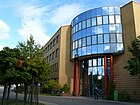
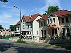
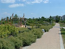
List of streets and squares in Berlin-Bohnsdorf

The list of streets and squares in Berlin-Bohnsdorf describes the street system in the Berlin district of Bohnsdorf with the corresponding historical references. At the same time, this compilation is part of the lists of all Berlin streets and places .
overview
Bohnsdorf has 11,671 inhabitants (as of December 30, 2019) and includes the postcode areas 12524 and 12526.
In the district of Bohnsdorf there are 118 dedicated streets and four squares, including the village square as the anger of the original village of Bohnsdorf. Of these 122 traffic areas, eight are only partially in Bohnsdorf or, like Waldstrasse, form the city limits of Berlin to the Brandenburg area. The overview also contains seven unofficial streets (marked with *). What is remarkable is the interweaving of long roads across the district with comparatively short settlement roads opening up the properties, which were initially marked with Roman numerals (I-IV). The total length of all streets in the district is 56.9 kilometers. The streets west of the Plumpengraben and south of the Bruno-Taut-Straße – Kirchsteig route including Bohnsdorfer Kirchsteig belonged to the Köpenick administrative district until 1938, then to the Treptow administrative district. With the merging of the districts in 2001, they are now united in the Treptow-Köpenick district . The district boundaries with Berlin-Altglienicke in the north and Berlin-Grünau in the east have been redefined several times.
The street names assigned first were based on the location (meadow, moat, hill or direction; 24 streets). Later, the municipality used street names to honor people who were related to Bohnsdorf or represent general job titles and gave names of former German villages as well as some from Greek and Roman mythology (a total of 29 streets). The newest residential areas are being built in the 21st century in the western area of Bohnsdorf between the two motorways A 113 and A 117 . The streets in it are named after German scientists, engineers or flight pioneers (including women), inspired by the nearby Johannisthal airfield .
Between 1913 and the 1920s, the “Berliner Spar- und Bauverein” was active in Bohnsdorf and commissioned the architects Taut & Hoffmann to implement their ideas for social housing. In the settlement known as the Garden City of Falkenberg , mainly single-family and four-family houses were built until 1920. According to the will of the architect Bruno Taut , the buildings were given striking colored paints and were therefore soon popularly known as the "Tuschkastensiedlung". The associated 40 streets were designated with terms from nature (plants, mushrooms, birds) or with reference to “garden”. They were created through the activities of the workers' building cooperative "Paradies", after which streets were also named.
Overview of streets and squares
The following table gives an overview of the streets and squares in the district as well as some related information.
- Name / location : current name of the street or square. Via the link Location , the street or the square can be displayed on various map services. The geoposition indicates the approximate center of the street length.
- Traffic routes not listed in the official street directory are marked with * .
- Former or no longer valid street names are in italics . A separate list may be available for important former streets or historical street names.
-
Length / dimensions in meters:
The length information contained in the overview are rounded overview values that were determined in Google Earth using the local scale. They are used for comparison purposes and, if official values are known, are exchanged and marked separately.
For squares, the dimensions are given in the form a × b for rectangular systems and for (approximately) triangular systems as a × b × c with a as the longest side.
If the street continues into neighboring districts, the addition ' in the district ' indicates how long the street section within the district of this article is. - Name origin : origin or reference of the name.
- Notes : further information on adjacent monuments or institutions, the history of the street and historical names.
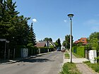
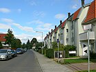
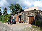
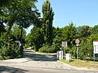
- Image : Photo of the street or an adjacent object.
| Name / location | Length / dimensions (in meters) |
Origin of name | Date of designation | Remarks | image |
|---|---|---|---|---|---|
|
Adlerstrasse
( Location ) |
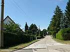
320 | Eagle , native bird of prey | 1904 | The street was laid out on a construction site of the workers' cooperative "Paradies". It connects Waltersdorfer Strasse (west) with Eichbuschstrasse (east). |
|
| Advocate's path
( Location ) |
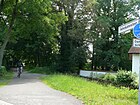
170 | Advokat , historical name for a lawyer, used in Germany until 1879 | May 29, 1998 | The Advokatensteig is a pedestrian street that branches off southwards from the Gründerstraße and after a swivel to the west leads to the Buntzelstraße. It runs on the route of the Henschelbahn, which was closed in 1959, and was only named in 1998. The street was previously called the Black Way by most of the local residents . The notary and lawyer Klaus-Stephan Bickel, who formerly resided at Gründerstraße 32, had talks with the State of Berlin in the 1990s because of its property line along this route and called the route for a clearer name. This was then officially adopted. |
|
| Acacia courtyard
( Location ) |
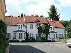
130 | Acacias , deciduous trees | Oct. 1913 | The street goes southwest from Am Falkenweg and opens up the residential area. In the real sense, it is a courtyard lined with acacias. The Akazienhof is part of a complete housing estate that was built by the former building cooperative “Berliner Spar- und Bauverein” (later “Bau- und Wohnungsgenossenschaft von 1892”). |
|
| Alexander-Meissner-Strasse
( Location ) |
1070 | Alexander Meißner (1883–1958), physicist, specialist in radio technology | Nov 27, 2009 | The street (project name "Transversale") was created on a new building area. It goes southeast from Am Seegraben and ends at the Berlin city limits. |

|
| At the Falkenberg
( Location ) |
440 (in the district) |
Falkenberg , a local elevation 52 meters high; also historical field name | 1902 | At Falkenberg there is a long access road in the district. It begins in the northwest in the district of Altglienicke (house numbers 19–111) as a continuation of Grünauer Straße, passes under the road bridge of Am Seegraben and ends on Kirchsteig near the historic town center. The waterworks in this street has its own official number (44489). |

|
| On Gartenstadtweg
( Location ) |
390 (as a ring) |
Garden city , name of the "Tuschkastensiedlung" created by the Bauverein 1913–1915 | Dec 8, 1983 | The access route only emerged in the 1970s in its current course; he was already unofficially named that way. The path runs from Paradiesstrasse in a north-easterly direction parallel to Am Seegraben. After a slight bend in an easterly direction, it joins Gartenstadtweg. |

|
| At the Plumpengraben
( Location ) |
180 | Plumpengraben, a moat between the Spree in Niederschöneweide, the wet meadows in the community of Schönefeld or from the Berlin city forest (the Falkenberg is a watershed) to the Teltow Canal |
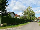
Aug 1, 1993 | According to the development plan, the street was called Straße 991 , and on June 16, 1960 it was named Straße des NAW . In 1992 the district office named Graben . Due to the risk of confusion with Grabenstrasse in the same district, a specification was made a year later. The street forms a connection between Dahmestraße (northwest) and Fichtestraße (southeast). The name is based on the Plumpengraben that runs parallel to it. |
|
| At the Seegraben (*)
( Location ) |
270 (in the district, east side) |
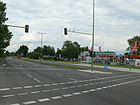
Moat that passes north of the Schönefelder See | after 1961 | This road is a section of the federal highway 96a and connects the eagle frame of Grünau over the A 117 with the community of Schönefeld . There the route continues as a Mittelstrasse. The road was rebuilt for civilian use after Schönefeld Airport opened and after the Wall was built in 1961.
Am Seegraben is not officially designated in the Berlin area (*), but is included by name in some city maps. In the map of Berlin 1: 5000, produced by the district surveying offices, the road in the district is named B 96a. At the Seegraben forms the northern boundary of Bohnsdorf. Between 2010 and 2011 the entire route was “completely renewed ” in order to improve its condition as a feeder to the planned BER airport . |
|
| On the meadow path
( Location ) |
300 | Meadow over which the Plumpengraben runs | around 1916 | This is a footpath between Gartenstadtweg and the Grünau S-Bahn station , it ends at Bruno-Taut-Straße. It was laid out by the house and landowners association of the "Landhauskolonie Falkenberg" in 1908 but was only named a few years later. |

|
| Amorstrasse
( Location ) |
560 | Cupid , Roman god of love | 1904 | It connects Eichbuschstrasse in a north-westerly direction with the Grünauer Strasse – Lessingstrasse road. |

|
| Amselweg
( Location ) |
140 | Blackbird , native songbird | around 1913 | The path connects Waltersdorfer Straße (west) with Schulzendorfer Straße (east). |
|
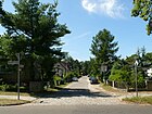
| Apollo Street
( Location ) |
330 | Apollo , Greco-Roman god of light / sun, spring, healing, etc. | around 1904 | This west-east street connects Schulzendorfer Strasse with Grünauer Strasse. |
|
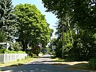
| Atlantis ring
( Location ) |
340 |
Atlantis , fabled sunken island; here the building cooperative is called that |
Jan. 18, 2005 | The private road located in a new housing estate, advertised with eco park Bohnsdorf. |

|
| Auraser way
( Location ) |
360 | 'Auras', place in Lower Silesia , today Uraz , part of Oborniki Śląskie in Poland | Jan. 29, 1937 | According to the development plan, the path was initially called Straße 975 or Siedlerweg I , and occasionally also Siedlungsweg I (1932). It curves slightly between Dahmestraße (north) and Siebweg (south). |

|
|
Bachstrasse
( Location ) |
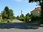
620 | Bach , after the Plumpengraben flowing through the district, towards which the road leads | before 1920 | The traffic route was created around 1914 in the Falkenhorst settlement. The Bachstraße is the eastern continuation of the Stromstraße. It connects Schulzendorfer Strasse with Birkenstrasse. |
|
| Binswangersteig
( Location ) |
440 |
Otto Binswanger (1852–1929), Swiss psychologist Otto Binswanger had examined and described a brain disease that became known as Binswanger's disease . |
Apr 10, 1931 | At first the traffic route was called Straße 51 , from before 1922 to 1934 Fritz-Reuter-Straße . The name was given to Otto Binswanger because he had "just" died (1929) and a connection to the nearby Hedwigshöhe hospital was created. The climb runs from Grottewitzstraße at the hospital (north) over Buntzelstraße - where it is offset to the east - to Dahmestraße (south). |

|
| Birkenstrasse
( Location ) |
160 | Birch trees , native deciduous trees | around 1920 | Birkenstrasse connects Wiesenstrasse (north) with Sandbacher Weg (formerly Hubertusstrasse ; south). |

|
| Birch path
( Location ) |
140 | Birch trees , native deciduous trees | around 1920 | The path is the southern continuation of Birkenstrasse. It connects the Sandbacher Weg with the Waldstraße on the Berlin city limits. |

|
| Bohnsdorfer Kirchsteig
( Location ) |
340 | Bohnsdorf , origin of today's district and direction to the village church | Oct 18, 1937 | This is the western continuation of the Kirchsteig. It leads across Paradiesstrasse to a commercial area. |

|
| Boviststrasse
( Location ) |
350 | Bovist , mushroom with a thickened, usually round, fruiting body | Aug 1, 2002 | This is a north-south traffic route that leads from the bend of the Kleine Spechtstrasse to the Kleiner Waldstrasse. Until the name was given, Boviststrasse was part of Strasse 959 . |

|
| Bruno-Taut-Strasse
( Location ) |
560 (in the district) |
Bruno Taut (1880–1938), architect | July 25, 1979 | The road was re-routed in 1979, including road 94 , which forms a branch to the west-northwest. The “Taut-Passage” shopping center, built at the east end of the street at the beginning of the 2000s, directly at the Grünau S-Bahn station bears house number 1. From here the street leads southwest to Am Falkenberg, makes a small offset and then continues in a straight line. Before it ends at a green area, Bruno-Taut-Straße forms a winding route to develop the settlement area. |

|
| Buntzelstrasse
( Location ) |
1880 (in the district) |
Max Buntzel (1850–1907), local politician, horticultural director, landowner in the Falkenberg estate | around 1905 | At first only the part of the traffic route from Grottewitzstrasse to Richterstrasse was called Buntzelstrasse, on April 10, 1931, Bahnhofstrasse was added as a western extension . At the beginning of the renaming, the house number ranges 1–41 and 2–52 belonged to Altglienicke. Buntzelstraße runs slightly swiveled several times between Richterstraße at Grünau train station and the village square in the old town center. A smaller section between Richterstraße and Schulzendorfer Straße belongs to the B 179 . A plaque on house number 119 reminds of the workers' building cooperative "Paradies" founded here in 1902. The municipal cemetery Bohnsdorf is located in the western area of Buntzelstraße . On the Buntzelberg there is the sports field of the Grünauer BC 1917 football club . |

|
| Wood anemone path
( Location ) |
100 | Wood anemones , spring flowers in the open forest | June 20, 2001 | The path is located in the garden city of Falkenberg, which was built by the “Berliner Spar- und Bauverein” from the 1910s and is now being expanded. |

|
|
Mushroom Street
( Location ) |
170 | Champignon , noble edible mushroom | Jan. 3, 2001 | The traffic route was initially called Straße 955 when it was built . It runs in a south-west-north-east direction on both sides of Kleine Lindenstrasse. |

|
|
Dahmestrasse
( Location ) |
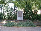
940 | Dahme , tributary of the Spree | around 1914 | Dahmestrasse runs in a west-east direction between Buntzelstrasse and Kablower Weg. At the intersection with Schulzendorfer Straße she makes a slight swing to the east-north-east. The school named after the sculptor Fritz Kühn is located in this street . It was built in 1916 as the 13th community school on a cooperative building site. In addition, a small memorial was set up here around 1960, which commemorates seven Bohnsdorf resistance fighters who were murdered during the Nazi era (see picture).
The civil engineering department of the Treptow-Köpenick district is located in house number 33 (as of February 2013). |
|
| Village square
( Location ) |
280 × 50 (village green) |
Village , core of the Bohnsdorf settlement, which was first mentioned in a document in 1375 |
reported (14th century) |
That is also the historical Anger . It includes house numbers 1–22 and runs once around the village pond in a lens shape. The defining structure here is the Bohnsdorf village church . |

|
|
Eichbuschplatz
( Location ) |
90 × 40 | Oak bush , oak planting | around 1914 | The rectangular square is delimited by Parchwitzer Straße (north), the back of properties (east), Sandbacher Weg (south) and Eichbuschstraße (west). |

|
| Eichbuschstrasse
( Location ) |
760 | Oak bush , oak planting | after 1914 | The road runs between Elsterstrasse (north) and Sandbachstrasse (south). According to the address book from 1933, it connected Schulzendorfer Strasse with Amorstrasse and comprised 44 parcels . |

|
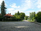
| Eichbuschweg
( Location ) |
200 | Oak bush , oak planting | before 1922 | The path initially runs as a southern extension of Eichbuschstrasse, then turns to the southeast and ends at the Berlin city limits, Waldstrasse. Nine parcels are assigned to it. |
|
| Elsterstrasse
( Location ) |
360 | Magpie , crow bird | around 1913 | It connects Waltersdorfer Strasse (west) with Schulzendorfer Strasse (east), forming a small, nameless triangular square at its eastern end with Eichbuschstrasse, which opens from the south. |

|
|
Falkenstrasse
( Location ) |
170 | Hawks , birds of prey | around 1908 | It connects Lindenstrasse (north) with Waldstrasse (south). |

|
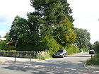
| Fasanenstrasse
( Location ) |
460 | Pheasants , chicken birds | before 1922 | It connects Gehrenweg (west) with Falkenstrasse (east) and crosses Waltersdorfer Strasse, which is part of federal highway 179 . |
|
| Feldstrasse (*)
( Location ) |
370 | Field around the village of Bohnsdorf | before 1925 | The field road is not dedicated . It was in the Berlin address book between 1930 and 1938. It runs from Hufenweg (west) to the route of the A 117 . When it was recorded in the address book, it connected Dorfstrasse with Friedenstrasse and had no buildings. The area south of the road is now a compensation area for the habitat of sand lizards created for BER Airport . |

|
| Dirt road (*)
( Location ) |
360 | Field corridor in the village of Bohnsdorf, here only symbolically chosen | before 2008 | The street is not dedicated . With its connecting road, it encloses a residential area (allotment gardens Grünbergallee) and leads west of the village center from Grünbergallee northwards. There it makes a sharp bend and becomes Rosenweg , which leads back to Grünbergallee. The numbering according to the development plan was Street 933 . The path is still marked as a garden path with its green sign, but there are signs on Grünbergallee that assign the adjacent properties of the path as Grünbergallee. |

|
| Fichtestrasse
( Location ) |
330 | Johann Gottlieb Fichte (1762–1814), philosopher | 1920 | Fichtestrasse goes off in a north-easterly direction from Schulzendorfer Strasse and ends on the wet meadows in front of the Plumpengraben. |

|
| Toadstool Street
( Location ) |
630 | Fly agaric , native toadstool | Oct 22, 2001 | Before the name was given, it was the longer southern part of road 957 according to the development plan . It runs in a north-south direction between Kleine Lindenstrasse and Kleine Waldstrasse. |

|
| Flow street
( Location ) |
620 | Fließ , another name for a small body of water, here based on the Plumpengraben | after 1914 | It leads in a north-easterly direction from Eichbuschstraße via Schulzendorfer Straße to the wet meadows in front of the Plumpengraben. |

|
| Florastrasse
( Location ) |
250 | Flora , Greco-Roman goddess of the plant world | after 1914 | It connects Parchwitzer Strasse with Lindenstrasse in a north-south route. |

|
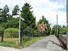
| Fraustadter way
( Location ) |
160 | 'Fraustadt', city in the province of Poznan , today Wschowa in Poland | Dec 3, 1937 | The path connects the Auraser Weg in a segmental arc south-east with the Siebweg. According to the development plan around 1914, it was first called Siedlerweg II , occasionally also Siedlungsweg II (1932), then Straße 974 . |
|
| Fritz-Kühn-Strasse
( Location ) |
460 | Fritz Kühn (1910–1967), photographer, sculptor and blacksmith | March 17, 1999 | It leads from Siebweg as a continuation of Hundsfelder Straße in a slight southwestern route to Parchwitzer Straße and beyond that it forms a dead end. Until it was officially named in honor of the famous Grünau citizen Kühn, it was part of Straße 955 . |

|
|
Gartenstadtweg
( Location ) |
510 | Falkenberg garden city , official name of the settlement | 1931 | When it was renamed, the path was merged from the previous Gartenstadtstraße , Straße 50 (both in the Treptow district; Altglienicke) and Wilhelm-Busch-Straße .
The Gartenstadtweg goes northeast from Am Gartenstadtweg, crosses the Am Falkenberg street and leads over the Plumpengraben in the direction of the KGA 'Waldfrieden'. It also forms a loop in the east with parcels 4–18. On 17 December 2001 accounted for the former southwestern part of the road and was in to garden city renamed |

|
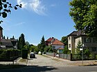
| gardenstreet
( Location ) |
190 | garden | around 1913 | The road has only eight parcels . It connects Waltersdorfer Straße (west) with Schulzendorfer Straße (east-north-east). |
|
| Gebrüder-Hirth-Strasse
( Location ) |
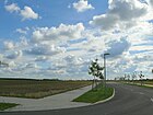
400 (in the district) | Brothers Hellmuth (1886–1938) and Wolf Hirth (1900–1959), aviation pioneers | Nov 27, 2009 | This street is part of a street network that was planned for a new building area. It goes south from the western end of Ludwig-Prandtl-Straße, crosses the Berlin city limits after approx. 400 meters and continues as a footpath around 200 meters in the Brandenburg district of Dahme-Spreewald (project name “Planstraße West”). |
|
| Gehrenweg
( Location ) |
1060 | Miter, derived from miter ; designated wedge-shaped parcels in Bohnsdorf ("Gehren zum Zweyten Felde", which were wedge-shaped to the "Hufen zum Zweyten Felde") |
March 8, 1935 | Gehrenweg was created by merging Straße 967 and Teltower Straße , both of which were laid out around 1910. It connects the Siebweg (north) with the forest road (south). |

|
| Glienicker Strasse
( Location ) |
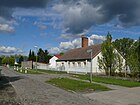
330 | Glienicke , direction | around 1920 | The connection known as Glienicker Weg (and more rarely also Glienicker Chaussee ) existed to the neighboring town before the 19th century .
In connection with the development of further building land in the 21st century and the review of the existing road network, a section from Weidenweg (between Bundesstraße 96a and Glienicker Straße) was included in Glienicker Straße. |
|
| Goethestrasse
( Location ) |
230 | Johann Wolfgang von Goethe (1749–1832), poet | around 1920 | The traffic route connects the Amorstrasse – Grünauer Strasse with the Fließstrasse. |

|
| Grabenstrasse
( Location ) |
470 | Trench , here based on the Plumpengraben | 1931 | In the 1930s, a Grabenstrasse was "planned" in the southeastern part of Bohnsdorf, which was supposed to leave Wiesenstrasse (east of Birkenstrasse / Birkenweg). Today's Grabenstrasse belonged to Grünau until 1938. It leads from the Gründerstrasse (north) to the Kablower Weg (southeast). |

|
| Grottewitzstrasse
( Location ) |
610 | Curt Grottewitz (1866–1905), writer | Jan. 16, 1925 | When the road system was laid out around 1908, the traffic route was given the name Straße 1 . The Hedwigshöhe Hospital is located on Grottewitzstrasse, which was created from a private villa and a convalescent and convalescent home for Catholics (still referred to as this in the address book in 1938). |

|
| Grünauer Strasse
( Location ) |
210 (in the district, without east side) |
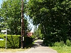
Grünau , direction to the neighboring district | before 1920 | It runs between Neptunstraße (north) and Amorstraße (southeast) on the very eastern edge of Bohnsdorf. |
|
| Grünbergallee
( Location ) |
510 (in the district) |
Alfred Grünberg (1901–1942), resistance fighter against Nazi rule | Apr 20, 1948 | The street was re-routed in 1895 at the earliest and 1900 at the latest, remained without development until 1925 and was called Schönefelder Strasse from 1925 to 1948 . It shortened the way to Schönefeld, since the old way from Bohnsdorf to Schönefeld, already called Schönefelder Weg in the 18th century , began about 300 meters north of Bohnsdorf. The eastern end of the new street, however, was the direct extension of the village square. In the west, the road reached to Bohnsdorfer Chaussee, which continued in the direction of Schönefeld.
The endpoints of the road have remained unchanged. From 1940 the outer freight ring crossed the street, later the Grünbergallee station was set up with a level crossing. When the road Am Seegraben was built in 1961, however, the road was interrupted at precisely this point. The railway line was expanded, the level crossing was replaced by an overpass for pedestrians and in 1962 the Grünbergallee S-Bahn station went into operation. Only the eastern part from the village square (east) to Am Seegraben is in Bohnsdorf. House numbers 1–101 and 270–328 belong to it. The western part of the street is in Altglienicke (numbers 102-269), as is the S-Bahn station. In 2011, the construction of a commercial area changed the traffic routing and the street was given a second western exit to the B 96a. |

|
| Gründerstrasse
( Location ) |
770 (in the district) |
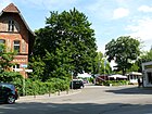
Founder , first settler of the place (most likely origin of name) | around 1920 | Its course and its sections have been changed several times since they were named around 1920. It currently connects Grabenstrasse (south) north-west with Richterstrasse (north, near Grünau S-Bahn station). The house numbers 11 and 13 on the northwest street section belong to the district of Grünau.
There is a contact person for the Treptower Schwimmverein Berlin e. V. |
|
| Greenfinch Trail
( Location ) |
340 | Greenfinch , native songbird | Oct. 1, 1996 | At its facility, the way was road 992 . When looking for a proper name, Fanny-Zobel-Strasse was in the planning stage. However, this name had just been given to a street in Alt-Treptow . The name chosen instead fits in well with the neighboring streets named after birds.
The Green Finch Trail connects Schulzendorfer Strasse (west) in a slight curve with Joachimstrasse (east). |

|
|
Habichtstrasse
( Location ) |
380 | Habicht , native bird of prey | 1920 | It connects Waltersdorfer Straße (West; B 179 ) with Eichbuschstraße. (East) |

|
| Blueberry trail
( Location ) |
100 | Blueberry , forest fruit, another name for blueberry | June 20, 2001 | It connects Johannes-Tobei-Strasse (north) with Grottewitzstrasse (south). |

|
|
Höhensteig
( Location ) |
150 | Height, height of the Falkenberge | Apr 4, 1934 | The climb is the eastern continuation of Johannes-Tobei-Straße. It ends in a turning loop near the Hedwigshöhe hospital. When it was built around 1915, the path leading to the hill was called Straße 6 , from 1925 Hasencleverstraße . |

|
|
Hüttendorfer way
( Location ) |
170 | Hüttendorf, German name of Huttendorf , place in Alsace in France | Feb 12, 1935 | It goes from Buntzelstraße in a north-westerly direction and ends at the intersection of Bohnsdorfer Kirchsteig, Kirchsteig and Theodor-Körner-Straße. The path was first called Richard-Wagner-Strasse . Its renaming is due to the multiple occurrences of this street name in Berlin. |

|
| Hufenweg
( Location ) |
400 | Hooves , historical measure by which the property of farmers was valued; the way along | Aug 8, 1935 | The Hufenweg goes south from Grünbergallee / Dorfplatz and joins Kleine Lindenstraße. In the address books of the 1920s it is shown on the maps contained, initially without a name, before its official name as Dorfstraße . In contrast, the route that continued to the north was already called Glienicker Strasse in the 19th century.
The building yard of the civil engineering department of the Treptow-Köpenick district is located on Hufenweg. |

|
| Hundsfelder Strasse
( Location ) |
370 | 'Hundsfeld', district of Wroclaw ; today the Psie Pole district of Wrocław in Poland | Aug 16, 1928 | At first the traffic route was called Straße 965 . Since it was not yet built upon when it was named, the address books still read until 1935 (“projected”). On April 5, 1934, the previous Lange Strasse was incorporated into Hundsfelder Strasse. The route of the Henschelbahn ran along the central promenade of Hundsfelder Strasse until it was closed in 1959 . |

|
|
Jaegerstrasse
( Location ) |
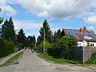
250 | Hunter , however, person who killed wildlife and the Hege perceives | around 1920 | The street name refers to the users of the forest and hunting area south of Bohnsdorf. The street runs from Parchwitzer Straße to Lindenstraße in a north-south direction. |
|
| Jahnstrasse
( Location ) |
290 | Friedrich Ludwig Jahn (1778–1852), pedagogue, gymnastics teacher | around 1920 | Jahnstrasse branches off from Schulzendorfer Strasse to the northeast and joins the street Am Plumpengraben. |

|
| Joachimstrasse
( Location ) |
730 | Joachim II (1505–1571) or Joachim Friedrich (1546–1608), Elector of Brandenburg | around 1920 | Only the male first name Joachim is considered to be the namesake, but more likely are Elector Joachim, who was often on the road in Grünau and the surrounding area between Königs Wusterhausen and Old Berlin , or Elector Joachim Friedrich, who died in 1608 in the then so-called Bohnsdorfische Busch after a stroke died, in whose memory a grave chapel based on a design by August Stüler was built in the Grünauer Forest (probably demolished in 1942 when the railway area at Grünau station was expanded)
The road connects the Binswangersteig (west) with the Green Finch Trail (east-north-east). |

|
| Johannes Tobei Street
( Location ) |
500 | Johannes Tobei (1930–1997), theologian, vicar general for Berlin | July 23, 2002 | The street runs between Paradiesstraße (west) and the Mohnblütenweg / Zur Gartenstadt (east). It opens up a new residential area in the northwest of Bohnsdorf. The naming honors Tobei's commitment to the Catholics in Berlin, who had died five years earlier. |

|
|
Kablower way
( Location ) |
1130 (in the district) |
Kablow , district of Königs Wusterhausen in Brandenburg | Aug 24, 1936 | When it was built around 1920, today's route was part of Nordstrasse and belonged entirely to Grünau (Cöpenick administrative district). This was renamed together with a section of the Gründerstraße in 1936 and incorporated into Bohnsdorf in 1938.
The house numbers 1–89 are in the Berlin-Bohnsdorf district, where the Kablower Weg runs in a north-west-south-east direction. At its southern end it bends to the northeast and leads under the railway embankment to the eagle frame. Here are two parcel numbers belonging to Grünau. |

|
| Karlstrasse
( Location ) |
100 | Friedrich Karl Alexander , Prince of Prussia (1801-1883) | around 1920 | Only the male first name Karl is considered to be the namesake . The reference to Prince Karl is also more likely here (as with Joachimstrasse).
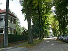
Karlstrasse connects Joachimstrasse (north-northwest) with Dahmestrasse (south). |
|
| Kirchsteig
( Location ) |
180 | Village church Bohnsdorf , way from the railway station to the village center | 1930 | For a long time it had been an unnamed footpath along the slope of the Falkenberge between the village square and the Grünau train station. In a map from 1900 it is entered as Küstersteig , in 1907 as Kirchensteig . In his current tour it consists of two non-connected parts, one of which goes from Paradiesstraße northeast and ends at Grottewitzstraße. Untitled, it led as a footpath to Bruno-Taut-Strasse. However, due to the new construction in the Johannes-Tobei-Straße area, this path has been omitted. The second part is a remnant in continuation of Richterstraße from Am Falkenberg. This section is a dead end and ends at the KGA 'Falkenberge'. |

|
| Kleine Lindenstrasse
( Location ) |
760 | Linden trees , deciduous trees | March 1, 2001 | Lindenstrasse was interrupted by the construction of the motorway in 1962 and the remaining part was therefore renamed. The Kleine Lindenstrasse leads from the Hufenweg (west) to the fly agaric road (east). |

|
| Little Woodpecker Street
( Location ) |
300 | Woodpecker , native forest bird | March 1, 2001 | The Spechtstraße was interrupted by the construction of the motorway in 1962 and the remaining part was therefore renamed. The Kleine Spechtstraße leads from the Perlpilzstraße (west) to the Boviststraße (east). |

|
| Small forest road
( Location ) |
440 | Forest , larger group of trees | March 1, 2001 | The forest road was interrupted by the construction of the motorway in 1962 and the remaining part was therefore renamed. At the western end it forms a bent arm (parcel numbers 326/328) that runs in a north-south direction. |

|
| Climbing rose trail
( Location ) |
100 | Climbing roses , roses climbing on trellises | June 20, 2001 | The path is in the newly developed construction site between Am Seegraben and the A 117 . It goes north from Johannes-Tobei-Straße and leads to the “Grünzug am Falkenberg”. |

|
| Kranichstrasse
( Location ) |
360 | Crane , Central European migratory bird | before 1920 | It is a north-south street between Habichtstrasse and Parchwitzer Strasse. |

|
| Crooked road
( Location ) |
350 | Shape of the road layout | around 1920 | It is slightly curved between Auraser Weg and Waltersdorfer Straße in a west-east direction. In the years after 1900 there was a chemical factory on Waltersdorfer Strasse on what is now the road area, which at that time was the only building in a wide area. |

|
|
Leschnitzer Strasse
( Location ) |
300 | Leschnitz, town in Upper Silesia , Poland, Polish Lesnica | Aug 16, 1928 | When it was first installed, the traffic route was called Strasse 578 . Before the current name it was given the name Neue Straße and Extended Neue Straße . It runs between Dahmestraße (north) and Siebweg (south). |

|
| Lessingstrasse
( Location ) |
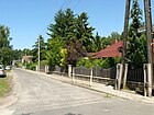
210 | Gotthold Ephraim Lessing (1729–1781), poet | around 1920 | Lessingstrasse connects Amorstrasse with Fließstrasse. It runs parallel to the east bank of the Plumpengraben. |
|
| Linden Blossom Street
( Location ) |
200 | Linden blossom , blossom of the linden tree | June 20, 2001 | The street goes south from Am Gartenstadtring, after the intersection with the Almond Blossom Path it ends as a dead end after around 110 meters. |

|
| Lindenstrasse
( Location ) |
1130 | Linden trees , deciduous trees | around 1913 | The east-west street stretches from the eastern embankment of the A 113 to the Teichhuhnsteig. Shortly after its alignment and naming (around 1925) it led from Waltersdorfer Straße (West) to Heidestraße (today: Teichhuhnsteig). In December 1956, Road 984 was added as an extension to the west. With the construction of the motorway feeder in 1962, the road was shortened again, the separated western section was named Kleine Lindenstraße in 2001. |

|
| Ludwig-Prandtl-Strasse
( Location ) |
920 | Ludwig Prandtl (1875–1953), physicist; Co-founder of fluid mechanics | Nov 27, 2009 | The street (project name “Planstraße Nord”) is located in a new development field in the west of Bohnsdorf. It runs from Gebrüder-Hirth-Straße (west) to Rita-Maiburg-Straße (east-north-east). |

|
|
Almond blossom trail
( Location ) |
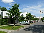
170 | Almond blossom , blossom of the almond tree | June 20, 2001 | The Almond Blossom Path begins on Gartenstadtweg in a southerly direction. After a bend it leads to the Lindenblütenweg (east). |
|
| Melitta-Schiller-Strasse
( Location ) |
570 | Melitta Schiller (1903–1945), engineer and aviator | Nov 27, 2009 | The street (project name “Planstraße Mitte”) is located in a new building area in the west of Bohnsdorf. It runs from Ludwig-Prandtl-Straße (north) to the Berlin city limits (south) via "Die Hufen im Seefelde". A continuation to Brandenburg is planned. |

|
| Mercury Street
( Location ) |
340 | Mercury , Greco-Roman god of merchants and thieves | before 1920 | It connects Eichbuschstrasse (west) with Schillerstrasse (east). |

|
| Mettkauer way
( Location ) |
160 | 'Mettkau', town in Lower Silesia , today Mietków in Poland | Dec 3, 1937 | According to the development plan, the traffic route was first called Straße 971 or Siedlerweg III , and occasionally also Siedlungsweg III (1932). It connects Krumme Strasse (north) with Siebweg (south). |

|
| Poppy flower path
( Location ) |
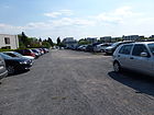
100 | Poppy flower, blossom of the poppy | June 20, 2001 | The poppy flower path descends northwards from the Höhensteig and leads to the “Grünzug Am Falkenberg”. It is used as a parking lot for the nearby Hedwigshöhe Hospital. |
|
| Mühlenweg (*)
( Location ) |
270 | Post mill , a reminder of history | between 1984 and 1987 | The street with the officially not (yet) registered name runs in a north-south direction between the north branch of Glienicker Strasse and Grünbergallee. The eponymous "Adler-M (ühle)" is entered on a city map from 1894 between Rudow and Bohnsdorf. With the expansion of the district, the street was included in Glienicker Straße. In 1983 the mill was dismantled. The numbering of the street according to the development plan was street 934 . The path is still marked as a garden path with its green sign, but there are signs on Grünbergallee that assign the adjacent properties of the path as Grünbergallee. |

|
|
Neptunstrasse
( Location ) |
320 | Neptune , Greco-Roman god of water | around 1914 | It runs between Schulzendorfer Strasse and Grünauer Strasse in a south-west-north-east direction. |

|
|
Paradise road
( Location ) |
1100 | "Paradise" , name of the building cooperative | 1904 | The street was laid out to develop the building site of the workers' building cooperative "Paradies". At first it ran between Bahnhofstrasse and Siebweg and comprised 32 parcels. In 1935 Straße 985 and Straße 954 and in 1964 Straße 101 were added to Paradiesstraße. After a further section was incorporated in 2000, it now runs on the one hand in a north-south direction from Am Seegraben to Parchwitzer Straße and on the other hand it has a short transverse arm to the west, opposite Johannes-Tobei-Straße, where the Falkenbergpark business park is located . A total of 291 house numbers belong to Paradiesstrasse. |

|
| Parchauer way
( Location ) |
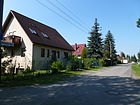
230 | 'Parchau', place in Lower Silesia , today: Parchów in Poland | Jan. 29, 1937 | The path was called Straße 961 at its layout . It connects Spechtstraße (north) with Waldstraße (south) and runs parallel to the A 117 federal motorway to the east. |
|
| Parchwitzer Strasse
( Location ) |
2560 | 'Parchwitz', place in Lower Silesia , today: Prochowice in Poland | Nov 23, 1933 | When it was renamed, the street was merged from Hubertusstraße , Straße 955 and Friedenstraße . It connects Buntzelstrasse (northwest) across Waltersdorfer and Schulzendorfer Strasse with Birkenweg (east). On October 22, 2001, the section of road 957 going south at the curve to the motorway was included in Parchwitzer Strasse. |

|
| Perlpilzstrasse
( Location ) |
470 | Pearl mushroom , noble edible mushroom | Jan. 3, 2001 | According to the development plan, these were previously road 956 and road 956a . The Perlpilzstraße connects the Kleine Lindenstraße (north) over the Kleine Spechtstraße with the Kleine Waldstraße (south). The part of the former street 956a forms a north-west branching branch (house numbers 320-320c), which ends at the Champignonstraße. |

|
| Pitschener Strasse
( Location ) |
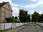
150 | 'Pitschen', town in Upper Silesia , today Byczyna in Poland | Aug 16, 1928 | According to the development plan, it was first called Straße 980 . Before the current name was given, it was briefly called Seitenstrasse . The traffic route connects Leschnitzer Strasse (west) with Hundsfelder Strasse (east) in a slight north curve. |
|
| Polkwitzer Strasse
( Location ) |
260 | Polkwitz, a town in Lower Silesia , now Polkowice in Poland | Aug 16, 1928 | Polkwitzer Strasse was laid out as Strasse 981 . Before the current name, it was called Mittelstrasse . It connects Paradiesstrasse (west) with Leschnitzer Strasse (east). |

|
| Prieborner Strasse
( Location ) |
1100 | 'Prieborn', town in Lower Silesia , today Przeworno in Poland | Aug 8, 1935 | At first it was called Straße 968 according to the development plan . It connects the Siebweg (north) with the forest road (south). |

|
|
Quaritzer Strasse
( Location ) |
190 | 'Quaritz', a place in Lower Silesia , today Gaworzyce in Poland | Aug 16, 1928 | The traffic route was officially designated as a private road when it was built around 1920 . Quaritzer Straße goes westward from Paradiesstraße, after a bend to the south it leads to Siebweg. |

|
|
Reihersteg
( Location ) |
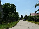
500 | Heron , native water bird | 1920 | It connects Adlerstrasse (north) with Parchwitzer Strasse (south). At first it ended south on Stromstrasse (according to the address book 1922). |
|
| Richterstrasse
( Location ) |
310 (in the district) |
Ferdinand Gustav Richter (1843–1918), landowner and local politician in Köpenick | 1904 | The parcels (1–10) belong to the district, the numbers 11, 12 and 13 are in Grünau . The road was laid out on the property of Richter. Richterstraße runs from Berlin-Grünau train station (confluence with water sports avenue; northeast) to Am Falkenberg (west-southwest). |

|
| Marigold Path
( Location ) |
100 | Marigold , flower of the sunflower family | June 20, 2001 | The planned route goes northwards from Johannes-Tobei-Straße and leads to the “Grünzug am Falkenberg”. It is part of a new settlement area in the garden city of Falkenberg. | |
| Ringweg (*)
( Location ) |
200 | Ring , guiding the way | before 2008 | The ring road west of the village center starts from the south lane of the B 96a to Bohnsdorf (one street before Grünbergallee). In keeping with its name, the Ringweg leads northwards back to Grünbergallee. He develops a former arbor colony area. To the west of it is a huge customer parking lot for a hardware store. The path is still marked as a garden path with its green sign, but there are signs on Grünbergallee that assign the adjacent properties of the path as Grünbergallee. |

|
| Rita-Maiburg-Strasse
( Location ) |
1140 | Rita Maiburg (1952–1977), in 1976 the world's first female pilot in scheduled flight service | Nov 27, 2009 | The street (project name “Planstraße Ost”) is located in a new development field in the garden city of Falkenberg in the west of Bohnsdorf. It runs from Ludwig-Prandtl-Straße (north) to the Berlin city limits (south). | |
| Rosenrotweg
( Location ) |
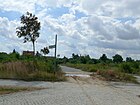
100 | Rosenrot, a title character of the Grimm fairy tale Snow White and Rose Red | June 20, 2001 | It connects Johannes-Tobei-Strasse (north) with Grottewitzstrasse (south). To the north, the path forms a dead end. It is located in a developed construction site to expand the Falkenberg garden city. |
|
| Rosenweg (*)
( Location ) |
360 | Roses , flower because of their beauty | after 2008 | This street, which is not dedicated to the west of the village center, encloses a residential area with its connecting street. It is located north of Grünbergallee and opens up the properties on the district boundary. At the north end there is a sharp bend in the field path , which leads back south to Grünbergallee. The numbering according to the development plan was Street 932 . The path is still marked as a garden path with its green sign, but there are signs on Grünbergallee that assign the adjacent properties of the path as Grünbergallee. |

|
|
Sandbacher Platz
( Location ) |
40 × 40 | probably Sandbach | Sep 9 1931 | Around 1920 the square was first called Heideplatz and Heidestrasse. It lies between Sandbacher Weg (north) and Lindenstrasse (south). | |
| Sandbacher way
( Location ) |
1640 | probably Sandbach | Sep 9 1931 | The path was created by merging a section of Karolinenhofer Strasse and Dianastrasse . It runs in a west-east direction from Gehrenweg to the meadows on Plumpengraben. Its original course (status: 1935) was from Teltower Straße / Waltersdorfer Straße via Florastraße, Jägerstraße, Sandbacherplatz (Teichhuhnsteig), Eichbuschweg, Schulzendorfer Straße to Birkenweg (district Grünau). |

|
| Sandowitzer Platz
( Location ) |
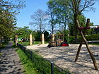
90 × 80 | 'Sandowitz', place in Upper Silesia , today Żędowice in Poland | Aug 16, 1928 | The town square is north of Siebweg and is bounded to the east by Leschnitzer Strasse and to the west by Hundsfelder Strasse. According to the development plan, it was previously referred to as open space 978 . Its surface serves as a retention basin for groundwater and rainwater in the place. There is a playground on the side east of Hundsfelder Straße. |
|
| Sausenberger Strasse
( Location ) |
560 | Sausenberg, place in Upper Silesia , Poland, Szumirad in Polish | Aug 16, 1928 | At first the traffic route was called Schulstrasse . A section of road 952 was added in the 1940s . Sausenberger Strasse runs between Parchwitzer Strasse (south) and Buntzelstrasse (north). It has a short eastern branch on parcels 43/45. |

|
| Schiller Street
( Location ) |
220 | Friedrich Schiller (1759–1805), poet | around 1920 | It connects Amorstrasse (north) with Fließstrasse (south) and is parallel to Goethestrasse and Lessingstrasse. |

|
| Umbrella Mushroom Street
( Location ) |
530 | Umbrella mushroom, noble edible mushroom | Jan. 3, 2001 | Before the name was given, it was street 958 according to the development plan . It runs between Kleine Lindenstrasse (north) and Kleine Waldstrasse (south). At the level of Kleine Spechtstraße, it forms a cul-de-sac that leads eastwards and then northwards. |

|
| Schlichtingsheimer Weg
( Location ) |
160 | "Schlichtingsheim", place in the province of Posen , today Szlichtyngowa in Poland | Dec 3, 1937 | At first the traffic route was called Siedlungsweg IV (road 972 ; occasionally also Siedlerweg IV) . It runs in a north-south direction between Krumme Straße and Siebweg. |

|
| Schulzendorfer Strasse
( Location ) |
1770 | Schulzendorf , direction | around 1912 | It is a main traffic route in Bohnsdorf, which begins north at the fork Grottewitzstraße / Buntzelstraße / Waltersdorfer Straße and runs to Waldstraße (south). In the surrounding area, the route continues nameless as a footpath and bike path.
On Buntzelberg (address Schulzendorfer Straße 112) is the former “Alfred Grünberg Oberschule”, today “Grundschule am Buntzelberg”. |

|
| Siebweg
( Location ) |
1120 | Sieb, field name of a swamp area on the Plumpengraben | 1910 | On a map of “Berlin and the surrounding area” from 1894, the name “The Sieve” is entered as a branch of the Plumpengraben near Bohnsdorf at the bottom of the picture, referring to the name given to the path that leads to it.
In the 1920s, the first residential buildings were built along this street for the workers' building cooperative "Paradies". In 1923 the parcels from 1 to 38 were "construction sites". The Siebweg connects Parchwitzer Straße from west to east in a straight line with Waltersdorfer Straße. |

|
| Spechtstrasse
( Location ) |
390 | Woodpecker , native forest bird | around 1913 | It runs between Parchauer Weg (west) and Waltersdorfer Straße (east). During the construction of the A 113 , a western section was outsourced and named Kleine Spechtstraße . |

|
| Sperberstrasse
( Location ) |
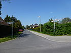
180 | Sparrowhawk , native bird of prey | 1920 | It connects Habichtstrasse with Stromstrasse in a north-south route. |
|
| Star flower path
( Location ) |
130 | Lavender star flower , species of African plant | June 20, 2001 | The path is located in a new development field in the west of Bohnsdorf and is accessible for cars from the Almond Blossom Path as a dead end street into a residential area. Then it continues without buildings as a stepped footpath and cycle path through a green area to Paradiesstraße. |

|
| Stromstrasse
( Location ) |
520 | Electricity , in the direction of the Plumpengraben | before 1920 | Stromstraße goes eastward from Waltersdorfer Straße and ends at Eichbuschstraße. Its continuation to the east is the Bachstrasse. |

|
|
Teichhuhnsteig
( Location ) |
160 | Moorhen , native water bird | Sep 9 1931 | The southern section of the climb was first called Heidestrasse from around 1910 . It connects the Sandbacher Weg (north) with the Waldstraße. |

|
| Theodor-Koerner-Strasse
( Location ) |
360 (in the district) |
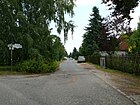
Theodor Körner (1791–1813), writer | around 1920 | The original route in Bohnsdorf was between Wilhelm-Busch-Strasse and Richard-Wagner-Strasse . Two owners and some construction sites are identified. In the 21st century, the street runs between Kirchsteig / Hüttendorfer Weg (west) and Zur Gartenstadt (east). |
|
|
Forget-me-not way
( Location ) |
100 | Forget-me-not , native spring flower | June 20, 2001 | It connects Johannes-Tobei-Strasse (north) with Grottewitzstrasse (south). The path belongs to a newly developed building site in the west of Bohnsdorf (extension of the Falkenberg garden city). |

|
|
Quail Street
( Location ) |
280 | Quail , pheasant-like chicken family | after 1913 | According to the development plan, the street was first called Straße 970 . It connects the Waltersdorfer with the Schulzendorfer Straße. Approximately in the middle it forms a south-facing branch. |

|
| Forest road
( Location ) |
2020 (in the district) |
Forest , larger group of trees | around 1906 | This street, together with the Kleine Waldstraße, which was spun off in 2001, forms the southern border of the district and at the same time the border between Berlin and the Brandenburg area. |

|
| Waltersdorfer Strasse
( Location ) |
1860 | Waltersdorf , part of the community Schönefeld in Brandenburg, direction | around 1910 | Waltersdorfer Straße is part of the historical route from Grünau to Waltersdorf. It extends the northern part of the route from Grünau to Bohnsdorf (since 1905 Buntzelstraße) where it bends to the west, further south. In the 19th century it led through the Bohnsdorf fields past the town center.
From 1888 to 1918 there was a chemical factory of the Riedel company here . Pharmaceuticals based on coal tar were produced here, including phenacetin, which was widely used at the time . At that time the street is said to have been called Riedelstraße at times . The confluence of "Krummen Strasse" was built on the former company premises around 1920. In the 1920s, a residential area was built, only on plot 52/53 was a sewing machine factory J. Müller from 1932 to 1935 . In the GDR, the road became part of trunk road 179 from (East) Berlin to Königs-Wusterhausen, later the B 179 . Since 2008, the construction of the A 113 has made it a federal road. The Bohnsdorf Volunteer Fire Brigade , which was founded in 1911, is located at Waltersdorfer Straße 107 . |

|
| Pussy willow path
( Location ) |
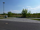
100 | Pussy willow , infructescence of willow | June 20, 2001 | The pussy willow path is located in a newly developed construction field. It goes south from Johannes-Tobei-Straße as a dead end. |
|
| Pasture path (*)
( Location ) |
360 | Willows , genus of trees and shrubs | before 1955 The path is still named after the name in the KGA. | The part west of Glienicker Strasse has existed since the 18th century. At that time it was called Schönefelder Weg because it led from Bohnsdorf to Schönefeld. Around 1900 he lost this function to Grünbergallee. At that time it formed the border from Bohnsdorf to Altglienicke along its entire length.
In 1961 the road was interrupted after about 100 meters by the construction of the federal highway 96a. The B 96a was set as the new district boundary. The "Weidenweg" still exists today, but lies entirely in the Altglienicke district. The first 100 meters now belonged entirely to Bohnsdorf. On April 12, 2000, this short stretch was included in Glienicker Strasse. The street that is not dedicated to the west of the village center is north of Grünbergallee with its connecting street to a residential area, but does not lead through to Rosenweg. The path is in the corner of the motorway access from the main road to the A 117 in the direction of the Ring and across the northern end of Glienicker Strasse and at Mühlen- . The path is still signposted as a garden path with the green sign, but the properties have been assigned to Glienicker Straße. Correspondingly, Weidenweg (2013) is listed on the Berlin map of the district surveying offices as the cross street of the same name from Glienicker Straße. |
|
| Meadow road
( Location ) |
760 | Meadow , agriculturally used grassland | around 1913 | It runs from Eichbuschallee (west) to across Birkenstrasse to the meadows in front of the Plumpengraben. |

|
| Wilhelmine-Duncker-Strasse
( Location ) |
100 | Wilhelmine Duncker (1850–1932), kindergarten teacher, mother of Hermann Duncker | June 20, 2001 | This street in the new development field of the garden city Falkenberg in the north-west of Bohnsdorf is the northward continuation of the Rosenweg . It connects Johannes-Tobei-Straße with the “Grünzug Am Falkenberg”. | |
| Wohlauer Strasse
( Location ) |
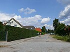
400 | Wohlau, a place in Lower Silesia , today Wolów in Poland | March 8, 1935 | When the road network was laid out, it was called road 973 . The plan was to name them in Esplanade . Wohlauer Straße connects Siebweg (north) with Parchwitzer Straße (south). |
|
|
To the garden city
( Location ) |
530 | Falkenberg garden city | Dec 17, 2001 | Between 1931 and its current name, the traffic route was the southern part of the Garden City Route. It leads from Dahmestraße in a northerly direction to the eponymous settlement and ends at Höhensteig. |

|
Former and planned streets
| Surname | Origin of name | when named | until when valid | possibly today's name | Remarks |
|---|---|---|---|---|---|
| Bahnhofstrasse | Grünau station , to which the street led | before 1922 | 1931 | → Buntzelstrasse | This road ran directly from the village center to the nearest train station. |
| Mountain road | Falkenberg, regional hill | before 1926 | before 1938 | devised and built on | It led from Schulzendorfer to Waltersdorfer Strasse and was the western continuation of Fichtestrasse. |
| Carolinenhofer Straße, from 1929 → Karolinenhofer Straße (section) | Karolinenhof , location in the Berlin-Schmöckwitz district ; direction | before 1920 | Sep 9 1931 (one section) | → Sandbacher Weg (section) | The remaining section only came to Sandbacher Weg in 1936. |
| Dianastrasse | Diana , Roman goddess of the hunt | 1920 | Sep 9 1931 | → Sandbacher Weg (section) | The choice of the hunting goddess for the street name was made because a hunting area extended south into the Berlin area. |
| Diepenseer Strasse | Diepensee , today's part of the community of Schönefeld; direction | before 1920 | July 14, 1961 | dedicated | The street formed the southern continuation of the Hufenweg over the agricultural area to the outskirts of Berlin. The unpaved road that continues there is still called Bohnsdorfer Weg and opens up the "Hubertus settlement". Their route in Bohnsdorf disappeared with the construction of the motorway at the end of the 1950s. |
| Fichteplatz | Johann Gottlieb Fichte (1762–1814), philosopher, educator | around 1920 | after 1943 | dedicated | It was bordered by Schulzendorfer Strasse (northeast) and Elsterstrasse (south). |
| Friedenstrasse | Peace of Frankfurt , with which the Franco-German War ended in 1871 | before 1920 | 1931 | → Parchwitzer Strasse | It ran between Dorfplatz and Siebweg and was merged with Hubertusstraße and Straße 965 in 1931 . |
| Fritz-Reuter-Strasse | Fritz Reuter (1810–1874), poet | before 1922 | 1934 | → Binswangersteig | The traffic route initially extended from Bahnhofstrasse at Berlin-Grünau train station to the neighboring district of Altglienicke. |
| Hasencleverstrasse |
Wilhelm Hasenclever (1837–1889) publicist, politician (namesake is not certain) |
after 1925 | Apr 4, 1934 | → Höhensteig | This street was initially in Berlin-Altglienicke (Treptow administrative district). It ran between Straße 50 and Buntzelstraße and initially comprised four unnumbered lots. In 1932 it was apparently extended, because now nine numbered parcels are indicated and the road connected the "Feldmark" with the Gartenstadtweg. |
| Heideplatz, Heidestrasse | Heide , name of an earlier area where the road system originated. | around 1920 | April 1931 | → Sandbacher Platz | The Heideberg (with a height of 44 m ), to which the road leads to the south, belongs to the community of Schönefeld, district of Schulzendorf. He could also have served as the namesake. |
| Heinrich-Heine-Strasse | Heinrich Heine (1797–1856), poet | before 1929 | 1936 | → Bohnsdorfer Kirchsteig | The street formed the extension of the Kirchsteig from Theodor-Körner-Straße to the beginning of the village square Bohnsdorf. In 1936 it was initially given back its plan number Straße 987 . In the following year, Street 986 and Street 987 were merged into Bohnsdorfer Kirchsteig. |
| Hubertusstrasse |
Hubertus , saint; Direction to the settlement of the same name in the Schönefeld / Waltersdorf district |
before 1920 | 1932 | → Parchwitzer Strasse | Integrated into the Sandbacher Weg as a section. |
| Short street | Street length | before 1920 | 1931 | devised and built on | The road connected Hubertusstraße (at the junction with Kranichstraße) with Wiesenstraße. |
| Long street | Street length (planned) | Aug 16, 1928 | 1934 | → Hundsfelder Strasse | Lange Straße was added to Hundsfelder Straße, which was named in 1928. |
| Mittelstrasse | according to the location in the new Paradies housing estate | 1927 | 1929 | → Polkwitzer Strasse | |
| New street; Extended New Street | newly constructed access road in the Paradies housing estate | 1927 | 1929 | → Leschnitzer Strasse | |
| Richard-Wagner-Strasse | Richard Wagner (1813–1883), composer | around 1920 | Feb 11, 1935 | → Hüttendorfer Weg | The renaming served to reduce the number of streets with the same name in Berlin. |
| Schleusenstrasse | Sluice , presumably a small water regulation system that was required for the Plumpengraben | around 1920 | 1941 | dedicated | It went south from the flow road and had no buildings. |
| Schönefelder Strasse | Schönefeld , neighboring municipality of Bohnsdorf; direction | before 1920 | Apr 20, 1948 | → Grünbergallee | Its course was given (1922) between Dorfplatz and Glienicker Straße ; In 1933 there was no development here. |
| Schulstrasse | Community School of Bohnsdorf; direction | 1927 | 1929 | → Sausenberger Strasse | When it was first entered in the address book in 1928, it led from Bahnhofstrasse to Neue Strasse . |
| Side street | Location in the new Paradies settlement | 1927 | 1929 | → Pitschener Strasse | |
| Street of the NAW | Nationales Aufbauwerk (NAW), a state organization founded in 1951 that activated all citizens of the GDR to volunteer for construction aid . | June 16, 1960 | Dec 31, 1991 | → At the Plumpengraben | With the naming of the previous numbered street, the voluntary construction hours of the residents of the settlement (equivalent to around 28,000 marks ) were officially recognized. |
| Teltower Strasse | Teltow , direction | around 1913 | 1933 | → Gehrenweg | from Waldstraße northwards to Lindenstraße |
| Waterway | Water , referring to the ditch | before 1920 | 1933 | dismantled, overbuilt | It ran between Sandbacher Weg and Hubertusstraße and was always "undeveloped". |
| Wilhelm-Busch-Strasse | Wilhelm Busch (1832–1908), poet and draftsman | before 1920 | Apr 10, 1931 | → Gartenstadtweg | Wilhelm-Busch-Straße was part of the traffic route that was redesignated as Gartenstadtweg in 1931. Gartenstadtstrasse and Strasse 50 were also included in this . |
- Further
plan number streets : 953 ("projected" in 1940), 953a, 962 (between Straße 956 and Waldstraße; 1939), 964, 969 (all listed in the address book from 1939)
Further locations in Bohnsdorf
Allotment gardens (colonies)
- KGA 'Waldfrieden II' (Bruno-Taut-Straße 2a, Lage ): The facility in the north of the district between the B 96a and the former railway branch from the Grünau S-Bahn station to the Güteraußenring. It is mentioned in Berlin's allotment garden development plan under 9088. With 21 parcels on 13,240 m² of state-owned leased land, it is designated as a fictitious permanent allotment garden according to the Federal Allotment Garden Act through the representation in the zoning plan as grassland (allotment gardens). As a result of the integration in level Vb, the facility is permanently secured, with the exception of a section that is affected by federal law for the expansion of the higher-level main road system. There are also three permanent users on the facility. The 'Waldfrieden I' facility is located on the Königsheideweg.
- KGA 'Gründerstraße 27' is a railway farm. It is included as 9201 (Gründerstraße / Adlergestell, Lage ) with 59 parcels on 23,225 m² railway site in the development plan in stage Ib as 'BLW Gründerstraße', but is subject to the lease conditions for railway agriculture. It is included in the street directory with 9553 and since the district boundary to Grünau runs through the railway property of the colony, a northern section is not located in the district.
Parks
- Green corridor on the Falkenberg ("Park auf den Falkenbergen", location ): east of the Tuschkastensiedlung and towards Buntzelstrasse there is a green area designed as a compensatory measure. The St. Hedwigs Kliniken and Hedwigshöghe Hospital are located to the south.
- Eco Park Bohnsdorf (at the Atlantisring )
- BBI Business Park Berlin: With the expansion of Schönefeld Airport to BBI, roads were laid on agricultural land in the southwest of the district, which are intended for the settlement of airport-related businesses. The name is also recorded with 'Falkenberg Park'. A green area will be kept free on the area of the business park. The central public green axis is part of the green order concept in the Bohnsdorf-West development plan area and has a size of approx. 11.4 hectares. The green axis is a 1.7 km long east-west connection between the Bohnsdorf settlement area and the Schönefeld area Lakes.
- State-owned cemetery Bohnsdorf (Buntzelstraße 141, cemetery development plan 5058): It is a village cemetery on 5657 m². The new, second Bohnsdorf cemetery, laid out in 1949 as a supplement, was at the end of the former street 956 (today Kleine Waldstraße), near the border to Schönefeld. It was cleared in 1963 because of the need to expand Schönefeld Airport with a new runway after the church area had been expropriated.
Others
- A section of the A 117 (motorway feeder Dresden) cuts through the area of the district from northwest to west-southwest. The length of the main lanes through the Bohnsdorf area is 3.4 kilometers. At the AD Treptow there are also 560 meters of the northern main carriageway, 470 meters of the exit to B 96a (north) and 350 meters of the entrance to B 96a (south) in the district.
- Bohnsdorf village church
- Hedwigshöhe Hospital
- (Southern) Plumpengraben: The Graben is a flowing body of water in the State of Berlin (2nd order) from the Teltow Canal to the Zeuthener See and is mentioned in descriptions long before Eichwald was founded. It runs from Altglienicke through Bohnsdorf and crosses the city limits, flows through Eichwalde and flows in Zeuthen into the Selchower Flutgraben , which flows into the Zeuthener See . In 1891 the ditch got its straightened shape.
- Taut Passage (Bruno-Taut-Straße 1): 5000 m² shopping center on the Bohnsdorf side at the Grünau S-Bahn station.
See also
Web links
- Berlin-Brandenburg Statistics Office: Directory of streets and squares in the Treptow-Köpenick district (as of February 2015); pdf
- Streets in Bohnsdorf by Kaupert Media
- berliner-adressbuecher.html (collection until 1943)
Individual evidence
- ↑ a b c d e f g h Office for Statistics Berlin-Brandenburg: RBS-Straße
- ^ Bernd Kuhlmann: Schönefeld near Berlin. One office, one airport and eleven train stations . Verlag GVE, Berlin 1996, ISBN 3-89218-038-5 , p. 74.
- ↑ a b c d e Decision of the ( Memento of the original dated May 31, 2014 in the Internet Archive ) Info: The archive link was inserted automatically and has not yet been checked. Please check the original and archive link according to the instructions and then remove this notice. BVV Treptow-Köpenick on the dedication of street land and street names in the development plan area XV-70a (PDF; 575 kB), accessed on February 7, 2013
- ↑ In the Berlin book plan from 1988 this section of the B96 a is so designated in its southwest area.
- ↑ There was no information available to the Treptow-Köpenick building authority at the time of the naming. On the other hand, it was announced: “The section of the federal highway 96a in the state of Berlin (Treptow-Köpenick district) between the state border with Brandenburg and the Adlergestell does not have a street name. (For the 44 penguins, the answer given by the building authority of January 22, 2013.)
- ↑ Press release of the BA Treptow-Köpenick on behalf of the Senate Department for Urban Development: Renewal of the B 96a South "Am Seegraben" , October 21, 2010; Retrieved January 20, 2013
- ↑ Berlin address book for the year 1939 → IV. Heads of household, companies and businesses registered by the commercial court sorted by street → Treptow administrative district → Bohnsdorf, Johannisthal, Niederschöneweide : Binswangersteig (for the first time with name origin)
- ↑ Homepage of the Taut Passagen Community with a representation of Bruno-Taut-Strasse , accessed on January 8, 2013
- ↑ Berlin address book 1932 → Part IV. Residents and companies sorted by street> Treptow administrative district : Buntzelstraße with the house numbers that belong to Alt-Glienicke
- ^ Homepage of the Fritz Kühn School in Bohnsdorf
- ^ Berlin address book 1933 → Part IV. Residents and companies sorted by street → Treptow administrative district : Eichbuschstraße
- ↑ a b c d The year the mill was dismantled and a city map from 1988 served as clues for naming the street. The Mühlenweg is entered, street 934 is still in brackets .
- ↑ a b c d On the city map (Berlin.de) still assigned to the allotment garden complex Grünbergallee, but which was canceled according to the allotment garden development plan 2010.
- ↑ a b c Berlin city map (Bohnsdorf). VEB Tourist Verlag, Berlin / Leipzig 1987, 4th edition ( page no longer available , search in web archives ) Info: The link was automatically marked as defective. Please check the link according to the instructions and then remove this notice.
- ↑ Explanation of the name Gehrenweg on kauperts.de
- ↑ Grabenstrasse . In: Berliner Adreßbuch , 1931, Part IV. Streets and houses of Berlin, p. 1996.
- ↑ a b c City map of Berlin and the surrounding area 1894 ( Memento of the original from December 18, 2015 in the Internet Archive ) Info: The archive link was automatically inserted and not yet checked. Please check the original and archive link according to the instructions and then remove this notice. (there year in the title 1899)
- ↑ a b Map of Berlin and the surrounding area from 1900 ( memento of the original from December 18, 2015 in the Internet Archive ) Info: The archive link was inserted automatically and has not yet been checked. Please check the original and archive link according to the instructions and then remove this notice. (there year in the title 1869): see route from Bohnsdorf to the Falkenberg plant
- ↑ a b c d city map from 1907 on www.blocksignal.de
- ↑ a b city map from 1955 on www.blocksignal.de
- ↑ Website Treptower Schwimmverein e. V.
- ↑ Hufenweg on Open Streetmap
- ↑ Joachimstrasse on Kauperts.de
- ^ Hans E. Pappenheim: The Joachim Friedrich memorial near Grünau. For the history of the monument concept in Brandenburg-Prussia at www.diegeschichteberlins.de
- ↑ Johannes Tobei died. In: Berliner Zeitung , May 3, 1997
- ↑ In contrast to the information from Kaupert / Luisenstädtischer Bildungsverein, according to which the Kirchsteig is said to have been named in 1937, this name is already in the 1930 address book.
- ^ ND archive: Neues Deutschland from August 29, 1962, accessed on December 3, 2017
- ↑ a b Sandbach is part of the Bohemian town of Žamberk (Senftenberg in Böhmen) , which was mentioned in documents as early as 1315, a "Sandbacher half" then in 1565 [1] . The place is located in the Eagle Mountains, immediately south of Silesia. According to Kauperts / Luisenstädtischer Bildungsverein, Sandbach is supposed to be a made-up word that arose from the attempt to adapt cities with Polish names in Silesia or Western Pomerania as namesake for German roads [2] . Only original documents from the year in which the place or path was named can provide clarity about the namesake.
- ^ Sausenberger Strasse . In: Berliner Adreßbuch , 1940, Heads of Households, Companies and Commercial Enterprises Registered by Commercial Court, sorted by street → Treptow Administrative District → Bohnsdorf, Johannisthal, Niederschöneweide, p. 2064. “Straße 952 = Sausenberger Straße”.
- ↑ According to Kaupert / Luisenstädtischer Bildungsverein, Sausenberger is said to have been formed from Street 982 and Street 951. A school street is not mentioned. [3]
- ↑ Homepage of the primary school at Buntzelberg
- ↑ Berlin city map 1894 ( page no longer available , search in web archives ) Info: The link was automatically marked as defective. Please check the link according to the instructions and then remove this notice. : Bohnsdorf and "Das Sieb"
- ^ Theodor-Körner-Strasse . In: Berliner Adreßbuch , 1928, part IV. Streets and houses of Berlin → Cöpenick administrative district, p. 1941.
- ↑ Waltersdorfer Straße on Kauperts.de
- ^ Waltersdorfer Straße 52, 53> J. Müller, Berlin, sewing machine factory . In: Berliner Adreßbuch , 1932, Teil IV, S. 1960. In the following years the building was initially uninhabited, later a “summer house” is mentioned on the property.
- ↑ Homepage of the Bohnsdorf volunteer fire brigade
- ^ Street 973 (Esplanade) . In: Berliner Adreßbuch , 1935, residents and companies of the city of Berlin sorted by streets and house numbers → Köpenick administrative district, p. 1949.
- ^ Hasencleverstrasse . In: Berliner Adreßbuch , 1926, Part IV. Streets and houses in Berlin> Administrative district Treptow, p. 1862.
- ↑ a b c d Mittelstrasse, Neue Strasse, Schulstrasse, side street . In: Berlin address book , 1928, part IV. Streets and houses of Berlin> Cöpenick administrative district, p. 1940.
- ↑ Stadtentwicklung.berlin.de: Small gardens Index
- ^ Stadtentwicklung.berlin.de: data and facts
- ↑ Near Schönefeld Airport: Tenants design their offices . In: Berliner Zeitung, November 2, 2014
- ↑ Preliminary draft planning of the public green areas in the BBI business park in Bohnsdorf-West
- ↑ Stadtentwicklung.berlin.de: Cemeteries, Begraebnisstätten
- ↑ Pensioner crashes through a moat in the car . In: BZ , February 24, 2014, with picture
- ^ Stadtentwicklung.berlin.de: secondary waters
- ↑ New information board for the Plumpengraben explains . In: Eichwalder Nachrichten , September 27, 2011

