Wschowa
| Wschowa | ||
|---|---|---|

|
|
|
| Basic data | ||
| State : | Poland | |
| Voivodeship : | Lebus | |
| Powiat : | Wschowa | |
| Area : | 8.38 km² | |
| Geographic location : | 51 ° 48 ′ N , 16 ° 18 ′ E | |
| Height : | 93 m npm | |
| Residents : | 13,875 (Jun. 30, 2019) |
|
| Postal code : | 67-400 | |
| Telephone code : | (+48) 65 | |
| License plate : | FWS | |
| Economy and Transport | ||
| Street : | Głogów - Leszno | |
| Next international airport : | Poznań-Ławica | |
| Gmina | ||
| Gminatype: | Urban and rural municipality | |
| Gmina structure: | 23 localities | |
| Surface: | 198.30 km² | |
| Residents: | 21,162 (Jun. 30, 2019) |
|
| Population density : | 107 inhabitants / km² | |
| Community number ( GUS ): | 0812033 | |
| Administration (as of 2007) | ||
| Mayor : | Danuta Patalas | |
| Address: | Rynek 1 67-400 Wschowa |
|
| Website : | www.wschowa.pl | |
Wschowa ( ), German Fraustadt , is the district town of Powiat Wschowski in the Polish Lebus Voivodeship .
geography
Wschowa is located in the southeast of the Lubusz Voivodeship along the Droga krajowa 12 state road . The voivodeship capital, Zielona Góra, is about 80 kilometers to the west. Other larger towns are Leszno in the east and Głogów in the south-west .
Wschowa lies on the Łódź – Forst (Lausitz) railway line .
history

middle Ages
The city was founded by German colonists around 1250 according to Magdeburg law in a disputed area between Silesia and Greater Poland ( Wielkopolska ). The origin was probably a border castle from which a settlement developed.
The first verifiable mention of the place as "Veschow" dates back to 1248. The first mention of the place as "Frowenstat Civitas" comes from the year 1290.
Until 1343 the ownership changed frequently, then the woman townspeople country was founded by King Casimir the Great finally conquered Poland and Fraustadt than immediately subordinate to the king Immediatstadt privileged. The Fraustädter Land became an independent administrative area ( Ziemia ). Nevertheless, there were repeated attempts by the German-inhabited city to be reunited with the neighboring Silesian duchy of Glogau . King Władysław II Jagiełło granted in 1426 that "no Polish law" should apply against Fraustadt.
Early modern times and Reformation
In the 16th century, Fraustadt was one of the strongholds of Protestantism in Poland thanks to its largely German citizenship . In 1555, after the declaration of Emperor Ferdinand I, the first German mass was celebrated. Since 1552 the position of German preacher had been given to a Protestant. The most important representatives of Protestantism in Fraustadt were the pastors Valerius Herberger (1562–1627) and Samuel Friedrich Lauterbach (1662–1728) and the writer and headmaster Christian Gryphius (1649–1706). As a royal city, it was subject to a royal Polish starost . After the Lutheran von Gorka family, only Catholics became starosts, the parish church had to be returned to the Catholic Church by royal order in 1604, with permission for the Lutherans to build their own church. Pastor Valerius Herberger made use of this and had the "Kripplein Christi" built as a new church.
Despite the Counter-Reformation , Poland remained tolerant and took in Protestant religious refugees from Silesia. The Starost Hieronimus Radomicki donated the Neustadt to Magdeburg law in 1633 because of the large number of visitors . Fraustadt thus consisted of the old town with two suburbs (Glogauer and Polish), the new town and two combing villages, Nieder- and Oberpritschen. In the Great Northern War met in the battle of Fraustadt on February 2nd jul. / February 13th 1706 greg. the Swedish and the Saxon-Russian armies on each other. The battle ended with a victory for the Swedes. During the rule of the Saxon House of Wettin in Poland, meetings of the Senate of the Republic took place in Fraustadt (the first in 1699), twice (1755, 1773) a Turkish embassy was received here.
Fraustadt was ravaged by the plague several times: 1,100 people fell victim to it in 1568, and 2,125 people in 1613.
Prussian rule
With the Second Partition of Poland in 1795 Fraustadt came to Prussia and in 1816 became the district town for the Fraustadt district on the southwestern border of the Posen province . From 1826 there was a Lutheran, a Catholic and an Israelite elementary school to meet all needs. The language of instruction in all three was German. There was no Polish school due to the lack of a Polish population. In 1840 the city had 5,303 inhabitants, 568 of whom were Jews. Although there was a settlement ban for them, which was last affirmed in 1768 by King Stanislaus II August, some families were able to establish themselves in the place. With the annexation to Prussia, all settlement restrictions for Jews fell, which led to a rapid influx. However, the number fluctuated greatly.
During the Polish uprising in other parts of the Prussian province of Posen in the spring of 1848, the city demanded, in the event of a separation of the parts of the province inhabited by Poles, that it would continue to belong to the German Confederation, possibly by assigning it to the neighboring province of Silesia . Fraustadt also became a Prussian garrison location . His most famous soldier stationed here was Paul von Hindenburg , who served as a company commander from 1884 to 1885.
After 1820 the cloth trade collapsed due to the Russian customs policy and the city had to look for other fields of activity. In 1881, Fraustadt was given a sugar factory that operated as a German-Polish franchise company until 2003. In 1857 the city received a railway connection ( Glogau – Lissa route ).
Under Prussia, in the course of economic development, an influx of Poles began: in 1871 Fraustadt had 6,515 inhabitants (4,100 Evangelicals, 2,050 Catholics, 350 Jews). 410 (or 6.3%) were Poles. By 1901, the German share of the population had declined to 72.2 percent, while the Polish share had increased to 27.8 percent due to immigration and a higher birth rate.
When the border was drawn in 1920, Fraustadt lost its hinterland and an economic decline began. After 1938 the city belonged to the Province of Lower Silesia. In 1939, Fraustadt was the only border town to be shelled by Polish artillery without causing any major damage.
As part of Poland
When the city was placed under Polish administration by the victorious Allied powers in 1945 after the Second World War , the German population was expelled. The city was repopulated by Poles from across the Bug , from Upper Silesia and other regions of Poland.
Since 2001 it has been a district town in the Lubusz Voivodeship again.
Attractions
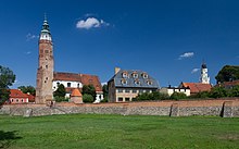
- Town hall from the 16th century, rebuilt in 1860
- Parish church under the patronage of St. Bishop and martyr Stanislaus and the Assumption of Mary, Gothic, from the 15th century, rebuilt between 1720 and 1726 after the fire of 1685
- Former Protestant church Kripplein Christi from 1604, rebuilt after a fire in 1647
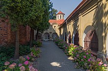
- Building complex of the Franciscan monastery, built 1638–1646, later rebuilt several times
- Evangelical cemetery from 1609
- City walls from the 15th and 16th centuries
Municipality (Gmina Wschowa)
The following localities ( German names until 1945 ) with Schulzenamt ( sołectwo ) belong to the rural community of Wschowa :
|
|
|
Other localities in the municipality without the Schulzenamt are:
|
|
traffic
In today's Wschowa service station, the Wschowa – Lipinka Głogowska railway branched off from the Łódź – Forst (Lausitz) railway .
Personalities
sons and daughters of the town
Sorted by year of birth
- Melchior Teschner (1584–1635), German composer, church musician and theologian
- Valerius Herberger (1562–1627), Lutheran theologian, writer of edification and hymn poet
- Balthasar Timaeus von Güldenklee (1600–1667), German doctor, mayor of Kolberg
- Jonas Deutschländer († 1661), German doctor
- Christian Gryphius (1649–1706), German educator and school dramatist
- Maximilian Preuß (1652–1721), German doctor and member of the " Leopoldina " academy of scholars
- Samuel Friedrich Lauterbach (1662–1728), Lutheran theologian and historian
- Wilhelm von Tschirschnitz (1796–1873), Hanoverian general of the infantry
- Robert von Hartmann (1802–1876), Prussian major general
- Max Cohnheim (1826–1896), German revolutionary, German-American writer and publicist
- Gustav Adolf Sachse (1834–1903), Prussian civil servant in the Reich Post Office
- Johannes Heinrich Valerius Graf (1837–1917), German painter
- Max Kirmis (1851–1926), German scientist and teacher
- Werner von Heynitz (1854–1928), Prussian lieutenant general
- Paul Mündner (1872 – after 1902), German racing cyclist and circus performer
- Otto von Boehn (1874–1957), German gardener and local researcher in Celle
- Leo Rosenberg (1879–1963), German legal scholar
- Fritz Thurm (1883–1937), German printer and member of the resistance against the Third Reich
- Curt Amend (1884 – after 1937), German editor and journalist
- Alfred Fellisch (1884–1973), German politician (SPD, SED), Minister and Prime Minister in Saxony
- Ernst Günther Burggaller (1896–1940), German racing driver, officer and pilot
- Elżbieta Rafalska (* 1955), Polish politician
literature
- Johann Daniel Ferdinand Neigebaur : Documented news about the earlier history of Fraustadt. In: General Archive for the History of the Prussian State. Volume 15, Berlin / Posen / Bromberg 1834, pp. 82-89. (Full text)
- Heinrich Wuttke : City book of the country Posen. Codex diplomaticus: General history of the cities in the region of Poznan. Historical news from 149 individual cities . Leipzig 1864, pp. 294-310.
- August Gustav Wilhelm Braune: History of the city of Fraustadt . Woman town 1889.
- Martin Sprungala: Kronika Wschowy / Chronicle of the city of Fraustadt (Wschowa). Towarzystwo Przyjaciół Sławy, Sława 2016, ISBN 978-83-932235-1-0 .
Web links
Individual evidence
- ↑ a b population. Size and Structure by Territorial Division. As of June 30, 2019. Główny Urząd Statystyczny (GUS) (PDF files; 0.99 MiB), accessed December 24, 2019 .
- ↑ a b Heinrich Wuttke: Codex diplomaticus magni ducatus Posnaniensis . Fries, 1864, p. 296 ( google.de [accessed on March 8, 2018]).
- ^ Association of Historians of Germany. Section for Church History, Society for Church History (Ed.): Journal for Church History . No. 84-85 . W. Kohlhammer, 1973, p. 115 ( google.at [accessed on March 8, 2018]).
- ^ Heinrich Wuttke: Codex diplomaticus magni ducatus Posnaniensis . Fries, 1864, p. 303 ( google.de [accessed on March 8, 2018]).
- ^ Heinrich Wuttke: Codex diplomaticus magni ducatus Posnaniensis . Fries, 1864, p. 302 ( google.de [accessed on March 8, 2018]).
- ^ Heinrich Wuttke: Codex diplomaticus magni ducatus Posnaniensis . Fries, 1864, p. 310 ( google.de [accessed on March 8, 2018]).
- ^ Heinrich Wuttke: Codex diplomaticus magni ducatus Posnaniensis . Fries, 1864, p. 308 ff . ( google.de [accessed on March 8, 2018]).
- ↑ L. v. J .: The Polish insurrection in Posen in the spring of 1848 . Glogau 1849, p. 41.
- ^ Gustav Neumann: The German Empire in geographical, statistical and topographical relation . 2nd Edition. tape 2 . Müller, Berlin 1874, p. 145 ( google.at [accessed on March 8, 2018]).
- ^ Royal Prussian State Statistical Office in Berlin (ed.): Prussian Statistics: (Official source work) . Publishing house of the Royal Secret Upper Hofbuchdruckerei (R. Decker), Berlin 1905, p. 142 ( google.at [accessed on March 8, 2018]).


