List of streets and squares in Berlin-Reinickendorf

The list of streets in Berlin-Reinickendorf shows the streets in the Berlin district of Reinickendorf with their historical references. At the same time, this compilation is part of the lists of all Berlin streets and places .
overview
Reinickendorf has 83,909 inhabitants (as of December 30, 2019) and includes the postal code areas 13403, 13407 and 13409. There are six squares and 166 dedicated streets in the district, 25 of which are partly in neighboring districts. The total length of the streets in the Reinickendorf district is 89.8 kilometers.
The street system of the district developed from the Angerdorf Reinickendorf around the street Alt-Reinickendorf. In 1877 Reinickendorf was connected to the Nordbahn and in 1893 to the Kremmener Bahn , which also increased the population. The settlement by Berliners and the incorporation of Reinickendorf into Berlin in 1920 determined the main features of the road system. In the 1920s, the large housing estate White City was built with its separate streets , which is now a UNESCO World Heritage Site . In 1877–1879, a mental hospital was built on sold property.
The former Bundesautobahn 105 was downgraded as the "Kurt-Schumacher-Platz feeder" and (as of 2013) is marked RBS class 'AUBA'. In the road development plan of Berlin, 5540 meters of the lanes of the federal motorway 111 are assigned to the large-scale system and a further 1940 meters to the higher-level system. The 3290 meters of the Bundesstraße 96 on the Markstraße, Residenzstraße, Lindauer Allee and Roedernallee as well as the 9620 meters of the city streets (or parts of them on the Lindauer Allee, Markstraße, Residenzstraße and Roedernallee) are of paramount importance. The road system in the district is supplemented by 8,520 meters of regional importance and 8,830 meters of supplementary roads. These main roads are Scharnweberstraße and Seidelstraße to Tegel , Holzhauser Straße between Wittenau and Haselhorst , Wald- / Wittestraße, Antonienstraße / Eichborndamm (parallel main streets). Ollenhauerstraße leads traffic from Kurt-Schumacher-Damm (from the motorway ring) via Oranienburger Straße to Wittenau, the Märkisches Viertel and Waidmannslust . From Kurt-Schumacher-Damm eastwards via Kapweg / Gotthard- / Emmentaler Straße (Residenzstraße) and Klemkestraße to Niederschönhausen and Pankow or northwards via Copenhagener Straße, the road system connects to Wilhelmsruh and Rosenthal . In the east of the district, the provincial road with the traffic connection between Gesundbrunnen and Wedding and Pankow touches on Niederschönhausen. In the neighboring districts in the south, all of these streets are connected to the ring road of See- / Osloer Straße as an extension of the federal highway 100 . A street from the 2010s is the connection of the street Am Nordgraben in the north of Reinickendorf over the former wall strip to Wilhelmsruh to Heinz-Brandt-Straße, which as part of the planned Nordtangente (fourth city ring) is to bring together the traffic through the north of Berlin.
Overview of streets and squares
The following table gives an overview of the streets and squares in the district as well as some related information.
- Name / location : current name of the street or square. Via the link Location , the street or the square can be displayed on various map services. The geoposition indicates the approximate center of the street length.
- Traffic routes not listed in the official street directory are marked with * .
- Former or no longer valid street names are in italics . A separate list may be available for important former streets or historical street names.
-
Length / dimensions in meters:
The length information contained in the overview are rounded overview values that were determined in Google Earth using the local scale. They are used for comparison purposes and, if official values are known, are exchanged and marked separately.
For squares, the dimensions are given in the form a × b for rectangular systems and for (approximately) triangular systems as a × b × c with a as the longest side.
If the street continues into neighboring districts, the addition ' in the district ' indicates how long the street section within the district of this article is. - Name origin : origin or reference of the name.
- Notes : further information on adjacent monuments or institutions, the history of the street and historical names.
- Image : Photo of the street or an adjacent object.
| Name / location | Length / dimensions (in meters) |
Origin of name | Date of designation | Remarks | image |
|---|---|---|---|---|---|
|
Aegirstrasse
( Location ) |
150 | Aegir , a giant of the sea and beer in Norse mythology | around 1904 | The road five of the development plan for the first time as Aegirstraße Berlin address 1904 named, in 1903 more than Lettestraße D . Under this name it was laid out in the 'small Lette colony' before 1887, and in 1900 a house was built on it. Aegirstrasse is a dead end to the east from Reginhardstrasse. |

|
| Alt-Reinickendorf
( Location ) |
1250 | Anger von Reinickendorf | July 31, 1952 | The street is between Roedernallee and Kopenhagener Straße. The name Dorfstraße has been adopted for the area of the old village around the Anger. With the urbanization of the area into an important and densely populated industrial location, the name Hauptstraße was introduced around 1889 . In 1952, as in other Berlin districts, the large number of main streets were clearly identified by prefixing the syllable "Alt-" in front of the district names. On February 10, 1961, the extension was included. A section of Roedernallee, a part of Humboldtstraße - between Alt-Reinickendorf and a new street - and a section of Veltener Straße were brought together under Alt-Reinickendorf. A quiet residential street with some business surrounds the old village green with the Reinickendorf village church. | |
| At the Bürgerpark
( Location ) |
480 (in the district) |
Bürgerpark , adjacent park in the northeast | Nov 9, 1994 | The street and the north side belong to Niederschönhausen , the southern edge of the street with the property 10 and the area of the freight yard Schönholz between Schützenstraße and Panke is in Reinickendorf. From 1905 to 1994 the street on which the Berlin Wall stood between 1961 and 1990 was called Bahnhofstraße , because it is located on the southern edge of the freight yard. The tracks of Schönholz station on the northern line were up to the street, but were later no longer used on the border between East and West Berlin. The district includes plots 1-14 on the southern edge of the street between Schützenstrasse and opposite (Pankower) Leonhard-Frank-Strasse, of which only plot 10 is built on with a residential building. In 1943 the Deutsche Reichsbahn was named as the owner with Bahnhofstrasse 1–8 to the marshalling yard, 9 a nursery, 10/11 railway maintenance office and a house on 12–14. |

|
| At the Doggelhof
( Location ) |
80 | Doggelhof, a farm in the name of an owner | Aug 4, 1930 | The road branches off to the east from Engelmannweg. In 1930 some streets were named after local places. Before that, it was run as Straße 21 , as planned according to the development plan. According to the address book from 1933, it is undeveloped. |

|
| Amendestrasse
( Location ) |
530 | K. Robert Amende (1825–1909), local politician | before 1887 | The street is between Residenzstrasse and Nordbahnstrasse. Amende was a member of the Reinickendorf community council and owned the site on which the road was laid. Around 1859 he was managing director of the Berlin powder factory. Around 1887 he lived in Reinickendorfer Dorfstrasse 10/11. In 1909 he was the owner of Residenzstrasse 113. | |
| At the north ditch
( Location ) |
580 (in the district) |
Nordgraben , the Panke rainwater drainage system built between 1928–1938 | Nov 1, 1968 | Before street 374 in the development plan, it was named in 1968. On July 1, 1976, road 473 was included. An extension was given this name on November 1, 1978, the extension to the Pankow district border was opened to traffic on November 13, 2006. In the extension with Heinz-Brandt-Straße in Niederschönhausen , a section of a north bypass is planned as part of the fourth city ring. The street lies between Roedernallee and the railway bridge of the S-Bahn line in the district. To the west it lies to Gorkistraße in Wittenau and Borsigwalde . |

|
| At the Schäfersee
( Location ) |
80 | Schäfersee , lake in the district | Oct. 20, 1932 | The street is west of the Residenzstraße going to the Schäfersee, but a 480 meter footpath under the same name leads south along the banks of the Schäfersee to Brienzer Straße. Around 1908, the Seebad street was laid out between Residenzstrasse and Markstrasse and, starting from that, in 1909 the lake promenade, both of which were named together in 1932. The name of the lake goes back to a sheep farm. The street currently includes the properties Am Schäfersee 2 (even) and 3–65 (odd). Houses 3 and 5-11 are accessible on the street section from Residenzstraße, 21-65 are located around a park-like inner courtyard and passage from Holländerstraße that opens onto the lake, while houses 15-19a face the lake behind houses Holländerstraße 6/7. |

|
| At the booth
( Location ) |
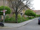
1060 | Stand , establishment of a shooting club | Aug 4, 1930 | The road goes from Klemkestrasse to the north and ends in a turning hammer. Before 1930 it was projected as street 22 of the development plan. In the 1933 address book it is listed between Feldmark and Schönholzer Weg , completely built on and occupied by Heimstätten Gesellschaft Primus mbH. |
|
| At the paddock
( Location ) |
190 | Paddock , fenced cattle area | Jan. 9, 1961 | The road 68 of the development plan is in the range of former pastures. The street is a dead end from Waldowstraße to the east. |

|
| Antonienstrasse
( Location ) |
1160 | Antonie Sommer, wife of the master turner Sommer, who built the first house | around 1875 | Antonienstraße is a one-way street in the direction of Scharnweberstraße and the A 111 , which makes it part of Berlin's extensive road system, supplemented by the north-facing one-way street on Eichborndamm. It is located between Scharnweberstrasse and the railway bridge in the district and connects to the Eichborndamm northwards in Borsigwalde. Antonienstraße was laid out between 1882 and 1887. On February 1, 1980, the extension from Kienhorststrasse to Wittestrasse and on April 15, 1982 its extension between Wittestrasse and Eichborndamm was included. |

|
| Crossbow path
( Location ) |
240 | Crossbow , firearm for bolts and arrows | Aug 4, 1930 | The quiet residential street ends from both sides - Emmentaler and Klemkestrasse - at the green area around the Breitkopf basin, from the north as a one-way street in the ring around a green area in the south as a dead end . The road is continuous for pedestrians and cyclists. The Paddenpuhl settlement on the Breitkopfbecken was built between 1927 and 1939 according to plans by the architects Fritz Beyer, Diekmann and Scherer. It is street 27 of the development plan. |

|
| Aroser Allee
( Location ) |
1330 (in the district) |
Arosa , political municipality as well as a holiday and recreation place in Switzerland | Apr 10, 1931 | The street with two-way lanes and a green median is in the district between Holländerstraße (district boundary) and Lindauer Allee with lots 60–200 (even) and 63–195 (odd). It continues south into Wedding . Around 1909 the street was laid out as the Schillerpromenade and on August 9, 1929, because of several street names with the same name since the formation of Greater Berlin, it was renamed Greulichpromenade , including street 35b . It was named after the Swiss politician Herman Greulich (1842–1925). It belongs to the White City , also known as the Swiss Quarter, a residential area from the 1920s. |

|
| Auguste-Viktoria-Allee
( Location ) |
1510 | Auguste Viktoria (1858–1921), wife of Wilhelm II , German Empress and Queen of Prussia | 1892 | The street lies between Ollenhauerstrasse and Zobeltitzstrasse. Triftstrasse , the route on which the Reinickendorf farmers drove their cattle to pasture , had been here since the 18th century . Auguste Viktoria inaugurated the Blessing Church in 1892 and the Neue Trift section of the street was named Auguste-Viktoria-Allee. In 1945/1946 the avenue was briefly named Kapitän-Chocholoff-Straße, which was not officially confirmed. | |
|
Baseler Strasse
( Location ) |
660 | Basel , the third largest city in Switzerland at the border triangle Switzerland / Germany / France | around 1909 | Baseler Strasse is between Holländerstrasse and Emmentaler Strasse. In the 1910 address book, Baseler Strasse is still listed as undeveloped from Holländer Strasse. |

|
| Becherweg
( Location ) |
310 | Johann Joachim Becher (1635–1682), doctor, alchemist and economist | Aug 4, 1930 | The street is a one-way street to the south between Humboldtstrasse and Lübener Weg, so it is routed as street 36 of the development plan. |

|
| Belowstrasse
( Location ) |
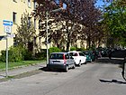
210 | Fritz von Below (1853–1918), military, in the First World War Battle of Lorraine and Winter Battle of Masuria | May 21, 1941 | As Straße 57 traced out is the Belowstraße as a one-way street from the Von-der-Gablentz Street to Zobeltitzstraße. According to the address book in 1943, the Primus non-profit housing association has completely built it up and has already moved in. It lies parallel to other streets named after the military. |
|
| Berenhorststrasse
( Location ) |
550 | Georg Heinrich von Berenhorst (1733–1814), military writer | June 25, 1936 | It is routed as Straße 56 between Von-der-Gablentzstraße and Zobeltitzstraße. It lies parallel to other streets named after the military. The street leads from both sides of the Zobeltitzstraße as a one-way street. |

|
| Bieler Strasse
( Location ) |
80 | Biel , largest bilingual city in Switzerland | Apr 10, 1933 | The street in the White City lies between Aroser Allee and Baseler Straße. Until it was named, it was listed as Straße 60 according to the development plan . In 1933, Strasse 60 between Aroser Allee and Baseler Strasse is indicated on the left-hand side with the apartment buildings of Primus-Baugesellschaft on plots 1-9 and on the right-hand side with vacant plots that have been allocated. In 2013, Bieler Strasse is listed with lots 1–9 (odd) and 2–8 (even). |

|
| Blankestrasse
( Location ) |
210 | Karl Blanke (1829-1892), landowner from a long-established family and owner of the site on which the road was laid | before 1887 | The street is north of Scharnweberstraße on Reuterstraße to the western edge of Dankes-Kirchhof. On April 1, 1967, the extension, Strasse 391 , was incorporated into Blankestrasse. In 1900 it is named from Scharnweberstraße to Reuter- / Friedrich-Karl-Straße with single-family houses on plots 1–12 and (backward) 12a – 16 (consecutive). |

|
| Borggrevestraße
( Location ) |
250 | Bernard Borggreve (1836–1914), forest scientist, zoologist and botanist | June 25, 1936 | The road laid out as road 67 of the development plan lies between Waldowstrasse and Klamannstrasse. |

|
| Breitkopfstrasse
( Location ) |
1010 | Bernhard Christoph Breitkopf (1695–1777), printer and publisher. | Aug 4, 1930 | The street lies between Mittelbruchzeile and Klemkestrasse in the Paddenpuhl settlement on the Breitkopfbecken , which was built between 1927 and 1939 according to plans by the architects Fritz Beyer, Diekmann and Scherer. It's a quiet residential street with old and post-war buildings. In the section north of Emmentaler Straße, it is located on and around the green area at the Breitkopf basin. The street was laid out before 1887 and was called Sunday Street , named after C. Sonntag, the owner (1859) of a cardboard factory in Pankow. Until 1903 the spelling was Sontagstrasse. In the address book of 1900 it is named with seven single-family houses as the cross street of Wilkestrasse. In 1930, Breitkopfstraße was named when Straße 25 was connected to Sonntagstraße to the south. | |
| Brienzer Strasse
( Location ) |
310 (in the district) |
Brienz , Swiss health resort on Lake Brienz | around 1909 | The 39, Div. X / 1 of the development plan, was named on 29 November 1876 as Hennigsdorfer road. The section between Holländerstrasse and Walderseestrasse was renamed Brienzer Strasse between 1907 and 1910. On March 11, 1937, the part of Hennigsdorfer Strasse in Wedding (up to Ungarnstrasse) was incorporated into Brienzer Strasse. The street with lots 26–56 (even) and 43–59 (odd) between Schäfersee and Walderseestrasse is located in the district and continues with the same name into Wedding. A quiet residential street with apartment blocks from the 1920s near Residenzstrasse. |

|
| Brusebergstrasse
( Location ) |
780 | Wilhelm Bruseberg (1861–1911), landowner in Tegel | Aug 4, 1930 | On October 1, 1963, the extension, Street 417 , was included after Street 4 was named in 1930 with a larger number of additional streets. The street lies between Humboldtstrasse and Teichstrasse. In the northern section it lies along the Reinickendorf cemetery, in the south it bends east to Teichstrasse. |

|
|
Büchsenweg
( Location ) |
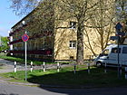
670 | Rifle , hunting or sports rifle with a rifled barrel | Aug 4, 1930 | The street lies between Emmentaler and Klemkestrasse. It was laid out as street 23 according to the development plan , on April 1, 1962 street 384 and on April 1, 1963 the extension was included. |
|
|
Büdnerring
( Location ) |
750 | Büdner , North German term for the owner of a small rural property, a Büdnerei | Apr 10, 1961 | The road lies between Reginhardstrasse and Herbststrasse and forms a ring in the northeast. The street name probably refers to Bürgerstraße . Until it was named, it was listed as Straße 388 . The street is built on, especially in the ring, with multi-storey residential buildings and high-rise residential buildings. |

|
| Bürgerstrasse
( Location ) |
230 | Citizens , members of a state or a municipality | before 1887 | The road is east of the provincial road to KGA Schönholz, which lies along the railway line. In the 1900 address book, the Bürgerstraße between the Provinzstraße and the Nordbahn is indicated as being built up and inhabited with multi-family houses. |

|
|
Dahnstrasse
( Location ) |
90 | Felix Dahn (1834–1912), legal scholar, writer and historian | 1904 | Dahnstrasse goes south from Kögelstrasse. Nazareth-Kirchhof II lies behind the eastern plots. In the 1910 address book it is specified between Kögelstrasse and Großkopfstrasse, with the developed plots 2, 4 and 16 with large multi-family houses, in house 16 there are 21 tenants. |

|
| German road
( Location ) |
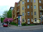
320 | Germany | before 1887 | The quiet residential street with new and post-war buildings between Residenzstrasse and (as a cul-de-sac to) Thurgauer Strasse, delimits the district of streets named after Swiss towns. At the time of naming, the choice of name probably had other aspects. There is a pedestrian passage to a small hiking trail that leads to the Schäfersee or the Emmentaler Straße. The western end of the street is caused by the ice works that used to be there. |
|
|
Eichborndamm
( Location ) |
1120 (in the district) |
Louis Eichborn (1812–1882), banker and chess player, lottery taker | May 20, 1937 | In the district, plots 1-99 and 2-100 are between Scharnweberstrasse and the S-Bahn line north of Waldstrasse. In the further course the street belongs to Borsigwalde and Wittenau . Since 1875 the Eichbornstrasse connected the Scharnweberstrasse with the S-Bahn station Eichbornstrasse. Its extension to the main street in Wittenau (since 1952 Alt-Wittenau) was the Charlottenburger street . Both streets were merged in 1937 and named Eichborndamm. A section of the Eichborndamm forms a one-way system with Antonienstraße in order to cope with traffic from the north ( Märkisches Viertel ) to the A 111 . The former S-Bahn station Eichborn street was named for the reopening of the route between Schönholz and Tegel on May 28, 1995 Eichborndamm . The Berlin State Archives are located in reconstructed commercial and machine halls in the Borsigwalde district along this street . |

|
| Polar Bear Trail
( Location ) |
130 | Polar bear , symbolic choice for the natural ice works of the entrepreneur Hermann Eduard Mudrack on the Schäfersee | December 17, 1932 | The road to the north as a one-way street and to the west with diagonal parking lanes between Mudrackzeile and Marienburnner Weg is a quiet residential street with apartment blocks from the 1920s. The polar bear trail is closed to public traffic. Sandstone figures with tools at the house entrances are a reminder of the activities of the former ice workers. The entrepreneur Hermann Eduard Mudrack owned a natural ice works on the Schäfersee and built ponds for ice extraction in the area around the lake as far as Baseler Strasse. On this area up to Baseler Straße the ice works was located northwest of the Schäfersee. After the invention of artificial ice by Linde , an artificial ice factory was created. The ponds were filled in and the area built on. Probably the name for the road 86 was chosen because of the workers clad in white sheepskins and clumsy like polar bears on the slippery ground, who broke the ice of the ponds. |

|
| Emmentaler Strasse
( Location ) |
1440 | Emmental , Swiss hilly landscape in the Bernese Mittelland | March 11, 1937 | Between Aroser Allee and Residenzstraße, Emmentaler Straße is a busy thoroughfare, while to the east between Residenzstraße and Klemkestraße it becomes a quieter residential street. Part of the street belongs to the White City and a UNESCO World Heritage Site , which was built between 1929 and 1931 according to an urban design by Otto Rudolf Salvisberg . The Berner Straße, laid out around 1909 (between Greulichpromenade , today Aroser Allee, and Residenzstraße) and the Wilkestraße built after 1898 (Residenzstraße and Schönholzer Straße , today Klemkestraße) were renamed Emmentaler Straße in 1937. The Berner Street was named after the German city in Switzerland and had the reference to Swiss district. The name of the Wilkestrasse was derived from the local politician Friedrich Wilke (1855-1939), who came from a local Kossät family and made a name for himself in the development of Tegel. | |
| Engelmannweg
( Location ) |
590 | Eduard Engelmann junior (1864–1944), Austrian figure skater | Aug 4, 1930 | The road 20 was named 1930 and 1933 built by the "Charlottenburg cooperative" with apartment buildings that are inhabited 1,933th The one-way street is between Scharnweberstraße and Auguste-Viktoria-Allee and continues northwards over the latter as a dead end . The namesake Engelmann came from a figure skating family, his father Eduard Engelmann senior († 1897) was the founder of the ice rink and the junior builder of the first open-air artificial ice rink in Vienna and other major cities. |

|
|
Epensteinplatz
( Location ) |
60 × 60 (circular) |
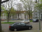
Hermann Epenstein (1821–1892), physician, property owner | around 1900 | The tree-lined square is at the intersection of Schwabstrasse and Epensteinstrasse. The streets are to the east and south around the square. Epenstein was the owner of the site on which the street was named after him. |
|
| Epensteinstrasse
( Location ) |
370 | Hermann Epenstein (1821–1892), physician, property owner | around 1898 | The street lies between Pankower Allee and Mittelbruchzeile. Epenstein was the owner of the site on which the street named after him is located. |

|
|
Fahlandgasse
( Location ) |
90 | Jakob Gottfried Fahland (1727–1811), theologian, pastor from 1760 to 1766 in Reinickendorf | Sep 1 1981 | Fahlandgasse is located between Pankower and Letteallee, east of Residenzstrasse, in the area of the former Lette Colonie. as a narrow street. |

|
| Fleet Street
( Location ) |
1690 | Fleet Association in Reinickendorf, which supported the nationwide propaganda for a German battle fleet | around 1900 | In 1899, Flottwellstrasse , named after the Prussian Minister of State Eduard von Flottwell (1786–1865), was identified by name. In 1903 the name Flottenstrasse already existed for this. The street lies between Roedernallee and Kopenhagener Straße, over which it continues as a dead end into an industrial area in the corner between the Nordbahn and the Kremmener Bahn . In 1910 there are six developed and three vacant lots in the address book. In 1910, a plot of land with the Fleck'schen House on Kopenhagener Strasse was built on. |

|
| Foxweg
( Location ) |
170 | George Fox (1624-1691), British Quaker | Nov 1, 1968 | The street 409 was named in 1968 as the eastern cul-de-sac from Quäkerstrasse. |

|
| Franz-Neumann-Platz
( Location ) |
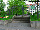
110 × 90 | Franz Neumann (1904–1974), locksmith, politician, resistance fighter against the Nazi regime | Oct. 20, 1979 | The square - not far from the Schäfersee - is at the transition between Residenzstrasse and Markstrasse, at the intersection with Holländerstrasse, and Pankower Allee flows from the east. In the east, the square is bounded by Fahlandgasse and this is where Letteallee opens . The U8 subway station of the same name is on the square . |
|
| Freedom way
( Location ) |
630 | Freedom, Luch in the Magistratsheide | 1920 | Projected as street 4 of the development plan, the path is north of Alt-Reinickendorf between Kopenhagener Straße and Luisenweg. Over the latter it continues as a dead end to the west, there is Hinter der Dorfaue in the ring to the north. There is no passage to Copenhagener Straße, east of Stegeweg it is also marked as a dead end . The narrow street ends to the west at the "Reinickendorf War Cemetery". |

|
| Friedrich-Karl-Strasse
( Location ) |
180 | Friedrich Karl Nikolaus , Prince of Prussia (1828–1885), military | 1898 | The street is between Ollenhauer- and Blanke- / Reuterstraße. In 1900 five plots of land were developed and three were undeveloped, including the land owned by the landowner C. Großkopf. |

|
| Friedrich-Wilhelm-Strasse
( Location ) |
260 | Friedrich Wilhelm (1882–1951), Prussian Crown Prince | 1898 | The street lies between Residenzstrasse and Breitkopfstrasse. In 1900 the Berlin Walkextract- und Fettwaarenfabrik was the only property on the street. |

|
|
Gamsbartweg
( Location ) |
90 | Gamsbart , hat jewelry for men | Aug 4, 1930 | The street named after a hunting symbol (like the surrounding one) goes as a dead end from Emmentaler Straße to Breitkopfpark and is completed to the north by the Lampesteig . The street belongs to the Paddenpuhl settlement on the Breitkopfbecken, which was built between 1927 and 1939 according to plans by the architects Fritz Beyer, Diekmann and Scherer. It is street 29 of the development plan. |

|
| Gedonstrasse
( Location ) |
160 | Lorenz Gedon (1844–1883), sculptor, builder, interior designer and craftsman | Apr. 27, 1936 | The cul-de-sac from Simmelstraße to the south ends in a turning hammer in front of a residential building on Pankower Allee . Through this house there is a passage for pedestrians and cyclists, in order to prevent the passage of motor vehicles, there is a barrier post. The road was laid out as road 55 according to the development plan . |

|
| General-Barby-Strasse
( Location ) |
1050 | Adalbert von Barby (1820–1905), Royal Prussian general of the cavalry | 1909 | In 1910, apart from a plot of land at the corner of Wacholderstrasse, the street was still undeveloped. According to the development plan, it is street 2 . After the farmer August Müller, a general from the Barby family became the owner of the property. As part of the denazification of Berlin street names, the proposal was made in 1945/1946 to name resistance fighters from the Beuthke family (especially Ernst Beuthke ) in (Ernst-) Beuthke-Straße, the name was not confirmed in the official decision. It is located between Scharnweberstraße and as a dead end over Waldstraße to the S-Bahn line ( Berlin Eichborndamm station ). In the 1940s and 1950s, the road run ends at road 5 in the arbor colony of the allotment garden association recovery II and the colony Eichbornplan, the route is planned to the railway line. At the end of the 1960s, the road was built and expanded. |

|
| General Woyna Street
( Location ) |
860 | Wilhelm von Woyna (1819–1896), Prussian general of the infantry | 1909 | The street lies between Scharnweber- and General-Barby-Straße , at the northern end of which it takes a course to the east to the Meller Bogen . It is listed as street 1 of the development plan in the 1910 address book with the comment “undeveloped” from Scharnweberstraße (to Auguste-Viktoria-Allee). The address book 1943 has the entry of the street for Reinickendorf West between Scharnweberstrasse and Auguste-Victoria-Allee in consecutive numbering, on the other side of Auguste-Victoria-Allee to Kienhorststrasse there are 22-34 construction sites for the plots. At the southern end of Scharnhorststrasse are the corner houses 67 and 72 and for 68, 69 and 70, 71 also construction sites and the sports field. The street leads over the Zobeltitzstraße. In 1945/1946 Hans Schulz (member of the Saefkow-Jacob-Bästlein-Organization ) was suggested to give the path its name . As part of the denazification of Berlin street names in 1947, this proposal was not officially confirmed. In the mid-1950s, General-Woyna-Strasse was entered between Scharnweberstrasse and the railway line (Kremmener Bahn) (this would include Humannstrasse). Listed south of Scharnweberstrasse as Tegeler Weg. With the development of allotment gardens north of Auguste-Victoria-Allee on April 1, 1962, the eastward-turning extension of Straße 5 (of the development plan) is included and the connection to General-Barby-Straße / Meller Bogen is established. There is a passage to Kienhorststraße between the houses 40 / 40a and 41 / 41a over the Kienhorstgraben. The street is in the western section parallel to General-Barby-Straße and other streets named after the military. In the 1930s / 1940s there was a loop of the tram from Scharnweberstraße through General-Woyna-, Zobeltitz-, Graf-Häseler-Straße, which was probably removed in the 1950s with the tramway in Eichborndamm. |

|
| Geneva street
( Location ) |
660 | Geneva , political municipality in Switzerland, capital of the canton of Geneva | 1909 | The central and quiet residential street in the listed ensemble of the White City ends south of Emmentaler Straße as a dead end and continues as a hiking trail to the Schäfersee. The White City, also known as the Swiss settlement, was built between 1929 and 1931 according to an urban design by Otto Rudolf Salvisberg . |

|
| Society Street
( Location ) |
340 | Construction company that laid the road and built on the land | before 1877 | The road lies between Reginhardstrasse and Provinzstrasse. The street was in the south of the "Lette-Colonie". |

|
| Gotthardstrasse
( Location ) |
1540 | Gotthard , mountain range in Switzerland | around 1914 | The street, according to the development plan street 1 , lies between Aroser Allee and Scharnweberstraße. On April 1, 1967, its extension, Straße 394 , and around 1964 the extension to Emmentaler Straße, Tellpromenade , were included in Gotthardstraße. |

|
| Graf-Haeseler-Strasse
( Location ) |
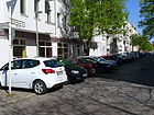
400 | Count Haeseler (1836–1919), Prussian field marshal | around 1910 | The street is parallel to other streets named after the military between Scharnweberstraße and Auguste-Viktoria-Allee. It is street 7 according to the development plan. From 1945 it was briefly called Rudolf-Grieb-Straße , which was not officially confirmed. |
|
| Grenade Street
( Location ) |
330 | Grenade , a hollow projectile filled with an active agent and provided with a detonator | before 1887 | There was previously an artillery firing range laid out by King Friedrich II the Great on the site . It was relocated to Jungfernheide in 1828. The street is located to the east as a cul-de-sac between Provinzstraße and the "KGA Schönholz" on the route of the northern railway . |

|
| Grindelwaldweg
( Location ) |
260 | Grindelwald , tourist town in the Bernese Oberland, Switzerland | Apr 20, 1937 | Between Baseler Strasse and Romanshorner Weg, it goes over the latter as a dead end to the west to the northern edge of the Golgotha, Gnaden and Johannes-Evangelist-Kirchhofs. The Inner Parkring runs over this street. As number 18, this is one of the 20 main green routes in Berlin, a system of recreational and hiking trails with cultural and historical information points. |

|
| Großkopfstrasse
( Location ) |
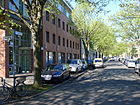
190 | Karl Großkopf (1847–1929), local politician | around 1898 | The road between Ollenhauerstrasse and Reuterstrasse was laid out by Großkopf, community leader of Reinickendorf and owner of the road area. Großkopf came from an old Reinickendorfer farming family and lived (1887) at Dorfstrasse 36/37. |
|
| Grünrockweg
( Location ) |
90 | Green skirt, symbolic of hunters and foresters after clothing | Aug 4, 1930 | The short, quiet residential street with direct access to the Residenzstraße underground station is a pedestrian area between Residenzstraße and Breitkopfstraße . The street belongs to the Paddenpuhl settlement on the Breitkopfbecken, which was built between 1927 and 1939 according to plans by the architects Fritz Beyer, Diekmann and Scherer. The streets of the settlement mainly carry symbolic terms from hunting. The road 28 of the development plan is 1933 still undeveloped. |

|
|
Hasslingerweg
( Location ) |
290 | Heinrich Haßlinger, sexton at the old village church between 1864 and 1882 | May 20, 1937 | Laid out as Straße 9 and named in 1937, it lies between Markstraße and Reginhardstraße. On February 1, 1980, the spelling “Haßlinger Weg”, which was temporarily separated, was corrected. |

|
|
House otter place
( Location ) |
80 × 80 (circular) |
Karl Hausotter (1829–1896), landowner | before 1887 | The circular square interrupts Winterstrasse and Kamekestrasse. The evangelical church and the house otter primary school are located on the square. The landowner Karl Hausotter had the square and the street laid out from an old Reinickendorfer family. |

|
| Hausotterstrasse
( Location ) |
1140 | Karl Hausotter (1829–1896), landowner | 1902 | The long and quiet residential street between Residenzstrasse and Provinzstrasse consists predominantly of multi-storey apartment blocks. The old and post-war buildings are interrupted in the middle street area by a few commercial yards with single-family houses. The landowner Hausotter from an old Reinickendorfer family had the road and the nearby Hausotterplatz built. | |
| Hechelstrasse
( Location ) |
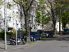
500 | Hechel (19th century), landowner | around 1898 | The street lies between Scharnweberstraße and Auguste-Viktoria-Allee. In the 19th century, Hechel acquired the property from Schulzen oat straw. The family still owns land. The rentier Hechel had given the building site for the Blessing Church free of charge and on June 15, 1891 the foundation stone for the church was laid, which was consecrated in 1892 by Empress Auguste Viktoria (1858–1921). |
|
| Autumn street
( Location ) |
680 | Autumn , season | before 1887 | The road lies between Provinzstraße and Büdnerring. Roads in the area are named after the three other seasons, with the spring road coming to Niederschönhausen as a result of border changes . |

|
| Behind the village meadow
( Location ) |
160 | beyond the town center the former village meadow | before 1922 | The path goes north from the Freiheitsweg in the arch, the residential buildings from the 1930s are outside and inside the ring. |

|
| Holländerstrasse
( Location ) |
2140 (in the district) |
Dutch , typical machine in the paper industry | Apr 10, 1861 | The street between Gotthardstraße and Letteallee / Residenzstraße (the latter extending over Markstraße) belongs to the district with road land and northern buildings, the plots 54–112 (continuous) on the southern side of the street between Kirchhof III of the Dorotheenstädtische community and Briezener Straße belong to Wedding . The street, which is located near the Holzstrasse and the Papierstrasse (Gesundbrunnen), was probably given its name in connection with the paper mill that was still working in Papierstrasse in 1839. |

|
| Wooden pasture path
( Location ) |
150 | old northern hallway name | Apr 20, 1937 | The Lindauer Allee can be reached via a pedestrian path to the north as a dead end from Borggrevestraße. Before it was named, it was line 3 of the development plan. |

|
| Hoppestrasse
( Location ) |
420 | Hoppe (19th century), nursery owner | before 1887 | It lies between the Provincial Road and a cul-de-sac on Klemkestrasse. Hoppe had his nursery in this area. |

|
| Humannstrasse
( Location ) |
330 | Karl Humann (1831–1888), landowner | before 1887 | The road lies between Kienhorststrasse and across Waldstrasse as a dead end. |

|
| Humboldtstrasse
( Location ) |
1240 | Alexander von Humboldt (1769–1859), natural scientist and explorer | before 1887 | The road between Lindauer Allee and Ollenhauerstraße belonged to the east and west location. A part of Humboldtstrasse was included on February 10, 1961 in Alt-Reinickendorf. |

|
| Huttwil path
( Location ) |
380 | Huttwil , political municipality in the lower Emmental, canton Bern, Switzerland, "flower town" lies between Eriswil, Wyssachen, Dürrenroth and Walterswil. | Aug 4, 1930 | The street in the route of street 31 and street 37 lies between Thurgauer and Walliser Straße. |

|
|
In the hoof loft
( Location ) |
430 (in the district) |
Hooves , old land measure and yard, the addition of blow stands for (cleared) forest clearing | Aug 4, 1930 | The original street 121 is between Eichborndamm and the entrance to the adjacent cemetery in Wittenau . After Reinickendorf it was extended on February 17, 2007 along the railway line between the S-Bahn stations Eichborndamm and Karl-Bonhoeffer-Nervenklinik , when the houses on the plots 23-53c (odd) were built on the former railway site. |

|
| In Rodeland
( Location ) |
210 | Rodeland , old hallway name | May 21, 1941 | The former street 70 goes from the Kienhorststraße and as a footpath to the Waldstraße. |

|
| Prospect path
( Location ) |
480 | Interested parties in the settler community | before 1961 | The street and lots 1a – 7 (continuous) lie between the Rödernau / Lengeder Straße settlement and the railway line, where it mostly leads through allotment gardens and ends there as a garden path with the same name. The officially assigned properties are 1–7 (consecutive). |

|
|
Julierstrasse
( Location ) |
110 | Julier Pass , connects the Engadine with the Oberhalbstein, Switzerland | Apr 10, 1961 | The road going off Winterthurstraße is on the route of the development plan for road 401 . |

|
| Jupiter Street
( Location ) |
130 | Jupiter , planet of the solar system | before 1951 | The street was previously laid out as street 44 . The street between Meteorstraße and Nordlichtstraße is located in a mixed area of commercial and single-family houses. The aircraft noise in the direct vicinity of Tegel Airport is annoying, but the planes hover almost at head height over the settlement, whose parallel streets are mostly named after planets. The settlement was built on the eastern border of the Tegel shooting range near the barracks area. |

|
|
Kamekestrasse
( Location ) |
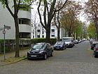
290 | Georg von Kameke (1817-1893), infantry general and politician | before 1897 | The street lies between Herbststraße and Mittelbruchzeile. |
|
| Kapweg
( Location ) |
280 (in the district) |
Cape of Good Hope , South Africa. | May 30, 1953 | The street was previously part of the Spandauer Weg , which existed before 1887. Its southern edge borders the "African Quarter" in Wedding . In May 1953 the part of the Spandauer Weg between Scharnweberstrasse and Fichtenstrasse (today: Meteorstrasse) was renamed Kapweg, in November the section from Charlottenburg to today's Kurt-Schumacher-Platz was named Kurt-Schumacher-Damm. |

|
| Kienhorststrasse
( Location ) |
1450 | Kienhorst, old hallway name | March 6, 1936 | The street lies between Waldowstrasse and Antonienstrasse. Before 1887 the Birkenstrasse ran from Antonienstrasse to Berliner Strasse (today Ollenhauerstrasse) and continued through the Scheffelstrasse, which was laid out around 1900, to Humboldtstrasse. Both were renamed Kienhorststrasse in 1936. After the Second World War (1945/1946) the name Birkenstraße was used for a short time, but not officially confirmed. Around 1954 there was a connection to the west via Antonienstraße to Innungsstraße (today: Otisstraße ), today the garden friends colony and a sports field are located here. |

|
| Klamannstrasse
( Location ) |
450 | Friedrich Ferdinand Klamann (1776–1837), landowner | Apr 4, 1961 | Before the 393 street in the development plan, it is Humboldtstraße and Lindauer Allee with a curved course. |

|
|
Klemkestrasse
( Location ) |
1120 (in the district) |
Fritz Klemke (1902–1932), worker, victim of the Nazi regime | July 31, 1947 | The street is between Kolpingplatz and the suburbs at the passage under the Berlin Northern Railway . The street continues behind the railway line with the lots 106-130 (even) and 107-115 (odd) in Niederschönhausen . Until the border shift in 1938, the entire street belonged to Reinickendorf. The street was named in 1947 after the worker Fritz Klemke, who was born in 1902 and was the victim of an attack by SA members on January 19, 1932 in his arbor. In 1900 was Schönholzer road to the colony Schönholz created, but around 1904 in Schönholzer way was named. On May 20, 1937 it was named Felseneckstrasse after the Reinickendorfer Kolonie Felseneck. This colony, inhabited by working-class families, was attacked by the SA in mid-1932 and the communist Fritz Klemke was shot. The subsequent trial against the perpetrators was one of the political scandals of the Weimar Republic. The judiciary allegedly failed to locate the shooter. On December 22, 1932, the court dropped the case because of the Christmas amnesty. After 1933, the National Socialists reevaluated the attack as one of their "heroic deeds". In 1947 the street was necessarily named after Klemke. | |
| Klenzepfad
( Location ) |
720 | Leo von Klenze (1784–1864), architect | March 6, 1936 | Located between Humboldtstrasse and Brusebergstrasse, this street was planned as street 39 in the development plan . |

|
| Klixstrasse
( Location ) |
410 | Klix, 19th century, landowner, military | before 1887 | The street between Scharnweberstraße and Auguste-Viktoria-Allee is one of several parallel streets named after the military. Lieutenant Klix was the administrator of the Chausseehaus on Tegeler Chaussee (today: Scharnweberstraße ), where a toll was levied to maintain the surrounding streets. Later Klix built a house at Klixstrasse 4, where after 1875 settler children were taught. |

|
|
Kögelstrasse
( Location ) |
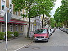
140 | Johannes Theodor Rudolf Kögel (1829–1896), theologian, court preacher. | around 1904 | The street is between Ollenhauer- and a dead-end street via Dahnstraße to the cemetery. |
|
| Kolpingplatz
( Location ) |
90 × 80 × 70 (triangular intersection) |
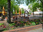
Adolph Kolping (1813–1865), theologian, founder of the Kolping Society . | Dec. 1, 1986 | The square is located at a noisy intersection, where Copenhagen, Klemke, Residenzstrasse, Lindauer Allee and Alt-Reinickendorf meet. The traffic from Residenzstrasse to Wilhelmsruh, Tegel and Wedding flows through it. |
|
| Copenhagen Street
( Location ) |
810 (in the district) |
Copenhagen , capital of Denmark | Apr 30, 1899 | The street lies with the lots 1–75 and 2–76 between Kolpingplatz and the district boundary behind the embankment at the Wilhelmsruh S-Bahn station in the district. The road continues northwards to Wilhelmsruh , until 1938 it belonged entirely to Reinickendorf. The street was once the connection between Rosenthal and Reinickendorf. The route is shown on the original measuring table from 1871. |

|
|
Kühleweinstrasse
( Location ) |
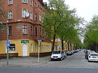
690 | Carl von Kühlewein (1846–1916), entrepreneur and numismatist | around 1904 | Carl Kühlewein was director of the Great Berlin Horse Railroad Company. He was the inspiration for the first Berlin trade exhibition in 1896. The paved street lies between Reginhard and Mittelbruchzeile. It leads over the Letteplatz and in the northern part from Simmelstraße as a dead end to the Mittelbruchzeile, which is designed here as a park path and is therefore blocked off with bollards and a barrier . On October 20, 1932, the southwestern transverse section of the Kühleweinstrasse was named Simmelstrasse. |
|
|
Kühnemannstrasse
( Location ) |
750 (in the district) |
Fritz Kühnemann (1840–1917), entrepreneur | before 1921 | The road between Provinzstraße and the Huge-Heinemann-Brücke over the Panke and the northern plots 1-51 (odd) are in the district. Plots 4–52 (straight) to the south belong to Gesundbrunnen . Kühnemannstrasse was named between 1918 and 1921 and was located between Wilhelm-Kuhrstrasse and Koloniestrasse at the time. On February 19, 1938, the extension to Provincial Road, Straße 1 , was included. |

|
| Kurt-Schumacher-Damm
( Location ) |
610 (in the district) |
Kurt Schumacher (1895–1952), politician, SPD, Member of the Bundestag, resistance fighter against the Nazi regime | Nov 7, 1953 | In the district, the street is between Kurt-Schumacher-Platz up to and including the confluence of the (previous) A 105 with properties 1 (odd) and 2–42 (even). The section west of the A 105 is in Tegel and the southern properties up to Kapweg in Wedding . In the south, in the district of Charlottenburg , the two-lane street with a median merges into the A 111 and partly runs alongside it (of the same name) as a connecting lane . In 1953, in recognition of his services to Berlin and on the occasion of the first anniversary of his death, the Tegeler Weg (before 1884) and the Spandauer Weg (before 1887) in Reinickendorf, Tegel and Wedding were renamed Kurt-Schumacher-Damm. On December 17, 1955, the Tegeler Weg and the Hinckeldeydamm in Charlottenburg were included in the street leading through several districts and districts. |

|
| Kurt-Schumacher-Platz
( Location ) |
100 x 100 (expanded intersection) |
Kurt Schumacher (1895–1952), politician | Aug 4, 1955 | The course is at the intersection of Scharnweberstrasse and Ollenhauerstrasse / Kurt-Schumacher-Damm. Two streets cross each other, each with two lanes with a median and two to four lanes underlining their importance in road traffic as superordinate main roads according to Berlin's road development plan. The place was named because of the proximity of the street named after it. |

|
|
Lamp slope
( Location ) |
190 | Meister Lampe , the hare in the animal fable | Aug 4, 1930 | The quiet residential street, previously street 26 , is a dead end from Klemke and Emmentaler Straße at Breitkopfpark. The road is continuous for pedestrians and cyclists. It belongs to the Paddenpuhl settlement on the Breitkopfbecken, built between 1927 and 1939 according to plans by the architects Fritz Beyer, Diekmann and Scherer. In the south, across the Breitkopfpark, the Gamsbartsteig is opposite. |

|
| Lengeder Strasse
( Location ) |
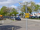
1520 | Lengede , place in Lower Saxony in the southeast of the Peine district | Apr 1, 1967 | The street between Roedernallee and Kopenhagener Straße lies on the northern edge of the industrial area, through which it also partially leads. At the western end are the allotment gardens KGA Trockendorf and KGA Vogelhain as well as the Roedernau settlement, and there are further pedestrian passages to the allotment gardens to the north. At the eastern end, it is parallel to the Nordbahn and Wilhelmsruh S-Bahn station . It is located in the route from Straße 1 and Straße 416 in the east of Reinickendorf. On November 26, 2005, the extension from the Markscheider to the exit on Kopenhagener Strasse (Wilhelmsruh S-Bahn station) was included. The city of Lengede became known nationwide through the mining disaster of 1963 . |
|
| Letteallee
( Location ) |
860 | Wilhelm Adolf Lette (1799–1868), social politician and lawyer | 1876 | Between 1872 and 1874 the Lette-Colonie was built in the area of Residenzstraße, Pankower Allee and Letteallee. Lette campaigned for the construction of rural homes and had founded a non-profit association for this purpose. Sons of farmers from the area settled here, later the workers from the brickworks and their families joined them, in 1878 this colony was still listed. On February 19, 1938, the Benkestrasse , which was laid out around 1898 between Kühleweinstrasse and Mickestrasse, was included, although the properties were probably already numbered continuously. The Benkestrasse was probably named after the landowner E. Benke (19th century), who provided the road land. On September 1, 1981, Strasse 54 was incorporated into Letteallee. |

|
| Letteplatz
( Location ) |
110 x 110 (square) |
Wilhelm Adolf Lette (1799–1868), social politician and lawyer | Feb. 19, 1938 | The space A of the development plan in the "Lette Colonie" is between Lette (in the south) and Pankow Avenue (north) and is bordered to the east by the Mickestraße. In the west it interrupts the Kühleweinstrasse, which borders the square as a park path. There are sports facilities and a playground on the square. |

|
| Lienemannstrasse
( Location ) |
330 | Lienemann, 16th century, long-established farming family | July 26, 1955 | Previously laid out as Straße 373 , it was named in 1955, lying between Waldstraße and Kienhorststraße. Via the latter, it continues as a dead end west of the Lienemann basin (a green rain catchment basin). |

|
| Lindauer Allee
( Location ) |
1850 | Lindau , administrative seat of the district in the Bavarian administrative district of Swabia. | Feb. 1, 1965 | The street with two lanes and a wide median lies between Residenzstraße on Kolpingplatz and Ollenhauerstraße. In 1965, Lindauer Strasse , which was laid out between Residenzstrasse and Teichstrasse around 1912, was named with Kuhnstrasse (Ollenhauerstrasse to Klamannstrasse) laid out before 1898, including Strasse 390 . The underground line U8 runs under the street, which is separated by two three-lane lanes and a median strip planted with trees . Between Residenzstrasse and Roedernallee, Lindauer Allee is the bearer of Bundesstrasse 96 . |

|
|
Lübener way
( Location ) |
350 | Lüben , Lower Silesian district town, Poland | Jan. 14, 1959 | The street lies between Brusebergstrasse and Teichstrasse and was planned as Strasse 7 according to the development plan . |

|
| Luisenweg
( Location ) |
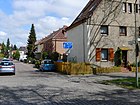
230 | Queen Luise of Prussia (1776–1810), wife of King Friedrich Wilhelm III. | 1922 | The road is north of Alt-Reinickendorf on the Freiheitsweg as a dead end . |
|
|
Mariabrunn way
( Location ) |
140 | Mariabrunn, part of the municipality Eriskirch on Lake Constance, Baden-Wuerttemberg | Oct. 20, 1932 | The road 85 , traced out according to construction plan, is between Mudrackzeile and Zermatt road. On this area up to Baseler Straße the ice works was located northwest of the Schäfersee. |

|
| Markscheiderstrasse
( Location ) |
650 | Markscheider , surveying engineer in mining | July 1, 2003 | The street, previously street 3 , between Flottenstrasse and Lengeder Strasse leads through the middle of an industrial area, whereby the western parallel street as Montanstrasse has the same reference to mining. |

|
| Markstrasse
( Location ) |
760 (in the district) |
Mark Brandenburg , nucleus of the Prussian state | before 1877 | The street has two lanes throughout with a median and is located between Pankower Allee (Friedrich-Neumann-Platz) and Louise-Schröder-Platz. The plots 14–19i (continuous) on the western side of the street between Walderseestrasse and Ungarnstrasse belong to Wedding . On March 8, 1957, the parallel section between Frauenfelder and Ungarnstrasse belonging to Wedding was given the same name with the houses 19f – i, 19–19c along Frauenfelder Strasse also belong to Markstrasse in Wedding. In the 1874 city map, Reinickendorfer Straße is named in the route , and marked as Markstraße on the 1877 map. |

|
| Mars Street
( Location ) |
120 | Mars , planet of the solar system | Jan. 21, 1937 | The small, unpaved road connecting Meteor and Northern Lights roads , which is noisy due to the proximity of Tegel Airport and the (former) A 105 , is located in a mixed area of commercial and single-family houses. The street 45 was named in 1937, but is not yet listed in the 1943 address book (in contrast to other "planetary streets " in East), but was recorded in 1954. The settlement was built on the eastern border of the Tegel shooting range near the barracks area. |

|
| Meller Bogen
( Location ) |
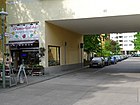
450 | Melle , largest city in the district of Osnabrück, Lower Saxony | Apr 29, 1972 | The street is curved between General-Barby-Straße (west) and Auguste-Viktoria-Allee (south). The street was laid out with the development on the route from street 51 and street 472 . The residential areas 2–32 (even) and 7–19 (odd) lead the street as a passage into a park-like, green interior area with multi-storey rows of apartment blocks. Melle has been a twin town in the Reinickendorf district since 1988. |
|
| Mercury Street
( Location ) |
110 | Mercury , planet of the solar system | Jan. 21, 1937 | The small, unpaved road connecting Meteorstrasse and Nordlichtstrasse , which is noisy due to the proximity of Tegel Airport and the (former) A 105 , is located in a mixed area of commercial and single-family houses. The road 47 of the development plan is located at the eastern border of the Tegeler firing range near the barracks resulting (planetary) settlement. |

|
| Meteor road
( Location ) |
650 | Meteor , also called shooting star, luminous phenomena from meteoroids penetrating into the earth's atmosphere | Sep 18 1958 | The name of the street is chosen to complement the cross streets named after planets. It is a narrow street in a mixed area of commercial and single-family houses, which lies in an east-west direction between Uranusstraße and Straße 462. Aircraft noise due to the direct proximity to Tegel Airport , with the aircraft floating almost at head height, and the traffic noise from the Kurt-Schumacher-Damm feeder, which is intended as a motorway to the city center , disturb the remote location of the street. An earth wall parallel to the road protects against the noise of the motorway. The embankment is a sought-after destination for plane spotters , because from here (outdated ) planes arriving and departing can be observed and the entire runway of the airport can be seen. The (planet) settlement was built on the eastern border of the Tegel shooting range near the barracks area. In 1954 the name Karl-Janisch-Straße is found. |

|
| Mickestrasse
( Location ) |
260 | Paul Micke (1844–1913), General Director (from 1898) of the Great Berlin Tram | 1906 | Before it was named, it was laid out as street 2 in the area of the former "Lette Colonie". The street lies between Reginhardstraße and Pankower Allee across Lette-Allee. |

|
| Middle fraction line
( Location ) |
1100 | Mittelbruch , old hallway name | Feb 21, 1937 | The street was built around 1899 as Grüner Weg ; in 1910 there were eight residential buildings, a nursery and a whip factory on it, but 77 lots were undeveloped (referred to as construction sites). It lies between Residenzstrasse and Provinzstrasse. |

|
| Montanstrasse
( Location ) |
640 | Montan , related to mining | June 1, 1962 | The street, previously street 2 , between Flottenstrasse and Lengeder Strasse opens up the access to the various commercial and industrial establishments in the commercial area located here, which was laid out on the "edge of the sector" at Wilhelmsruh since the 1960s . |

|
| Mudrack line
( Location ) |
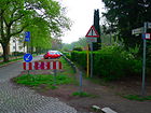
260 | Hermann Eduard Mudrack (19th century), entrepreneur, in 1856 the natural ice works on Lake Schäfersee, the first of its kind | Oct. 20, 1932 | This street is located near the Schäfersee between Baseler Straße and Mariabrunner Weg as a quiet residential street with apartment blocks from the 1920s. There is a pedestrian passage between Mudrackzeile and Stargardtstraße. The southern and eastern side of the street, which runs at right angles, are bounded by the allotment gardens Mariabrunn and the allotment gardens Am Schäfersee. Before road 86 of the development plan, the Mudrackzeile originally ran only in a north-south direction, it was divided by construction measures and on April 10, 1961 the western part was included in the Mudrackzeile. On this area up to Baseler Strasse the ice works was located northwest of the Schäfersee, Mudrack had ice break at the Schäfersee in winter, stored in the Mudrackschen natural ice sheds (dug ponds isolated with peat) and delivered it to the surrounding inns and butchers in the summer. A section of the "Inner Parkring" is led over this street, as No. 18 it is one of the 20 main green routes in Berlin, a system of recreational and hiking trails with cultural and historical information points. |
|
|
Neptunstrasse
( Location ) |
150 | Neptune , Roman god of flowing water | 1905 | It is a dead end street east of Reginhardstrasse opposite Mickestrasse. This street A of the development plan is in the area of the former "Lette-Colonie" ( see also Lette ) and was already listed as Lettestrasse C before 1887 . In 1905 it was named lying parallel to Aegirstraße (south of Lette-Allee ). In the 1943 address book it is given for the location east with the properties 1–30 in horseshoe numbering as a spur road from Seestrasse . |

|
| Nordbahnstrasse
( Location ) |
450 | Near the northern runway located | before 1887 | Nordbahnstrasse 1-37c (continuous) lies between Raschdorffstrasse and Sommerstrasse, leads over the latter as a dead end towards the Nordbahn (S-Bahn station Schönholz) and continues as a pedestrian path to Seebeckstrasse, which lies along the line. There is no connection to the Nordbahnstraße at the Wollankstraße train station between Niederschönhausen and Gesundbrunnen except for the naming. In 1910, the Nordbahnstrasse between Amendestrasse and Nordbahn is given in horseshoe numbering from 1–34 with ten undeveloped and single-family houses and multi-family houses. |

|
| Northern Lights Road
( Location ) |
750 | Northern lights , luminous phenomenon of the solar wind in the polar regions | Sep 18 1958 | The street in the "Planetensiedelung" with commercial and single-family houses lies between Uranusweg and Straße 443. The properties on the northern side of the street border on the elevated railway of the U6 line from Alt-Mariendorf to Alt-Tegel. In addition, the aircraft noise from the neighboring Tegel Airport comes from the aircraft crossing at a low altitude. The Heiligenseer Weg, No. 18 of the 20 green main routes in Berlin , leads over this street . The (planet) settlement was built on the eastern border of the Tegel shooting range near the barracks area. In 1958, Karl-Janisch-Straße (previously Straße 43 ), named after the Siemens engineer and manager Karl Janisch (1870-1946 ), was given the name adapted to the transverse “planetary streets ”. |

|
|
Ollenhauerstrasse
( Location ) |
1590 | Erich Ollenhauer (1901–1963), politician, resistance fighter against the Nazi regime | March 25, 1964 | The Berliner Straße in the district was renamed the 63rd birthday of Ollenhauer (one year after his death). The path was laid out in the 18th century as Dalldorfer Chaussee (Dalldorf, former name of Wittenau ) and, with increasing settlement, was named Berliner Straße before 1888 . The street lies between Kurt-Schumacher-Platz and the suburb of Wittenau on the bridge of the S-Bahn line to Tegel . The road with two lanes and a partially green median (two to four lanes each) is part of the superordinate road system of the road development plan of Berlin. Plots 1–139 are assigned to the street in horseshoe numbering. |

|
| East Street
( Location ) |
90 | East , direction | before 1951 | The short unpaved road, previously road 48 , is the easternmost of the small cross-connections between Meteor Road and Northern Lights Road . It complements the western street (westernmost) and the other parallel paths named after planets. It is located in a mixed use of commercial and single-family homes and by the traffic noise of the A 105 planned feeder Kurt-Schumacher-Damm and ( [date] yet) aircraft noise close proximity to the runways of the airport Tegel loaded. The (planet) settlement was built on the eastern border of the Tegel shooting range near the barracks area. |

|
| Otisstrasse
( Location ) |
910 (in the district) |
Elisha Graves Otis (1811–1861), American master mechanic, entrepreneur | July 19, 1956 | The road between Seidelstrasse and Wittestrasse lies with the road in Tegel , the district boundary is on the western edge of the road, so that plots 12-76 on the east side of the street belong to the district. The previous name of the street was Innungsstraße, which still exists in Borsigwalde today . The road runs under the motorway and the elevated railway line. The administration of OTIS GmbH is located at Otisstraße 33. |

|
|
Pankower Allee
( Location ) |
950 | Pankow , neighboring town to the east | before 1877 | The connecting route from Reinickendorf to Pankow and Niederschönhausen (probably) existed for a long time and was laid out before 1877 as an avenue from the Schäfersee north of the "Lette Colonie". The street lies between Residenzstrasse and Provinzstrasse. |

|
| Pfahlerstrasse
( Location ) |
230 | Pfahler, 19th century, landowner in Reinickendorf | 1898 | Pfahlerstrasse is located between Ollenhauerstrasse and Waldowstrasse and used to run from Berliner Strasse (today: Ollenhauerstrasse) to Humboldtstrasse. After 1924 the area between Waldowstrasse and Humboldtstrasse was redesigned, most of the old streets were removed and new ones were created later. In 1900 the street was still vacant. |

|
| Chanterelle path
( Location ) |
130 | Chanterelle , edible mushroom | Apr 1, 1937 | The previous line 1 is a spur road northwards from Borggrevestraße. There is a pedestrian path to Lindauer Allee. |

|
| Provincial road
( Location ) |
1320 (in the district) |
Province of Brandenburg , one of the provinces of Prussia | before 1877 | The road continues south in Wedding and north in Niederschönhausen . In the district, the plots 35–62a and 81–127 (continuous) are between Ritterlandweg and, including the underpass of the Berlin Northern Railway , the street area belongs to the district. The name may go back to the creation by the provincial administration, but the naming could also be related to the Markstrasse (which also belongs to the east) after the Mark Brandenburg . | |
|
Quaker Street
( Location ) |
420 | Quakers , Protestant religious group | Nov 1, 1968 | It is located between Auguste-Viktoria-Allee and Otisstraße on the route of road 408 . Quäkerstraße 1–37 (odd) and 2–28 (even) as well as Foxweg 1–37 (odd) is a quiet Gewobag residential complex from the 1960s with 1,500 apartments northeast near the A 114 . The outgoing Foxweg is named after the founder of the "Christian Society of Friends", whose members were disparagingly called "Quakers". At the southern end of the street is the Albert Einstein Church and a retirement home. |

|
|
Ragazer Strasse
( Location ) |
310 | Bad Ragaz , political municipality in the canton of St. Gallen in Switzerland | 1909 | The street lies between Lindauer Allee and Thurgauer Straße. In 1925 the street was still shown in the address book as undeveloped, in 1930 all the land was built on. |

|
| Raschdorffstrasse
( Location ) |
1110 | Julius Carl Raschdorff (1823–1914), architect (Berlin Cathedral) | 1901 | The street lies between Residenzstrasse and Sommerstrasse. |

|
| Reginhardstrasse
( Location ) |
1560 (in the district) |
Reginhard , male name, Reginhard is said to be the form of Reinhard for the naming of Reinickendorf |
Nov 1, 1957 | The street is in the district between Emmentaler and Markstraße (Louise-Schroeder-Platz). The southern plots 6–32 (straight) between Markstrasse and Ritterlandweg belong to Gesundbrunnen . The Seestrasse (partly from Oskarplatz, today: Louise-Schroeder-Platz), Isarstrasse and Saßnitzstrasse were named in 1957 as a uniform street all the way to Emmentaler Strasse. Around 1901, the Saßnitzstrasse, named after the town of Saßnitz , was laid out as a dead end between Winterstrasse and Raschdorffstrasse. The Isarstrasse, which was laid out around 1901 (after the Danube tributary Isar ), was located between Winterstrasse and Letteallee. Seestrasse was laid out when the Kämmereiheide was parceled out and was named as early as 1827, and construction began in 1907. In the district it was between Oskarplatz and Letteallee and was integrated into Reginhardstrasse. |

|
| Reinicke's court
( Location ) |
330 | Paul Reinicke († after 1911), educator, local politician | Aug 4, 1930 | The street is the access street west of Ollenhauerstraße to properties 1–22 (continuous). It forms a green courtyard and leads north as a dead end to the Saalmannsteig . The street lies on the route of street 34 and street 34a . From 1889 to 1914 Reinicke was the main teacher in Dalldorf and from 1906 also director of the village school. He was the mayor and alder in Reinickendorf. |

|
| Residenzstrasse
( Location ) |
1770 (in the district) |
Residence , residence and official residence of sovereigns | before 1877 | The Residenzstrasse is located between Kolpingplatz and the suburbs on the Ritterlandstrasse in the district, it then continues with the plots 76-90 (continuously) in Wedding . Residenzstrasse is marked by name on the map from 1877, and Reinickendorfer Chaussee runs along its route in 1874 . This name applies to the Chaussee from Wedding to (today) Alt-Reinickendorf. The name Residenzstraße, on the other hand, applies to via Wedding to the royal residence Berlin. The street is part of the higher-level street system of Berlin, 1120 meters of which also belong to Bundesstraße 96 . |

|
| Reuterstrasse
( Location ) |
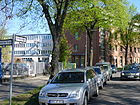
130 | Fritz Reuter (1810–1874), Low German poet | around 1898 | Reuterstraße is located between Friedrich-Karl- and Großkopfstraße. The Dankes churchyard borders on the east and the KGA Schweinkopf on the northern part. The square at the southern end of Blankestrasse is called Reuterplatz by residents, but is not an official name. |
|
| Rib movement
( Location ) |
70 | Christian Ribbe (18th century), landowner in Reinickendorf | June 1, 1962 | The street leads from Raschdorffstraße as a dead end . It bears the name of a local personality, but compared to the street names from the 19th century, the owner of the street was not chosen here. A footpath leads over the vacant lots at Amendestrasse 24 and 85 and Hausotterstrasse 81b, over playgrounds and through green areas, which is named by residents alike. The properties Ribmobil 32–36 (even, east) and 33, 35 (odd, west) with residential buildings from the 1960s are assigned, the residential buildings 86, 86a connected to 33–35 belong to Amendestrasse. |

|
| Ritterlandweg
( Location ) |
550 (in the district) |
Ritterland, here the estate of the manor (Nyenhove, der Neue Hof) | 17 Sep 1938 | The road country and the north side between residence - and provincial road is in the village, part of the land to the south is 16 to 62 (even) in Gesundbrunnen on which skirts the district border. In the 14th century there was a Nyenhove estate on the Schäfersee (called Reinickendorfer See until the 19th century), probably a manor. The street name until 1938 was Justusstraße , which was already marked by name on the Straubes map from 1877. According to the 1910 address book, the houses 1–5 and on to Provinzstrasse 6–30 (five of which are undeveloped) and on the other side of the street 31–52 (five undeveloped, on 52 a coal field) and further 53 ( undeveloped) to 62 on Residenzstraße. In 1939, the buildings at Justusstrasse 6–30 no longer belong to the Reinickendorf administrative district ; |

|
| Roedernallee
( Location ) |
750 (in the district) |
Siegfried von Roedern (1870–1954), lawyer, politician | before 1910 | The southern section between Lindauer Allee and the suburbs on Thyssenstraße with lots 2–56 and 171–204 (continuous) is located in the district, to the north the road continues to Wittenau . Bundesstraße 96 is on Roedernallee and the street is part of the superordinate Berlin street system. Roedernallee first became Reinickendorfer Strasse, which was laid out before 1902 in Wittenau between the district boundary (today Tessenowstrasse) and the Chaussee to Hermsdorf (today: Oranienburger Strasse) . The Oranienburger Chaussee , which already existed from Hauptstraße (today: Alt-Reinickendorf) before 1905 , was incorporated into the (Wittenauer) street that was renamed Graf-Roedern-Alle around 1912 . Roedern was appointed District Administrator for Niederbarnim in 1905 and Senior President in Potsdam in 1911. In 1910 von Roedern was raised to the status of a legal knight of the Order of St. John. The Graf-Roedern-Allee was named Roedernallee on July 18, 1956 (again without a title). A section of Roedernallee came to Alt-Reinickendorf on February 10, 1961 and at the same time its extension was named Roedernallee on that day. The Paracelsus bath is located here . |

|
| Romanshorn way
( Location ) |
1150 | Romanshorn , political municipality in the district of Arbon in the canton of Thurgau in Switzerland | Apr 20, 1937 | The length of the street is interrupted several times between Lindauer Allee (in the north) and Holländer Straße (in the south). In 1937, the Davoser Straße , laid out around 1909, was given the name Romanshorner Weg using the route from Straße 49 in the development plan. South of Grindelwaldstrasse there is a dead end street with lots 15–19 (odd) and 16–20a (even) up to the Johannes-Evangelist-Kirchhof. To the north of Grindelwaldstrasse are plots 21–51 (odd) and 22–52 (even) over Zermatterstrasse and Emmentaler Strasse, further over Schillerring partly shifted to the east and following plots 54–92 (even) and 59–85 (odd) and with 111 and 165 buildings of the Humboldt Hospital and the Reinickendorf District Office and on the east side (north of the extended Genfer Strasse) two terraced apartment blocks 96/148 and 150/202 to Sankt-Galler-Strasse, one of which is east with 204– 212 built dead - end street with turning hammer goes north, which leads next to the youth traffic school as a footpath to Lindauer Allee. For Davoser Straße , Lindauer Straße, St. Gallener Straße, (east only) Genfer Straße, Tellpromenade, Schillerring, Appenzeller Straße are listed in 1930. On this street there are vacant lots, the hospital and on the east side between Tellpromenade and Lindauer Straße new buildings. |

|
| Rorschacher line
( Location ) |
90 | Rorschach , town and political municipality on Lake Constance in the canton of St. Gallen in Switzerland | July 7, 1959 | Projected as street 376 of the development plan, it goes from Residenzstraße, opposite Grünrockweg, to the west with lots 2–14 (even) and 1–5 (odd). |

|
| Rütlistraße
( Location ) |
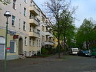
340 | Rütli , mountain meadow on the bottom of the Uri community of Seelisberg in Switzerland, known for the Rütli oath | around 1909 | The street goes from Holländerstraße / corner of Vierwaldstätter Weg as a dead end to the north and ends in front of the sports field west of Schäfersee. |
|
| Rundpfuhlweg
( Location ) |
150 | Rundpfuhl, old hallway name | Apr 20, 1937 | When line 2 configured he goes north on the road Borggreve as one of three parallel streets. |

|
|
Saalmannsteig
( Location ) |
200 | Saalmann (died around 1913), landowner in Reinickendorf | July 26, 1955 | The path is between Saalmannstrasse and Ollenhauerstrasse and was previously noted as footpath 103 . The properties in Saalmannsteig 1–13 (odd) are assigned to him. The pedestrian path is provided with bollards on Ollenhauerstraße, but is a driveway to the properties. The choice of name relates to Saalmannstraße. |

|
| Saalmannstrasse
( Location ) |
380 | Saalmann (died around 1913), landowner in Reinickendorf | around 1901 | The road leads as a dead end from Waldstraße to the S-Bahn line between the two railway farms Wittenau-Saalmannstraße and Saalmannsteig. From the northern end of this cul-de-sac, the Saalmannsteig leads eastwards as a pedestrian path to Ollenhauerstraße, and as a driveway it is an entrance to the houses Saalmannsteig 1–13 (odd) between Reinickes Hof and Ollenhauerstraße. According to the development plan, Saalmannstrasse is 35 . In 1945/1946 the street was briefly named Karl-Lüdtke-Straße , the name was not officially confirmed and then reversed. Saalmann was a dairy owner and lived at Scharnweberstrasse 77. |

|
| Sankt-Galler-Strasse
( Location ) |
290 | St. Gallen , main town in the canton of St. Gallen, Switzerland | 1909 | The street is between Aroser Allee and Teichstraße. |

|
| Saturn Street
( Location ) |
110 | Saturn , planet | Sep 18 1958 | Parallel to the other streets named after planets, this small unpaved road connecting Meteorstraße and Northern Lightsstraße lies in a mixed area of commercial and single-family houses. According to the development plan, it is Straße 46 . The compounds of this settlement in the city center would be the A 105 become, which was downgraded to the feeder Kurt-Schumacher-Damm, another source of noise comes from the runway end of the airport Tegel lies directly behind the southern end of the street. The (planetary) settlement was built in the mid-1930s on the eastern border of the Tegel shooting range (now Tegel Airport ) near the barracks area. This cross street was one of the last to receive the officially dedicated name. |

|
| Scharnweberstrasse
( Location ) |
1510 (in the district) |
Georg Scharnweber (1816–1894), Prussian politician, lawyer, Royal Prussian District Administrator for Niederbarnim (1843–1891). | before 1888 | The largest section of the street belongs in particular to the street area of the district, only the eastern section with the (southern) properties 159–160 (continuous) is in Wedding . The road lies between Weddinger district boundary (at the connection Müllerstraße, Dorotheenstädtischer Friedhof III) and the transition to Seidelstraße at the level of the bridge over the A 111 . The larger part of Scharnweberstrasse in this street from Tegel with the city center (Müllerstrasse, Scharnweberstrasse, Seidelstrasse) belongs to the regional road system according to the road development plan of Berlin. However, due to the entrance to "Junction 6 Seidelstrasse" of the A 111 and the entrance to Antonienstraße and the exit to Eichborndamm of "Junction 7 Eichborndamm", 130 meters of the spacious and 250 meters of the superordinate road system of Berlin are allocated, which for the traffic density that Road conditions and the repair times of this city street is significant. In the Berlin address book from 1887 the name of Tegeler Chaussee is still shown, but in 1888 the street is called Scharnweberstraße. Scharnweber successfully ran for the Royal Prussian District Office Niederbarnim, which he held from January 1, 1843 to December 31, 1891, which is why the name of the street was chosen. | |
| Schillerring
( Location ) |
390 | Friedrich Schiller (1759–1805), writer | around 1906 | The street lies between Emmentaler Straße and Romanshorner Weg. On January 27, 1931, the section between Davoser (now Romanshorner Weg) and Baseler Strasse was renamed Zermatter Strasse. |

|
| Schillingstrasse
( Location ) |
480 | Schilling (19th century), cigar manufacturer and landowner | before 1887 | This street is between Scharnweberstraße and Auguste-Viktoria-Allee. |

|
| Schützenstrasse
( Location ) |
60 (in the district) |
Rifle guild in the nearby Schützenhaus on Schönholzer Heide | around 1904 | The road between Hermann-Hesse- and Buddestraße lies with the road in Niederschönhausen . To Reinickendorf belongs on the east side (along the fence) the area of the goods station Schönholz, (here) as Am Bürgerpark Nr. 1. Until the district reform in 1938, the street as a whole belonged to the district. Around 1943 the street was not officially designated as Am Schießstand . Today it is an almost meaningless street, which is the entrance to the loading street at the freight station in the district. In addition to the rifle house of the Berlin rifle guild, which was built in 1882–1889, the X. Federal Shooting, held in Schönholz in 1890, may have been the reason for the street name. The Berlin Wall stood on this street from 1961–1990 / 1991 , today's asphalt surface was probably created when the remains of the wall were removed. |

|
| Schulenburgstrasse
( Location ) |
190 | Rudolf von der Schulenburg (1860–1930), lawyer, royal Prussian chief president and politician. | 1898 | The one-way street is between Waldowstrasse and Ollenhauerstrasse (in that direction). As early as 1900, Schulenburgstrasse was between Berliner Strasse (today Ollenhauerstrasse) and Waldowstrasse, and the Ziegeleiweg that leads to Humboldtstrasse was gradually incorporated into Schulenburgstrasse until 1924. After 1924 the area between Waldowstraße and Humboldtstraße was redesigned and the routes of the streets changed. |

|
| Schwabstrasse
( Location ) |
340 | Gustav Schwab (1792–1850), writer, theologian | Oct. 20, 1932 | This inner-city residential street with cobblestones and buildings made up of old and new buildings is located between Reginhardstrasse and Provinzstrasse. The street leads east-west over Epensteinplatz. Around 1898, Albert-Freytag-Strasse , which was probably named after a local resident, was located here , which in 1932 was renamed Simmelstrasse in the south-west and Schwabstrasse in the north-east. |
|
| Schwartzstrasse
( Location ) |
130 | Schwartz, head of the district and community, owned a farm in the district | around 1914 | The road lies between Epensteinstrasse and Provinzstrasse. |

|
| Seebeckstrasse
( Location ) |
80 | Seebeck was one of the first residents in the 19th century | before 1887 | The street initially ran between the summer and provincial streets and lay entirely on Reinickendorfer Flur, but was shortened before the regional reform in 1938. Plots 1–4 on the south side are assigned to the short street between Sommerstrasse and the railway line. |

|
| Seidelstrasse
( Location ) |
630 (in the district) |
Gustav Adolph Ferdinand Seidel (1803–1884), landowner, city councilor, leaseholder of the Berlin corpse transport system | around 1906 | The road lies between Otisstrasse and the Seidelstrasse bridge over the A 111 at junction 7 (Eichborndamm) in the district, here it turns into Scharnweberstrasse. The southern plots 15–75 (continuous) belong to Tegel . Seidelstrasse was initially set up in Tegel, it ran from the junction of Berliner / Bernauer Strasse to the Berlin-Tegel prison , and around 1906 the continuation, Tegeler Landstrasse , was included. |

|
| Semkensteig
( Location ) |
90 | Semke was a Reinickendorfer teacher | Sep 1 1981 | The street leads south from Pankower Allee to Letteallee, without any land being assigned to it |

|
| Septimerstrasse
( Location ) |
700 | Septimer, an important Alpine pass in Switzerland in antiquity and the Middle Ages | Apr 10, 1961 | The street lies in an arch north of and to Holländerstraße and has a few side streets as access to the adjacent properties. It lies on the route of roads 396, 397, 398 and 399 of the development plan. |

|
| Siedelmeisterweg
( Location ) |
160 | Settler master, usually the first Schulze of a newly established German village in the Slavic region, who recruited new settlers | July 18, 1958 | The road 111 was the limit of the industrial zone to the west preceding the name. The road goes from the forest road to the north. |

|
| Simmelstrasse
( Location ) |
470 | Georg Simmel (1858–1918), sociologist and cultural philosopher | Oct. 20, 1932 | The street between Residenzstrasse and Kühleweinstrasse is the western branch of Albert-Freitag-Strasse , which has been here since 1898 , and which was probably named after (or by) a first settler. |

|
| Solferinostrasse
( Location ) |
230 | The Battle of Solferino is the reason for the idea of founding the Red Cross aid organization | June 18, 1959 | The previous street 100 in the development plan was named in 1959 and lies in the arch between Waldow and Pfahlerstraße. It was named on the 100th anniversary of the Battle of Solferino, the course and effects of which are considered the reason for the idea of founding the Red Cross aid organization . |

|
| Summer street
( Location ) |
670 | Summer , a season | around 1888 | The street lies between Klemkestrasse and Winterstrasse. Of the four streets according to the seasons, the spring street is in the area that came from Reinickendorf to Pankow in 1938. |

|
| Stargardtstrasse
( Location ) |
260 | Stargardt, 19th century, owner of this area | 1897 | The quiet residential street north of the Schäfersee starts as a dead end from Residenzstraße, and there is a pedestrian passage between Mudrackzeile and Stargardtstraße. A child, youth and family center is housed in house no. 9 ("Haus am See"). This street is the number 18 “Innerer Parkring” of the 20 green main routes in Berlin. Originally the street was laid out between Baseler and Residenzstraße, but was divided by construction work and the western section was included in the Mudrackzeile on April 10, 1961. |

|
| Stegeweg
( Location ) |
310 | Footbridge, narrow footpath, small bridge | around 1899 | The road between Alt-Reinickendorf and Flottenstraße runs through the railway line. A previous name was Rosenthaler Weg, the route was by the A. Becker machine factory. |
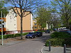
|
| Road 442
( Location ) |
110 | Numbered according to the settlement plan | after 1930 | It is located between Kurt-Schumacher-Damm and Nordlichtstraße. The (planet) settlement was built on the eastern border of the Tegel shooting range near the barracks area. |

|
| Road 443
( Location ) |
150 | Numbered according to the settlement plan | after 1930 | The road goes south from the Northern Lights Road on the eastern edge of the planetary settlement. The (planet) settlement was built on the eastern border of the Tegel shooting range near the barracks area. |

|
| Street 455
( Location ) |
170 | Numbered according to the settlement plan | after 1930 | The street is on the eastern edge of the planetary settlement to the south from street 443 to Kurt-Schumacher-Damm. The (planet) settlement was built on the eastern border of the Tegel shooting range near the barracks area. |

|
| Road 462
( Location ) |
120 | Numbered according to the settlement plan | after 1930 | It is a short connecting road from Kurt-Schumacher-Damm to Nordlichtstraße, with a BVG stop that can only be used in one direction. The Heiligenseer Weg, one of the 20 main green routes in Berlin, is led along this street and is marked with number 03. The (planet) settlement was built on the eastern border of the Tegel shooting range near the barracks area. |

|
|
Teichstrasse
( Location ) |
810 | Angel ponds formerly located here | before 1887 | The road between Lindauer Allee and Gotthardstraße with lots 1–69 (continuous) continues Roedernallee to the south, but not the B 96 . Teichstrasse is part of Berlin's regional road system. The street is named after the Engelteiche, named after the Berlin merchant Peter Engel, who bought land in Reinickendorf in 1632, on which these ponds were located. In the 1900 address book, Teichstrasse is indicated by the Hauptstrasse (today: Alt-Glienicke) and the corner of Humboldtstrasse with plots 1–49, 1–5 cultivated by gardeners, 47–49, the rest of them belong to a truck yard owner. In 1910 the new building of the hospital and a sewage treatment plant of the community Reinickendorf is noted, the land on the Humboldtstrasse is now called 105-107, opposite the nursery, otherwise the street is undeveloped. |

|
| Thaterstrasse
( Location ) |
270 | Louis Thater, 19th century, ice maker and landowner | before 1887 | The street is named after the ice cream entrepreneur Louis Thater, who, like Hermann Eduard Mudrack ( Mudrackzeile ), broke ice from the Schäfersee, stored it professionally and sold it for cooling purposes. The quiet residential street with new and post-war buildings is located west of Residenzstrasse to KGA Marienbrunn. There is a pedestrian passage to a small hiking trail that leads to the Schäfersee or the Emmentaler Straße. |

|
| Thurgauer Strasse
( Location ) |
710 | Thurgau , German-speaking canton in northeastern Switzerland | Aug 4, 1930 | The street lies on the edge of the White City monument, which is a UNESCO World Heritage Site . The quiet residential street with apartment blocks from the 1920s lies between Aroser Allee and Deutscher Straße . Luzerner Strasse was laid out on October 3, 1908, and in 1910 and still in 1920 it was stated to be vacant from the Schillerpromenade (now Aroser Allee ). In the 1930 address book from Berner Straße (today Emmentaler Straße ) via Straße 31 (today: Huttwiler Weg ) the multi-family houses 1–10 are assigned to the “Roland” building company, via Ragazer Straße to Straße 32 , the multi-family houses 11/12 follow City of Berlin, street and undeveloped land to Schillerpromenade. Here is a sports field of the high school. In 1930, the Luzerner Straße and the side street 32 of the development plan up to Thaterstraße were given the name Thurgauer Straße, in 1943 it is only given up to Deutsche Straße. On July 18, 1958, the northern side of Thurgauer Strasse (house numbers 64 and 66 and 68-90) was renamed Walliser Strasse, and on July 7, 1959, the extension was included. |

|
| Thyssenstrasse
( Location ) |
430 (in the district) |
August Thyssen (1842–1926), industrialist and founder of the Thyssen works | before 1922 | The street between Roedernallee and transitioning into Sittestrasse belongs to the district with the road land and the commercial properties 1–27 (odd) to the south, the north side with the residential properties 4–28 belongs to Wittenau . In the address book of 1912, it was first noted from Graf-Roedern-Allee and listed as undeveloped. |

|
|
Uranus way
( Location ) |
280 | Uranus , planet of the solar system | May 30, 1953 | The connecting road between Meteorstraße and Scharnweberstraße is in a mixed area of commercial and single-family houses. There are several sports fields on the north side of the street and the subway runs as an elevated train across the street before it connects to Scharnweberstraße. Immediately adjacent are Tegel Airport and the road that was previously planned as the A 105 but has been downgraded as a feeder to Kurt-Schumacher-Platz. The (planet) settlement was built on the eastern border of the Tegel shooting range near the barracks area. The path lies on the street of the Tegeler Weg , which was proven before 1897 . The Tegeler Weg once went from Scharnweberstrasse to Jungfernheide and there it flowed into Spandauer Weg (in Charlottenburg). During the expansion of the Tegel airfield , it was shortened, on May 30, 1953 a part (matching the surrounding "planetary road") was renamed Uranusweg and on November 7, 1953 the remaining part was renamed Kurt-Schumacher-Damm. |

|
|
Venus Street
( Location ) |
90 | Venus , Earth's neighbor planet | Jan. 21, 1937 | The small connecting road, previously Straße 47 , between Meteorstraße and Nordlichtstraße is located in a mixed area of commercial and single-family houses. Other streets named after planets are parallel to it and are also directly behind the southern end of the street, Tegel Airport and the feeder road planned as A 105, subject to traffic noise. The (planet) settlement was built on the eastern border of the Tegel shooting range near the barracks area. |

|
| Extended Koloniestrasse
( Location ) |
230 | Colony , with reference to Koloniestrasse | 1905 | The street is north of Kühnemannstraße and continues the Koloniestraße (located in Gesundbrunnen ) to Granatenstraße. It leads through the small industrial area around the former canning factory in the northern section along the KGA Schönholz. |

|
| Vierwaldstätter Weg
( Location ) |
180 | Lake Lucerne , a lake in central Switzerland surrounded by mountains | Apr 21, 1932 | The street is north as a dead end from Holländerstraße to Park am Schäfersee. Between 1908 and 1910 the Thuner Straße in Reinickendorf Ost was laid out on its route , named after Thun because of the surrounding streets named after Swiss towns. It led to the Wedding without buildings. In 1932 the Reinickendorfer branch was named Vierwaldstätter Weg, whereby the proximity to the Schäfersee was probably important. The Weddinger section was included in Barefoot Street. |

|
| Von-der-Gablentz-Strasse
( Location ) |
370 | Otto Heinrich von der Gablentz (1898–1972), political scientist, resistance fighter against the Nazi regime | Sep 11 1998 | The street lies between Ollenhauerstraße and Berenhorststraße. It lies parallel to Scharnweberstraße and closes with the associated properties Berenhorststraße and Belowstraße in the south, at the western end a green area leads from Berenhorstraße to Scharnweberstraße. The road was laid out in 1941 on a still undeveloped area in the southeast of the area named after the military as Hoeferstraße . In 1943, lots 2–23 were still undeveloped, 2–32 (even) and 25–31 (odd) are multi-family houses owned by the Primus construction company. Karl Hoefer (1862–1939) was a lieutenant general as well as a free corps leader and supporter of the Nazi movement. The renaming took place on the 100th birthday of von der Gablentz '. |

|
|
Walderseestrasse
( Location ) |
310 (in the district) |
Alfred Graf von Waldersee (1832–1904), Prussian Field Marshal General | before 1897 | The street was named between 1889 and 1897. It is located between Mark- undis Brienzer Straße, with the street area and the north side of the plots 1–16 (continuous) in the district, the south side belongs to the district of Wedding . |

|
| Waldowstrasse
( Location ) |
630 | Wilhelm von Waldow (1856–1937), Prussian politician | around 1898 | The street is located between Lindauer Allee and Humboldtstraße as a one-way street to the south. The plots 34-37 are on the west side of the dead end of the Lindauer Allee section, on the east side of this dead end is the KGA unit I. In 1892, the namesake took over the provisional administration of the Niederbarnim district in the Potsdam administrative region. He promoted the construction of highways and small railways and expanded the fire extinguishing system. |

|
| Forest road
( Location ) |
1210 | Former forest section of Bauernheide | before 1887 | The street lies between Ollenhauerstraße and Eichborndamm in the Lindauer Allee – Wittestraße and belongs to the superordinate Berlin main street system according to the street development plan. The road runs through an industrial area between Saalmannstrasse and Lienemannstrasse. The Waldstraße led from Berliner Straße (today: Ollenhauerstraße) to the border to Dalldorf , where the forest of the Bauernheide was once located. When the Eichborndamm / Antonienstraße road was redesigned on April 1, 1969, the part west of Eichborndamm became Wittestrasse . |

|
| Walliser Strasse
( Location ) |
250 | Canton of Valais , in southwest Switzerland, valley of the same name in the Upper Rhone | July 18, 1958 | The street is between Thurgauer Straße and Huttwiler Weg, from the latter it goes as a dead end to the north, at the turning hammer it is not possible for vehicles to drive through to Lindauer Allee. In 1958, the side street “Thurgauer Straße” (previously of the same name as Thurgauer Straße) was separated from the route from Straße 68 and Straße 90 of the development plan and named Walliser Straße. On the east side are the residential buildings on plots 1–25 (odd) and opposite the Paul-Löbe-Oberschule and the youth leisure center “Fuchsbau”. |

|
| Werftendensteig
( Location ) |
130 | Shipyard ends, old hallway designation | Jan. 29, 1937 | The street 102 of the development plan was named after a parcel and lies between Simmelstraße and Mittelbruchzeile. |

|
| West Street
( Location ) |
140 | West , direction | before 1951 | The small connecting street , previously street 43a , in a mixed area of commercial and single-family houses, lies between Meteor and Northern Lights streets and is the westernmost of the parallel streets . It is located in the immediate vicinity of Tegel Airport and the Kurt-Schumacher-Damm feeder road , which, as part of an " A 105 ", was to direct traffic to the city center directly behind the southern end of the street. The (planet) settlement was built on the eastern border of the Tegel shooting range, now Tegel Airport , near the barracks area. |
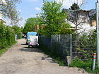
|
| Winter road
( Location ) |
440 | Winter , season | before 1887 | The winter road is interrupted by the circular Hausotterplatz and lies between Reginhardstrasse and Provinzstrasse. A quiet residential street with multi-family houses and a few commercial yards with single-family houses. In the vicinity there are the roads according to the other three seasons, the summer road goes north. |
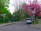
|
| Winterthurstrasse
( Location ) |
210 | Winterthur , political municipality in the canton of Zurich, Switzerland, sixth largest city in the country | Apr 1, 1961 | Before street 400 of the development plan, it was named to match the surrounding streets and is located between Septimerstraße and Gotthardstraße. |

|
| Wittestrasse
( Location ) |
460 (in the district) |
Peter Witte (1822–1902), farmer and politician | before 1897 | The eastern section of the road from the district boundary on Otisstrasse with properties 2-15a and 51-78 (continuous) to Eichborndamm is located in the district and continues to the west in Tegel . Wittestrasse was named between 1889 and 1897 during Peter Witte's lifetime, he is the namesake for the renaming from Dalldorf to Witte nau. When the traffic flow changed in the one-way street train Eichborndamm / Antonienstraße (northern extension of Antonienstraße) Wittestraße remained until Eichborndamm. |

|
|
Zermatt Street
( Location ) |
470 | Zermatt , political municipality in the Visp district of the Swiss canton of Valais, holiday resort | Jan. 23, 1931 | It lies between Baseler Straße over Aroser Allee and Romanshorner Weg as a dead end . |

|
| Zobeltitzstrasse
( Location ) |
1540 | Hanns von Zobeltitz (1853–1918) and Fedor von Zobeltitz (1857–1934), writers | Dec. 1, 1936 | The street lies between Belowstraße and Auguste-Viktoria-Allee, except for the western section parallel between Auguste-Viktoria-Allee and Scharnweberstraße. Wacholderstraße was laid out in the street before 1887, and in 1936 it was renamed Zobeltitzstraße, including the route from Straße 58. In 1945/1946 the name Wacholderstrasse was used again for a short time , but was not officially confirmed. As part of the planned new buildings in the area (Quäkerstraße settlement), the section parallel to the (later built) A 114 , street 407 , was included on October 1, 1963 . |

|
Other locations in Reinickendorf
Allotment colonies
| Surname | Address / location | Size in m² | Number of parcels | status | annotation |
|---|---|---|---|---|---|
| ELW Schönholz 1 | Kühnemannstrasse
( Location ) |
10,657 | 35 | Railroad Agriculture | railway own |
| Allotment garden colony Am Schäfersee | Mudrakzeile / Stargardtstrasse
( Location ) |
8,178 | 25th | Fictitious permanent allotment gardens | national |
| KGA An der Nordbahn | Prospect path
( Location ) |
49,990 | 134 | Permanent allotments | national |
| Allotment gardens of the BVG | Pankower Allee 53–57
( Location ) |
27,090 | ? | Permanent allotments | Private |
| Allotment garden association triangle | Klemkestrasse 101
( Location ) |
5,759 | 16 | Fictitious permanent allotment gardens | national |
| Allotment garden association unit I. | Lindauer Allee
( Location ) |
7,863 | 20th | Permanent allotments | |
| Allotment garden association Unit II | Ollenhauer Strasse 64b
( Location ) |
28,709 | 87 | Fictitious permanent allotment gardens | national |
| KGA recovery | Auguste-Viktoria-Allee 16
( Location ) |
31,203 | 64 | Permanent allotments | national |
| KGA Flora | Roedernallee
( Location ) |
29,218 | 70 | Permanent allotments | national |
| KGA leisure | Roedernallee 38-44
( Location ) |
28,318 | 87 | Permanent allotments | national |
| Garden friends allotment garden association (Seidelstrasse) | Seidelstrasse 5-14
( Location ) |
90,697 | 175 | Temporary allotments | national |
| Garden friends allotment garden association (Otisstraße) | Otisstrasse 14-48
( Location ) |
12,840 | 30th | Permanent allotments | national |
| Allotment garden association Gartenfreunde-Promenade | Auguste-Viktoria-Allee
( Location ) |
5,050 | 14th | temporary permanent use | national |
| Allotment garden association Gartenfreunde-Wackerplatz | Wackerplatz
( Location ) |
46,474 | 100 | provisional permanent use (reserved for sports area) | national |
| KGA Im Peckwisch | Lengeder streets
( Location ) |
1,541 | 5 | Permanent allotments | national |
| KGA zest for life | Roedernallee
( Location ) |
31,655 | 78 | Permanent allotments | national |
| KGA Mariabrunn | Baseler Strasse 42-60
( Location ) |
38,985 | 121 | Temporary allotment gardens The KGA is located on the site of the former ice works to the northwest of the Schäfersee and to the north by Emmentaler, and to the west by Baseler Straße. | Private |
| KGA Müller | Roedernallee
( Location ) |
12,338 | 33 | Permanent allotments | national |
| KGA New Life | Prospect path
( Location ) |
34,617 | 114 | Permanent allotments | national |
| Parkheim allotment garden association | Lindauer Allee 52
( Location ) |
16,322 | 39 | Fictitious permanent allotment gardens | Private |
| Plantersheim allotment garden association | Lindauer Allee
( Location ) |
51,078 | 133 | Fictitious permanent allotment gardens | national |
| KGA Roedernallee | Am Nordgraben 31 / Roedernallee 55
( Location ) |
77,522 | 139 | Permanent allotments | national |
| Schillerring allotment garden association | Baseler Strasse 20-24
( Location ) |
7.170 | 52 | Highly secured allotments | Private |
| Allotment garden association Schillerring (2) | Baseler Strasse 20-24
( Location ) |
8,055 | 33 | Fictitious permanent allotment gardens | national |
| Allotment garden association Schweinkopf | Großkopfstrasse 9–13
( Location ) |
9,531 | 20th | Permanent allotments | national |
| KGA Simmelgarten | Pankower Allee 29
( Location ) |
1,569 | 5 | Fictitious permanent allotment gardens | national |
| Dry village allotment garden association | Roedernallee 18–31
( Location ) |
21,869 | 49 | Permanent allotments | national |
| United Arbor Colonists | Mittelbruchzeile / Werftendenstrasse
( Location ) |
5,076 | 18th | Fictitious permanent allotment gardens | national |
| KGA Vogelhain | Roedernallee 32
( Location ) |
26,000 | 92 | Permanent allotments | Private |
| Free plaice growers' association | Middle fraction line 78
( Location ) |
7,832 | 28 | Permanent allotments | national |
Housing estate and repealed KGA
- Settlement Roedernau ( location ) with plots 1–27 (sideways) is located on a 300-meter-long street (an unnamed dead end) west of Lengeder Strasse and the path of interest . The abolished allotment garden and area dedicated as building land lies between the KGA Vogelhain, Freizeit and Lebensfreude.
Parks and green spaces
- Breitkopfpark ( location ), there is a green area around the Breitkopfbecken in the Paddenpuhl settlement
- Dorfaue Reinickendorf ( location )
- Kienhorstpark ( location )
- Klemkepark ( location )
- Lärchenkamp ( location )
- Schäferseepark ( location )
- Cemeteries and graveyards
- State-owned cemetery Reinickendorf (Humboldtstrasse 74–90, Lage ), a park cemetery on 155,532 m²
- Reinickendorf war cemetery (Am Freiheitsweg, Lage ), park cemetery on 10,087 m², it is the former state-owned cemetery Reinickendorf I.
- Dankeskirchhof (Blankestrasse 12, Lage ), Parkfriedhof on 45,944 m²
- Roman-Catholic cathedral cemetery St. Hedwig III (Ollenhauerstraße 24–28, Lage ), park cemetery on 73,882 m² with architectural monuments
- Evangelical churchyard Dorotheenstadt III (Scharnweberstrasse 2a, Lage ), monument, avenue district cemetery, 27,326 m²
- Ev. Nazarethkirchhof II (Blankestrasse 12, Lage ), 98,086 m², park cemetery
- Roman Catholic St. Sebastian Cemetery (Humboldtstrasse 68–73, location ), park cemetery, monument, 46,741 m²
Traffic and commercial areas
- Commercial areas in Reinickendorf
- Freight station Reinickendorf as a commercial area ( location )
- Freight station Schönholz (unused and closed) ( location )
- Schönholz S-Bahn station (S1 and S25) as part of the Berlin Northern Railway ( location )
- Wilhelmsruh S-Bahn station (S1) as part of the Berlin Northern Railway ( location )
- S-Bahn station Alt-Reinickendorf of the S25 as part of the Kremmener Bahn ( location )
- Eichborndamm S-Bahn station of the S25 as part of the Kremmener Bahn ( location )
- S-Bahn station Karl-Bonhoeffer-Nervenklinik of the S25 in the course of the Kremmener Bahn ( location )
See also
Web links
- Street directory Reinickendorf. Retrieved June 21, 2010 .
- Map of Berlin 1: 5000 with district boundaries. Senate Department for Urban Development Berlin, 2009, accessed on January 11, 2011 .
- Office for Statistics Berlin-Brandenburg: Directory of streets and places in the Reinickendorf district (as of February 2015); pdf
- Hermann Jansen: Zoning plan Berlin-Reinickendorf
Individual evidence
- ↑ FIS Broker Detail Network (regional reference system)
- ↑ a b c d Clarification of the situation on map 1: 5000, produced by the district surveying offices
- ↑ a b c d e f g h i Lette Kolonie in the supplement to the Berlin address book 1893 ( page no longer available , search in web archives ) Info: The link was automatically marked as defective. Please check the link according to the instructions and then remove this notice.
- ↑ a b c d e f g h Situation 1900 . In: Address book for Berlin and its suburbs , 1900, Vororte> Reinickendorf, p. 151.
- ↑ Figure 25 of the "photos-of-the-border troops-of-the-gdr-of-the-berliner-sector border shows a look into Bahnhofstrasse ( Memento of the original from December 8, 2012 in the Internet Archive ) Info: The archive link was automatically inserted and still not checked. Please check the original and archive link according to the instructions and then remove this notice.
- ↑ At the Doggelhof . In: Berliner Adreßbuch , 1933, Part IV. Inhabitants and companies sorted by street> Reinickendorf administrative district> Reinickendorf, p. 2286.
- ^ At the Schäfersee . In: Berliner Adreßbuch , 1930, Part IV. Streets and houses of Berlin> Reinickendorf administrative district> Reinickendorf> Directory of streets with all houses a. Construction sites along with details of the owner, manager, etc. Tenants> M- Z, p. 2239 (Seebad (Ost)).
- ↑ At the booth . In: Berliner Adreßbuch , 1933, Part IV. Inhabitants and companies sorted by street> Administrative district Reinickendorf> Reinickendorf, p. 2309.
- ↑ a b c d e f g h Situation in 1910 . In: Berliner Adreßbuch , 1910, V. Suburbs of Berlin> Reinickendorf, p. 351ff.
- ^ Bieler Strasse . In: Berliner Adreßbuch , 1933, Part IV. Inhabitants and companies sorted by street> Reinickendorf administrative district> Reinickendorf> M- Z, p. 2310 (street 60).
- ↑ Bürgerstrasse . In: Address book for Berlin and its suburbs , 1900, Vororte> Reinickendorf, p. 147ff.
- ↑ a b c d e f g h i j k l m n o p q r map of Berlin and the surrounding area (1922) in 12 sheets VI Berlin.
- ↑ Engelmannweg . In: Berliner Adreßbuch , 1933, Part IV. Inhabitants and companies sorted by street> Reinickendorf administrative district> Reinickendorf, p. 2287.
- ↑ a b on the person of Epenstein
- ↑ to Reinickendorfer Freiheit
- ↑ a b kriegsgraeberstaette / berlin-reinickendorf
- ↑ on the person of General Adalbert von Barby
- ↑ City map of Berlin. Verlag Richard Schwarz: Reinickendorf around 1946 ( page no longer available , search in web archives ) Info: The link was automatically marked as defective. Please check the link according to the instructions and then remove this notice.
- ↑ On the person of Ernst (Gustav Philip) Beuthke, Stolperstein in Quäkerstraße 28 , as well as memorial plaques in Berlin resistance fighters
- ↑ Sheet 4245 from 1942, 1948 ( Memento of the original dated November 16, 2016 in the Internet Archive ) Info: The archive link was inserted automatically and has not yet been checked. Please check the original and archive link according to the instructions and then remove this notice.
- ↑ Sheet 4245 from 1968, 1978 ( Memento of the original dated November 16, 2016 in the Internet Archive ) Info: The archive link was inserted automatically and has not yet been checked. Please check the original and archive link according to the instructions and then remove this notice.
- ^ General-Woyna-Straße FIS-Broker (map of Berlin 1: 5000 (K5 color edition)) of the Senate Department for Urban Development and Environment Berlin
- ↑ General-Woyna-Strasse . In: Berliner Adreßbuch , 1943, Part IV., P. 2527.
- ↑ In the Berlin address books, vacant lots, whose owners are entered in the land register, are referred to as construction sites. Parcel, on the other hand, denotes plots without registration. As soon as construction has been completed, new construction is entered.
- ↑ a b Sheet 4346 from 1942 and 1938, as well as 4342 from 1931 ( Memento of the original from November 16, 2016 in the Internet Archive ) Info: The archive link was inserted automatically and has not yet been checked. Please check the original and archive link according to the instructions and then remove this notice.
- ↑ Pharus city map Berlin large edition: Reinickendorf around 1954 ( page no longer available , search in web archives ) Info: The link was automatically marked as defective. Please check the link according to the instructions and then remove this notice.
- ↑ Sheet 4346 from 1968 ( Memento of the original from November 16, 2016 in the Internet Archive ) Info: The archive link was inserted automatically and has not yet been checked. Please check the original and archive link according to the instructions and then remove this notice.
- ↑ Large Berlin city map. Verlag Richard Schwarz: Reinickendorf around 1961 ( page no longer available , search in web archives ) Info: The link was automatically marked as defective. Please check the link according to the instructions and then remove this notice.
- ↑ a b c 20 green main paths Innerer Parkring
- ↑ Grünrockweg . In: Berliner Adreßbuch , 1933, Part IV. Inhabitants and companies sorted by street> Administrative district Reinickendorf> Reinickendorf, p. 2291.
- ↑ Hasslingerweg . In: Berliner Adreßbuch , 1943, Reinickendorf administrative district> Reinickendorf, p. 2529.
- ↑ a b c d e f g Situation in 1943 . In: Berliner Adreßbuch , 1943, Reinickendorf administrative district> Reinickendorf, p. 2514ff.
- ↑ on the person of Kameke
- ↑ 1954 Pharus city map Berlin large edition, dimensions: 2 sheets of 86 × 100 cm, part of Reinickendorf ( page no longer available , search in web archives ) Info: The link was automatically marked as defective. Please check the link according to the instructions and then remove this notice.
- ↑ Fritz Klemke and the Felseneck Trial
- ↑ Klixstrasse - Berlin-Reinickendorf
- ↑ to the person Kühnemann
- ↑ a b Pharus city map Berlin large edition 1954, Süd-Reinickendorf ( page no longer available , search in web archives ) Info: The link was automatically marked as defective. Please check the link according to the instructions and then remove this notice.
- ^ Meteorstrasse - Berlin-Reinickendorf
- ↑ a b c d 1954 Pharus city map Berlin large edition, Reinickendorf Nord ( page no longer available , search in web archives ) Info: The link was automatically marked as defective. Please check the link according to the instructions and then remove this notice.
- ↑ a b Stadtentwicklung.berlin.de: Description of route 03
- ^ Berliner Kurier: Land under in the bathroom . October 8, 2012
- ↑ Ragazer Strasse . In: Berliner Adreßbuch , 1925, IV. Streets and houses of Groß = Berlin> Reinickendorf administrative district> Reinickendorf, Rosenthal, p. 2058.
- ↑ Ragazer Strasse . In: Berliner Adreßbuch , 1930, Part IV. Streets and houses of Berlin> Reinickendorf administrative district> Reinickendorf> Directory of streets with all houses a. Construction sites along with details of the owner, manager, etc. Tenants> M- Z, p. 2232 (Ragazer Str. (Ost)).
- ↑ Saalmannstrasse . In: Berliner Adreßbuch , 1890, V. Surroundings of Berlin> H. Reinickendorf, p. 99 (Saalmann Scharnweberstrasse 77).
- ↑ Municipal House Stegeweg the Luther parish Reinickendorf
- ↑ Thaterstraße Berlin-Reinickendorf
- ↑ a b Vierwaldstätter Weg . In: Berliner Adreßbuch , 1920, V. Suburbs of Berlin> Berlin = Reinickendorf, p. 268.
- ^ Thyssenstrasse . In: Berliner Adreßbuch , 1912, V. Suburbs of Berlin> Reinickendorf, p. 432.
- ↑ Stadtentwicklung.Berlin.de KleingartenStock_12.pdf ( Memento of the original from September 29, 2013 in the Internet Archive ) Info: The archive link has been inserted automatically and has not yet been checked. Please check the original and archive link according to the instructions and then remove this notice.
- ↑ District Association of Allotment Gardeners Reinickendorf eV
- ↑ a b c d e f Level Vb: Fictitious permanent allotment gardens according to §§ 16 and 20 a BKleingG. The fictitious permanent allotment gardens are additionally protected by being shown in the zoning plan as green areas - allotments
- ↑ a b c d e f g h i j k l m Level Va: allotment garden areas that are defined as permanent allotment gardens by the development plan.
- ↑ a b c d e f Level III: Fictitious permanent allotment gardens which, according to the FNP, are to be used for another purpose.
- ↑ a b Allotment garden areas that are to be retained according to the presentation of the land use plan.
- ↑ Level Ia: Allotment gardens on private areas that are intended for another use according to the representations of the land use plan. A termination is possible at any time in compliance with the allotment garden regulations.
- ↑ Senate List of Friedhoefe.pdf


