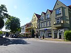
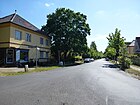
List of streets in Berlin-Rahnsdorf

The list of streets in Berlin-Rahnsdorf describes the street system in the Berlin district of Rahnsdorf with the corresponding historical references. At the same time, this compilation is part of the lists of all Berlin streets and places .
overview
The road system
Rahnsdorf has 9,523 inhabitants (as of December 30, 2019) and includes the postcode area 12589. The 126 streets in the district have a total length of 64.4 kilometers, six streets continue across the district boundary.
The road system is characterized by settlement roads . The development of the locations can be found in the street names, the old fishing village Rahnsdorf with village and mill street , the colony "Rahnsdorfer Mühle", differs from Wilhelmshagen, which was laid out as a colony of Neu-Rahnsdorf , with streets in a star shape around the central ring at the Taborkirche . From 1892 onwards , names related to Wilhelm I , the emperor at the time (and locations of Prussian battlefields) were chosen for the streets. South of Fürstenwalder Allee are the locations of New Venice with paths named after birds between canals, mostly starting from the Rialtoring, as well as the Hessenwinkel adjoining to the east on Dämeritzsee . A settlement was built north of Fürstenwalder Allee up to (today's) Freienbrinker Saum , which preferably has street names according to places and locations in the vicinity (Erkner, Königs Wusterhausen, Grünheide).
Other roads, such as the Hegemeisterweg - named after the officials responsible for forest and hunting protection - remained undeveloped. They lost the status of a settlement road and remained forest roads, but the road sign was retained.
The main street in the district in east-west direction is the street ( L 38) Fürstenwalder Damm / Fürstenwalder Allee. Because of the bridgeless watercourse of the Müggelspree between Dämeritzsee and Großem Müggelsee in the south and the continuous forest area in the north, this is the connection to Köpenick and Friedrichshagen and eastwards to Erkner in the state of Brandenburg. It is complemented by the north-leading road to Fichtenau , which also brings the Lower Silesian-Märkische Bahn via the Rahnsdorf S-Bahn station to the center of Rahnsdorf, while the Wilhelmshagen S-Bahn station connects the eastern locations to the south via Schönblicker Strasse .
District boundaries by streets
The district boundaries of Rahnsdorf coincide in the east with the Berlin city limits. Rahnsdorf borders Müggelheim in the south along the Müggelspree , whereby the Kleine Müggelsee belongs completely to the district. From the headland at Müggelhort (already) on the Köpenick side, the boundary leads northwest to the Großer Müggelsee to the triple boundary point ( location ) with Friedrichshagen and from there to the northeast to the north bank of the Müggelseen, further north through the Berlin urban forest via Fürstenwalder Damm and Schöneicher Landstrasse. The district boundary meets (south of the Münchehofer Heide) the city boundary to Schöneiche and leads eastwards along the edge of the forest again to Schöneicher Landstrasse, then delimits the Alten Fischerweg against the Rahnsdorfer Strasse in Schöneiche and follows southwards Am Alten Fließ the boundary of Fichtenau (Schöneiche reaches in here as a tip) eastwards and again northwards in an angle where the Lübeck, Hamburger and Geschwister-Scholl-Straße between Fichtenau and Grätzwalde run through the district.
The district boundary follows the forest fringes of the Berlin urban forest to the southeast, with Woltersdorf being reached as a neighboring town on the city boundary . North of the NSG Wilhelmshagener-Woltersdorfer Dünenzug to the east to Rahnsdorfer Straße in Woltersdorf, further to a corner of the district with access to Flakensee, which is only accessible through the street width of Woltersdorfer Landstraße, the city limit leads around a corner of Erkner along the edge of the forest to the southwest . The quail is outside in Erkner, its extension to the south, Grenzweg, is in the district. At the railway facility at Erkner station, the border runs to the west for 320 meters north, then south of the railway line. An area strip 30 meters wide and 1300 meters long protrudes into Rahnsdorf. Landjägerallee, which belongs to Erkner, is located here. Further to the south, the Fürstenwalder Allee is crossed and then the north bank of the Dämeritzsee is reached, which is spanned to the southwest to a headland on the opposite bank from the city limits. On the local west bank of the Dämeritzsee along the headland, the district boundary leads to Müggelheim (at the entrance to the Gosener Graben and Canal ) on the south bank of the Old Spree arm and merges into the course of the Müggelspree.
Overview of the streets
The following table gives an overview of the existing streets in the district and some related information.
- Name / location : current name of the street. The street can be displayed on various map services via the Location link . The geoposition indicates the approximate center of the street length.
- Traffic routes not listed in the official street directory are marked with * .
- Former or no longer valid street names are in italics . A separate list may be available for important former streets or historical street names.
-
Length / dimensions in meters:
The length information contained in the overview are rounded overview values that were determined in Google Earth using the local scale. They are used for comparison purposes and, if official values are known, are exchanged and marked separately.
If the street continues into neighboring districts, the addition ' in the district ' indicates how long the street section within the district of this article is. - Name origin : origin or reference of the name.
- Notes : further information on adjacent monuments or institutions, the history of the street and historical names.
- Image : Photo of the street or an adjacent object.
| Name / location | Length / dimensions (in meters) |
Origin of name | Date of designation | Remarks | image |
|---|---|---|---|---|---|
|
Aalstieg
( Location ) |
330 | Eel , edible fish | July 1, 2008 | The road 565 was renamed in 2008 to match the surrounding roads and is located between Hechtstraße and Am Stieggarten. |

|
| Ahornstrasse
( Location ) |
310 | Maple , street tree | around 1890 | Ahornstrasse is located in the Hessenwinkel settlement area south of Lindenstrasse and connects to it on both sides. In 1937 it is listed in the address book between Lindenstrasse and Lutherstrasse again to Lindenstrasse. The right-hand side (even) is almost completely inhabited, on the left-hand side there are parks up to plot number 9, of plots 9-27 (odd) only three are built on and inhabited, the others are construction sites or do not exist. |

|
| Old fishing path
( Location ) |
1450 | Fishermen from Schöneiche used this path to the Müggelsee (a symbolic name in 1967) | May 12, 1967 | Until 1967 the section here was called Rahnsdorfer Straße, the same name as the continuation in the neighboring town. The street with lots 1–5 leads through the forest and is located between the Rahnsdorf S-Bahn station and the city limits of Schöneiche . |

|
| At the sexton garden
( Location ) |
170 | Sexton garden, field name | before 1922 | The road lies between Dorfstraße and the Müggelspree opposite the island of Schilfwall. In 1922, four parcels were already built in the address book, but they are named after the house owners and have not yet been numbered. |

|
| At the mill flow
( Location ) |
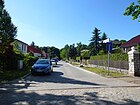
140 | Fredersdorfer Mühlenfließ | July 20, 1938 | The street is a dead end west of Woltersdorfer Weg to the edge of the forest, it was laid out around 1900 as Königin-Luise-Straße . The Rahnsdorfer Mühle ( cutting mill ) was built in 1654 near the confluence of this river in the Müggelsee and existed until the end of the 19th century.
The villa colony created here and the current location were given the name "Rahnsdorfer Mühle". |
|
| On the Schonungsberg
( Location ) |
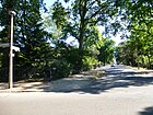
570 | Schonungsberg, here lying elevation with formerly young trees ( Schonung ) | Aug 16, 1928 | Set up as street 5 , it lies between Püttbergeweg and Fürstenwalder Allee. |
|
| At the stair garden
( Location ) |
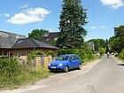
260 | Rose , parcel east of the road | Nov 4, 1935 | It is located between Mühlenweg and Dorfstraße and was road 563 of the development plan in the local area of Rahnsdorfer Mühle. |
|
| At the benches
( Location ) |
630 | The banks , bay between the eastern Müggelsee and Entenwall at an outflow of the Müggelspree | around 1925 | The road lies between Müggelwerder- and Richard-Hörnke-Weg on the Großer Bänkegraben. In 1925 it was still listed as Straße 19 . |

|
|
Bachstelzenweg
( Location ) |
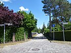
220 | wagtail | around 1958 | The street in New Venice between Canal III and IV is an eastern dead end from the Rialtoring. |
|
| Baldurstrasse
( Location ) |
120 | Baldur , Germanic god of the sun | around 1913 | The street in the south of Hessenwinkel lies between Triglawstrasse and Wodanstrasse . In 1937 the street in the same location as the house on plot 1 (left side) at the corner of Triglawstraße is inhabited, with the exception of a new building, all other plots are designated as construction sites. |

|
| Bauernheideweg
( Location ) |
850 | Bauernheide, shared farm forest on the Püttberge | July 20, 1938 | Laid out as Mittelstrasse in the colony around 1900 , the route lies between Hortwinkeler Weg and Hangelsberger Gang. The peasant forest was divided among interested parties in 1853 by the heather separation axis. The Rahnsdorf fishermen transferred their property to a terrestrial company . |

|
| Beiersdorfer Weg
( Location ) |
470 | Beiersdorf, part of the community of Beiersdorf-Freudenberg in Brandenburg | July 20, 1938 | Around 1900 this street was laid out as Prinz-Friedrich-Straße , was still vacant in 1928 and was renamed in 1938. It is one of the cross streets between Püttbergeweg and Freienbrinker Saum. |

|
| Berghofer Weg
( Location ) |
430 | Berghof, residential area of the community of Rüdersdorf in Brandenburg; Direction of the road | Nov 14, 1935 | Established as road 461 , it lies between Am Schonungsberg and Grünheider Weg. |

|
| Beaver Fur Street
( Location ) |
590 | The beaver fur , drama by Gerhart Hauptmann | Jan. 24, 1938 | The Spreestrasse was laid out with the Hessenwinkel colony. In 1938, the newly named road between Rialtoring and Im Haselwinkel was formed from the part of road 520 running from the canal and the subsequent part of Spreestrasse up to the Hohe Brücke. |

|
| Birkenstrasse
( Location ) |
270 | Birch , deciduous tree | before 1925 | It is located in Hessenwinkel between Biberpelzstrasse and Hubertusstrasse . In 1937 the street was indicated at Hubertus- / Spree- / Fahlenbergstraße. The churchyard is on Spreestrasse, apart from two summer houses, a garden and construction sites, there are eight inhabited houses on the consecutively numbered properties. |

|
| Blossiner Strasse
( Location ) |
440 | Blossin , part of the municipality of Heidesee in Brandenburg | July 20, 1938 | The street was laid out in 1900 as a residential street and is located between Püttbergeweg and Freienbrinker Saum. |

|
| Flowerslake
( Location ) |
300 | Lake | Nov 29, 2005 | The street was called Straße 549 until 2005 and was named at the request of the residents. It lies between Schleiengang and Straße 546. |

|
| Bogenstrasse
( Location ) |
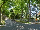
370 | Arch , according to the shape of the street | before 1925 | The street in Hessenwinkel lies between Waldstrasse and Canalstrasse . According to the 1937 address book in the same location, there are 14 single-family houses on the 28 properties in consecutive numbering, as well as two gardens and a summer house. |
|
| Brueckenstrasse
( Location ) |
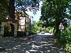
190 | Bridge over the Fredersdorfer Mühlenfließ | before 1922 | The Brückenstraße branches off as a spur road north of the Seestraße, a pedestrian bridge over the Mühlenfließ leads into the Erlenbruch on the Großer Müggelsee. This street with three parcels can be found in the Berlin address book as early as 1922. |
|
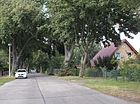
| Buriger way
( Location ) |
440 | Burig, residential area of the community of Gosen-Neu Zittau in Brandenburg | July 20, 1938 | The street was laid out as a park street around 1900 and is located between Freienbrinker Saum and Püttbergeweg. |
|
|
Dämeritzstrasse
( Location ) |
210 | Dämeritzsee | before 1925 | The road lies between the Waldstrasse and the banks of the Dämeritzsee in the locality of Hessenwinkel . According to the 1937 address book in the location across Lindenstrasse, Willers'sche Haus, two gardens, one with a garage and summer houses are listed. The Gesellschaftshaus restaurant belongs to Lindenstrasse 44. |

|
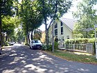
| Path rich in then
( Location ) |
440 | Dannenreich , part of the community Heidesee in Brandenburg | July 20, 1938 | It lies between the Freienbrinker Saum and the Püttbergeweg. The path served as the main street of the settlement built north of Hohenzollernstrasse after 1890 . |
|
| Village street
( Location ) |
780 | Settlement area of the fishing village | handed down | It lies between Mühlenweg and Kruggasse and forms two village green, one at the height of the salmon catch and the second in the actual center of the village with the village church and other listed architectural monuments. From here the Kruggasse continues to the ferry F24 to Berlin-Müggelheim . The residents of Rahnsdorf on the edge of the Müggelsee initially lived exclusively from fishing. For the year 1541 there are 18 fishing spots. | |
| Throttle path
( Location ) |
440 | Thrush , songbird | around 1958 | The Drosselweg is located in New Venice between Canal II and III and is accessible via the Kuckuckssteig. |

|
|
Eichbergstrasse
( Location ) |
640 | Eichberg, elevation northeast of Wilhelmshagen | May 31, 1951 | Laid out as Moltkestrasse in Wilhelmshagen after 1892 , the street between Erknerstrasse and Langfuhrer Allee was renamed after the Second World War.
The parish and parish hall of the Protestant church in Rahnsdorf are located here. |

|
| Oak Street
( Location ) |
160 | Oak , forest tree | around 1900 | The street in Hessenwinkel lies between Waldstrasse and Lindenstrasse. According to the 1937 address book, the street has horseshoe numbering in the same location. At the corner of Lindenstrasse on plots 1–1b there is a residential building, a storage area and the construction business. The ten plots are built on and inhabited (out of 6 a summer house). |

|
| Elsterweg
( Location ) |
320 | Magpie , crow bird | around 1958 | It is located in New Venice south of Canal V, goes east from the Rialtoring and is extended by the Schwanenweg. |

|
| Erknerstrasse
( Location ) |
570 | Erkner , neighboring city in Brandenburg | May 10, 1951 | The street was named after Viktoriastraße , which was established around 1892, including Viktoriaplatz in 1951. |

|
|
Fahlenbergstrasse
( Location ) |
790 | Fahler Berg, field name between Gosener Graben and Gosener Kanal near the former Fahlenberg forestry | Nov 9, 1926 | It is located between Hubertusstrasse and Lasallestrasse in Hessenwinkel. The street was formed in 1926 from Bülowstraße , which was laid out after 1902, and its extension, the Black Way . Here is the Elisabeth Diakonie Senior Center, an institution of the Stephanus Foundation . |

|
| Catcher way
( Location ) |
210 | Catch lock, part of the community Grünheide in Brandenburg, towards the road | Nov 4, 1935 | The path, laid out as road 462 , lies between Püttberge- and Berghofer Weg. |

|
| Fichtenauer Strasse
( Location ) |
340 | Fichtenau, residential area of the neighboring community Schöneiche in Brandenburg | Nov 9, 1926 | Laid out as Straße 8 according to the development plan , it was then referred to as Amtsstraße . The road lies between Püttbergeweg and Mühlenweg. |

|
| Finkenweg
( Location ) |
590 | Finch , passerine bird | after 1958 | It is located in New Venice, east of the Rialtoring, between canals I and II. |

|
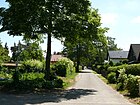
| Trout jump
( Location ) |
200 | Trout , freshwater fish | July 1, 2008 | At the request of the residents, the street 566 was renamed in 2008. It lies between Quappenzeile and Aalstieg. |
|
| Frankenbergstrasse
( Location ) |
540 | Friedrich von Frankenberg (1835–1897), Prussian politician | around 1892 | It is located in Wilhelmshagen, between Hochlandstrasse and Fahlenbergstrasse. Like Moltke, Frankenberg was one of the founders of the "Deutsche Volksbaugesellschaft", whose activities included the construction of the "Neu-Rahnsdorf" colony. |

|
| Fredersdorfer Weg
( Location ) |
170 | Fredersdorf, part of the community Fredersdorf-Vogelsdorf in Brandenburg | Oct 10, 1936 | The street lies between Steinhöfeler and Kolpiner Weg and was set up as Straße 454 and Straße 464 in the development plan . It is located in an area with roads to places in the Brandenburg area. The Catholic Church of the Three Kings is on plot 22 . |

|
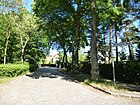
| Freienbrinker hem
( Location ) |
1380 | Freienbrink, part of the community Grünheide in Brandenburg | July 20, 1938 | The road lies between Woltersdorfer and Kalkbergeweg and borders (lines) the settlement between the location “Rahnsdorfer Mühle” (Woltersdorfer Weg) and the Püttberge to the north towards the forest. In 1938 the road 475 and the border road to Freienbrinker Saum were merged. In the area south to Fürstenwalder Allee streets are named after Brandenburg towns in the area. |
|
|
Fürstenwalder Allee
( Location ) |
4150 | Fürstenwalde , city in Brandenburg | Apr 21, 1932 | The connecting road through Friedrichshagen to Fürstenwalde is called Fürstenwalder Allee eastwards from Rahnsdorf from the road to Fichtenau. Until 1932 the name Fürstenwalder Straße and before that Fürstenwalder Chaussee was common. |

|
|
Fürstenwalder Dam
( Location ) |
1450 (in the district) |
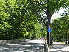
Fürstenwalde , city in Brandenburg | Apr 21, 1932 | The Fürstenwalder Damm lies between the suburbs and the road to Fichtenau and continues westward to Friedrichshagen and Köpenick . The road from Köpenick to Fürstenwalde belonged to Rahnsdorf area before the renaming in 1932 to Fürstenwalder Chaussee , the westward sections were Berliner Straße (Köpenick, around 1870-1958) and Cöpenicker Straße (Friedrichshagen, 1881-1932). The tram line 61 follows this street of Friedrichshagen coming and ends at the stop Rahnsdorf / Waldschänke before the road to Fichtenau. The Müggelsee lido is located here . |
|
| 475
( Location ) |
180 | Number according to the development plan | before 1925 | The narrow path is between Berghofer Weg and Mönchsheimer Straße west of Schonungsberg with lots 1–5 (odd). |

|
| Footpath 552
( Location ) |
160 | Number according to the development plan | before 1925 | The path with parcels 1–16 lies west of the salmon catch and turns into Richard-Hörnke-Weg. |

|
|
Geschwister-Scholl-Strasse
( Location ) |
350 (in the district) |
The Scholl siblings , members of the White Rose, a Munich group that is essentially student-based in the resistance against National Socialism | around 1958 | The Geschwister-Scholl-Straße leads through the forest in the district and connects two localities of Schöneiche. It continues in the east as Rüdersdorfer Straße in Schöneiche. A western branch in Fichtenau to the north to Lübecker Straße leads to the Rahnsdorf area. Stauffenbergstrasse in Fichtenau also ends east on Rahnsdorfer Flur. In the Schöneich district of Fichtenau, this road continues the road to Fichtenau coming from Rahnsdorf. |

|
| Grasehorstweg
( Location ) |
450 | Grasehorst, field name, wooded wall in the Gosener meadows | July 20, 1938 | It lies between the Püttbergeweg and the Freienbrinker Saum. When the Wilhelmshagen colony was created, the traffic route was named Prinz-Albrecht-Straße . |

|
| Grätzwalder Strasse
( Location ) |
370 | Grätzwalde, residential area of the neighboring community Schöneiche in Brandenburg | March 8, 1935 | The asphalt road with green strips on both sides in front of the properties with residential buildings is between Püttbergeweg and Fürstenwalder Allee. |

|
| Grenzbergweg
( Location ) |
390 | Border mountains, Wilhelmshagen elevation in the forest | May 24, 1951 | The street was laid out as Bismarckstraße around 1892 . It lies between Erknerstrasse and Lassallestrasse, over which it continues as a dead end. There is a driveway to the Stephanus Foundation site. |

|
| Grenzweg
( Location ) |
640 | Border between the areas of the Rahnsdorf manor and the fishermen's meadows | after 1930 | The Grenzweg lies between Plutoweg and Müggelspree, west of Canal I. The southern part of the street is roughly identical to the old border between the former Rahnsdorf manor and the farm-free meadows of the Rahnsdorf fishermen and now forms the western border of New Venice. Another border route in the district (north of the Erkner train station) is the unofficial name of the route in extension Am Wachtelschlag in Erkner, where the city boundary changes to the east side of the road before it goes west on the railway line. |

|
| Grünelinder Strasse
( Location ) |
450 | Grünelinde, residential area of the Rüdersdorf community in Brandenburg | May 31, 1951 | In 1902 the traffic route was laid out and named Roonstraße . The street lies between Frankenbergstraße and Fürstenwalder Allee. In 1951 the name was changed and adapted to the already existing street names of Rahnsdorf nearby places. |

|
| Grünheider way
( Location ) |
1310 | Grünheide , municipality in Brandenburg | Apr 10, 1931 | The path, initially laid out as road 470 , lies between Freienbrinker Saum and Fürstenwalder Allee. In 1931 it was incorporated into Düppelstrasse and renamed (to match the surrounding streets after surrounding places). |

|
| Güttlander Strasse
( Location ) |
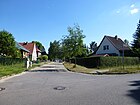
330 | Güttland, place in West Prussia , since 1945 Koźliny in Poland | Sep 9 1931 | The concrete road set up as road 503 with sidewalks on both sides with lawn and (partly) trees lies between Hochlandstrasse and Schönblicker Strasse, on the central square of this main road. |
|
|
Hamburger Street
( Location ) |
600 (in the district) |
Hamburg , city in Northern Germany | 1996 | Hamburger Straße leads through forest in the district without residential property (Berliner Forsten, Jagen 239 and 242). It connects Hamburger Straße in the Schöneich locality of Fichtenau and the forest road in the locality of Grätzwalde von Schöneiche. |

|
| Hangelsberger Gang
( Location ) |
410 | Hangelsberg , part of the community Grünheide in Brandenburg | May 11, 1938 | It lies between Freienbrinker Saum and Püttbergeweg and was laid out around 1900 as Königgrätzer Straße . |

|
| Hechtstrasse
( Location ) |
610 | Pike , freshwater fish | Feb. 18, 1927 | The road 13a of the development plan was named to match the fishing village. It lies between Mühlenweg and An den Bänken, over which it continues as a dead end. |

|
| Heidelandstrasse
( Location ) |
520 | Farmers heath : jointly farmed wooded area of Rahnsdorf farmers | March 8, 1935 | The Heidelandstraße was laid out as Straße 458 according to the development plan . It runs between Fürstenwalder Allee and Püttbergeweg. There is an entrance to the Rahnsdorf cemetery at it . |

|
| Herzfelder Steig
( Location ) |
630 | Herzfelde , part of the municipality of Rüdersdorf in Brandenburg | Apr 10, 1931 | The path was laid on the planned street of street 473 and footpath 473a . It goes south from the Kalkbergeweg and at an arch to the west reaches the Kalkbergeweg in the south, which runs at an angle. |

|
| Highland road
( Location ) |
1200 | Püttberge , a range of hills around 50 meters high | May 24, 1951 | It lies between Erknerstrasse and Fürstenwalder Allee and was created with the Wilhelmshagen colony around 1900, which borders it to the west of the Püttberge. Until 1951 it was called Kaiserstraße . |

|
| Hohenberger Steig
( Location ) |
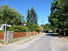
330 | Hohenberge, residential area of the neighboring community Schöneiche in Brandenburg | Apr 10, 1931 | Formed from road 476 and footpath 476a , the path lies between the Kalkberge- and Waldweg. |
|
| Hohenbinder Steig
( Location ) |
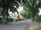
420 | Hohenbinde, residential area of the city of Erkner in Brandenburg | July 20, 1938 | It lies between Freienbrinker Saum and Püttbergeweg and was laid out around 1900 as Kaiser-Wilhelm-Straße . |
|
| Hortwinkeler Weg
( Location ) |
430 | Hortwinkel, residential area of the Rüdersdorf community in Brandenburg | Jan. 24, 1938 | It lies between Freienbrinker Saum and Püttbergeweg and was laid out around 1900 in the settlement north of Fürstenwalder Allee as Kaiser-Friedrich-Straße . |

|
| Hubertusstrasse
( Location ) |
220 | Hubertus von Lüttich (around 656–727), patron saint of hunting | around 1910 | It lies between the forest / oak and birch roads. In Hessenwinkel it was laid out as a forest road , but renamed in the neighboring colony because of the road of the same name. |

|
| In the Haselwinkel
( Location ) |
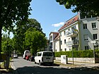
450 | Field name Hasselwinkel, which also gave Hessenwinkel its name | Jan. 24, 1938 | The street in the locality of Hessenwinkel runs between Biberpelzstrasse and Kanalstrasse . It was created in 1938 from the combination of the chestnut , island and part of the Spreestrasse from the "High Bridge". |
|
|
In the corner
( Location ) |
120 | location | around 1935 | The unpaved road lies between Biberpelzstraße and Lagunenweg and opens up (approximately) 75 ° -angled west-south-facing properties on Canal I of the New Venice. |

|
| Ingeborg-Hunzinger-Strasse
( Location ) |
1120 | Ingeborg Hunzinger (1915–2009), sculptor with a studio in Rahnsdorf | 19th July 2015 | The newly named road runs between Fürstenwalder Damm and the S-Bahn station and was a section of the road to Fichtenau until 2015 . In order to increase the number of streets named after women, the Treptow-Köpenick District Office decided to rename a section of this street. The dedication took place with the decision no. 363/15 of the district office passed on April 21, 2015. The naming refers to the 100th birthday of the artist, but is carried out on the occasion of the 6th anniversary of her death.
At the southern end of the street, tram line 61 from Friedrichshagen along Fürstenwalder Damm reaches the final stop Rahnsdorf / Waldschänke. |

|
| Island road
( Location ) |
40 | island | after 1990 | The Inselstraße leads as a cul-de-sac from Im Haselwinkel to the banks of the Müggelspree. No properties are assigned to the street. The name of the street refers to the island that was created in the southern part of the "Kolonie Hessenwinkel" through the straightening of the Spree in 1879. For 1937 Inselstraße is listed in the address book as undeveloped with the connection to Kastanienstraße . In the length parallel to the bank of the Müggelspree, the route was integrated into Im Haselwinkel in 1938 and the name deleted. Inselstraße in Hessenwinkel is not listed in the 1939 street directory. The short road leading to the shore was resumed under the name Inselstraße. It is mentioned in the Berlin street directory under 09104 in the location Hessenwinkel (Rahnsdorf / 0912) and is between Im Haselwinkel 36 and 38 opposite 37. |

|
|
Kageler way
( Location ) |
300 | Kagel , part of the community Grünheide in Brandenburg | Apr 10, 1931 | On the route from road 477 and footpath 477a , the path that lies between Püttberge- and Kalkbergeweg was laid out. |

|
| Kalkbergeweg
( Location ) |
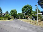
1040 | Kalkberge , former part of the municipality of Rüdersdorf in Brandenburg | Apr 10, 1931 | It lies between Grünheider and Waldweg, beyond the latter as a dead end. The street was laid out as Sedanstraße after 1900 . In 1931 this was combined with the streets 471, 472 and received the current name. |
|
| Canal Street
( Location ) |
550 | The canal , a branch of the Spree since 1879 | before 1925 | The street lies between Lindenstrasse and the canal, which was created as an artificial arm of the Spree when the Müggelspree was straightened in 1879. |

|
| Kirchstrasse
( Location ) |
240 | Tabor Church in Wilhelmshagen | before 1925 | It is located between Schönblicker and Fahlenbergstrasse, east of the church that was consecrated in 1911. |

|
| Kolpiner way
( Location ) |
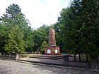
130 | Kolpin, part of the municipality of Reichenwalde in Brandenburg | July 10, 1964 | It lies between Fredersdorfer Weg and Mönchsheimer Straße. When naming the streets 465 , 468 and 469 of the development plan were combined and the path created. At the northern end of this path, on an artificial hill, stands the war memorial for the people who died from Rahnsdorf in the two world wars. The monument was newly renovated in the 21st century (picture below). |

|
| Kruggasse
( Location ) |
50 | Dorfkrug , present in the fishing village of Rahnsdorf since 1550 | before 1930 | The lane goes to the southeast from Dorfstraße to Müggelspree with the ferry dock for the F 23 and the rowing ferry F 24. | |
| Cuckoo path
( Location ) |
280 | Cuckoo , bird family | around 1964 | It lies between Fürstenwalder Allee and Drosselweg and opens up to New Venice via canals I and II. |

|
| Küsterwiesen *
( Location ) |
65 | Küster and Wiese, probably - like the street Am Küstergarten - after the traditional field name | around 1964 | The traffic route, not included in the official street list, is a dead end and forms the southwestern continuation of the Paul-Rahn-Weg. At the same time, it is a cross street from An den Bänken. From here, a footpath leads over the Großer Bänkegraben to the Küsterwiesen holiday complex. | |
| Short street
( Location ) |
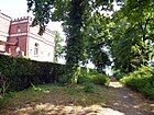
50 | short length of road | around 1927 | The footpath is to the east of Kanalstrasse up to the Dämeritzsee. |
|
|
Salmon fishing
( Location ) |
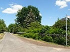
310 | Salmon , edible fish | July 1, 2008 | On request, the residents was street 564 2008 named, it is between Quappenzeile and village street. The name refers to the fishing of the Rahnsdorfer in the Müggelsee. |
|
| Lagoon path
( Location ) |
650 | Lagoon , location-based on the canal situation of New Venice | Apr 20, 1948 | Between Fürstenwalder Allee and Biberpelzstraße, the street opens up the eastern access to the New Venice settlement , whereby the connection to the lagoon in Venice is also underlined by the Rialtoring in the west. |

|
| Long-choice way
( Location ) |
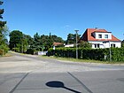
180 | Langewahl , municipality in Brandenburg | July 10, 1964 | The path, first road 486 , lies between Grünheider Weg and the edge of the Püttberge forest. |
|
| Langfuhrer Allee
( Location ) |
330 | Langfuhr , part of Danzig in West Prussia , since 1945 from Gdańsk in Poland | Sep 9 1931 | Established as Straße 500 , it was named in 1931 and is located between Hochlandstraße and Schönblicker Straße, on the central square with the Taborkirche. |

|
| Lassallestrasse
( Location ) |
730 | Ferdinand Lassalle (1825–1864), politician and publicist | May 31, 1951 | It lies between the Hochlandstrasse and Forstmeisterweg on the edge of the forest and was laid out in the Neu-Rahnsdorf colony (Wilhelmshagen) as Pleßstrasse . Clara Müller-Jahnke died in 1905 in house number 67, which was built in 1903 . |

|
| Lerchenweg
( Location ) |
230 | Lark , songbird | around 1964 | It is located between Elsterweg and Schwanenweg in New Venice. |

|
| Lindenstrasse
( Location ) |
1240 | Linden , deciduous tree | around 1890 | The street in Hessenwinkel lies between Eichenstrasse and beyond Ahornstrasse through the former barracks area. In the 2000s it was extended to Fürstenwalder Allee. Two buildings on this street (numbers 20 and 21) are listed monuments. |

|
| Lutherstrasse
( Location ) |
450 | Martin Luther (1483–1546), reformer | before 1920 | The street in Hessenwinkel connects the Fürstenwalder Allee with the Müggelspree. |

|
| Luebecker Strasse
( Location ) |
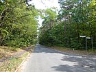
200 | Lübeck , city in Schleswig-Holstein | before 1993 | The Lübecker Straße leads through forest in the district and connects two localities of Schöneiche. |
|
|
Mariannensteig
( Location ) |
120 | Marianne , female name | around 1964 | The walk 532 was named 1964th It goes from the Finkenweg to the east and leads via Canal I as a footpath to the Lagunenweg. |

|
| Mönchsheimer Strasse
( Location ) |
740 | Mönchsheim, residential area of the municipality of Hoppegarten in Brandenburg | March 8, 1935 | The paved road in the western area has sidewalks, in the eastern section only the road is paved, there are no sidewalks. It emerged from Straße 457 , Straße 463 and 463-2b, which were laid out in 1910 . The traffic route is between Fichtenauer Straße and Berghofer Weg. |

|
| Müggelspreeweg
( Location ) |
400 | Müggelspree , waters on the southern boundary of the district | July 23, 2001 | The Müggelspreeweg, a paved residential road in Wilhelmshagen, lies between Lagunenweg and Wolfgang-Steinitz-Straße in Hessenwinkel; they are built on with settlement houses on both sides. The eastern houses built in the 2010s were connected by short access roads. |

|
| Müggelwerderweg
( Location ) |
580 | Müggelwerder , island in the bay The banks of the Great Müggelsee | before 1925 | The path is between Mühlenweg and Die Bänke, where the departure point for the F 23 ferry line to Müggelhort and Müggelheim and the F 24 rowing ferry is located. |

|
| Mühlenweg
( Location ) |
970 | Mill at Fredersdorfer Mühlenfließ | 17th century | The Mühlenweg lies between Seestrasse / Fürstenwalder Allee and Dorfstrasse, parallel to the avenue. The Rahnsdorfer Mühle was a cutting mill that existed between 1654 and the end of the 19th century near the confluence of the river in the Müggelsee . The millstones of the mill building have been preserved and placed under monument protection. |

|
|
Nickelswalder Strasse
( Location ) |
310 | Nickelswalde, a place in West Prussia at the mouth of the Vistula , since 1945 Mikoszewo in Poland | Aug 9, 1929 | The street 506 was named in 1929 after the neighborhood of Gdansk . It runs across the square at the Taborkirche to Güttlander Straße across from Schönblicker Straße and Fürstenwalder Allee. |

|
|
Paul-Rahn-Weg
( Location ) |
380 | Paul Rahn (1934–2002), ferryman and Rahnsdorfer original | 2010 | Until 2010 the path was called Straße 13a . It goes south from the Aalstieg and leads along the Großer Bänkegraben to the Müggelspree. |

|
| Petershagener way
( Location ) |
470 | Petershagen, part of the community Petershagen / Eggersdorf in Brandenburg | July 20, 1938 | It lies between Freienbrinker Saum and Püttbergeweg and was laid out around 1900 as Kronprinzenstrasse . Surrounding streets and paths are now also named after places in the vicinity. |

|
| Pluto path
( Location ) |
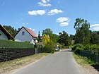
800 | Pluto , Greek god of the underworld | Apr 20, 1948 | It lies between Mühlenweg and Rialtoring and was previously named Straße 528 according to the development plan . |
|
| Püttbergeweg
( Location ) |
1760 | Püttberge , hills between Rahnsdorf and Wilhelmshagen | July 20, 1938 | The path runs from the Fürstenwalder Allee / Seestraße intersection straight eastwards towards the chain of hills that gives it its name. Up to Herzfelder Straße it is a road that can be used by motor vehicles, beyond that it is only a pedestrian and cycle path. It ends at Kageler Weg or the forest path. With the Wilhelmshagen colony laid out as Hohenzollernstrasse , the renaming of the same street names several times since the formation of the Greater Berlin community took place in 1938 .
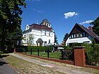
Worth mentioning is the church building 'Wichernraum', which houses the Protestant kindergarten “Noah's Ark” (lower picture). |

|
|
Tadpole row
( Location ) |
280 | Burbot , freshwater fish | Aug 1, 2008 | The road 562 was renamed at the request of residents in 2008, the line is east of Hechtstraße and trout jumping and salmon catching go south from it. |

|
|
Rhedaer way
( Location ) |
150 | Rheda , town in West Prussia , since 1945 Reda in Poland | Apr 10, 1931 | It is located between Nickelswalder and Grünelinder Strasse in Wilhelmshagen and was previously called Strasse 505 . |

|
| Rialtoring
( Location ) |
1250 | Rialto , urban area of Venice in Italy, best known for the Rialto Bridge | Apr 20, 1948 | According to the development plan laid out as road 520 and 526 , it was combined and named in 1948. The ring runs in an L-shape between Fürstenwalder Allee and Lagunenweg.
In 1926 a meadow area of the Rahnsdorf estate was drained by canals and a water sports colony was founded. This was named New Venice . Like the residential district, the street name refers to the Italian city and its famous building, the Rialto Bridge. |

|
| Richard Hilliges Way
( Location ) |
160 | Richard Hilliges (1889–1970), ferryman in Rahnsdorf | Dec 20, 2010 | In 2010 the renaming of the road 567a took place . The Hilliges-Weg lies between Aalstieg and Richard-Hörnke-Weg. Hilliges set up the ferry service between the center of Rahnsdorf and the Müggelheimer Wiesen with a rowing ferry around 1911 and ran it himself until 1942, then until 1945 together with his wife in the family business. |

|
| Richard-Hörnke-Weg
( Location ) |
390 | Richard Hörnke, (1900–1985), ferryman in Rahnsdorf | Dec 20, 2010 | Part of footpath 552 was named in 2010. The Hörnke-Weg lies between An den Bänken and Salmonfang. The section going north kept the previous name. After Richard Hilliges, Hörnke was the ferryman to Müggelheim and Müggelhort. |

|
| Rotkehlchenweg
( Location ) |
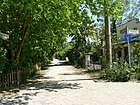
280 | European robin , songbird | around 1958 | It is located in New Venice as a dead end street east of the Rialtoring between Canal IV and V. |
|
|
Saarower way
( Location ) |
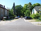
280 | Bad Saarow , municipality in Brandenburg | June 10, 1964 | It comprises parcels 2–51 and is the eastern continuation of Grünheider Weg, going down to the edge of the Püttberge forest. According to the development plan, it was first called Straße 487 . The "Wilhelm-Fahle-Sportstadion" is located on Saarower Weg. Across from house 51 is a granite boulder in memory of the poet Clara Müller-Jahnke . (Image)
The Protestant cemetery Rahnsdorf stretches along this path (plot 51). |
|
| Schettkatstrasse
( Location ) |
210 | Albert Schettkat (1902–1945), politician, resistance fighter against the Nazi regime | May 31, 1951 | The first name was Stolbergstrasse (1902–1951). It lies between Hochland- / Lassalle- and Erknerstraße. |

|
| Schleiengang
( Location ) |
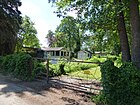
480 | Tench , carp fish | May 31, 1951 | Until 2008 it had the official name Straße 538 , it lies between Plutoweg and as a dead end street beyond Blumeslake. |
|
|
Schönblicker Strasse
( Location ) |
550 + 320 | Schönblick, living space of the neighboring community Woltersdorf in Brandenburg | May 10, 1951 | Created in 1892 as Wilhelmstrasse and north-south axis in the Wilhelmshagen settlement, it was renamed in 1951. It still forms the main and commercial street between Erknerstrasse and Fürstenwalder Allee. It runs from Berlin-Wilhelmshagen train station to Fürstenwalder Allee. In the middle of the intersection with Langfuhrer Straße (formerly Wilhelmplatz ) is the Protestant Tabor Church . |

|
| Schöneicher country road
( Location ) |
800 (in the district) |
Schöneiche , neighboring community in Brandenburg | around 1919 | The street continues in Friedrichshagen under the same street name in Berlin. It leads through the forest to the city limits of Schöneiche, where it has a different name. |

|
| Gentle walk
( Location ) |
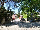
100 | Schonungsberg, neighboring elevation | May 17, 1930 | It is located between Fredersdorfer and Grünheider Weg, created from road 468 of the development plan and the adjacent footpath. Fredersdorf is connected via a staircase. |
|
| Schwanenweg
( Location ) |
220 | Swan , duck bird | around 1964 | It lies parallel to Canal I between Rialtoring and Elsterweg in New Venice . |

|
| Seestrasse
( Location ) |
730 | Müggelsee , direction of the road | around 1895 | The street lies between Fürstenwalder Allee and Wiesenstraße, over which it leads as a dead end to the Müggelsee and as a path to the Müggelwerder island. |

|
| Silk bee path
( Location ) |
160 | Silk bees , genus of bees | Oct. 1, 2009 | The Seidenbienenweg with its properties 2–14 (straight) was called Straße 523 until 2009 . It is located (not a continuous route) between Birkenstrasse and Wolfgang-Steinitz-Strasse. |

|
| Springeberger way
( Location ) |
180 | Springeberg, residential area of the neighboring community Woltersdorf in Brandenburg | July 20, 1938 | The path is between Püttberge- and Woltersdorfer Weg. It was laid out around 1900 and was named Adalbertstrasse . There are two copper houses on lots 8 and 10 (listed monuments) |

|
| Steinfurther way
( Location ) |
110 | Steinfurt, part of the municipality of Gosen-Neu Zittau in Brandenburg | July 20, 1938 | It lies between the Waldschützpfad and Buriger Weg. It is the eastern part of Mittelstrasse , which was laid out in 1900 and was planned along the middle of the colonial area, but a section to the east was built over. At the corner with the Waldschützpfad there is a newly renovated two-storey house with the year 1912. However, it is not listed as a monument. |

|
| Steinhöfeler Weg
( Location ) |
230 | Steinhöfel , municipality in Brandenburg | Nov 4, 1935 | It lies between Fredersdorfer Weg and Mönchsheimer Straße, over which it continues as a dead end to the north. In 1935 it was merged from Straße 469 and Straße 460a . |

|
| Street 5d
( Location ) |
140 | numbered according to the development plan | before 1920 | This unofficial name extends the Fredersdorfer Weg from the Kolpiner to the Grünheider Weg and opens up adjacent background pieces. The street name is noted in the address book from 1922 as a cross street. | |
| Street 545
( Location ) |
170 | numbered according to the development plan | before 1925 | Plots 6-10 on the east side and the allotment gardens to the west are accessed through the road north of the Blumeslake . |

|
| Street 546
( Location ) |
180 | numbered according to the development plan | before 1925 | The street at the western end of the Blumeslake opens up newly created properties in the area of the former allotment garden on the branch canal or the oxbow lake, called the northern branch of the Müggelspree |

|
| Road 567
( Location ) |
160 | numbered according to the development plan | before 1925 | The street with lots 1–5 and 15 only leads as a back street through the previous allotment garden between Aalstieg and Richard-Hörnke-Weg. |

|
| Street 574
( Location ) |
310 | numbered according to the development plan | before 1925 | Road 574 is east of Dorfstraße in the direction of Schleiengang, but ends at property 1 across the street. |

|
| Road to Fichtenau
( Location ) |
840 | Fichtenau, residential area of the neighboring community Schöneiche in Brandenburg | after 1930 | The road leads from the Rahnsdorf S-Bahn station northeast to the city limits to Fichtenau, where it turns into Geschwister-Scholl-Straße. Tram line 87 runs parallel to a section of the street from Rahnsdorf S-Bahn station to Woltersdorf. The southern section of the street was named Ingeborg-Hunziger-Straße in 2015 . Plots 1 and 3 belong to the road to Fichtenau. They are located north of the railway line ( S-Bahn station Rahnsdorf ) in the northeast corner and with the Alten Fischerweg 4 there is the Rahnsdorf district forester. |

|
|
Triglawstrasse
( Location ) |
410 | Triglaw , in Slavic mythology the highest deity over heaven, earth and underworld | around 1912 | The road between Im Haselwinkel and Wodanstraße forms the access to the island in the south of Hessenwinkel via the Triglawbrücke , which was created when the Spree Canal was created by straightening in 1879. A Slavic sacrificial and oracle site with the image of this three-headed god Triglaw is said to have been located on the Müggelberge. |

|
|
Ukelei path
( Location ) |
170 | Bleak , carp fish | Sep 9 1931 | The street 554 between Fürstenwalder Allee and Mühlenweg was named in 1931. |

|
|
Vogelsdorfer Steig
( Location ) |
450 | Part of the community of Fredersdorf-Vogelsdorf in Brandenburg | July 20, 1938 | The path between Püttbergeweg and Freienbrinker Saum was planned and laid out as Prinz-Heinrich-Straße as early as 1900 in the colony west of Neu-Rahnsdorf , but was still undeveloped when it was renamed in 1938. |

|
|
Waldschützpfad
( Location ) |
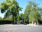
400 | Waldschütz, poetic for hunters | July 20, 1938 | The road, set up around 1900 with the "Rahnsdorfer Mühle Colony", was already a forest road here before . It runs between the Püttbergeweg and the Freienbrinker Saum.
Some older, well-renovated houses have been preserved in this street, including a half-timbered house , but they are not architectural monuments. |
|
| Forest road
( Location ) |
1030 | running at the edge of the forest | before 1925 | The street lies between Lutherstraße and Im Haselwinkel in Hessenwinkel. The development with the plots 1-42 (continuous) is on the lake side, the northern side of the road stretches along the forest. The forest chapel of the Protestant parish Rahnsdorf is located here. |

|
| Forest path
( Location ) |
260 | Forest area of the northern part of the Püttberge | before 1930 | The path in the eastern part of the settlement here lies between the Kalkberge and Püttbergewegs. The only built-up property number 14 is on the west side, on the other side of the street is the forest. |

|
| Weichselmünder Weg
( Location ) |
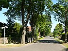
350 | Weichselmünde , place and fortress in West Prussia , since 1945 Gdańsk-Wisłoujście in Poland | Aug 9, 1929 | This cross street, previously street 507 of the development plan, in the south of Wilhelmshagen, lies between Schönblicker and Grünelinder Straße. |
|
| Wiebelskircher way
( Location ) |
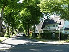
600 | Wiebelskirchen , district of Neunkirchen in Saarland | July 5, 1935 | The street is located in the Wilhelmshagen settlement area between Schettkatstraße and Grenzbergeweg. The name of Dernburgstrasse , which was laid out in 1892, took place when the Saar area was connected in 1935 . |
|
| Meadow road
( Location ) |
470 | Wedge meadow , formerly a local parcel | before 1925 | The eight-meter-wide street mostly has grass verges on both sides and is located between Seestraße and Hechtstraße in the local area of “Rahnsdorfer Mühle”. |

|
| Wodanstrasse
( Location ) |
330 | Wodan , main god of Norse mythology | around 1912 | The street in the east of the Hessenwinkler Südinsel lies between Baldurstrasse and Triglawstrasse and, as a dead end, opens up the properties on the banks of Dämeritzsee. The name of the Germanic Wodan complements Triglaw, the main Slavic god. |

|
| Wolfgang-Steinitz-Strasse
( Location ) |
400 | Wolfgang Steinitz (1905–1967), linguist and folklorist | March 1, 2007 | The street 522 got its name in 2007. It is located in Hessenwinkel between Biberpelzstrasse and Fahlenbergstrasse. |

|
| Woltersdorfer Landstrasse
( Location ) |
710 (in the district) |
Woltersdorf , neighboring municipality in Brandenburg | handed down | This street is located in the district from the city limits to Woltersdorf in the north and leads at Jagen 205 with 520 meters at the city limits to Woltersdorf to the east on the east side of the street. 150 meters to the south, the city limit to Erkner joins on the west side at a length of 550 meters. Thus, only the road itself provides access to a Rahnsdorf forest on Flakensee. The street of the same name continues to the south in Erkner. |

|
| Woltersdorfer Weg
( Location ) |
440 | Woltersdorf , neighboring municipality in Brandenburg | around 1925 | It is between Fürstenwalder Allee and Freienbrinker Saum. The road was in 1900 as Bahnhofstrasse set up because on the Hegemeisterweg the Berlin-Rahnsdorf station is reachable. The latter remained in the condition of a forest path. |

|
|
Zeesener Weg
( Location ) |
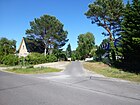
300 | Zeesen , part of the city of Königs Wusterhausen in Brandenburg | July 10, 1964 | The Zeesener Weg is a narrow residential street with an asphalt surface, but unpaved edge strips without road drainage and goes east from Grünheider Weg. It leads as a driveway to the edge of the forest on the Püttberge and turns into a forest path . |
|
Former and planned streets
In the 1922 address book, in addition to the streets contained in the following overview, other traffic routes and two places with their plan numbers are listed. The streets of Rahnsdorf and Wilhelmshagen are in separate chapters:
1a, 2, 4, 5, 5b, 6, 7, 8, 8a, 8b, 9a, 10b, 11, 13b, 16, 17, 19, 20, 21, 23, 27, 29, 29a, 31, 34, 35, 36, 37, 38, 39, 41, 42, 43 as well as places C and II .
| Original name | from | to | renamed | annotation |
|---|---|---|---|---|
| Adalbertstrasse | after 1900 | July 20, 1938 | → Springeberger Weg | Adalbert (1811–1873), Prince of Prussia, Inspector General of the Prussian Navy, noted in 1922 between Hohenzollernstrasse and Woltersdorfer Weg. |
| Amtsstrasse | around 1913 | Nov 9, 1926 | → Fichtenauer Strasse | In 1922 it was specified between Fürstenwalder Straße, Hohenzollernstraße and Straße 9a as Straße 8 according to the development plan . The local office of the municipality of Rahnsdorf was located at the intersection with Fürstenwalder Straße (Chaussee). |
|
Bahnhofstrasse At the train station |
around 1900 | around 1925 | → Woltersdorfer Weg | Today's Woltersdorfer Weg continued through the Hegemeisterweg led to the Rahnsdorf train station. The Lower Silesian-Märkische Eisenbahn set up a stop near the Fredersdorfer Fließ in 1879. The station building was inaugurated in 1901 and suburban traffic to Erkner began on May 1, 1902. The course of Am Bahnhof was given in 1922 between Rahnsdorf, over the path to the outdoor pool, the Hegemeisterweg, the Berlin suburban railway, the path to Fichtenau to the Fichtenau district. |
| Bismarckstrasse | around 1892 | May 24, 1951 | → Grenzbergweg | Bismarck , Chancellor until 1890 |
| Bülowstrasse | around 1902 | Nov 9, 1926 | → Fahlenbergstrasse |
Bernhard Ernst von Bülow (1815–1879), State Secretary in the Foreign Office At first it was Straße 13 . In 1926 she was included in the Black Path . |
| Dernburgstrasse | around 1892 | July 5, 1935 | → Wiebelskircher Weg |
Bernhard Dernburg (1865–1937), politician and banker. The renaming took place after the success of the referendum on the connection of the Saar area in 1935. |
| The duck wall | before 1922 | ? | designated as a separate green area. | Ducks . According to the address book entry from 1922, this path was between Die Bänke and Kleinem Müggelsee and was undeveloped. |
| Dr.-Wilhelm-Külz-Strasse | before 1989 | before 1993 | → Lübecker Strasse | Wilhelm Külz (1875–1948), politician (DDP, LDP), 1945 to 1948 chairman of the LDP. |
| Düppelstrasse | around 1900 | Apr 10, 1931 | → Grünheider Weg | It connects the Grenzstrasse with the former Hohenzollernstrasse . It was named around 1900 after Düppel (today Dybbøl, Denmark), the location of the Düppeler Schanzen in the German-Danish War of 1864. |
| Forest Road (2) | before 1900 | July 20, 1938 | → Waldschützpfad | The road was created with the layout of the "Colony Rahnsdorfer Mühle" and was named because of the direction towards the former royal forest . The renaming took place in 1938 to reduce streets of the same name in the merger to Greater Berlin . In 1922 the route between Hohenzollern , Mittelstrasse and Grenzstrasse is given. |
| Forest Road (1) | handed down | around 1910 | → Hubertusstrasse | The road was created with the layout of the "Kolonie Hessenwinkel" and lay next to the forest road along the forest . It was renamed in 1910 because of the road of the same name in the neighboring villa colony. |
| Fürstenwalder Strasse | 19th century | Apr 21, 1932 | → Fürstenwalder Allee → Fürstenwalder Damm |
The 1922 address book shows the course of Fürstenwalder Straße between the Chaussee to Friedrichshagen and the Wilhelmshagen district, back to the way to the Rahnsdorf train station . Some of the side streets still have their plan numbers such as 8a, 7, 6, 5, 5b and 4 . When it was renamed, it was divided into Allee and Chaussee . |
| Border road | around 1900 | July 20, 1938 | → Freienbrinker hem | The street formed the northern boundary of the development of the settlement area created after 1890 north of the Hohenzollernstraße towards the Berlin urban forest. With the extension to road 475 , the term (forest) hem was chosen when it was renamed to Freienbrinker Saum. |
| Main road | around 1900 | July 20, 1938 | → Path rich in then | The name of the street refers to its central location (i.e. main street) in the settlement area north of Hohenzollernstraße created after 1890 . In 1938 street names that existed several times in Greater Berlin were cleared. |
| Hegemeisterweg | around 1900 | July 20, 1938 | → Hiking trail through the forest | An official responsible for forest and hunting protection was designated as the guardian, which roughly corresponds to a today's forester . In 1922, the Hegemeisterweg was named as an undeveloped road between Grenzstraße and Rahnsdorf station. In 1943, the "Waldklause restaurant" (belonging to the train station) on the street was the only development. The local end point is on the Waldschützpfad / Freienbrinker Saum. Currently (as of 2014) the Hegemeisterweg has the status of a hiking trail through the Berlin Forest, the name is not officially registered. |
| Hohenzollernstrasse | around 1900 | July 20, 1938 | → Püttbergeweg | Hohenzollern , German ruling family, especially (around 1900) of the imperial family (Brandenburg-Prussian line). Since the formation of Greater Berlin , there have been several streets with the same name in the city of Berlin, which were renamed in 1938. |
| Island road | after 1890 | Jan. 24, 1938 | deleted → In Haselwinkel |
The straightening of the Spree in 1879 led to the creation of an island in the southern part of the Hessenwinkel colony, which gave the street its name. The street name was deleted in 1938, and the adjacent properties were included in the numbering of the street Im Haselwinkel. |
| Kaiser-Friedrich-Strasse | around 1900 | Jan. 24, 1938 | → Hortwinkeler Weg | Friedrich III. (1831–1888), King of Prussia, "99-day emperor" |
| Kaiserstrasse | after 1905 | May 24, 1951 | → Highland road | At the time the road was built in the 'Wilhelms'hagen colony, Wilhelm II was German Emperor. In 1951, street names were renamed after previous rulers. |
| Kaiser-Wilhelm-Strasse | around 1900 | July 20, 1938 | → Hohenbinder Steig | Wilhelm I (1797–1888), King of Prussia, German Emperor. The street in Wilhelmshagen was renamed to Greater Berlin because of the multiple existing names of the same name . |
| Kastanienstraße | around 1890 | Jan. 24, 1938 | deleted → In Haselwinkel |
Chestnut , beech family. The street name was deleted in 1938, and the adjacent properties were included in the numbering of the street Im Haselwinkel. |
| Königgrätzer Strasse | around 1900 | May 11, 1938 | → Hangelsberger Gang | Königgrätz, today Hradec Králové in the Czech Republic, is synonymous with the Battle of Königgrätz , in which Prussian troops were victorious. |
| Queen-Luise-Strasse | around 1900 | July 20, 1938 | → At the mill flow | The popular Luise (1776-1810), Queen of Prussia, gave the city its name. The street was renamed in 1938 because there were several streets with the same name due to the formation of Greater Berlin . |
| Kronprinzenstrasse | around 1900 | July 20, 1938 | → Petershagener Weg | Crown princes are the direct heirs to the throne. In particular, Prince Wilhelm was the first son (Crown Prince) of Kaiser Wilhelm II and Auguste Victoria at the time the street was named. |
| Mittelstrasse | around 1900 | July 20, 1938 | → Bauernheideweg → Steinfurther Weg |
The street was planned in the middle as a west-east axis of the settlement area created north of Hohenzollernstrasse after 1890 and was interrupted by the development. In 1938 the western part between Waldschützpfad and Buriger Weg was renamed Steinfurther Weg, and the larger part between Hortwinkler Weg and Hangelsberger Gang was renamed Bauernheideweg. |
| Moltkestrasse | around 1892 | May 31, 1951 | → Eichbergstrasse | Moltke (1800–1891) was chairman of a “princely group” that founded the “Deutsche Volksbaugesellschaft” around 1890 with the aim of providing poorer sections of the population with affordable housing in the countryside. The Neu-Rahnsdorf settlement (today Wilhelmshagen) also goes back to it, as do the street names after the princes Pleß and Stolberg-Wernigerode and Count Frankenberg. |
| Parkstrasse | around 1900 | July 20, 1938 | → Buriger way | The name of the street in the western part of the settlement north of Fürstenwalder Allee was supposed to take on the character of a park , delimiting the forest road (near the forest) . |
| Plessstrasse | around 1892 | May 31, 1951 | → Lassallestrasse | Hochberg-Pleß (1833–1907), like Moltke, was involved in the “Deutsche Volksbaugesellschaft”, to which Wilhelmshagen (Neu-Rahnsdorf) also goes back. In 1951 it was renamed like other streets named after princes. |
| Prinz-Albrecht-Strasse | around 1900 | July 20, 1938 | → Grasehorstweg | Prince Albrecht (1837–1906), military. The street branched off from Hohenzollernstrasse and was still vacant in 1922. |
| Prinz-Friedrich-Karl-Strasse | around 1900 | July 20, 1938 | → Beiersdorfer Weg | Prince Friedrich Karl (1828–1885), military, nephew of Kaiser Wilhelm I. The street branched off from Hohenzollernstrasse and in 1922 was still undeveloped. |
| Prinz-Heinrich-Strasse | around 1900 | Jul 20, 1938 | → Vogelsdorfer Steig | The street, which was still undeveloped in 1922, was named after Prince Heinrich (1862–1929), the younger brother of Emperor Wilhelm II. The street branched off from Hohenzollernstrasse . |
| Rahnsdorfer Strasse * | handed down | May 12, 1967 | → Old fisherman's path | Road to Rahnsdorf from Schöneiche. It is not listed in the 1922 address book or 1943. |
| Residenzstrasse | around 1900 | July 20, 1938 | → Blossiner Strasse | The residence is the residence and official seat of sovereigns, the term is in Rahnsdorf / Wilhelmshagen in connection with street names after the Hohenzollern house in this area around the then Hohenzollernstrasse . |
| Roonstrasse | 1902 | May 31, 1951 | → Grünelinder Strasse | Albrecht von Roon (1803–1879), Prussian general and 1859–1879 Minister of War under Bismarck. |
| Schöneicher Chaussee | after 1883 | after 1919 | → Schöneicher Landstrasse | In 1922 it is listed as Chaussee (for Friedrichshagen) and as Landstrasse in 1943. |
| Sedanstrasse | around 1900 | Apr 10, 1931 | → Kalkbergeweg | Battle of Sedan in 1870 during the Franco-Prussian War. Sedanstraße (still undeveloped in 1922) lost its name when it was merged with streets 471 and 472 to form Kalkbergeweg. |
| Spreestrasse | around 1890 | Jan. 24, 1938 | → Biberpelzstraße → Im Haselwinkel |
The street ran parallel to the Spree and was divided and renamed in 1938, as there were several streets of the same name after the formation of Greater Berlin . The part of the road 520 from Canal I ( New Venice ) and the subsequent part of the Spreestrasse to the Hohen Brücke were renamed Biberpelzstrasse, the part of the Spreestrasse running from the Hohen Brücke and the adjoining Kastanienstrasse and Inselstrasse to Im Haselwinkel. |
| Stolbergstrasse | 1902 | May 31, 1951 | → Schettkatstrasse | Stolberg-Wernigerode (1837–1896), politician and military. He was chief treasurer from 1884-1894 and minister of the royal house from 1885 to 1888, besides Moltke he was involved in the German Volksbaugesellschaft, established around 1890, to which Neu-Rahnsdorf (Wilhelmshagen) goes back. |
| Viktoriaplatz | around 1892 | May 10, 1951 | → Erknerstrasse → Schönblicker Strasse |
The Wilhelmshagener Bahnhofsvorplatz, named after Victoria (1840–1901) and laid out as a decorative square , was abolished in 1951 and incorporated into Schönblicker (to the southwest) and Erknerstrasse (northwest / southeast). |
| Viktoriastrasse | around 1892 | May 10, 1951 | → Erknerstrasse | Victoria (1840–1901), German Empress, Queen of Prussia. The street crossed Wilhelmstrasse at Victoriaplatz in front of the train station . |
| Wilhelmplatz | around 1900 | May 10, 1951 | → Schönblicker Strasse | Wilhelm II. (1859–1941), last German Emperor, abdicated in 1918. The central square around the church was included in the renaming of Wilhelmstrasse. In 1943 it was no longer in the address book. |
| Wilhelmstrasse | around 1892 | May 10, 1951 | → Schönblicker Strasse | The north-south axis through Wilhelmshagen, named after Kaiser Wilhelm II (1859–1941), was renamed with the remaining streets named after members of the House of Hohenzollern . |
Further locations in Rahnsdorf
Allotment gardens (KGA)
In the district there are mostly allotment gardens on the site south of the Dorfstrasse to the Müggelspree.
- KGA Blumeslake ( location ):
Blumeslake / Straße 549 No. 18-22, with 5,405 m² and eight parcels on private property with the status “should be preserved according to the FNP ”. - KGA Kleiner Müggelfleck ( location ):
Hechtstrasse / Strasse 552/567/565 with 16,300 m² for 23 plots, fictitious permanent allotment gardens according to §§ 16 and 20a BKleingG on state-owned land. - KGA Kuckucksnest ( location ):
Straße 549, allotments worth preserving according to FNP on 16,514 m² of private leased land for 33 plots. - KGA Müggelspreeufer ( location ):
Grenzweg / Müggelspree, on 13,000 m² of private leased land with 28 parcels that are to be preserved as allotment gardens according to FNP. - KGA Mühlenwiese-Finkenheerd ( location ) ::
Dorfstrasse 123-20, 52 parcels on 35,422 m² of state-owned leased land are fictitious permanent gardens according to the Federal Allotment Garden Act, a further 99 parcels on 38,838 m² of private leased land are to be retained according to FNP. - KGA Rahnsdorf-Süd ( location ):
Fürstenwalder Straße, eight parcels on 4,362 m² of state-owned leased land are fictitious permanent allotments. - KGA Schulzendienstwiese ( location ):
Straße 538 / Grenzweg, 13 parcels of 5,699 m² owned by the state are considered fictitious allotments and a further seven parcels on 2,662 m² of private leased land are to be retained by the FNP. - Settlement am Walde ( location ):
Fürstenwalder / Langfuhrer Allee, the 113 parcels with 63,896 m² around the former Schützenwäldchen are included in the development plan as fictitious permanent allotments on land owned by the state, but according to the FNP intended for landscaped residential development. - KGA Wittigwiesen:
27 parcels on land owned by the city. The facility is permanently secured "until after 2025", after which residential houses are to be built on the area.
Green spaces, islands
Large parts of Berlin's forests belong to the district of Rahnsdorf with its locations.
- (former) Schützenwäldchen ( location )
- Alder break ( location )
- Border mountains ( location )
- Protected areas
- NSG Wilhelmshagen-Woltersdorfer Düne ( location ) This inland dune complex is four kilometers long and over one kilometer wide., 178.6 hectares, designated as a nature reserve since 1995
- NSG Püttberge ( Lage ), sub-area Püttberge included in the NSG of the Dünenzug
- LSG Müggelspree on an area of 128.57 hectares on the southern edge of the district
- Schonungsberg ( location )
- Cemeteries and graveyards
- State-owned cemetery Hessenwinkel ( location ), Biberpelzstr. 29, 5,445 square feet
- Püttberge cemetery ( Lage ), on the Hochlandstrasse
- State-owned cemetery Rahnsdorf ( location ), Fürstenwalder Allee 93, 10,153 square meters
- Islands at the transition from the Müggelspree to the Großer Müggelsee, “Die Bänke” bay; all islands in this group form a landscape protection area
- Dreibock ( location )
Dreibock, a small neighboring island from Entenwall, developed from a sandbank in the course of the Müggelspree. It is not inhabited or built on. - Entenwall ( location )
The island known as the Entenwall was first entered on maps from 1724. But it is still listed as undeveloped in the Berlin address book from 1922. It is contained between Die Bänke and Kleiner Müggelsee .
The entire island lies in the Natura 2000 area Müggelsee – Müggelspree. The larger area of the island (19,521 m² ), with deciduous trees, mostly alder trees, 900 m² of which was leased to a weekend user, was to be auctioned on March 22, 2018 with a minimum bid of 125,000 euros . Now the auction has been canceled after an objection by the Berlin Senate Department for the Environment, Transport and Climate Protection because the land is "particularly valuable in terms of nature conservation". - Kelchsecke (also Kelchs Ecke ) ( location ) with a settlement colony
Kelchs Ecke is a small, undeveloped island that was separated from the Müggelheim mainland in the 18th century. A narrow canal now runs between it and the island of Entenwall. - Müggelwerder ( location ), access from Seestrasse
- Reed wall ( location )
- Dreibock ( location )
- Müggelsee lido
See also
Web links
- Map of Berlin 1: 5000 with district boundaries. Senate Department for Urban Development Berlin, 2009, accessed on September 3, 2012 .
- Berlin-Brandenburg Statistics Office: Directory of streets and squares in the Treptow-Köpenick district (as of February 2015); pdf
- Streets in Rahnsdorf from Kaupert Media , accessed on September 5, 2012
Individual evidence
- ↑ Development plan XVI-21
- ↑ Special area with the purpose of 'weekend house area' ( Memento of the original from February 23, 2014 in the Internet Archive ) Info: The archive link was automatically inserted and not yet checked. Please check the original and archive link according to the instructions and then remove this notice. (PDF file; 1.66 MB)
- ↑ a b c d e f g h i j k l m FIS Broker map display FIS Broker preview map of Berlin 1: 5000 (K5 color edition)
- ↑ a b c d e f g Streets in Hessenwinkel . In: Berliner Adreßbuch , 1937, Part IV, p. 2080.
- ↑ Plots for which this has been acquired and entered are noted in the address book as a construction site. Development does not have to take place.
- ↑ a b c d Homepage Ev. Rahnsdorf Church
- ↑ List of churches ( Memento of the original from August 27, 2014 in the Internet Archive ) Info: The archive link was inserted automatically and has not yet been checked. Please check the original and archive link according to the instructions and then remove this notice. after the three kings in Germany.
- ↑ a b Printed matter VII / 0994 Renaming of a section of the public road to Fichtenau as "Ingeborg-Hunzinger-Straße"
- ↑ berlin.de/ba-treptow-koepenick: Ingeborg Hunzinger on the 100th birthday
- ^ Obituary for Ingeborg Hunzinger in press release of July 22, 2009
- ↑ Berlin city map. VEB Tourist Verlag, Berlin / Leipzig 1987 / 4th edition. ( Page no longer available , search in web archives ) Info: The link was automatically marked as defective. Please check the link according to the instructions and then remove this notice.
- ↑ Island Street . In: Berliner Adreßbuch , 1939, Teil IV, S. IX (In the 1939 address book an island street is only listed for C 2 (p. 402) and Schwanenwerder (p. 1440).).
- ↑ Berlin city map 1961
- ^ F23: Rahnsdorf – Kruggasse , F24: Rahnsdorf – Müggelheim The ferries from Rahnsdorf; Retrieved February 7, 2016.
- ↑ On Hillige's person
- ↑ On the person of Hörnke
- ↑ On the person of Albert Schettkat
- ↑ On the occasion of the renaming
- ↑ a b c d e f g h i j k l m Berlin address book 1922: Cöpenick administrative district> Grünau, Hessenwinkel, Hirschgarten, Müggelheim, Rahnsdorf , Rauchfangswerder, Schmöckwitz, Wilhelmshagen. Part IV, page 1687 ff.
- ↑ a b c d address book 1943: Köpenick administrative district> Müggelheim, Oberschöneweide, Rahnsdorf with Rahnsdorfer mill . Part IV., Page 2191 ff.
- ↑ Address book 1928 (Part IV. Streets and houses of Berlin): Cöpenick administrative district> Müggelheim, Rahnsdorf with Rahnsdorfer mill, Rauchfangswerder, Schmöckwitz, Wilhelmshagen. Page 1980 ff.
- ↑ Allotment gardens in the Treptow-Köpenick district ( Memento of the original from September 29, 2013 in the Internet Archive ) Info: The archive link has been inserted automatically and has not yet been checked. Please check the original and archive link according to the instructions and then remove this notice. (PDF; 38 kB)
- ↑ FNP Berlin in the version of the new announcement of November 12, 2009 (OJ p. 2666), last amended on June 9, 2011 (OJ p. 2343).
- ↑ Key to the Berlin zoning plan (PDF; 2.0 MB)
- ↑ Current FNP of the Senate Administration ( Memento of the original from September 7, 2012 in the Internet Archive ) Info: The archive link was inserted automatically and has not yet been checked. Please check the original and archive link according to the instructions and then remove this notice. (PDF; 6.7 MB)
- ^ The property , Journal des VDGN, 11 / 12-2016, p. 07.
- ↑ Overview of the landscape protection areas
- ↑ NATURA-2000: Wilhelmshagen-Woltersdorfer Dünenzug
- ↑ Factual data on the LSG Müggelspree
- ↑ List of Berlin cemeteries (including surrounding areas) (PDF; 84 kB)
- ↑ a b c Maike Schultz: Ripe for the island . In: Berliner Zeitung , February 27, 2018, p. 9.
- ↑ Frauke Hinrichsen: Entenwall will not be auctioned. In: Berliner Zeitung , March 21, 2018, p. 13.

